Mori Atlas logo
National parkMalá Fatra National Park

Discover the mapped terrain and regional geography surrounding this protected Slovakian national park.

Malá Fatra National Park: National Park Geographic Context and Protected Landscape Boundaries

(Národný park Malá Fatra)

Malá Fatra National Park stands as a significant protected landscape within Slovakia, offering users an entry point to understanding its unique geographic identity. This page details the park's status as a national park and provides essential context for exploring its mapped boundaries and surrounding terrain. Delve into the atlas-driven discovery of Malá Fatra National Park, appreciating its role within the regional geography of Slovakia through structured geographic data.

mountain parkslimestone landscapesCarpathian Mountainsbrown bear habitatnational parksold-growth forests

Malá Fatra National Park

National park

Park overview

Structured park overview, official facts, and landscape profile for Malá Fatra National Park

Malá Fatra National Park park facts, protected area profile, and essential visitor context
Review the core facts for Malá Fatra National Park, including designation, size, terrain, visitor scale, habitats, and operating context in one park-focused overview.

About Malá Fatra National Park

Malá Fatra National Park occupies a prominent position in Slovakia's protected area network, safeguarding a mountain landscape of outstanding natural and cultural value in the northern part of the country. The park is situated within the Malá Fatra mountain range, a distinctive Carpathian subrange that forms a natural barrier between the Slovak capital of Bratislava and the northern border regions. The terrain is characterized by remarkable topographic diversity, with steep rocky ridges, deep V-shaped valleys, cascading waterfalls, and open alpine meadows creating a mosaic of habitats within a relatively compact area. The park's establishment in 1988 reflected growing recognition of the need to protect this ecologically significant mountain environment, which had already benefited from two decades of protection as a protected landscape area. The governance body, Správa Národného parku Malá Fatra, oversees management of the park and its buffer zone, working to balance conservation objectives with sustainable recreational use by the many visitors who come to experience the area's natural beauty each year.

Quick facts and research context for Malá Fatra National Park

Located in northern Slovakia within the Krivánska Malá Fatra mountains, the park spans 226.3 square kilometers with a 232.62 square kilometer buffer zone. Established on April 1, 1988, it was previously protected as a landscape area from 1967 to 1988. The highest point is Veľký Kriváň at 1,708 meters above sea level. Approximately 83 percent of the park is covered by forest, with mixed beech forests dominating lower elevations and spruce-fir communities at higher altitudes. The park contains notable geological features including the Crystal Cave with calcite formations and the 38-meter-high Šútovo Waterfall.

Park context

Deeper park guide and search-rich context for Malá Fatra National Park

Malá Fatra National Park history, landscape, wildlife, and travel context
Explore Malá Fatra National Park through its history, landscape character, ecosystems, wildlife, conservation priorities, cultural context, and seasonal travel timing in a structured park guide built for atlas discovery and search intent.

Why Malá Fatra National Park stands out

Malá Fatra is best known for its dramatic limestone mountain scenery and exceptional biodiversity. The park preserves some of the most visually striking peaks in the Slovak Carpathians, including the iconic Veľký Rozsutec with its distinctive rocky summit formation reaching 1,610 meters. The area is famous for the Jánošíkove diery, a spectacular system of narrow gorges and canyons carved by mountain streams, which has become one of Slovakia's most popular hiking attractions. The park also maintains significant populations of Central Europe's iconic large mammals, including brown bears, grey wolves, and lynx, making it a destination of special interest for wildlife enthusiasts and conservationists.

Malá Fatra National Park history and protected-area timeline

The protection of Malá Fatra evolved through several distinct phases reflecting changing approaches to nature conservation in Czechoslovakia and later Slovakia. The area was first granted formal protected status in 1967 when it was designated as a protected landscape area, providing initial safeguards against uncontrolled development and resource extraction. This intermediate level of protection maintained for over two decades allowed ecological systems to stabilize while conservation science advanced. On April 1, 1988, the protected landscape area was upgraded to national park status, elevating the protection level and bringing additional resources for scientific monitoring and visitor management. The transition to national park designation acknowledged the area's outstanding natural values and its importance as a representative sample of Carpathian mountain ecosystems. Since becoming a national park, Malá Fatra has continued to serve as a living laboratory for ecological research and as a beloved outdoor recreation destination for Slovaks and international visitors alike.

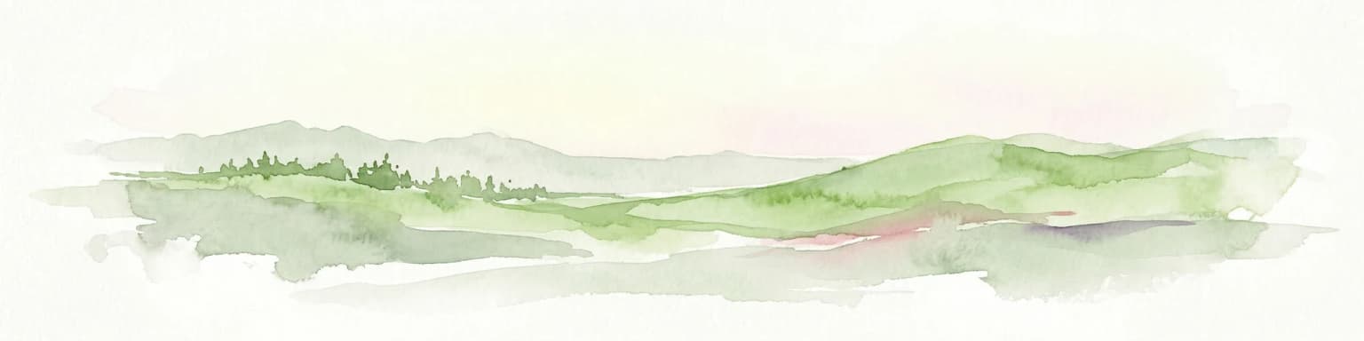
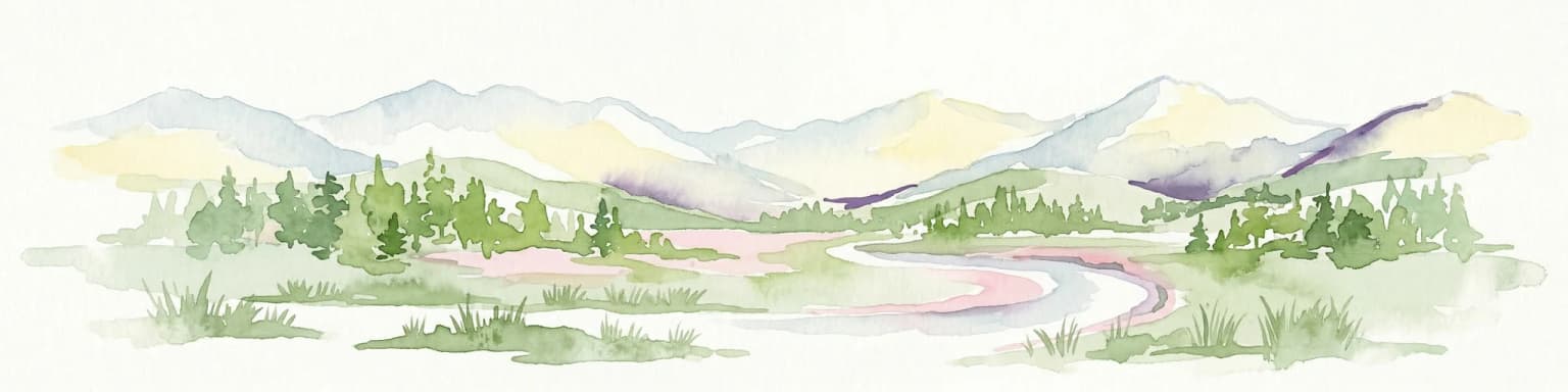
Malá Fatra National Park landscape and geographic character

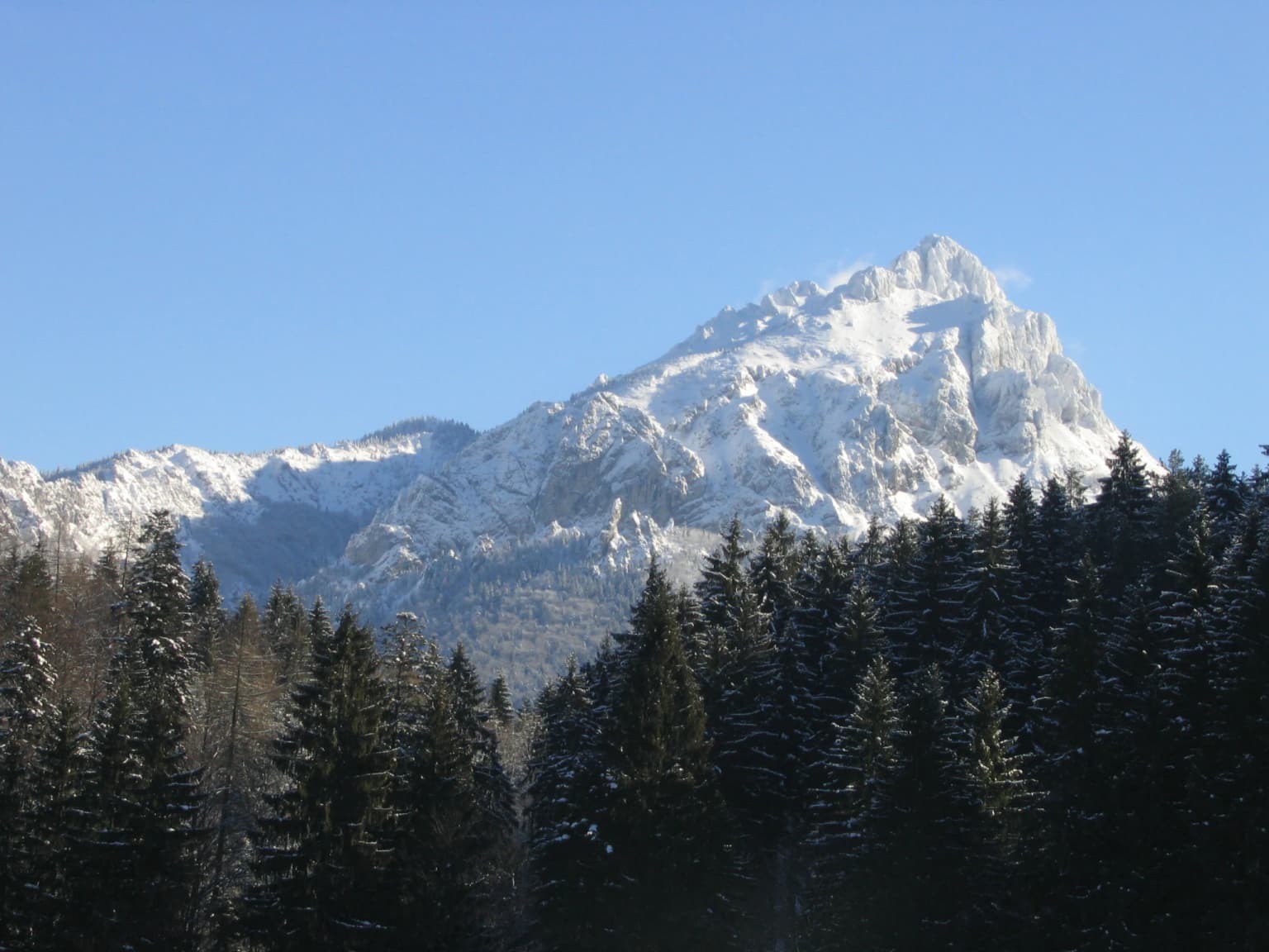
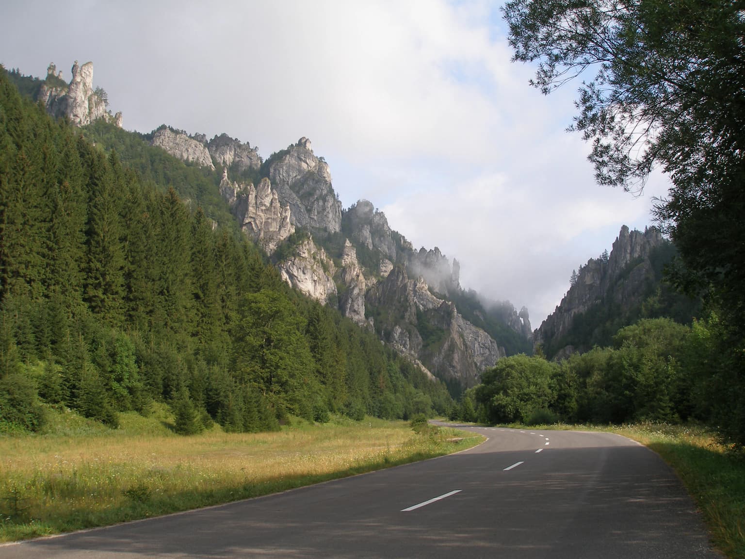
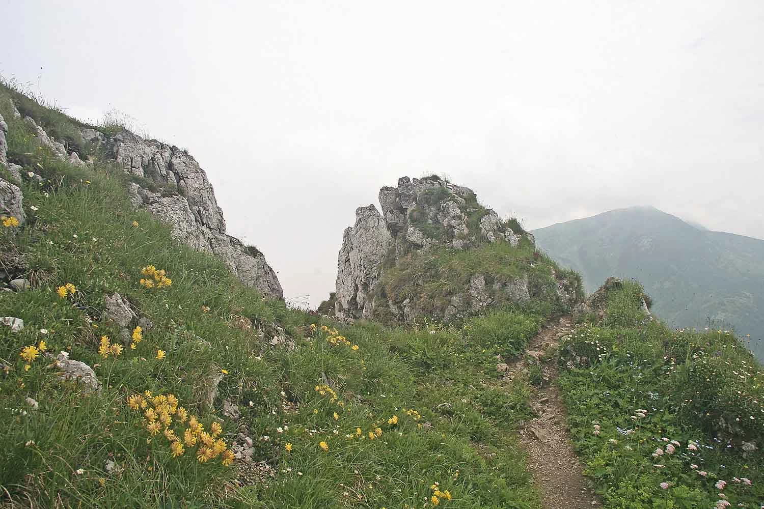
The physical landscape of Malá Fatra National Park presents a dramatic backdrop of Carpathian mountain terrain shaped by millions of years of geological processes and ongoing erosion. The mountains consist primarily of limestone and dolomite formations that have been carved by water and ice into the distinctive ridges, cliffs, and rock towers visible today. The highest peak within the park is Veľký Kriváň at 1,708 meters, while the more visually striking Veľký Rozsutec reaches 1,610 meters and is renowned for its rugged rock face and panoramic summit views. Deep gorges such as those comprising the Jánošíkove diery system cut through the mountain slopes, creating narrow passages flanked by vertical rock walls and punctuated by waterfalls and cascades. The Šútovo Waterfall drops 38 meters in a single dramatic plunge, one of the park's most impressive geological features. The terrain transitions from forested lower slopes through a mosaic of subalpine vegetation to exposed rock and alpine meadows near the summits, providing diverse visual environments within a relatively compact geographic area.

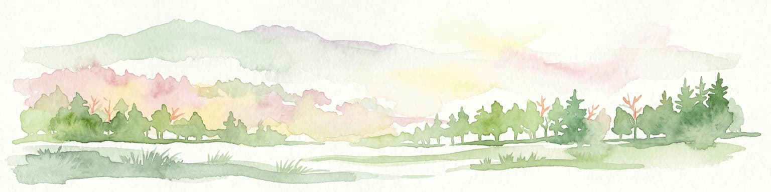
Malá Fatra National Park ecosystems, habitats, and plant life

The ecological character of Malá Fatra reflects the park's position within the Carpathian mountain system and its range of elevations and microclimates. Approximately 83 percent of the park's area is covered by forest, with mixed beech forests dominating the lower and middle elevations. At higher altitudes, the forest composition shifts to include fir and spruce communities adapted to colder conditions and shorter growing seasons. Alpine meadows and pine woods occur at the highest elevations, creating a distinctive vertical zonation of vegetation communities. The park supports remarkable botanical diversity, with species such as the clusii gentian, auricula primrose, and the rare lady's slipper orchid thriving in the park's varied habitats. Wetland areas host specialized plants including the round-leaved sundew, a carnivorous species adapted to nutrient-poor soils. This botanical richness makes Malá Fatra one of Slovakia's most botanically significant protected areas.

Malá Fatra National Park wildlife and species highlights

The fauna of Malá Fatra National Park includes several species of significant conservation interest, particularly large mammals that require extensive territories and intact habitats. The park supports populations of brown bear, grey wolf, and lynx, three species that have recolonized much of their historic European range only in recent decades as conservation measures have allowed populations to expand. These carnivores occupy the forest and rocky terrain throughout the park, with the relatively large area and connectivity to surrounding landscapes supporting viable populations. Bird species of note include the golden eagle, which nests on the rocky cliffs and hunts in the alpine zones, and the black stork, which prefers the forest streams and wet meadows. The eagle-owl occupies cliff nesting sites, while smaller mammals such as the beech marten, European otter, and wildcat complete the mammalian community. This assemblage of species makes Malá Fatra one of Slovakia's most important areas for predator conservation.

Malá Fatra National Park conservation status and protection priorities

Malá Fatra National Park plays a significant role in Slovakia's conservation framework as a Category II protected area under the IUCN classification system. The park protects representative Carpathian mountain ecosystems that have retained relatively high ecological integrity despite centuries of human presence in the region. The protection of large carnivore populations demonstrates the park's importance beyond its borders, as these wide-ranging species require connectivity with surrounding landscapes and benefit from the protected area's strict land-use regulations. The forest coverage, spanning approximately 83 percent of the park, stores significant carbon and provides watershed protection for communities downstream. The diversity of habitats from valley floors to alpine ridges supports botanical and faunal assemblages of conservation concern, including several species protected under European and national legislation. The national park designation provides the strongest form of protection available under Slovak law, restricting development and resource extraction while allowing for scientific research, education, and carefully managed outdoor recreation.

Malá Fatra National Park cultural meaning and human context

The cultural landscape of Malá Fatra extends beyond its natural features to include historical structures and traditional settlements that reflect centuries of human interaction with this mountain environment. Medieval castles dot the landscape, with Strečno Castle standing as a prominent ruin perched on a rocky spur overlooking the valley and Starhrad representing another historic fortification within the park's boundaries. These structures attest to the strategic importance of the mountain passes and valleys that traverse the region. Traditional settlements such as Štefanová and Podšíp preserve vernacular architecture characteristic of the Slovak mountain regions, with wooden structures and steep-pitched roofs reflecting local building traditions. The village of Terchová serves as a center of Slovak folklore and cultural heritage, maintaining traditions that connect the contemporary community to the mountain landscape. The Jánošíkove diery gorges carry the name of Juraj Jánošík, a legendary Slovak folk hero and outlaw whose exploits in the mountains became embedded in regional identity and cultural memory.

Top sights and standout views in Malá Fatra National Park

Malá Fatra National Park offers visitors exceptional mountain scenery, ecological diversity, and cultural heritage within a compact and accessible protected area. The iconic peak of Veľký Rozsutec provides one of the most photographed mountain vistas in Slovakia, its rocky summit rising dramatically above surrounding forests. The Jánošíkove diery gorge system presents hikers with a thrilling landscape of narrow passages, natural bridges, and cascading water. The Crystal Cave showcases geological beauty with its calcite formations, while the 38-meter Šútovo Waterfall provides a spectacular natural display. The presence of brown bears, wolves, and lynx distinguishes this park as one of Slovakia's premier locations for observing large European mammals, though sightings require patience and respect for wildlife. Traditional villages and historic castles add cultural depth to the hiking experience, making Malá Fatra a destination where natural and cultural heritage combine memorably.

Best time to visit Malá Fatra National Park

The optimal seasons for visiting Malá Fatra National Park offer different experiences suited to varied interests and tolerance for mountain conditions. Summer months from June through August provide the warmest weather and longest days, making them ideal for hiking the extensive trail network and enjoying the alpine meadows in full flower. This is the peak season for visitors, with comfortable temperatures for extended walks but also larger crowds at popular destinations. Autumn brings cooler temperatures and changing foliage colors, creating visually striking landscapes as the beech forests turn gold and crimson. The quieter shoulder season often appeals to experienced hikers seeking fewer visitors and atmospheric mountain conditions. Winter transforms the park into a snowy wilderness suitable for winter sports and those comfortable with cold mountain conditions, though many trails become challenging or inaccessible. Spring provides a shoulder season with rising temperatures and melting snow creating dramatic waterfall displays, though weather can be variable.

Park location guide

Geography guide, regional context, and park location map for Malá Fatra National Park

Malá Fatra National Park park geography, regions, and map view in Slovakia
Understand where Malá Fatra National Park sits in Slovakia through a broader geographic reading of the surrounding landscape, nearby location context, and its mapped position within the national park landscape.

How Malá Fatra National Park fits into Slovakia

Slovakia is a landlocked Central European country with a population of over 5.4 million. It became independent from Czechoslovakia in 1993 and is a member of the European Union. The country features mountainous terrain, with the Carpathian Mountains running through its territory. Bratislava serves as the capital and largest city, while Košice is the second-largest city.

Wider geography shaping Malá Fatra National Park in Slovakia

Slovakia is located in Central Europe, landlocked between Poland to the north, Ukraine to the east, Hungary to the south, Austria to the west, and the Czech Republic to the northwest. The territory is mostly mountainous, with the Carpathian Mountains, including the High Tatras, dominating the northern region. The Danube River forms part of the southern border with Hungary.

Map view of Malá Fatra National Park

Use this park location map to pinpoint Malá Fatra National Park in Slovakia, understand its exact geographic position, and read its mapped placement within the surrounding landscape more clearly.

Pigeon | © OpenStreetMap contributors

Location context for Malá Fatra National Park

Žilina Region
Park atlas

Explore more Carpathian mountain parks, limestone landscapes, and protected areas across Slovakia and Central Europe, tracing regional conservation efforts.

Discover Other National Parks and Protected Areas Near Malá Fatra National Park
After exploring Malá Fatra National Park's rugged Carpathian mountains and unique limestone landscapes, browse other national parks and protected areas across Slovakia and the wider Central European region. Compare diverse mountain terrain, identify shared conservation efforts, and trace the regional spread of significant protected natural habitats, expanding your atlas-style exploration.
National park

Veľká Fatra National Park: Slovakia's Premier Protected Landscape for Geographic Discovery

Explore the park's mapped boundaries and regional natural terrain.

Veľká Fatra National Park stands as a distinct protected area, offering critical insights into Slovakia's regional geography and landscape character. This entry provides an atlas-driven perspective on its mapped boundaries and its significance as a national park. Delve into the structured geographic details and protected land context that define Veľká Fatra National Park for comprehensive discovery.

Area
403.713 km²
Established
2002
Relief
Mountain
Climate
Temperate
National park

Low Tatras National Park: Slovakia's Vast National Park and Carpathian Protected Landscape

Explore mapped terrain and regional geographic context.

The Low Tatras National Park represents Slovakia's largest protected area, encompassing the entirety of the Low Tatras mountain range. Its landscape is defined by dramatic altitudinal diversity, from alpine summits like Ďumbier to extensive forest zones and significant karst formations with notable cave systems. This page provides detailed geographic context and map-based discovery for the park's protected boundaries and its ecological significance within the Carpathian region.

Area
728 km²
Established
1978
IUCN
II
Relief
Mountain
Watercolor painting of mountain ranges, forests, and a winding river
National parkLesser Poland Voivodeship

Tatra National Park: Poland's Premier Alpine National Park and Protected Landscape

Explore dramatic glacial terrain, mountain lakes, and regional geography.

Tatra National Park is the definitive Alpine protected area in Poland, located in Lesser Poland Voivodeship. It showcases unique glacial landforms, including over 30 mountain lakes and dramatic peaks like Rysy. This national park serves as a crucial habitat for endemic species and offers unparalleled opportunities for atlas exploration of its rugged, mapped terrain. Understand its geographic significance as part of the Carpathian Mountains and its role as a protected landscape.

Area
211.64 km²
Established
1954
IUCN
II
Visitors
3.9M annual
Watercolor painting showing rolling green hills, forests, and distant mountains under a pale sky
National parkLesser Poland Voivodeship

Gorce National Park: Carpathian Forest Ecosystems and Mapped Terrain in Lesser Poland

Protected landscape discovery within the Western Beskids.

Delve into the protected landscape of Gorce National Park, a key national park situated in Poland's Lesser Poland Voivodeship. This atlas entry focuses on its mapped geography, highlighting the characteristic Carpathian mountain terrain, extensive old-growth forests, and unique alpine meadows. Understand the park's protected boundaries and its significance within the regional landscape context of the Western Beskids, providing a foundation for structured geographic exploration.

Area
70.3 km²
Established
1981
IUCN
II
Visitors
80K annual
National parkBanská Bystrica Region

Muránska planina National Park: Discover Slovakia's Karst Plateau and Protected Natural Landscape

Explore mapped boundaries, caves, and endemic flora in Banská Bystrica Region.

Muránska planina National Park represents a significant protected landscape in central Slovakia's Banská Bystrica Region, defined by its extensive karst topography. This national park encompasses a limestone and dolomite plateau rich with geological wonders, including over 150 caves, sinkholes, and karst springs. The unique contrast between the flat plateau surface and the sharp, rocky ravines showcases a dramatic natural terrain. Explore the park's mapped boundaries and its remarkable biodiversity, highlighted by 35 endemic species and rare Tertiary relict flora like Daphne arbuscula, making it a key destination for atlas-based geographic discovery.

Area
213.18 km²
Established
1997
IUCN
II
Relief
Mountain
Watercolor illustration of a river flowing through a forested valley with rolling hills and scattered trees
National parkPrešov Region

Pieniny National Park: Slovakia's Distinctive Protected Landscape and Dunajec River Gorge

Explore mapped boundaries, regional geography, and protected karst terrain.

Pieniny National Park offers a focused exploration of dramatic limestone gorges and unique Carpathian mountain geography within Slovakia's Prešov Region. This national park is celebrated for the spectacular Dunajec River Gorge, a feature that defines its protected landscape and provides a profound example of natural terrain shaping. Understanding Pieniny National Park involves appreciating its specific mapped boundaries and its role as a significant protected area within the broader atlas of European natural wonders and conservation territories.

Area
37.5 km²
Established
1967
IUCN
II
Relief
Mountain
Watercolor illustration of a winding river through rolling green hills with trees in the foreground
National parkKošice Region

Slovak Paradise National Park: Protected Area Mapping & Geographic Context in Košice Region

Explore the boundaries and terrain of this national park.

Investigate Slovak Paradise National Park, a designated national park situated within Slovakia's Košice Region. This detailed entry provides essential context for understanding its protected landscape features, mapped geographic distribution, and role within regional atlas exploration. Discover its unique terrain and boundaries to build a comprehensive view of Slovak conservation areas.

Area
197.63 km²
Established
1988
IUCN
II
Relief
Mountain
National parkLesser Poland Voivodeship

Ojców National Park: Karst Geography and Protected Landscape Atlas Entry

Explore the mapped terrain and unique geology of this national park.

Ojców National Park, situated in Lesser Poland Voivodeship, offers a concentrated display of dramatic karst topography. This protected national park is renowned for its towering limestone cliffs, intricate ravines, and over 400 caves, showcasing a unique Jurassic geology. As a vital protected area, its mapped boundaries encompass distinctive rock formations like Hercules' Club and the historic Trail of the Eagles' Nests, providing rich context for landscape discovery and atlas exploration.

Area
21.46 km²
Established
1956
IUCN
II
Relief
Upland

Common questions about visiting, size, designation, and location context for Malá Fatra National Park

Malá Fatra National Park FAQs for park facts, access, geography, and protected area context
Find quick answers about Malá Fatra National Park, including protected-area facts, park geography, trail and visitor context, and how the park fits into its surrounding country and regional landscape.
MoriAtlas Explorer

Continue Your Protected Areas Search Across the Global Atlas

Deepen your exploration by continuing the structured search for national parks and protected areas worldwide. Utilize the comprehensive filtering capabilities to compare different conservation landscapes and refine your understanding of global park geography. Discover more about the distribution and characteristics of protected natural areas.

Global natural geography