Mori Atlas logo
National parkGorce National Park

Discover the mapped boundaries and extensive forest ecosystems of this Polish national park.

Gorce National Park: Carpathian Protected Landscape and Geographic Context in Lesser Poland

(Gorczański Park Narodowy)

Gorce National Park represents a significant protected landscape within Poland's Lesser Poland Voivodeship, showcasing the distinctive geography of the Western Beskids. This atlas entry provides detailed insights into the park's mapped terrain, characterized by arched mountain peaks, deep river valleys, and approximately 95% forest coverage, primarily Carpathian beech and spruce-fir woodlands. Explore the unique ecosystem of its characteristic mountain meadows, known as polanas, and understand its role as a vital protected area within the broader regional geography of the Carpathians.

Carpathian mountainsnational parkold-growth forestbeech forestmountain meadowslarge carnivores
Stylized illustration of rolling green hills, forests, and mountains under a light pink sky

Gorce National Park

National park

Park overview

Structured park overview, official facts, and landscape profile for Gorce National Park

Gorce National Park park facts, protected area profile, and essential visitor context
Review the core facts for Gorce National Park, including designation, size, terrain, visitor scale, habitats, and operating context in one park-focused overview.

About Gorce National Park

Gorce National Park occupies a distinctive position in Poland's protected area network as a preservation of the Gorce Mountains, a mid-elevation Carpathian range that forms a natural bridge between the higher Tatra Mountains to the south and the Beskid ranges to the north. The park's terrain is characterised by rounded, arched peaks separated by steep valleys carved by mountain streams. Unlike the dramatic alpine scenery of neighbouring ranges, the Gorce presents a more gentle but equally wild mountain landscape of forested slopes, open meadows, and panoramic ridges.

The park's establishment followed decades of recognition of the area's ecological value. The first protective measures came in 1927 when Count Ludwik Wodzicki established a forest reserve on his estate at Poręba Wielka, creating the Władysław Orkan Nature Reserve. This early conservation effort eventually led to the formal creation of Gorce National Park in 1981, initially covering 23.9 square kilometres before subsequent expansions brought the park to its present extent. The park's administrative headquarters remain in Poręba Wielka, where the Wodzicki family legacy continues to influence the region's conservation identity.

The Gorce Mountains have been shaped by centuries of human activity, particularly pastoral farming that created and maintained the characteristic meadows known as polanas. These open areas, locally called hale, were established in the 14th century by shepherds who migrated from the Balkan Peninsula and brought with them a pastoral culture that transformed the mountain landscape. The meadows once supported extensive sheep grazing that continued intensively until the Second World War, making the Gorce region after the Tatras the most important pastoral centre in southern Poland.

Quick facts and research context for Gorce National Park

Gorce National Park protects the central and northeastern portions of the Gorce Mountains in the Carpathian range of southern Poland. The park was established in 1981 and has grown from an initial 23.9 km² to its current 70.3 km², with an additional protective buffer zone of 166.47 km². The highest peak is Turbacz at 1,310 meters above sea level. Forests dominate the landscape at approximately 95% coverage, with the remainder consisting of mountain meadows and stream corridors. The park supports over 900 vascular plant species, 185 vertebrate species including 21 listed in the Polish Red Book, and more than 1,000 invertebrate species with 23 Carpathian endemics.

Park context

Deeper park guide and search-rich context for Gorce National Park

Gorce National Park history, landscape, wildlife, and travel context
Explore Gorce National Park through its history, landscape character, ecosystems, wildlife, conservation priorities, cultural context, and seasonal travel timing in a structured park guide built for atlas discovery and search intent.

Why Gorce National Park stands out

Gorce National Park is best known for its extensive Carpathian forest ecosystems and the distinctive mountain meadows that characterise the Gorce landscape. The park protects significant populations of large carnivores including lynx, wolves, and brown bears within its boundaries. The fire salamander, with its striking black and yellow coloration, is the park's official symbol and represents the region's unique amphibian fauna. The Jaworzyna Kamienicka meadow, one of the most beautiful in the range, is notable for the historic Bulanda Chapel and proximity to the Zbójnicka Jama cave. The park is also recognized for its Carpathian beech and spruce-fir forests that represent some of the last remaining old-growth woodland in the Polish Carpathians.

A scenic mountain landscape featuring dense forests, rolling green valleys, and distant mountain ridges under a clear blue sky
Panoramic view of the Lubania Range from Pieniny Mountains within Gorce National Park

Gorce National Park history and protected-area timeline

The conservation history of Gorce National Park traces back to the interwar period when the natural beauty and ecological significance of the Gorce Mountains first received formal recognition. In 1927, Count Ludwik Wodzicki, owner of the Poręba Wielka estate, established a nature reserve spanning 114 hectares on his property, naming it after Władysław Orkan, the prominent Polish writer associated with the region. This early protected area represented one of the first conservation efforts in the Polish Carpathians and laid the groundwork for future national park establishment.

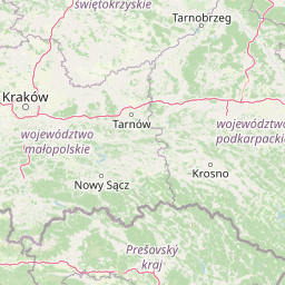
Gorce National Park was formally created in 1981 through a regulation of the Council of Ministers dated August 8, 1980, initially covering 5,908 hectares. The park was subsequently expanded to 6,763 hectares in 1988, with further increases bringing the total area to 7,029.85 hectares by 2016. Jerzy Honowski served as the organizer and first director of the park. In 1997, a protective buffer zone (otulina) of 16,647 hectares was established around the park boundaries. The park lies within five municipalities: Mszana Dolna, Niedźwiedź, Kamienica, Nowy Targ, and Ochotnica Dolna, with the majority of land in state ownership, though some private and municipal parcels remain within the boundaries.

Gorce National Park landscape and geographic character

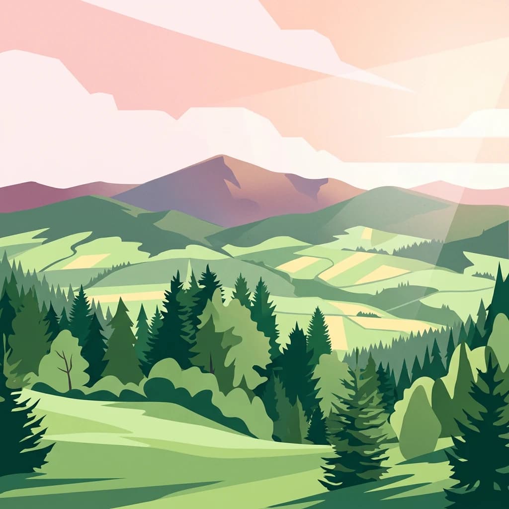
The Gorce Mountains present a characteristic Carpathian landscape of rounded, dome-shaped peaks rising to elevations between 1,200 and 1,310 meters above sea level. The range is defined by its arched ridge formations, with valleys cutting deeply into the mountain mass. The highest summit, Turbacz, reaches 1,310 meters and serves as a popular hiking destination with sweeping views across the Carpathian landscape. Other significant peaks include Jaworzyna Kamienicka (1,288m), Kiczora (1,282m), Trzy Kopce (1,281m), Kudłoń (1,274m), Gorc (1,228m), and Czoło Turbacza (1,258m).

The park's hydrography is characterised by small water bodies, with streams covering only 0.18 square kilometres of the total area. There are no natural lakes within the park boundaries, but numerous mountain streams descend through steep valleys, feeding the larger river systems of the region. A few small caves exist in the park, with Zbójnicka Jama being the most notable, situated near Jaworzyna Kamienicka. The landscape is predominantly forested, with approximately 95% coverage, while the remaining open areas consist of mountain meadows and clearings created by historical human activity.

Forest-covered mountains with a small building visible in the midground, dirt road on the right, clear blue sky
View from Knrowska Pass showing forested mountains and a small building

Gorce National Park ecosystems, habitats, and plant life

The ecological character of Gorce National Park is defined by extensive Carpathian forest ecosystems that represent some of the most well-preserved woodland in the Polish mountains. The forests occur in two distinct vegetation zones: the lower montane forest (regel) from 650 to 1,100 meters, and the upper montane forest above 1,100 meters. The dominant tree species include spruce, beech, and fir, with admixture of larch, sycamore maple, ash, and grey alder in certain areas. Many trees exceed 100 years of age, and the park contains significant stands of old-growth forest including Carpathian beech forest, acidic montane beech forest, fertile spruce-fir forest, and bog alder woodland.

The park's flora is exceptionally diverse, with over 900 vascular plant species, 25 moss species, 450 lichen species, and 116 liverwort species recorded within the park and its buffer zone. Mountain species are well represented, including Alpine rose, jagged monkshood, butterbur, and mountain avens. The subalpine zone supports characteristic species such as mountain avens, Alpine timothy grass, and Alpine cat's-tail. Twenty-two species typical of the alpine meadow zone occur in the park. The mountain meadows (polanas) support approximately 130 plant species exclusive to these open habitats, including orange hawkweed, gladiolus, common butterwort, European globeflower, and thirteen orchid species.

Grassy meadow with scattered small trees and shrubs, surrounded by forested hills and mountains in the distance, showing autumn colors
Młyńska clearing within Gorce National Park showing autumnal meadow with forested mountains in background

Gorce National Park wildlife and species highlights

Gorce National Park supports a rich vertebrate fauna of 185 species, with 21 species listed in the Polish Red Book of Animals indicating their conservation significance. The mammal population includes approximately 50 species, with notable large carnivores such as the Eurasian lynx, grey wolf, and brown bear present within the park. Other mammals include wild boar, red deer, roe deer, European otter, European badger, and stoat. The park provides crucial habitat for these species in a region where suitable wilderness areas have become increasingly fragmented.

The bird community is particularly diverse, with over 90 breeding bird species and approximately 130 species recorded in total. Notable species include capercaillie, white-backed woodpecker, three-toed woodpecker, Ural owl, eagle owl, pygmy owl, boreal owl, and golden eagle. Nine bat species have been recorded, representing important components of the park's nocturnal fauna. Amphibians and reptiles are represented by seven species, with the fire salamander being particularly significant as the park's symbolic species. The streams support brown trout and bullhead fish, while the invertebrate fauna includes over 1,000 species with 23 Carpathian or Carpathian-Sudeten endemics. Mountain and boreal invertebrates are especially well-represented, with approximately 100 species.

Field of purple crocus flowers growing in a grassy meadow.
Purple crocus flowers blooming across a meadow in Gorce National Park, Poland.

Gorce National Park conservation status and protection priorities

Gorce National Park plays a crucial role in the protection of Carpathian forest ecosystems and the biodiversity they support. The park protects significant populations of large carnivores including lynx, wolves, and brown bears, species that require extensive territories and intact habitat corridors. The Carpathian beech and spruce-fir forests represent rare examples of old-growth woodland that have survived centuries of human activity in the mountains. The mountain meadows, once maintained by traditional pastoral practices, now require active management to prevent their succession to forest and preserve their unique biodiversity.

The park's conservation challenges include the ongoing succession of meadows to forest as traditional grazing practices have declined, threatening species that depend on open grassland habitats. The park has implemented active management including rotational mowing and limited sheep grazing on certain meadows such as Hala Długa to maintain the open character and biodiversity of these habitats. The park also participates in broader Carpathian conservation initiatives aimed at protecting the ecological connectivity of mountain ecosystems across national boundaries. The presence of 21 species in the Polish Red Book and 23 Carpathian endemics underscores the park's significance for European biodiversity conservation.

Gorce National Park cultural meaning and human context

The cultural landscape of the Gorce Mountains reflects centuries of pastoral activity that shaped both the natural environment and the regional identity. The mountain meadows (polanas) were created beginning in the 14th century by shepherds who migrated from the Balkan Peninsula, known locally as Wołochy, bringing their distinctive pastoral culture to the Carpathian highlands. These shepherds practiced controlled burning of forest to create grazing areas, followed by ongoing maintenance through grazing and mowing that prevented the meadows from reforesting. The meadows, called hale in local dialect, represent a cultural landscape element that has become integral to the Gorce identity.

The most intensive period of pastoral activity occurred before the Second World War, when the Gorce region was, after the Tatras, the most important centre of sheep husbandry in southern Poland. Traditional shepherd's huts (szałasy) dotted the meadows during the summer grazing season. The decline of pastoral activities after the war has led to the gradual encroachment of forest onto many meadows, a process that threatens both the scenic character and biodiversity of these open habitats. The Bulanda Chapel on Jaworzyna Kamienicka, funded by the renowned Gorce shepherd Tomasz Chlipała at the beginning of the 20th century, stands as a historical landmark of this pastoral heritage.

Top sights and standout views in Gorce National Park

Gorce National Park offers visitors access to some of the most scenic mountain landscapes in the Polish Carpathians, with panoramic views from meadow ridges extending toward the Tatra Mountains, Pieniny, Beskid Wyspowy, and Beskid Sądecki. The park's network of hiking trails provides access to Turbacz and other major peaks, while the mountain meadows in spring display spectacular displays of crocus flowers covering the grassland in purple hues. The Zbójnicka Jama cave near Jaworzyna Kamienicka offers speleological interest, while the historical Bulanda Chapel provides cultural connection to the region's pastoral heritage. The diversity of large mammals including lynx, wolves, and brown bears makes the park significant for wildlife observation, though these species are typically elusive.

Best time to visit Gorce National Park

The Gorce Mountains can be visited year-round, though the most popular season for hiking extends from May through October when trail conditions are most favorable. Spring brings the spectacular flowering of crocuses on the mountain meadows, creating particularly memorable scenery in late April and May. Summer months offer warm conditions for mountain hiking and the opportunity to experience the traditional cultural landscape at its most vibrant. Autumn provides stunning fall color in the beech forests and typically stable weather patterns. Winter transforms the park into a cross-country skiing destination, though snow conditions can be variable. The park receives approximately 80,000 visitors annually, with numbers concentrated in the peak summer months.

Park location guide

Geography guide, regional context, and park location map for Gorce National Park

Gorce National Park park geography, regions, and map view in Poland
Understand where Gorce National Park sits in Poland through a broader geographic reading of the surrounding landscape, nearby location context, and its mapped position within the national park landscape.

How Gorce National Park fits into Poland

Poland, officially the Republic of Poland, is a Central European country spanning from the Baltic Sea in the north to the Carpathian Mountains in the south. It borders Germany, Czech Republic, Slovakia, Ukraine, Belarus, Lithuania, and Kaliningrad Oblast. The country has a temperate climate, diverse landscapes, and is known for its rich history, cultural heritage, and strong economic position within the EU.

Wider geography shaping Gorce National Park in Poland

Poland occupies 312,696 km2 in Central Europe, extending from the Baltic Sea coast in the north to the Sudetes and Carpathian Mountains in the south. It borders Germany to the west, Czech Republic and Slovakia to the south, Ukraine and Belarus to the east, and Lithuania and Kaliningrad Oblast to the northeast. The landscape includes lowland plains, uplands, and mountain ranges.

Map view of Gorce National Park

Use this park location map to pinpoint Gorce National Park in Poland, understand its exact geographic position, and read its mapped placement within the surrounding landscape more clearly.

Pigeon | © OpenStreetMap contributors

Location context for Gorce National Park

Lesser Poland Voivodeship

Explore the Scenery and Habitats of Poland's Gorce Mountains, a Key Protected Area of the Western Beskids

Gorce National Park Photos: Visualizing Carpathian Forests, Mountain Meadows, and Protected Landscapes
Visually explore the diverse landscapes of Gorce National Park, from its extensive Carpathian spruce-fir and beech forests to the iconic mountain meadows, known as polanas. These images provide essential insight into the park's characteristic terrain, rich wildlife habitats, and unique protected-area environment, offering a clear understanding of its ecological significance within the Polish Carpathians.

A scenic mountain landscape featuring dense forests, rolling green valleys, and distant mountain ridges under a clear blue sky

Wide landscape view of Gorce National Park showing forested hills, meadow, and clear blue sky

Forest-covered mountains with a small building visible in the midground, dirt road on the right, clear blue sky

Grassy meadow with scattered small trees and shrubs, surrounded by forested hills and mountains in the distance, showing autumn colors

Field of purple crocus flowers growing in a grassy meadow.

A barred fire salamander with black and yellow markings on a rock

Park atlas

Trace the regional spread of Carpathian protected areas and compare adjacent mountain park geography around southern Poland.

Discover More National Parks Near Gorce National Park, Exploring Lesser Poland's Protected Landscapes
After exploring Gorce National Park's Carpathian forests and mountain meadows, browse a curated list of other national parks and protected areas located within or adjacent to Lesser Poland Voivodeship. Compare their distinct landscape features, conservation priorities, and geographic context to expand your understanding of southern Poland's diverse protected lands.
Watercolor illustration of a river flowing through a forested valley with rolling hills and scattered trees
National parkPrešov Region

Pieniny National Park: Slovakia's Distinctive Protected Landscape and Dunajec River Gorge

Explore mapped boundaries, regional geography, and protected karst terrain.

Pieniny National Park offers a focused exploration of dramatic limestone gorges and unique Carpathian mountain geography within Slovakia's Prešov Region. This national park is celebrated for the spectacular Dunajec River Gorge, a feature that defines its protected landscape and provides a profound example of natural terrain shaping. Understanding Pieniny National Park involves appreciating its specific mapped boundaries and its role as a significant protected area within the broader atlas of European natural wonders and conservation territories.

Area
37.5 km²
Established
1967
IUCN
II
Relief
Mountain
Watercolor painting of mountain ranges, forests, and a winding river
National parkLesser Poland Voivodeship

Tatra National Park: Poland's Premier Alpine National Park and Protected Landscape

Explore dramatic glacial terrain, mountain lakes, and regional geography.

Tatra National Park is the definitive Alpine protected area in Poland, located in Lesser Poland Voivodeship. It showcases unique glacial landforms, including over 30 mountain lakes and dramatic peaks like Rysy. This national park serves as a crucial habitat for endemic species and offers unparalleled opportunities for atlas exploration of its rugged, mapped terrain. Understand its geographic significance as part of the Carpathian Mountains and its role as a protected landscape.

Area
211.64 km²
Established
1954
IUCN
II
Visitors
3.9M annual
National parkLesser Poland Voivodeship

Ojców National Park: Karst Geography and Protected Landscape Atlas Entry

Explore the mapped terrain and unique geology of this national park.

Ojców National Park, situated in Lesser Poland Voivodeship, offers a concentrated display of dramatic karst topography. This protected national park is renowned for its towering limestone cliffs, intricate ravines, and over 400 caves, showcasing a unique Jurassic geology. As a vital protected area, its mapped boundaries encompass distinctive rock formations like Hercules' Club and the historic Trail of the Eagles' Nests, providing rich context for landscape discovery and atlas exploration.

Area
21.46 km²
Established
1956
IUCN
II
Relief
Upland
National park

Low Tatras National Park: Slovakia's Vast National Park and Carpathian Protected Landscape

Explore mapped terrain and regional geographic context.

The Low Tatras National Park represents Slovakia's largest protected area, encompassing the entirety of the Low Tatras mountain range. Its landscape is defined by dramatic altitudinal diversity, from alpine summits like Ďumbier to extensive forest zones and significant karst formations with notable cave systems. This page provides detailed geographic context and map-based discovery for the park's protected boundaries and its ecological significance within the Carpathian region.

Area
728 km²
Established
1978
IUCN
II
Relief
Mountain
Watercolor illustration of a winding river through rolling green hills with trees in the foreground
National parkKošice Region

Slovak Paradise National Park: Protected Area Mapping & Geographic Context in Košice Region

Explore the boundaries and terrain of this national park.

Investigate Slovak Paradise National Park, a designated national park situated within Slovakia's Košice Region. This detailed entry provides essential context for understanding its protected landscape features, mapped geographic distribution, and role within regional atlas exploration. Discover its unique terrain and boundaries to build a comprehensive view of Slovak conservation areas.

Area
197.63 km²
Established
1988
IUCN
II
Relief
Mountain
National park

Malá Fatra National Park National Park: Geographic Context and Protected Area Mapping

Explore the mapped terrain and regional geography.

Malá Fatra National Park serves as a cornerstone for understanding Slovakia's protected landscapes. This dedicated park page provides crucial geographic context, detailing its national park designation and the extent of its protected area boundaries. Users can leverage MoriAtlas to visualize the park's location within the broader regional geography, facilitating a structured approach to discovering its natural landscape and terrain through map-based exploration.

Area
226.3 km²
Established
1988
IUCN
II
Relief
Mountain
National park

Veľká Fatra National Park: Slovakia's Premier Protected Landscape for Geographic Discovery

Explore the park's mapped boundaries and regional natural terrain.

Veľká Fatra National Park stands as a distinct protected area, offering critical insights into Slovakia's regional geography and landscape character. This entry provides an atlas-driven perspective on its mapped boundaries and its significance as a national park. Delve into the structured geographic details and protected land context that define Veľká Fatra National Park for comprehensive discovery.

Area
403.713 km²
Established
2002
Relief
Mountain
Climate
Temperate
National parkBanská Bystrica Region

Muránska planina National Park: Discover Slovakia's Karst Plateau and Protected Natural Landscape

Explore mapped boundaries, caves, and endemic flora in Banská Bystrica Region.

Muránska planina National Park represents a significant protected landscape in central Slovakia's Banská Bystrica Region, defined by its extensive karst topography. This national park encompasses a limestone and dolomite plateau rich with geological wonders, including over 150 caves, sinkholes, and karst springs. The unique contrast between the flat plateau surface and the sharp, rocky ravines showcases a dramatic natural terrain. Explore the park's mapped boundaries and its remarkable biodiversity, highlighted by 35 endemic species and rare Tertiary relict flora like Daphne arbuscula, making it a key destination for atlas-based geographic discovery.

Area
213.18 km²
Established
1997
IUCN
II
Relief
Mountain

Common questions about visiting, size, designation, and location context for Gorce National Park

Gorce National Park FAQs for park facts, access, geography, and protected area context
Find quick answers about Gorce National Park, including protected-area facts, park geography, trail and visitor context, and how the park fits into its surrounding country and regional landscape.
MoriAtlas Explorer

Continue Your Protected Areas Search Across the Global Atlas

Deepen your exploration by continuing the structured search for national parks and protected areas worldwide. Utilize the comprehensive filtering capabilities to compare different conservation landscapes and refine your understanding of global park geography. Discover more about the distribution and characteristics of protected natural areas.

Global natural geography