Mori Atlas logo
National parkBükk National Park

Explore the vast mapped boundaries and unique geology of this expansive protected area.

Bükk National Park: Hungary's Premier Karst Landscape and Protected National Park

(Bükki Nemzeti Park)

Bükk National Park, situated within Borsod-Abaúj-Zemplén County, represents Hungary's largest protected natural landscape. Established in 1977, this national park is distinguished by its spectacular karst topography, featuring over 1,100 caves and striking limestone formations. The park's ancient beech forests and diverse ecosystems offer a rich context for atlas-driven geographic discovery and understanding protected lands.

national parkkarst landscapelimestone plateaucave systemsancient forestorchid diversity
Illustration of a waterfall surrounded by forested mountains and a lake

Bükk National Park

National park

Park overview

Structured park overview, official facts, and landscape profile for Bükk National Park

Bükk National Park park facts, protected area profile, and essential visitor context
Review the core facts for Bükk National Park, including designation, size, terrain, visitor scale, habitats, and operating context in one park-focused overview.

About Bükk National Park

Bükk National Park occupies the core of the Bükk Mountains in Northern Hungary, a range that rises prominently above the surrounding hills and lies in the shadow of the higher Mátra range to the west. The park was established in 1977 as Hungary's third national park and remains the largest in the country by area. The landscape is dominated by the Bükk-fennsík, an extensive limestone and dolomite plateau that reaches elevations approaching 1,000 meters, surrounded by steep cliffs and rocky peaks locally called "kövek." This dramatic terrain was shaped by the interplay of marine sedimentary processes during the Mesozoic era and subsequent karst erosion that created the cave systems and sinkholes characteristic of the region. The Garadna stream divides the plateau into northern and southern sections, while the Szalajka valley has become one of the park's most visited areas, accessible via a historic forest railway. The park's administrative headquarters are located in Felnémet, a historic parish building in Eger's northern district. Beyond the mountainous core, the national park encompasses diverse landscape protection areas extending into the surrounding hills and plains, including the Upponyi Mountains, the Cserhát region, and portions of the Great Hungarian Plain.

Quick facts and research context for Bükk National Park

Bükk National Park covers approximately 402-431 square kilometers in the Bükk Mountains of Northern Hungary, making it the country's largest national park. Established in 1977, it is managed by the Bükk National Park Directorate based in Eger. The park features the Bükk-fennsík plateau surrounded by steep limestone cliffs, with the second-highest peak Istállós-kő at 959 meters. Over 1,100 caves have been documented within the park, 45 of which receive strict protection. The park's emblem plant is Carlina acaulis (stemless carline thistle). Ninety bird species nest here, and the area supports significant populations of raptors including the saker falcon and golden eagle.

Park context

Deeper park guide and search-rich context for Bükk National Park

Bükk National Park history, landscape, wildlife, and travel context
Explore Bükk National Park through its history, landscape character, ecosystems, wildlife, conservation priorities, cultural context, and seasonal travel timing in a structured park guide built for atlas discovery and search intent.

Why Bükk National Park stands out

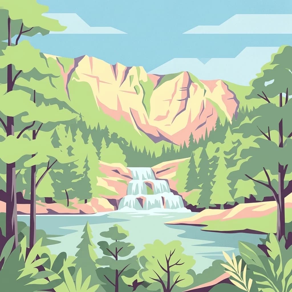
Bükk National Park is best known for its exceptional karst cave systems and the Bükk-fennsík, a distinctive limestone plateau surrounded by dramatic rock spires. The park contains Hungary's longest and deepest caves, with Istállós-kői-barlang and Szeleta-barlang preserving important Neanderthal archaeological finds. The ancient beech forest known as Őserdő represents one of Hungary's few remaining primeval forests. The park supports an extraordinary diversity of orchids with 53 species recorded, including the protected lady's slipper (Cypripedium calceolus). The Fátyol Waterfall cascading 17 meters over travertine barriers in Szalajka Valley is among Hungary's most scenic natural attractions.

Lake Bélapátfalva reflecting forested mountains and rocky cliffs under a clear blue sky
Lake Bélapátfalva reflecting forested mountains and Bél-kő rock formations in Bükk National Park, Hungary

Bükk National Park history and protected-area timeline

Bükk National Park was founded in 1977 as the third national park in Hungary, following Hortobágy (1973) and Kiskunság (1975). The creation of the park reflected Hungary's growing commitment to nature conservation during the late Communist period, when environmental protection began receiving greater institutional attention. The selection of the Bükk Mountains for national park status was driven primarily by the region's exceptional geological characteristics and its largely intact forest cover. The mountains have been inhabited since prehistoric times, with archaeologists discovering Neanderthal tools and remains in caves such as Istállós-kői-barlang and Szeleta-barlang, providing evidence of human presence dating back approximately 30,000 years. Later periods left additional cultural traces, including Avar-period hillforts on mountain peaks. The region's more recent history involved limestone quarrying, charcoal production, and glass manufacturing in the mountain villages. The park is managed by the Bükk National Park Directorate, which also oversees numerous landscape protection areas and nature reserves throughout northeastern Hungary.

Bükk National Park landscape and geographic character

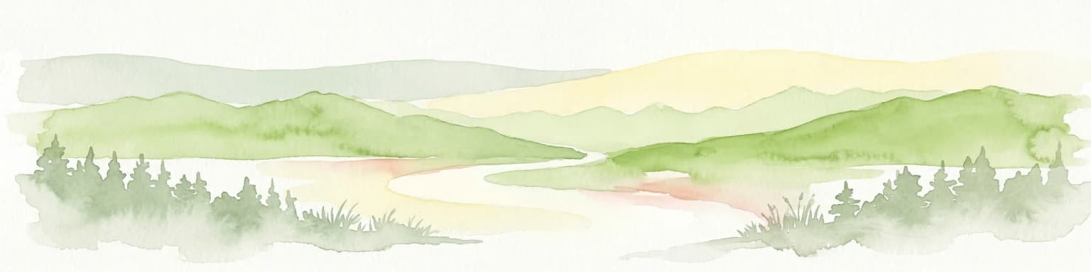
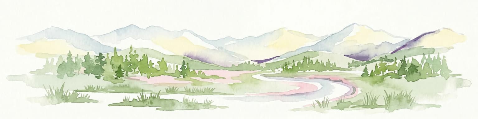
The Bükk landscape is defined by its mountainous karst terrain, one of the most spectacular in Hungary. The Bükk-fennsík is a broad limestone plateau surrounded by steep rocky walls and towering cliff formations known collectively as the "kövek" - prominent peaks that rise abruptly from the forested slopes. These include Imó-kő and Fehér-kő in the southern Bükk, Odvas-kő, Látó-kő, Örvény-kő (773m), Pes-kő, and Tar-kő in the northern section, and the dramatic Ablakoskő with its natural limestone window. The highest point is Istállós-kő at 959 meters, the second-highest peak in the Bükk Mountains. The plateau is dissected by the Garadna stream into two main sections. Karst phenomena dominate the landscape, with sinkholes, swallow-holes, ravines, and rock fields covering the limestone surfaces. Springs at the mountain base have deposited travertine formations, while the valleys feature characteristic bérc (cliff-rimmed basins) and gorge-like völgy formations. The Szalajka stream descends through Szalajka-völgy to the Fátyol Waterfall, where water cascades 17 meters over travertine barriers.

A calm reservoir reflecting a mountain with rocky cliffs and forested slopes under a clear blue sky
Gyári-tó reservoir and Bél-kő mountain in Bükk National Park, Hungary

Bükk National Park ecosystems, habitats, and plant life

The vegetation of Bükk National Park reflects the park's position at the crossroads of multiple biogeographic regions, creating exceptional botanical diversity. Forests cover approximately 94% of the park, with oak-beech communities dominating the lower slopes, hornbeam-oak forests in middle elevations, and pure beech forests above 400 meters. The ancient Őserdő (Primeval Forest) preserves beech trees exceeding 200 years old in an area where forest management has been suspended for over 150 years, recently closed to visitors to protect its ecological integrity. The plateau's sinkhole meadows host remarkable plant communities including the fiery lily (Lilium bulbiferum), various rare orchids such as the lady's slipper, and northern dragonhead (Dracocephalum ruyschiana), which reaches the southern limit of its Hungarian distribution here. The karst cliffs support specialized rock rose communities, while the warm southern slopes feature sumac (Cotinus coggygria) that turns the hillsides brilliant red in autumn. Over 53 orchid species have been recorded in the park, one of the highest diversities in Hungary.

Tall waterfall cascading down a rocky cliff face surrounded by dense forest, with several people visible on the cliffside
Waterfall at Lillafüred within Bükk National Park, Hungary

Bükk National Park wildlife and species highlights

Bükk National Park supports significant wildlife populations across its diverse habitats. The bird fauna includes ninety nesting species, with particular importance for birds of prey. The saker falcon (kerecsensólyom) has benefited from a complex conservation program spanning nearly two decades, while the golden eagle (parlagi sas), short-toed snake eagle (kígyászölyv), and booted eagle find suitable breeding habitat on the rocky cliffs. The rare rock thrush (kövirigó), common raven (holló), and eagle owl (uhu) nest in the abandoned quarries and rock faces. The park's bat fauna is exceptionally diverse, with nearly all Hungarian bat species recorded, including the Schreiber's bent-winged bat (Miniopterus schreibersii) that exclusively uses caves for breeding and wintering. Large mammals include red deer, mouflon, and wild boar, while the Eurasian lynx has been a permanent resident of the Bükk forests for over a decade, with a growing population of wild wolves recorded since the early 2000s. The Bükk has a notable butterfly species, the Scarce copper, and the area supports amphibians including the Alpine newt and yellow-bellied toad in the plateau's forest pools.

Multi-tiered waterfall flowing through a forested area with green vegetation in the foreground and trees surrounding the water
Veil waterfall in Bükk National Park, Hungary, showing multiple tiers of cascading water surrounded by forest vegetation

Bükk National Park conservation status and protection priorities

Bükk National Park represents one of Hungary's most important conservation areas, protecting the country's largest mountain forest ecosystem and its associated karst formations. The park's strict protection zone covers nearly 38 square kilometers, preserving the most sensitive habitats including the ancient Őserdő and the karst cliff communities. The cave systems receive particular attention, with 45 caves designated for strict protection due to their geological, archaeological, or biological significance. The park's biodiversity value is underscored by the presence of over 22,000 animal species and exceptional plant communities, including 53 orchid species representing approximately half of Hungary's orchid flora. The Bükk-fennsík and its surrounding cliffs serve as critical habitat for endangered raptor species, and long-term conservation programs for the saker falcon have demonstrated measurable success. The park also includes multiple landscape protection areas extending beyond the mountainous core, encompassing lowland grasslands, wetlands, and volcanic formations in the surrounding regions, all managed by the Bükk National Park Directorate.

Bükk National Park cultural meaning and human context

The Bükk Mountains have been inhabited since prehistoric times, with archaeological evidence of Neanderthal presence dating back approximately 30,000 years. Caves such as Istállós-kői-barlang and Szeleta-barlang have yielded significant archaeological finds including stone tools, fire remains, and other evidence of prehistoric occupation. Medieval hillforts from the Avar period crown several mountain peaks. More recent human history includes the development of limestone quarrying and burning, charcoal production for ironworks, and glass manufacturing in the mountain villages that once characterized the region. Traditional agriculture and forest use shaped the surrounding landscapes. The park encompasses villages where visitors can experience regional culture, including Szilvásvárad with its historic Lipicai horse breeding traditions, Lillafüred with its spa and forest railway, and the historic Diósgyőr Castle near Miskolc. These settlements and their cultural heritage form an integral part of the park's broader identity.

Top sights and standout views in Bükk National Park

Bükk National Park offers exceptional variety within a single protected area, from dramatic karst plateaus and cave systems to ancient beech forests and species-rich meadows. The Fátyol Waterfall in Szalajka-völgy ranks among Hungary's most beautiful natural attractions, accessible via the historic forest railway. The cave systems, including the spectacular Szent István-barlang at Lillafüred and the archaeologically significant Istállós-kői-barlang and Szeleta-barlang, provide windows into both geological processes and human prehistory. The ancient Őserdő preserves old-growth beech forest increasingly rare in Europe. The park supports remarkable biodiversity, with 53 orchid species and significant populations of raptors including saker falcons and golden eagles. Visitors can explore scenic valleys like Szalajka-völgy and the Garadna valley, climb dramatic peaks such as Istállós-kő, or discover historic sites including the medieval Diósgyőr Castle and traditional mountain villages.

Best time to visit Bükk National Park

Bükk National Park can be visited throughout the year, with each season offering distinct experiences. Spring and early summer bring flowering meadows and optimal conditions for orchid viewing, particularly in May and June when many species bloom. Autumn offers spectacular fall colors as the beech forests turn golden and the sumac on southern slopes turns vivid red. Summer provides the best conditions for hiking the mountain trails and exploring the cave systems, though this is also the busiest season. Winter transforms the landscape with snow on the higher peaks, and the area offers skiing opportunities around Lillafüred. The park's higher elevations and north-facing slopes remain cool even in summer, while the sheltered valleys can become quite warm. The most comfortable period for strenuous hiking typically spans from late April through June and again from September through mid-October.

Park location guide

Geography guide, regional context, and park location map for Bükk National Park

Bükk National Park park geography, regions, and map view in Hungary
Understand where Bükk National Park sits in Hungary through a broader geographic reading of the surrounding landscape, nearby location context, and its mapped position within the national park landscape.

How Bükk National Park fits into Hungary

Hungary is a landlocked Central European country occupying the Carpathian Basin, also known as the Pannonian Basin. It borders Slovakia, Ukraine, Romania, Serbia, Croatia, Slovenia, and Austria. Budapest serves as both the capital and largest city. The population is predominantly ethnic Hungarians (Magyars), with Hungarian as the official language.

Wider geography shaping Bükk National Park in Hungary

Hungary occupies the Carpathian Basin in Central Europe, a large lowland plain surrounded by the Carpathian Mountains. It is bordered by Slovakia to the north, Ukraine to the northeast, Romania to the east and southeast, Serbia to the south, Croatia and Slovenia to the southwest, and Austria to the west. The Danube River flows through the country, providing its primary drainage.

Map view of Bükk National Park

Use this park location map to pinpoint Bükk National Park in Hungary, understand its exact geographic position, and read its mapped placement within the surrounding landscape more clearly.

Pigeon | © OpenStreetMap contributors

Location context for Bükk National Park

Borsod-Abaúj-Zemplén County

Visually trace Bükk's unique karst terrain, ancient forest ecosystems, and dramatic rock formations that define this protected mountain region.

Bükk National Park Imagery: Visualizing Hungary's Karst Mountains, Ancient Forests, and Protected Landscapes
These images offer a comprehensive visual guide to Bükk National Park, illustrating its spectacular karst landscape, intricate cave entrances, and pristine ancient beech forests. Gain a deeper understanding of the park's diverse habitats and geological significance, crucial for comprehending this protected area's unique environmental character and conservation value.

Lake Bélapátfalva reflecting forested mountains and rocky cliffs under a clear blue sky

Close-up of a Saker Falcon with speckled brown and white plumage, yellow beak, and dark eyes against a green background

A calm reservoir reflecting a mountain with rocky cliffs and forested slopes under a clear blue sky

Tall waterfall cascading down a rocky cliff face surrounded by dense forest, with several people visible on the cliffside

Multi-tiered waterfall flowing through a forested area with green vegetation in the foreground and trees surrounding the water

Park atlas

Map the geographic spread of protected areas surrounding Bükk National Park in Northern Hungary.

Explore National Parks and Protected Areas Near Bükk National Park, Northern Hungary
Discover other national parks and protected areas in Northern Hungary, including those in the Bükk Mountains region and across Borsod-Abaúj-Zemplén County. Compare their distinct karst terrain, ancient forests, and unique protected-area features to gain a richer understanding of Hungary's diverse conservation landscapes.
Watercolor painting showing a winding river, green trees, distant hills, and grassy foreground
National park

Aggtelek National Park

Karst Landscape & Cave Systems

Explore the protected area of Aggtelek National Park, a UNESCO World Heritage site known for its extensive karst landscapes and significant cave systems. Understand its geographic setting and protected land status.

Area
198.92 km²
Established
1985
IUCN
II
Relief
Mixed relief
National parkKošice Region

Slovak Karst National Park: Premier Central European Karst Landscape and Cave Systems

Explore protected terrain and mapped underground wonders in Košice Region.

Slovak Karst National Park offers an unparalleled glimpse into a dynamic karst environment. As a designated national park and UNESCO Biosphere Reserve, it preserves a significant concentration of caves, dramatic limestone formations, and rugged canyons within its territory in southeastern Slovakia. This atlas-focused presentation highlights the park's distinctive geology, mapped landscape features, and its importance as a protected natural area within the broader geography of the Košice Region. Understand the park's surface topography and its world-renowned subterranean realms.

Area
346.11 km²
Established
2002
IUCN
II
Relief
Mountain
Watercolor painting depicting grasslands, hills, and a body of water.
National park

Hortobágy National Park: A UNESCO Protected Steppe Landscape in Eastern Hungary

Explore the unique geography and mapped park boundaries of Hungary's first national park.

Hortobágy National Park is a monumental protected area in Eastern Hungary, recognized globally as the first national park established in the country and a UNESCO World Heritage site. This vast expanse of semi-natural grassland, known as the puszta, stretches across approximately 74,820 hectares, embodying over four millennia of pastoral traditions. The park's landscape is characterized by alkaline soils and sweeping horizons, offering a unique ecosystem with significant avian populations and preserved cultural landmarks. MoriAtlas provides structured geographic context and mapped details to understand this exceptional protected landscape.

Area
748.2 km²
Established
1973
IUCN
II
Relief
Lowland
Watercolor illustration of a forested landscape with mountains, trees, and a river
National parkBanská Bystrica Region

Muránska planina National Park: Discover Slovakia's Karst Plateau and Protected Natural Landscape

Explore mapped boundaries, caves, and endemic flora in Banská Bystrica Region.

Muránska planina National Park represents a significant protected landscape in central Slovakia's Banská Bystrica Region, defined by its extensive karst topography. This national park encompasses a limestone and dolomite plateau rich with geological wonders, including over 150 caves, sinkholes, and karst springs. The unique contrast between the flat plateau surface and the sharp, rocky ravines showcases a dramatic natural terrain. Explore the park's mapped boundaries and its remarkable biodiversity, highlighted by 35 endemic species and rare Tertiary relict flora like Daphne arbuscula, making it a key destination for atlas-based geographic discovery.

Area
213.18 km²
Established
1997
IUCN
II
Relief
Mountain
Watercolor illustration of a winding river through rolling green hills with trees in the foreground
National parkKošice Region

Slovak Paradise National Park: Protected Area Mapping & Geographic Context in Košice Region

Explore the boundaries and terrain of this national park.

Investigate Slovak Paradise National Park, a designated national park situated within Slovakia's Košice Region. This detailed entry provides essential context for understanding its protected landscape features, mapped geographic distribution, and role within regional atlas exploration. Discover its unique terrain and boundaries to build a comprehensive view of Slovak conservation areas.

Area
197.63 km²
Established
1988
IUCN
II
Relief
Mountain
Watercolor painting of rolling mountains in green, yellow, and pink tones
National park

Low Tatras National Park: Slovakia's Vast National Park and Carpathian Protected Landscape

Explore mapped terrain and regional geographic context.

The Low Tatras National Park represents Slovakia's largest protected area, encompassing the entirety of the Low Tatras mountain range. Its landscape is defined by dramatic altitudinal diversity, from alpine summits like Ďumbier to extensive forest zones and significant karst formations with notable cave systems. This page provides detailed geographic context and map-based discovery for the park's protected boundaries and its ecological significance within the Carpathian region.

Area
728 km²
Established
1978
IUCN
II
Relief
Mountain
National parkPest County

Danube-Ipoly National Park: Protected Landscape and Geographic Atlas

Mapping Hungary's diverse terrain and protected natural areas.

Delve into Danube-Ipoly National Park, a significant protected area renowned for its extraordinary ecological diversity. This page explores the park's distinct landscapes, from the volcanic formations of the Börzsöny Mountains to the deep karst cave systems of the Pilis, set against the backdrop of the Danube and Ipoly river floodplains. Understand its geographic placement within Pest County and its role as a vital protected landscape for conservation and atlas-based discovery.

Area
603.14 km²
Established
1997
IUCN
V
Relief
Mixed relief
Watercolor painting of mountain ranges, forests, and a winding river
National parkLesser Poland Voivodeship

Tatra National Park: Poland's Premier Alpine National Park and Protected Landscape

Explore dramatic glacial terrain, mountain lakes, and regional geography.

Tatra National Park is the definitive Alpine protected area in Poland, located in Lesser Poland Voivodeship. It showcases unique glacial landforms, including over 30 mountain lakes and dramatic peaks like Rysy. This national park serves as a crucial habitat for endemic species and offers unparalleled opportunities for atlas exploration of its rugged, mapped terrain. Understand its geographic significance as part of the Carpathian Mountains and its role as a protected landscape.

Area
211.64 km²
Established
1954
IUCN
II
Visitors
3.9M annual

Common questions about visiting, size, designation, and location context for Bükk National Park

Bükk National Park FAQs for park facts, access, geography, and protected area context
Find quick answers about Bükk National Park, including protected-area facts, park geography, trail and visitor context, and how the park fits into its surrounding country and regional landscape.
MoriAtlas Explorer

Continue Your Protected Areas Search Across the Global Atlas

Deepen your exploration by continuing the structured search for national parks and protected areas worldwide. Utilize the comprehensive filtering capabilities to compare different conservation landscapes and refine your understanding of global park geography. Discover more about the distribution and characteristics of protected natural areas.

Global natural geography