
Mori Atlas logo
Protected landscapeTahoe National Forest

Examining the complex terrain, watershed geography, and granite mountain ridgelines of the Sierra Nevada

Tahoe National Forest: A Comprehensive Geographic Atlas of California Protected Wilderness Landscapes

Tahoe National Forest encompasses a vast and varied landscape within the California Sierra Nevada, stretching from the deep canyons of the American River to the rugged peaks along the Sierra Crest. This protected area features hundreds of high-alpine lakes, expansive conifer forests, and the unique northernmost grove of giant sequoias. By mapping its elevation ranges and hydrological contributions to the Truckee River watershed, this atlas entry provides a detailed look at the forest's foundational role in regional geography.

sierra nevadanational forestmountain forestsgranite canyonsalpine lakesPacific Crest Trail
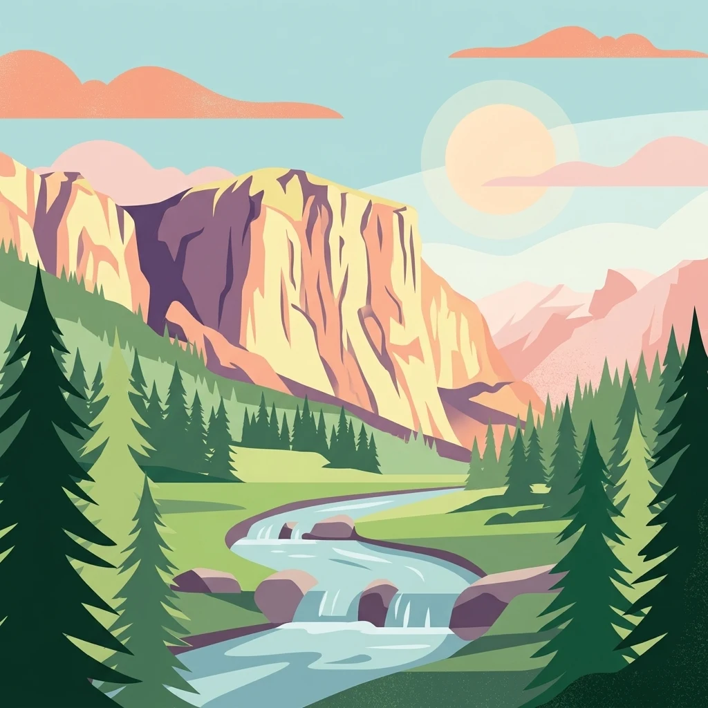
A stylized digital illustration of a scenic mountain landscape featuring steep cliffs, a flowing river with small cascades, and surrounding evergreen trees under a soft, warm sun.

Tahoe National Forest

Protected landscape

Park overview

Structured park overview, official facts, and landscape profile for Tahoe National Forest

Tahoe National Forest park facts, protected area profile, and essential visitor context

Review the core facts for Tahoe National Forest, including designation, size, terrain, visitor scale, habitats, and operating context in one park-focused overview.

About Tahoe National Forest

Tahoe National Forest occupies a substantial portion of the northern and central Sierra Nevada in California, anchored by the area northwest of Lake Tahoe. The forest stretches across parts of Sierra, Placer, Nevada, Yuba, Plumas, and El Dorado counties, with its administrative headquarters in Nevada City and ranger district offices in Camptonville, Foresthill, Sierraville, and Truckee.

The landscape is characterized by strong topographic relief. The American River canyon lies near the lower end of the elevation range, while summits including Mount Lola along the Sierra Crest rise above 9,000 feet. Sierra Buttes, near Sierra City, reaches 8,587 feet and offers commanding views of Mount Lassen and Mount Shasta. Throughout the forest, granite bedrock is deeply carved by rivers and shaped into long ridges, river canyons, and rocky basins that hold hundreds of lakes and reservoirs, including the prominent Boca Reservoir.

Vegetation changes dramatically with elevation. Lower slopes support mountain chaparral and mixed conifer forests, mid-elevations transition into red fir stands, and drier eastern exposures shift into eastside sage-pine and brush communities. Old-growth forest still exists in pockets, with species such as coast Douglas fir, ponderosa pine, white fir, sugar pine, California incense cedar, California black oak, lodgepole pine, and red fir represented. The Placer County Big Trees Grove, a tiny but ecologically important cluster of six old-growth giant sequoias in the American River watershed, marks the northernmost extent of giant sequoia range.

Tahoe National Forest is a major recreation forest in the Sierra Nevada, known for being relatively accessible from the Sacramento and Reno metropolitan areas. Roads such as Foresthill Road and Mosquito Ridge Road open large portions of the forest to regular vehicle travel, while a dense network of trails, including a section of the Pacific Crest Trail, supports hiking, backpacking, and access to the nearby Granite Chief Wilderness. The forest also supports campgrounds, winter sports, fishing, mountain biking, and other outdoor activities.

Beyond recreation, the forest plays a defining role in regional water supply. Its watersheds feed the American River system, supporting communities such as Lincoln, Auburn, and Rocklin, and drain through the Truckee River to Reno, Sparks, and ultimately Pyramid Lake in Nevada. This dual identity as a working watershed and a recreation-rich protected landscape shapes the way the forest is managed by the U.S. Forest Service.

Quick facts and research context for Tahoe National Forest

Tahoe National Forest is a federally administered United States National Forest covering roughly 871,495 acres of the Sierra Nevada in California, managed by the U.S. Forest Service. It lies northwest of Lake Tahoe, spans six counties, and is one of eighteen national forests in California.

The forest contains hundreds of lakes and reservoirs, prominent river canyons carved into granite bedrock, a section of the Pacific Crest Trail, and the Granite Chief Wilderness nearby. It hosts the northernmost grove of giant sequoias, the Placer County Big Trees Grove, sits on watersheds that supply drinking water for several California and Nevada towns, and is among the most popular recreation forests in the region.

Protection and recognition

Examine the documented protection status and establishment timeline for Tahoe National Forest.

Tahoe National Forest Protection Status and Designated History

Tahoe National Forest maintains a terrestrial protection status established in 1905 across its managed forest landscape. Review the documented conservation framework, designation history, and territorial scope associated with this protected area.

Protection details

Protection scope
Terrestrial
Designated year
1905
Transboundary protection
No
Park context

Deeper park guide and search-rich context for Tahoe National Forest

Tahoe National Forest history, landscape, wildlife, and travel context

Explore Tahoe National Forest through its history, landscape character, ecosystems, wildlife, conservation priorities, cultural context, and seasonal travel timing in a structured park guide built for atlas discovery and search intent.

Why Tahoe National Forest stands out

Tahoe National Forest is especially known for the broad sweep of western Sierra Nevada landscapes it protects, from deep granite river canyons along the American River basin to alpine ridges near 9,000 feet, with the prominent Sierra Buttes peak offering views of Mount Lassen and Mount Shasta. It is also recognized for its hundreds of lakes and reservoirs, a stretch of the Pacific Crest Trail, and the rare presence of the Placer County Big Trees Grove, the northernmost giant sequoia grove in the world. Equally distinctive is its role as a working headwater forest, providing municipal drinking water to foothill communities such as Lincoln, Auburn, and Rocklin, and supporting the Truckee River watershed that flows through Reno and Sparks to Pyramid Lake. The combination of dramatic scenery, accessible recreation, and watershed importance defines much of the forest's identity.
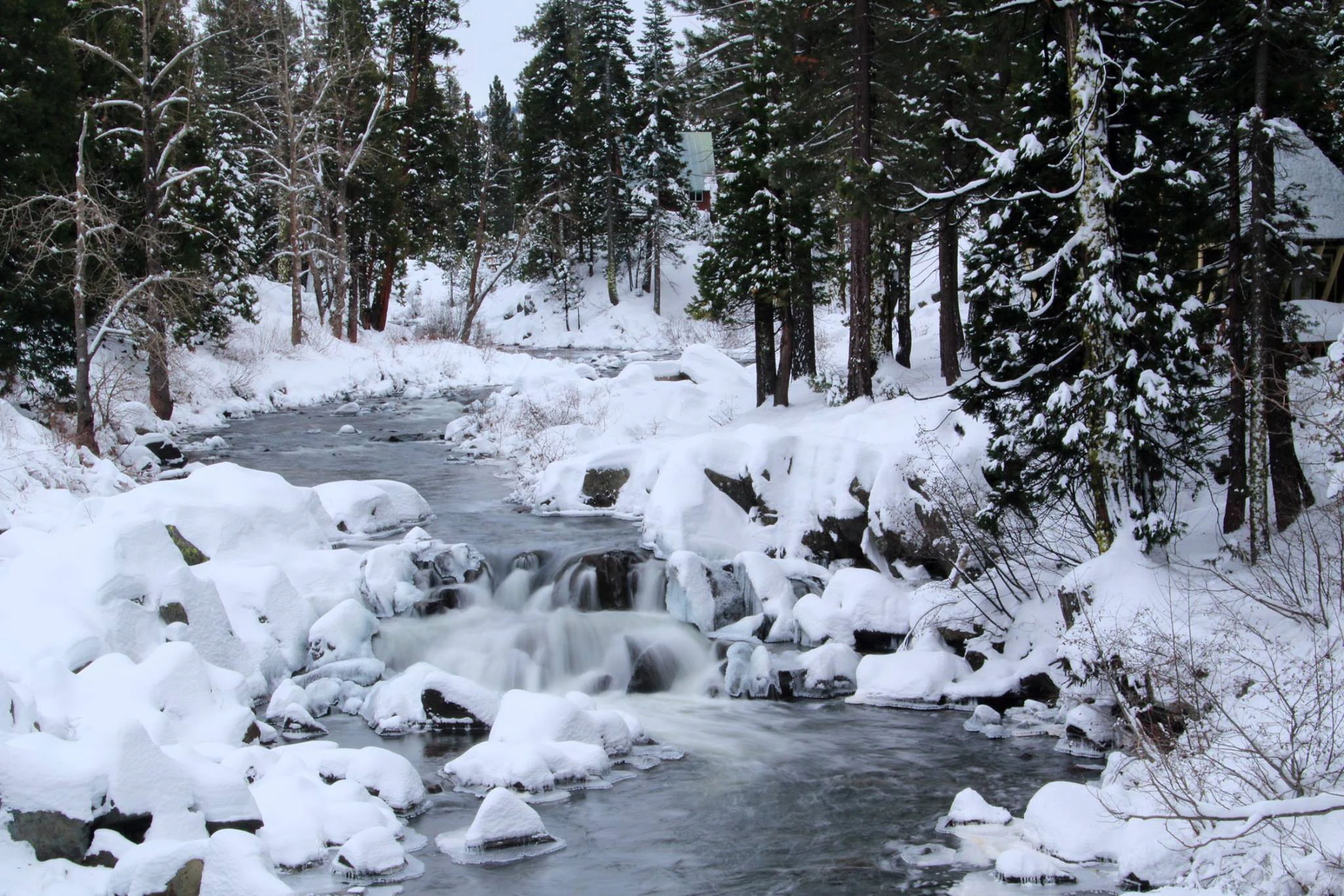
A rushing stream flows through a snow covered forest with ice and snow draped over the surrounding trees and rocks.
A snow covered stream flowing through the forest in Tahoe National Forest.

Tahoe National Forest history and protected-area timeline

The lands that now make up Tahoe National Forest have been inhabited for at least two thousand years. The Washoe people historically lived on these lands, using Lake Tahoe as a major source of food, fishing, and plant milling, and establishing seasonal camps along meadows and streams that flowed from the lake into the forest. Their presence was disrupted in 1849 with the California Gold Rush, when widespread migration brought miners and settlers into territories that had previously belonged to the Washoe.

In response to unregulated exploitation of forest resources, the federal government created the Forest Reserves in 1893. The Sierra Forest Reserve in California then encompassed over four million acres. The area that would become Tahoe National Forest was first formally reserved as the Lake Tahoe Forest Reserve on April 13, 1899. The name was later changed to Tahoe in 1905, and the reserve became part of the developing National Forest System that same year.

In 1905, President Theodore Roosevelt supported the transfer of forest reserves from the U.S. Department of the Interior to the Department of Agriculture, placing them under the new U.S. Forest Service led by Gifford Pinchot. This reshaped federal forest management and established the modern National Forest System. In 1908, the Sierra National Forest was divided into five units; subsequent adjustments led to the current configuration in which Tahoe National Forest is one of several Sierra Nevada forests.

The founding charter issued by Secretary of Agriculture James Wilson framed the National Forests as lands intended to preserve perpetual timber supplies, protect forest cover that regulates streamflow, and safeguard local residents from unfair competition in the use of forest and range resources. Since then, Tahoe National Forest has continued to be managed for timber, water, pasture, mineral, and recreation values under this overarching federal mandate.

In more recent years, the forest has faced significant wildfire pressure, most notably the 2021 Caldor Fire and the Bear Fire, which burned thousands of acres across the forest and surrounding landscapes. These events have reinforced the importance of fire prevention and access management across the forest.

Tahoe National Forest landscape and geographic character

Tahoe National Forest occupies a striking section of the western Sierra Nevada, where deep canyons, granite highlands, and forested ridges combine to form a varied mountain landscape. Elevations range from approximately 1,500 feet in the lower American River canyon to more than 9,000 feet along the Sierra Crest, including the high point of Mount Lola. The terrain reflects the broader geological character of the Sierra Nevada, with rivers cutting deep into granite bedrock to form river canyons, benches, and rugged valley walls.

Among the most prominent landforms is Sierra Buttes, an 8,587-foot peak near Sierra City that offers panoramic views to Mount Lassen in the north and Mount Shasta further north. The Granite Chief Wilderness lies nearby and features similar granite-dominated topography, with trails radiating outward toward Lake Tahoe and into more remote terrain. The American River watershed, which contains the Placer County Big Trees Grove, features dramatic canyon scenery and serves as one of the forest's defining geographic features.

Water dominates much of the landscape character. The forest holds hundreds of lakes and reservoirs, including Boca Reservoir, and is laced with rivers and streams that flow through canyon country. The Truckee River, which exits the forest eastward, continues across Nevada to Pyramid Lake. Two major roads, Foresthill Road and Mosquito Ridge Road, allow vehicle access to areas that otherwise would be considered remote in nearby national forests, making large portions of the landscape unusually accessible for a Sierra Nevada setting.
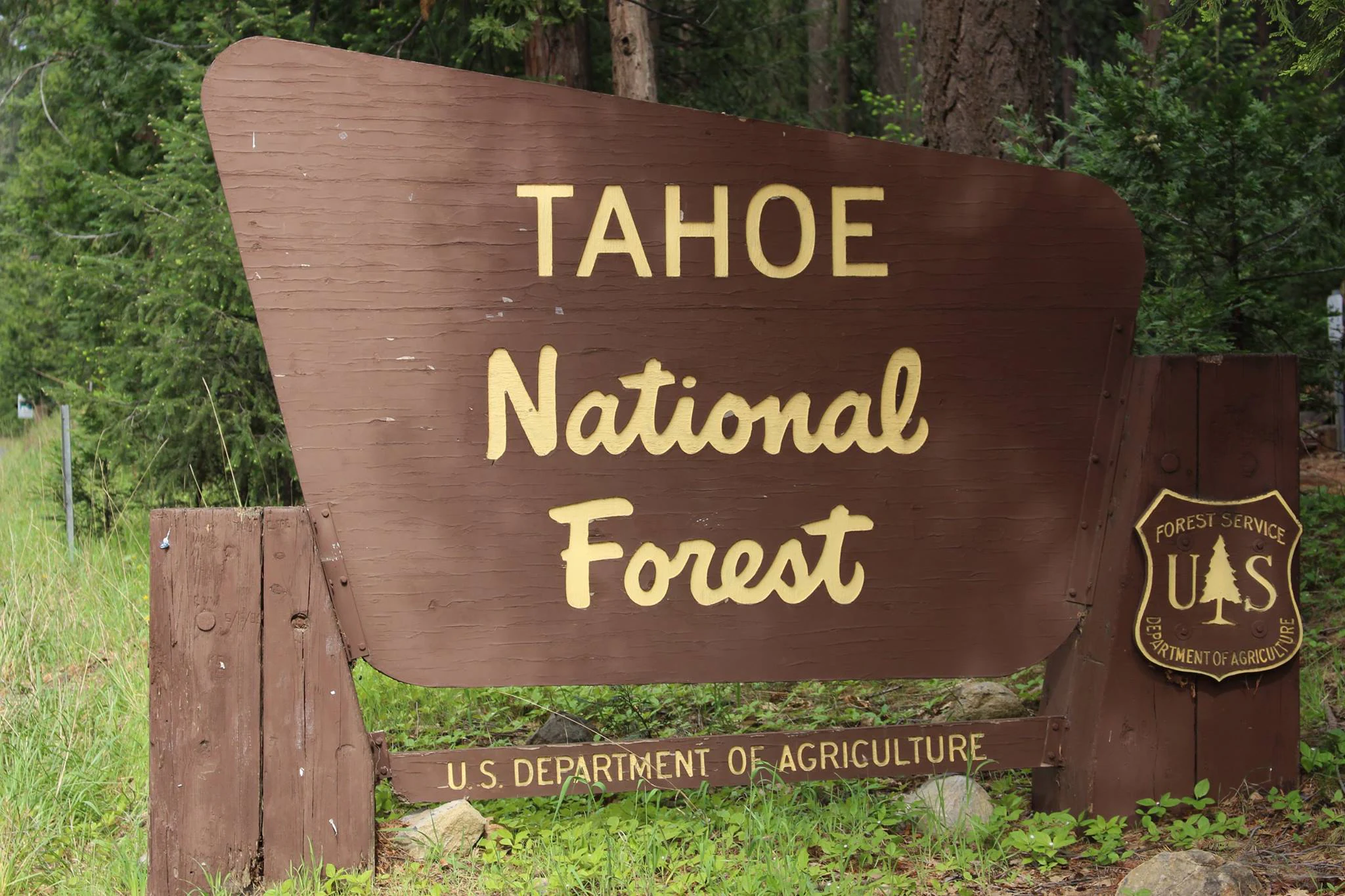
A brown wooden sign with yellow lettering reading Tahoe National Forest, positioned among green forest trees.
The official entrance sign for Tahoe National Forest.

Tahoe National Forest ecosystems, habitats, and plant life

Tahoe National Forest encompasses a layered sequence of Sierra Nevada vegetation zones, mirroring the steep rise from foothill canyons to high ridges. At lower elevations, mountain chaparral and mixed conifer forests dominate, while mid-elevations transition into red fir and mixed conifer with shaded understories. Higher slopes along the Sierra Crest include red fir forest, and drier eastern exposures support eastside sage-pine and brush communities. Old-growth forest survives in patches across the forest, with conifers such as coast Douglas fir, ponderosa pine, white fir, sugar pine, California incense cedar, lodgepole pine, and red fir coexisting alongside hardwood species like California black oak.

A 2002 report estimated nearly 84,000 acres of old growth within the forest, scattered across these vegetation zones. The Placer County Big Trees Grove in the American River watershed hosts six old-growth giant sequoias; although small in number, it is the northernmost grove of giant sequoias in existence, marking a rare northern outlier of that species.

The forest also faces ecological pressures from invasive plants. Documented invasive species include thistles, knapweeds, mustards, toadflaxes, daisies, brooms, and various aquatic weeds. Vegetation diversity and the contrast between wet west-side forests and drier east-side slopes help define the ecological identity of the forest.
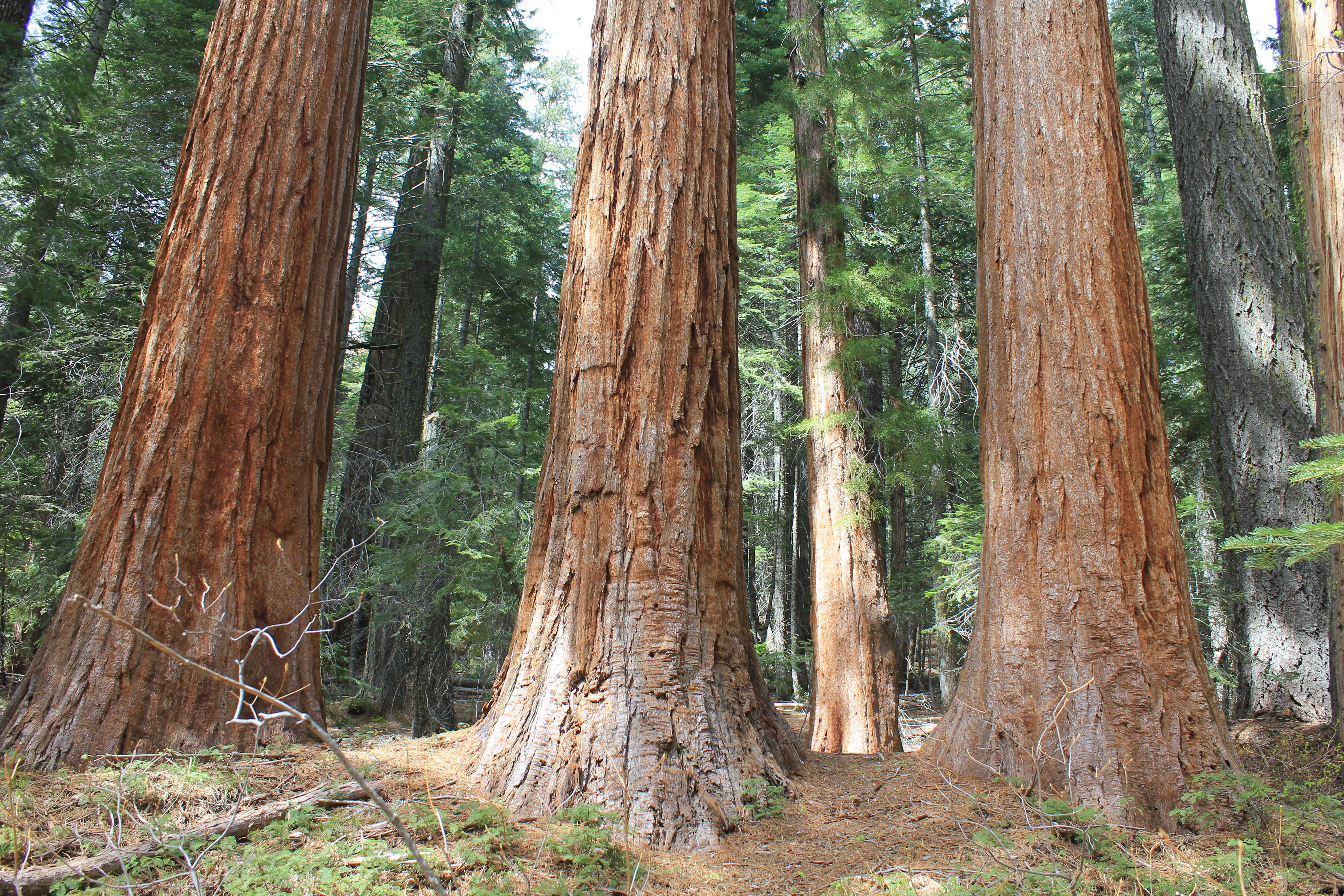
Several large mature giant sequoia trees with reddish-brown, fibrous bark standing in a forest setting.
Giant sequoias in the Placer Grove area of Tahoe National Forest.

Tahoe National Forest wildlife and species highlights

Tahoe National Forest supports diverse wildlife, with estimates suggesting more than 290 animal species use the forest alongside more than 1,000 plant species. The topographic and vegetation diversity drives this richness, allowing species associated with very different Sierra Nevada habitats to coexist within the same national forest.

Among the most prominent species are the Lahontan cutthroat trout, an important fish in the forest's cold-water streams and lakes; the Sierra red fox, a rare high-elevation carnivore; and the mountain beaver, a secretive rodent associated with dense undergrowth. The forest is also known to support wolverines, a notable high-country carnivore species that depends on extensive, relatively undisturbed terrain.

Riparian corridors along rivers such as the American River and the Truckee River support aquatic communities, and the many lakes and reservoirs provide habitat for fish and waterbirds. Higher forest zones provide habitat for species adapted to rocky, coniferous terrain, while lower chaparral and oak environments support different suites of wildlife. The combination of significant elevation range, varied habitats, and the presence of flagship species like the wolverine and Sierra red fox gives the forest considerable wildlife significance.

Tahoe National Forest conservation status and protection priorities

Tahoe National Forest was created and is managed according to a federal charter that emphasizes the long-term preservation of timber, water, pasture, and mineral resources for public benefit. From its origins as the Lake Tahoe Forest Reserve in 1899, the forest has functioned both as a working landscape and as a protected natural area, with explicit goals of preserving forest cover, regulating stream flow, and protecting local communities from resource exploitation.

The forest serves as a critical headwater area, providing drinking water to communities such as Lincoln, Auburn, and Rocklin in the California foothills, and to Reno and Sparks in Nevada via the Truckee River. This watershed role is itself a major conservation function, as healthy forest cover is essential to stabilize runoff and water quality.

Conservation significance also includes the roughly 84,000 acres of old-growth forest documented in 2002, the protection of the Placer County Big Trees Grove as the northernmost giant sequoia grove, and the protection of habitat for rare species such as the wolverine, Sierra red fox, and Lahontan cutthroat trout. Invasive plant management, old-growth retention, and watershed health are central concerns. Recent major wildfires, including the 2021 Caldor Fire and the Bear Fire, have underscored the importance of fire management, prevention, and visitor awareness in maintaining these conservation values.

Tahoe National Forest cultural meaning and human context

Tahoe National Forest occupies land with a long human history. The Washoe people lived in and around the area for at least two thousand years, using Lake Tahoe and surrounding meadows, streams, and fisheries as important sources of food and materials. Their seasonal camps along streams and in mountain meadows reflect a deep traditional relationship with the Sierra Nevada landscapes that now form the forest.

This cultural landscape was dramatically altered by the 1849 California Gold Rush, which brought large numbers of miners and settlers into the region and disrupted Washoe territorial control. The subsequent establishment of the Lake Tahoe Forest Reserve in 1899 and its later incorporation into the U.S. Forest Service system in 1905 marked a new phase of federal management that continues to shape how the land is used, including for grazing, timber, mining, water supply, and recreation.

Today, the forest reflects this layered history: an indigenous homeland, a Gold Rush era of resource extraction, and a modern era of federal conservation that integrates timber production, watershed protection, recreation, and ecological preservation into a single mandate.

Top sights and standout views in Tahoe National Forest

Tahoe National Forest's most compelling features include its dramatic elevation range from the American River canyon to summits above 9,000 feet, its granite river canyons, and the presence of Sierra Buttes offering long-distance views of Mount Lassen and Mount Shasta. The forest hides hundreds of lakes and reservoirs, with Boca Reservoir among the most prominent, and includes a portion of the Pacific Crest Trail, linking it into the wider Sierra Nevada hiking network.

Equally notable is the Placer County Big Trees Grove, the northernmost grove of giant sequoias, which gives the forest unique botanical significance. Combined with the Granite Chief Wilderness nearby and the forest's role as a vital headwater for both California foothill towns and Nevada communities, these features make Tahoe National Forest one of the most ecologically and hydrologically important national forests in the Sierra Nevada.

Best time to visit Tahoe National Forest

Tahoe National Forest offers distinct experiences across the seasons. Summer and early fall are typically the most favorable times for hiking, camping, fishing, mountain biking, and exploring lakes and reservoirs at higher elevations, when snow has receded from most roads and trails. Late spring runoff can revive waterfalls and river flows but may make some higher trails muddy or inaccessible.

Winter brings a very different character, transforming the forest into a recreation area for snow sports with opportunities for cross-country skiing, snowshoeing, and permitted Christmas tree cutting. Visitors during winter should expect seasonal road closures and snow-covered access routes. Shoulder seasons can be rewarding for those seeking fewer crowds, though weather variability, residual snow at high elevations, and fire restrictions or closures during dry periods can affect plans. Checking current fire restrictions and seasonal closures is advisable before visiting.

Monthly climate preview

Measured average temperatures and precipitation normals across the representative coordinate

Tahoe National Forest Climate and Long-Term Weather Patterns by Month

Representative coordinates record annual shifts in temperature and precipitation normals for Tahoe National Forest across twelve recorded intervals. Examining the complete monthly climate profile reveals precise variations in long-term averages for this protected California landscape.
Annual mean9 °C
0 °C21 °C
Jan
Feb
Mar
Apr
May10°
Jun16°
Jul21°
Aug20°
Sep17°
Oct10°
Nov
Dec
Warmest month
July

20.8 °C

Coolest month
December

-0 °C

Wettest month
December

6.4 mm/day

Driest month
July

0.1 mm/day

Park location guide

Geography guide, regional context, and park location map for Tahoe National Forest

Tahoe National Forest park geography, regions, and map view in United States of America

Understand where Tahoe National Forest sits in United States of America through a broader geographic reading of the surrounding landscape, nearby location context, and its mapped position within the national park landscape.

How Tahoe National Forest fits into United States of America

The United States of America is a federal presidential republic and one of the world's largest countries by area and population. It consists of 50 states across a vast territory spanning multiple time zones, with its capital in Washington, D.C. and largest city in New York City. The nation has a diverse economy, influential political system, and significant cultural and military presence globally.

Wider geography shaping Tahoe National Forest in United States of America

The United States occupies a vast territory in North America, bordered by Canada to the north and Mexico to the south. The 48 contiguous states stretch from the Atlantic to the Pacific Ocean, while Alaska occupies the northwestern region and Hawaii is an archipelago in the Pacific. The country encompasses diverse terrain including the Rocky Mountains, Appalachian Mountains, Great Plains, and extensive river systems.

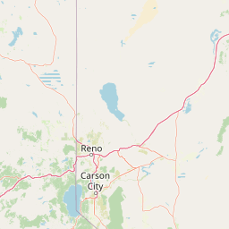
Map view of Tahoe National Forest

Use this park location map to pinpoint Tahoe National Forest in United States of America, understand its exact geographic position, and read its mapped placement within the surrounding landscape more clearly.

Pigeon | © OpenStreetMap contributors

Location context for Tahoe National Forest

California
Recorded earthquake history

Explore the Historical Earthquake Records for Tahoe National Forest

Review the documented history of seismic activity associated with this expansive region of the Sierra Nevada. MoriAtlas provides a clear, searchable catalogue of recorded earthquake events, magnitudes, and depths for researchers and enthusiasts examining the area's long-term geological context.

Tahoe National Forest Earthquake History

Catalogued events

746 events

Strongest magnitude

Magnitude 5.7

Most recent event

Jun 27, 2026

This history includes earthquakes recorded inside the park or within 50 km of its borders

Examine protected area views, granite river canyons, and alpine habitats across the Sierra Nevada.

Tahoe National Forest Photos and Scenic Landscapes Visual Exploration

Visual records illustrate the rugged mountain terrain, dense conifer forests, and alpine water basins defining Tahoe National Forest. Photographic documentation offers clear insight into the protected landscape character, geological features, and diverse elevation zones spanning the region.

A rushing stream flows through a snow covered forest with ice and snow draped over the surrounding trees and rocks.

A wide, eye level view of a green meadow in the foreground transitioning into a dense coniferous forest and rocky mountain ridgeline under a partly cloudy sky.

A brown wooden sign with yellow lettering reading Tahoe National Forest, positioned among green forest trees.

Several large mature giant sequoia trees with reddish-brown, fibrous bark standing in a forest setting.

Park atlas

Compare surrounding mountain terrain and connected wilderness areas

Parks Near Tahoe National Forest and Related Sierra Nevada Protected Landscapes

Browsing parks near Tahoe National Forest reveals adjacent mountain ecosystems and deep granite river canyons across the Sierra Nevada. Extending the geographic comparison highlights connected protected landscapes and regional watershed geography.
A watercolor painting showing soft green hills, distant pink-hued mountains, and a pale blue lake in a serene, stylized landscape.
Protected landscapeNevada
Park boundaries overlap#1 closest

East

Humboldt, Toiyabe National Forest: Protected Landscape and Regional Mountain Geography

A vast network of Nevada mountain ranges and alpine wilderness

Humboldt, Toiyabe National Forest serves as a defining public land entity across Nevada and eastern California. As the largest national forest in the contiguous United States, it preserves a striking collection of isolated mountain ranges, including the Ruby Mountains and the rugged Jarbidge wilderness, within a broader basin-and-range landscape. Examine the boundaries and terrain that characterize this complex, high-desert ecosystem.

Area
25,454 km²
Established
1908
Relief
Mountain
Access
Easy access
Protected landscapeCalifornia
Park boundaries overlap#2 closest

North

Plumas National Forest: Mapped Geography and Protected Landscape Features in California

Exploring the Sierra Nevada watershed and wilderness terrain

Plumas National Forest serves as a critical protected landscape in northern California, anchoring the headwaters of the Feather River system. This atlas entry details the forest's rugged canyons, high elevation mountain lakes, and significant old growth conifer stands that define its role within the northern Sierra Nevada ecosystem.

Area
4,640 km²
Established
1907
Relief
Mountain
Climate
Mediterranean
Protected areaNevada
About 10 km away#3 closest

Southeast

Mount Rose Wilderness: Protected Landscape and Regional Geography in Northwestern Nevada

Carson Range alpine terrain and ecological transition mapping

Mount Rose Wilderness represents a significant protected area in the Carson Range, where 31,223 acres of terrain transition from the forested, subalpine slopes of the Sierra Nevada to the drier, sage-dominated Great Basin. The mapped landscape includes high granite peaks and meadows, offering a clear view of the complex environmental gradients that define this unique section of the American West.

Area
126.35 km²
Established
1989
Relief
Mountain
Climate
Temperate
A wide watercolor illustration showing a calm body of water surrounded by green hills, conifer trees, and reeds in the foreground.
Protected landscapeCalifornia
47 km away#4 closest

North

Lassen National Forest: Mapped Geography and Protected Landscapes of Northern California

Volcanic terrain and expansive old growth ecosystems

Lassen National Forest represents a vast protected landscape in Northern California, defined by its severe volcanic geology and resilient conifer forests. This atlas entry provides essential geographic context regarding the forest boundaries, the volcanic rim of Mount Tehama, and the intricate river systems shaping the region. Explore the terrain, from accessible lava tubes to the wilderness areas preserved within this significant mountain corridor.

Area
4,331.53 km²
Established
1905
Relief
Mountain
Climate
Temperate
Watercolor painting of green rolling hills, a tree-lined foreground, and a soft pink sunset sky.
Protected landscapeCalifornia
53 km away#5 closest

South

Stanislaus National Forest: Sierra Nevada Mountain Geography and Protected Wilderness Lands

California mountain terrain and forest landscape map

Stanislaus National Forest is a sprawling protected landscape located in the central Sierra Nevada of California. Characterized by volcanic and granite formations, the area protects critical watersheds, Wild and Scenic rivers, and large swaths of old growth forest that define the rugged mountain interior.

Area
3,634.48 km²
Established
1897
Relief
Mountain
Climate
Temperate
Wildlife reserveCalifornia
77 km away#6 closest

Northwest

Ishi Wilderness Wildlife Reserve: Mapping the Volcanic Canyons of the Cascade Foothills

Geographic atlas of protected northern California wilderness and cultural landscapes.

Ishi Wilderness represents a crucial protected area in northern California, where volcanic geology meets a deep-rooted cultural history. Explore the mapped ridgelines, river canyons, and diverse oak woodland habitats that define this unique wildlife reserve and its role within the Cascade foothills.

Area
167.29 km²
Established
1984
IUCN
Ib
Relief
Mountain
National parkCalifornia
87 km away#7 closest

Northwest

Lassen Volcanic National Park: Protected Landscape Identity and Geographic Context

Discover the mapped boundaries and natural terrain of this California national park.

Gain a structured understanding of Lassen Volcanic National Park as a protected landscape. This detail page provides essential geographic context, focusing on the park's mapped boundaries and its specific terrain characteristics within California. It is designed for users seeking detailed information about the park's protected status and its placement within the broader atlas of natural areas, emphasizing its unique geographic identity and conservation significance.

Area
430.8 km²
Established
1916
IUCN
II
Visitors
504.8K annual
Watercolor painting of a tranquil mountain lake surrounded by pine forests and distant rolling peaks in muted green and pink tones.
Wildlife reserveTuolumne County
91 km away#8 closest

Southeast

Emigrant Wilderness: A Detailed Geographic Atlas of Protected Sierra Nevada Landscapes

Mapping glaciated granite basins and volcanic ridges in Tuolumne County.

Emigrant Wilderness is a sprawling protected area defined by a distinct mix of granitic domes, cirques, and a unique volcanic sector in its northeastern reaches. Spanning from lower forest elevations to alpine peaks, the area provides a window into the complex geological history of the central Sierra Nevada. The terrain includes hundreds of high-country lakes and meadow systems that support diverse alpine ecosystems and represent the rugged nature of the Pacific Crest Trail corridor.

Area
454.37 km²
Established
1974
IUCN
Ib
Relief
Mountain

Common questions about visiting, size, designation, and location context for Tahoe National Forest

Tahoe National Forest FAQs for park facts, access, geography, and protected area context

Find quick answers about Tahoe National Forest, including protected-area facts, park geography, trail and visitor context, and how the park fits into its surrounding country and regional landscape.
MoriAtlas Explorer

Continue Your Protected Areas Search Across the Global Atlas

Deepen your exploration by continuing the structured search for national parks and protected areas worldwide. Utilize the comprehensive filtering capabilities to compare different conservation landscapes and refine your understanding of global park geography. Discover more about the distribution and characteristics of protected natural areas.

Global natural geography