
Mori Atlas logo
Nature reserveUnkenpfuhle Marzahn

Examining the unique glacial topography and wetland habitats of this urban protected landscape

Unkenpfuhle Marzahn: A Critical Protected Nature Reserve and Amphibian Sanctuary in Berlin

(Naturschutzgebiet Unkenpfuhle Marzahn)

Unkenpfuhle Marzahn serves as an essential nature reserve within the Berlin urban landscape, protecting three distinct ponds and surrounding dry grassland communities. This small but ecologically significant area, forged by glacial moraine processes, safeguards rare amphibian populations and diverse flora. Discover the precise geographic boundaries and the complex habitat mosaic that makes this site a vital natural refuge in eastern Berlin.

urban nature reserveamphibian breeding pondsdry grasslandreedbedglacial moraineendangered amphibians
A flat-style digital illustration showing a winding river flowing through a forested valley toward a large waterfall cascading down rocky mountain cliffs under a pale sky.

Unkenpfuhle Marzahn

Nature reserve

Park overview

Structured park overview, official facts, and landscape profile for Unkenpfuhle Marzahn

Unkenpfuhle Marzahn park facts, protected area profile, and essential visitor context

Review the core facts for Unkenpfuhle Marzahn, including designation, size, terrain, visitor scale, habitats, and operating context in one park-focused overview.

About Unkenpfuhle Marzahn

Unkenpfuhle Marzahn is a compact nature reserve in Berlin-Marzahn that exemplifies how small, carefully managed green spaces can hold significant ecological value within a major European city. Covering only about 3.3 hectares, the reserve encompasses three ponds, varying in size from a tiny 65 square metre pool to a 300 square metre waterbody, along with reedbeds, scrub, dry grassland, and ruderal vegetation.

The reserve lies north of the Parkfriedhof Marzahn cemetery and is otherwise hemmed in by commercial land use. Despite this urban context, the combination of open water, shallow marshy margins, and adjacent dry sandy grassland creates a remarkable diversity of microhabitats packed into a tiny footprint. This mosaic supports a surprising range of amphibian, reptile, and invertebrate species that would otherwise struggle in Berlin's built-up east.

Unkenpfuhle Marzahn is one of more than thirty designated nature reserves across Berlin and stands out for its role in amphibian conservation. Its small size and fenced, non-accessible character distinguish it from typical open parkland, making it primarily a refuge for wildlife rather than a place for active public recreation. Instead, the surrounding walking paths and trails offer visitors a chance to appreciate its protected character from the perimeter.

Quick facts and research context for Unkenpfuhle Marzahn

Unkenpfuhle Marzahn is a designated nature reserve (Naturschutzgebiet) located in the Marzahn locality of the Marzahn-Hellersdorf borough in eastern Berlin. Its official designation is NSG-34 and it falls within IUCN Category IV (Habitat/Species Management Area).

The reserve covers roughly 3.3 hectares and consists of three separate waterbodies (Unkenpfuhl I, II, and III), reedbeds, dry grassland, and ruderal vegetation. It was placed under formal protection by ordinance on 25 October 2001, with effect from 10 February 2002.

The area is fenced and not open to public access, although the long-distance Hönower Weg walking trail runs along its edge. Protection is focused on endangered amphibian breeding habitat and rare plant communities typical of sandy and loamy glacial ground moraines.

Protection and recognition

Explore documented terrestrial protection records and recognition data for Unkenpfuhle Marzahn.

Unkenpfuhle Marzahn Protection Status and Designated Conservation Scope

Unkenpfuhle Marzahn maintains a documented terrestrial protection status within the global protected area network. Conservation records compile official management scope and designation tracking without external recognition sources.

Protection details

Protection scope
Terrestrial
WDPA ID
319238
Park context

Deeper park guide and search-rich context for Unkenpfuhle Marzahn

Unkenpfuhle Marzahn history, landscape, wildlife, and travel context

Explore Unkenpfuhle Marzahn through its history, landscape character, ecosystems, wildlife, conservation priorities, cultural context, and seasonal travel timing in a structured park guide built for atlas discovery and search intent.

Why Unkenpfuhle Marzahn stands out

Unkenpfuhle Marzahn is best known as one of Berlin's important amphibian breeding reserves in an intensely urban environment. The three ponds, although extremely small, were created or shaped partly through former construction activity and now sustain populations of rare toads and frogs that have largely vanished from surrounding districts. The reserve is also notable for the unexpected coexistence of rare dry grassland habitats, including remnants of carrot and white melilot communities, alongside wet reedbeds and pond margins. This combination of microhabitats, all compressed into a few hectares, gives the site disproportionate ecological value within the city. The name itself references the fire-bellied toad, the species that was historically a key reason for the protection designation even though it has since disappeared locally.
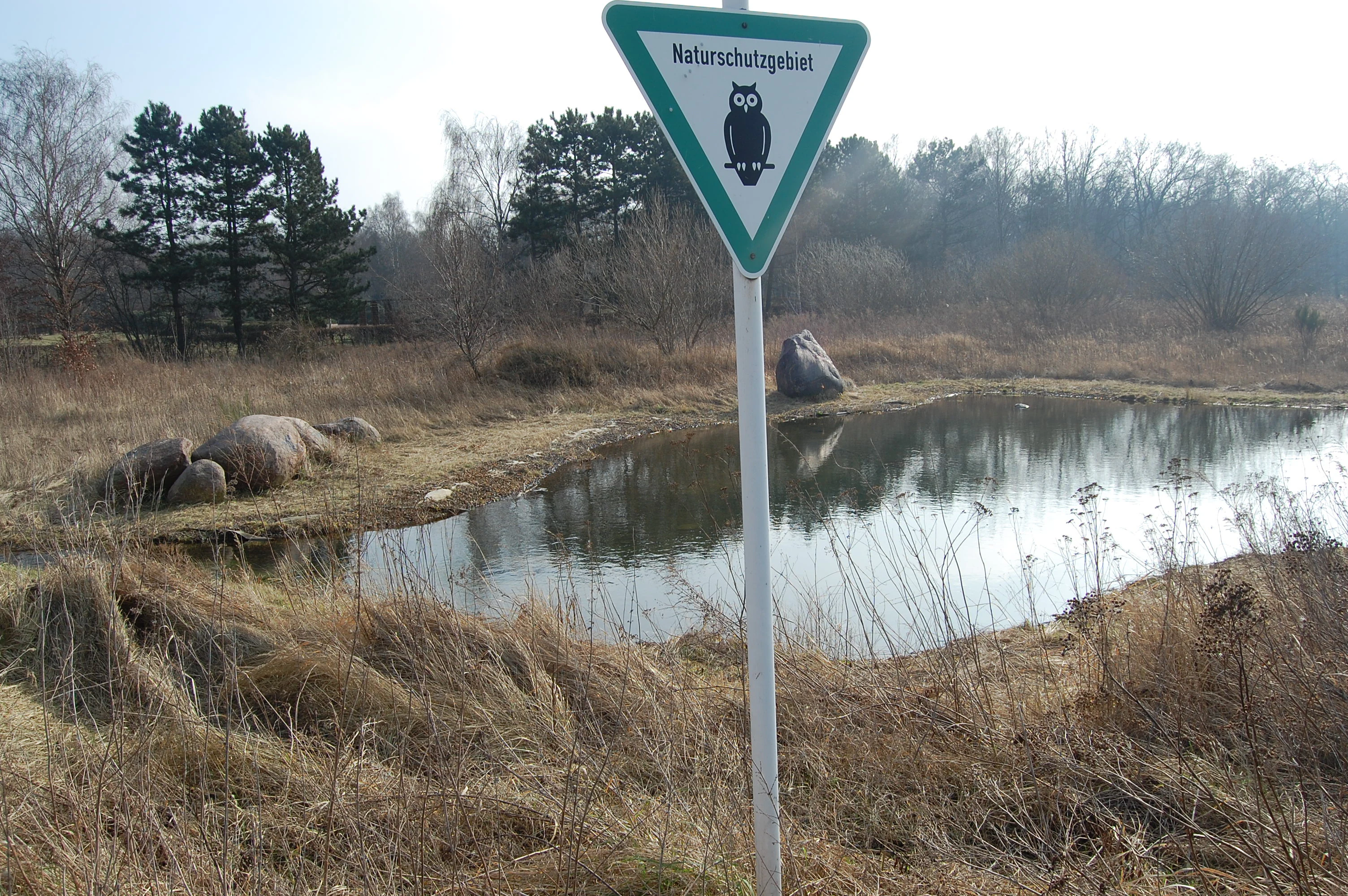
A triangular Naturschutzgebiet sign featuring an owl symbol, standing in front of a small pond surrounded by dry grasses and trees.
A nature reserve sign at the Unkenpfuhle Marzahn, marking the protected wetland area.

Unkenpfuhle Marzahn history and protected-area timeline

The geological foundation of the Unkenpfuhle area was laid during the Weichselian glaciation, when ground moraine deposits of glacial till accumulated to form a gently undulating plateau. The present-day soils are dominated by loamy sand and loam over poorly permeable clay and till layers, which is why water can collect on the surface and sustain ponds.

In the 1980s, the Marzahn housing estate was built, and the area that would eventually become the nature reserve was used as a construction site. In 1985, the first two ponds (Unkenpfuhl I and II) were formed within former building pits. A drainage channel (Unkenpfuhlgraben) was later dug north of the cemetery in the 1990s, although in practice it contributes little or no water to the ponds.

By the mid-1990s, the local environment office had recognised the ecological value of the unintentional ponds and their surroundings. In 1996, soil probing confirmed an impermeable clay layer that helped retain water in the basins. A third pond, Unkenpfuhl III, was deliberately created in the mid-1990s to bolster amphibian populations, with a shallow profile and sealed base.

The area received formal protection through an ordinance dated 25 October 2001, taking legal effect on 10 February 2002. This made Unkenpfuhle Marzahn a fully recognised Naturschutzgebiet under Berlin law, with its full official title being Naturschutzgebiet Unkenpfuhle Marzahn.

Unkenpfuhle Marzahn landscape and geographic character

The physical landscape of Unkenpfuhle Marzahn is shaped by the legacy of the Weichselian glaciation. Beneath the reserve, a ground moraine plateau composed largely of glacial till provides a substrate of loamy sand and loam over heavier, poorly permeable layers. It is this natural sealing that allows the ponds to hold water without significant inflow.

The surface topography is gentle and undulating, with low embankments around the smallest pond and a shallow excavated basin for the largest. Natural stone blocks were placed around Unkenpfuhl III as part of its 1990s construction, becoming permanent landscape features.

Surrounding land use is essentially urban. To the south lies the Parkfriedhof Marzahn, a park cemetery, and elsewhere the reserve is bordered by commercial and industrial zones. Within this tight urban envelope, the ponds and their immediate fringing habitats form a small but pronounced natural depression in an otherwise built landscape.

Unkenpfuhle Marzahn ecosystems, habitats, and plant life

Ecologically, Unkenpfuhle Marzahn combines several distinct habitat types in a very small area. Open water in the three ponds is fringed by reedbeds of common reed and bulrush, and on the shallower margins by low marsh communities of rushes, sedges, and amphibious herbs. Hornwort, water knotweed, and various pondweeds grow submerged or floating in the waterbodies.

Landward of the wet zones, the reserve has retained patches of dry and semi-dry grassland communities typical of sandy, calcium-influenced soils in the Berlin region. Wild carrot and white melilot flourish in these dry swards, and surveys have recorded around 220 fern and flowering plant species within the small site.

Vegetation management is essential here. Continuous succession would otherwise convert the open habitats to scrub and woodland; conversely, unchecked expansion of reed would silt up the ponds. Periodic removal of broad-leaved cattail and other interventions are used to keep the balance between open water, marsh, grassland, and shrub.

Unkenpfuhle Marzahn wildlife and species highlights

Unkenpfuhle Marzahn is most celebrated as an amphibian breeding refuge. The reserve provides spawning habitat for endangered species including the European green toad, the garlic toad, the moor frog, the smooth newt, and the common water frog. Historically it also hosted the fire-bellied toad, the species for which the reserve is named, though that species is now locally extinct; individuals were still documented in 1996 but disappeared in the years following protection.

Reptiles and invertebrates round out the wildlife profile. Sand lizards and grass snakes use the dry and damp edges depending on the season, while at least 34 butterfly species have been recorded across the reserve, taking advantage of the diverse flora. Small refuges distributed across the reserve serve as overwintering and retreat sites for amphibians, helping populations persist through cold months.

The combination of rare amphibians, reptiles, and pollinators gives Unkenpfuhle Marzahn an ecological importance that is unusually high for such a small site embedded in an urban district.

Unkenpfuhle Marzahn conservation status and protection priorities

The core conservation purpose of Unkenpfuhle Marzahn is the long-term protection of breeding habitat for endangered amphibians and the preservation of rare plant communities. Protection status under Berlin nature reserve law, combined with IUCN Category IV designation, gives the area a strong legal framework for habitat management.

Active measures reflect this priority. Water levels in Unkenpfuhl I and II have been stabilised through engineering work, including a 1992 lining intervention in the southern part of the smaller pond. Construction debris, old shafts, and unnecessary fencing from the site's earlier life as a building site have been cleared. Periodic mowing, selective clearing, and partial renewal of the perimeter fence keep habitats in suitable condition.

The reserve is also heavily dependent on volunteer engagement. Local honorary caretakers carry out much of the practical conservation work, an arrangement that gives the site sustained care but also constrains how intensively it can be managed. The fenced and non-accessible character is itself a deliberate conservation choice, designed to limit disturbance to sensitive species.

Unkenpfuhle Marzahn cultural meaning and human context

Unkenpfuhle Marzahn sits within Marzahn, a district strongly shaped by late twentieth-century large-scale housing construction. The reserve emerged from the very processes that defined modern Marzahn: large estates, construction activity, and infrastructure development. Its ponds were essentially accidental products of building pits from the 1980s, before being deliberately turned into a nature reserve.

This origin gives the reserve a particular local cultural meaning. Rather than being an untouched patch of countryside, it represents a successful transformation of a residual urban construction site into a valued habitat. The neighbouring Parkfriedhof Marzahn reinforces this sense of green infrastructure shaped by careful planning rather than natural wilderness.

The reserve's relationship with the Hönower Weg, a long-distance walking trail that runs along its edge, ties it into the wider regional network of recreational paths that connect eastern Berlin's green spaces.

Top sights and standout views in Unkenpfuhle Marzahn

The strongest points of distinction at Unkenpfuhle Marzahn are its three protected ponds, the contrasting dry and wet habitats compressed into a minuscule area, and the unusual concentration of threatened amphibian species within a dense Berlin neighbourhood. Despite being only about 3.3 hectares, the reserve supports more than two hundred plant species and dozens of butterfly species in addition to its herpetological fauna.

The site's origin story, where construction debris and former building pits were turned into officially designated wildlife habitat, is also a highlight in itself. Active management, including targeted control of reed expansion and ongoing water-level stabilisation, keeps the protected habitats in ecologically valuable condition.

For visitors, the main highlight is the experience of encountering a fenced, protected nature reserve tucked between commercial zones and a major Berlin cemetery, a tangible example of how small, well-managed urban reserves can carry real ecological weight.

Best time to visit Unkenpfuhle Marzahn

Unkenpfuhle Marzahn itself is fenced and not accessible to visitors, so appreciation of the site is largely tied to surrounding paths such as the Hönower Weg. These paths can be walked at any time of year, but late spring and early summer tend to bring the most active amphibian and reptile movements and the richest display of dry grassland wildflowers.

Late summer can also be rewarding visually, when reedbeds and flowering plants reach their peak biomass and butterfly activity around the reserve margins is high, though many of these species occur just outside the fence. Winter visits offer quieter, more contemplative walking, with the dormant marsh and grassland landscape visible from the perimeter.

Because the reserve itself is closed to entry, weather considerations matter mainly for comfortable walking along the adjacent trails rather than for any specific wildlife viewing condition inside the protected area.

Monthly climate preview

Long-term representative point measurements for monthly temperature and precipitation variation

Unkenpfuhle Marzahn Climate Normals and Annual Temperature Rhythm

Unkenpfuhle Marzahn exhibits a measured annual temperature range from sub-zero winter minimums to warm summer maximums alongside steady daily precipitation rates. Examining the complete twelve-month climate profile reveals detailed long-term averages across all recorded observation periods.
Annual mean9 °C
-1 °C20 °C
Jan-1°
Feb
Mar
Apr
May14°
Jun18°
Jul20°
Aug20°
Sep15°
Oct
Nov
Dec
Warmest month
July

20.3 °C

Coolest month
January

-0.9 °C

Wettest month
July

2.4 mm/day

Driest month
April

1.1 mm/day

Park location guide

Geography guide, regional context, and park location map for Unkenpfuhle Marzahn

Unkenpfuhle Marzahn park geography, regions, and map view in Germany

Understand where Unkenpfuhle Marzahn sits in Germany through a broader geographic reading of the surrounding landscape, nearby location context, and its mapped position within the national park landscape.

How Unkenpfuhle Marzahn fits into Germany

Germany is a federal republic in Western and Central Europe with a population of over 83 million across sixteen constituent states. It is Europe's largest economy by nominal GDP and a major global exporter and importer. The capital is Berlin, and the country borders Denmark, Poland, Czech Republic, Austria, Switzerland, France, Luxembourg, Belgium, and the Netherlands.

Wider geography shaping Unkenpfuhle Marzahn in Germany

Germany is located in Western and Central Europe, spanning 357,022 km². It borders Denmark to the north, Poland and the Czech Republic to the east, Austria and Switzerland to the south, and France, Luxembourg, Belgium, and the Netherlands to the west. The country has coastlines on the Baltic Sea and North Sea to the north, with the Alps located in the southern region.

Map view of Unkenpfuhle Marzahn

Use this park location map to pinpoint Unkenpfuhle Marzahn in Germany, understand its exact geographic position, and read its mapped placement within the surrounding landscape more clearly.

Pigeon | © OpenStreetMap contributors

Location context for Unkenpfuhle Marzahn

Berlin

Visualizing urban amphibian breeding ponds and rare dry grassland habitats

Unkenpfuhle Marzahn Photos and Landscape Scenery

Visual records reveal the physical terrain and protected habitats of Unkenpfuhle Marzahn within its dense urban Berlin environment. Photographic observation clarifies the topography of the glacial moraine ponds, surrounding reedbeds, and specialized conservation zones.

A triangular Naturschutzgebiet sign featuring an owl symbol, standing in front of a small pond surrounded by dry grasses and trees.

A wide, flat field of dry, tall grass in the foreground and midground, with a few bare trees and apartment buildings in the background under a pale sky.

Park atlas

Compare adjacent urban reserves and connected conservation areas across the surrounding region.

Exploring Parks Near Unkenpfuhle Marzahn and Regional Protected Landscapes

Browse other protected areas and urban nature reserves located near Unkenpfuhle Marzahn to compare regional habitats and wetland ecosystems. Examining adjacent conservation zones provides broader geographical context for urban wildlife preservation and regional park geography.
A watercolor painting of a flat, marshy landscape with soft green trees in the midground and pale hills under a light sky in the background.
Nature reserveBerlin
About 2.9 km away#1 closest

North

Falkenberger Rieselfelder Nature Reserve: A Detailed Atlas of Berlin Protected Lands

Reclaimed wetland geography and urban conservation habitats

Falkenberger Rieselfelder acts as an ecologically rich refuge where former industrial irrigation fields have been repurposed into a mosaic of seasonal pools and meadows. Located on the urban fringe of Berlin, this nature reserve offers a unique look at how conservation grazing and habitat management support species like the great crested newt within a dense metropolitan region.

Area
0.881 km²
Established
1995
IUCN
IV
Relief
Lowland
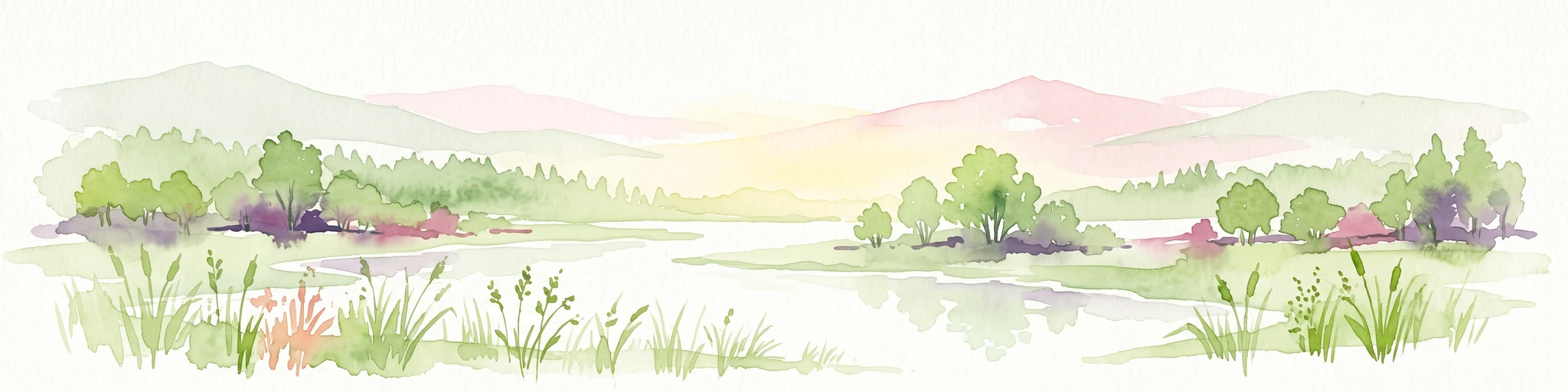
Watercolor painting of a peaceful wetland landscape with lush green trees, reeds, and soft hills in the background under a light sky.
Nature reserveBerlin
About 4.8 km away#2 closest

Northwest

Malchower Aue Nature Reserve: A Detailed Atlas of Urban Protected Landscapes in Berlin

Wetland habitats and glacial terrain within the Berlin city limits.

Malchower Aue stands as a protected enclave of wetland diversity featuring a system of reed-fringed peat-cutting ponds, wet meadows, and rare dry-grassland vegetation on historical soil mounds. This site provides a vital geographic perspective on how post-glacial relief and human land-use history shape protected areas within the modern urban landscape of Berlin.

Area
0.222 km²
Established
1995
Relief
Lowland
Climate
Temperate
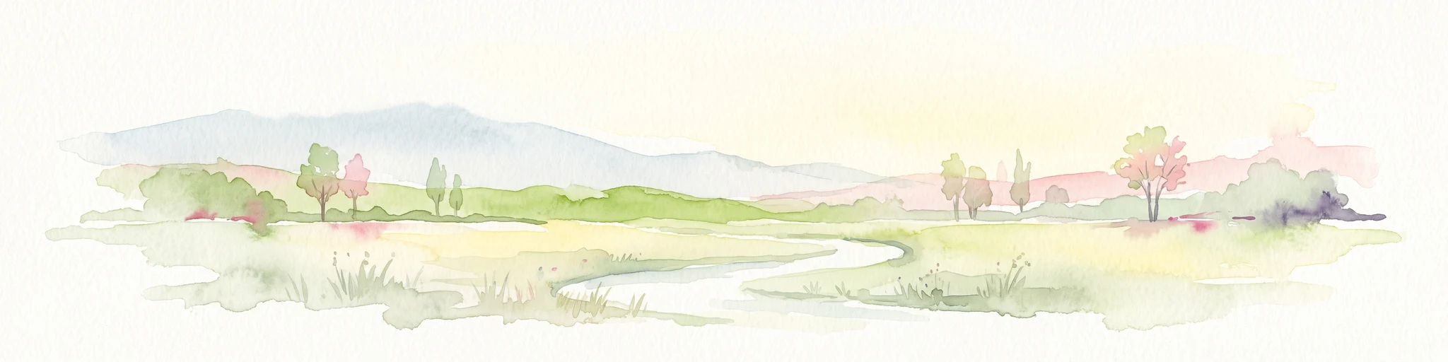
A pale, minimalist watercolor painting depicting an open field with a winding stream, scattered trees, and distant rolling hills on a white background.
Nature reserveBerlin
About 7 km away#3 closest

South

Biesenhorster Sand Nature Reserve: Protected Glacial Landscape in Berlin

Urban nature reserve featuring dry grassland and rare species habitats.

Located in eastern Berlin, Biesenhorster Sand preserves a significant glacial outwash plain that supports an extraordinary concentration of rare species. This nature reserve serves as a vital ecological corridor, protecting a mosaic of dry grassland and open sand terrain that contrasts with the surrounding urban fabric of Germany's capital.

Area
0.429 km²
Established
2021
Relief
Lowland
Scope
Terrestrial
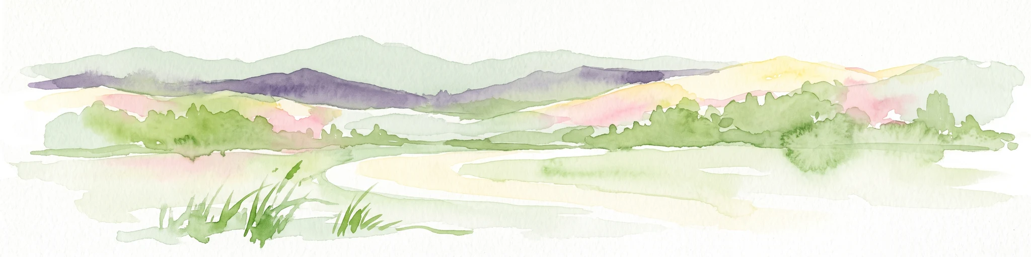
Watercolor painting of a rolling landscape with green grass, bushes, and soft-colored hills in the background.
Protected landscapeBerlin
About 7 km away#4 closest

Southeast

Kaulsdorfer Seen: A Protected Landscape in Berlin with Glacial and Industrial History

Exploring the groundwater protection zones and post-mining lakes of eastern Berlin

The Kaulsdorfer Seen area represents a distinct protected landscape located in Berlin. It showcases the transition between ice-age glacial regions, featuring two prominent lakes that evolved from sand and gravel pits into a mature ecosystem of willow thickets, woodland, and reeds. This site functions as an important drinking-water protection zone, offering a structured look at the complex interplay between urban development and natural resource conservation.

Area
0.937 km²
Water
Major water bodies
A horizontal watercolor painting depicting a marshy landscape with ponds, green vegetation, and soft distant hills against a light background.
Nature reserveBerlin
About 9.6 km away#5 closest

Northwest

Karower Teiche Nature Reserve: Mapped Protected Wetland Geography in Northeast Berlin

Transitional lowland fen and pond mosaic

Karower Teiche protects a unique 128 hectare wetland mosaic in the Pankow district of Berlin. Centered on four shallow ponds and extensive reedbeds, the reserve maintains a vital ecological corridor between the Barnim plateau and the Berlin glacial valley. This site provides essential habitat for amphibians and reed-specialist birds within an urban setting.

Area
1.286 km²
Established
1994
IUCN
IV
Relief
Lowland
Watercolor illustration showing a soft landscape with a pond, marsh vegetation, and a background of rolling hills or meadows.
Nature reserveBerlin
About 11 km away#6 closest

North

Mittelbruch Nature Reserve: Mapped Wetland Geography and Protected Landscape in Berlin

Examining lowland peat diggings and protected moorland ecosystems

Mittelbruch stands as a compact nature reserve in northeastern Berlin, featuring a layered landscape of former peat diggings and open moor meadows. This area plays a critical role in urban conservation by providing essential refuge for waterbirds and diverse meadow flora. Utilize the atlas to study the reserve's internal geography, including its managed reed belts and surrounding forest edges that form a distinct ecological mosaic within the city landscape.

Area
0.282 km²
Established
1997
IUCN
IV
Relief
Lowland
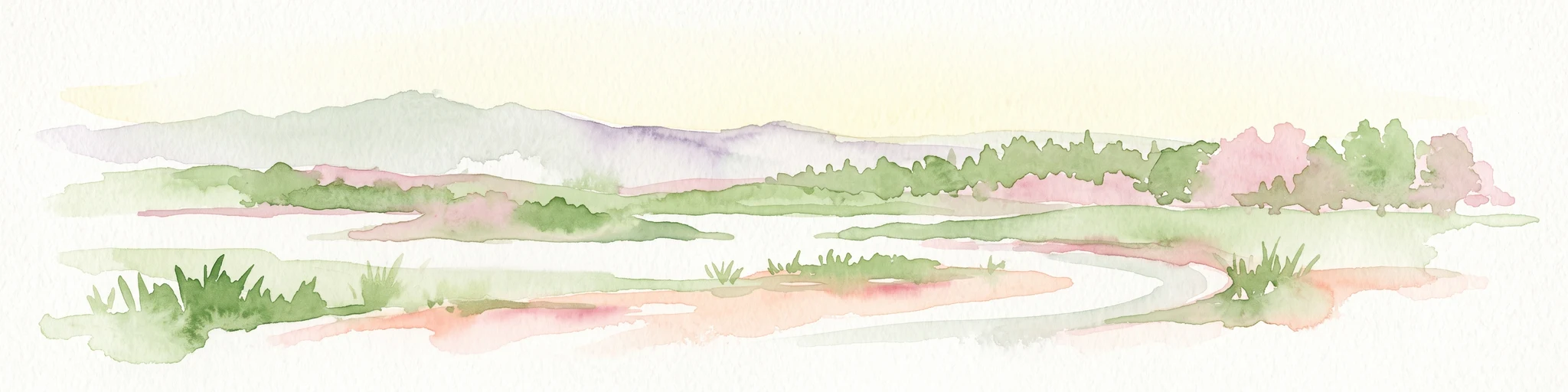
A horizontal watercolor illustration of a wetland scene with soft pink and green tones, showing sparse trees on the banks of a shallow, marshy water area under a pale sky.
Nature reserveBrandenburg
About 11 km away#7 closest

North

Ausstichgelände Röntgental: Brandenburg Nature Reserve and Protected Wetland Atlas

Mapped ecological landscapes on the Berlin metropolitan fringe

Investigate the detailed geography of Ausstichgelände Röntgental, a compact nature reserve in Brandenburg. Formed from nineteenth-century railway sand quarries, this protected area features a diverse mosaic of reed beds, open water, and alder carr forest. The site provides a compelling case study of post-industrial ecological recovery within the broader Barnim Nature Park landscape.

Area
0.248 km²
Established
1990
IUCN
IV
Nature reserveBerlin
About 12 km away#8 closest

South

Wasserwerk Johannisthal Nature Reserve: Mapping Berlin's Industrial and Hydrological Landscape

A protected urban groundwater zone in Treptow-Köpenick.

Explore the unique geography of Wasserwerk Johannisthal, a nature reserve in Berlin that balances industrial heritage with modern environmental management. This thirty-five-hectare site offers insights into urban protected areas, showing how historic water infrastructure is now secured for groundwater monitoring and remediation, set against the backdrop of the city's complex transport and green-space network.

Area
0.35 km²
Established
2007
IUCN
IV
Relief
Lowland

Common questions about visiting, size, designation, and location context for Unkenpfuhle Marzahn

Unkenpfuhle Marzahn FAQs for park facts, access, geography, and protected area context

Find quick answers about Unkenpfuhle Marzahn, including protected-area facts, park geography, trail and visitor context, and how the park fits into its surrounding country and regional landscape.
MoriAtlas Explorer

Continue Your Protected Areas Search Across the Global Atlas

Deepen your exploration by continuing the structured search for national parks and protected areas worldwide. Utilize the comprehensive filtering capabilities to compare different conservation landscapes and refine your understanding of global park geography. Discover more about the distribution and characteristics of protected natural areas.

Global natural geography