Mori Atlas logo
Park earthquake history

A structured catalogue of registered epicentres located within the proximity of this wetland reserve

Historical Earthquake Records and Seismic Activity Associated with Untere Wümme in Bremen

This historical record collection tracks seismic events that have occurred in the vicinity of Untere Wümme. The data presents a filtered timeline of recorded earthquakes, detailing their epicentre distance from the reserve, magnitude, and depth. Users can review these geological reports to understand historical seismic trends documented in the landscape surrounding the lower Wümme river corridor.

A flat-style digital illustration of a calm river winding through a grassy meadow, surrounded by sparse trees and rounded hills under a pastel sky.

Tidal lower Wümme river corridor preserving reedbeds, willow floodplain forest, and freshwater mudflats in Bremen.

Untere Wümme

Untere Wümme is a nature reserve (Naturschutzgebiet) in the Free Hanseatic City of Bremen, Germany, protecting the tidal lower course of the Wümme river between the districts of Borgfeld, Blockland, and Horn-Lehe, and continuing upstream into a like-named reserve in neighboring Lower Saxony. The 148.5-hectare Bremen section forms part of a wider Natura 2000 network, being included in the 445-hectare FFH area of the same name and the much larger Blockland EU Bird Directive site. It has been protected since 8 October 1991 and is managed today by the Stiftung NordWest Natur, a foundation established in 1999. The reserve centers on the meandering, tide-influenced lower Wümme as it flows from Borgfeld toward the Lesum, sandwiched between the Lower Saxon state border in mid-river and the Wümme dike. Its landscape is defined by extensive reedbeds, willow gallery forest, tall-herb wetlands, and unusual freshwater tidal flats, making it one of the more ecologically distinctive inner-German tidal river systems. South of the dike lies Blockland, a historic flood-meadow landscape designated as a separate landscape protection area, strengthening the site's continuity as a floodplain ecosystem. Ecologically, the area functions as a critical link in the regional wetland chain connecting the Fischerhude and Borgfeld Wümme lowlands upstream with the Hamme lowland system to the northwest, and its combination of riparian forest, reedbed, and tidal mudflat habitats supports migratory fish, lampreys, otters, waterbirds, and a notable grey heron colony near the Oberneuland lock.


Location
Germany
Park type
Nature reserve
Established
1991
Area
1.5 km²
Highest point
2 m
Untere Wümme Nature Reserve Atlas

Navigate Untere Wümme observations by date and distance

Review historical earthquake records in the wider Untere Wümme area

Untere Wümme’s earthquake records are grouped by mapped epicentres and calculated distance from the protected river landscape, not evidence of boundary occurrence. The searchable time, magnitude, depth, locality, separation, and source fields support historical review without interpreting floodplain or wetland features as seismic causes, declaring present hazard, or projecting later activity.

Sort by
Magnitude
Location

This page describes catalogued earthquakes associated with the park by epicentre location and distance. It does not establish causation, assess current danger, or predict future earthquakes.

No earthquake records match the current filters

Park atlas

Move past Untere Wümme earthquake observations to other places

Find further parks and protected destinations beyond Untere Wümme

After the earthquake section for Untere Wümme, readers can explore other protected landscapes with separate geographic and conservation records. Their presence does not indicate common tidal river, reedbed, floodplain, German reserve status, proximity, seismic history, risk, or dedicated earthquake pages, and no shared conditions should be inferred.
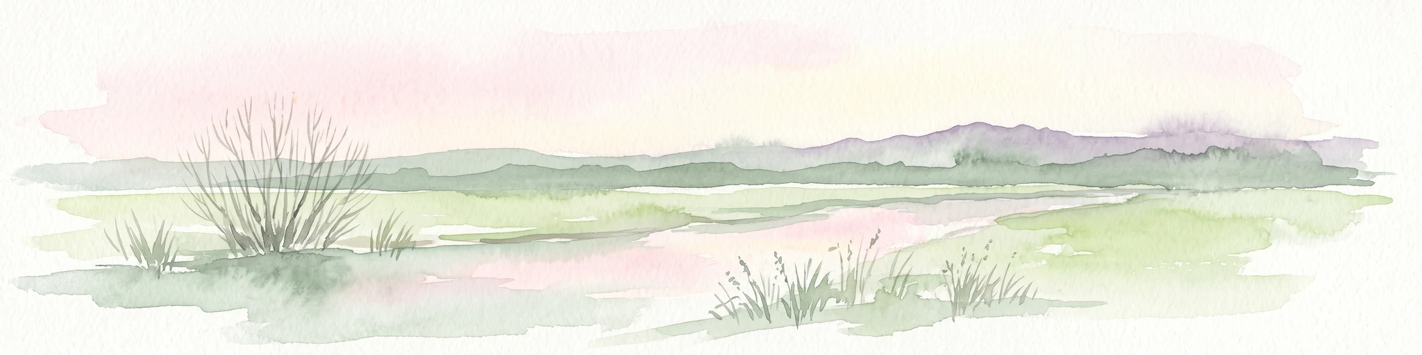
A pale, soft-toned watercolor illustration of a calm river meandering through open, green marshy meadows with distant rolling hills under a soft pink sky.
Nature reserveBremen
Park boundaries overlap#1 closest

Southeast

Borgfelder Wümmewiesen: Protected Wetland and Floodplain Geography in Bremen

An expansive 688-hectare nature reserve with river-fed grasslands.

Borgfelder Wümmewiesen offers a look at one of the largest protected nature reserves in the Bremen region. The landscape is characterized by its flat, open terrain and regular water dynamics that frame a rich mosaic of wet meadows, reedbeds, and ponds, providing essential habitat for breeding and migratory bird species along the Wümme river corridor.

Area
6.88 km²
Established
1987
Relief
Lowland
Climate
Temperate
A soft, painterly watercolor illustration depicting a winding river through a flat green meadow with rolling hills in the background.
Nature reserveBremen
0.1 km away#2 closest

Southeast

Hollerland Nature Reserve: A Protected Cultural Landscape and Wetland in Bremen

Historic marshland terrain with unique saline spring ecosystems

Hollerland is a 293-hectare nature reserve in Bremen, Germany, notable for its well-preserved cultural landscape of wet grasslands and an intricate medieval ditch network. This protected area serves as a critical breeding ground for meadow birds and hosts an ecologically significant inland saline spring, providing a rare habitat for brackish-adapted plant communities deep within the regional landscape.

Area
2.93 km²
Established
1985
IUCN
IV
Relief
Lowland
A horizontal watercolor painting showing a tranquil lake scene with green trees, low-lying hills in the distance, and grassy banks against a white background.
Nature reserveBremen
1 km away#3 closest

West

Grambker Feldmarksee Nature Reserve: Mapping the Protected Landscapes of Bremen

A vital wetland sanctuary shaped by regional infrastructure and natural restoration

Grambker Feldmarksee offers a focused look at how post-industrial quarry sites evolve into ecologically dense nature reserves. This groundwater-fed lake in Bremen acts as a green island, showcasing mature woodland fringes and specialized wetland habitats that are integral to the local bird protection network.

Area
0.226 km²
Established
2009
Relief
Lowland
Climate
Temperate
Nature reserveBremen
1.4 km away#4 closest

South

Kuhgrabensee Nature Reserve: Mapped Geography and Protected Areas in Bremen

An ecologically vital lake and bird sanctuary in Northwest Germany

Kuhgrabensee serves as a prime example of landscape restoration within Bremen, featuring a groundwater-fed lake with notable saline influences. This protected area supports a diverse array of pioneer plants and wildlife across its reed-lined shores and shallow-water habitats, providing a quiet corridor for ecological observation and study in the heart of the local landscape.

Area
0.296 km²
Established
1987
Relief
Lowland
Climate
Temperate
A watercolor painting showing a serene landscape with calm water, small islands of trees, and rolling hills in the background.
Nature reserveBremen
About 2.6 km away#5 closest

South

Am Stadtwaldsee (Uni-Wildnis) Nature Reserve: Geographic Atlas and Park Map Context

Protected secondary habitat landscape in Bremen, Germany

Located in Bremen, the Am Stadtwaldsee (Uni-Wildnis) nature reserve offers a compelling study of secondary ecological succession. The area features a dense concentration of ponds and wooded ground shaped by historical sand mining. Explore the mapped boundaries of this eleven-hectare refuge to understand its role in urban biodiversity and regional landscape conservation.

Area
0.114 km²
Established
1991
IUCN
IV
Nature reserveBremen
About 2.8 km away#6 closest

West

Ruschdahlmoor Nature Reserve: Deep Peatlands and Protected Wetland Geography in Bremen

Geological subsidence sinkhole and urban protected landscape

Ruschdahlmoor stands as a unique nature reserve in Bremen, Germany, distinguished by a peat-forming wetland developed inside a sinkhole over the Lesum salt dome. This protected area supports tall herb meadows, reed-fringed ponds, and rare peat-depth records, offering a dense, ecologically rich landscape context that remains a vital part of the city's natural geography.

Area
0.048 km²
Established
1991
IUCN
IV
Relief
Lowland
Nature reserveBremen
About 4.4 km away#7 closest

West

Dunger See Nature Reserve: Mapped Protected Wetland and Landscape Geography in Bremen

A structured geographic look at the Werderland bird protection habitat.

Dunger See is a compact, ecologically diverse nature reserve in Bremen, shaped by intentional land management to provide critical nesting and wintering grounds for wildfowl. This protected area stands out for its indented shoreline, artificial island clusters, and surrounding woodland buffers that contrast with the open agricultural terrain of the wider Werderland landscape.

Area
0.33 km²
Established
1990
Relief
Lowland
Climate
Temperate
Nature reserveLandkreis Osterholz
About 5.4 km away#8 closest

Northeast

Westliche Hälfte des Langen Moores Nature Reserve in Landkreis Osterholz

A protected mosaic of highmoor peatland geography

Examine the distinct ecological features of Westliche Hälfte des Langen Moores, a protected nature reserve in Landkreis Osterholz. This site offers a compact look at highmoor regeneration and the diverse plant communities found within the historic Teufelsmoor cultural landscape of northern Germany.

Area
0.11 km²
Established
1984
IUCN
IV
MoriAtlas Explorer

Continue Exploring the Untere Wümme Nature Reserve and Bremen Protected Landscapes

Dive into the geographic structure and protected boundaries of Untere Wümme. MoriAtlas provides a focused look at this tidal river corridor, highlighting its role within the Bremen regional ecosystem and the importance of its mosaic of reedbeds, floodplains, and riparian habitats for regional conservation.

Global natural geography