

Mori Atlas logo
Nature reserveUntere Wümme

Trace the meandering riparian corridors and tidal mudflat mosaics of this protected lowland wetland.

Untere Wümme Nature Reserve: A Protected Freshwater Tidal River Landscape in Bremen, Germany

(Naturschutzgebiet Untere Wümme)

The Untere Wümme nature reserve preserves a distinct freshwater tidal river system within the Free Hanseatic City of Bremen. This 148.5-hectare protected landscape features a rich mosaic of willow gallery forests, reedbeds, and rare tidal mudflats that remain influenced by the North Sea rhythm. Functioning as a critical link in a broader regional wetland network, the area supports diverse migratory wildlife and connects seamlessly with inland floodplain meadows through an intricate dike-and-floodplain geometry.

freshwater tidal flatsreedbed habitattidal riverriparian forestwetland reserveNatura 2000
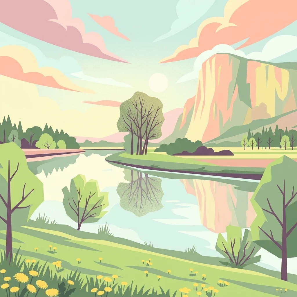
A flat-style digital illustration of a calm river winding through a grassy meadow, surrounded by sparse trees and rounded hills under a pastel sky.

Untere Wümme

Nature reserve

Park overview

Structured park overview, official facts, and landscape profile for Untere Wümme

Untere Wümme park facts, protected area profile, and essential visitor context

Review the core facts for Untere Wümme, including designation, size, terrain, visitor scale, habitats, and operating context in one park-focused overview.

About Untere Wümme

Untere Wümme is a compact but ecologically dense nature reserve in the northwestern outskirts of Bremen, anchoring the protection of the lower Wümme river where it turns toward its confluence with the Lesum. Although it covers only 148.5 hectares within the Free Hanseatic City of Bremen, it plays a disproportionately large role in the regional conservation system because of its direct physical and ecological continuity with the partner Untere Wümme reserve across the river in Lower Saxony. Together the two reserves function as a single coherent corridor along the river.

The reserve's geographic position places it at the interface of Bremen city districts Borgfeld, Blockland, and Horn-Lehe, with the state border to Lower Saxony running through the middle of the river. This border-in-river setting is unusually direct: the Bremen reserve extends only from mid-channel to the western dike, while the wider floodplain beyond the dike falls within the Blockland landscape protection area. The result is a layered patchwork of protected designations, including the Bremen nature reserve itself, the FFH site, the EU bird protection area, and the Blockland landscape protection area, all reinforcing the conservation value of the wet lowlands northwest of Bremen city center.

Ecologically, the site is shaped almost entirely by water. The lower Wümme here is meandering and subject to tidal influence from the North Sea, an unusual condition for a small lowland river well inland. This combination of freshwater flow and tidal rhythm has produced extensive reedbeds, patches of willow alluvial forest, wet tall-herb communities, and freshwater tidal flats, habitats that are now rare across much of northwest Germany. By preserving this combination, Untere Wümme maintains not only a stand-alone site but a key ecological bridge between the Wümme lowlands upstream and the large Hamme lowland system downstream and northwestward.

Its proximity to Bremen also gives the reserve a meaningful cultural and recreational dimension. A former Kleinbahn Bremen-Tarmstedt railway alignment now serves as a cycling and walking path through the reserve, and the broader landscape of meadows, ditches, and dike-top routes connects the protected site to traditional countryside uses of the Blockland floodplain. Although tucked against a major German city, the reserve preserves a working example of a tidal lowland river ecosystem that is otherwise increasingly squeezed by infrastructure, agriculture, and embankment.

Quick facts and research context for Untere Wümme

Untere Wümme is a 148.5-hectare Bremen state nature reserve registered as number 13 in the city's nature protection book. It was designated on 8 October 1991 and lies within the city districts of Borgfeld, Blockland, and Horn-Lehe. It forms part of the 445-hectare FFH site "Untere Wümme" and the 3,180.3-hectare EU Bird Directive site "Blockland," giving it both habitat and bird-protection status under European Union law. The reserve encompasses the tidal lower Wümme between the Lower Saxon state border and the Wümme dike, continuing the upstream Untere Wümme reserve in Osterholz district. Management has been handled since 2006 by the Stiftung NordWest Natur, while the Senator for Environment, Construction, and Transport of Bremen serves as the responsible nature-protection authority.

Protection and recognition

Terrestrial conservation framework and documented Natura 2000 designations

Untere Wümme Protection Status and International Recognition Details

Untere Wümme maintains a recorded terrestrial protection status backed by structured international recognition sources. Official designation records outline the governing framework and conservation boundaries established for the protected landscape.

International recognition

Protection details

Protection scope
Terrestrial
Transboundary protection
No
WDPA ID
166001
Park context

Deeper park guide and search-rich context for Untere Wümme

Untere Wümme history, landscape, wildlife, and travel context

Explore Untere Wümme through its history, landscape character, ecosystems, wildlife, conservation priorities, cultural context, and seasonal travel timing in a structured park guide built for atlas discovery and search intent.

Why Untere Wümme stands out

Untere Wümme is best known as one of the few freshwater tidal river systems in northern Germany, where the rising and falling North Sea tide still creates freshwater mudflats and dynamic reedbed edges along the lower Wümme. It is equally notable for combining an unusually rich mosaic of habitats in a small Bremen-area reserve: willow alluvial forest, tall-herb wet meadows, reed and sedge beds, and open tidal flats side by side along a meandering lowland river. The reserve is also valued as a living link for migratory fish and semiaquatic wildlife in the wider Bremen and Lower Saxony wetland network. Atlantic salmon, sea trout, eel, three lamprey species, European weatherfish, and the recovering Eurasian otter all use the river corridor, while the reedbeds and adjacent meadows support reed warblers, marsh harriers, and one of Bremen's small grey heron colonies near the Oberneuland lock.
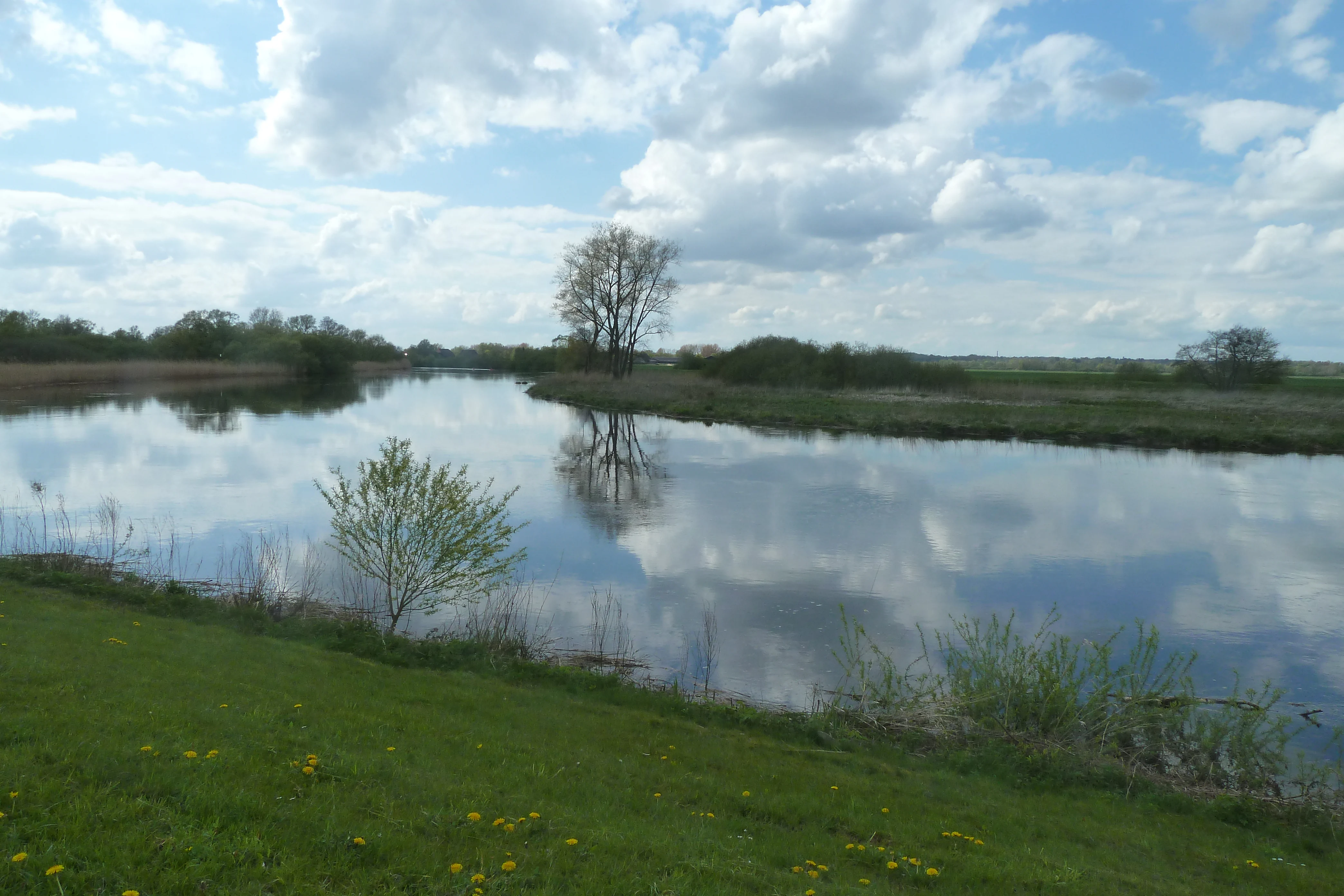
A wide view of the Wümme river reflecting the sky and scattered clouds, surrounded by green meadow banks, wetlands, and scattered trees.
The Wümme river flowing through the Untere Wümme nature reserve in Bremen.

Untere Wümme history and protected-area timeline

The Untere Wümme reserve was formally placed under nature protection on 8 October 1991, recognizing the ecological importance of Bremen's stretch of the lower Wümme river as a tidal freshwater corridor surrounded by wet meadows. The designation built on the long-standing recognition of the surrounding Blockland floodplain, which had already been identified as a traditional flood-meadow landscape of the Wümme and is currently designated as the landscape protection area "Blockland-Burgdammer Wiesen" south of the dike.

Following the designation, the reserve was integrated into the European Union's Natura 2000 framework, becoming part of the 445-hectare FFH site "Untere Wümme" and the much larger 3,180.3-hectare EU Bird Directive area "Blockland," extending its protection well beyond a purely national designation. A grey heron colony established itself near the Oberneuland lock in the early 1990s, coinciding closely with the period of formal protection and reinforcing the site's growing value for breeding waterbirds.

In 1999, the Stiftung NordWest Natur was founded to coordinate practical conservation management across protected areas in northwestern Lower Saxony and Bremen, and from 2006 it has been responsible for management of the Untere Wümme reserve. The Senator for Environment, Construction, and Transport of the Free Hanseatic City of Bremen remains the legally responsible nature protection authority. The reserve's Bremen identification number in the city's nature protection book is 13, a position that reflects its early place in Bremen's modern protected-area system.

Untere Wümme landscape and geographic character

The landscape of Untere Wümme is shaped by the meandering, tidally influenced course of the Wümme between Borgfeld and the head of the Lesum. Within the Bremen reserve, the river occupies the eastern half of the area, bordered on the west by the Wümme dike. The dike separates the strictly protected riverine corridor from the broader Blockland flood-meadow landscape, a flat, historically flooded lowland that still functions as the river's buffer zone. Elevation within the reserve is low, ranging roughly from sea level to about 2.5 meters above sea level, giving the entire area the gentle, water-shaped profile typical of northwest German tidal river landscapes.

The most distinctive landform is the freshwater tidal flat. Because the lower Wümme is still affected by North Sea tides, exposed sediment banks emerge and disappear with the daily tidal rhythm, producing a feature that would otherwise be associated with the Wadden Sea rather than a small inland river. Around these flats, the reserve holds extensive reedbelts, softwood floodplain forest dominated by willows along the channel, and wet tall-herb communities on the higher ground that escape the most frequent flooding. The result is a layered, river-centered landscape in which reed, willow, and open water constantly intergrade.

Outside the dike, the Blockland adds a contrasting but connected character: flat, ditch-divided meadows that were historically inundated by the Wümme and retain the appearance of an old floodplain even where current embankments have largely controlled the waters. Together, the dike-and-floodplain geometry gives Untere Wümme its compact, edge-rich form: a narrow river corridor within a much wider wet landscape mosaic.

Untere Wümme ecosystems, habitats, and plant life

Untere Wümme protects one of the more unusual habitat mosaics in the Bremen area, combining freshwater tidal flats, extensive reedbeds, willow alluvial forest, and tall-herb wet meadows within a single continuous river corridor. The mix arises from the river's position: the Wümme here is small enough to behave like an inland stream, yet influenced enough by North Sea tides to maintain open sediment banks, while the surrounding floodplain provides space for forbs, sedges, and softwood forest. The reserve adds significant ecological value to the region simply by keeping this dynamic combination intact rather than letting it become uniformly reed-choked or uniformly forested.

The reedbeds, willows, and wet tall-herb communities are not only habitats in themselves but also act as a transitional zone, or ecotone, where aquatic, semi-aquatic, and terrestrial species overlap. The freshwater tidal flats in particular are a habitat type that has largely disappeared from other smaller rivers in Lower Saxony and Bremen because of embankment and tideless management. By keeping this gradient open, the reserve supports species that depend on shifting conditions between exposed mud, shallow water, flooded reed margins, and shaded willow stands.

On the botanical side, characteristic wetland species of the area include marsh marigold (Sumpfdotterblume) and marsh ragwort (Sumpfgreiskraut), both indicators of long-established wet grassland and reed-edge conditions. The continuity of these plant communities helps explain why the area also functions so well for breeding birds and for fish moving between freshwater and the estuarine systems further downstream. The Untere Wümme FFH site designation underlines that the habitat value of the reserve is formally recognized at European level, not just locally.

Untere Wümme wildlife and species highlights

The Wümme river in the Untere Wümme reserve is a living corridor for migratory fish that historically moved between the North Sea and the inland waters of northern Germany. Native species using the river include the European eel, Atlantic salmon, and sea trout, as well as three species of lamprey: the sea lamprey, the river lamprey, and the brook lamprey. The European weatherfish, a smaller bottom-dwelling species of conservation interest, also inhabits the river. The presence of these species, particularly the migratory salmonids and lampreys, indicates that the Wümme still functions ecologically as a route between freshwater and the marine estuary system, even within the tightly managed dyke-protected Bremen landscape.

On the riverbanks and along the ditches, the Eurasian otter has returned as a resident mammal, using the channel network and reed fringe as hunting and movement habitat. This reappearance is itself a sign of improving water quality and habitat continuity in the Wümme lowlands, and the Bremen reserve plays a small but important role in connecting otter habitat along the regional wetland chain.

The reedbeds and adjacent meadows support a typical reedbed bird community, with several species of reed warbler breeding in the extensive Phragmites stands. Marsh harrier (Rohrweihe) is recorded as a breeding raptor of the area, hunting over the reedbeds and meadows. A particular point of interest is the grey heron colony that established itself near the Oberneuland lock in the early 1990s, taking advantage of quiet sections of willow floodplain forest close to productive feeding grounds. Together, these breeding and feeding populations give the reserve a birdlife character well beyond what its small Bremen footprint would suggest, and the site's inclusion in the EU Blockland bird protection area formalizes this significance at the European scale.

Untere Wümme conservation status and protection priorities

Untere Wümme's conservation significance begins with its formal status as a Bremen state nature reserve since 1991, but extends well beyond that designation through its embeddedness in European Union nature policy. It is part of the Untere Wümme FFH site, recognizing its habitat value under the EU Habitats Directive, and of the much larger Blockland EU Bird Directive site, recognizing its importance for protected bird species. This layered protection means the reserve is judged not only for its Bremen-scale ecological role but also for its contribution to the wider European Natura 2000 network.

Within this framework, the reserve functions as a service area, or stepping stone, in the continuum of wet habitats stretching from the Fischerhude and Borgfeld Wümme lowlands upstream to the Hamme lowland northwest of Bremen. By keeping the tidal lower Wümme, its reedbeds, willow forest, and freshwater tidal flats intact, the reserve maintains a transition zone between flowing freshwater river, tidally influenced mudflats, and managed wet meadows that is increasingly rare in heavily drained northwest German lowlands. The integration of the area with the Blockland landscape protection area on the floodplain side adds a buffer against intensification of land use directly adjacent to the most sensitive habitats.

Management of the reserve has been the responsibility of the Stiftung NordWest Natur since 2006, an institution founded in 1999 to coordinate practical conservation across the northwestern German region. The Senator for Environment, Construction, and Transport remains the responsible nature-protection authority for Bremen. The reserve's identification number in Bremen's nature protection book is 13, classifying it as the 13th protected area formally entered into the city's modern nature protection register. Its World Database on Protected Areas entry (WDPA ID 166001) gives the site an internationally recognized identity in databases used for conservation monitoring.

Untere Wümme cultural meaning and human context

Though small, Untere Wümme sits inside a deeply traditional cultural landscape. The Blockland floodplain south of the dike has been used for centuries as hay meadow and rough grazing for Bremen city, and its pattern of ditches, meadows, and dike-edged fields reflects a long history of human coexistence with the Wümme's floods. The river itself has long served as a boundary, and today still marks, at least in part, the state border between the Free Hanseatic City of Bremen and Lower Saxony, a fact subtly encoded in the fact that the Bremen reserve occupies only the western bank of the river while the eastern bank falls under the Lower Saxon Untere Wümme (Osterholz) reserve.

The reserve today also carries a tangible industrial-heritage layer: the former Kleinbahn Bremen-Tarmstedt railway alignment, now repurposed as a cycling and walking path, passes through the protected area. The presence of this old transport corridor, and of the Oberneuland lock and connecting Neue Semkenfahrt waterway on the southern edge of the reserve, illustrates how the current conservation landscape overlays an older working landscape of small railways, drainage ditches, and managed meadows, rather than being a purely rewilded space. The cycling and walking route also underscores the site's role as a nearby greenspace for Bremen's urban population, bridging ecological and cultural value.

Top sights and standout views in Untere Wümme

Untere Wümme is best understood through the unusual pairing of freshwater and tidal influence in a small inner-city lowland river, holding one of the few remaining freshwater tidal flat systems in the Bremen and Lower Saxony region within a 148.5-hectare Bremen nature reserve. The reserve operates simultaneously as a Bremen state nature reserve, a German FFH site, and a component of the larger Blockland EU bird protection area, a stacking of designations that reflects both local and European conservation importance. It is managed under a partnership between the Bremen Senate and the Stiftung NordWest Natur, and it directly continues the Untere Wümme reserve across the river in Lower Saxony, forming a cross-border ecological corridor.

Best time to visit Untere Wümme

Visitors interested in the Untere Wümme reserve will find the most rewarding experience when water, reeds, and birds are at their most active. Late spring and early summer bring the reedbed breeding season into full swing, when reed warblers, marsh harriers, and the grey heron colony near the Oberneuland lock are most conspicuous, while the wet meadow plants of Blockland, such as marsh marigold, are in flower. Late summer and early autumn tend to be the most useful period for observing migratory fish activity and waterbirds along the tidal flats, when lower water levels expose more of the freshwater mudflats and concentrate feeding activity along the edges of the reedbeds. The flat, low-lying terrain and the tidal rhythm of the river mean that conditions change visibly through the day around high and low tide, so a visit timed to one of the tidal extremes generally reveals more wildlife and landscape character than a visit timed only to a fixed hour.

Monthly climate preview

Long-term representative coordinate data outlining monthly temperature and precipitation cycles

Untere Wümme Climate Normals, Average Temperature and Precipitation Rhythm

Representative point measurements track the recorded annual temperature and precipitation rhythm across twelve months at Untere Wümme. Detailed monthly climate normals expand this baseline record to compare multi-year averages and regional weather patterns.
Annual mean9 °C
1 °C18 °C
Jan
Feb
Mar
Apr
May13°
Jun16°
Jul18°
Aug18°
Sep14°
Oct10°
Nov
Dec
Warmest month
July

18 °C

Coolest month
January

1 °C

Wettest month
July

2.5 mm/day

Driest month
April

1.4 mm/day

Park location guide

Geography guide, regional context, and park location map for Untere Wümme

Untere Wümme park geography, regions, and map view in Germany

Understand where Untere Wümme sits in Germany through a broader geographic reading of the surrounding landscape, nearby location context, and its mapped position within the national park landscape.

How Untere Wümme fits into Germany

Germany is a federal republic in Western and Central Europe with a population of over 83 million across sixteen constituent states. It is Europe's largest economy by nominal GDP and a major global exporter and importer. The capital is Berlin, and the country borders Denmark, Poland, Czech Republic, Austria, Switzerland, France, Luxembourg, Belgium, and the Netherlands.

Wider geography shaping Untere Wümme in Germany

Germany is located in Western and Central Europe, spanning 357,022 km². It borders Denmark to the north, Poland and the Czech Republic to the east, Austria and Switzerland to the south, and France, Luxembourg, Belgium, and the Netherlands to the west. The country has coastlines on the Baltic Sea and North Sea to the north, with the Alps located in the southern region.

Map view of Untere Wümme

Use this park location map to pinpoint Untere Wümme in Germany, understand its exact geographic position, and read its mapped placement within the surrounding landscape more clearly.

Pigeon | © OpenStreetMap contributors

Location context for Untere Wümme

Bremen
Recorded earthquake history

View Historical Seismic Records and Earthquake Activity Near Untere Wümme

Explore the documented earthquake history associated with the geography of Untere Wümme. This MoriAtlas dataset provides a clear, structured view of historical seismic events to help interested users understand local geomorphological records near the Bremen reserve.

Untere Wümme Earthquake History

Catalogued events

3 events

Strongest magnitude

Magnitude 4.5

Most recent event

Jul 15, 2005

This history includes earthquakes recorded inside the park or within 50 km of its borders

Explore protected area views, freshwater tidal flats, and riparian gallery forest character.

Untere Wümme Landscape Photography and Scenery: Visualizing Tidal River Habitats

Visual documentation captures the meandering tidal river channels, exposed freshwater mudflats, and extensive reedbed corridors defining this reserve. Photographic records reveal the wetland mosaic and lowland terrain morphology supporting regional wildlife populations.

A wide view of the Wümme river reflecting the sky and scattered clouds, surrounded by green meadow banks, wetlands, and scattered trees.

Park atlas

Discover surrounding regional wetland reserves and connected lowland river habitats

Parks Near Untere Wümme and Related Protected Areas to Compare

Browsing other protected areas near Untere Wümme reveals the broader ecological network shaping northwest German river valleys. Comparing adjacent lowland reserves and connected wetland corridors provides essential regional context for regional nature conservation.
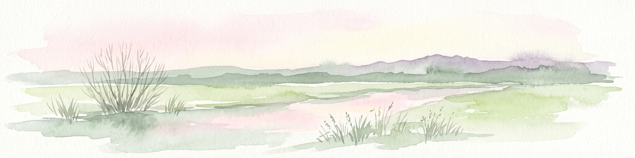
A pale, soft-toned watercolor illustration of a calm river meandering through open, green marshy meadows with distant rolling hills under a soft pink sky.
Nature reserveBremen
Park boundaries overlap#1 closest

Southeast

Borgfelder Wümmewiesen: Protected Wetland and Floodplain Geography in Bremen

An expansive 688-hectare nature reserve with river-fed grasslands.

Borgfelder Wümmewiesen offers a look at one of the largest protected nature reserves in the Bremen region. The landscape is characterized by its flat, open terrain and regular water dynamics that frame a rich mosaic of wet meadows, reedbeds, and ponds, providing essential habitat for breeding and migratory bird species along the Wümme river corridor.

Area
6.88 km²
Established
1987
Relief
Lowland
Climate
Temperate
A soft, painterly watercolor illustration depicting a winding river through a flat green meadow with rolling hills in the background.
Nature reserveBremen
0.1 km away#2 closest

Southeast

Hollerland Nature Reserve: A Protected Cultural Landscape and Wetland in Bremen

Historic marshland terrain with unique saline spring ecosystems

Hollerland is a 293-hectare nature reserve in Bremen, Germany, notable for its well-preserved cultural landscape of wet grasslands and an intricate medieval ditch network. This protected area serves as a critical breeding ground for meadow birds and hosts an ecologically significant inland saline spring, providing a rare habitat for brackish-adapted plant communities deep within the regional landscape.

Area
2.93 km²
Established
1985
IUCN
IV
Relief
Lowland
A horizontal watercolor painting showing a tranquil lake scene with green trees, low-lying hills in the distance, and grassy banks against a white background.
Nature reserveBremen
1 km away#3 closest

West

Grambker Feldmarksee Nature Reserve: Mapping the Protected Landscapes of Bremen

A vital wetland sanctuary shaped by regional infrastructure and natural restoration

Grambker Feldmarksee offers a focused look at how post-industrial quarry sites evolve into ecologically dense nature reserves. This groundwater-fed lake in Bremen acts as a green island, showcasing mature woodland fringes and specialized wetland habitats that are integral to the local bird protection network.

Area
0.226 km²
Established
2009
Relief
Lowland
Climate
Temperate
Nature reserveBremen
1.4 km away#4 closest

South

Kuhgrabensee Nature Reserve: Mapped Geography and Protected Areas in Bremen

An ecologically vital lake and bird sanctuary in Northwest Germany

Kuhgrabensee serves as a prime example of landscape restoration within Bremen, featuring a groundwater-fed lake with notable saline influences. This protected area supports a diverse array of pioneer plants and wildlife across its reed-lined shores and shallow-water habitats, providing a quiet corridor for ecological observation and study in the heart of the local landscape.

Area
0.296 km²
Established
1987
Relief
Lowland
Climate
Temperate
A watercolor painting showing a serene landscape with calm water, small islands of trees, and rolling hills in the background.
Nature reserveBremen
About 2.6 km away#5 closest

South

Am Stadtwaldsee (Uni-Wildnis) Nature Reserve: Geographic Atlas and Park Map Context

Protected secondary habitat landscape in Bremen, Germany

Located in Bremen, the Am Stadtwaldsee (Uni-Wildnis) nature reserve offers a compelling study of secondary ecological succession. The area features a dense concentration of ponds and wooded ground shaped by historical sand mining. Explore the mapped boundaries of this eleven-hectare refuge to understand its role in urban biodiversity and regional landscape conservation.

Area
0.114 km²
Established
1991
IUCN
IV
Nature reserveBremen
About 2.8 km away#6 closest

West

Ruschdahlmoor Nature Reserve: Deep Peatlands and Protected Wetland Geography in Bremen

Geological subsidence sinkhole and urban protected landscape

Ruschdahlmoor stands as a unique nature reserve in Bremen, Germany, distinguished by a peat-forming wetland developed inside a sinkhole over the Lesum salt dome. This protected area supports tall herb meadows, reed-fringed ponds, and rare peat-depth records, offering a dense, ecologically rich landscape context that remains a vital part of the city's natural geography.

Area
0.048 km²
Established
1991
IUCN
IV
Relief
Lowland
Nature reserveBremen
About 4.4 km away#7 closest

West

Dunger See Nature Reserve: Mapped Protected Wetland and Landscape Geography in Bremen

A structured geographic look at the Werderland bird protection habitat.

Dunger See is a compact, ecologically diverse nature reserve in Bremen, shaped by intentional land management to provide critical nesting and wintering grounds for wildfowl. This protected area stands out for its indented shoreline, artificial island clusters, and surrounding woodland buffers that contrast with the open agricultural terrain of the wider Werderland landscape.

Area
0.33 km²
Established
1990
Relief
Lowland
Climate
Temperate
Nature reserveLandkreis Osterholz
About 5.4 km away#8 closest

Northeast

Westliche Hälfte des Langen Moores Nature Reserve in Landkreis Osterholz

A protected mosaic of highmoor peatland geography

Examine the distinct ecological features of Westliche Hälfte des Langen Moores, a protected nature reserve in Landkreis Osterholz. This site offers a compact look at highmoor regeneration and the diverse plant communities found within the historic Teufelsmoor cultural landscape of northern Germany.

Area
0.11 km²
Established
1984
IUCN
IV

Common questions about visiting, size, designation, and location context for Untere Wümme

Untere Wümme FAQs for park facts, access, geography, and protected area context

Find quick answers about Untere Wümme, including protected-area facts, park geography, trail and visitor context, and how the park fits into its surrounding country and regional landscape.
MoriAtlas Explorer

Continue Your Protected Areas Search Across the Global Atlas

Deepen your exploration by continuing the structured search for national parks and protected areas worldwide. Utilize the comprehensive filtering capabilities to compare different conservation landscapes and refine your understanding of global park geography. Discover more about the distribution and characteristics of protected natural areas.

Global natural geography


