
Mori Atlas logo
Regional parkWaitākere Ranges

Mapping the dramatic coastal cliffs, ancient forest canopy, and steep ridges of Auckland

Waitākere Ranges Regional Park: A Detailed Geographic Atlas of Protected Volcanic Terrain

(Waitākere Ranges Regional Park)

The Waitākere Ranges represent a significant protected landscape on the western fringe of Auckland, characterized by ancient volcanic formations and steep ridges falling to the Tasman Sea. This atlas provides a detailed look at the regional park boundaries, the network of water reservoirs, and the regenerating native forest ecosystems that define this rugged west coast environment. Discover the intersection of Māori cultural heritage and dramatic geological features across this expansive wilderness area.

coastal cliffsblack sand beachesnative forestkauri forestregenerating bushvolcanic landscape
A flat-style digital illustration showing a tropical beach with a central large rock formation, a waterfall to the left, palm trees, and rolling hills in the background under a pale sun.

Waitākere Ranges

Regional park

Park overview

Structured park overview, official facts, and landscape profile for Waitākere Ranges

Waitākere Ranges park facts, protected area profile, and essential visitor context

Review the core facts for Waitākere Ranges, including designation, size, terrain, visitor scale, habitats, and operating context in one park-focused overview.

About Waitākere Ranges

The Waitākere Ranges form a 25-kilometre-long chain of forested hills on the western edge of Auckland, between the city and the Tasman Sea. Often thought of as Auckland's backyard wilderness, they are one of the largest and most ecologically significant blocks of native forest near any major New Zealand city, with their western flanks plunging into rugged cliffs and dark, surf-pounded beaches. Although modest in height, with the highest peak Te Toiokawharu at 474 metres, the ranges feel larger than life because they rise so abruptly out of the suburban fringe.

The ranges were built up from the ancient Waitākere volcano to the west, with erosion-resistant volcanic conglomerate and lava flows laid down in the Miocene, then uplifted from the sea floor several million years later. Their western coastline is carved into cliffs that frequently exceed 300 metres, interspersed with the great black sand beaches for which the coast is famous. Inland, the hills are covered in native forest that has been regenerating since the heavy logging and farming of the late nineteenth and early twentieth centuries. The most prominent ridge is followed by Scenic Drive, connecting the communities of Titirangi, Waiatarua, and Swanson, while the southern ranges are anchored by the Huia area and the iconic Lion Rock at Piha.

Their cultural and ecological weight is just as important as their scenery. The ranges are traditionally known to Māori as Te Wao Nui a Tiriwa, the great forest of Tiriwa, and the rohe of Te Kawerau ā Maki, with more than 550 recorded archaeological sites along the coast and river valleys. At the same time, they provide roughly a quarter of Auckland's drinking water through a network of reservoirs constructed between 1910 and 1948, and they are the focus of major conservation work to protect kauri from dieback disease and to restore native bird populations through projects such as Ark in the Park.

Quick facts and research context for Waitākere Ranges

The Waitākere Ranges lie in West Auckland, about 25 kilometres west of central Auckland, with their western edge dropping to the Tasman Sea. The ranges and their foothills encompass roughly 27,720 hectares of combined public and private land, of which about 17,000 hectares form the Waitākere Ranges Regional Park, one of Auckland's flagship regional parks.

Geologically, the ranges are the uplifted eastern slopes of the ancient Waitākere volcano, formed from erosion-resistant volcanic conglomerate and lava flows between 12 and 25 million years old. They carry regenerating native forest, predominantly podocarp-broadleaf species including kauri, northern rātā, and rimu, and they host an endemic plant, the Waitākere rock koromiko, as well as one of New Zealand's few mainland gannet colonies at Otakamiro Point. Five reservoirs within the ranges supply a significant share of Auckland's potable water.

Protection and recognition

Documented conservation scope and official designation timeline for Waitākere Ranges

Waitākere Ranges Protection Status and Terrestrial Designation History

Terrestrial protection status for Waitākere Ranges dates back to the established 2008 designation baseline. Documented management parameters and recognition records provide essential context for this protected natural area.

Protection details

Protection scope
Terrestrial
Designated year
2008
Transboundary protection
No
Park context

Deeper park guide and search-rich context for Waitākere Ranges

Waitākere Ranges history, landscape, wildlife, and travel context

Explore Waitākere Ranges through its history, landscape character, ecosystems, wildlife, conservation priorities, cultural context, and seasonal travel timing in a structured park guide built for atlas discovery and search intent.

Why Waitākere Ranges stands out

The Waitākere Ranges are best known for their close juxtaposition of wild, regenerating native forest with a dramatic black sand surf coast, just a short drive from central Auckland. The ranges protect one of the most extensive surviving kauri forests in the Auckland region, despite extensive logging in the nineteenth and early twentieth centuries, and they shield a chain of iconic west coast beaches, Piha, Karekare, Muriwai, and Te Henga (Bethells Beach), known for their powerful surf and dark volcanic sand. They are also recognised for their layered conservation story: an Auckland regional park established gradually from 1894 onward, a heritage area protected by the Waitākere Ranges Heritage Area Act of 2008, and a long-running effort to defend the kauri trees from kauri dieback disease. Combined with a strong Māori heritage tied to Te Kawerau ā Maki, the ranges carry both ecological and cultural weight that extends well beyond their modest elevation.
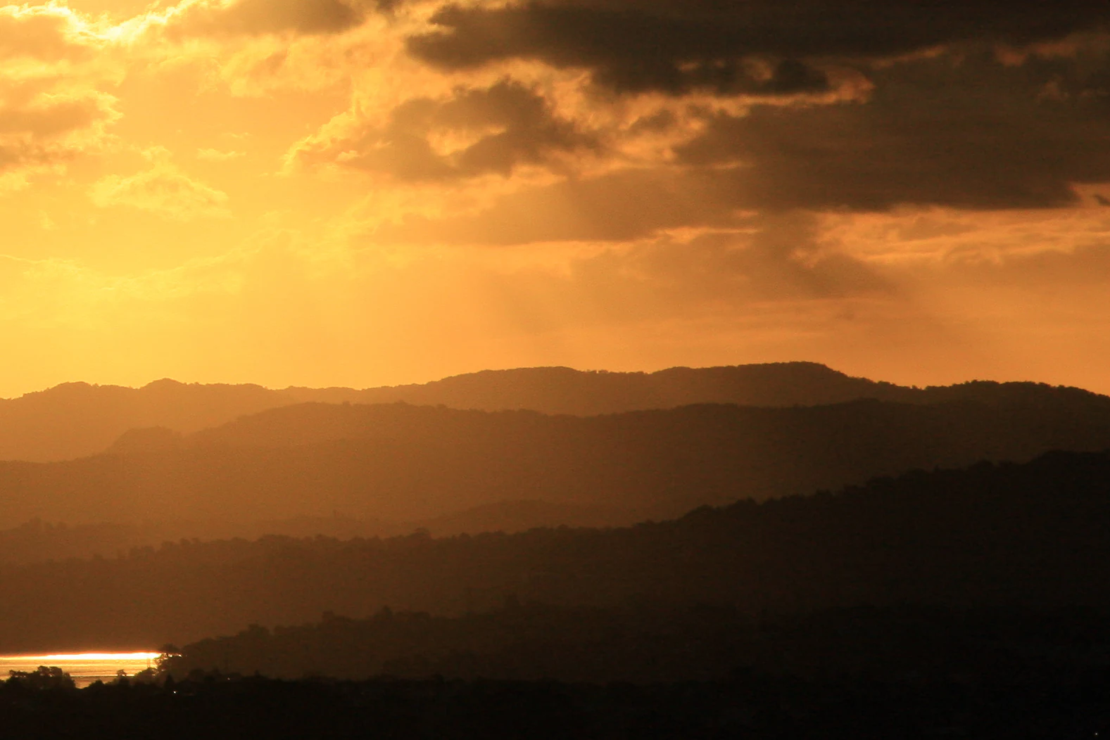
A silhouette of layered mountain ridges against a glowing orange sunset sky with clouds, featuring a glimpse of reflective water in the lower left.
Sunset view over the rugged landscape of the Waitākere Ranges.

Waitākere Ranges history and protected-area timeline

The ranges have a long human history. Tāmaki Māori had strong traditional associations with the Waitākere Ranges; the area lies within the rohe of Te Kawerau ā Maki, whose most intensive settlements clustered around the Waitākere River and Te Henga (Bethells Beach). The warm, sheltered west coast valleys supported crops such as kūmara, taro, hue (calabash), and aruhe (bracken fern) root, and abundant coastal and forest resources supported a thriving pre-European economy. More than fifty pā sites have been recorded, with caves around Piha and Whatipu serving as wartime refuges between the sixteenth and eighteenth centuries. In the creation traditions of the Auckland volcanic field, the ranges were said to be the home of the patupaiarehe tribe led by the chief Tiriwa, and fishing nets, baskets, and cloak fragments have been recovered from sites along the coast.

In 1853 and 1854 the New Zealand government acquired about 40,000 hectares of Te Kawerau ā Maki land in the ranges, purchased from other iwi without consultation; reserves were created at Piha and Te Henga, but by the 1950s almost all Te Kawerau ā Maki land in the Waitākere Ranges had been partitioned and sold. The early colonial period brought intensive kauri logging, with twenty-three timber mills operating between 1840 and 1940 and an estimated 120,000 trees felled. Tramways along the west coast and dams on the waterways helped move giant logs to sawmills such as the one at Whatipu, with a wharf on Paratutae Island serving the industry until 1921.

Protection began in 1894, when naturalist Algernon Thomas persuaded Auckland City Council to reserve 3,500 acres in the Nihotupu area, followed by further reserves vested with the council in 1895 for the conservation of native flora and fauna. The Auckland Centennial Memorial Park was opened in 1940, expanded significantly by engineer and Titirangi resident Arthur Mead, and in 1964 was renamed the Waitākere Ranges Regional Park. By 1992 it had grown to about 17,000 hectares. In 2008 the Waitākere Ranges Heritage Area Act was passed, formally protecting about 27,700 hectares of public and private land. The most recent chapter came in 2017 when Te Kawerau ā Maki imposed a rāhui over the ranges to slow the spread of kauri dieback, prompting Auckland Council to close forested areas from May 2018 while tracks were upgraded to protect kauri roots.

Waitākere Ranges landscape and geographic character

The Waitākere Ranges are physically defined by their abrupt transition from coastal lowlands to steep, forested hills. The core of the ranges is a roughly 25-kilometre north to south chain of hills lying some 25 kilometres west of central Auckland, capped by Te Toiokawharu at 474 metres in the south, Ruaotuwhenua at 440 metres in the mid range, and Pukematekeo at 336 metres at the northern end above the city.

To the west, the ranges drop sharply to the Tasman Sea in cliffs that frequently exceed 300 metres, with isolated beaches tucked between rocky headlands. The four famous west coast beaches, Piha, Karekare, Muriwai, and Te Henga (Bethells Beach), sit on dark volcanic sand derived from erosion of the ancient volcanic rocks, and Lion Rock at Piha and Te Toka-Tapu-a-Kupe (Ninepin Rock) near Whatipu are dramatic remnants of volcanic vents and plugs.

Inland, the terrain is dissected by stream valleys such as the Nihotupu, Huia, and Waitākere catchments, which were dammed in the early twentieth century to create reservoirs supplying Auckland's water supply. The eastern ridge of the ranges is followed by Scenic Drive, a winding road that links Titirangi, Waiatarua, and Swanson and offers repeated panoramas back over Auckland and out to the Tasman coast. Many of the named peaks along this ridge carry dual Māori and English names that reflect both the natural and cultural history of the range.
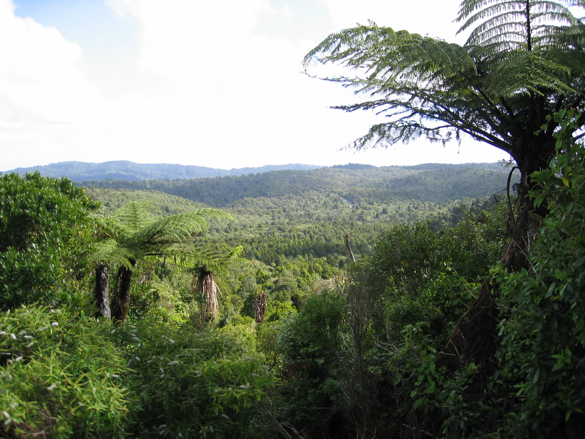
A wide, eye-level landscape shot of a lush, green forest canopy in the Waitākere Ranges, featuring prominent silver ferns in the foreground and rolling hills in the background under a cloudy sky.
A view overlooking the dense, forest-covered landscape of the Waitākere Ranges.

Waitākere Ranges ecosystems, habitats, and plant life

Ecologically, the Waitākere Ranges are a recovering podocarp-broadleaf forest ecosystem that once dominated the Auckland isthmus. Before human settlement the ranges were densely forested in kauri, northern rātā, rimu, and other native hardwoods and conifers, and although much of the original forest was cleared for kauri logging and farming, large areas have been regenerating in native bush since the early twentieth century. The forest is particularly rich in ferns, with over 110 species recorded, and in native orchids, some of which self-established from wind-borne seeds carried across the Tasman from Australia.

The ranges support some species that are rare elsewhere in the Auckland region. The Waitākere rock koromiko (Veronica bishopiana) is endemic to the area, and the west coast kōwhai (Sophora fulvida) and coastal hebe (Veronica obtusata) are largely confined to coastal West Auckland. Invertebrate life is distinctive, including the kauri snail, a number of wētā species, and unusual velvet worms (Onychophora) with 14, 15, and 16 pairs of legs, including ovoviviparous species in the genus Peripatoides. Native fauna also includes the New Zealand long-tailed bat and Hochstetter's frog, but introduced predators such as rodents, stoats, weasels, possums, and cats have profoundly shaped the contemporary ecology and have driven conservation projects aimed at restoring forest health and bird populations.
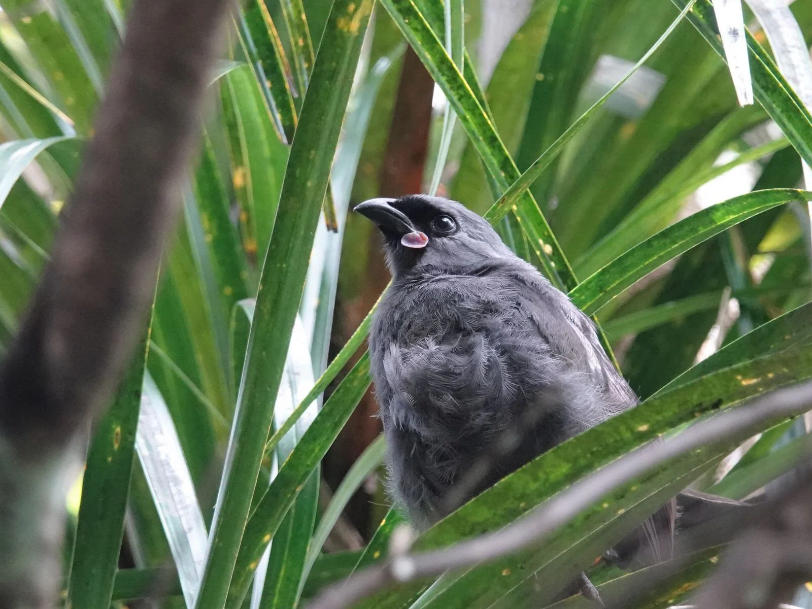
A grey kōkako bird with a distinctive blue wattle perching among long green leaves.
A North Island kōkako perched within the dense foliage of the Waitākere Ranges.

Waitākere Ranges wildlife and species highlights

Wildlife is one of the defining interests of the Waitākere Ranges. The forests carry populations of many endemic New Zealand birds, and the ranges have been the focus of intensive predator control and reintroductions under the Ark in the Park project, a collaboration between Forest and Bird and Auckland Council that has grown from 200 hectares of volunteer-trapped land in 2002 to more than 2,200 hectares. Reintroduced species include the whitehead (pōpokatea), the North Island robin (toutouwai), and the North Island kōkako, which had last been seen in the ranges in the 1950s before returning in 2009.

A wide range of other native birds are found throughout the ranges, alongside resident populations of Hochstetter's frog and the New Zealand long-tailed bat. At the northern edge of the ranges, Otakamiro Point hosts one of New Zealand's few mainland breeding colonies of Australasian gannets, a major draw for wildlife visitors. The invertebrate fauna is unusually rich on the west coast, with kauri snails, wētā in various forms, and distinctive velvet worms with 14, 15, and 16 pairs of legs adding both ecological and scientific interest to the forest environment.
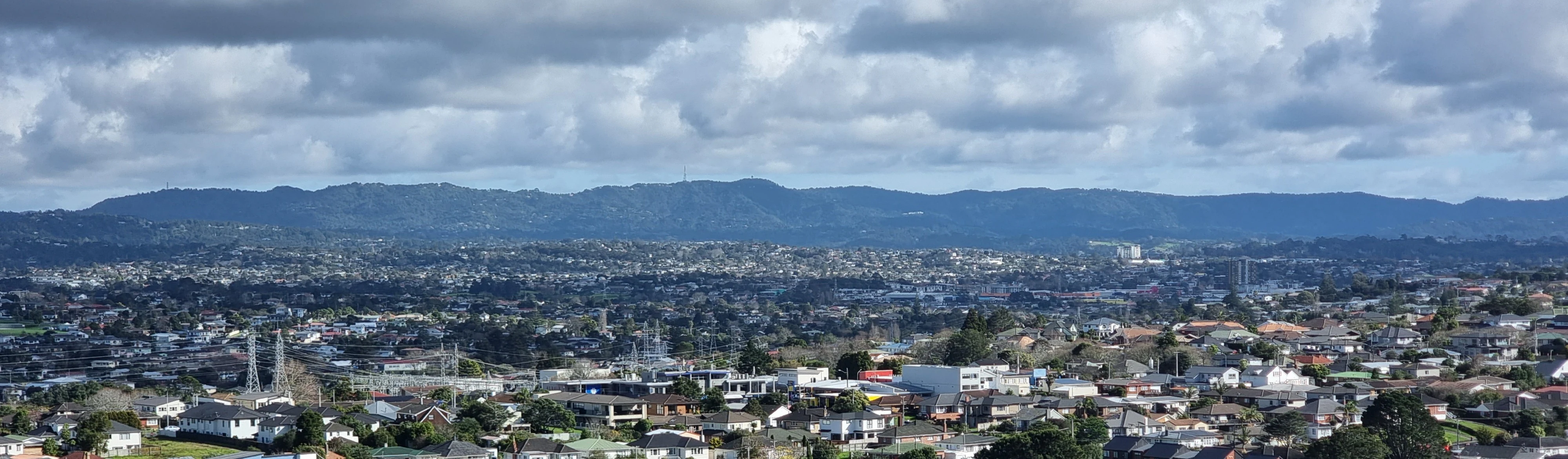
A wide-angle, long-distance view of the forested Waitakere Ranges stretching across the horizon, with suburban buildings and infrastructure in the foreground and midground.
A distant view of the Waitakere Ranges overlooking the suburban landscape of Auckland.

Waitākere Ranges conservation status and protection priorities

Conservation is central to the identity of the Waitākere Ranges. About 27,700 hectares of public and private land across the ranges are protected under the Waitākere Ranges Heritage Area Act of 2008, one of the more comprehensive pieces of regional conservation legislation in New Zealand. The Waitākere Ranges Regional Park itself, one of Auckland's flagship regional parks, covers roughly 60 percent of that heritage area and protects a large block of regenerating native forest adjacent to a major city.

The most urgent conservation challenge is kauri dieback, a disease caused by oomycete organisms that attack kauri trees and prevent them from taking up nutrients. The disease was first identified in the ranges in 2006 by entomologist Peter Maddison, and in 2017 Te Kawerau ā Maki placed a rāhui over the ranges asking visitors to stay out. From May 2018 Auckland Council restricted access to the forested areas of the regional park so tracks could be upgraded to a dry foot standard designed to protect kauri roots and slow the spread of the disease. Parallel to this effort, the Ark in the Park project has used volunteer trapping to reduce introduced predators and create safe refuges for native birds.

Waitākere Ranges cultural meaning and human context

The cultural fabric of the Waitākere Ranges is deeply tied to Te Kawerau ā Maki, the iwi whose traditional rohe includes the ranges and their coastline. The Māori name for the forested heart of the ranges, Te Wao Nui a Tiriwa, evokes the legendary chief Tiriwa of the Tūrehu patupaiarehe. Pre-European settlement focused on the Waitākere River valleys, Te Henga (Bethells Beach), and the sheltered west coast streams, where crops such as kūmara, taro, hue (calabash), and aruhe (bracken fern) root were grown, and coastal seafood and forest game were abundant.

The landscape holds oral traditions about taniwha guardians, patupaiarehe inhabitants, and the navigator Rakatāura of the Tainui canoe, who named many features of the west coast. More than fifty pā sites, including Whakaari pā at Lion Rock in Piha and wartime refuges in the Whatipu caves, reflect the long history of conflict and adaptation. Nineteenth-century land purchases by the Crown and the kauri logging era reshaped the community; by the 1950s almost all Te Kawerau ā Maki land within the ranges had been lost, and most of the iwi had moved from their ancestral settlements. Modern cultural recognition is expressed through formal protections, the 2017 rāhui over the ranges to protect kauri, and ongoing involvement of Te Kawerau ā Maki in the governance of the heritage area.
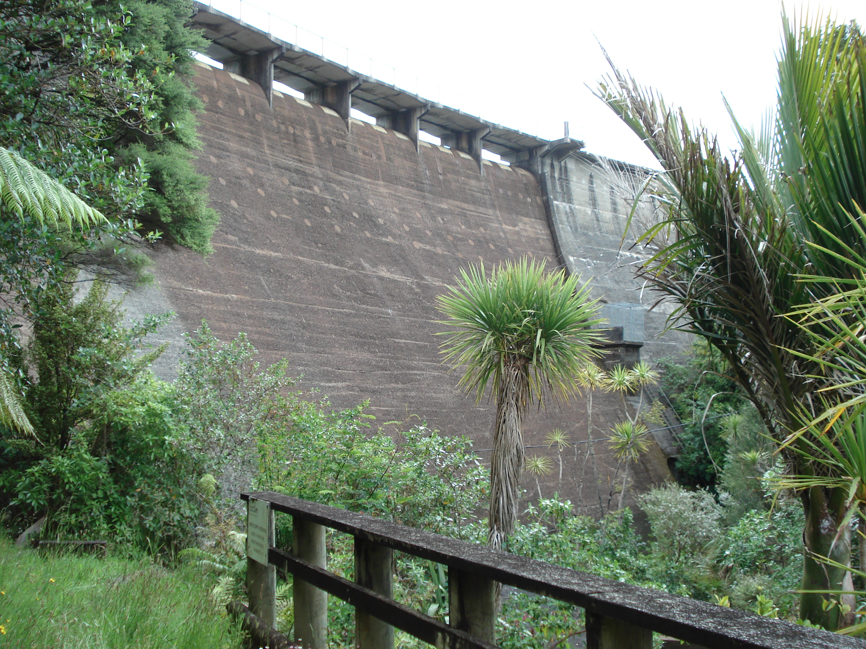
A low-angle view of a large concrete dam wall set into a lush, green forest environment with a wooden railing in the foreground.
The concrete structure of the Waitākere Dam viewed from below in the Waitākere Ranges.

Top sights and standout views in Waitākere Ranges

The Waitākere Ranges bring together a remarkable combination of dramatic scenery, regenerating native forest, and cultural depth within easy reach of Auckland. The dark, surf-pounded beaches of Piha, Karekare, Muriwai, and Te Henga are emblematic, as is Lion Rock framing the entrance to Piha beach. Inland, an extensive network of tracks, including the 77-kilometre Hillary Trail from Arataki Visitor Centre to Muriwai, runs beneath a canopy of kauri, northern rātā, rimu, and more than 110 species of ferns.

Viewpoints along Scenic Drive and from peaks such as Te Toiokawharu, Ruaotuwhenua, and Pukematekeo sweep across both coasts and out over Auckland, while the Otakamiro Point gannet colony near Muriwai offers one of New Zealand's most accessible mainland seabird experiences. The combined heritage area, regional park, and active conservation programmes, including Ark in the Park and the long-running effort to halt kauri dieback, mean the ranges carry real ecological weight in addition to their visual and cultural appeal.
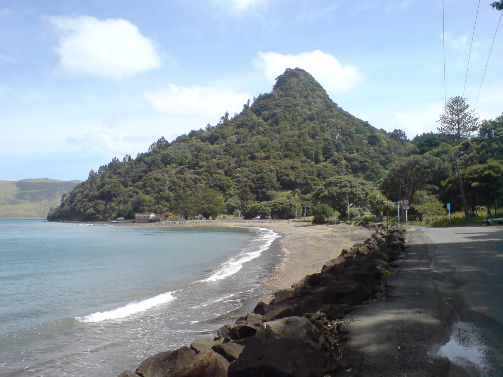
A beach with dark sand curving along the coast, leading toward a prominent forest-covered hill with a road and a low rock wall in the foreground.
A coastal view of Little Huia within the Waitākere Ranges region.

Best time to visit Waitākere Ranges

The Waitākere Ranges have a temperate, maritime climate shaped by high orographic rainfall on the western slopes, with weather that can change quickly. Summer, generally December through February, brings the warmest conditions, calmer seas, and the peak surf and beach scene at Piha, Muriwai, Karekare, and Te Henga, when surf life saving patrols are also active. This is also when forest tracks are at their most inviting, though track closures and access restrictions tied to kauri dieback protection should always be checked in advance.

Autumn and spring offer quieter conditions, softer light for photography along Scenic Drive and the coastal lookouts, and a steady stream of bird activity as native species, including reintroduced kōkako, robins, and whiteheads, are most easily heard and seen. Winter brings cooler temperatures, the greenest forest conditions, and dramatic surf along the west coast beaches, but also higher rainfall and shorter days, which can make some cliff-top walking more exposed. Because the ranges are close to Auckland and used year-round by locals, any season can suit a visit if access and track conditions are confirmed in advance.

Monthly climate preview

Long term temperature and precipitation patterns across representative coordinates

Waitākere Ranges Climate Normals and Monthly Weather Records

Recorded baseline data shows measured monthly averages ranging from cooler midwinter lows to warmer summer maximums alongside varying daily precipitation rates. Opening the complete monthly climate profile reveals full twelve month temperature cycles and precipitation trends for this protected regional landscape.
Annual mean16 °C
13 °C20 °C
Jan20°
Feb20°
Mar19°
Apr18°
May16°
Jun14°
Jul13°
Aug13°
Sep13°
Oct14°
Nov16°
Dec18°
Warmest month
February

20.3 °C

Coolest month
August

12.7 °C

Wettest month
July

4.2 mm/day

Driest month
January

2.2 mm/day

Park location guide

Geography guide, regional context, and park location map for Waitākere Ranges

Waitākere Ranges park geography, regions, and map view in New Zealand

Understand where Waitākere Ranges sits in New Zealand through a broader geographic reading of the surrounding landscape, nearby location context, and its mapped position within the national park landscape.

How Waitākere Ranges fits into New Zealand

New Zealand is an island nation in the southwestern Pacific Ocean comprising two main islands and numerous smaller islands. Located east of Australia across the Tasman Sea, it features varied topography with the Southern Alps running along the South Island and volcanic terrain on the North Island. The country was settled by Maori people between 1280 and 1350, followed by European exploration beginning in 1642, and became a Dominion in 1907 before gaining full independence in 1947.

Wider geography shaping Waitākere Ranges in New Zealand

New Zealand lies in the southwestern Pacific Ocean, east of Australia across the Tasman Sea. The country consists of two main islands, the North Island and South Island, plus over 600 smaller islands. The North Island features volcanic plateaus and hills while the South Island is dominated by the Southern Alps mountain range. The country has a long coastline and is surrounded by the Pacific Ocean.

Map view of Waitākere Ranges

Use this park location map to pinpoint Waitākere Ranges in New Zealand, understand its exact geographic position, and read its mapped placement within the surrounding landscape more clearly.

Pigeon | © OpenStreetMap contributors

Location context for Waitākere Ranges

Auckland Region

Visualizing native kauri forests, steep volcanic hills, and dark coastal surf beaches.

Waitākere Ranges Landscape and Scenery Photography Gallery

Explore detailed photography documenting the rugged terrain and protected natural habitats of the Waitākere Ranges. Visual reference materials capture the dramatic transition from forested inland ridges down to the Tasman Sea coastline.

A silhouette of layered mountain ridges against a glowing orange sunset sky with clouds, featuring a glimpse of reflective water in the lower left.

A dense view of a temperate forest canopy with several large silver ferns clearly visible in the midground against a background of deep green trees and blue sky.

A wide, eye-level landscape shot of a lush, green forest canopy in the Waitākere Ranges, featuring prominent silver ferns in the foreground and rolling hills in the background under a cloudy sky.

A grey kōkako bird with a distinctive blue wattle perching among long green leaves.

A wide-angle, long-distance view of the forested Waitakere Ranges stretching across the horizon, with suburban buildings and infrastructure in the foreground and midground.

A high-angle view looking down at a large rock formation known as Lion Rock on a sandy beach, with crashing surf and coastal cliffs in the background under a cloudy sky.

A low-angle view of a large concrete dam wall set into a lush, green forest environment with a wooden railing in the foreground.

A beach with dark sand curving along the coast, leading toward a prominent forest-covered hill with a road and a low rock wall in the foreground.

Park atlas

Compare adjacent coastal terrain and regional protected areas

Parks Near Waitākere Ranges and Connected Protected Landscapes

Browse other parks near Waitākere Ranges to examine connected protected landscapes and regional coastal geography. Comparing adjacent protected areas provides a wider view of volcanic terrain and native forest ecosystems across the surrounding region.
A soft, pale watercolor illustration depicting a winding stream flowing through a lush, green landscape with gentle hills in the background.
Nature reserveNew Zealand
About 14 km away#1 closest

North

Goldie Bush Scenic Reserve: Protected Forested Landscapes in West Auckland, New Zealand

A study in regenerating bush and Mokoroa Stream topography

Goldie Bush Scenic Reserve encompasses a dense, sheltered catchment valley known for its native forest canopy and the prominent Mokoroa Falls. Once heavily logged, this protected area now serves as an example of ecological restoration in the Waitākere Ranges. The reserve maps a blend of cultural history, including Māori fortification sites, against a backdrop of steep ridges and humid, stream-fed lowland terrain.

Area
2.49 km²
Established
1926
Relief
Upland
Scope
Terrestrial
A pale, minimalist watercolor painting showing a grassy island or shoreline with a small cluster of trees, set against a quiet body of water and soft, distant rolling hills.
Protected areaAuckland Region
About 18 km away#2 closest

Northeast

Motumānawa / Pollen Island: Protected Marine Reserve and Scientific Landscape in Auckland

A coastal shellbank island refuge within the Waitematā Harbour.

Motumānawa / Pollen Island is an essential protected area near the Rosebank Peninsula, serving as a sanctuary for native bird populations and estuarine vegetation. Its status as both a scientific and marine reserve highlights the importance of small-scale coastal conservation within a major metropolitan harbour landscape in New Zealand.

Established
2006
Relief
Lowland
Scope
Marine
Water
Water-dominated
A flat-style digital illustration showing a winding river through a valley with pine trees, steep rock cliffs, and a waterfall under a soft sun.
Nature reserveAuckland
About 29 km away#3 closest

East

Puhinui Reserve: Protected Nature Reserve and Volcanic Geography in Auckland, New Zealand

Coastal wetlands, maar craters, and working agricultural lands

Explore the physical geography of Puhinui Reserve, a protected nature reserve in South Auckland. This site encompasses rare saltmarsh habitat, active volcanic maar features, and estuarine environments situated on the shores of the Manukau Harbour. Gain insight into the volcanic ash, alluvium, and peat soil structures that define this unique transitional landscape.

Area
1.99 km²
Established
1991
Relief
Lowland
Climate
Temperate
A horizontal watercolor painting of a coastal island landscape with rolling green hills, pale distant mountains, and coastal greenery.
Wildlife reserveAuckland
About 42 km away#4 closest

Northeast

Motuihe Island Wildlife Reserve: Protected Landscapes and Hauraki Gulf Geography

Ecological restoration and coastal island history near Auckland

Motuihe Island represents a significant case study in island conservation, featuring intensive native forest regeneration and successful wildlife reintroduction. The mapped landscape details an elongated island geography defined by coastal beaches, sandstone terrain, and rich archaeological layers, serving as a prominent protected reserve for the Auckland region.

Area
1.79 km²
Relief
Lowland
Climate
Subtropical
Access
Moderate access
Regional parkAuckland Region
About 50 km away#5 closest

North

Wenderholm Regional Park: Coastal Forest and Estuary Geography in the Auckland Region

Mapped protected landscapes of a coastal New Zealand peninsula

Situated on a narrow peninsula north of Auckland, Wenderholm Regional Park offers a compact study in diverse coastal terrain. The park encompasses the forested Maungatauhoro headland, the tidal Puhoi sandspit, and riverine boundaries that create a distinct protected environment. Since its 1965 founding, the area has become a haven for native bird restoration and coastal vegetation, providing a unique vantage point across the Hauraki Gulf.

Area
1.35 km²
Established
1965
Relief
Mixed relief
Climate
Temperate
Regional parkAuckland Region
About 51 km away#6 closest

North

Te Muri Regional Park: Mapped Coastal Peninsula and Estuarine Geography in Auckland

Protected native forest and tidal estuary landscapes

Te Muri Regional Park presents a unique peninsular landscape situated between the Puhoi River and Te Muri O Tarariki Stream in Auckland. This protected area showcases a complex interface between native coastal forest and tidal ecosystems, offering clear mapped boundaries that connect to the wider Hauraki Gulf coastal belt. Explore the topographical transition from sea level estuaries to rolling hill country.

Area
4.44 km²
Established
2010
Relief
Upland
Scope
Terrestrial
Regional parkAuckland Region
About 51 km away#7 closest

East

Whakanewha Regional Park: Mapping the Protected Landscapes and Wetlands of Waiheke Island

Coastal forest and wetland geography in the Auckland Region

Whakanewha Regional Park serves as a vital protected area on Waiheke Island, known for its mature broadleaf forests and significant freshwater wetlands. The park provides a compact yet varied landscape of stream valleys and coastal ridgelines, representing a key component of the regional geography within the Hauraki Gulf, sheltered from broader environmental pressures.

Area
2.7 km²
Established
2007
Relief
Upland
Climate
Temperate
Regional parkAuckland Region
About 55 km away#8 closest

East

Waitawa Regional Park: Coastal Geography and Recreation Landscapes in Auckland

Mapped terrain along the Tāmaki Strait shoreline

Waitawa Regional Park serves as a notable example of repurposed land within the Auckland Region, featuring an open coastal landscape on the Tāmaki Strait. This protected space, formerly an industrial explosives site, now offers a unique geography of grassy tracks, beach access, and historical remnants. Its layout provides a specialized atlas view of coastal development and public land use for outdoor activity.

Area
1.88 km²
Established
2013
Relief
Upland
Climate
Temperate

Common questions about visiting, size, designation, and location context for Waitākere Ranges

Waitākere Ranges FAQs for park facts, access, geography, and protected area context

Find quick answers about Waitākere Ranges, including protected-area facts, park geography, trail and visitor context, and how the park fits into its surrounding country and regional landscape.
MoriAtlas Explorer

Continue Your Protected Areas Search Across the Global Atlas

Deepen your exploration by continuing the structured search for national parks and protected areas worldwide. Utilize the comprehensive filtering capabilities to compare different conservation landscapes and refine your understanding of global park geography. Discover more about the distribution and characteristics of protected natural areas.

Global natural geography