
Mori Atlas logo
Regional parkWhakanewha Regional Park

Mapping the native forest, freshwater wetlands, and coastal terrain of an island sanctuary

Whakanewha Regional Park: A Protected Landscape and Geographic Atlas of Waiheke Island

Whakanewha Regional Park encompasses a distinct mosaic of regenerating native shrublands, mature podocarp forests, and critical freshwater wetlands on the southern shores of Waiheke Island. Stretching from the central ridgeline down to the coastline of the Hauraki Gulf, the terrain is defined by three stream catchments and diverse coastal environments. This protected area offers deep insight into the regional geography and natural heritage of the Auckland Region through its unique island-based ecological composition.

regional parkWaiheke IslandHauraki Gulfnative broadleaf forestpodocarp forestfreshwater wetland
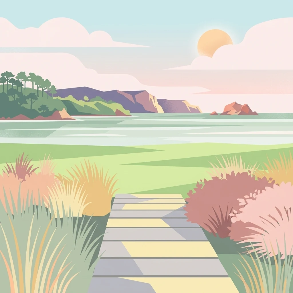
A flat-style digital illustration depicting a wooden boardwalk path leading through grassy coastal dunes toward a serene bay with forested headlands and a setting sun in the distance.

Whakanewha Regional Park

Regional park

Park overview

Structured park overview, official facts, and landscape profile for Whakanewha Regional Park

Whakanewha Regional Park park facts, protected area profile, and essential visitor context

Review the core facts for Whakanewha Regional Park, including designation, size, terrain, visitor scale, habitats, and operating context in one park-focused overview.

About Whakanewha Regional Park

Whakanewha Regional Park sits at the heart of Waiheke Island, one of the most populated islands in the Hauraki Gulf, and provides a revealing contrast to the island's well-known vineyards, beaches, and residential communities. Rather than a heavily developed landscape, the park preserves a substantial block of native habitat where forest, wetland, streams, and coastal headlands meet along the southern shoreline.

From the central ridgeline of the island, the park's land descends toward Rocky Bay, also called Whakanewha Bay, incorporating the three stream catchments that drain into this bay. The result is a varied terrain of slopes, gullies, flats, and wetland margins, offering a layered environment where different native plant communities and animal habitats coexist within a relatively small area.

Ecologically, Whakanewha is notable for the vigor of its native vegetation. The absence of possums on Waiheke Island has allowed native tree species, including broadleaf trees and podocarps, to flourish more successfully here than they often do on the mainland. Much of the current landscape is also shaped by regeneration: former farmland has given way to extensive mānuka and kānuka shrublands, gradually transitioning back toward older native forest associations and adding to the park's environmental interest.

As a regional park, Whakanewha is an important piece of Auckland's broader conservation estate. It preserves wetland habitat that is increasingly scarce in the region, anchors stream catchments flowing into the Hauraki Gulf, and offers refuge for bird species that have declined across much of the North Island. For visitors and residents of Waiheke alike, it represents the island's deep natural baseline, where indigenous biodiversity, Māori cultural heritage, and ongoing ecological recovery converge.

Quick facts and research context for Whakanewha Regional Park

Whakanewha Regional Park covers roughly 270 hectares on the southern coast of central Waiheke Island, in the Hauraki Gulf near Auckland. The park is administered by Auckland Council as part of New Zealand's regional park network and was formally opened as a public park in 2007, following its purchase for redevelopment in 1994.

Its terrain runs from the island's central ridge down to Rocky Bay (Whakanewha Bay) and is shaped by the catchments of three streams that drain into the bay. Native broadleaf forest, podocarp remnants, regenerating mānuka and kānuka shrublands, and a sizeable wetland together define the present-day ecological profile of the park.

Protection and recognition

Documented terrestrial protection metrics and official recognition records

Whakanewha Regional Park Protection Status and Designated Conservation Scope

Whakanewha Regional Park maintains a defined terrestrial protection scope within its regional landscape. Official conservation data tracks international recognition sources and management status for geographic analysis.

Protection details

Protection scope
Terrestrial
Transboundary protection
No
Park context

Deeper park guide and search-rich context for Whakanewha Regional Park

Whakanewha Regional Park history, landscape, wildlife, and travel context

Explore Whakanewha Regional Park through its history, landscape character, ecosystems, wildlife, conservation priorities, cultural context, and seasonal travel timing in a structured park guide built for atlas discovery and search intent.

Why Whakanewha Regional Park stands out

Whakanewha is best known for its combination of mature and regenerating native forest and a significant freshwater wetland within a compact island setting. The park's broadleaf and podocarp stands, including taraire, pūriri, kahikatea, and tānekaha, are notably healthy in ecological terms, partly because of the absence of possums on Waiheke Island. The south-west wetland is a defining feature, supporting secretive native birdlife such as the New Zealand bittern, banded rail, and fernbird. Together with its bay-facing streams and ridgeline setting, this mix of wetland, forest, and coastal headwaters gives Whakanewha its distinctive place among Auckland's regional parks.
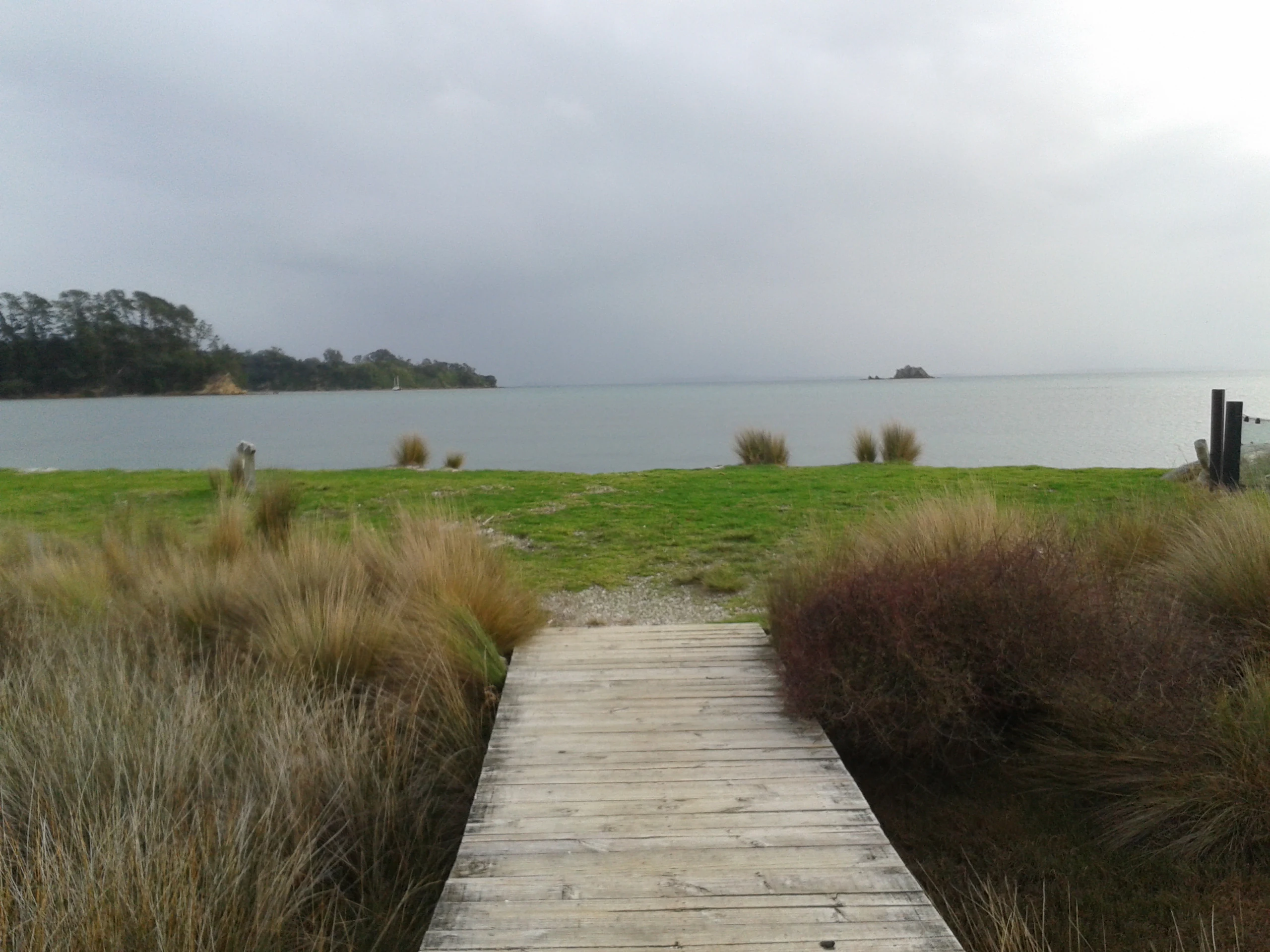
A wooden boardwalk path leading through grasses to a calm bay under an overcast sky at Whakanewha Regional Park.
A wooden boardwalk leads toward the coast at Whakanewha Regional Park.

Whakanewha Regional Park history and protected-area timeline

Whakanewha has deep Tāmaki Māori roots, with archaeological evidence of long-term settlement in the form of large shell middens and a pā site within what is now the park. The name itself, which can be interpreted as "shading eyes from the setting sun," reflects the area's longstanding cultural and geographical meaning. Iwi and hapū with continuing association to the land include Ngāti Pāoa, Ngāi Tai ki Tāmaki, and Te Ākitai Waiohua.

During the 1850s, Māori communities including Ngāti Pāoa grew large quantities of fruit and vegetables on eastern Waiheke Island to supply Auckland, and Whakanewha was part of this productive landscape. Around 1855, Samuel Wood purchased part of the land without consultation with its Māori residents, leading to dispute and the burning of Wood's house in response. The Crown later confirmed his title in 1858, after which the property changed hands and passed to the O'Brien family, who ran the area as a sheep farm through the late nineteenth and twentieth centuries.

The park's modern history began in 1994, when the land was purchased with the intention of developing it as a regional park. After years of restoration and planning, Whakanewha Regional Park was formally opened to the public in February 2007. Since then, Auckland Council has managed the site as a protected landscape, allowing former pastures to regenerate into native shrubland and forest, while also addressing environmental pressures such as stream sedimentation that have affected freshwater habitat within the park.

Whakanewha Regional Park landscape and geographic character

The physical character of Whakanewha is shaped by the central spine of Waiheke Island and the way its southern slopes drain toward the coast. The park extends from the main ridgeline downward to Rocky Bay, also known as Whakanewha Bay, taking in ridgeline, mid-slope, valley, and coastal-edge environments in a relatively continuous sweep.

Three streams form the backbone of the park's hydrology, their catchments carving shallow valleys and feeding the bay. Along these watercourses, flatter ground accumulates moisture and supports wetland vegetation, most visibly in the large wetland occupying the south-west portion of the park. The combination of ridgeline, stream valleys, wetland flats, and bay-facing slopes gives the park a layered and varied topography within a compact area.

The lower edges of the park meet the rocky southern shoreline of Waiheke Island, tying the terrestrial landscape to the Hauraki Gulf. Even where human land use once dominated, much of the visible terrain today reads as a mosaic of regenerating shrubland, regenerating and mature forest, and open wetland margins, providing a striking contrast to the more developed parts of eastern Waiheke.

Whakanewha Regional Park ecosystems, habitats, and plant life

Ecologically, Whakanewha reflects what the Hauraki Gulf's islands can offer when invasive mammal pressures are reduced and land is allowed to recover. The park's forests are dominated by broadleaf species such as taraire and pūriri, together with podocarp trees including kahikatea and tānekaha. These species form a multilayered canopy structure typical of northern New Zealand lowland forest, enriched locally by the favorable conditions of an island environment.

Across large parts of the park, the older forest is interspersed with and increasingly replaced by regenerating mānuka and kānuka shrublands. This regrowth is gradually recolonizing areas that were once cleared for farming, creating a transitional vegetation pattern where early-successional shrubland grades into older broadleaf/podocarp associations. Without possums, which are absent from Waiheke Island, native tree species here have been able to establish and persist with greater success than on many comparable mainland sites.

The south-west wetland is perhaps the park's most ecologically distinctive habitat. It supports wetland-dependent birdlife and ties the park's forested interior to its stream systems and ultimately to the Hauraki Gulf. The wetland, along with the three stream catchments that converge on Rocky Bay, plays an important role in freshwater and estuarine habitat continuity in this part of the gulf.

Whakanewha Regional Park wildlife and species highlights

The wildlife profile of Whakanewha is shaped by its combination of mature forest, regenerating shrubland, streams, and wetland. The park provides habitat for several bird species that have become uncommon or threatened on the mainland. The south-west wetland is a particularly important area, supporting secretive wetland birds such as the New Zealand bittern, the buff-banded rail, and the New Zealand fernbird.

Forest and shrubland habitats across the rest of the park host typical northern New Zealand forest birds, supported by the abundance of broadleaf and podocarp vegetation and the relatively healthy state of the understory. The absence of possums on Waiheke Island has been linked to the better-than-expected condition of forest foliage, which in turn benefits invertebrates, fruit-eating birds, and the wider forest food web.

Freshwater wildlife has also been part of Whakanewha's profile. In the 1990s, the cascade stream and the poukaraka wetland were known habitat for giant kōkopu, a native fish. Stream sedimentation linked to an unsealed road upstream of the park has since degraded parts of this habitat, and Auckland Council has been considering options for reintroducing giant kōkopu to suitable stretches of stream within the park.

Whakanewha Regional Park conservation status and protection priorities

Whakanewha's significance for conservation lies in what it preserves within a heavily populated island landscape just a short distance from central Auckland. By protecting roughly 270 hectares of native and regenerating habitat, the park maintains a sizeable refuge for forest and wetland communities that have been lost or reduced across much of the Auckland region.

Its wetland habitat is particularly important: large wetlands of this character have become increasingly rare in northern New Zealand, and they support some of the country's most range-restricted and threatened bird species. The park's stream catchments also protect freshwater links between forested uplands and the Hauraki Gulf, with corresponding benefits for downstream estuarine habitat.

The island setting gives Whakanewha an additional conservation edge. Lacking possums, Waiheke provides conditions in which native vegetation can regenerate more freely, and the park demonstrates how this can translate into healthier forest structure and richer birdlife. At the same time, the park faces its own pressures, including stream sedimentation that has degraded habitat for giant kōkopu and prompted active management discussions around restoration.

Whakanewha Regional Park cultural meaning and human context

Whakanewha sits within a landscape of long Māori settlement and use, and the cultural presence in the park is tangible rather than symbolic. The presence of large shell middens and a pā site points to sustained occupation by Tāmaki Māori over generations, and the park's Māori name, translated as "shading eyes from the setting sun," reinforces the deep place-based meaning of the land.

Multiple iwi and hapū maintain association with this area, including Ngāti Pāoa, Ngāi Tai ki Tāmaki, and Te Ākitai Waiohua. In the mid-nineteenth century, members of Ngāti Pāoa cultivated fruit and vegetables at Whakanewha and elsewhere on eastern Waiheke to supply the growing city of Auckland, placing the park within an important regional food-supply history.

The mid-nineteenth-century Crown purchase of part of the park by Samuel Wood, undertaken without consultation with Māori residents and followed by retaliation and eventual Crown confirmation of title, also marks the area as part of the broader story of contested land transactions in nineteenth-century New Zealand. Its identity today as a regional park continues to develop alongside this layered Māori and non-Māori heritage.

Top sights and standout views in Whakanewha Regional Park

Whakanewha stands out for the way it concentrates so many distinct environments within a small island footprint: ridgeline, mature broadleaf and podocarp forest, regenerating mānuka and kānuka shrubland, a sizeable freshwater wetland, three stream valleys, and a rocky southern bay shoreline, all connected in a single landscape.

Its combination of high-quality native forest and a significant wetland gives the park a conservation profile that is unusual so close to Auckland, while its shell middens and pā site make it one of Waiheke Island's most culturally layered landscapes.

Best time to visit Whakanewha Regional Park

Spring and early summer tend to bring the park's wetland and forest into particularly active periods, with birdsong and visible breeding activity across both habitats. Warmer months also offer easier walking conditions along the park's coastal and ridgeline edges, making it a natural time to explore the connection between forest, stream, and bay.

Autumn and winter bring their own character: cooler, wetter conditions refresh the wetland, sustain stream flow through the three catchments, and emphasize the green density of the regenerating forest. These seasons can be rewarding for those interested in the park's quieter ecological rhythms, though conditions on the southern coast of Waiheke can be changeable.

Monthly climate preview

Long term temperature and precipitation measurements for Whakanewha Regional Park

Whakanewha Regional Park Climate Normals and Annual Weather Patterns

Measured coordinates record average temperatures ranging from 11.43 degrees Celsius to 20.34 degrees Celsius alongside varying monthly precipitation rates across the year. Reviewing the complete twelve month profile provides detailed numerical context for comparing temperature extremes and precipitation shifts.
Annual mean16 °C
11 °C20 °C
Jan20°
Feb20°
Mar19°
Apr17°
May15°
Jun12°
Jul11°
Aug12°
Sep13°
Oct14°
Nov16°
Dec18°
Warmest month
February

20.3 °C

Coolest month
July

11.4 °C

Wettest month
July

3.7 mm/day

Driest month
January

1.8 mm/day

Park location guide

Geography guide, regional context, and park location map for Whakanewha Regional Park

Whakanewha Regional Park park geography, regions, and map view in New Zealand

Understand where Whakanewha Regional Park sits in New Zealand through a broader geographic reading of the surrounding landscape, nearby location context, and its mapped position within the national park landscape.

How Whakanewha Regional Park fits into New Zealand

New Zealand is an island nation in the southwestern Pacific Ocean comprising two main islands and numerous smaller islands. Located east of Australia across the Tasman Sea, it features varied topography with the Southern Alps running along the South Island and volcanic terrain on the North Island. The country was settled by Maori people between 1280 and 1350, followed by European exploration beginning in 1642, and became a Dominion in 1907 before gaining full independence in 1947.

Wider geography shaping Whakanewha Regional Park in New Zealand

New Zealand lies in the southwestern Pacific Ocean, east of Australia across the Tasman Sea. The country consists of two main islands, the North Island and South Island, plus over 600 smaller islands. The North Island features volcanic plateaus and hills while the South Island is dominated by the Southern Alps mountain range. The country has a long coastline and is surrounded by the Pacific Ocean.

Map view of Whakanewha Regional Park

Use this park location map to pinpoint Whakanewha Regional Park in New Zealand, understand its exact geographic position, and read its mapped placement within the surrounding landscape more clearly.

Pigeon | © OpenStreetMap contributors

Location context for Whakanewha Regional Park

Auckland Region
Recorded earthquake history

Explore Historical Earthquake Records Associated with Whakanewha Regional Park

Browse the MoriAtlas catalogue of recorded seismic events associated by distance with Whakanewha Regional Park. This structured collection offers an accessible way to examine the regional earthquake history of the Waiheke Island environment.

Whakanewha Regional Park Earthquake History

Catalogued events

3 events

Strongest magnitude

Magnitude 4.5

Most recent event

Mar 13, 2007

This history includes earthquakes recorded inside the park or within 50 km of its borders

Explore real terrain views, forest canopies, and coastal wetlands across Waiheke Island.

Whakanewha Regional Park Photos and Scenery: Visualizing Island Habitats

Visual documentation captures the varied topography of Whakanewha Regional Park, extending from central ridgelines down to the rocky southern coastline of the Hauraki Gulf. Examining these protected habitats provides a clearer understanding of mature native forests, freshwater wetlands, and coastal stream environments.

A wooden boardwalk path leading through grasses to a calm bay under an overcast sky at Whakanewha Regional Park.

Park atlas

Compare nearby regional reserves and coastal habitats across the wider regional geography.

Explore Other Parks Near Whakanewha Regional Park and Surrounding Protected Landscapes

Continue browsing related protected areas and coastal nature reserves located near Whakanewha Regional Park. Compare surrounding island ecosystems and regional landscapes to expand your understanding of local conservation geography.
A soft, watercolor painting of a coastal landscape featuring green rolling hills, distant pale mountains, and patches of vegetation against a white background.
Nature reserveAuckland Region
About 9.9 km away#1 closest

East

Rotoroa Island Nature Reserve: Mapping the Geography of this Hauraki Gulf Sanctuary

A vital protected island terrain for native species and reforestation

Rotoroa Island serves as a managed conservation landscape within the Hauraki Gulf, defined by its role as a pest-free sanctuary for threatened bird populations and intensive native forest restoration. The island offers a distinct geography that combines maritime coastal terrain with a rich history of social welfare, preserved through intentional land management and active environmental rehabilitation efforts near the Auckland coast.

Area
0.82 km²
Established
2011
Relief
Lowland
Scope
Terrestrial
A horizontal watercolor painting of a coastal island landscape with rolling green hills, pale distant mountains, and coastal greenery.
Wildlife reserveAuckland
About 10 km away#2 closest

West

Motuihe Island Wildlife Reserve: Protected Landscapes and Hauraki Gulf Geography

Ecological restoration and coastal island history near Auckland

Motuihe Island represents a significant case study in island conservation, featuring intensive native forest regeneration and successful wildlife reintroduction. The mapped landscape details an elongated island geography defined by coastal beaches, sandstone terrain, and rich archaeological layers, serving as a prominent protected reserve for the Auckland region.

Area
1.79 km²
Relief
Lowland
Climate
Subtropical
Access
Moderate access
Regional parkAuckland Region
12 km away#3 closest

Southeast

Waitawa Regional Park: Coastal Geography and Recreation Landscapes in Auckland

Mapped terrain along the Tāmaki Strait shoreline

Waitawa Regional Park serves as a notable example of repurposed land within the Auckland Region, featuring an open coastal landscape on the Tāmaki Strait. This protected space, formerly an industrial explosives site, now offers a unique geography of grassy tracks, beach access, and historical remnants. Its layout provides a specialized atlas view of coastal development and public land use for outdoor activity.

Area
1.88 km²
Established
2013
Relief
Upland
Climate
Temperate
Regional parkWaikato Region
28 km away#4 closest

Southeast

Waharau Regional Park: Protected Coastal Forest and Hunua Ranges Gateway

Geographic landscape transition in the Waikato region

This protected area offers a deep look into the transition from native forest hill country to estuarine environments along the Firth of Thames. Spanning 170 hectares, it serves as a functional geographic corridor between the Hunua Ranges and the Hauraki Gulf, showcasing layered history and varied topography within the Waikato region.

Area
1.7 km²
Established
1979
Relief
Upland
Climate
Temperate
A flat-style digital illustration showing a winding river through a valley with pine trees, steep rock cliffs, and a waterfall under a soft sun.
Nature reserveAuckland
About 30 km away#5 closest

Southwest

Puhinui Reserve: Protected Nature Reserve and Volcanic Geography in Auckland, New Zealand

Coastal wetlands, maar craters, and working agricultural lands

Explore the physical geography of Puhinui Reserve, a protected nature reserve in South Auckland. This site encompasses rare saltmarsh habitat, active volcanic maar features, and estuarine environments situated on the shores of the Manukau Harbour. Gain insight into the volcanic ash, alluvium, and peat soil structures that define this unique transitional landscape.

Area
1.99 km²
Established
1991
Relief
Lowland
Climate
Temperate
A pale, minimalist watercolor painting showing a grassy island or shoreline with a small cluster of trees, set against a quiet body of water and soft, distant rolling hills.
Protected areaAuckland Region
About 36 km away#6 closest

West

Motumānawa / Pollen Island: Protected Marine Reserve and Scientific Landscape in Auckland

A coastal shellbank island refuge within the Waitematā Harbour.

Motumānawa / Pollen Island is an essential protected area near the Rosebank Peninsula, serving as a sanctuary for native bird populations and estuarine vegetation. Its status as both a scientific and marine reserve highlights the importance of small-scale coastal conservation within a major metropolitan harbour landscape in New Zealand.

Established
2006
Relief
Lowland
Scope
Marine
Water
Water-dominated
A soft watercolor illustration showing the low-lying shape of Motuora Island surrounded by calm water, with a distant hilly coastline in the background.
Nature reserveNorth Island
About 42 km away#7 closest

Northwest

Motuora Nature Reserve: Protected Coastal Island Geography and Restoration Map

Predator-free ecological sanctuary in the Hauraki Gulf

Motuora occupies a key position in the Hauraki Gulf, offering a well-mapped look at coastal island restoration in New Zealand. This protected area features a regenerated forest interior and cliff-edged terrain, serving as an important mainland-island site for avian conservation, including kiwi and petrel colonies.

Area
0.8 km²
Established
1965
Relief
Lowland
Climate
Subtropical
Regional parkAuckland Region
43 km away#8 closest

Northwest

Wenderholm Regional Park: Coastal Forest and Estuary Geography in the Auckland Region

Mapped protected landscapes of a coastal New Zealand peninsula

Situated on a narrow peninsula north of Auckland, Wenderholm Regional Park offers a compact study in diverse coastal terrain. The park encompasses the forested Maungatauhoro headland, the tidal Puhoi sandspit, and riverine boundaries that create a distinct protected environment. Since its 1965 founding, the area has become a haven for native bird restoration and coastal vegetation, providing a unique vantage point across the Hauraki Gulf.

Area
1.35 km²
Established
1965
Relief
Mixed relief
Climate
Temperate

Common questions about visiting, size, designation, and location context for Whakanewha Regional Park

Whakanewha Regional Park FAQs for park facts, access, geography, and protected area context

Find quick answers about Whakanewha Regional Park, including protected-area facts, park geography, trail and visitor context, and how the park fits into its surrounding country and regional landscape.
MoriAtlas Explorer

Continue Your Protected Areas Search Across the Global Atlas

Deepen your exploration by continuing the structured search for national parks and protected areas worldwide. Utilize the comprehensive filtering capabilities to compare different conservation landscapes and refine your understanding of global park geography. Discover more about the distribution and characteristics of protected natural areas.

Global natural geography