
Mori Atlas logo
Nature reserveMotuora

A restored island ecosystem and predator-free refuge located off the coast of New Zealand's North Island

Motuora Nature Reserve: Mapped Protected Landscapes and Ecological Geography in the Hauraki Gulf

Motuora is a distinctive 80-hectare nature reserve positioned in the western Hauraki Gulf. The island serves as a vital ecological sanctuary where extensive volunteer-led reforestation efforts have transformed former farmland back into native coastal forest. Its geographic isolation and protected-area status support critical recovery programmes, including the predator-free rearing of North Island brown kiwi and the establishment of new seabird and reptile populations.

islandnature reserveecological restorationpredator-free islandnative forest replantingseabird breeding
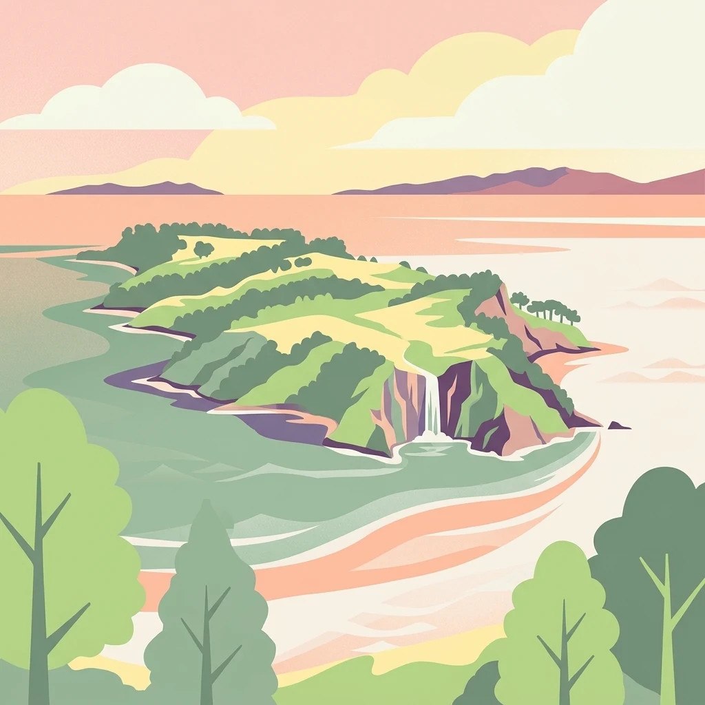
A stylized digital illustration of a green island set in a calm sea, featuring a small waterfall on its cliffside and a soft pastel-colored sky.

Motuora

Nature reserve

Park overview

Structured park overview, official facts, and landscape profile for Motuora

Motuora park facts, protected area profile, and essential visitor context

Review the core facts for Motuora, including designation, size, terrain, visitor scale, habitats, and operating context in one park-focused overview.

About Motuora

Motuora is a narrow, low-lying island in the outer Hauraki Gulf, oriented roughly north-south along New Zealand's north-eastern coastline. Although only about two kilometres long and half a kilometre wide, with a highest point of around 67 metres, it sits in a strategic position between Kawau Island, the Mahurangi Heads mainland coast, and the wider gulf waters. Its compact size and exposed location give it a distinctive character: steep coastal cliffs, regenerating coastal forest, and open restored interiors that together form a patchwork of habitats typical of inner-gulf islands.

The island's modern identity is inseparable from the restoration movement that began in 1990 and was formalised in 1995 with the founding of the Motuora Restoration Society. Together with the Department of Conservation, the society has overseen decades of replanting, invasive species control, and deliberate introductions of native fauna. Because exotic mammals never became established on Motuora, it offers a relatively safe stage for species that have struggled elsewhere on the mainland, and the restoration programme has used this advantage deliberately to bolster populations of kiwis, geckos, skinks, giant weta, and petrels.

For visitors and researchers drawn to the Hauraki Gulf, Motuora represents a model of community-led island conservation. Its combination of active native forest regeneration, ongoing reptile and invertebrate reintroductions, and significant seabird breeding work places it among the better-studied restoration sites in northern New Zealand.

Quick facts and research context for Motuora

Motuora is an 80 hectare nature reserve island in the western Hauraki Gulf, administered by New Zealand and jointly managed by the Motuora Restoration Society and the Department of Conservation. It lies south-west of Kawau Island and east of Mahurangi Heads, roughly 35 kilometres north of Auckland. The island has never had established populations of exotic mammals, which underpins its role as a refuge for native species. It is used as a predator-free 'kiwi creche' for North Island brown kiwi and supports active restoration of native forest, reptile populations, and seabird colonies.

Protection and recognition

Examine the documented protection scope and international recognition sources for Motuora.

Motuora Protection Status and Designated Area Recognition Records

Motuora maintains a mixed protection scope governed by established management frameworks and conservation standards. Review the verified designation records and structured protection details associated with the natural area.

Protection details

Protection scope
Mixed
Transboundary protection
No
Park context

Deeper park guide and search-rich context for Motuora

Motuora history, landscape, wildlife, and travel context

Explore Motuora through its history, landscape character, ecosystems, wildlife, conservation priorities, cultural context, and seasonal travel timing in a structured park guide built for atlas discovery and search intent.

Why Motuora stands out

Motuora is best known as a community-driven ecological restoration island and as a predator-free 'kiwi creche' for North Island brown kiwi under the Department of Conservation's Operation Nest Egg. It is also recognised for its small breeding colony of Australasian gannets, its ongoing translocations of diving petrels and Pycroft's petrels to establish new seabird colonies, and its replanting of native coastal forest over former farmland. The island's combination of relief from introduced mammals and sustained volunteer effort makes it a textbook example of mainland-island restoration in the Hauraki Gulf.
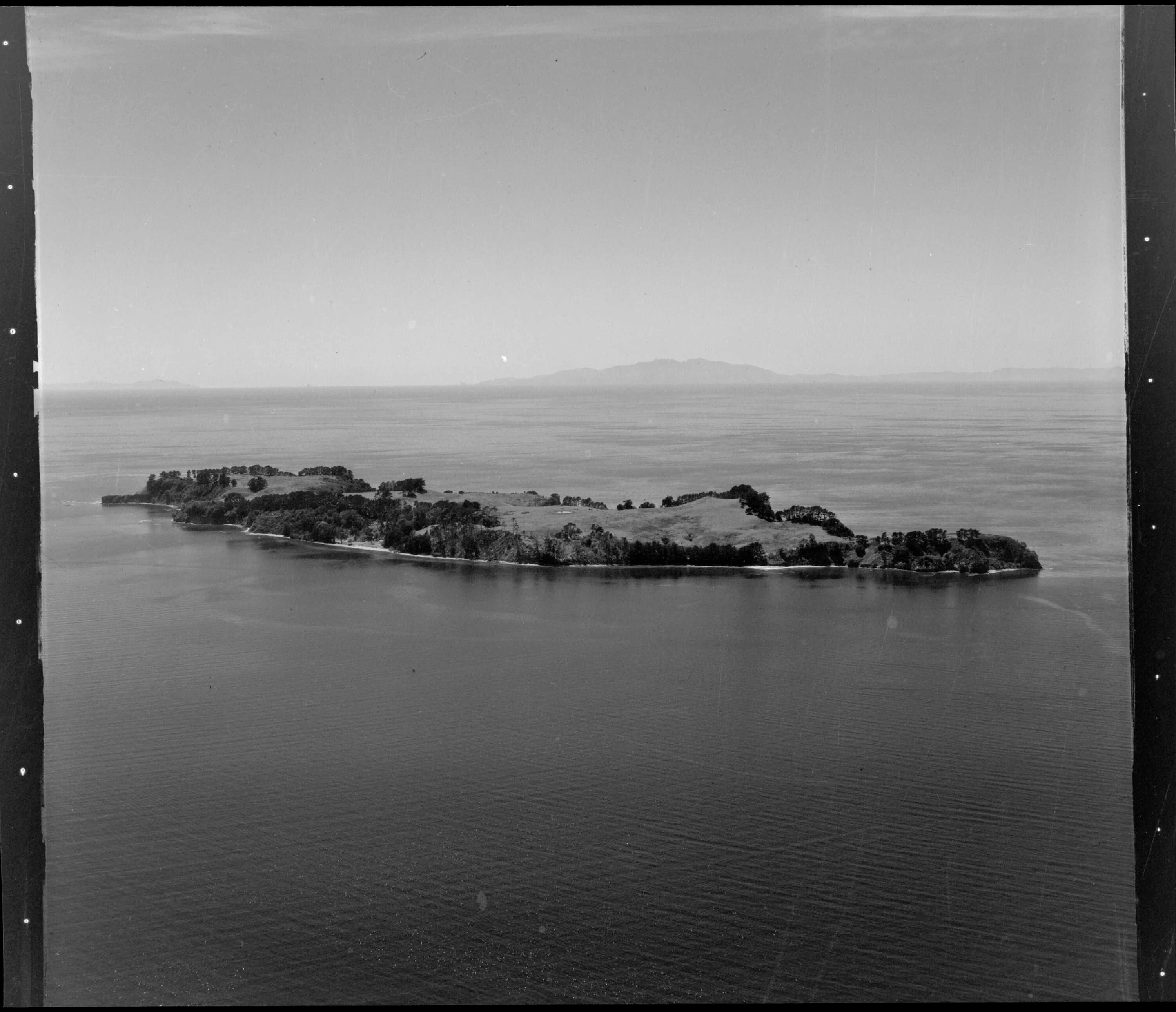
A black and white aerial photograph showing the entire landmass of Motuora Island surrounded by calm sea waters.
Aerial view of Motuora Island in the Hauraki Gulf, captured in black and white.

Motuora history and protected-area timeline

Motuora has no permanent residents today, but the island was clearly known to earlier generations and used intensively during the twentieth century. During that period the original coastal forest was cleared and the land was worked as a farm, leaving only remnant strips of native vegetation clinging to the steeper cliff and coastal edges. The transformation of much of the island's surface into pasture marked a significant loss of its original ecological character.

The Crown purchased Motuora in 1965 and designated it as a recreation reserve, a move that set the stage for later ecological ambitions. By 1990 a programme of ecological restoration had begun, largely driven by volunteers who began the long task of replanting native vegetation across the cleared areas. In 1995 the volunteer effort was formalised through the establishment of the Motuora Restoration Society, which has since worked alongside the Department of Conservation to manage the island's restoration, replanting, and species introductions.

Motuora landscape and geographic character

Motuora is a small, elongated island roughly two kilometres long and only about half a kilometre wide, oriented along the western edge of the Hauraki Gulf. Its terrain rises to a maximum elevation of around 67 metres, with a mix of sloping coastal faces, regenerating forested interior, and cliff edges where original native vegetation has survived most intact. The island's modest scale and exposed marine setting produce a landscape that feels extensively shaped by its coastal surroundings, with the sea defining much of its visual character.

Around the island, the cliffs and headlands alternate with lower coastal margins, producing a varied shoreline that has influenced where native forest remnants survived the farming era and where new plantings have been concentrated. The landforms reflect the typical combination of eroded coastal margins and softer inland terraces common to inner Hauraki Gulf islands, giving Motuora a clearly layered landscape of cliff, slope, and restored interior.

Motuora ecosystems, habitats, and plant life

Motuora's ecological story is one of deliberate reconstruction. The original coastal forest was largely cleared during the farming era, leaving only patchy remnants along the steeper cliffs and coastal fringes. From 1990 onwards, extensive replanting of native vegetation has worked to knit those remnants back into a continuous native forest cover, with the result that much of the island now consists of native plantings at varying stages of maturity. Because exotic mammals never established on Motuora, the regenerating forest has developed in a relatively undisturbed setting, providing habitat for reintroduced and naturally arriving native species.

The combination of replanted forest, surviving cliff-edge remnants, and an absence of mammalian predators gives the island a layered habitat structure typical of carefully managed restoration sites in northern New Zealand. It is this combination that underpins the wide range of native fauna that the Motuora Restoration Society and the Department of Conservation have sought to encourage on the island.

Motuora wildlife and species highlights

Motuora is particularly important for its native reptile fauna, which has been actively rebuilt through introductions and reintroductions. The giant wetapunga, New Zealand's largest weta, is among the species present on the island, alongside shore skinks and three species of gecko: the common gecko, the Pacific gecko, and Duvaucel's gecko. These reptile populations are a central focus of the restoration programme, reflecting the island's role as a refuge for species that have been heavily impacted on the mainland.

The island's birdlife combines naturally occurring seabirds with deliberately established populations. A small breeding colony of Australasian gannets occupies part of the island, while grey-faced petrels nest there as part of the established fauna. Chicks of common diving petrels and Pycroft's petrels have been translocated to Motuora in efforts to establish new breeding colonies. Since 1999, North Island brown kiwi chicks have been brought to the island under Operation Nest Egg, using Motuora as a 'kiwi creche' where juveniles can grow in a predator-free environment before being returned to the mainland.

Motuora conservation status and protection priorities

Motuora's conservation significance rests on three connected facts: it was acquired by the Crown and protected as a reserve, it has never had established populations of exotic mammals, and it has been the focus of a sustained restoration effort since 1990. Together these factors have made the island a refugium where native species can recover and where vulnerable juveniles can be raised safely. The Motuora Restoration Society and the Department of Conservation jointly manage the island, combining volunteer-led replanting, reptile and invertebrate introductions, seabird translocations, and kiwi 'creche' operations.

The island's role in Operation Nest Egg is perhaps its most distinctive conservation contribution. By providing a predator-free setting for North Island brown kiwi juveniles, Motuora helps bridge the vulnerability gap between hatching and the age at which kiwi can better defend themselves on the mainland. Its parallel work to establish new seabird colonies and bolster reptile populations cements its standing as a highly active, multi-species restoration site in the Hauraki Gulf.

Motuora cultural meaning and human context

The Māori name of the island, Motuora, reflects its long identification within Te Ao Māori, although the source material does not detail specific traditional associations of the island. Its twentieth-century history as a farmed island and its later transition to a community-led restoration project represent a more recent layer of human relationship with the land, in which residents and volunteers have rebuilt the island's native ecological character after decades of clearance.

Top sights and standout views in Motuora

Among Motuora's strongest points of distinction is its status as a predator-free restoration island in the western Hauraki Gulf, where native coastal forest has been progressively replanted across former farmland since 1990. Its 'kiwi creche' role for North Island brown kiwi, its small Australasian gannet breeding colony, and its ongoing translocations of diving petrels and Pycroft's petrels make it a genuinely multi-species restoration site. The combination of volunteer-led replanting, joint management with the Department of Conservation, and the deliberate reintroduction of reptiles such as geckos, skinks, and wetapunga gives the island a strong and distinctive restoration profile within northern New Zealand.

Best time to visit Motuora

Because Motuora is an uninhabited restoration island accessed primarily through organised and research-related trips, seasonality is best considered in terms of the natural rhythms of the Hauraki Gulf rather than tourist calendars. Cooler months tend to bring calmer gulf waters around the island, while warmer months coincide with the height of seabird breeding activity. The replanted native forest can be most vividly experienced when conditions are mild enough to allow walking across the regenerating terrain and observing the island's revegetation progress.

Monthly climate preview

Long-term representative measurements defining monthly weather patterns across Motuora

Motuora Climate Normals, Annual Temperature and Precipitation Rhythm

Representative baseline coordinates record measured monthly temperature ranges and precipitation totals across Motuora from 1991 to 2020. Detailed twelve-month profiles provide comprehensive numerical comparisons for ongoing environmental research.
Annual mean16 °C
12 °C21 °C
Jan20°
Feb21°
Mar19°
Apr18°
May16°
Jun14°
Jul13°
Aug12°
Sep13°
Oct15°
Nov16°
Dec18°
Warmest month
February

20.6 °C

Coolest month
August

12.5 °C

Wettest month
July

3.5 mm/day

Driest month
January

1.7 mm/day

Park location guide

Geography guide, regional context, and park location map for Motuora

Motuora park geography, regions, and map view in New Zealand

Understand where Motuora sits in New Zealand through a broader geographic reading of the surrounding landscape, nearby location context, and its mapped position within the national park landscape.

How Motuora fits into New Zealand

New Zealand is an island nation in the southwestern Pacific Ocean comprising two main islands and numerous smaller islands. Located east of Australia across the Tasman Sea, it features varied topography with the Southern Alps running along the South Island and volcanic terrain on the North Island. The country was settled by Maori people between 1280 and 1350, followed by European exploration beginning in 1642, and became a Dominion in 1907 before gaining full independence in 1947.

Wider geography shaping Motuora in New Zealand

New Zealand lies in the southwestern Pacific Ocean, east of Australia across the Tasman Sea. The country consists of two main islands, the North Island and South Island, plus over 600 smaller islands. The North Island features volcanic plateaus and hills while the South Island is dominated by the Southern Alps mountain range. The country has a long coastline and is surrounded by the Pacific Ocean.

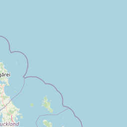
Map view of Motuora

Use this park location map to pinpoint Motuora in New Zealand, understand its exact geographic position, and read its mapped placement within the surrounding landscape more clearly.

Pigeon | © OpenStreetMap contributors

Location context for Motuora

North Island

Explore protected area views, coastal cliffs, and restored native forest environments.

Motuora Photos and Landscape Scenery: Visualizing Island Habitats

Visual records capture the rugged coastal cliffs, sloping terrain, and regenerating native forest across the protected island landscape. Examining these field photographs reveals the distinct ecological character and island environment of Motuora.

A black and white aerial photograph showing the entire landmass of Motuora Island surrounded by calm sea waters.

Close-up of a person holding a North Island Brown Kiwi wrapped in a towel, with a bird monitoring T-shirt visible in the background.

Park atlas

Compare adjacent island reserves and regional coastal landscapes

Explore Protected Areas and Parks Near Motuora in the Hauraki Gulf

Browsing other protected areas near Motuora reveals a wider network of restored island sanctuaries and coastal habitats across the Hauraki Gulf. Expanding the geographic scope allows travelers to compare regional conservation efforts and discover connected natural landscapes.
Regional parkAuckland Region
About 6.6 km away#1 closest

West

Te Muri Regional Park: Mapped Coastal Peninsula and Estuarine Geography in Auckland

Protected native forest and tidal estuary landscapes

Te Muri Regional Park presents a unique peninsular landscape situated between the Puhoi River and Te Muri O Tarariki Stream in Auckland. This protected area showcases a complex interface between native coastal forest and tidal ecosystems, offering clear mapped boundaries that connect to the wider Hauraki Gulf coastal belt. Explore the topographical transition from sea level estuaries to rolling hill country.

Area
4.44 km²
Established
2010
Relief
Upland
Scope
Terrestrial
Regional parkAuckland Region
About 7.5 km away#2 closest

Southwest

Wenderholm Regional Park: Coastal Forest and Estuary Geography in the Auckland Region

Mapped protected landscapes of a coastal New Zealand peninsula

Situated on a narrow peninsula north of Auckland, Wenderholm Regional Park offers a compact study in diverse coastal terrain. The park encompasses the forested Maungatauhoro headland, the tidal Puhoi sandspit, and riverine boundaries that create a distinct protected environment. Since its 1965 founding, the area has become a haven for native bird restoration and coastal vegetation, providing a unique vantage point across the Hauraki Gulf.

Area
1.35 km²
Established
1965
Relief
Mixed relief
Climate
Temperate
A watercolor painting showing a soft, bright landscape with green grasses and wildflowers on both sides of a calm, pale blue body of water, with a green coastline in the distance.
Marine protected areaNew Zealand
About 25 km away#3 closest

North

Cape Rodney-Okakari Point Marine Reserve: New Zealand Marine Protected Area Geography

Mapped coastal boundaries and marine ecosystem terrain

Delve into the geography of Cape Rodney-Okakari Point Marine Reserve, where protected waters meet a complex interface of greywacke bedrock and sandy substrates. This assessment highlights the ecological transition from exposed rocky headlands to sheltered Whangateau Harbour, illustrating the structural depth of New Zealand's foundational marine site through its diverse invertebrate and fish habitats.

Area
5.5 km²
Established
1975
IUCN
Ia
Visitors
200K annual
Regional parkAuckland Region
About 35 km away#4 closest

North

Te Ārai Regional Park: Mapping Coastal Dune Systems and Protected Geography in Auckland

A protected coastal landscape featuring expansive dune systems and northern headlands.

Te Ārai Regional Park sits as a major protected coastal area on the northern edge of the Auckland Region. Its primary defining feature is an expansive system of sand dunes that anchor a diverse coastal environment. Extending southward toward Poutawa Stream and bordered by the Mangawhai Forest, the park represents a critical geography for endangered species breeding and provides a distinct topographic profile along the North Island coast.

Established
2008
Relief
Lowland
Climate
Subtropical
Access
Easy access
A horizontal watercolor painting of a coastal island landscape with rolling green hills, pale distant mountains, and coastal greenery.
Wildlife reserveAuckland
About 37 km away#5 closest

South

Motuihe Island Wildlife Reserve: Protected Landscapes and Hauraki Gulf Geography

Ecological restoration and coastal island history near Auckland

Motuihe Island represents a significant case study in island conservation, featuring intensive native forest regeneration and successful wildlife reintroduction. The mapped landscape details an elongated island geography defined by coastal beaches, sandstone terrain, and rich archaeological layers, serving as a prominent protected reserve for the Auckland region.

Area
1.79 km²
Relief
Lowland
Climate
Subtropical
Access
Moderate access
A pale, minimalist watercolor painting showing a grassy island or shoreline with a small cluster of trees, set against a quiet body of water and soft, distant rolling hills.
Protected areaAuckland Region
About 41 km away#6 closest

South

Motumānawa / Pollen Island: Protected Marine Reserve and Scientific Landscape in Auckland

A coastal shellbank island refuge within the Waitematā Harbour.

Motumānawa / Pollen Island is an essential protected area near the Rosebank Peninsula, serving as a sanctuary for native bird populations and estuarine vegetation. Its status as both a scientific and marine reserve highlights the importance of small-scale coastal conservation within a major metropolitan harbour landscape in New Zealand.

Established
2006
Relief
Lowland
Scope
Marine
Water
Water-dominated
Regional parkAuckland Region
About 42 km away#7 closest

Southeast

Whakanewha Regional Park: Mapping the Protected Landscapes and Wetlands of Waiheke Island

Coastal forest and wetland geography in the Auckland Region

Whakanewha Regional Park serves as a vital protected area on Waiheke Island, known for its mature broadleaf forests and significant freshwater wetlands. The park provides a compact yet varied landscape of stream valleys and coastal ridgelines, representing a key component of the regional geography within the Hauraki Gulf, sheltered from broader environmental pressures.

Area
2.7 km²
Established
2007
Relief
Upland
Climate
Temperate
Regional parkAuckland Region
About 46 km away#8 closest

West

Te Rau Pūriri Regional Park: Geography and Protected Land Overview for Auckland Region

Coastal harbour landscape and native forest recovery zones

Te Rau Pūriri Regional Park occupies a strategic position on the South Kaipara Head, serving as a protected corridor between agricultural land and the expansive Kaipara Harbour. The park serves as an atlas-worthy example of ecological transition, featuring sandy bays, eucalyptus stands, and native pūriri forests that provide habitat stability within the wider Auckland coastal geography.

Area
2.49 km²
Established
2006
Relief
Lowland
Climate
Temperate

Common questions about visiting, size, designation, and location context for Motuora

Motuora FAQs for park facts, access, geography, and protected area context

Find quick answers about Motuora, including protected-area facts, park geography, trail and visitor context, and how the park fits into its surrounding country and regional landscape.
MoriAtlas Explorer

Continue Your Protected Areas Search Across the Global Atlas

Deepen your exploration by continuing the structured search for national parks and protected areas worldwide. Utilize the comprehensive filtering capabilities to compare different conservation landscapes and refine your understanding of global park geography. Discover more about the distribution and characteristics of protected natural areas.

Global natural geography