
Mori Atlas logo
Regional parkTe Rau Pūriri Regional Park

Discover the unique terrain where pastoral farmland meets native pūriri forest and estuarine wetlands.

Te Rau Pūriri Regional Park: Mapped Geography and Protected Coastal Landscape in Auckland

Te Rau Pūriri Regional Park sits on the eastern flank of the South Kaipara Head peninsula, creating a distinct coastal protected area within the Auckland Region of New Zealand. The park features a complex landscape transition from rolling agricultural hills and sandy beaches at Waipiro Bay to regenerating native bush and the adjacent Wairotoroto wetland. This geographic intersection of working farmland and restored pūriri forest offers a clear view into the region's evolving natural terrain and coastal conservation efforts.

regional parkcoastal parkKaipara Harbourworking farmregenerating forestnative bush
An illustration of a lush mountain valley featuring steep cliffs, a winding stream, a waterfall, and evergreen trees under a soft, pastel-colored sky.

Te Rau Pūriri Regional Park

Regional park

Park overview

Structured park overview, official facts, and landscape profile for Te Rau Pūriri Regional Park

Te Rau Pūriri Regional Park park facts, protected area profile, and essential visitor context

Review the core facts for Te Rau Pūriri Regional Park, including designation, size, terrain, visitor scale, habitats, and operating context in one park-focused overview.

About Te Rau Pūriri Regional Park

Te Rau Pūriri Regional Park is a relatively compact regional park on the eastern edge of the South Kaipara Head, a broad peninsula that separates the inner Kaipara Harbour from the Tasman Sea to the west. Within the Auckland Region it sits in the Rodney local board area, well north of central Auckland, and forms part of Auckland Council's growing network of regional parks designed to protect coastal, rural, and regenerating landscapes at the edges of the metropolitan region.

The park's character is shaped by the meeting of land and sea along the Kaipara Harbour. Long sandy beaches curve around Waipiro Bay, while pastoral fields slope toward sheltered tidal waters. Beyond the farmland edges, the park holds stands of introduced plantation species such as Eucalyptus botryoides and Populus deltoides, planted in earlier land-use phases, set against a backdrop of native forest that is slowly returning through natural regeneration. To the north, kanuka and rewarewa forest reclaims portions of the peninsula, and along parts of the coast a distinctive belt of coastal pūriri forest forms one of the park's most ecologically notable features.

To the south, the Wairotoroto wetland extends the park's ecological footprint with estuarine habitat, reinforcing the transitional quality of the landscape between pasture, coastal bush, and tidal flats. Operated by Auckland Council and still functioning primarily as a working farm, Te Rau Pūriri offers an interesting example of how Auckland's regional park system is integrating continuing pastoral use with the gradual restoration of native forest ecosystems.

Quick facts and research context for Te Rau Pūriri Regional Park

Te Rau Pūriri Regional Park is a regional park of about 249 hectares, situated in the Auckland Region of New Zealand and administered by Auckland Council. Its setting on the east coast of the South Kaipara Head gives it a strong coastal identity, defined by the Kaipara Harbour shoreline and by Waipiro Bay's sandy beaches.

The park is still primarily run as a working farm, with land use history shaping much of its present character. Native regeneration is taking place in patches across parts of the park, and the park's name itself references the recovering coastal pūriri forest that gives the protected area its identity.

Protection and recognition

Documented terrestrial protection scope and administrative recognition records

Te Rau Pūriri Regional Park Protection Status and Management Scope

Terrestrial protection status and administrative management records for Te Rau Pūriri Regional Park remain cataloged through verified conservation datasets. Structured protected area details provide a comprehensive overview of territorial boundaries and official recognition frameworks.

Protection details

Protection scope
Terrestrial
Transboundary protection
No
Park context

Deeper park guide and search-rich context for Te Rau Pūriri Regional Park

Te Rau Pūriri Regional Park history, landscape, wildlife, and travel context

Explore Te Rau Pūriri Regional Park through its history, landscape character, ecosystems, wildlife, conservation priorities, cultural context, and seasonal travel timing in a structured park guide built for atlas discovery and search intent.

Why Te Rau Pūriri Regional Park stands out

Te Rau Pūriri is best known for its coastal location on the South Kaipara Head peninsula, where farmland meets the tidal shoreline of the Kaipara Harbour. The park's regenerating coastal pūriri forest is its namesake feature and one of its most distinctive natural elements, alongside the adjoining Wairotoroto wetland. Equally defining is the park's character as a working agricultural landscape in the process of ecological recovery, where introduced plantation trees like eucalyptus and poplar coexist with returning native kanuka, rewarewa, and pūriri forest. This blend of pastoral land use and regenerating native bush gives the park a layered, transitional identity unusual among Auckland's regional parks.
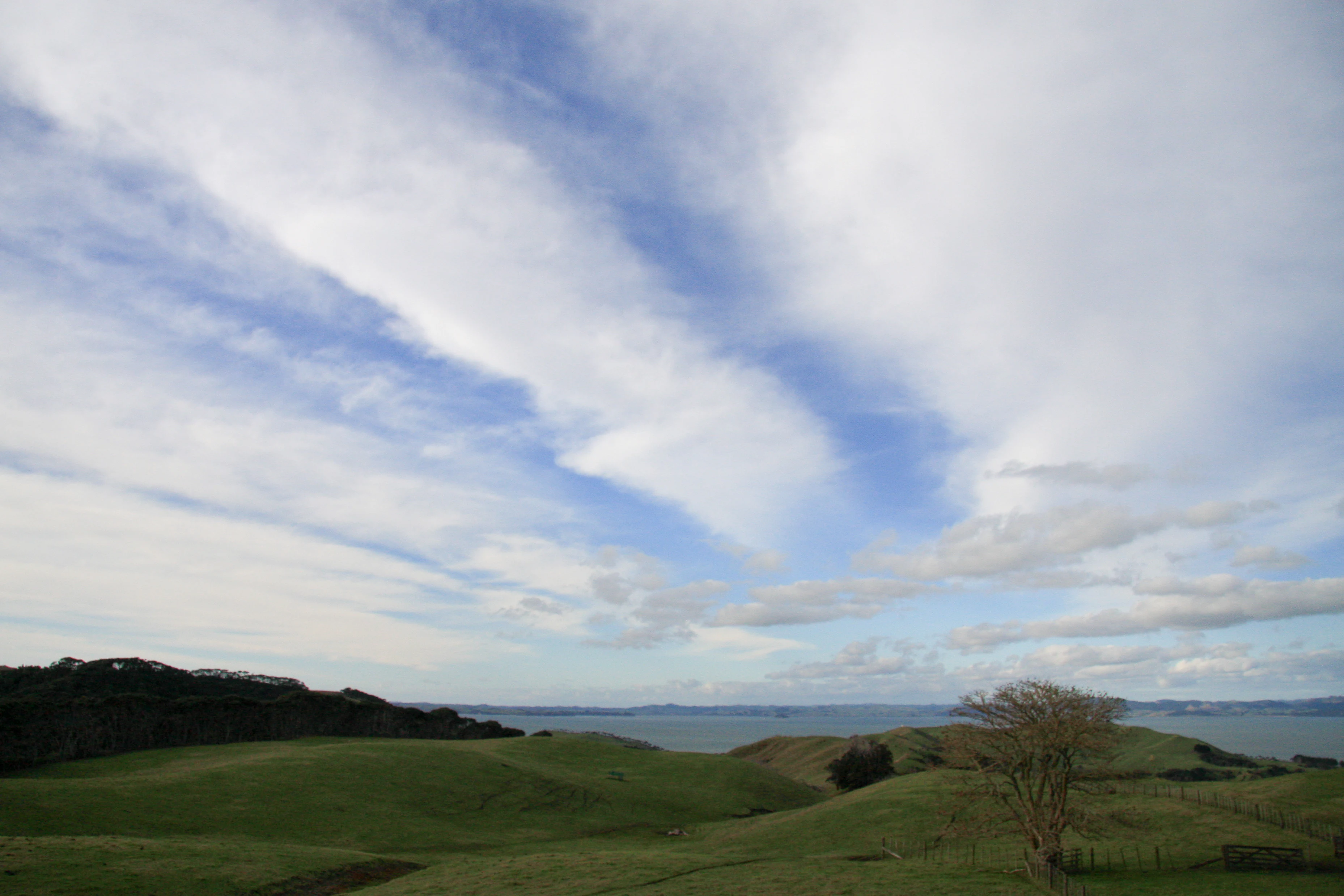
A wide, eye-level landscape view of grassy, rolling hills leading down to a body of water under a bright sky with wispy clouds.
A wide view of rolling farmland and coastal terrain at Te Rau Pūriri Regional Park, overlooking Kaipara Harbour.

Te Rau Pūriri Regional Park history and protected-area timeline

The land that now forms Te Rau Pūriri Regional Park has a layered pastoral history going back to the late nineteenth century. In 1870, the South Kaipara Head land was purchased by Daniel Pollen, an Auckland politician, together with a local farmer named William Young. In 1882, Pollen and Young sold the property to Alfred Buckland, who developed it as part of an extensive cattle run covering much of the surrounding peninsula.

In the 1920s, Buckland's broad cattle run was subdivided into individual farms, and the property that would eventually become the park was primarily used for running deer. The shift from cattle station to smaller-scale deer farming reflected broader changes in New Zealand rural land use during the twentieth century.

A new chapter began in 2006, when the Auckland Regional Council and Rodney District jointly purchased the land with the intention of developing it as a regional park. The park's name, Te Rau Pūriri, was deliberately not an existing traditional place name. Instead, it was gifted by the elders of Haranui Marae, who chose the name to honor the regenerating coastal pūriri forest that had begun to establish itself along parts of the property, embedding a Māori cultural connection into the new protected area from its founding.

Te Rau Pūriri Regional Park landscape and geographic character

Te Rau Pūriri Regional Park occupies the eastern flank of the South Kaipara Head, a wide peninsula that projects into the Kaipara Harbour on Auckland's northwestern edge. The terrain is shaped by rolling pastoral country that descends toward the harbour, with gentle, undulating farmland lying at the heart of the protected area. The land edge meets the water in long sandy stretches around Waipiro Bay, giving the park an open, coastal feel despite its relatively modest size.

The peninsula setting means the park enjoys an enclosed, harbour-side character rather than an exposed oceanic coastline. Inland views take in the curve of the wider South Kaipara Head and the adjoining landforms of the Rodney area, while the bay and tidal flats shape the foreground scenery. The pastoral openness is interrupted in places by belts and blocks of trees, including planted Eucalyptus botryoides and Populus deltoides stands that reflect earlier phases of land management.

To the south of the park, the Wairotoroto wetland adds a flatter, estuarine element to the landscape, marking a transition from rolling farmland and sandy beaches into tidal wetland terrain. Together, these elements give the park a layered coastal landscape of farmland, regenerating forest, sandy bay, and adjoining wetland.

Te Rau Pūriri Regional Park ecosystems, habitats, and plant life

Ecologically, Te Rau Pūriri sits at the interface between modified pastoral land, regenerating native forest, and tidal estuarine habitat. Much of the park remains in working agricultural use, which means the vegetation pattern is a patchwork rather than a continuous block of bush. Planted stands of introduced trees, including Eucalyptus botryoides and Populus deltoides, occupy significant portions of the park and reflect decades of tree planting associated with farming systems.

Across the northern part of the park, this exotic vegetation gives way to regenerating native forest dominated by kanuka (Kunzea ericoides) and rewarewa, indicating areas where pasture has been allowed to revert and native species are progressively reclaiming the land. Along the coastal edge, a distinctive band of coastal pūriri forest establishes a more mature native character, and its presence is what gives the park both its name and a key ecological anchor.

Beyond the terrestrial vegetation, the Wairotoroto wetland to the south extends the park's natural values into the estuarine zone of the Kaipara Harbour. This wetland habitat adds shorebird, salt marsh, and tidal flat elements to a park otherwise dominated by farmland and regenerating bush, broadening the ecological profile of the protected area.

Te Rau Pūriri Regional Park wildlife and species highlights

Because Te Rau Pūriri retains much of its working-farm character and is in an active phase of native regeneration, its wildlife profile reflects a blend of introduced pastoral species and the early stages of native fauna recovery. The mix of pasture, hedgerow, plantation forest, regenerating kanuka and rewarewa, and coastal pūriri forest creates varied habitat niches for common North Island bush and farmland birds, as well as for the mammals typically associated with rural Auckland landscapes.

The park's coastal edge along Waipiro Bay and its connection to the broader Kaipara Harbour shoreline give it additional value for shorebirds and seabirds associated with the harbour, while the adjoining Wairotoroto wetland extends habitat possibilities into the estuarine zone. The regenerating native forest, although still relatively young, contributes to the gradual local recovery of native biodiversity in a landscape that was historically dominated by pastoral and plantation land use.

Te Rau Pūriri Regional Park conservation status and protection priorities

Te Rau Pūriri Regional Park is significant from a conservation standpoint primarily because it protects a transitional coastal landscape at the urban-rural edge of the Auckland Region. By bringing former deer farm land into the regional park network in 2006, Auckland Council secured an area where native forest regeneration could continue under formal protection, particularly the recovering coastal pūriri forest for which the park is named.

The park also plays a role in protecting and buffering the Wairotoroto wetland, an estuarine system adjacent to the south of the park. Retaining the land within a regional park framework helps limit further fragmentation of pastoral and coastal habitat on the South Kaipara Head and provides a managed context in which native regeneration can expand alongside ongoing farm operations.

Te Rau Pūriri Regional Park cultural meaning and human context

The name Te Rau Pūriri itself reflects the park's cultural foundations. Rather than preserving an existing traditional Māori place name, the park's name was gifted by the elders of Haranui Marae in recognition of the regenerating coastal pūriri forest on the land. This act embedded a direct Māori cultural reference into the park at the moment of its establishment, linking the protected area to local iwi and hapū identity on the South Kaipara Head.

The broader context of the park includes its nineteenth- and twentieth-century pastoral history, from the large-scale cattle run of Alfred Buckland through subsequent subdivision and deer farming to its present public ownership under Auckland Council. This layered agricultural past forms part of the human story of the peninsula, complementing the more recent Māori cultural naming of the park.

Top sights and standout views in Te Rau Pūriri Regional Park

A defining feature of Te Rau Pūriri Regional Park is its coastal position on the South Kaipara Head, where sandy Waipiro Bay, rolling farmland, and regenerating native forest come together within a single protected landscape. The park's namesake coastal pūriri forest is a particular highlight, marking one of the more distinctive native vegetation communities in the Auckland regional park network.

The juxtaposition of planted Eucalyptus botryoides and Populus deltoides stands with recovering kanuka, rewarewa, and pūriri forest is another point of interest, illustrating the park's role as a working landscape in active ecological transition. Together with the adjoining Wairotoroto wetland, these elements make Te Rau Pūriri a compact but ecologically varied example of Auckland's approach to regional park conservation.

Best time to visit Te Rau Pūriri Regional Park

As a primarily working-farm and coastal landscape in the northern Auckland Region, Te Rau Pūriri is shaped largely by mild coastal climate conditions typical of the Kaipara Harbour edge. Warmer, drier months tend to make the rural tracks and farm areas more comfortable to explore and offer clearer views across the harbour and surrounding farmland. Cooler months can bring greener pasture conditions and an atmospheric quality to the coastal forest belts without making the area inaccessible.

Because the park's native forest is still regenerating and its pastoral land is in ongoing use, visiting at quieter times of day can make it easier to appreciate the regenerating coastal pūriri stands, the kanuka and rewarewa forest edges, and the sweeping shoreline of Waipiro Bay without the visual interruption of active farming operations.

Monthly climate preview

Long-term representative coordinate measurements mapping twelve-month temperature and precipitation patterns

Te Rau Pūriri Regional Park Climate Normals, Annual Temperature and Precipitation Rhythm

Te Rau Pūriri Regional Park records sustained long-term variations in average monthly temperature and precipitation from NASA climate data. Reviewing the complete twelve-month profile provides detailed meteorological context for regional conservation terrain.
Annual mean16 °C
13 °C21 °C
Jan20°
Feb21°
Mar19°
Apr18°
May16°
Jun14°
Jul13°
Aug13°
Sep13°
Oct15°
Nov16°
Dec18°
Warmest month
February

20.6 °C

Coolest month
August

12.6 °C

Wettest month
July

3.7 mm/day

Driest month
January

1.9 mm/day

Park location guide

Geography guide, regional context, and park location map for Te Rau Pūriri Regional Park

Te Rau Pūriri Regional Park park geography, regions, and map view in New Zealand

Understand where Te Rau Pūriri Regional Park sits in New Zealand through a broader geographic reading of the surrounding landscape, nearby location context, and its mapped position within the national park landscape.

How Te Rau Pūriri Regional Park fits into New Zealand

New Zealand is an island nation in the southwestern Pacific Ocean comprising two main islands and numerous smaller islands. Located east of Australia across the Tasman Sea, it features varied topography with the Southern Alps running along the South Island and volcanic terrain on the North Island. The country was settled by Maori people between 1280 and 1350, followed by European exploration beginning in 1642, and became a Dominion in 1907 before gaining full independence in 1947.

Wider geography shaping Te Rau Pūriri Regional Park in New Zealand

New Zealand lies in the southwestern Pacific Ocean, east of Australia across the Tasman Sea. The country consists of two main islands, the North Island and South Island, plus over 600 smaller islands. The North Island features volcanic plateaus and hills while the South Island is dominated by the Southern Alps mountain range. The country has a long coastline and is surrounded by the Pacific Ocean.

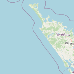
Map view of Te Rau Pūriri Regional Park

Use this park location map to pinpoint Te Rau Pūriri Regional Park in New Zealand, understand its exact geographic position, and read its mapped placement within the surrounding landscape more clearly.

Pigeon | © OpenStreetMap contributors

Location context for Te Rau Pūriri Regional Park

Auckland Region
Recorded earthquake history

Explore Historical Earthquake Records for Te Rau Pūriri Regional Park

Review recorded seismic events and epicentre proximity data for the landscape surrounding Te Rau Pūriri Regional Park. This MoriAtlas collection offers a factual history of recorded activity, providing clarity on the regional seismic background without making future predictions or hazard assessments.

Te Rau Pūriri Regional Park Earthquake Records

Catalogued events

1 event

Strongest magnitude

Magnitude 4.5

Most recent event

Dec 17, 2003

This history includes earthquakes recorded inside the park or within 50 km of its borders

Visualizing coastal pasture, regenerating native bush, and harbour shorelines

Te Rau Pūriri Regional Park Photos and Landscapes

Visual documentation of Te Rau Pūriri Regional Park reveals the complex interplay between rolling pastoral farmland, sandy bay shores, and regenerating native forest habitats. Studying these protected-area photographs provides a clearer understanding of the terrain, estuarine wetlands, and transitional ecology shaping the Kaipara Harbour coastline.

A wide, eye-level landscape view of grassy, rolling hills leading down to a body of water under a bright sky with wispy clouds.

Park atlas

Compare coastal landscapes and regional nature reserves across the wider Auckland area.

Explore Other Parks Near Te Rau Pūriri Regional Park and Surrounding Protected Areas

Browse nearby protected areas and regional parks sharing similar coastal geography, regenerating native forest, and estuarine wetland terrain. Comparing adjacent reserves helps reveal the broader ecological patterns and landscape diversity found across the northwestern peninsula.
Regional parkAuckland Region
37 km away#1 closest

East

Te Muri Regional Park: Mapped Coastal Peninsula and Estuarine Geography in Auckland

Protected native forest and tidal estuary landscapes

Te Muri Regional Park presents a unique peninsular landscape situated between the Puhoi River and Te Muri O Tarariki Stream in Auckland. This protected area showcases a complex interface between native coastal forest and tidal ecosystems, offering clear mapped boundaries that connect to the wider Hauraki Gulf coastal belt. Explore the topographical transition from sea level estuaries to rolling hill country.

Area
4.44 km²
Established
2010
Relief
Upland
Scope
Terrestrial
Regional parkAuckland Region
38 km away#2 closest

East

Wenderholm Regional Park: Coastal Forest and Estuary Geography in the Auckland Region

Mapped protected landscapes of a coastal New Zealand peninsula

Situated on a narrow peninsula north of Auckland, Wenderholm Regional Park offers a compact study in diverse coastal terrain. The park encompasses the forested Maungatauhoro headland, the tidal Puhoi sandspit, and riverine boundaries that create a distinct protected environment. Since its 1965 founding, the area has become a haven for native bird restoration and coastal vegetation, providing a unique vantage point across the Hauraki Gulf.

Area
1.35 km²
Established
1965
Relief
Mixed relief
Climate
Temperate
A soft, pale watercolor illustration depicting a winding stream flowing through a lush, green landscape with gentle hills in the background.
Nature reserveNew Zealand
About 43 km away#3 closest

Southeast

Goldie Bush Scenic Reserve: Protected Forested Landscapes in West Auckland, New Zealand

A study in regenerating bush and Mokoroa Stream topography

Goldie Bush Scenic Reserve encompasses a dense, sheltered catchment valley known for its native forest canopy and the prominent Mokoroa Falls. Once heavily logged, this protected area now serves as an example of ecological restoration in the Waitākere Ranges. The reserve maps a blend of cultural history, including Māori fortification sites, against a backdrop of steep ridges and humid, stream-fed lowland terrain.

Area
2.49 km²
Established
1926
Relief
Upland
Scope
Terrestrial
A soft watercolor illustration showing the low-lying shape of Motuora Island surrounded by calm water, with a distant hilly coastline in the background.
Nature reserveNorth Island
About 46 km away#4 closest

East

Motuora Nature Reserve: Protected Coastal Island Geography and Restoration Map

Predator-free ecological sanctuary in the Hauraki Gulf

Motuora occupies a key position in the Hauraki Gulf, offering a well-mapped look at coastal island restoration in New Zealand. This protected area features a regenerated forest interior and cliff-edged terrain, serving as an important mainland-island site for avian conservation, including kiwi and petrel colonies.

Area
0.8 km²
Established
1965
Relief
Lowland
Climate
Subtropical
Regional parkAuckland Region
47 km away#5 closest

Northeast

Te Ārai Regional Park: Mapping Coastal Dune Systems and Protected Geography in Auckland

A protected coastal landscape featuring expansive dune systems and northern headlands.

Te Ārai Regional Park sits as a major protected coastal area on the northern edge of the Auckland Region. Its primary defining feature is an expansive system of sand dunes that anchor a diverse coastal environment. Extending southward toward Poutawa Stream and bordered by the Mangawhai Forest, the park represents a critical geography for endangered species breeding and provides a distinct topographic profile along the North Island coast.

Established
2008
Relief
Lowland
Climate
Subtropical
Access
Easy access
A watercolor painting showing a soft, bright landscape with green grasses and wildflowers on both sides of a calm, pale blue body of water, with a green coastline in the distance.
Marine protected areaNew Zealand
51 km away#6 closest

Northeast

Cape Rodney-Okakari Point Marine Reserve: New Zealand Marine Protected Area Geography

Mapped coastal boundaries and marine ecosystem terrain

Delve into the geography of Cape Rodney-Okakari Point Marine Reserve, where protected waters meet a complex interface of greywacke bedrock and sandy substrates. This assessment highlights the ecological transition from exposed rocky headlands to sheltered Whangateau Harbour, illustrating the structural depth of New Zealand's foundational marine site through its diverse invertebrate and fish habitats.

Area
5.5 km²
Established
1975
IUCN
Ia
Visitors
200K annual
A pale, minimalist watercolor painting showing a grassy island or shoreline with a small cluster of trees, set against a quiet body of water and soft, distant rolling hills.
Protected areaAuckland Region
About 54 km away#7 closest

Southeast

Motumānawa / Pollen Island: Protected Marine Reserve and Scientific Landscape in Auckland

A coastal shellbank island refuge within the Waitematā Harbour.

Motumānawa / Pollen Island is an essential protected area near the Rosebank Peninsula, serving as a sanctuary for native bird populations and estuarine vegetation. Its status as both a scientific and marine reserve highlights the importance of small-scale coastal conservation within a major metropolitan harbour landscape in New Zealand.

Established
2006
Relief
Lowland
Scope
Marine
Water
Water-dominated
Regional parkAuckland Region
About 57 km away#8 closest

Southeast

Waitākere Ranges Regional Park: Geographic Mapping of Auckland's Protected Coastal Forest

Volcanic terrain and expansive coastal wilderness boundaries

Examine the rugged geography of the Waitākere Ranges, spanning from sheer western sea cliffs to lush, regenerating forest valleys. This overview details the protected land, including volcanic rock formations, black sand surf beaches, and the inland reservoirs serving the Auckland region, highlighting its status as an ecologically critical heritage area.

Area
277.2 km²
Established
1895
Relief
Mountain
Climate
Subtropical

Common questions about visiting, size, designation, and location context for Te Rau Pūriri Regional Park

Te Rau Pūriri Regional Park FAQs for park facts, access, geography, and protected area context

Find quick answers about Te Rau Pūriri Regional Park, including protected-area facts, park geography, trail and visitor context, and how the park fits into its surrounding country and regional landscape.
MoriAtlas Explorer

Continue Your Protected Areas Search Across the Global Atlas

Deepen your exploration by continuing the structured search for national parks and protected areas worldwide. Utilize the comprehensive filtering capabilities to compare different conservation landscapes and refine your understanding of global park geography. Discover more about the distribution and characteristics of protected natural areas.

Global natural geography