

Mori Atlas logo
Nature reserveWongalara Sanctuary

Mapping the sandstone escarpments, savannah woodlands, and river systems of an ecological stronghold

Wongalara Sanctuary: An Extensive Nature Reserve and Protected Landscape in Australia's Top End

Wongalara Sanctuary sits on the southern edge of Arnhem Land in the Northern Territory, representing a significant protected area within Australia's Top End. This nature reserve features a complex mosaic of sandstone plateaus, monsoon rainforest patches, and sprawling savannah woodlands. Centered around the Wilton River, the geography provides a critical refuge for biodiversity across one of the most ecologically varied landscapes in the region.

Top EndNorthern Territorynature reservesavannah woodlandsandstone escarpmentmonsoon rainforest

Wongalara Sanctuary

Nature reserve

Park overview

Structured park overview, official facts, and landscape profile for Wongalara Sanctuary

Wongalara Sanctuary park facts, protected area profile, and essential visitor context

Review the core facts for Wongalara Sanctuary, including designation, size, terrain, visitor scale, habitats, and operating context in one park-focused overview.

About Wongalara Sanctuary

Wongalara Sanctuary is a privately managed nature reserve in the Top End of Australia's Northern Territory, set on the southern boundary of Arnhem Land. It lies approximately 120 kilometres southeast of Kakadu National Park, deep within a region defined by tropical savannah, sandstone escarpments, and seasonal rivers. The property was historically a pastoral lease, but after its acquisition by the Australian Wildlife Conservancy in 2007, it was transformed into a conservation reserve aimed at restoring and protecting the ecological values of this part of northern Australia.

The sanctuary covers about 1,910 square kilometres, making it one of the largest privately managed reserves in the region. Its landscapes transition between spinifex-covered ranges, sandstone plateaus and escarpments, eucalypt forests and woodlands, small patches of monsoon rainforest, and open wetlands. Low open savannah woodland dominates much of the property, giving it a quintessential Top End character shaped by monsoonal wet seasons and prolonged dry periods. The Mainoru, Jalbot, and Wilton Rivers all run through the sanctuary, providing essential freshwater corridors and supporting the dense vegetation that grows along their banks.

Conservation management at Wongalara is active and scientifically driven. The Australian Wildlife Conservancy has invested heavily in fencing to exclude feral cattle, buffalo, horses, and pigs, animals that otherwise degrade habitats and outcompete native wildlife. A substantial portion of the sanctuary has been enclosed, with plans to extend the fencing across the entire property, which would create the largest feral herbivore-free area in Australia. This scale of management places the sanctuary at the forefront of landscape-scale restoration in the north of the country. Researchers also use the property as a base for studying mammals and other wildlife during the dry season, when animals are concentrated and easier to monitor.

Geographically, Wongalara is bordered by Mainoru Station and vacant crown land to the north, Mountain Valley Station to the west, Lonesome Dove and Big River Stations to the south, the Urapunga Aboriginal land trust to the south, and the South-East Arnhem Land Indigenous Protected Area to the east and southeast. This makes the sanctuary an important component of a much broader conservation landscape across the Top End, connecting formal reserves, Indigenous protected areas, and pastoral lands in a region of exceptional biodiversity.

Quick facts and research context for Wongalara Sanctuary

Wongalara Sanctuary is a privately managed nature reserve of approximately 1,910 square kilometres in the Top End of the Northern Territory, on the southern margin of Arnhem Land and roughly 120 kilometres southeast of Kakadu National Park. It is owned and operated by the Australian Wildlife Conservancy, which acquired the former pastoral lease in 2007 with support from a public fundraising campaign and an Australian Government grant under the National Reserve System Program. The reserve protects spinifex ranges, sandstone plateaus, eucalypt woodlands, monsoon rainforest patches, wetlands, and river corridors, with the Mainoru, Jalbot, and Wilton Rivers flowing through it. By the early 2010s, a major predator and feral animal control program had enclosed a substantial section of the sanctuary, making it one of the largest feral herbivore-free areas in Australia.

Protection and recognition

Review the documented terrestrial protection scope and administrative recognition records.

Wongalara Sanctuary Protection Status and Formal Conservation Designations

Wongalara Sanctuary maintains a documented terrestrial protection scope within the regional conservation network. Administrative records outline the official conservation status and formal recognition parameters established for the protected area.

Protection details

Protection scope
Terrestrial
Transboundary protection
No
Park context

Deeper park guide and search-rich context for Wongalara Sanctuary

Wongalara Sanctuary history, landscape, wildlife, and travel context

Explore Wongalara Sanctuary through its history, landscape character, ecosystems, wildlife, conservation priorities, cultural context, and seasonal travel timing in a structured park guide built for atlas discovery and search intent.

Why Wongalara Sanctuary stands out

Wongalara Sanctuary is best known for its sheer size and habitat diversity within the Top End, and for the large-scale effort to remove feral herbivores from a significant portion of the property. The reserve combines sandstone escarpments and plateaus with extensive savannah woodlands, monsoon rainforest patches, and wetlands fed by several river systems, giving it a rare ecological richness within a single management unit. Equally important is the sanctuary's role as a refuge for threatened and declining Australian species. Conservationists have focused on protecting populations such as the northern quoll, northern masked owl, Gouldian finch, red goshawk, hooded parrot, crested shrike-tit, and freshwater crocodile within the reserve. The fencing program that excludes feral cattle, buffalo, horses, and pigs has positioned Wongalara as one of the largest feral herbivore-free landscapes in the country, making it a key site for ecological recovery and research.

Wongalara Sanctuary history and protected-area timeline

Wongalara was originally established as a pastoral lease in the Top End of the Northern Territory, used for cattle grazing across the savannah country at the edge of Arnhem Land. Like many former pastoral properties in tropical Australia, its long history of grazing contributed to the degradation of native vegetation, the spread of invasive grasses, and the proliferation of feral cattle, buffalo, horses, and pigs across the landscape.

The transformation of Wongalara into a conservation reserve began in 2007, when the Australian Wildlife Conservancy acquired the property. The acquisition was supported by a public fundraising campaign and a grant of about A$2.1 million from the Australian Government's National Reserve System Program. Following the purchase, the AWC shifted the focus of the property from pastoral production to ecological restoration and wildlife protection.

A key milestone in the sanctuary's conservation history has been the construction of long predator and feral animal exclusion fences. By 2013, around 1,000 square kilometres of the sanctuary had been enclosed at a cost of about A$500,000 for 160 kilometres of fencing. This infrastructure enabled the removal of feral herbivores from a large section of the reserve and was intended to eventually fence the entire property. If completed, this enclosure would create the largest feral herbivore-free area in Australia, a conservation outcome with national significance. The sanctuary has also become a field site for scientific research, particularly during the dry season when researchers trap and study mammals and monitor broader ecosystem health.

Wongalara Sanctuary landscape and geographic character

The landscape of Wongalara Sanctuary is a textbook example of the Top End's physical geography, combining rugged sandstone country with broad, open savannah and lush river corridors. Spinifex-covered ranges rise across parts of the property, their harsh, dry slopes contrasting with the deeper soils and denser vegetation found lower in the catchment. Sandstone plateaus and escarpments lend dramatic relief to the scenery, carving long sight lines across the reserve and producing the cliffs, gorges, and rocky outcrops characteristic of western Arnhem Land country.

Beyond the rocky terrain, much of the sanctuary is dominated by low open savannah woodland, where scattered eucalypts rise over a sprawling grass layer that shifts from green in the wet season to straw-coloured in the dry months. Patches of monsoon rainforest occur in sheltered and moister locations, particularly along drainage lines, providing small but ecologically important refuges for rainforest-dependent species. Wetlands punctuate the property, often seasonal in nature but ecologically rich during and after the wet season rains.

Three river systems define much of the sanctuary's hydrology: the Mainoru River, the Jalbot River, and the Wilton River. The Wilton River in particular is a defining feature, flowing through the reserve and shaping the vegetation, wildlife, and floodplain dynamics along its course. The rivers and their associated floodplains connect the sandstone plateaus, woodlands, and wetlands into a single ecological system, sustaining the sanctuary's biodiversity and shaping the rhythms of life across its vast area.

Wongalara Sanctuary ecosystems, habitats, and plant life

Wongalara Sanctuary encompasses a rich mosaic of northern Australian ecosystems, all shaped by the monsoonal climate and the underlying sandstone geology. Eucalypt forests and woodlands cover much of the property, forming an open-canopy landscape typical of the Top End. Low open savannah woodland is the dominant vegetation type, with grasses and scattered trees creating habitat that supports a wide variety of birds, mammals, reptiles, and insects.

In moister and more sheltered locations, small patches of monsoon rainforest survive as isolated islands of closed forest, contrasting sharply with the surrounding savannah. These patches are biologically significant because they harbor species that depend on more humid, shaded conditions and are vulnerable to fire regimes and feral animal pressure. Wetlands and seasonal floodplains add another ecological dimension, supporting waterbirds, amphibians, and aquatic species during and after the wet season flows.

The three main river systems that run through the sanctuary; the Mainoru, Jalbot, and Wilton Rivers; tie these habitats together. Their corridors concentrate moisture and nutrients, supporting denser vegetation and creating important movement pathways for wildlife across the broader landscape. The interaction between rocky sandstone habitats, savannah, rainforest patches, wetlands, and river corridors gives Wongalara its ecological richness and makes it a vital refuge for many of the region's species.

Wongalara Sanctuary wildlife and species highlights

Wongalara Sanctuary supports a substantial component of the Top End's wildlife, particularly threatened species that have declined across much of northern Australia. Among the significant birds recorded on the property are the northern masked owl, Gouldian finch, crested shrike-tit, hooded parrot, and the powerfully built red goshawk. These species depend on intact savannah woodlands and tree hollows, making the sanctuary's protected eucalypt forests and woodlands especially important.

A diverse mammal community is also present, including the northern quoll, a small carnivorous marsupial that has suffered severe declines across much of its former range. Wongalara is also home to less well-known but regionally significant species such as the Kakadu dunnart, reflecting the sanctuary's importance as refuge habitat for small mammals that are easily overlooked. Freshwater crocodiles inhabit the rivers and larger waterholes of the reserve, completing a reptile profile that is characteristic of the Top End.

Wildlife research is an established part of the sanctuary's program. Scientists come to Wongalara during the dry season to trap and study mammals and to monitor broader ecological change. The ongoing removal of feral cattle, buffalo, horses, and pigs from fenced sections of the sanctuary is one of the most important wildlife interventions on the property. By reducing grazing pressure, trampling, and competition with native herbivores, the fencing program allows vegetation to recover and animal populations to stabilize, providing a rare chance for wildlife to rebound across a landscape-sized area.

Wongalara Sanctuary conservation status and protection priorities

As a privately owned and actively managed property of the Australian Wildlife Conservancy, Wongalara Sanctuary exists primarily as a conservation reserve rather than a tourism destination. The sanctuary's conservation significance lies in its combination of large size, habitat diversity, and the scale of its feral animal control program. With around 1,910 square kilometres under management, it is large enough to support ecological processes that require extensive natural landscapes, including the movements of wide-ranging mammals and the maintenance of fire mosaics across the savannah.

The most important conservation intervention at Wongalara has been the construction of long feral animal exclusion fences. By removing feral cattle, buffalo, horses, and pigs from large sections of the property, the Australian Wildlife Conservancy is allowing native vegetation to regenerate and reducing the pressure these animals place on native wildlife. Plans to extend the fencing across the entire sanctuary would create the largest feral herbivore-free area in Australia, an outcome with national significance for both species recovery and ecological research.

The sanctuary also plays a wider conservation role by linking with neighbouring protected and Indigenous-managed lands, including vacant crown land to the north, the Urapunga Aboriginal land trust to the south, and the South-East Arnhem Land Indigenous Protected Area to the east and southeast. This position makes Wongalara a key piece in a broader conservation landscape across eastern Arnhem Land. Its contribution to research, particularly on threatened mammals, further enhances its conservation value, allowing the lessons learned at Wongalara to inform management of similar landscapes elsewhere in northern Australia.

Wongalara Sanctuary cultural meaning and human context

Wongalara sits within a region of profound cultural significance for Aboriginal people, particularly for traditional owners with connections to Arnhem Land and the surrounding country. The sanctuary adjoins the Urapunga Aboriginal land trust to the south and the South-East Arnhem Land Indigenous Protected Area to the east and southeast, meaning that it is part of a wider landscape that includes Aboriginal-owned and Aboriginal-managed lands.

While the sanctuary itself is a former pastoral lease now managed by the Australian Wildlife Conservancy, its location places it within a context where Indigenous land management, conservation, and cultural heritage are deeply intertwined with the broader landscape. Aboriginal-owned estates to the north, south, and east complement Wongalara's conservation efforts, contributing to a regionally significant network of country that is cared for both for its ecological values and its enduring cultural meaning.

Top sights and standout views in Wongalara Sanctuary

Wongalara Sanctuary stands out for its sheer scale, its ecological diversity, and the ambition of its landscape-scale conservation program. Within a single reserve, it brings together spinifex ranges, sandstone escarpments, savannah woodland, monsoon rainforest patches, wetlands, and three named river systems, creating an unusually rich mosaic of Top End habitats.

The sanctuary's central achievement is its ongoing transformation into one of Australia's largest feral herbivore-free areas, achieved through extensive fencing and active management by the Australian Wildlife Conservancy. This work underpins the recovery of threatened species such as the northern quoll, Gouldian finch, hooded parrot, red goshawk, and freshwater crocodile, and turns Wongalara into a key refuge and research site for the wildlife of the Top End.

Best time to visit Wongalara Sanctuary

Wongalara Sanctuary is primarily a research and conservation property rather than a public tourism destination, and access is generally limited. Seasonality nonetheless defines how the sanctuary looks and functions. The tropical Top End climate produces a distinct wet season, when heavy rains transform rivers, fill wetlands and waterholes, and trigger the greening of savannah and monsoon rainforest patches, followed by a long dry season when vegetation dries out, waterhole levels drop, and many animals concentrate around remaining water sources.

Visiting or conducting fieldwork during the dry season provides easier access along tracks and roads in the region, cooler overnight temperatures, and better conditions for spotting wildlife and mammals, which is why researchers typically come to Wongalara at this time of year. The wet season, while logistically more challenging, brings the most dramatic transformation of the landscape, with swampy floodplains, raging river flows, and lush seasonal vegetation, and it is the period when migratory waterbirds and breeding activity are most pronounced.
Monthly climate preview

Long-term representative temperature and precipitation patterns across twelve recorded months

Wongalara Sanctuary Climate Normals and Annual Weather by Month

Representative coordinates record annual shifts in average temperature and monthly precipitation rhythm from NASA POWER climatology data. Examining the complete twelve-month normals profile reveals detailed variations in baseline thermal conditions and moisture distribution.
Annual mean27 °C
22 °C32 °C
Jan28°
Feb27°
Mar27°
Apr26°
May24°
Jun23°
Jul22°
Aug24°
Sep28°
Oct31°
Nov32°
Dec31°
Warmest month
November

32 °C

Coolest month
July

22.4 °C

Wettest month
January

8.1 mm/day

Driest month
August

0 mm/day

Park location guide

Geography guide, regional context, and park location map for Wongalara Sanctuary

Wongalara Sanctuary park geography, regions, and map view in Australia

Understand where Wongalara Sanctuary sits in Australia through a broader geographic reading of the surrounding landscape, nearby location context, and its mapped position within the national park landscape.

How Wongalara Sanctuary fits into Australia

Australia is a constitutional monarchy and federal parliamentary democracy comprising six states and ten territories. With a population of nearly 28 million, it is one of the world's most urbanised countries, with most people concentrated on the eastern seaboard. The country has a high Human Development Index and is known for its cultural diversity, ancient Aboriginal heritage, and unique wildlife.

Wider geography shaping Wongalara Sanctuary in Australia

Australia occupies the entire Australian continent, the island of Tasmania, and numerous smaller islands. It is the world's flattest and driest inhabited continent, featuring vast deserts in the interior (the Outback), tropical rainforests along the eastern coast, and a coastline bordering the Indian and Pacific Oceans.

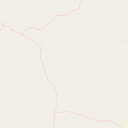
Map view of Wongalara Sanctuary

Use this park location map to pinpoint Wongalara Sanctuary in Australia, understand its exact geographic position, and read its mapped placement within the surrounding landscape more clearly.

Pigeon | © OpenStreetMap contributors

Location context for Wongalara Sanctuary

Northern Territory
Park atlas

Compare regional conservation landscapes, sandstone plateaus, and nearby savannah habitats.

Explore Protected Areas and Parks Near Wongalara Sanctuary in Northern Australia

Browse nearby national parks and protected reserves surrounding Wongalara Sanctuary across the Top End of Australia. Comparing these neighboring conservation landscapes reveals broader regional biodiversity patterns and connected wildlife habitats.
National parkNorthern Territory
About 69 km away#1 closest

Southeast

Limmen National Park: Explore Australia's Northern Territory National Park & Protected Landscape

Discover mapped geography and regional context for this protected area.

Limmen National Park stands as a distinct protected area within the Northern Territory, offering valuable insights for geographic exploration. This national park serves as a focal point for understanding the mapped landscape and the broader regional context of protected lands in Northern Australia. Its identity as a national park contributes significantly to the geographic narrative of the territory, making it a crucial point for atlas-based discovery.

Area
9,369.26 km²
Established
2012
IUCN
II
Relief
Upland
National parkNorthern Territory
About 159 km away#2 closest

Southwest

Elsey National Park: Northern Territory National Park Atlas and Protected Landscape Context

Discover the mapped terrain and unique natural features of Elsey National Park.

Elsey National Park, located in Australia's Northern Territory, is a significant protected area known for its distinctive thermal springs and characteristic paperbark woodlands. This national park provides a valuable point of study for understanding regional geography, mapped natural landscapes, and the hydrological importance of its riverine environments, offering a concrete example of protected land within the tropical savanna biome.

Area
138.96 km²
Established
1991
IUCN
II
Visitors
207.7K annual
National parkAustralia
About 160 km away#3 closest

Northwest

Kakadu National Park: Australia's Protected Landscape and Regional Geography

Explore Kakadu National Park's mapped boundaries and natural terrain.

Kakadu National Park stands as a significant national park entity within Australia, providing rich geographic context for atlas discovery. This page details the park's protected area identity, its mapped natural landscapes, and its place within the broader Australian continent's geography. Understand the unique regional setting and the specific topographic features that define Kakadu National Park for detailed exploration and comparative geographic analysis.

Area
19,804 km²
Established
1979
IUCN
II
Visitors
250K annual
National parkNorthern Territory
About 185 km away#4 closest

West

Nitmiluk National Park: Detailed Protected Landscape and Geographic Context

Explore mapped park boundaries and regional terrain.

Delve into the specifics of Nitmiluk National Park, a designated national park within the Northern Territory of Australia. This section focuses on its protected-area status and how its geography contributes to the regional landscape. Users can explore the park's mapped extent and understand its placement within the broader geographical atlas, highlighting its importance as a distinct protected natural area.

Area
2,946.64 km²
Established
1977
IUCN
II
Visitors
309.8K annual
Nature reserveNorthern Territory
About 222 km away#5 closest

West

Cutta Cutta Caves Nature Park: A Tropical Karst and Cave Reserve in Northern Territory

Protected tropical limestone karst and subterranean landscape geography.

Cutta Cutta Caves Nature Park is a specialized protected area in Australia, safeguarding a unique tropical limestone karst landscape near Katherine. This reserve manages subterranean cave systems, mineral-rich chambers, and the surrounding woodland terrain. As a significant ecological site, it provides essential habitat for rare wildlife, highlighting the complex intersection of geological formations and tropical biodiversity within the Northern Territory.

Area
14.99 km²
Established
1967
IUCN
III
Visitors
17.2K annual
Protected areaNorthern Territory
About 228 km away#6 closest

East

Anindilyakwa Indigenous Protected Area: Mapping Northern Territory Conservation Landscapes

A vast island archipelago and sea Country ecosystem

The Anindilyakwa Indigenous Protected Area is defined by its significant island and marine geography within Australia's Northern Territory. This protected area preserves intact tropical woodland, coastal mangrove systems, and vital reef habitats through traditional Anindilyakwa stewardship, representing one of the largest Indigenous-managed landscapes in the region.

Area
10,000 km²
Established
2006
Relief
Lowland
Climate
Tropical
Protected landscapeNorthern Territory
About 252 km away#7 closest

West

Kintore Caves Conservation Reserve: Karst Geography and Protected Landscape Analysis

Mapping subterranean terrain and cultural heritage in Australia's Northern Territory.

Kintore Caves Conservation Reserve in the Northern Territory is a vital protected area defined by its rare limestone karst geology and extensive cave networks. This site provides a concentrated look at subterranean biodiversity and archaeological history within a transitional rural setting near Katherine, showcasing the importance of focused conservation boundaries in safeguarding geological and human-linked landscapes.

Area
4.23 km²
Established
1965
IUCN
V
Access
Access unknown
Nature reserveNorthern Territory
About 268 km away#8 closest

South

Bullwaddy Conservation Reserve: Protected Woodland Geography on the Northern Territory Sturt Plateau

Nature reserve boundary and landscape context

Bullwaddy Conservation Reserve represents an important protected woodland enclave on the Sturt Plateau. The terrain, defined by nutrient-poor lateritic soils, supports dense native thickets that stand out against the backdrop of the surrounding pastoral landscape. This nature reserve provides essential ecological integrity for local species and serves as a significant site for understanding the natural vegetation patterns of the Australian outback.

Area
115.3 km²
Established
2000
IUCN
Ia
Relief
Upland

Common questions about visiting, size, designation, and location context for Wongalara Sanctuary

Wongalara Sanctuary FAQs for park facts, access, geography, and protected area context

Find quick answers about Wongalara Sanctuary, including protected-area facts, park geography, trail and visitor context, and how the park fits into its surrounding country and regional landscape.
MoriAtlas Explorer

Continue Your Protected Areas Search Across the Global Atlas

Deepen your exploration by continuing the structured search for national parks and protected areas worldwide. Utilize the comprehensive filtering capabilities to compare different conservation landscapes and refine your understanding of global park geography. Discover more about the distribution and characteristics of protected natural areas.

Global natural geography