
Why Aareknie Wolfwil-Wynau stands out
Aareknie Wolfwil-Wynau is best known for being one of the last freely flowing, largely unengineered stretches of the Aare in the Swiss lowlands, anchored by a dramatic river bend where the Aare swings more than ninety degrees around a molasse rock face. The site is associated with the rapids known as the Cheer, the Wandflue cliff on the Wolfwil side, shifting gravel banks that are reshaped during floods, and softwood floodplain forests along both banks. The area is also recognized for the survival here of ecological features that the Aare has largely lost elsewhere: current-loving fish in the braided arms, the nationally important amphibian spawning site at Chli Aarli, and regular sightings of the threatened kingfisher. Culturally, it is known for the medieval ferry at Fahr, the historic mill of Wolfwil, and the Romanesque church of Wynau with medieval wall paintings, one of the oldest church buildings in canton Bern.
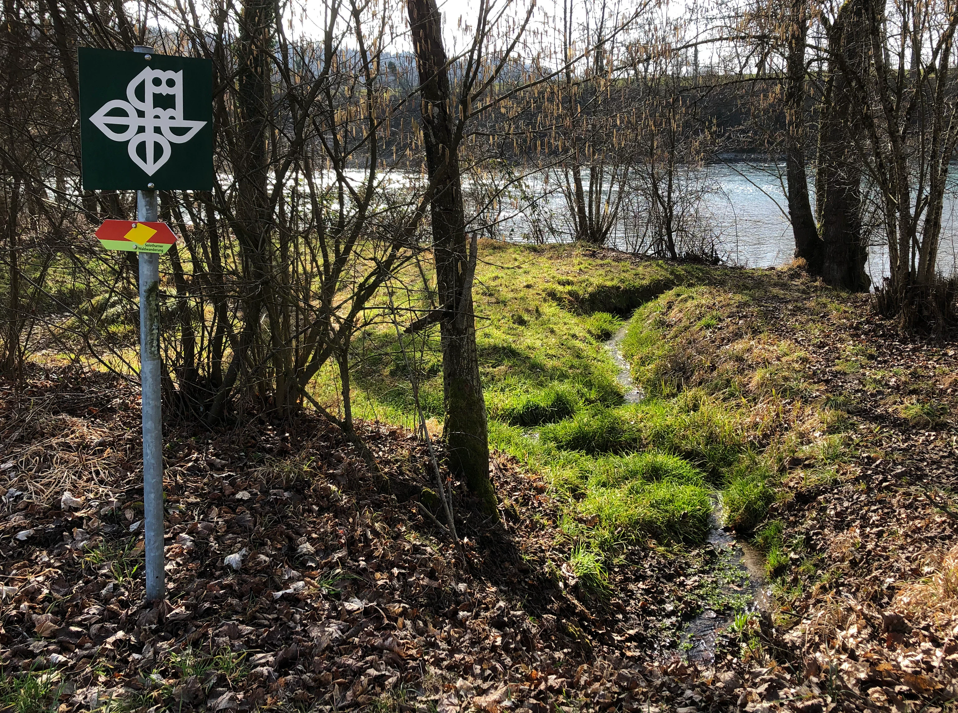
Aareknie Wolfwil-Wynau history and protected-area timeline
The Aareknie has been a recognizable element of the regional landscape for centuries, long before modern protection. A ferry has operated across the Aare near the settlement of Fahr south of Wolfwil since the late Middle Ages, and the old mill complex in the heart of Wolfwil traces back to a feudal lease mill of the medieval period. The church of Wynau, a small Romanesque hall church with medieval wall paintings, is considered one of the oldest church buildings in canton Bern and is part of its inventory of cultural properties of national significance, anchoring the human history of the protected zone.
The river bend also has a documented history of risk and conflict. In 1881 a serious boating accident occurred in the upper rapids near the Schränne during high water, in the area now occupied by the Wynau hydroelectric plant. From the twentieth century onward the area faced repeated development pressures, including plans for the Transhelvetic Canal and a proposal by the Onyx electricity company to expand the Wynau power station by exploiting the gradient along the river bend with a three-kilometer tailrace tunnel, a scheme that would have largely dewatered the rapids and the adjacent wetlands.
Long-term advocacy by the Arbeitsgemeinschaft zum Schutz der Aare helped keep these pressures in check. The decisive turning point came in 1996, when the landscape was placed under federal protection through the Bundesinventar der Landschaften und Naturdenkmäler von nationaler Bedeutung, giving it BLN-object status as area 1319. In 2001 the amphibian area Chli Aarli on the left bank was added to the federal inventory of amphibian spawning sites of national importance, strengthening protection of the wetland side of the landscape.
Aareknie Wolfwil-Wynau landscape and geographic character
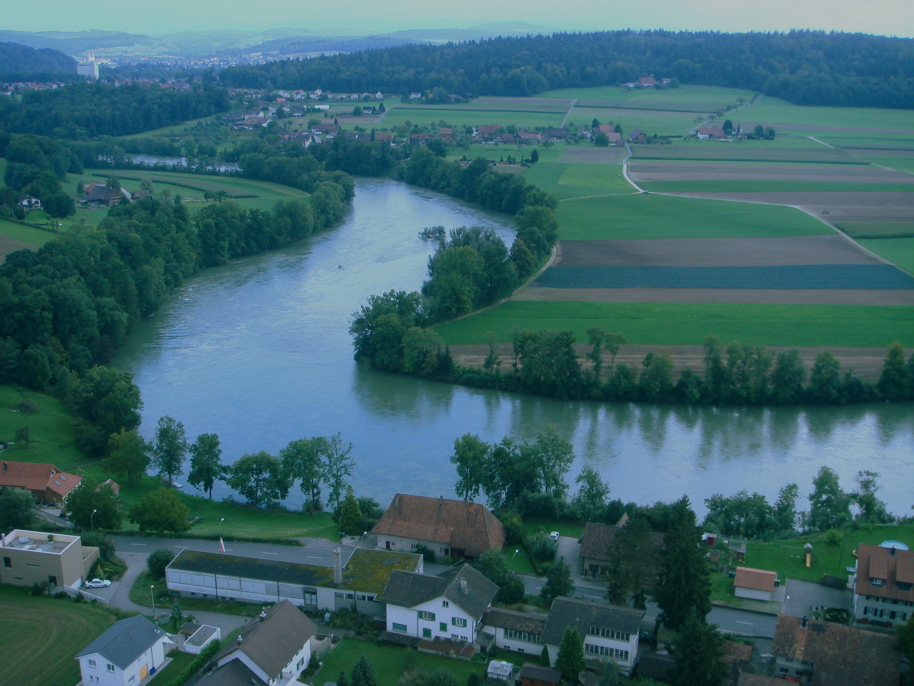
The defining landform of the area is the sharp meander of the Aare at the Cheer, where the river changes direction by more than ninety degrees and presses against the Wandflue, a steep, wooded cliff on the Wolfwil side. The cliff is cut into molasse rock, and the same molasse appears in places along the Wynau slopes, sometimes overlain by tufa-like calcareous deposits laid down by the river. The exposed bedrock, together with the cultivated fields of Lammere, Grossacher, Hinderfeld, Cheerächer, and Ortenacher on the right bank, gives the protected zone a strong visual contrast between open farmland, forested slope, and active riverbed.
Beyond the river bend itself, the valley fill is shaped by ice-age sediments. Massive gravel deposits left at the foot of the Rhone-Aare glacier south of the Jura form the broad substrate of the valley, into which the Aare has carved a channel up to thirty meters deep. Within this channel the river has built a wide bed of gravel bars and low islands, including the Berner Insel downstream of the rapids. Because the bars are regularly reshaped by floods, the river appears braided, with active channels, side arms, and newly emerging sand and gravel surfaces that are characteristic of a near-natural lowland river.
On the valley edges the cultural landscape still dominates. Old village cores sit on the lower gravel terrace of Wolfwil and on the slope above the river at Wynau, framed by wooded slopes, including the steep Chellebode slope on the Wynau side. North of the river the former mill of Wolfwil is connected to a once-captured springs stream, the Mühlebach, that was historically the only notable tributary feeding the Aare along this stretch before the runoff mostly seeped into the gravel toward the groundwater zone.
Aareknie Wolfwil-Wynau ecosystems, habitats, and plant life
Ecologically, Aareknie Wolfwil-Wynau marks a transition between aquatic, riparian, woodland, and slope habitats, all crowded into a small lowland area. The river itself, with its rapids, eddies, and quieter side arms, supports current-loving fish in the main channel and provides habitat for invertebrates that anchor the food web. Gravel banks deposited and reshaped during floods form open, sun-exposed pioneer habitats that are otherwise rare on the regulated Aare. Along the banks, softwood floodplain forest, periodically inundated by the Aare, creates a wet woodland fringe that has largely disappeared from much of the river downstream.
The slopes frame the aquatic zone with forest communities: the wooded cliff of the Wandflue on the Wolfwil side and the Chellebode slope on the Wynau side provide habitat continuity with the surrounding Mittelland forest belt. Between forest and river lie wet meadows, marsh patches, and former channel arms where amphibian and reptile species find breeding and shelter sites. This mosaic of water, gravel, wet woodland, marsh, and slope forest is what gives the site its particular ecological value within the Swiss lowlands.
The site also has a special role in conserving crested newts: the area called Chli Aarli on the left bank, which lies in a former side arm of the Aare, is a nationally designated amphibian spawning site and is the only place in the Oberaargau Emerald Area where the very rare crested newt has been confirmed. Restoration work around 2021, financed in part through the Alpiq Eco Fund, redesigned parts of the wetland to improve conditions for amphibians, reinforcing the area's function as a stronghold for lowland river and wetland species.
Aareknie Wolfwil-Wynau wildlife and species highlights
The river and its banks host a characteristic assemblage of lowland river and wetland species, rather than a few headline animals. The main channel and its braided arms are used by current-loving fish species, and the dynamic gravel banks provide substrate and feeding grounds for invertebrates that in turn support fish, birds, and amphibians. The softwood floodplain forests along both banks, regularly refreshed by flood events, harbor specialized birds and small fauna adapted to wet, shifting conditions.
Among the species of particular conservation interest, the threatened kingfisher is regularly present in the landscape protection area, using the riverbanks and exposed earth for nesting. Amphibians are a major focus: the Chli Aarli wetland supports a nationally important amphibian community, including the rare crested newt, and the broader mosaic of wet meadows and marshy depressions provides habitat for other amphibians as well as reptiles and a wide range of insects associated with open, sun-exposed gravel and water margins.
The periodic restoration of gravel transport since the mid-2000s has allowed a new gravel bar to form downstream of the rapids near the Berner Insel, which has measurably expanded available habitat for small animals, fish spawning grounds, and feeding areas for waterbirds. This dynamic is one of the key reasons the area is treated as a living ecological system rather than a static protected monument.
Aareknie Wolfwil-Wynau conservation status and protection priorities
The conservation significance of Aareknie Wolfwil-Wynau rests on three layers of formal protection. At the federal level, the landscape has been part of the Bundesinventar der Landschaften und Naturdenkmäler von nationaler Bedeutung since 1996, safeguarding it as BLN object 1319 under the federal law on inventories of national landscape importance. At the cantonal and regional level, it forms part of the Oberaargau Emerald Area, an ecological network that links it to other valuable sites in the region. At the site-specific level, the Chli Aarli amphibian spawning area is a federal amphibian spawning site of national importance, protected since 2001.
The formal protection goals explicitly target the natural dynamics of the river: maintaining the largely unobstructed, free-flowing course of the Aare, preserving its near-natural banks, rapids, islands, and sand and gravel bars, sustaining the river's dynamic sediment transport and the natural succession of riparian habitats, and protecting the wetland biotopes, the forests, and the cultural landmark church ensemble at Wynau. Because the gravel transport that once characterized the Aare here had been disrupted by upstream hydropower, the cantons of Bern and Solothurn supported a targeted restoration in 2005 by depositing new gravel at Deitingen and Aarwangen, which has enabled new bars to form downstream in the protected area.
Equally important has been the ongoing role of civil society and regional advocacy. The Arbeitsgemeinschaft zum Schutz der Aare campaigned for decades against projects that would have fundamentally altered the river bend, including the Transhelvetic Canal scheme of the twentieth century and the Onyx company's plan to expand the Wynau power station through a long tailrace tunnel that would have drained the rapids and main wetlands. Together, statutory protection, active habitat management, and sustained public engagement have kept this stretch of the Aare from becoming another regulated and heavily engineered section of river.
Aareknie Wolfwil-Wynau cultural meaning and human context
The cultural layer of the landscape is woven closely into the natural setting. On the left bank the village of Wolfwil retains its medieval ferry crossing at the settlement of Fahr, in continuous use since the late Middle Ages, as well as the old mill complex around the historic mill, which is rooted in a medieval feudal lease mill and was originally fed by a captured springs stream, the now largely covered Mühlebach. On the right bank, the Romanesque church of Wynau with its medieval wall paintings and the adjoining parsonage form one of the oldest church ensembles in canton Bern and are listed as cultural property of national significance within the Bern inventory.
The names of the landscape itself preserve local Alemannic speech. The sharp bend is known in dialect as the Cheer, from a regional word meaning to turn, and is also called the Aarerank, with rank used in the sense of curve. From this comes the field name Cheerächer for the cultivated land southeast of the bend. The river also had an older role in regional transport: the section near Wolfwil historically presented a difficult passage for river shipping and timber rafting, culminating in a serious boating accident in 1881 during high water at the upper rapids near the Schränne.
Top sights and standout views in Aareknie Wolfwil-Wynau
The standout features of Aareknie Wolfwil-Wynau are concentrated in a short stretch of river yet layered in meaning. The free-flowing bend of the Aare at the Cheer, with the Wandflue cliff and the active rapids, is the visual signature of the site. Closely tied to it are the dynamic gravel bars and islands, including the newer gravel bar downstream of the rapids near the Berner Insel, and the softwood floodplain forests that are repeatedly renewed by flood events.
On top of these natural highlights, the area carries strong cultural anchors: the medieval ferry at Fahr, the historic mill of Wolfwil, and the Romanesque church of Wynau with medieval wall paintings, all preserved within the BLN perimeter. The combination of a functioning lowland river ecosystem, federally protected wetlands including the nationally important Chli Aarli amphibian area, and tangible cultural heritage is what gives the Aareknie its exceptional profile within the Oberaargau Emerald Area.
Best time to visit Aareknie Wolfwil-Wynau
Because the landscape is defined by river dynamics rather than seasonal tourism operations, timing affects the experience mainly through water levels. Late spring and early summer, when snowmelt and rainfall typically raise the Aare, are the seasons in which the gravel bars are most likely to be reshaped or partially submerged, exposing fresh sediment, feeding side channels, and producing the most vivid braided appearance of the river. By contrast, late summer and periods of low water expose the rapids and extensive gravel banks in a more skeletal form that highlights the geological structure of the riverbed and the Wandflue cliff.
For ecological interest, late spring is also when amphibian activity in the Chli Aarli wetland and adjacent marshland is at its peak, while birdlife along the floodplain forests and gravel bars is generally richer in the warmer months when water levels are more moderate. Autumn brings quieter, clearer conditions that favor walking the field paths on both sides of the river, with stable weather for viewing the contrast between the open floodplain and the wooded slopes. Winter visits are possible but tend to be quieter, with fewer active ecological signals, though the bare slopes make the bedrock and the bend of the river more visually apparent.