

Mori Atlas logo
Protected landscapeAlibijaban Protected Landscape and Seascape

A diverse island landscape integrating mangrove forests, coral reefs, and seagrass habitats

Alibijaban Protected Landscape and Seascape: Coastal Geography and Protected Area Map

Alibijaban Protected Landscape and Seascape is a low-lying island located off the Bondoc Peninsula within the Ragay Gulf of the Philippines. This protected area supports an exceptionally undisturbed mangrove wilderness, diverse fringing coral reefs, and extensive seagrass beds. Visitors can analyze the island's coastal geography, where varied terrestrial and marine ecosystems converge under national protection to form a unique wildlife habitat in the Calabarzon region.

mangrove forestcoral reefseagrass bedsmarine protected areaislandbirdwatching

Alibijaban Protected Landscape and Seascape

Protected landscape

Park overview

Structured park overview, official facts, and landscape profile for Alibijaban Protected Landscape and Seascape

Alibijaban Protected Landscape and Seascape park facts, protected area profile, and essential visitor context

Review the core facts for Alibijaban Protected Landscape and Seascape, including designation, size, terrain, visitor scale, habitats, and operating context in one park-focused overview.

About Alibijaban Protected Landscape and Seascape

Alibijaban Protected Landscape and Seascape sits at the edge of Ragay Gulf, the broad embayment that separates the Bondoc Peninsula from the rest of southern Luzon. The island lies roughly 3.6 kilometres offshore from the municipality of San Andres, making it the only non-mainland barangay in that municipal area. Its position at the southwestern mouth of the gulf places it within a transitional coastal zone influenced by both peninsular runoff and open gulf waters, an environmental setting that supports unusually rich mangrove and reef habitats.

The island itself is small and low-lying, stretching about 4.6 kilometres from north to south but only around 1.3 kilometres across at its widest. Despite this modest size, the protected landscape supports an unusually complete sequence of coastal habitats: mangrove wilderness in the central and northern interior, sandy beaches and rocky shores along parts of the coastline, seagrass beds near the shore, and a continuous fringing reef around the island. Human settlement is limited to two sitios concentrated on the southwestern coast, leaving large parts of the island in a largely undisturbed natural condition.

The protected area formally combines terrestrial and marine values. The mangrove forest is the park's most celebrated feature, hosting at least twenty-two mangrove species and a varied bird community that includes species such as the Tabon scrubfowl, white-collared kingfisher, Philippine collared dove, black-naped oriole, and black-crowned night heron. The surrounding marine environment is notable for thirty or more genera of hard coral and seasonal visits from large marine animals including whale sharks, manta rays, and sea turtles, often collectively referred to locally as pawikans.

Conservation administration began with formal wilderness-area recognition in 1981, and the site's protection status under the National Integrated Protected Areas System has since attracted both research and tourism attention. Management is shared between the Community Environment and Resources Office under the Department of Environment and Natural Resources and the Provincial Government of Quezon. The 2006 municipal ordinance that banned fishing in designated waters strengthened on-the-ground protection and contributed to the recovery and maintenance of reef habitats.

Today, Alibijaban functions both as a conservation anchor within Ragay Gulf and as a recognisable destination for visitors drawn to its combination of mangrove forest, white sand beach, and coral-rich waters. Accessibility through boat services from the port of San Andres, along with its position along the broader Luzon travel corridor via the Pan-Philippine Highway, makes the protected landscape an approachable example of the Philippines' coastal biodiversity within the Calabarzon region.

Quick facts and research context for Alibijaban Protected Landscape and Seascape

Alibijaban Protected Landscape and Seascape is a national protected area in the Philippines, located about 3.6 kilometres off the southeastern coast of the Bondoc Peninsula in Quezon province. It encompasses a roughly 4.6-kilometre-long island with mangrove-dominated interior and fringing reefs, classified under the National Integrated Protected Areas System.

The park covers approximately 1,056 hectares of land and sea. Surrounding waters of about 225 hectares are additionally designated as the Alibijaban Fish Sanctuary, a marine protected area managed with local government and DENR oversight.

Protection and recognition

Examine the mixed protection scope and recorded international recognition parameters.

Alibijaban Protected Landscape and Seascape Protection Status

Alibijaban Protected Landscape and Seascape holds a mixed protection scope outlining its formal conservation framework. Official records compile documented management classifications and designation sources for structured spatial evaluation.

Protection details

Protection scope
Mixed
Transboundary protection
No
Park context

Deeper park guide and search-rich context for Alibijaban Protected Landscape and Seascape

Alibijaban Protected Landscape and Seascape history, landscape, wildlife, and travel context

Explore Alibijaban Protected Landscape and Seascape through its history, landscape character, ecosystems, wildlife, conservation priorities, cultural context, and seasonal travel timing in a structured park guide built for atlas discovery and search intent.

Why Alibijaban Protected Landscape and Seascape stands out

Alibijaban is best known for its pristine mangrove wilderness, often described as among the most undisturbed in the Philippines, and for its coral diversity within Ragay Gulf. The combination of mangrove interior, fringing reef with seagrass beds, and white sand beaches makes it a distinctive compact coastal protected area. The park is also recognised for wildlife variety that includes at least fourteen recorded bird species, fruit bats, monitor lizards, hard coral genera dominated by Porites, Montipora, and Acropora, and seasonal visits by whale sharks, manta rays, and marine turtles. This overlap of mangrove, reef, and beach habitats in one small offshore island gives Alibijaban a strong conservation identity.
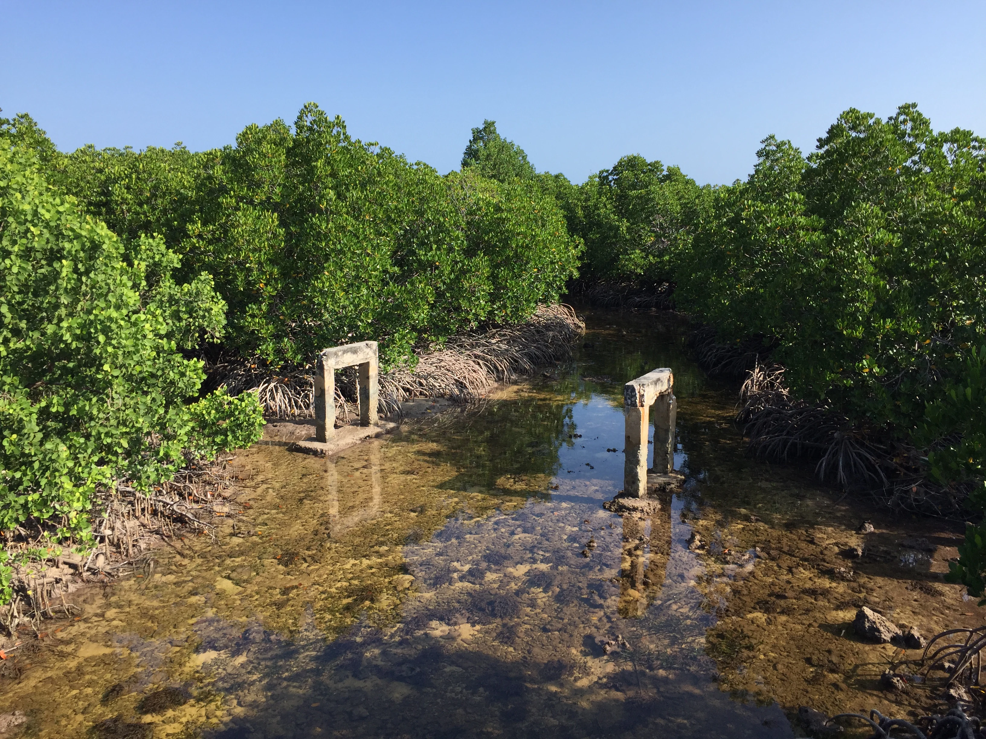
Alibijaban Island, San Andres
A view of the shoreline at Alibijaban Island in Quezon Province

Alibijaban Protected Landscape and Seascape history and protected-area timeline

Alibijaban's conservation history began in 1981, when the island was designated as a wilderness protected area. This initial recognition established a baseline of formal protection that distinguished the island from other nearby coastal lands and laid the groundwork for later marine and terrestrial safeguards.

In 2006, a municipal ordinance tightened conservation in surrounding waters, prohibiting all kinds of fishing in designated zones. This local action effectively complemented national wilderness recognition, supporting reef recovery and creating clearer boundaries between community livelihoods and marine protection. Surrounding waters of roughly 225 hectares were later declared as the Alibijaban Fish Sanctuary, formalising the marine side of conservation.

The island was previously part of the municipality of San Narciso before being transferred administratively to San Andres in 1959, when its offshore barangay status was realigned. Over time, mangrove protection, reef oversight, and provincial-government engagement with the Department of Environment and Natural Resources through CENRO have shaped the protected area into a jointly administered ecological reserve.

More recently, the site's classification under the National Integrated Protected Areas System evolved. Until 2025, Alibijaban was categorised as a wilderness area; since then, it has been recognised specifically as a protected landscape and seascape, reflecting its combined land and sea conservation values. This reclassification broadens recognition of both the mangrove interior and the reef-rich marine zone that together define the park.

Alibijaban Protected Landscape and Seascape landscape and geographic character

Alibijaban is a low-lying island whose topography reflects its coastal position and its setting within a broad gulf. The terrain is flat to gently undulating across most of the island, with no significant high ground. This low profile is part of why mangrove forests have been able to develop so extensively across the central and northern interior, where freshwater and tidal conditions converge.

The coastline combines different coastal expressions. White sandy beaches are found along portions of the western and southwestern side facing San Andres and Bondoc Peninsula, while rocky shores and more rugged formations appear along the northeastern side. Together, these coastal formations create a varied shoreline that supports mangrove, beach, and reef habitats in unusually close proximity.

Surrounding the island is a continuous fringing reef interspersed with seagrass beds, particularly close to the shore. This reef structure transitions outward into the deeper waters of Ragay Gulf, producing a layered coastal landscape where shallow reef flats, seagrass meadows, and offshore waters meet the broader gulf ecosystem. The result is a compact but ecologically layered island landscape characterised more by habitat transitions than by dramatic relief.

Alibijaban Protected Landscape and Seascape ecosystems, habitats, and plant life

The defining ecological feature of Alibijaban is its mangrove wilderness, which has often been described as among the most undisturbed in the country. The mangrove system is unusually diverse for an island of this size, supporting at least twenty-two mangrove species and forming dense interior forest structure that buffers the coast and shelters a wide range of associated species.

Complementing the mangrove forest is a fully marine ecosystem expressed through fringing reef, seagrass beds, and offshore waters. Seagrass beds occur close to the shore, providing important nursery habitat for fish and invertebrates, while the fringing reef forms a continuous ring that connects the island to the wider reef network of Ragay Gulf. This reef has been recorded as supporting thirty or more hard coral genera, with Porites, Montipora, and Acropora dominating the coral community.

Bird life is significant within the park. Habitats ranging from mangrove interior to beach and rocky shoreline support a varied avifauna, including species such as the Tabon scrubfowl, white-collared kingfisher, jungle crow, black-naped oriole, Philippine collared dove, Asian glossy starling, chestnut munia, Philippine pied fantail, common emerald dove, black-crowned night heron, and common snipe. Together, the mangrove, reef, seagrass, and shoreline environments create overlapping habitat zones that allow a wider range of species than one habitat alone could sustain.

Alibijaban Protected Landscape and Seascape wildlife and species highlights

Wildlife at Alibijaban is shaped by the close connection between mangrove forest, reef, and shoreline habitats. The mangrove interior provides refuge for bird species, fruit bats, and monitor lizards, while the surrounding reef and gulf waters host coral communities, reef-associated fish, and seasonal visits by larger marine animals.

At least fourteen bird species have been recorded in the protected area. These include the Tabon scrubfowl, a ground-dwelling bird typical of Philippine forest and scrub habitats; the white-collared kingfisher; the black-naped oriole; the Philippine collared dove; the Asian glossy starling; the chestnut munia; the Philippine pied fantail; the common emerald dove; the jungle crow; the black-crowned night heron; and the common snipe. This bird community reflects a mix of mangrove, coastal woodland, and shoreline habitats, contributing to the park's reputation for rich bird life.

Marine wildlife extends beyond reef species. Adjacent waters are visited by whale sharks and manta rays, and by marine turtles collectively referred to as pawikans in Filipino. The presence of these larger marine visitors, alongside a diverse hard coral community, gives the park a wildlife profile that combines small-island forest biodiversity with large-pelagic marine significance.

Alibijaban Protected Landscape and Seascape conservation status and protection priorities

Alibijaban's conservation significance lies in the combination of unusually undisturbed mangrove wilderness and the most diverse marine habitat recorded in Ragay Gulf. The mangrove forest is regarded as one of the least disturbed in the Philippines, while the surrounding reef hosts thirty or more coral genera, making the protected area an important ecological reference point within the broader gulf ecosystem.

Protection is supported through multiple layers. The island has been designated as a protected landscape and seascape under the National Integrated Protected Areas System, replacing an earlier wilderness-area classification that had stood since 1981. Around 225 hectares of surrounding waters are designated as the Alibijaban Fish Sanctuary, providing formal marine protection. A municipal ordinance passed in 2006 prohibited all kinds of fishing within designated waters, strengthening on-site enforcement.

Management is shared between the Community Environment and Resources Office under the Department of Environment and Natural Resources and the Provincial Government of Quezon. This joint structure, together with the locally enforced fishing ban, allows the protected area to combine national-level ecological recognition with place-based community engagement, an approach that has helped maintain mangrove cover, reef health, and the broader ecological integrity of the island.

Alibijaban Protected Landscape and Seascape cultural meaning and human context

Alibijaban has a long-standing character as a small offshore community within Quezon province. It is the only barangay of San Andres located outside the mainland, reflecting a separate historical and administrative identity shaped by dependence on the sea and on coastal resources. The two sitios on the western and southwestern coast are the main centres of population, with most residents concentrated relatively close to the marine channel connecting the island to the Bondoc Peninsula.

The transfer of the island from San Narciso to San Andres in 1959 shaped present-day municipal identity and aligned Alibijaban with the local governance structures that have since played a role in conservation decisions, including the 2006 fishing ordinance. Cultural references to marine turtles through the term pawikan also connect everyday local vocabulary to the wildlife values of the protected landscape, suggesting a familiar relationship between residents and the species that visit these waters.

Top sights and standout views in Alibijaban Protected Landscape and Seascape

Alibijaban Protected Landscape and Seascape is notable for compactly combining mangrove forest, fringing reef, seagrass beds, and white sand beaches within a single offshore island. The mangrove interior is widely regarded as among the most undisturbed in the country, and the surrounding reef is recognised as the most diverse marine habitat in Ragay Gulf.

The protected area supports at least twenty-two mangrove species, fourteen recorded bird species, thirty or more hard coral genera, and seasonal visits from whale sharks, manta rays, and marine turtles. Layered national recognition under NIPAS, locally enforced fishing protection, and a sanctuary designation within adjacent waters together highlight Alibijaban as an integrated model of mangrove-and-reef conservation within the Calabarzon region.

Best time to visit Alibijaban Protected Landscape and Seascape

Alibijaban's tropical Philippine climate is shaped by the broader weather patterns of southeastern Luzon, where dry and wet seasons influence conditions on the island and across Ragay Gulf. The dry months, generally associated with calmer seas, tend to favour clearer water for reef experiences and easier boat transfer from San Andres, while the wet months can bring rougher conditions offshore but often sustain lush mangrove interior vegetation.

Bird life remains present across seasons, supported by stable mangrove habitat. Marine wildlife such as whale sharks, manta rays, and sea turtles is more strongly linked to broader oceanographic conditions in Ragay Gulf than to a single calendar window, so seasonal wildlife encounters can vary. Visitors interested in clearer water and calmer boat travel generally find the drier part of the year most conducive to activities such as camping, boating, and snorkeling.
Monthly climate preview

Long-term temperature and precipitation trends across twelve recorded intervals

Alibijaban Protected Landscape and Seascape Climate Normals

Representative coordinates record mean monthly temperatures spanning from 25.66 to 29.15 degrees Celsius alongside shifting daily precipitation rates. Analyzing the complete monthly profile provides structured insight into the long-term climatic rhythm of this protected coastal geography.
Annual mean27 °C
26 °C29 °C
Jan26°
Feb26°
Mar27°
Apr28°
May29°
Jun29°
Jul28°
Aug28°
Sep28°
Oct28°
Nov27°
Dec26°
Warmest month
May

29.2 °C

Coolest month
January

25.7 °C

Wettest month
December

13.8 mm/day

Driest month
April

3 mm/day

Park location guide

Geography guide, regional context, and park location map for Alibijaban Protected Landscape and Seascape

Alibijaban Protected Landscape and Seascape park geography, regions, and map view in Philippines

Understand where Alibijaban Protected Landscape and Seascape sits in Philippines through a broader geographic reading of the surrounding landscape, nearby location context, and its mapped position within the national park landscape.

How Alibijaban Protected Landscape and Seascape fits into Philippines

The Philippines, officially the Republic of the Philippines, is an archipelagic nation in Southeast Asia comprising approximately 7,641 islands categorized into three main geographical divisions: Luzon, Visayas, and Mindanao. Located in the western Pacific Ocean, it shares maritime borders with Taiwan, Japan, Palau, Indonesia, Malaysia, Vietnam, and China. Manila serves as the capital city, while Quezon City is the most populated city, both within Metro Manila.

Wider geography shaping Alibijaban Protected Landscape and Seascape in Philippines

The Philippines is an archipelagic nation in Southeast Asia, positioned in the western Pacific Ocean. Its islands are bounded by the South China Sea to the west, Philippine Sea to the east, and Celebes Sea to the south. The country shares maritime borders with Taiwan to the north, Japan to the northeast, Palau to the east and southeast, Indonesia to the south, Malaysia to the southwest, Vietnam to the west, and China to the northwest.

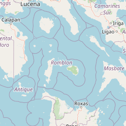
Map view of Alibijaban Protected Landscape and Seascape

Use this park location map to pinpoint Alibijaban Protected Landscape and Seascape in Philippines, understand its exact geographic position, and read its mapped placement within the surrounding landscape more clearly.

Pigeon | © OpenStreetMap contributors

Location context for Alibijaban Protected Landscape and Seascape

CalabarzonQuezon

Visualizing the rare mangrove wilderness, coral reefs, and coastal terrain

Alibijaban Protected Landscape and Seascape Photos and Scenery

Browse detailed photography documenting the undisturbed mangrove interior and marine ecosystems of Alibijaban Protected Landscape and Seascape. Visual references capture the coastal terrain, fringing coral reefs, and protected island habitats across Ragay Gulf.

Alibijaban Island, San Andres

Park atlas

Compare regional protected areas and coastal ecosystems across surrounding marine habitats.

Explore Parks Near Alibijaban Protected Landscape and Seascape

Continue browsing other national parks and protected areas located near Alibijaban Protected Landscape and Seascape. Compare adjacent coastal ecosystems and regional marine habitats for broader geographic discovery.
Wildlife reserveQuezon
About 19 km away#1 closest

West

Mulanay Watershed Forest Reserve: Mapping Protected Lowland Rainforests in Quezon

A watershed conservation site on the Bondoc Peninsula

Spanning 474 hectares in the province of Quezon, the Mulanay Watershed Forest Reserve acts as a protected anchor for local biodiversity and hydrological health. The reserve preserves rolling, forest-covered hills that feed the Cawayan Creek, illustrating the importance of small, strategically managed protected lands within the larger Philippine conservation framework.

Area
4.74 km²
Established
1938
Relief
Upland
Water
Minor water
National parkPhilippines
About 46 km away#2 closest

Northeast

Libmanan Caves National Park: Philippines National Park and Mapped Landscape

Explore protected area boundaries and regional geography.

Libmanan Caves National Park is a protected national park within the Philippines, offering a distinct focus for geographic discovery. This entry provides detailed context on its mapped landscape and its place within the archipelago's protected areas. Users can gain a clear understanding of the park's regional setting, facilitating atlas-style exploration and comprehension of its conservation significance within the Philippine geography.

Area
0.194 km²
Established
1934
IUCN
III
Relief
Upland
Nature reserveQuezon
About 70 km away#3 closest

Northwest

Lopez Watershed Forest Reserve: Protected Nature Reserve and Watershed Atlas of Quezon

A foundational rainforest landscape within the Quezon province protected network.

Lopez Watershed Forest Reserve is a significant nature reserve located in the rolling hills of southern Quezon, Philippines. This site preserves a continuous block of tropical lowland and lower montane forest, functioning as an essential watershed catchment area within the broader Luzon landscape. Learn about its institutional importance and its role as an early component of the Philippine protected area management framework.

Area
4.18 km²
Established
1940
Relief
Upland
Water
Minor water
Wildlife reserveQuezon
About 75 km away#4 closest

Northwest

Calauag Watershed Reservation: Geographic Analysis of Protected Rainforest in Quezon Province

Mapping lowland tropical forest terrain and regional watershed boundaries

Located in the rolling hills of Quezon, the Calauag Watershed Reservation serves as a critical protected landscape featuring dense stands of Philippine hardwoods and varied forest microhabitats. This record details the reserve's topography, ranging from moderate slopes to drainage corridors, illustrating its function as both a biodiversity sanctuary and a essential water catchment for the surrounding CALABARZON region.

Area
3.28 km²
Established
1939
Relief
Upland
Climate
Tropical
Protected areaCamarines Norte
About 77 km away#5 closest

North

Abasig-Matogdon Mananap Natural Biotic Area: Regional Geography and Protected Forest Terrain

A vital ecological reserve in the Bicol Region of Luzon

Located in Camarines Norte, the Abasig-Matogdon Mananap Natural Biotic Area protects critical lowland and montane rainforests surrounding Mount Labo. This area serves as a key component of the regional conservation landscape, defined by its steep volcanic terrain, numerous geothermal springs, and habitat for endemic species within the Philippine archipelago.

Area
54.2 km²
Established
2000
Relief
Mountain
Climate
Tropical
National parkCamarines Sur
About 79 km away#6 closest

Northeast

Mount Isarog National Park: Exploring the Volcanic Geography and Forested Slopes of Camarines Sur

Mapping the altitudinal zonation of a significant Luzon stratovolcano

Mount Isarog National Park defines the natural profile of southeastern Luzon. This protected area preserves a full volcanic stratigraphy, ranging from tropical lowland rainforest to stunted mossy summit forests. The park is characterized by its steep ravines, drainage channels, and globally recognized biological endemism, providing a clear example of altitudinal compression within a single mountain ecosystem in the Philippines.

Area
99.71 km²
Established
1938
Relief
Mountain
Climate
Tropical
Wildlife reserveMarinduque
About 84 km away#7 closest

West

Marinduque Wildlife Sanctuary: Map of the Protected Interior Forest

Exploring the essential wildlife habitats of Marinduque Island

Spanning 8,800 hectares of hilly terrain across five municipalities, the Marinduque Wildlife Sanctuary protects a critical block of forest. This reserve is recognized as a vital sanctuary for endemic Philippine species and forms a significant ecological backbone within the heart of the island landscape.

Area
88.28 km²
Established
2004
Relief
Mountain
Climate
Tropical
National parkProvince of Romblon
About 106 km away#8 closest

South

Mount Guiting-Guiting Natural Park: Mapped Geography and Protected Forest Landscapes

Exploring the highest massif in the Province of Romblon

Discover the geographic identity of Mount Guiting-Guiting Natural Park, a protected reserve encompassing the dense, old-growth rainforests of Sibuyan Island. This park serves as a key upland habitat, with its terrain rising sharply to the highest point in the Romblon province. MoriAtlas provides a clear view of its mountainous boundaries and the rugged forest gradients that define this significant island landscape.

Relief
Mountain
Water
Minor water

Common questions about visiting, size, designation, and location context for Alibijaban Protected Landscape and Seascape

Alibijaban Protected Landscape and Seascape FAQs for park facts, access, geography, and protected area context

Find quick answers about Alibijaban Protected Landscape and Seascape, including protected-area facts, park geography, trail and visitor context, and how the park fits into its surrounding country and regional landscape.
MoriAtlas Explorer

Continue Your Protected Areas Search Across the Global Atlas

Deepen your exploration by continuing the structured search for national parks and protected areas worldwide. Utilize the comprehensive filtering capabilities to compare different conservation landscapes and refine your understanding of global park geography. Discover more about the distribution and characteristics of protected natural areas.

Global natural geography