
Mori Atlas logo
Nature reserveAlte Werra

A vital ecological corridor within the Middle Werra valley featuring extensive meadow habitats and restored river oxbows.

Alte Werra Nature Reserve: Protected Floodplain Landscapes and River Geography in Wartburgkreis, Germany

(Naturschutzgebiet Alte Werra)

Alte Werra represents a significant protected nature reserve spanning 258 hectares within the Wartburgkreis district. The landscape features a complex mosaic of floodplain meadows, meandering river sections, and silted oxbow remnants that serve as a crucial meadow-breeder sanctuary. By integrating into the European Natura 2000 network, the reserve provides essential geographic continuity for bird populations and riparian conservation efforts across the Middle Werra valley.

floodplainmeadow-breeder habitatriver meandersoxbowwet meadowsreed beds
A graphic illustration showing a winding river flowing through a forested valley flanked by steep cliffs and waterfalls.

Alte Werra

Nature reserve

Park overview

Structured park overview, official facts, and landscape profile for Alte Werra

Alte Werra park facts, protected area profile, and essential visitor context

Review the core facts for Alte Werra, including designation, size, terrain, visitor scale, habitats, and operating context in one park-focused overview.

About Alte Werra

Alte Werra sits within a broad widening of the Werra valley northeast of the municipality of Gerstungen, in the western Thuringian district of Wartburgkreis. The protected landscape combines flat, periodically flooded meadows with a lively, meandering stretch of the Werra, an aging oxbow remnant in the central area, and the two Böllerteiche ponds that originated from historical clay extraction. Approximately 600 meters wide in cross-section, the floodplain hosts a mosaic of grassland, reed, and aquatic habitats along a roughly 258 hectare footprint.

The reserve is ecologically tied to the wider Werra valley system. It is one of the most valuable meadow-breeder (Wiesenbrüter) areas in Thuringia, and the conservation aim recorded in its founding ordinance is the preservation of a richly structured floodplain complex that serves birds and amphibians in particular. Since 2006, the Stiftung Naturschutz Thüringen has been actively rewetting parts of the reserve, including restoration work on the weir and selective redredging of the oxbow, to develop wetter, more ecologically valuable grassland.

At the European level, Alte Werra is fully integrated into Natura 2000. It lies within the Fauna-Flora-Habitat area 'Werra bis Treffurt mit Zuflüssen', focused on the near-natural Werra course, its associated fish populations, amphibian habitats, fen meadows, and a notable bat community. The reserve is also part of the Special Protection Area 'Werra-Aue zwischen Breitungen und Creuzburg', ensuring that its floodplain serves both breeding meadow birds and migratory waterfowl across an area of more than 2,500 hectares. The river itself reflects regional industrial history: long saline inflows from the local potash industry have made the Werra Germany's longest brackish stream, an environmental challenge that drives much of the conservation interest in the wider floodplain.

Quick facts and research context for Alte Werra

Alte Werra is a 257.8 hectare nature reserve (Naturschutzgebiet) in the Werra floodplain between Gerstungen and Neustädt in the Wartburgkreis of western Thuringia, Germany. It was placed under protection on 30 April 1996 and carries the Thuringian identifier 214 and the WDPA code 162103. The terrain lies between about 202 and 255 meters above sea level in the natural-region unit known as the Berkaer Becken within the Salzunger Werrabergland.

The reserve sits inside both the Natura 2000 Fauna-Flora-Habitat site 'Werra bis Treffurt mit Zuflüssen' and the European Bird Protection Area 'Werra-Aue zwischen Breitungen und Creuzburg'. The Werra here is a saline-impacted river classified as Germany's longest brackish stream, and the floodplain habitats combine periodically flooded meadows, an oxbow remnant, and the two Böllerteiche still-water ponds.

Protection and recognition

Documented terrestrial protection scope and conservation records

Alte Werra Protection Status and International Recognition Data

Alte Werra maintains a recorded terrestrial protection status within official conservation databases. Official records outline the assigned management scope and baseline designation data for this protected area.

Protection details

Protection scope
Terrestrial
Transboundary protection
No
WDPA ID
162103
Park context

Deeper park guide and search-rich context for Alte Werra

Alte Werra history, landscape, wildlife, and travel context

Explore Alte Werra through its history, landscape character, ecosystems, wildlife, conservation priorities, cultural context, and seasonal travel timing in a structured park guide built for atlas discovery and search intent.

Why Alte Werra stands out

Alte Werra is particularly known for its role as one of Thuringia's most significant meadow-breeding bird areas, where extensive grassland, an oxbow arm, and a meandering section of the Werra come together in a single protected floodplain complex. The site is equally valued within the European Natura 2000 framework, where it forms part of the 'Werra bis Treffurt mit Zuflüssen' Fauna-Flora-Habitat area and the 'Werra-Aue zwischen Breitungen und Creuzburg' bird protection area. Its mix of wet meadows, reed beds, river meanders, and still waters makes it a representative example of a Middle Werra floodplain landscape under active conservation management.
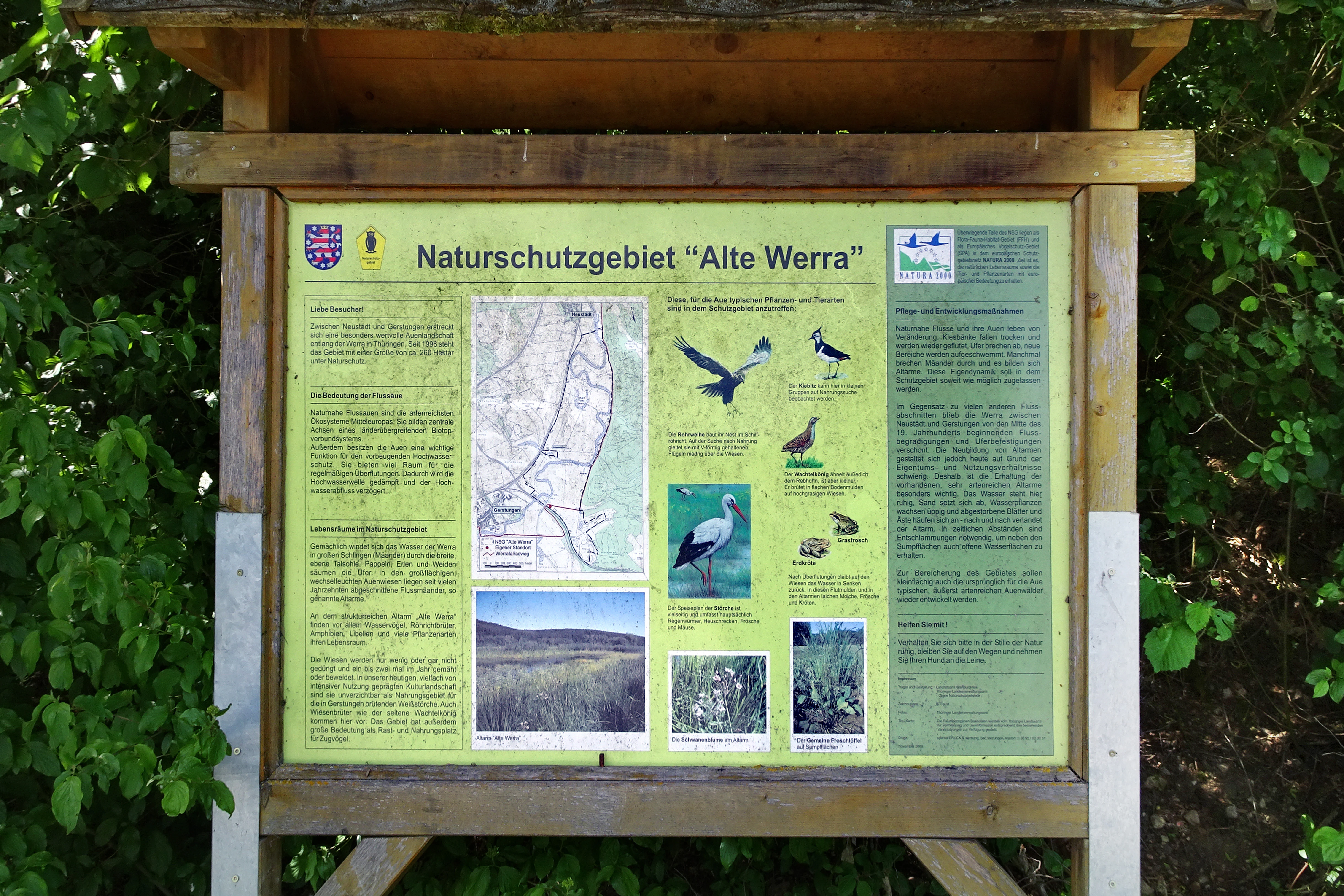
A wooden-framed information sign for the Alte Werra nature reserve, featuring a map, images of local wildlife, and explanatory text in German.
An information board at the Alte Werra nature reserve providing details on the local ecology.

Alte Werra history and protected-area timeline

Alte Werra was placed under provisional protection between 1990 and 1995, a transitional period that followed the restructuring of conservation administration in the newly reconstituted Free State of Thuringia after German reunification. On 30 April 1996, the Thüringer Landesverwaltungsamt in Weimar formally designated 257.8 hectares as the Naturschutzgebiet Alte Werra, with the explicit conservation purpose of preserving a varied floodplain complex of meandering Werra, oxbow remnants, and the Böllerteiche as habitat for birds and amphibians.

In the early 2000s, conservation actors began rewetting the oxbow arm area to recreate shallow seasonal flooding, and from 2006 the Stiftung Naturschutz Thüringen, a public-law foundation established in 1995 by the Free State of Thuringia, took over management as a dedicated project across roughly 24 hectares using compensation funds from intervention-regulatory obligations. The foundation refurbished the area's weir in summer 2010 so that the drainage function of the existing ditch network could be actively halted in spring, allowing more genuinely wet grassland to develop.

Alte Werra landscape and geographic character

The Alte Werra landscape unfolds in a flat, broad section of the Werra valley where the river forms pronounced meanders within a roughly 600 meter wide floodplain. Elevations across the reserve range from about 202 to 255 meters, with the riverbed itself incised 2 to 3 meters into the surrounding meadows. The floodplain's surface geology rests on Quaternary and Holocene loose sediments, including porphyry, granite, quartz, and radiolarite pebbles together with musselkalk and Buntsandstein gravels, capped by sand, gravel, and a layer of Auelehm flood loam that can reach about a meter in thickness. Soil forms include sandy-loam Vega soils, calcareous-loam Gley and Anmoorgley profiles in the wetter zones, and patches of Decksalm-Braunerde on drier sites.

Two still-water features break the otherwise open grassland: the Böllerteiche, a pair of small ponds in the southeastern edge of the reserve created by historical clay extraction, and the central Werra oxbow remnant, around 650 meters long and 15 to 25 meters wide, which is partially silted and increasingly being restored to a more dynamic, partially flooded state. To the east, low hill ridges (the Obereller Hügelland) frame the floodplain, while to the west the landscape transitions into agricultural land along the Landesstraße 1021.
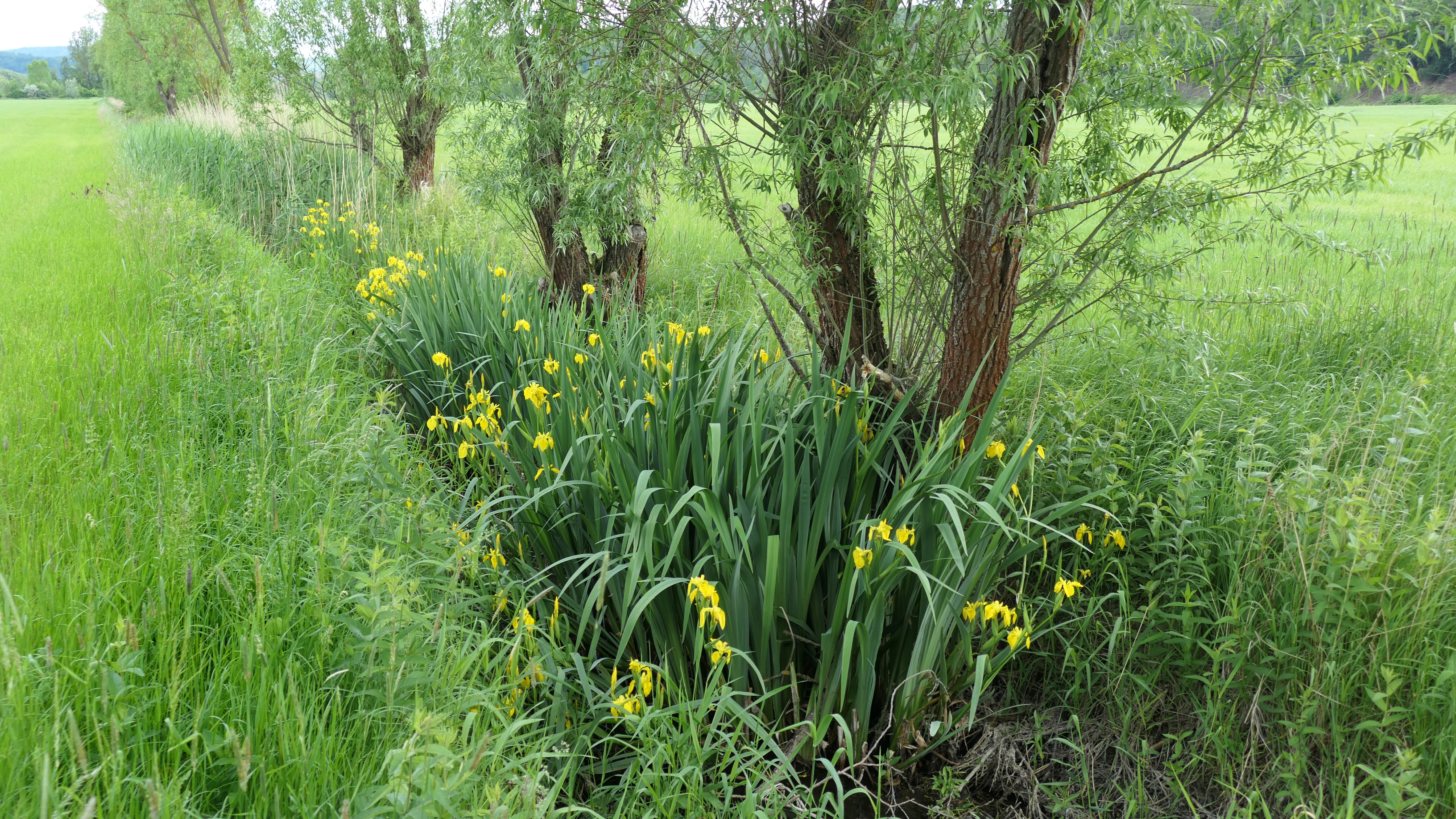
A line of yellow iris flowers growing along the base of several small trees in a green, grassy floodplain meadow.
Yellow irises blooming along a drainage ditch in the Alte Werra nature reserve.

Alte Werra ecosystems, habitats, and plant life

Alte Werra's vegetation reflects the dual pressures of agriculture and floodplain dynamics. The managed grassland is dominated by relatively species-poor, nutrient-rich Fettweiden communities with abundant perennial ryegrass, but the wetter margins, particularly around the rewetted oxbow, support extensive reed beds of common reed, larger sedge communities with slender sedge and fox sedge, reed canary grass stands, and tall-herb fringes. Along the Werra, planted hybrid poplars grow alongside black alder, pedunculate oak, willows, and shrubs.

The flora includes several notable species recorded in the area, such as frogbit, bog stitchwort, and flowering rush, while the Böllerteiche margins host small-flowered bird's foot and wall gypsophila. Brackish-influenced reed communities with sea club-rush reflect the unusual chemical character of the Werra, which carries significant saline pollution from regional potash mining, a legacy that also shapes the conservation challenges of the floodplain soils and waters.
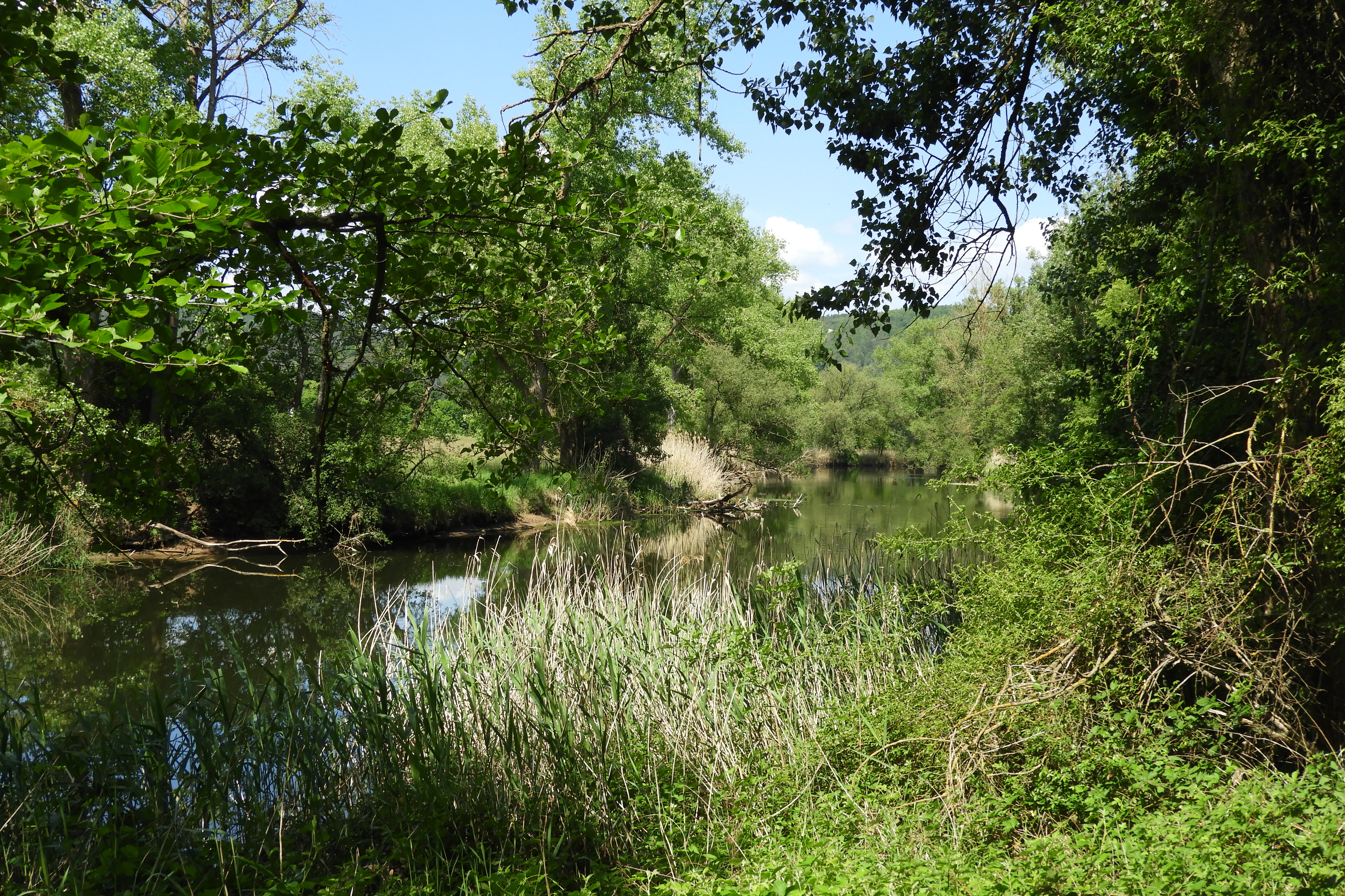
A calm, narrow river winding through dense green deciduous trees and riverbank grasses under a clear sky.
A view of the Werra river as it meanders through the Alte Werra nature reserve.

Alte Werra wildlife and species highlights

The reserve's birdlife is its most prominent natural asset. Meadow-breeding species using the Alte Werra floodplain as breeding habitat include common snipe, bluethroat, whinchat, common kingfisher, little ringed plover, marsh harrier, spotted crake, spotted rail, corncrake, and meadow pipit. White stork, black stork, northern lapwing, and red kite have also been observed foraging in the area. According to the 2010 Red List of breeding birds of Thuringia, common snipe, spotted crake, white stork, and lapwing are considered critically endangered within the state, while whinchat and corncrake are classed as strongly endangered.

Several of these species, including white stork, black stork, red kite, marsh harrier, spotted crake, corncrake, kingfisher, and bluethroat, are listed in Annex I of the EU Birds Directive and therefore receive special conservation measures under European law. Fish and amphibians are also notable: the broader FFH area supports European bullhead, brook lamprey, and European otter along the Werra, together with yellow-bellied toad and northern crested newt in the still-water habitats, and a bat community that includes lesser horseshoe, Bechstein's, Barbastelle, and pond bats.

Alte Werra conservation status and protection priorities

Alte Werra is significant primarily as a floodplain conservation site at the intersection of national and European protection systems. Nationally, it is one of the linked Naturschutzgebiete along the Middle Werra whose joint purpose is to preserve a chain of Auenbiotope, or floodplain biotopes, that retain open, species-rich grassland and dynamic river processes. Its formal conservation aim, set in 1996, frames it as habitat for birds and amphibians within a diverse floodplain mosaic.

At the European level, the reserve is embedded in Natura 2000 via the Fauna-Flora-Habitat site 'Werra bis Treffurt mit Zuflüssen' and the Special Protection Area 'Werra-Aue zwischen Breitungen und Creuzburg'. These designations attach conservation value to the near-natural Werra course, key aquatic species such as bullhead, brook lamprey, and otter, amphibian habitats for yellow-bellied toad and crested newt, an inland saline site with dark meadow-clover butterfly habitat, and bat populations that include Germany's species of national responsibility like Bechstein's and Barbastelle bats. Active rewetting, oxbow dredging, and weir renovation by the Stiftung Naturschutz Thüringen form an ongoing practical layer of conservation management alongside the legal designations.

Alte Werra cultural meaning and human context

Alte Werra sits within the traditional cultural landscape of the Werra valley, where floodplain meadows have long supported mixed agriculture with mowing and cattle grazing; settlement outside the reserve is shaped by the historic road network, including the Landesstraßen 1020 and 1021 that frame parts of the protected boundary. The Böllerteiche ponds themselves are a small but tangible reminder of the area's small-scale extractive history, having originated from clay working along the floodplain edge.

The Werra as a whole carries a strong regional industrial memory, particularly from the potash mining industry that has left the river unusually saline and made it Germany's longest brackish stream; conservation work at Alte Werra is in part a response to that long-running environmental legacy. Outdoor recreation in the floodplain is oriented around the Werratal-Radweg long-distance cycling route, which traverses the southern edge of the protected area, complemented by rest benches and interpretive panels that connect the landscape's natural values to the broader Werra valley trail network.

Top sights and standout views in Alte Werra

Highlights of Alte Werra include the meandering main course of the Werra, the partially restored central Werra oxbow remnant, and the Böllerteiche still-water ponds in the southeastern margin. The reserve stands out within Thuringia for its combination of extensive wet and dry meadow-breeding habitat, a nationally notable bird community anchored by Annex I species of the EU Birds Directive, and active rewetting projects led by the Stiftung Naturschutz Thüringen.

Equally important is the site’s embeddedness in the European Natura 2000 network: a single 258 hectare German nature reserve that simultaneously anchors a 2,260 hectare Fauna-Flora-Habitat area and feeds into a more than 2,500 hectare Special Protection Area, giving it significance well beyond its modest local footprint.

Best time to visit Alte Werra

Alte Werra is best experienced in the warmer months when its meadows are in active growth, the Werra and oxbow waters are most lively, and floodplain birdlife is at its most visible. Late spring and early summer tend to bring the highest meadow-breeding bird activity, while the open, flat setting means weather conditions can shift quickly; visitors walking or cycling the Werratal-Radweg through the southern part of the reserve will generally find the broadest scenic and ecological impressions during this period rather than in the dormant winter landscape.


Monthly climate preview

Long-term monthly temperature ranges and precipitation patterns across Wartburgkreis

Alte Werra Climate Normals, Annual Temperature and Precipitation Rhythm

Representative coordinate records show measured long-term averages spanning sub-zero winter minimums to warm summer maximums alongside steady daily precipitation rates. Examining the full monthly sequence clarifies the complete annual climate cycle and multi-month thermal trends across the landscape.
Annual mean8 °C
-1 °C18 °C
Jan-1°
Feb
Mar
Apr
May12°
Jun16°
Jul18°
Aug18°
Sep14°
Oct
Nov
Dec
Warmest month
July

18.3 °C

Coolest month
January

-1.1 °C

Wettest month
July

2.6 mm/day

Driest month
April

1.4 mm/day

Park location guide

Geography guide, regional context, and park location map for Alte Werra

Alte Werra park geography, regions, and map view in Germany

Understand where Alte Werra sits in Germany through a broader geographic reading of the surrounding landscape, nearby location context, and its mapped position within the national park landscape.

How Alte Werra fits into Germany

Germany is a federal republic in Western and Central Europe with a population of over 83 million across sixteen constituent states. It is Europe's largest economy by nominal GDP and a major global exporter and importer. The capital is Berlin, and the country borders Denmark, Poland, Czech Republic, Austria, Switzerland, France, Luxembourg, Belgium, and the Netherlands.

Wider geography shaping Alte Werra in Germany

Germany is located in Western and Central Europe, spanning 357,022 km². It borders Denmark to the north, Poland and the Czech Republic to the east, Austria and Switzerland to the south, and France, Luxembourg, Belgium, and the Netherlands to the west. The country has coastlines on the Baltic Sea and North Sea to the north, with the Alps located in the southern region.

Map view of Alte Werra

Use this park location map to pinpoint Alte Werra in Germany, understand its exact geographic position, and read its mapped placement within the surrounding landscape more clearly.

Pigeon | © OpenStreetMap contributors

Location context for Alte Werra

Wartburgkreis

Explore floodplain meadows, oxbow remnants, and river meanders through detailed park imagery.

Alte Werra Photos and Landscape Scenery: Visualizing the Protected River Valley

Visual records reveal the diverse terrain and meadow habitats that define the protected river valley environment. Examining these landscape views helps researchers understand the ecological character and topography of the regional reserve.

A wooden-framed information sign for the Alte Werra nature reserve, featuring a map, images of local wildlife, and explanatory text in German.

A wide, green, open meadow under a bright blue sky with scattered white clouds, bordered by a line of green deciduous trees.

A line of yellow iris flowers growing along the base of several small trees in a green, grassy floodplain meadow.

A calm, narrow river winding through dense green deciduous trees and riverbank grasses under a clear sky.

Park atlas

Compare regional river valleys, wetland reserves, and neighboring floodplain biotopes.

Explore Parks Near Alte Werra and Connected Protected Landscapes

Visitors exploring Alte Werra can continue browsing neighboring protected areas across the Middle Werra river valley. Expanding the regional view helps compare similar floodplain habitats, wetland bird reserves, and connected valley conservation zones.
Nature reserveThuringia
Mapped location lies within the park boundary#1 closest

Northeast

Werra-Aue zwischen Breitungen und Creuzburg: Protected Floodplain and River Geography

Nature reserve sanctuary in western Thuringia

Spanning over 33 kilometers of the Werra river, this protected floodplain is defined by its distinctive geological sinkholes, seasonal wetlands, and diverse bird habitats. Discover the layered conservation status and riparian terrain that mark this significant Thuringian nature reserve as a crucial node for European ecological connectivity.

Area
25.78 km²
Established
2007
IUCN
IV
Relief
Lowland
Nature reserveThuringia
Mapped location lies within the park boundary#2 closest

Northeast

Werra bis Treffurt mit Zuflüssen: Protected River and Floodplain Network in Thuringia

Mapping an extensive 191 kilometer Natura 2000 river corridor.

The Werra bis Treffurt mit Zuflüssen protected area serves as a vital ecological corridor in Thuringia. This site encompasses a complex mosaic of fast-flowing highland brooks, expansive floodplain meadows, inland salt sites, and rare dissolution lakes. Its geography bridges high-altitude source regions with lower river valleys, creating a distinctive landscape transect that supports essential freshwater habitats and rare aquatic species across the state.

Area
22.6 km²
Established
2008
IUCN
IV
Relief
Mixed relief
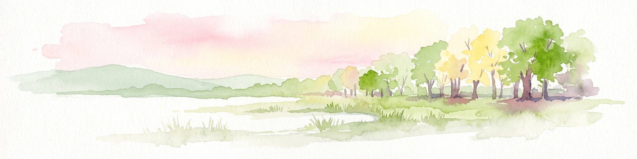
A soft watercolor illustration of a wetland landscape featuring trees, green grasses, a small pond, and distant rolling hills against a pale pink sky.
Nature reserveHesse
About 4.4 km away#3 closest

Southwest

Obersuhler Aue Protected Meadow Complex and Werra Valley Geographic Mapping

Expansive floodplain ecosystems and conservation corridors in Hesse

Obersuhler Aue comprises a vital lowland meadow system that spans the Werra valley floor. The area is characterized by its open, unfragmented grassland terrain, which serves as a landmark site for biodiversity within the Hessian Green Belt. From historic linden avenues to seasonally flooded reedbeds, the landscape provides essential habitat continuity across the regional basin.

Area
0.679 km²
Established
1990
IUCN
IV
Nature reserveWartburgkreis
About 5.8 km away#4 closest

Southwest

Werraaue bei Berka und Untersuhl: Protected Floodplain and Wetland Geography in Wartburgkreis

Mapped riverine habitat and regional conservation area

Located in the heart of the Berka basin, this nature reserve protects a diverse floodplain environment featuring rare inland saline habitats and intricate oxbow lake systems. Serving as a vital ecological stepping stone along the former inner-German border, it represents one of the most important meadow bird corridors within the Wartburgkreis district.

Area
2.558 km²
Established
1996
IUCN
IV
Relief
Lowland
A soft watercolor illustration of a calm pond surrounded by green vegetation and rolling hills in the background.
Nature reserveWartburgkreis
About 6.4 km away#5 closest

Southwest

Dankmarshäuser Rhäden: Protected Wetland Reserve and Mapped Floodplain in Wartburgkreis

Restored basin landscape along the historic Green Belt corridor.

Dankmarshäuser Rhäden comprises a complex wetland mosaic in the Wartburgkreis district. This nature reserve, characterized by shallow subsidence basins and active floodplain management, represents a critical migratory bird sanctuary and a key component of the protected Green Belt. The area reveals a history of land-use transition, from agricultural depression to a functional, water-managed ecosystem supporting diverse meadow-nesting and migratory bird populations.

Area
1.217 km²
Established
1995
IUCN
IV
A soft watercolor illustration depicting a flat green wetland landscape with a winding river and distant rolling hills under a pale sky.
Nature reserveHesse
About 6.7 km away#6 closest

Southwest

Rhäden bei Obersuhl und Bosserode: Nature Reserve and Wetland Mosaic in Northern Hesse

A restored floodplain landscape in the Werra valley

Rhäden bei Obersuhl und Bosserode represents a significant subsidence basin restored from agricultural land into a thriving wetland. This protected nature reserve in Hesse features a structured mosaic of ponds, reedbeds, and wet meadows, serving as a primary regional site for bird migration and habitat conservation within the Werra valley geography.

Area
1.204 km²
Established
1973
IUCN
IV
Relief
Lowland
A minimalist watercolor illustration depicting a soft, rolling landscape with gentle hills, a winding path, and sparse trees in light green, yellow, and muted tones.
Nature reserveHesse
About 7.2 km away#7 closest

North

Iberg bei Markershausen: Nature Reserve and Geological Landmark in Hesse, Germany

Calcareous forests and limestone cliff landscapes within the Ringgau plateau

Iberg bei Markershausen is a protected nature reserve in northern Hesse recognized for its complex Muschelkalk terrain. The reserve encompasses a 180-meter limestone cliff, rare relict yew populations, and a dense forest floor featuring spring geophytes and diverse orchid species. This site serves as a vital anchor for regional biodiversity, linking steep rockfall remnants with open dry grassland habitats.

Area
0.32 km²
Established
1988
IUCN
IV
Relief
Upland
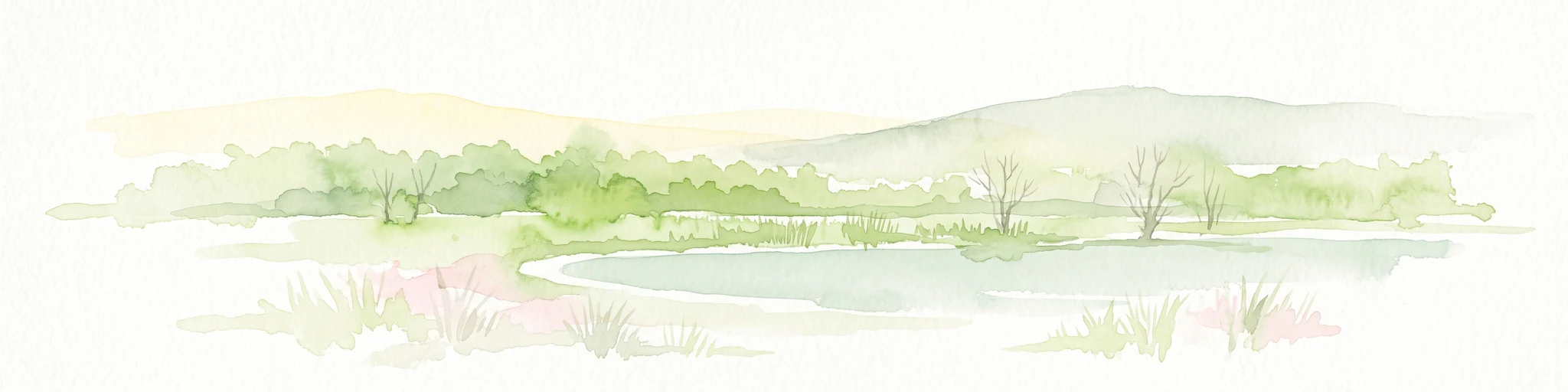
A soft watercolor illustration of a wetland scene with light blue water in the foreground, green trees in the midground, and soft pink hills in the background.
Nature reserveHessen
About 9.4 km away#8 closest

Southwest

Rohrlache von Heringen Protected Area and Werra Valley Wetland Geography

Nature reserve featuring rare saline meadows and alluvial terrain

Rohrlache von Heringen stands as the largest inland saline site in Hesse. This protected area preserves a rare ecosystem of salt-tolerant flora and vital breeding grounds for waterbirds, shaped by both natural Zechstein geology and long-term industrial influences along the Werra river floodplain.

Area
0.765 km²
Established
1979
IUCN
IV
Relief
Lowland

Common questions about visiting, size, designation, and location context for Alte Werra

Alte Werra FAQs for park facts, access, geography, and protected area context

Find quick answers about Alte Werra, including protected-area facts, park geography, trail and visitor context, and how the park fits into its surrounding country and regional landscape.
MoriAtlas Explorer

Continue Your Protected Areas Search Across the Global Atlas

Deepen your exploration by continuing the structured search for national parks and protected areas worldwide. Utilize the comprehensive filtering capabilities to compare different conservation landscapes and refine your understanding of global park geography. Discover more about the distribution and characteristics of protected natural areas.

Global natural geography