
Why Alter Stolberg stands out
Alter Stolberg is best known as a compact, heavily wooded karst plateau on the southern margin of the Harz, where Zechstein geology creates distinctive surface and underground features. Its dense forest cover, modest elevations, and traditional villages give it a quiet, enclosed character that contrasts with the more open Harz uplands to the north. The ridge is also notable for the combination of natural heritage and cultural landmarks within a small geographic footprint. The Heimkehle gypsum cave in the Reesberg area is a regionally important geological attraction, while the nearby Grasburg castle ruin links the landscape to medieval noble history, including traditions about the ancestral seat of the Counts of Stolberg.
Alter Stolberg history and protected-area timeline
The natural and landscape protection of the Alter Stolberg dates back to 1961, when the northern portion of the wooded ridge was designated as the Naturschutzgebiet Alter Stolberg. Large additional areas were later placed under the broader Landschaftsschutzgebiet Alter Stolberg, extending protection across much of the plateau.
Human history in the area is closely tied to the medieval landscape of the southern Harz margin. The Grasburg ruin near the Reesberg is traditionally associated with the ancestral history of the Counts of Stolberg, and although the site is now in ruins, it remains one of the most recognized historical landmarks within the protected area.
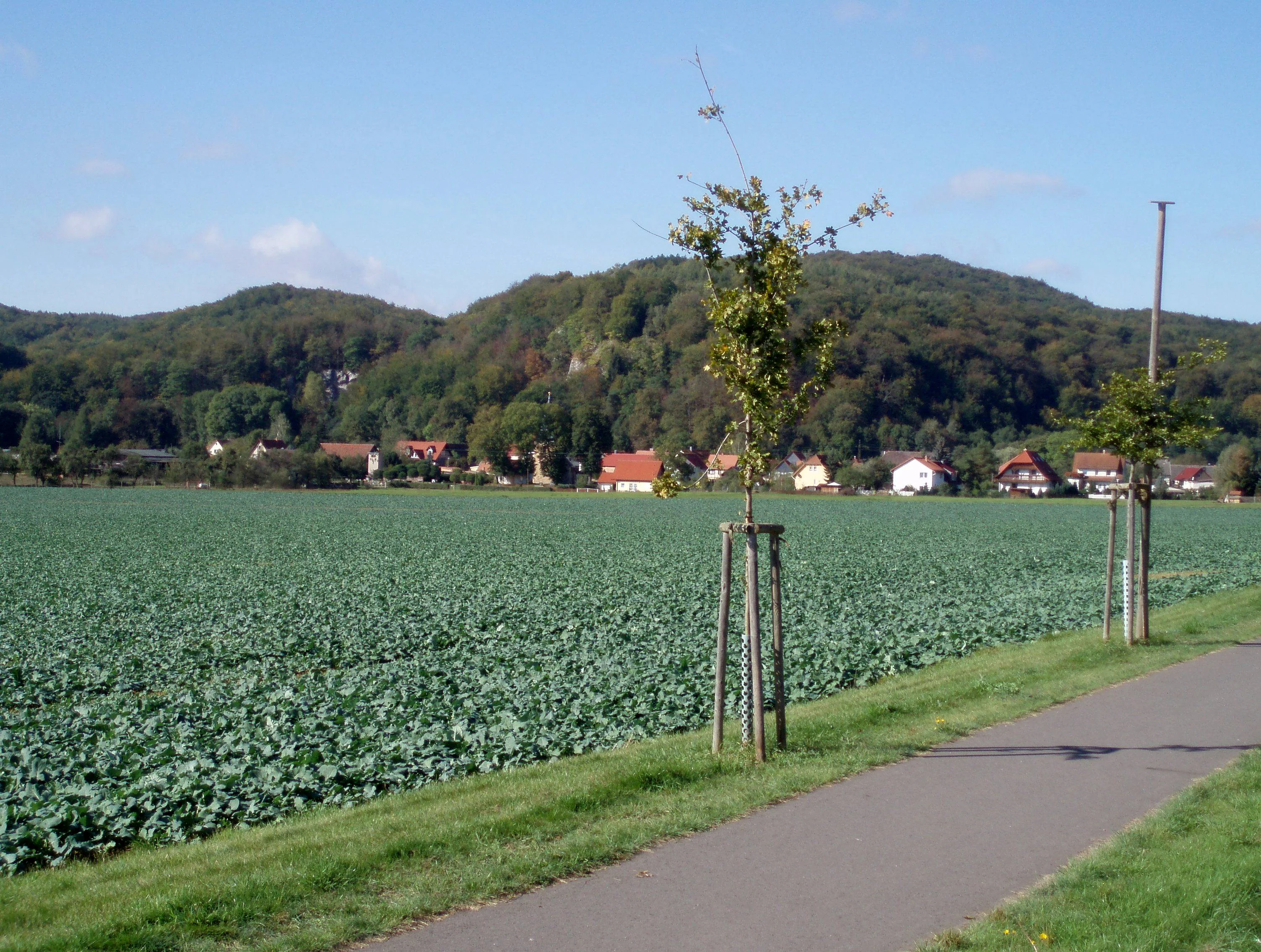
Beyond these formal designations, the Alter Stolberg has long functioned as a wooded, lightly settled landscape used for forestry and small-scale agriculture, with villages such as Stempeda, Herrmannsacker, and Rottleberode forming part of the regional cultural fabric. The state border between Thuringia and Saxony-Anhalt runs across the eastern part of the ridge, shaping the modern administrative and conservation geography of the area.
Alter Stolberg landscape and geographic character
The Alter Stolberg is a broad, gently elevated ridge rather than a sharply mountainous landscape. It rises to about 357.7 meters at the Königskopf in the north and to roughly 325 meters at the Reesberg in the southeast, descending from there toward the valleys of the Krebsbach and Thyra rivers on its eastern spurs in Saxony-Anhalt. To the south, the plateau drops toward the Helme valley and the broader lowland of the Goldene Aue, while the higher uplands of the Harz rise to the north.
The terrain is heavily wooded across most of its extent, with continuous forest cover broken only by small clearings, road corridors, and the margins around the surrounding villages. Zechstein geology shapes the surface: soluble gypsum and limestone layers produce karst features, small caves, and a generally rounded plateau topography. The Heimkehle gypsum cave in the Reesberg area is the most visible expression of this underground karst character.
Alter Stolberg ecosystems, habitats, and plant life
Ecologically, the Alter Stolberg is dominated by extensive forest cover on Zechstein-derived soils. The plateau's karst geology, combined with its position on the southern edge of the Harz, creates a transitional habitat mosaic between the higher Harz forests and the lower Thuringian lowlands to the south.
Woodland is the defining habitat across most of the protected area, with smaller openings, stream valleys, and meadow pockets adding structural variety. The overall ecological value lies in the continuity of forest cover, the karst-related microhabitats, and the position of the plateau as a forested link between two larger natural regions. The Thuringian portion alone accounts for roughly 622 hectares of protected natural area, with additional protected zones extending across the state border into Saxony-Anhalt.
Alter Stolberg conservation status and protection priorities
The Alter Stolberg has been part of Germany's protected-area system since 1961, when its northern portion was formally designated as the Naturschutzgebiet Alter Stolberg. Large parts of the wider ridge are protected through the Landschaftsschutzgebiet Alter Stolberg, and a small adjoining protected area continues the conservation corridor across the state line into Saxony-Anhalt in the Landkreis Mansfeld-Südharz.
The protected areas are classified under IUCN Category IV as habitat and species management areas. Their conservation value comes primarily from the continuity of forest cover across the karst plateau, the ecological transitions between the Harz and the southern lowlands, and the karst features such as the Heimkehle cave system, which support specialized underground habitats. The long-standing protection status also helps preserve the visual and ecological integrity of the landscape around the historic villages along the ridge's edges.
Alter Stolberg cultural meaning and human context
The cultural landscape around the Alter Stolberg reflects long-standing rural settlement on the southern Harz margin. Villages such as Stempeda, Herrmannsacher, Rodishain, Rottleberode, and Uftrungen lie around the ridge, and their traditional relationship with the surrounding forest and small valley meadows is part of the area's regional identity.
The most prominent cultural landmark is the Grasburg, a medieval castle ruin near the Reesberg. Although now in ruins, it is locally associated with the ancestral history of the Counts of Stolberg and gives the broader landscape a clear historical anchor. The Heimkehle gypsum cave, used historically for various purposes and now a regional attraction, links natural heritage with the area's broader cultural and geological story.
Top sights and standout views in Alter Stolberg
The Alter Stolberg combines forest, karst geology, and a long-running protected-area status within a compact and accessible landscape on the southern edge of the Harz. Its continuous woodland cover, the karst-influenced terrain of the South Harz Zechstein Belt, and the traditional villages at its feet give it a coherent regional identity.
Two specific landmarks stand out within the protected area: the Heimkehle gypsum cave in the Reesberg section, a regionally important underground feature shaped by Zechstein geology, and the Grasburg castle ruin, which links the landscape to the medieval history of the Counts of Stolberg. Together with the nature reserve status dating to 1961 and the broader landscape protection area, these elements define the plateau's distinctive character.
Best time to visit Alter Stolberg
The Alter Stolberg is a low, forested karst plateau, so its character shifts mainly with the seasons rather than with tourism peaks. Late spring and early summer bring fresh leaf cover and clearer views from the plateau edges toward the Harz to the north and the Goldene Aue to the south, while autumn turns the extensive beech and mixed forests into the area's most visually distinctive seasonal display. Winter can emphasize the karst plateaus and ridge profiles, though conditions on smaller forest paths may vary with weather and snow.
For visitors interested in the Heimkehle cave near the Reesberg, cave interiors maintain relatively stable conditions year-round, making the geological visit largely independent of the seasons. Forest walks, village edges at places like Stempeda or Rottleberode, and viewpoints along the state-border transition between Thuringia and Saxony-Anhalt are generally best in mild, dry weather when the woodland paths are most accessible.