Mori Atlas logo
Protected areaÁrea protegida municipal Bajo Paraguá

A critical transition zone between the Amazon basin and the Chaco in northern Santa Cruz.

Área protegida municipal Bajo Paraguá: Mapped Protected Landscapes and Regional Geography

(Área Protegida Municipal Bajo Paraguá)

Área protegida municipal Bajo Paraguá preserves a vast expanse of the Chiquitano dry forest within the northern lowlands of the Santa Cruz Department. This protected territory integrates biodiversity conservation with the territorial safeguard of resident Chiquitano and Guarasugwe communities. The landscape features a complex mosaic of deciduous forest cover, alluvial plains along the Paraguá river, and scattered Precambrian rock outcrops that define this unique transitional ecoregion.

Chiquitano dry forestlowland forestmunicipal protected areaindigenous communitiestransition ecoregionriver landscape

Área protegida municipal Bajo Paraguá

Protected area

Park overview

Structured park overview, official facts, and landscape profile for Área Protegida Municipal Bajo Paraguá

Área Protegida Municipal Bajo Paraguá park facts, protected area profile, and essential visitor context

Review the core facts for Área Protegida Municipal Bajo Paraguá, including designation, size, terrain, visitor scale, habitats, and operating context in one park-focused overview.

About Área Protegida Municipal Bajo Paraguá

Área Protegida Municipal Bajo Paraguá was established in 2021 by a municipal ordinance of San Ignacio de Velasco, located in the northern part of Santa Cruz department in Bolivia. Though the formal designation is very recent, the area has long been part of the historic Reserva Forestal Bajo Paraguá, a much larger national-level forest reserve created in 1988. The municipal protected area nests inside that older reserve, effectively reinforcing conservation governance on a sub-national level.

The territory's defining environmental context is the Chiquitano dry forest, an ecosystem that occupies a broad belt across central-eastern Bolivia. This forest type is structurally and floristically distinct from both the wet Amazon rainforest further north and the dry Chaco further south. Its dry-season deciduousness, combined with relatively high tree species diversity, makes it one of South America's most distinctive lowland forests.

Geographically, the area lies on predominantly flat to slightly undulating terrain, with elevations varying from around 155 meters to over 500 meters above sea level. Near the Paraguá river, the landscape opens into alluvial plains, while Precambrian rock outcrops create modest hill and serranía features elsewhere. The river Paraguá itself, with riverside communities such as Piso Firme, is part of the protected area's daily living landscape.

Alongside its natural values, the protected area serves a strong cultural function. Four indigenous communities live within its boundaries, including three Chiquitano communities and one Guarasugwe community. By recognizing these communities within the area's legal framework, Bajo Paraguá is positioned not simply as a forest reserve but as a territory where indigenous land tenure, cultural continuity, and conservation management are meant to coexist.

Quick facts and research context for Área Protegida Municipal Bajo Paraguá

Área Protegida Municipal Bajo Paraguá is a Bolivian municipal protected area created on February 12, 2021, under Municipal Law N.º 469/2021 of San Ignacio de Velasco. It is administered by the municipal government of San Ignacio de Velasco.

The territory lies entirely within the Reserva Forestal Bajo Paraguá, a much larger forest reserve dating from 1988, and within the Chiquitano dry forest ecoregion. It is home to four indigenous communities and covers a large expanse of flat to gently undulating lowland forest bordered by the Paraguá river system and adjacent to Noel Kempff Mercado National Park.

Protection and recognition

Documented terrestrial protection metrics and official designation records

Área protegida municipal Bajo Paraguá Protection Status and Conservation Scope

Terrestrial protection status records for Área protegida municipal Bajo Paraguá outline the formal conservation scope and designated boundaries. Structured governance facts provide verified administrative context for evaluating regional protected area management.

Protection details

Protection scope
Terrestrial
Park context

Deeper park guide and search-rich context for Área Protegida Municipal Bajo Paraguá

Área Protegida Municipal Bajo Paraguá history, landscape, wildlife, and travel context

Explore Área Protegida Municipal Bajo Paraguá through its history, landscape character, ecosystems, wildlife, conservation priorities, cultural context, and seasonal travel timing in a structured park guide built for atlas discovery and search intent.

Why Área Protegida Municipal Bajo Paraguá stands out

The protected area is best known for embedding a major slice of the Chiquitano dry forest inside a legally recognized municipal conservation framework. The Chiquitano ecoregion is internationally recognized as a biogeographic transition between the Amazon basin and the Chaco, and Bajo Paraguá sits at a critical point in that transition zone. It is also notable for combining strict biodiversity objectives with the formal recognition of resident indigenous communities, integrating cultural protection into the same legal instrument that protects the forest. The area's identity is thus as much about lowland indigenous territorial defense as it is about forest conservation.

Área Protegida Municipal Bajo Paraguá history and protected-area timeline

The institutional history of Bajo Paraguá begins in 1988, when the Reserva Forestal Bajo Paraguá was created by Supreme Decree N.º 22024. That much larger reserve was established in the provinces of Velasco and Ñuflo de Chaves and became the foundation upon which later environmental measures were built.

Beginning around 2005, the area experienced increased irregular settlements promoted through actions of the National Institute for Agrarian Reform (INRA). In response, in 2015 two inter-institutional meetings were organized in San Ignacio de Velasco under the title First and Second Inter-Institutional Encounter for the Protection and Conservation of the Reserva Forestal Bajo Paraguá. These meetings sought mechanisms to strengthen protection of the reserve and laid political groundwork for further conservation measures.

The decisive step came on February 12, 2021, when the municipal government of San Ignacio de Velasco enacted Municipal Law N.º 469/2021, creating the Área Protegida Municipal Bajo Paraguá. This new legal layer nested the area more firmly inside a modern municipal conservation framework and formalized the protection of both the forest and its resident indigenous communities. The creation date places Bajo Paraguá among the most recent municipal protected areas in Bolivia.

Área Protegida Municipal Bajo Paraguá landscape and geographic character

The landscape of Bajo Paraguá is overwhelmingly lowland: a vast, predominantly flat to slightly undulating terrain typical of central-north Santa Cruz. Elevations within the protected area range roughly from the mid-150s to above 500 meters above sea level, offering subtle but real topographic variation across a very large surface.

Near the Paraguá river, the terrain opens into alluvial plain, characterized by seasonal hydrological dynamics tied to the river's flow regime. Away from the river, occasional Precambrian rock outcrops produce small hills and low serranías, breaking up what would otherwise be an almost uniformly level canopy.

The vegetation that overlays this relief is the Chiquitano dry forest, a formation marked by a mix of deciduous and semi-deciduous trees adapted to a strong dry season. The result is a mosaic landscape where forest cover is dense but seasonally porous, allowing light penetration and understory growth during dry months.

Área Protegida Municipal Bajo Paraguá ecosystems, habitats, and plant life

Ecologically, the protected area is defined by the Chiquitano dry forest, an ecoregion that occupies a transitional zone between the Amazon basin to the north and the Chaco to the south. This transitional character gives the forest a hybrid composition: many canopy species are shared with Amazonian formations, while others have clear Chacoan or Cerrado-like affinities.

The forest supports a structured vertical profile with multiple tree layers, a notable dry-season deciduous component, and an understory adapted to seasonal water stress. The combination of high tree diversity, marked seasonality, and relatively intact forest cover makes the area ecologically significant at a regional scale.

Because the protected area is large and relatively well connected to other forest blocks, including the Noel Kempff Mercado National Park to the east, it contributes to broader landscape-level ecological processes such as dispersal, seasonal migration, and resistance to edge effects. This connectivity is one of the area's most important non-visible ecological values.

Área Protegida Municipal Bajo Paraguá wildlife and species highlights

The Chiquitano dry forest hosts a community of mammals, birds, reptiles, and insects typical of the transition between Amazonian and Chacoan biotas. Forest-interior species, including medium and large mammals as well as a wide range of birds, find continuous habitat across the protected area and adjacent reserves.

The proximity and ecological continuity with Noel Kempff Mercado National Park reinforce the area's importance for wide-ranging species, including large mammals that depend on extensive, undisturbed forest blocks. The riverine corridors around the Paraguá river add wetter habitat conditions that contrast with the dryer upland forest, supporting a diverse fish and aquatic fauna.

The exact species inventory of the protected area is not fully documented in available sources, and deliberate faunal inventories would be needed to confirm specific community composition. Nevertheless, the area's habitat configuration supports the broader lowland fauna characteristic of well-preserved Chiquitano landscapes.

Área Protegida Municipal Bajo Paraguá conservation status and protection priorities

From a conservation standpoint, Bajo Paraguá matters because it overlays a large, relatively intact block of Chiquitano dry forest with strong connectivity to Noel Kempff Mercado National Park. By creating a municipal protected area within an existing national forest reserve, the legal framework defends the same forest through multiple, stacked governance instruments.

The area is also significant because it formalizes coexistence between conservation and indigenous habitation. The presence of four recognized indigenous communities within the protected area means that conservation policy is, at least in principle, integrated with cultural and territorial rights rather than purely exclusionary.

The conservation challenge is acute. Monitoring through Global Forest Watch between March 2020 and June 2021 detected very large numbers of deforestation alerts across the broader Bajo Paraguá landscape, and the FCBC (Foundation for the Conservation of the Chiquitano Forest) reported clearings inside the protected zone. Illegal settlements and fires compound the pressure, making enforcement and territorial governance the central conservation priority going forward.

Área Protegida Municipal Bajo Paraguá cultural meaning and human context

The territory has long-standing indigenous presence, embodied by the four indigenous communities that live within the protected area. Three of these communities belong to the Chiquitano people, whose linguistic and cultural heritage is closely tied to the forest landscape that gives its name to the ecoregion. The remaining community belongs to the Guarasugwe, traditionally also identified as a Guaraní-family people of the lowlands.

For these communities, the forest is not merely a backdrop but the material substrate of subsistence, identity, and social reproduction. The 2021 municipal law explicitly recognizes this dimension by safeguarding both biological and cultural diversity, framing conservation as inseparable from indigenous territorial protection.

Riverside settlements such as Piso Firme, situated along the Paraguá river, illustrate the everyday integration of community life with forest and river ecology. A cultural reading of the protected area therefore must include these inhabited places as central rather than peripheral.

Top sights and standout views in Área Protegida Municipal Bajo Paraguá

The protected area's standout features are its sheer size within the Chiquitano dry forest, its position adjacent to Noel Kempff Mercado National Park, and its combined biodiversity and cultural mandate. Few other recent municipal protected areas in Bolivia integrate indigenous territorial recognition so directly into the conservation instrument itself.

Its location along the Paraguá river and within a much larger historic forest reserve gives it weight beyond its municipal status, contributing to a regional network of protected lowland forest landscapes. The legal layering of the 1988 Reserva Forestal Bajo Paraguá and the 2021 municipal protected area forms a notable case of stacked conservation governance.

Best time to visit Área Protegida Municipal Bajo Paraguá

The Chiquitano dry forest region is strongly seasonal, with a pronounced dry season and a wet season that shapes both access and scenery. During the dry months, the forest canopy thins and many trees shed their leaves, opening up views, concentrating wildlife around water sources, and generally making overland movement easier. The wet months bring full canopy cover, greener landscapes, and more challenging accessibility on unpaved roads.

For visitors interested in seeing the forest at its most characteristic, the transition between wet and dry seasons offers a particularly vivid sense of the ecosystem's seasonality. Cooler dry-season mornings typical of lowland Santa Cruz also favor early wildlife observation along rivers and forest edges. Operational details about specific months are best confirmed locally, but the broad seasonal contrast defines the experience of the area more than any single date.
Monthly climate preview

Long term temperature ranges and monthly precipitation distributions for the protected area

Área protegida municipal Bajo Paraguá Annual Climate Normals and Weather Patterns

Representative coordinate records show recorded mean temperatures ranging from 24.05 degrees Celsius to 28.67 degrees Celsius alongside distinct monthly precipitation variations across the year. Reviewing the complete twelve month dataset provides deeper analytical context on long term thermal and moisture cycles.
Annual mean26 °C
24 °C29 °C
Jan26°
Feb25°
Mar25°
Apr25°
May24°
Jun24°
Jul25°
Aug27°
Sep29°
Oct29°
Nov27°
Dec26°
Warmest month
October

28.7 °C

Coolest month
June

24.1 °C

Wettest month
February

7.9 mm/day

Driest month
July

0.5 mm/day

Park location guide

Geography guide, regional context, and park location map for Área Protegida Municipal Bajo Paraguá

Área Protegida Municipal Bajo Paraguá park geography, regions, and map view in Bolivia

Understand where Área Protegida Municipal Bajo Paraguá sits in Bolivia through a broader geographic reading of the surrounding landscape, nearby location context, and its mapped position within the national park landscape.

How Área Protegida Municipal Bajo Paraguá fits into Bolivia

Bolivia, officially the Plurinational State of Bolivia, is a landlocked country in central South America. It features diverse geography including the Andean mountain range, Amazonian plains, Gran Chaco, and the Pantanal wetland. The country has a population of approximately 11.4 million and is administratively divided into nine departments, with La Paz as the seat of government and Sucre as the constitutional capital.

Wider geography shaping Área Protegida Municipal Bajo Paraguá in Bolivia

Bolivia is located in central South America, bordered by Brazil to the north and east, Paraguay to the southeast, Argentina to the south, Chile to the southwest, and Peru to the west. The country is divided between a western Andean region and tropical lowlands to the east and north. It includes the Amazonian plain, Gran Chaco, temperate valleys, the high-altitude Altiplano plateau, and part of the Pantanal wetland along its eastern border.

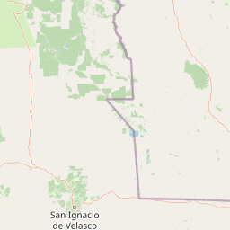
Map view of Área Protegida Municipal Bajo Paraguá

Use this park location map to pinpoint Área Protegida Municipal Bajo Paraguá in Bolivia, understand its exact geographic position, and read its mapped placement within the surrounding landscape more clearly.

Pigeon | © OpenStreetMap contributors

Location context for Área Protegida Municipal Bajo Paraguá

Santa Cruz Department
Park atlas

Compare adjacent lowland reserves and connected forest conservation areas in northern Santa Cruz.

Other Parks Near Área protegida municipal Bajo Paraguá and Regional Protected Landscapes

Browsing other parks near Área protegida municipal Bajo Paraguá reveals adjacent lowland reserves and connected forest landscapes in northern Santa Cruz. Comparative geographic analysis helps trace regional ecosystem continuity across the wider Chiquitano dry forest transition zone.
National parkSanta Cruz Department
About 39 km away#1 closest

East

Noel Kempff Mercado National Park: Detailed Protected Landscape Map and Geography

Explore national park boundaries and regional landscape context in Santa Cruz.

Noel Kempff Mercado National Park is a crucial protected area offering deep insights into Bolivia's natural geography. This entry provides specific details on its mapped landscape and geographic position within the Santa Cruz Department, enabling users to explore its protected boundaries and understand its regional context for atlas-based discovery. Dive into the mapped terrain and natural features that define this significant national park.

Area
15,523 km²
Established
1979
IUCN
II
Relief
Mixed relief
Wildlife reserveSanta Cruz
About 93 km away#2 closest

West

Reserva de Vida Silvestre Ríos Blanco y Negro: Protected Area Geography and Landscape Map

Transitional lowland forests and river floodplains in Santa Cruz

The Reserva de Vida Silvestre Ríos Blanco y Negro protects a massive stretch of lowland forest in northeastern Bolivia. This area is characterized by its transitional ecology where dry forests meet the Amazon, shaped by the dynamic flooding of the San Pablo and Blanco rivers. Access this detailed geographic overview to understand the conservation significance and territorial extent of this critical wetland and forest environment.

Area
14,000 km²
Established
1990
Relief
Lowland
Climate
Tropical
Watercolor painting of a tranquil landscape featuring a calm water body in the foreground, lines of trees, and soft hills in the background under a pale sky.
Nature reserveBeni
About 141 km away#3 closest

Northwest

Reserva científica, ecológica y arqueológica Kenneth Lee: Beni Nature Reserve Atlas

Amazonian forest and wetland archaeological landscape

This protected area in the Beni department of Bolivia encompasses a sophisticated interplay of tropical forests and expansive seasonally inundated grasslands. Known for its wild cacao populations and traces of hydraulic cultures, the reserve serves as a critical reference for integrated natural and cultural conservation within the Amazonian basin.

Area
4,393 km²
Established
1996
Relief
Lowland
Climate
Tropical
Protected landscapeSanta Cruz
About 312 km away#4 closest

Southwest

Área Natural de Manejo Integrado Humedales del Norte Protected Landscape and Wetland Atlas

Mapping the floodplain ecosystems of northern Santa Cruz, Bolivia.

An extensive protected area in northern Santa Cruz that sustains vital Amazonian river systems and seasonal wetland mosaics. This landscape supports complex hydrological functions, including the regulation of climate and regional water cycles, through its vast network of periodically flooded forest tracts and permanent waterways.

Area
4,900.51 km²
Established
2012
Relief
Lowland
Scope
Terrestrial
A soft, horizontal watercolor painting depicting a calm wetland landscape with distant rolling hills, green vegetation, and small islands in the water.
Protected landscapeSanta Cruz
About 329 km away#5 closest

Southeast

Área Natural de Manejo Integrado San Matías: Mapping Bolivia’s Largest Protected Wetland

Ecological transitions across the Santa Cruz eastern lowlands

Área Natural de Manejo Integrado San Matías serves as a critical bridge between the Chiquitano forest, the Cerrado, and the Bolivian Pantanal. The landscape showcases a dramatic seasonal flood cycle that defines the regional hydrology and supports high biodiversity within its crystalline rock hills and sprawling lowland basins.

Area
29,185 km²
Established
1997
Relief
Mixed relief
Climate
Tropical
Protected landscapeBeni
About 341 km away#6 closest

West

Parque Municipal y Área Natural de Manejo Integrado Gran Mojos: Regional Geography

Protected floodplain ecosystems in the Beni department of Bolivia.

Analyze the spatial distribution of this large protected area located in the Mamoré River basin. Learn about its dual-designation structure, bridging core municipal forests with integrated management zones that preserve vital lowland Amazonian habitats and endemic biodiversity within the Llanos de Moxos ecoregion.

Area
5,804.3 km²
Established
2017
Relief
Lowland
Scope
Terrestrial
A watercolor painting showing a soft, atmospheric landscape with a winding river, green banks, trees, and distant low hills against a white background.
Protected areaBeni Department
About 351 km away#7 closest

West

Área Protegida Municipal Ibare-Mamoré: Geography and Protected Area Context

Riverine landscapes and wetlands in Bolivia's Beni Department

The Área Protegida Municipal Ibare-Mamoré encompasses a diverse range of ecosystems, from upland forests to open grasslands and shifting river channels. As a key conservation unit near the city of Trinidad, this area highlights the ecological importance of the Llanos de Moxos region through its interconnected aquatic and terrestrial habitats.

Area
256.08 km²
Established
2011
Relief
Lowland
Climate
Tropical
A soft watercolor painting showing a winding river through a valley with trees and palms on the banks and rolling hills in the background.
Nature reserveSanta Cruz
About 393 km away#8 closest

Southwest

Parque de Protección Ecológica del Río Piraí: Protected Geography and Riverine Landscapes

Nature reserve and flood-control corridor in Santa Cruz, Bolivia

This nature reserve encompasses a narrow, sediment-rich corridor following the Río Piraí. It protects representative lowland habitats including Chiquitano dry forest and gallery woodlands, while balancing vital flood-mitigation roles against the pressures of urban expansion. Explore the map of this unique alluvial landscape to understand its ecological significance and role in the regional geography of Santa Cruz.

Area
15.868 km²
Established
1991
Relief
Lowland
Climate
Tropical

Common questions about visiting, size, designation, and location context for Área Protegida Municipal Bajo Paraguá

Área Protegida Municipal Bajo Paraguá FAQs for park facts, access, geography, and protected area context

Find quick answers about Área Protegida Municipal Bajo Paraguá, including protected-area facts, park geography, trail and visitor context, and how the park fits into its surrounding country and regional landscape.
MoriAtlas Explorer

Continue Your Protected Areas Search Across the Global Atlas

Deepen your exploration by continuing the structured search for national parks and protected areas worldwide. Utilize the comprehensive filtering capabilities to compare different conservation landscapes and refine your understanding of global park geography. Discover more about the distribution and characteristics of protected natural areas.

Global natural geography