
Mori Atlas logo
Marine protected areaAur Island

A remote island system defined by rugged interior terrain, calm lagoons, and protected offshore coral structures.

Aur Island Marine Protected Area and Johor Coastal Geographic Landscape Atlas

Aur Island represents a key component of the Johor Marine Park, situated well off the peninsula in the South China Sea. This protected area features compact, hilly topography, tropical evergreen vegetation, and extensive submerged reef structures that provide essential marine habitats. By tracing its boundaries and regional setting, observers gain insight into how this isolated island environment maintains its ecological character within the broader Johor coastal geography.

tropical islandmarine parkdiving destinationcoral reefspelagic marine lifeSouth China Sea
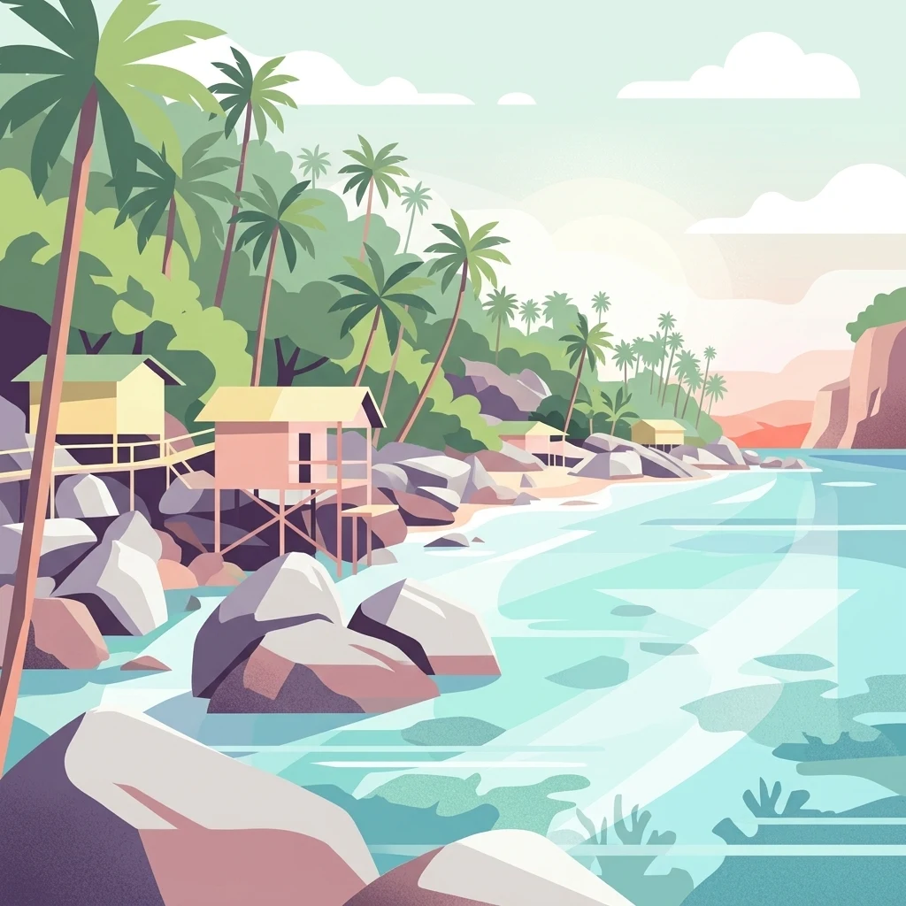
A digital illustration of a tropical coastline with palm trees, small stilted bungalows on rocks, and clear shallow water.

Aur Island

Marine protected area

Park overview

Structured park overview, official facts, and landscape profile for Aur Island

Aur Island park facts, protected area profile, and essential visitor context

Review the core facts for Aur Island, including designation, size, terrain, visitor scale, habitats, and operating context in one park-focused overview.

About Aur Island

Aur Island is a small, remote island in the South China Sea, belonging to Mersing District in the Malaysian state of Johor. It lies about 76 kilometres east of Mersing Town and forms the core of the Aur Islands archipelago, which sits within the larger Johor Marine Park. Its relative distance from the peninsula gives it a notably remote character compared with the closer resort islands further north along the Mersing coastline.

The island's identity is strongly tied to the sea around it. Aur is primarily recognised for clear offshore water, well-developed coral formations, and a concentration of pelagic marine life that has made it one of Johor's marquee diving destinations. Divers typically access the island via chartered boats from Mersing or from Singapore, and many dive operations are based on Aur together with its immediate neighbour, Dayang Island, separated by a narrow channel of only a few hundred metres at its tightest point.

In addition to its diving reputation, Aur Island functions as a beach and recreation destination within the Johor Marine Park. White-sand beaches, protected lagoons, and calm inshore waters make it accessible to non-divers as well, while the island's small local population continues traditional fishing activity and welcomes visitors seeking a quieter island atmosphere. The combination of marine biodiversity, recreational diving, and simple island scenery has positioned Aur as a defining element of the Johor Marine Park experience, distinct from the closer, more developed resort islands of Mersing.

The island's character shifts considerably with the monsoons. Because it faces the open South China Sea on one side and the more sheltered strait approaches on the other, Aur is exposed to both the northeast monsoon from November to March and the southwest monsoon influence later in the year. These seasonal shifts shape when diving, boating, and beach activities are most rewarding, and they reinforce the island's identity as a sea-dependent place whose rhythms are closely tied to wind and tide.

Quick facts and research context for Aur Island

Aur Island lies in the South China Sea, off the east coast of Johor, Malaysia, and falls administratively under Mersing District. It is the principal island of the Aur Islands group and sits roughly 76 kilometres east of Mersing Town, making it one of the most geographically remote inhabited islands in the Peninsular Malaysia archipelago.

The island forms part of the Johor Marine Park and is closely associated with the smaller Dayang Island, which lies just a few hundred metres away across a narrow channel. Its main draws are clear offshore water, developed coral reefs, and reliable encounters with pelagic marine life, while on land it remains small, lightly populated, and supported by basic island facilities rather than large-scale tourism infrastructure.

Protection and recognition

Examine official management designations and international recognition records for Aur Island.

Aur Island Protection Status and Documented Conservation Scope

Aur Island maintains a mixed protection scope governed by structured conservation frameworks and administrative guidelines. Official records assemble documented management parameters, designation history, and international recognition details.

Protection details

Protection scope
Mixed
Transboundary protection
No
Park context

Deeper park guide and search-rich context for Aur Island

Aur Island history, landscape, wildlife, and travel context

Explore Aur Island through its history, landscape character, ecosystems, wildlife, conservation priorities, cultural context, and seasonal travel timing in a structured park guide built for atlas discovery and search intent.

Why Aur Island stands out

Aur Island is best known as a diving and snorkelling destination within the Johor Marine Park, where clear offshore water and well-developed coral structures create strong conditions for pelagic encounters. Its dive sites are recognised for sightings of manta rays, sharks, barracudas, large trevally schools, and sizeable reef fish such as bumphead parrotfish and Napoleon wrasse. The island's broader appeal rests on its combination of remote location, clean white-sand beaches, and calm lagoons that make it attractive both to divers and to casual day visitors. Within the Johor Marine Park system, Aur Island has become one of the signature island experiences, often paired with neighbouring Dayang Island for a fuller island-hopping visit.
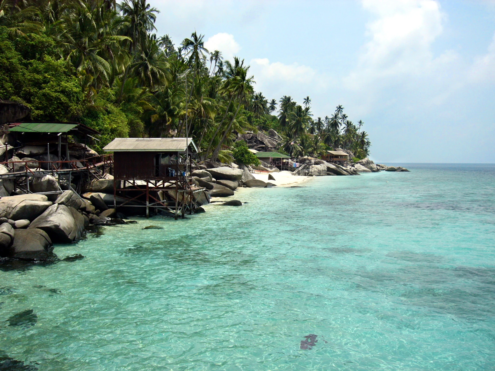
Tropical coastline on Aur Island featuring clear turquoise water, a sandy beach, large boulders, and wooden stilt huts nestled under palm trees.
A scenic view of a coastal beach with wooden stilt structures on Aur Island, Malaysia.

Aur Island history and protected-area timeline

Aur Island's most distinctive historical reference is indirect rather than based on land-based settlement. In 1804, during the Napoleonic Wars, the waters near the island played host to the Battle of Pulo Aura, a naval engagement between British and French forces. The event gives the island an enduring place in regional maritime history, even though it was a transient military episode rather than a development of the island itself.

Beyond that historical footnote, the island's longer-running human story is one of small-scale maritime activity. Aur has long functioned as a stopover point and base of operations for fishermen working the South China Sea off Johor's east coast. Its current small resident population reflects this fishing-based heritage, with traditional livelihoods continuing alongside the more recent growth of marine tourism and diving operations linked to Mersing and Singapore.

Aur Island landscape and geographic character

Aur Island has the compact, rugged profile typical of small South China Sea islands lying well off the Johor coast. Although small, it rises sufficiently from the sea to create hilly interior terrain, with elevated areas that experience measurably cooler temperatures than the coastal lowlands. The interior retains tropical evergreen vegetation, while the shoreline is defined by white-sand beaches, small coves, and protected inshore waters.

The offshore setting defines much of the island's physical character. Coral formations, lagoons, and submerged reef structures surround Aur and its near neighbour Dayang Island, shaping the coastline's appearance and protecting the beaches from full open-sea exposure. The narrow channel between Aur and Dayang, only about 400 metres wide at its narrowest, gives the two islands a paired physical relationship, and many visitors experience the landscape as a two-island system within the Johor Marine Park.

Aur Island ecosystems, habitats, and plant life

Aur Island's natural environment is dominated by its marine and coastal ecosystems rather than extensive terrestrial habitats. The surrounding waters contain well-developed coral communities that form the foundation of the island's biodiversity, supporting populations of reef fish, larger pelagic species, and visiting marine megafauna such as manta rays and sharks. The island's distance from the mainland contributes to clearer inshore water and healthier reef structures compared with many closer shoreline areas.

On land, the island supports tropical vegetation, with evergreen forest cover across its hilly interior. The combination of forest, beach, fringing reef, and offshore marine habitat gives Aur a layered ecological character, where sea-facing ecosystems are the main focus but terrestrial vegetation frames the island's inland landscape. The waters around Aur also serve as a recognised spawning area for giant cockles, adding a shellfish-reef dimension to the local marine ecosystem.

Aur Island wildlife and species highlights

The wildlife profile of Aur Island is overwhelmingly marine. Divers and snorkellers regularly encounter manta rays, barracudas, and whitetip sharks in the waters around the island, alongside schools of jacks, trevally, and yellowback fusiliers cruising the offshore drop-offs. Reef fish diversity is high, with angelfish, titan triggerfish, and large bumphead parrotfish commonly sighted, and Napoleon wrasse also recorded among the signature species.

Turtles are part of the regular marine fauna observed during dives, contributing to the island's reputation for big-animal encounters in relatively accessible conditions. While terrestrial wildlife is less prominently documented in available sources, the surrounding waters clearly support a rich and ecologically significant marine community that has made Aur one of the recognisable diving destinations along the Johor coast.

Aur Island conservation status and protection priorities

Aur Island's principal conservation significance lies in its position within the Johor Marine Park, a protected marine framework that recognises the ecological value of the islands, reefs, and surrounding waters off Johor's east coast. The marine park designation gives formal recognition to the importance of the coral reef systems, pelagic habitat, and spawning areas such as the documented giant cockle grounds around Aur.

By being the most offshore island in the Mersing group, Aur benefits from clearer water and more intact reef communities than many closer coastal sites. Its recognised role for pelagic species sightings, reef biodiversity, and shellfish spawning gives the island a meaningful conservation profile within Peninsular Malaysia's marine protected-area system, even where detailed management data is not broadly documented.

Aur Island cultural meaning and human context

Aur Island's cultural context is rooted in the maritime traditions of the east coast of Johor. The island's small population is predominantly Malay, with Malaysian Malay and the local Johor-Riau Malay dialect as the main languages, reflecting the broader linguistic and cultural character of the Mersing coastal region. The island's longstanding role as a stopover and base for fishermen has shaped this coastal, sea-oriented community identity.

In the wider Malaysian tourism context, Aur has come to symbolise one of the more laid-back island experiences within the Johor Marine Park, popular with domestic visitors and with diving communities from Singapore seeking accessible offshore islands. The blend of traditional fishing life and newer marine tourism activity gives the island a transitional cultural character, where long-standing maritime livelihoods coexist with a growing visitor economy.

Top sights and standout views in Aur Island

Aur Island's standout qualities include its position as one of the most offshore and remote inhabited islands within the Johor Marine Park, and its strong reputation for clear-water diving with frequent pelagic encounters. The pairing of Aur with neighbouring Dayang Island, separated by only a short narrow channel, allows visitors to experience two distinct island environments within a single trip.

The combination of white-sand beaches, sheltered lagoons, tropical island scenery, and reliable offshore marine life makes Aur a versatile destination for divers, snorkellers, and general island visitors. Its place within the Johor Marine Park also gives it a protected status that reinforces its appeal as one of Johor's signature natural island experiences.

Best time to visit Aur Island

Aur Island's visit character is strongly shaped by the seasonal monsoons that sweep across the South China Sea. The northeast monsoon from November to March brings heavy rainfall, strong winds, and rough seas that restrict diving, boating, and general sea-based activities. During this period the island's rhythm shifts towards boat maintenance, fishing preparation, and calmer onshore pursuits like kite flying.

The southwest monsoon influence from May to September affects the more sheltered side of the island, while the inter-monsoon periods frequently bring additional heavy rainfall. For diving, snorkelling, and beach visits, the calmer windows between the strongest monsoon phases tend to offer the best water clarity and sea conditions, while the island's inland hills can provide cooler temperatures than the coast at any time of year.
Monthly climate preview

Long-term representative measurements of monthly temperature and rainfall patterns for Johor

Aur Island Climate Normals, Annual Temperature and Precipitation Rhythm

Representative coordinate records show average monthly temperatures remaining steady alongside shifting daily precipitation volumes throughout the year. Examining the full twelve-month profile provides complete historical averages for temperature and rainfall distribution.
Annual mean28 °C
27 °C29 °C
Jan27°
Feb27°
Mar27°
Apr28°
May29°
Jun29°
Jul28°
Aug28°
Sep28°
Oct28°
Nov28°
Dec27°
Warmest month
May

28.7 °C

Coolest month
January

26.6 °C

Wettest month
December

13.2 mm/day

Driest month
February

3.8 mm/day

Park location guide

Geography guide, regional context, and park location map for Aur Island

Aur Island park geography, regions, and map view in Malaysia

Understand where Aur Island sits in Malaysia through a broader geographic reading of the surrounding landscape, nearby location context, and its mapped position within the national park landscape.

How Aur Island fits into Malaysia

Malaysia is a federal constitutional monarchy located in Southeast Asia. The country consists of 13 states and three federal territories, divided by the South China Sea into Peninsular Malaysia on the Indochinese Peninsula and East Malaysia on the island of Borneo. With a population of over 34 million, it achieved independence from Britain in 1957 and became a modern federation in 1963. The country is recognized for its multicultural population, tropical climate, and significant economic role in the region.

Wider geography shaping Aur Island in Malaysia

Malaysia occupies a strategic position in Southeast Asia, split by the South China Sea into two distinct regions. Peninsular Malaysia lies on the Indochinese Peninsula, sharing a land border with Thailand to the north and maritime borders with Singapore, Vietnam, and Indonesia. East Malaysia occupies the northern portion of Borneo, sharing land borders with Brunei and Indonesia, and maritime borders with the Philippines and Vietnam. The country's terrain includes coastal plains, mountain ranges such as the Titiwangsa in the peninsula, and extensive tropical rainforests.

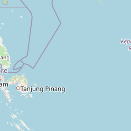
Map view of Aur Island

Use this park location map to pinpoint Aur Island in Malaysia, understand its exact geographic position, and read its mapped placement within the surrounding landscape more clearly.

Pigeon | © OpenStreetMap contributors

Location context for Aur Island

Johor

Explore visual records of rugged terrain, white sand beaches, and coral habitats.

Aur Island Photos and Landscape Scenery: Visualising Remote Marine Park Environments

Visual documentation captures the remote terrain, coastal lagoons, and marine habitats defining the protected landscape around Aur Island. Studying these images provides clearer insight into the physical geography and underwater environments supporting regional biodiversity.

Tropical coastline on Aur Island featuring clear turquoise water, a sandy beach, large boulders, and wooden stilt huts nestled under palm trees.

Park atlas

Compare adjacent marine parks and regional island environments across the South China Sea

Explore Other Parks Near Aur Island and Surrounding Protected Marine Areas

Browse protected areas and marine reserves situated near Aur Island to examine broader regional park geography. Continuing into adjacent coastal sanctuaries provides valuable context on surrounding coral ecosystems and offshore island habitats.
Protected areaJohor
About 26 km away#1 closest

Northwest

Pemanggil Island Protected Landscape: Johor Offshore Geography and Island Topography

Mapping coastal features and inland terrain in the South China Sea.

Pemanggil Island serves as a significant geographic landmark within the Mersing cluster of Johor. This detailed atlas entry focuses on the island's structural composition, including its prominent central hill, the rocky interior, and coastal features such as Teluk Lancang. Understand the maritime geography and spatial character of this protected area within the context of the southern Malay Peninsula.

Area
8.82 km²
Relief
Upland
Climate
Tropical
Access
Moderate access
Protected areaJohor
About 48 km away#2 closest

West

Tinggi Island Protected Area: Geography, Rainforest Terrain, and Johor Coastal Map

Mountainous forest meets extensive coral-rich coastal waters.

Located southeast of Mersing, Tinggi Island is defined by its dramatic silhouette and dense rainforest interior. The protected landscape stretches from the elevated peak of Mount Semundu down to a shoreline of white sand and coastal caves, creating a distinct marine and terrestrial environment unique to the Johor region.

Water
Major water bodies
Season
Year-round
A minimalist watercolor illustration depicting abstract green rolling hills and distant pink-toned ridges against a white background.
Wildlife reservePahang
About 55 km away#3 closest

Northwest

Pulau Tioman Wildlife Reserve: Mapping Island Rainforests and Marine Boundaries

Protected island geography within the Pahang region

Covering the forested interior of Tioman Island, this wildlife reserve protects lowland and hill rainforest habitats that rise to Gunung Kajang. The area serves as a significant conservation landscape, bridging remote inland mountain terrain with vibrant coral-fringed coastlines in the South China Sea.

Area
136 km²
Established
1972
Relief
Mountain
Climate
Tropical
Marine protected areaJohor
About 56 km away#4 closest

Southwest

Sibu Island: Marine Protected Area and Coastal Landscape Analysis

Mapping the coral reefs and pyroclastic terrain of the Johor coast

Sibu Island is a protected marine area in the South China Sea, distinguished by its unique pyroclastic geology and surrounding coral reef ecosystems. This entry provides a structured look at the island's coastal geography, vegetation, and maritime boundaries off the coast of Mersing, Johor. Access detailed geographic context for this tropical landscape.

Area
4.05 km²
Established
1993
Relief
Lowland
Climate
Tropical
A minimalist watercolor illustration depicting a tropical island coastline with sand beaches, green trees, and rolling hills in the background.
Marine protected areaJohor
About 60 km away#5 closest

West

Besar Island Marine Protected Area: Coastal Geography and Protected Waters in Johor

Mapping the island's reef ecosystems and tropical landscape

Besar Island offers a distinct look at a small-scale marine protected area off the Johor coast. Its geography encompasses a transition from sandy beach fronts to a hilly, jungle-clad interior, all contained within a gazetted two-nautical-mile conservation zone. The surrounding waters support approximately 60 marine species, making this an essential case study for understanding protected marine habitats within the Babi Islands archipelago.

Area
4.77 km²
Relief
Upland
Climate
Tropical
Access
Easy access
A watercolor painting showing layers of soft green and pink rolling hills, with a line of trees in the midground and an open, flat foreground.
Protected areaJohor
About 61 km away#6 closest

West

Rawa Island Protected Area: Coastal Geography and Island Landscape Context in Johor

A protected coral island within the Johor archipelago

Rawa Island serves as a significant protected landscape off the coast of Johor, Malaysia. Defined by its sharp contrast between rocky cliffs and clear, coral-filled waters, the island represents a crucial node in regional island geography. Delve into the spatial characteristics and environmental features of this South China Sea destination through our map-driven atlas framework.

Area
0.23 km²
Water
Water-dominated
National parkJohor
About 121 km away#7 closest

West

Endau-Rompin National Park: Ancient Tropical Rainforest Protected Landscape in Johor, Malaysia

Explore unique mapped geography and ancient geological features.

Endau-Rompin National Park in Johor, Malaysia, is a testament to Earth's ancient history, housing tropical rainforests built upon geological formations around 248 million years old. This protected area offers a detailed look at rugged mountainous terrain, vital river systems, and a diverse mapped landscape, crucial for understanding regional geography and conservation. Its status as one of the oldest rainforest complexes makes it a significant site for exploring the planet's prehistoric natural heritage and protected land distribution.

Area
870 km²
Established
1993
IUCN
II
Relief
Mountain
Nature reserveJohor
About 164 km away#8 closest

Southwest

Pulai River Nature Reserve: Johor Coastal Mangrove and Estuarine Geography

Protected Ramsar wetland and coastal landscape in southern Malaysia.

Spanning from the highlands of Mount Pulai to the Tebrau Straits, Pulai River Nature Reserve acts as a major ecological interface in Johor. This site encompasses dense mangrove forest reserves and the country's single largest seagrass bed, serving as a primary study area for regional coastal conservation and wetland management.

Established
2003
Relief
Lowland
Scope
Mixed
Water
Water-dominated

Common questions about visiting, size, designation, and location context for Aur Island

Aur Island FAQs for park facts, access, geography, and protected area context

Find quick answers about Aur Island, including protected-area facts, park geography, trail and visitor context, and how the park fits into its surrounding country and regional landscape.
MoriAtlas Explorer

Continue Your Protected Areas Search Across the Global Atlas

Deepen your exploration by continuing the structured search for national parks and protected areas worldwide. Utilize the comprehensive filtering capabilities to compare different conservation landscapes and refine your understanding of global park geography. Discover more about the distribution and characteristics of protected natural areas.

Global natural geography