

Mori Atlas logo
Wildlife reserveBabanango Game Reserve

A study of mistbelt grasslands, river valleys, and community-led conservation land use

Babanango Game Reserve: Mapping the Geography of a Major South African Rewilding Project

Babanango Game Reserve encompasses 20,000 hectares of diverse terrain within the upper White Umfolozi River valley of KwaZulu-Natal. This protected area transforms degraded land into a functioning wilderness of rolling grasslands, steep river corridors, and ancient rocky ridges. Through its focus on ecological restoration and community-led conservation, the reserve offers a unique window into the intersection of geological history and biodiversity rebirth in South Africa.

malaria-free game reserverewilding projectBig Fivecommunity-led conservationmistbelt grasslandthornveld
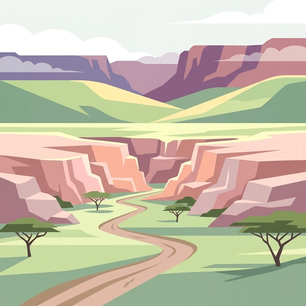
A flat-style digital illustration depicting a winding road leading through a savanna valley surrounded by canyon-like cliffs and acacia trees.

Babanango Game Reserve

Wildlife reserve

Park overview

Structured park overview, official facts, and landscape profile for Babanango Game Reserve

Babanango Game Reserve park facts, protected area profile, and essential visitor context

Review the core facts for Babanango Game Reserve, including designation, size, terrain, visitor scale, habitats, and operating context in one park-focused overview.

About Babanango Game Reserve

Babanango Game Reserve is a malaria-free game reserve in the KwaZulu-Natal province of South Africa, covering approximately 20,000 hectares of restored wilderness in the upper White Umfolozi River valley. Its terrain combines rolling grasslands, rocky ridges, and steep valleys carved by the river system, creating a mosaic of mistbelt grassland, thornveld, and riparian habitats that is unusually varied for an inland reserve.

The reserve emerged from a major rewilding effort that began in 2018, when a partnership between the Emcakwini, Esibongweni, and KwaNgono community trusts, Ezemvelo KZN Wildlife, and the African Habitat Conservancy launched the rehabilitation of land that had been heavily grazed and ecologically degraded. The project involved removing thousands of head of cattle, eradicating invasive plants, repairing erosion, and completing an 81 kilometre perimeter fence that allowed animals to be translocated and roam freely. Within a few years, more than 3,500 medium and large mammals were reintroduced, culminating in the return of elephants in 2023, which established the full Big Five population.

Today Babanango is regarded as both an ecological and social restoration project. Around three-quarters of its permanent staff are drawn from surrounding communities, and the Babanango Foundation channels tourism revenue into education, water provision, and conservation outreach. The reserve is also deeply tied to local heritage: its landscapes lie close to the sites of the 1879 battles of Isandlwana and Rorke's Drift, and the reserve's lodges incorporate Zulu cultural references, including isiZulu place names and architecture inspired by traditional beehive huts.

Quick facts and research context for Babanango Game Reserve

Babanango Game Reserve is a privately managed reserve in KwaZulu-Natal, South Africa, established around 2017 and developed through a conservation partnership from 2018 onward. It lies in the upper White Umfolozi River valley, between the towns of Vryheid, Ulundi, and Melmoth, and spans roughly 20,000 hectares of mixed grassland and thornveld terrain.

The reserve is malaria-free, supports all of the Big Five, and has been recognised as a flagship rewilding and community-based conservation project. It sits on Archaean basement rocks more than three billion years old and is bordered by cultural landscapes tied to the Zulu Kingdom and the Anglo-Zulu War of 1879.

Protection and recognition

Documented terrestrial conservation scope and official designation records

Babanango Game Reserve Protection Status and International Recognition

Babanango Game Reserve maintains a documented terrestrial protection scope within its regional conservation landscape. Official records outline the established designation framework and management boundaries without external international recognition sources.

Protection details

Protection scope
Terrestrial
Transboundary protection
No
Park context

Deeper park guide and search-rich context for Babanango Game Reserve

Babanango Game Reserve history, landscape, wildlife, and travel context

Explore Babanango Game Reserve through its history, landscape character, ecosystems, wildlife, conservation priorities, cultural context, and seasonal travel timing in a structured park guide built for atlas discovery and search intent.

Why Babanango Game Reserve stands out

Babanango is best known as one of South Africa's most ambitious recent rewilding projects, where degraded cattle-grazing land has been restored into a functioning Big Five wilderness. It is celebrated for returning the Big Five to a historically significant Zulu landscape, including the reintroduction of critically endangered black rhino through WWF's Black Rhino Range Expansion Project within just a few years of the reserve's establishment. The reserve is also recognised for its community-led conservation model, in which land leased from traditional Zulu communities generates employment, training, and revenue, alongside the wildlife restoration. Its combination of ancient geology, Anglo-Zulu War heritage, and ecological rebirth gives Babanango a distinctive identity among South African game reserves.
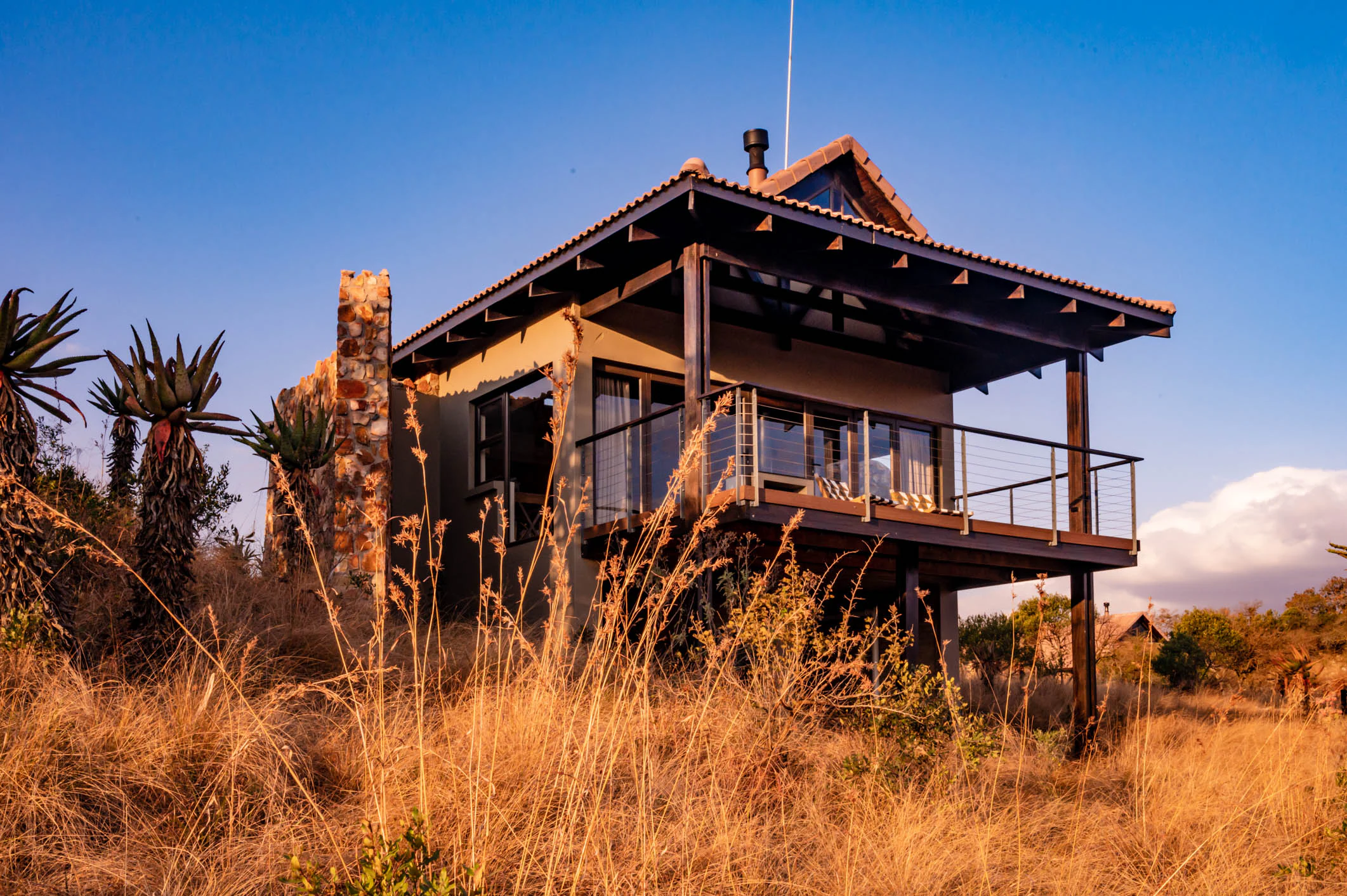
A safari lodge building with a stone chimney and elevated deck, surrounded by dry golden grass and succulent plants at sunset.
Zulu Rock Lodge situated within the Babanango Game Reserve.

Babanango Game Reserve history and protected-area timeline

The landscape of Babanango sits within a region shaped by successive waves of settlement and political change. Originally populated by Nguni-speaking peoples who migrated from Central Africa in the 16th century, the area became part of the Zulu Kingdom under King Shaka Zulu in the early 19th century. In 1879, the British invasion of Zululand brought some of the most famous battles of the Anglo-Zulu War, including Isandlwana and Rorke's Drift, to lands close to the present-day reserve. After the British victory, the territory was redistributed to white settlers who converted much of it into cattle farms.

With the end of apartheid in the mid-1990s, the land was returned to its traditional Zulu owners but remained largely unused and ecologically degraded, dominated by overgrazing and invasive plants. The decisive modern chapter began in 2018, when three local community trusts partnered with the provincial conservation agency Ezemvelo KZN Wildlife and the African Habitat Conservancy to launch the rewilding project.

By 2022, an 81 kilometre perimeter fence was complete and reintroductions expanded from fenced-off holding areas into the open landscape. Cheetah, rhino, and lions returned between 2022 and mid-2023, and elephants completed the Big Five restoration in June 2023, marking one of the fastest rewilding turnarounds of its kind in South Africa.

Babanango Game Reserve landscape and geographic character

Babanango Game Reserve occupies a striking section of the upper White Umfolozi River valley, characterised by a mix of rolling grasslands, rugged hills, and steep river-cut valleys. The reserve's topography shifts between open plateaus, rocky ridges, and narrow river corridors, giving the landscape a layered visual quality that distinguishes it from flatter savanna reserves elsewhere in KwaZulu-Natal.

The underlying geology adds another dimension to the scenery. The reserve sits on Archaean granitoids and gneisses of the Kaapvaal Craton, more than three billion years old, overlain by remnants of the ancient Nsuze Group and later Karoo Supergroup sediments. Jurassic dolerite intrusions from the Karoo Large Igneous Province form prominent dark ridges and cliffs that shape the reserve's hill silhouettes. Together these features create a landscape that ranges from open grassy plains to boulder-strewn hillsides and shaded river frontage.
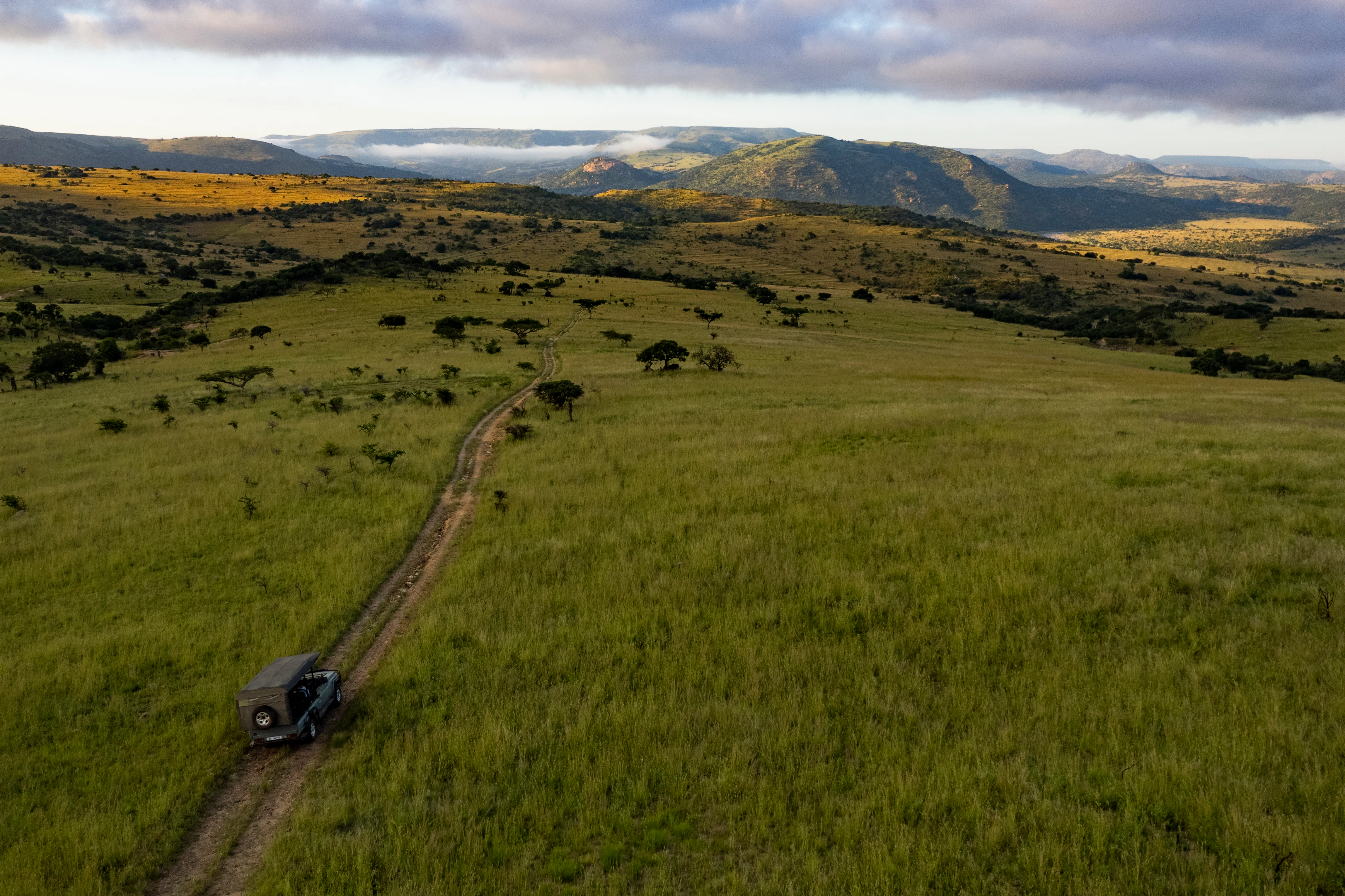
Aerial view of a dark-colored safari vehicle driving along a dirt track through expansive green rolling hills and savanna grasslands, with distant mountains under a morning sky.
A safari vehicle traversing the grasslands of Babanango Game Reserve at sunrise.

Babanango Game Reserve ecosystems, habitats, and plant life

Babanango Game Reserve protects a diverse mosaic of habitats shaped by both elevation and the White Umfolozi River system. Mistbelt grasslands occupy some of the higher elevations, while thornveld and mixed bushveld cover much of the middle slopes, and dense riverine vegetation lines the valleys. This habitat diversity supports an unusually broad range of ecological communities within a single reserve.

Vegetation recovery has been a central focus of the rewilding programme, with invasive plant species removed and natural grazing and browsing patterns restored after decades of cattle farming. Indigenous flora now visible across the reserve includes sweet thorn, splendid thorn, common coral tree, red-leafed fig, aloes, and a variety of grasses and forbs that form the foundation for the reserve's mammal and bird populations.
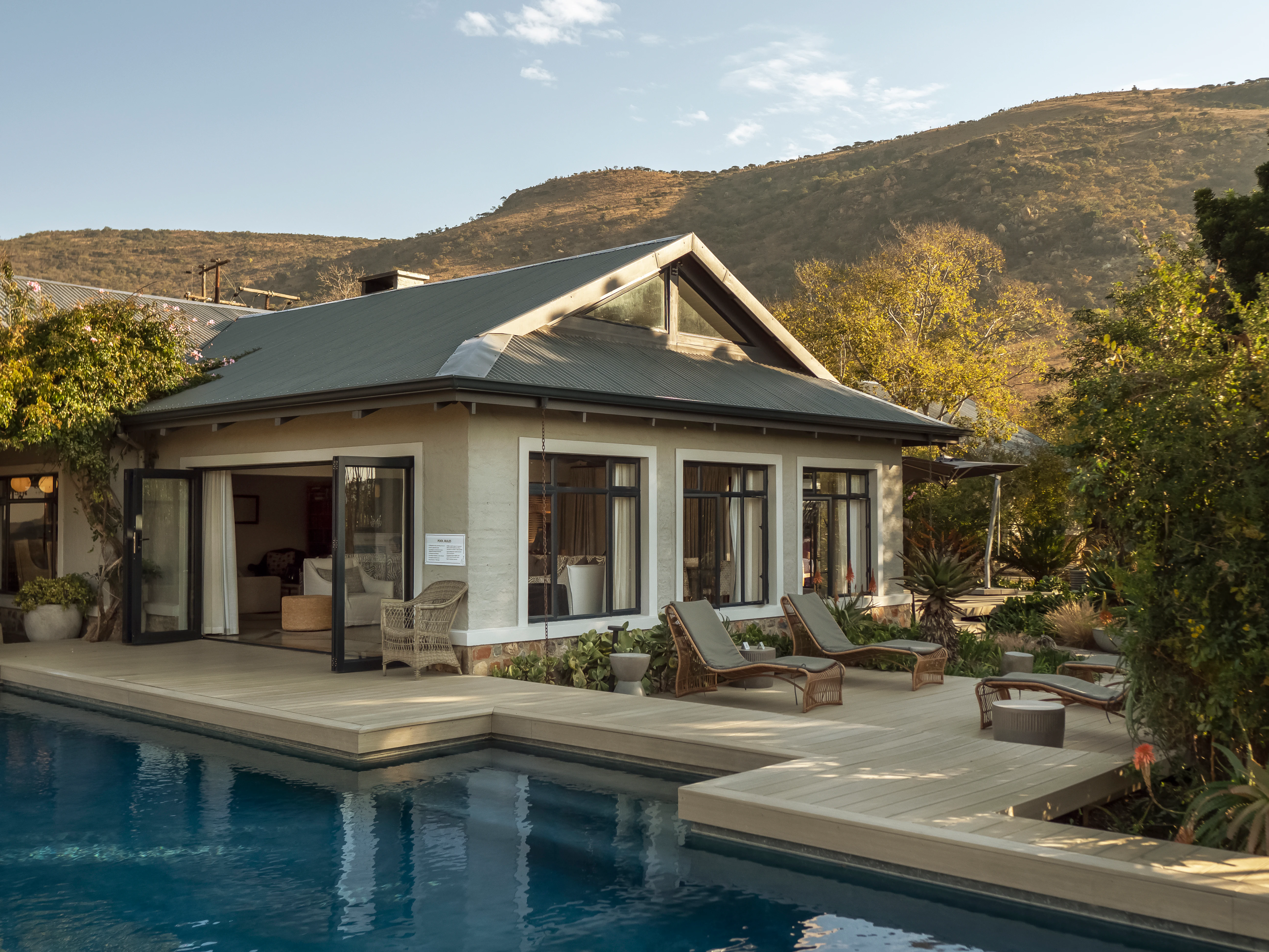
A modern, single-story lodge building with large windows and open doors, featuring an adjacent swimming pool and lounge chairs on a wooden deck, with a large hill in the background.
The Valley Lodge facility at Babanango Game Reserve, featuring a swimming pool and outdoor lounge area set against a mountain backdrop.

Babanango Game Reserve wildlife and species highlights

Babanango is home to the full Big Five: lion, leopard, elephant, buffalo, and both black and white rhinoceros. The black rhino reintroduction, carried out with WWF's Black Rhino Range Expansion Project, was a particular milestone, establishing a new population of this critically endangered species from orphaned individuals. To reduce poaching risk, the rhinos' horns are regularly trimmed.

Beyond the headline species, the reserve supports a wide spectrum of plains game, including oribi, eland, giraffe, zebra, warthog, and several other antelope species. Rarer and more elusive mammals are also present, including brown hyena, aardvark, aardwolf, serval, and caracal. The reserve records some 334 bird species across its varied habitats, drawing both grassland specialists and rare raptors such as Verreaux's eagle and the blue crane, alongside many typical KwaZulu-Natal bushveld, riverine, and grassland species.
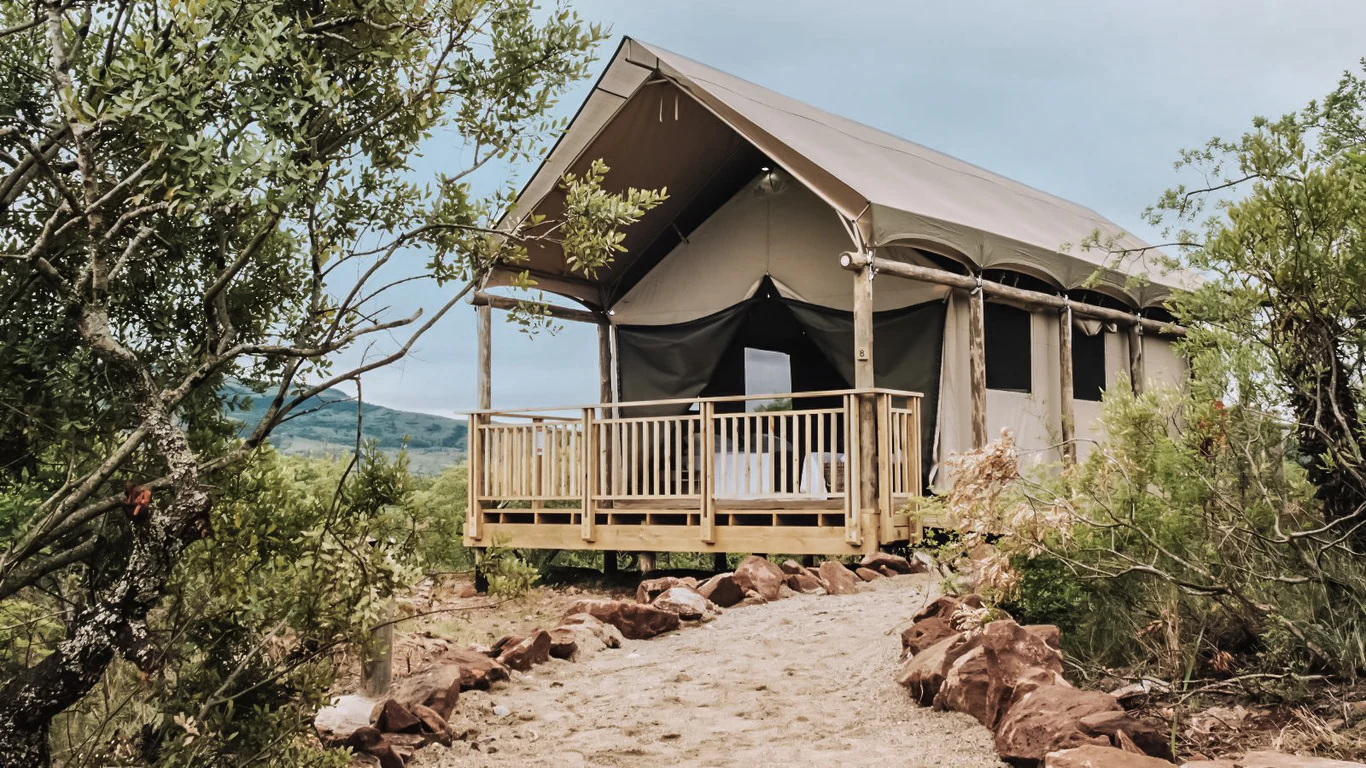
A luxury safari tent set on a wooden platform at Matatane Camp, surrounded by natural bushveld with a dirt path leading up to its deck.
A canvas tent suite at Matatane Camp in Babanango Game Reserve.

Babanango Game Reserve conservation status and protection priorities

Babanango Game Reserve stands out as one of the largest and fastest biodiversity restoration projects in South Africa in recent decades. Its conservation work centres on the rewilding of land that had been heavily grazed and ecologically degraded, and more than 3,500 medium to large mammals have been reintroduced, culminating in a functioning Big Five population by 2023.

At an institutional level, the reserve is a partnership between three local community trusts, Ezemvelo KZN Wildlife, and the African Habitat Conservancy, and it has been recognised by the international 30x30 initiative as a role model of community-led conservation. Conservation strategies include invasive species removal, erosion repair, perimeter and internal fencing management, rhino horn trimming as an anti-poaching measure, and a phased reintroduction programme that begins with fenced buffers before releasing animals across the full landscape.

Babanango Game Reserve cultural meaning and human context

The lands of Babanango carry deep Zulu cultural and political significance. The region was part of the Zulu Kingdom under King Shaka Zulu, and the wider area was shaped by the 1879 Anglo-Zulu War, with the battles of Isandlwana and Rorke's Drift fought close to the present-day reserve. After the British victory, Zulu grazing lands in this area were transferred to white farmers, a legacy that was only reversed with the end of apartheid in the 1990s.

The modern reserve is built on land leased back from traditional Zulu communities, and this heritage is reflected in its identity. Names such as Madwaleni, meaning "The place of the rock" in isiZulu, and architectural choices inspired by traditional beehive huts and locally woven materials, tie the conservation project directly to the cultural landscape of the Zulu people.

Top sights and standout views in Babanango Game Reserve

Babanango combines ancient geology, Zulu heritage, and one of South Africa's most ambitious recent rewilding efforts in a single malaria-free reserve. Its restored Big Five population, including a new breeding group of critically endangered black rhino, gives it a strong ecological identity.

The reserve's mix of mistbelt grassland, thornveld, and White Umfolozi river frontage creates unusual habitat diversity for inland KwaZulu-Natal, while the community-led conservation model and proximity to historic Anglo-Zulu battlefield sites give it a distinctive cultural and social profile among South African game reserves.

Best time to visit Babanango Game Reserve

As a malaria-free reserve in KwaZulu-Natal, Babanango can be visited year-round, but the dry winter months from roughly May to August generally offer the most comfortable conditions for game viewing. The vegetation thins out and animals tend to concentrate around remaining water sources and the White Umfolozi River frontage, improving visibility for guided drives and walking safaris.

Summer brings greener, lusher landscapes and vibrant bird activity, though afternoon thunderstorms are common and humidity is higher. Birdwatchers often prefer the warmer months for observing migratory and breeding species, while visitors interested in cooler walking conditions and clearer views of the rocky terrain often favour the winter dry season.
Monthly climate preview

Long term temperature and precipitation averages for KwaZulu Natal conservation terrain

Babanango Game Reserve Climate Normals and Annual Weather Patterns

Representative coordinate records show measured monthly temperature and precipitation fluctuations across the reserve terrain from 1991 through 2020. Examining the complete twelve month climate profile reveals detailed shifts in average daily maximums, lows, and moisture levels throughout the year.
Annual mean19 °C
14 °C23 °C
Jan23°
Feb22°
Mar21°
Apr19°
May16°
Jun14°
Jul14°
Aug16°
Sep18°
Oct19°
Nov21°
Dec22°
Warmest month
January

22.5 °C

Coolest month
July

13.7 °C

Wettest month
January

4.3 mm/day

Driest month
June

0.7 mm/day

Park location guide

Geography guide, regional context, and park location map for Babanango Game Reserve

Babanango Game Reserve park geography, regions, and map view in South Africa

Understand where Babanango Game Reserve sits in South Africa through a broader geographic reading of the surrounding landscape, nearby location context, and its mapped position within the national park landscape.

How Babanango Game Reserve fits into South Africa

South Africa is the southernmost country in Africa, spanning 1.22 million km² with a population of over 63 million. The country operates with three capital cities, Pretoria (executive), Cape Town (legislative), and Bloemfontein (judicial), and is renowned for its biodiversity, national parks, and multicultural society.

Wider geography shaping Babanango Game Reserve in South Africa

South Africa occupies the southernmost region of Africa, with coastline along both the Atlantic Ocean to the west and the Indian Ocean to the east. The interior features elevated plateaus including the Highveld, with the Drakensberg escarpment marking the eastern highlands. The country shares borders with Namibia, Botswana, Zimbabwe, Mozambique, Eswatini, and Lesotho.

Map view of Babanango Game Reserve

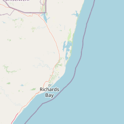
Use this park location map to pinpoint Babanango Game Reserve in South Africa, understand its exact geographic position, and read its mapped placement within the surrounding landscape more clearly.

Pigeon | © OpenStreetMap contributors

Location context for Babanango Game Reserve

KwaZulu-Natal

Explore protected area imagery, rolling grasslands, and river valley habitats

Babanango Game Reserve Photos and Landscape Scenery Visual Guide

Visual documentation of Babanango Game Reserve reveals the rugged terrain, mistbelt grasslands, and restored wildlife habitats of the upper White Umfolozi River valley. Examining authentic field photography helps visitors understand the topography, geological formations, and protected landscape character of the region.

A safari lodge building with a stone chimney and elevated deck, surrounded by dry golden grass and succulent plants at sunset.

A modern lodge structure with wooden siding and a curved roof sits on a rocky ridge overlooking a verdant valley in Babanango Game Reserve.

Aerial view of a dark-colored safari vehicle driving along a dirt track through expansive green rolling hills and savanna grasslands, with distant mountains under a morning sky.

A modern, single-story lodge building with large windows and open doors, featuring an adjacent swimming pool and lounge chairs on a wooden deck, with a large hill in the background.

A luxury safari tent set on a wooden platform at Matatane Camp, surrounded by natural bushveld with a dirt path leading up to its deck.

Park atlas

Compare nearby protected landscapes and regional wildlife reserves across KwaZulu-Natal

Explore Parks Near Babanango Game Reserve and Surrounding Regional Protected Areas

Continue geographic discovery by comparing Babanango Game Reserve with other protected areas located across the surrounding region. Examining adjacent terrain and regional reserves reveals broader conservation patterns within the White Umfolozi river valley.
Wildlife reserveKwaZulu-Natal
About 73 km away#1 closest

Southeast

Thula Thula Private Game Reserve: Protected Wildlife Habitats and Geography

Bushveld and riverine geography in the KwaZulu-Natal Zululand corridor

Thula Thula Private Game Reserve features a unique intersection of bushveld habitats and river systems within South Africa. This reserve provides important protected land for elephants, rhinoceros, and over 350 avian species. It remains a key geographic entity for understanding the Royal Zulu Biosphere and the conservation history of the northeastern KwaZulu-Natal region.

Area
45 km²
Established
1911
Scope
Terrestrial
Nature reserveKwaZulu-Natal
About 83 km away#2 closest

East

Hluhluwe, Imfolozi Park Nature Reserve: Detailed Protected Area and Regional Geography

Explore mapped boundaries and landscape context in KwaZulu-Natal.

Hluhluwe, Imfolozi Park, designated as a nature reserve, offers a distinct protected landscape within KwaZulu-Natal, South Africa. This entity page provides an atlas-focused view, emphasizing the park's mapped boundaries and its contribution to the region's protected area network. Understand its geographic setting and unique landscape character through structured data, essential for any explorer keen on mapping protected lands.

Area
960 km²
Established
1895
Relief
Mountain
Climate
Subtropical
Wildlife reserveKwaZulu-Natal
About 85 km away#3 closest

North

Ithala Game Reserve: Mapping the Protected Landscape and Ancient Geology of KwaZulu-Natal

A rugged wilderness reserve defined by dramatic escarpment and river valley topography.

Ithala Game Reserve represents a critical protected area in South Africa where deep river valleys meet the high-altitude grasslands of the Ngotshe Mountains. Its topography provides a unique study in vertical relief, featuring exposed sandstone cliffs and dolerite spires. The reserve serves as a prime example of ecological diversity within the region, combining ancient geological formations with a successfully reestablished mosaic of bushveld, savanna, and forest habitats.

Area
296.53 km²
Established
1973
IUCN
IV
Relief
Mountain
Wildlife reserveKwaZulu-Natal
About 126 km away#4 closest

Southwest

Weenen Game Reserve: Wildlife and Restored Acacia Savanna in Inland KwaZulu-Natal

A mapped wildlife reserve and ecological restoration project

Located in the inland reaches of KwaZulu-Natal, Weenen Game Reserve represents a significant success in landscape recovery. The reserve protects a distinct mix of dry tall grassveld, dense thornveld, and valley bushveld, providing critical habitat for black and white rhinoceros, giraffe, and numerous bird species. This atlas entry details the physical terrain, drainage lines, and the engineering history that transformed the land into a functioning sanctuary.

Area
50.09 km²
Established
1975
Relief
Upland
Climate
Subtropical
Nature reserveKwaZulu-Natal
About 128 km away#5 closest

Northeast

Phongolo Nature Reserve: Mapped Protected Landscapes of Northern KwaZulu-Natal

Historic reserve terrain at the Lebombo escarpment

Spanning over 10,000 hectares, Phongolo Nature Reserve represents a critical geographic unit defined by the Pongolapoort Dam and the surrounding Lebombo range. Its terrain transitions from clay-rich lowveld plains to dramatic high-altitude rocky escarpments, forming a complex protected environment within the KwaZulu-Natal borderlands. Explore the mapped extent and structural biodiversity of this long-standing South African conservation site.

Area
104.85 km²
Established
1894
IUCN
IV
Relief
Mountain
A soft watercolor painting of a serene landscape with rolling hills in the background; a body of water in the midground; and grassy plains with a few scattered trees in the foreground.
Nature reserveKwaZulu-Natal
About 162 km away#6 closest

West

Spioenkop Dam Nature Reserve: Mapping KwaZulu-Natal Reservoir Landscapes and Heritage

Explore aquatic habitats and historic inland terrain.

Spioenkop Dam Nature Reserve serves as a focal point for protected biodiversity and historical land use in KwaZulu-Natal. The reserve spans a significant impoundment, creating a verdant aquatic habitat that contrasts with the surrounding grasslands and woodland terrain. Users can examine the park's boundaries and topographic features, including the historic Spion Kop battlefield that rises above the reservoir to anchor the northern landscape.

Area
44 km²
Established
1975
Relief
Upland
Climate
Temperate
Protected areaKwaZulu-Natal
About 174 km away#7 closest

Northeast

Lake Sibaya Protected Area: Mapping the Freshwater Heart of the KwaZulu-Natal Coast

Freshwater wetlands and coastal dune forest topography

Lake Sibaya encompasses the largest freshwater basin in South Africa, defined by its position near the Maputaland coast. The landscape represents a significant freshwater interface between coastal dune forests and the Indian Ocean, serving as an important protected study site for catchment ecosystems, water-bird habitats, and regional hydrological diversity.

Area
64 km²
Established
1991
Relief
Lowland
Climate
Subtropical
Protected areaKwaZulu-Natal
About 175 km away#8 closest

Southwest

uKhahlamba-Drakensberg Park: Protected Mountain Landscapes and Escarpment Geography in South Africa

Exploring the basalt cliffs and alpine plateau of KwaZulu-Natal.

uKhahlamba-Drakensberg Park encompasses an expansive protected region where the Drakensberg escarpment rises sharply from the foothills of KwaZulu-Natal. This atlas record details the park landscape, including its transition from sandstone terraces to high-altitude basalt, its extensive river gorges, and the concentration of archaeological cave sites. Use this resource to understand the geographic scale of this transboundary conservation area.

Area
2,429.13 km²
Relief
Mountain
Climate
Temperate
Access
Access unknown

Common questions about visiting, size, designation, and location context for Babanango Game Reserve

Babanango Game Reserve FAQs for park facts, access, geography, and protected area context

Find quick answers about Babanango Game Reserve, including protected-area facts, park geography, trail and visitor context, and how the park fits into its surrounding country and regional landscape.
MoriAtlas Explorer

Continue Your Protected Areas Search Across the Global Atlas

Deepen your exploration by continuing the structured search for national parks and protected areas worldwide. Utilize the comprehensive filtering capabilities to compare different conservation landscapes and refine your understanding of global park geography. Discover more about the distribution and characteristics of protected natural areas.

Global natural geography
