
Mori Atlas logo
Nature reserveRezerwat przyrody Bagno Przecławskie

A detailed geographic look at bog forest terrain, raised bog communities, and lowland mire boundaries.

Rezerwat przyrody Bagno Przecławskie: Protected Peatland and Wetland Landscapes in Podkarpackie

Rezerwat przyrody Bagno Przecławskie preserves a distinctive peatland landscape situated within the Sandomierz Basin of southeastern Poland. This nature reserve protects a vital mosaic of floating bog mats, raised bog communities, and moisture-tolerant forest that characterizes the region's historical wetland identity. Through this mapped landscape profile, users can examine the topographic variety of the bog pools and the transition zones where the open mire meets the surrounding pine-dominated forest ecosystems.

peatlandbograised bogwetland forestnature reserveSandomierz Basin
A colorful vector-style illustration of a forested mountain valley with a waterfall flowing into a central pool, surrounded by wildflowers and pine trees under a clear sun.

Rezerwat przyrody Bagno Przecławskie

Nature reserve

Park overview

Structured park overview, official facts, and landscape profile for Bagno Przecławskie Nature Reserve

Bagno Przecławskie Nature Reserve park facts, protected area profile, and essential visitor context

Review the core facts for Bagno Przecławskie Nature Reserve, including designation, size, terrain, visitor scale, habitats, and operating context in one park-focused overview.

About Bagno Przecławskie Nature Reserve

Bagno Przecławskie Nature Reserve is a peatland reserve located in the lowland landscapes of the Sandomierz Basin, in the southern part of the Podkarpackie Voivodeship. Although its 25.56 hectares make it a relatively small protected site, its ecological value is high because it preserves plant communities that once defined the natural character of the entire basin. The reserve's square-shaped boundaries lie just south of the road connecting the town of Przecław with Łączki Brzeskie, in a quiet rural setting dominated by wetland vegetation.

The protected area combines an open peatland with surrounding forest, forming a compact yet ecologically diverse landscape. Floating bog mats, raised bog vegetation, and bog pine forest all develop within its borders, creating a layered mosaic of wetland habitats. Evidence of former peat extraction remains visible in the form of small bog pools, which today form part of the reserve's natural mosaic. Over time, parts of the open bog have been gradually colonised by stunted pine and birch, a typical successional pattern in lowland peatlands where active management is required to maintain open bog communities.

The reserve is managed with a combination of active and strict protection, including monitoring of peatland vegetation change and maintenance of the marked hiking trail. It is not surrounded by a protective buffer zone, but its position outside larger landscape protection areas gives the reserve its own distinct identity. The presence of two ecological use sites within such a small reserve is uncommon in Poland and reflects the layered approach taken to habitat protection in this part of the Sandomierz Basin.

Quick facts and research context for Bagno Przecławskie Nature Reserve

Bagno Przecławskie Nature Reserve lies in Mielec County, within the Gmina Przecław area of the Podkarpackie Voivodeship in southeastern Poland. It sits in the Sandomierz Basin (Kotlina Sandomierska), a broad lowland region historically marked by wetlands and peat deposits. The reserve was established on 15 May 1979 under Polish legal notice M.P. of 1979, and its area is approximately 25.56 hectares. It combines active and strict conservation management, hosts two ecological use sites within its borders, and includes a marked footpath for visitors.

Protection and recognition

Examine the documented terrestrial conservation scope and official designation records.

Rezerwat przyrody Bagno Przecławskie Protection Status and Designated Area Record

Rezerwat przyrody Bagno Przecławskie maintains a recorded terrestrial protection status within the regional conservation inventory. Reviewers can access verified designation frameworks and associated management details without relying on external assumptions.

Protection details

Protection scope
Terrestrial
Transboundary protection
No
Park context

Deeper park guide and search-rich context for Bagno Przecławskie Nature Reserve

Bagno Przecławskie Nature Reserve history, landscape, wildlife, and travel context

Explore Bagno Przecławskie Nature Reserve through its history, landscape character, ecosystems, wildlife, conservation priorities, cultural context, and seasonal travel timing in a structured park guide built for atlas discovery and search intent.

Why Bagno Przecławskie Nature Reserve stands out

The reserve is known for protecting an open peatland with surrounding bog forest in the heart of the Sandomierz Basin, one of the few remaining examples of the region's natural wetland character. It is especially notable for its floating bog mats, raised bog communities, and boggy pine forest. The combination of historical peat exploitation and ongoing ecological recovery gives the site a distinctive texture, while the unusual presence of two ecological use sites within a single reserve adds to its conservation profile.
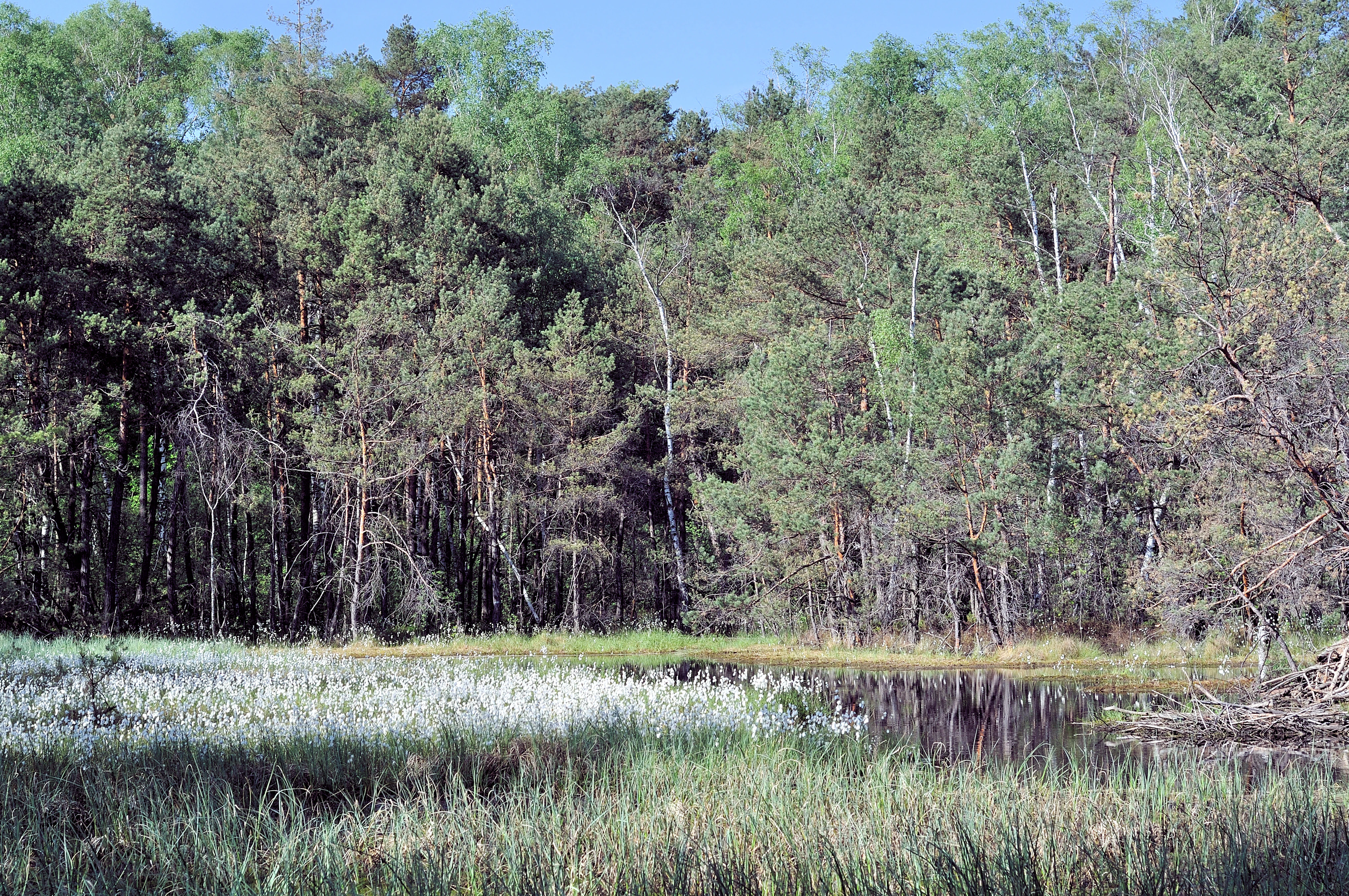
A peaceful landscape view of a nature reserve, showing a wetland area with grasses in the foreground, calm dark water, and a dense mixed forest of pine and birch trees in the background under a clear sky.
A scenic view of the Bagno Przecławskie nature reserve, featuring wetlands and forest.

Bagno Przecławskie Nature Reserve history and protected-area timeline

Bagno Przecławskie was established on 15 May 1979 as a peatland nature reserve, a category chosen because the Sandomierz Basin had historically contained extensive peat-forming wetlands that were increasingly being lost to drainage, agriculture, and peat extraction. The reserve's founding aimed to protect representative examples of these peatland communities in their natural state.

Although the protected area was intended to preserve an intact peatland, historical peat cutting left visible traces in the landscape, including the bog pools still present in the reserve. In later decades, ecological surveys documented the bog's recovery and its continued importance for bog flora and wetland fauna, leading to modern conservation tasks covering the period 2016-2021. These tasks focused on ongoing monitoring of peatland vegetation and on maintaining the visitor trail that allows public access to the site.

Bagno Przecławskie Nature Reserve landscape and geographic character

The landscape of Bagno Przecławskie is shaped by lowland peatland terrain typical of the Sandomierz Basin. The protected area consists of a roughly square block of land dominated by open, waterlogged peatland bordered by boggy forest. The terrain is mostly flat, reflecting the basin's character as a broad lowland depression where surface water has historically accumulated to form mires and bogs.

Within the open central area, the surface is broken up by floating bog mats and shallow bog pools that originated during the area's former use for peat extraction. These water-filled hollows add topographic variety to the otherwise level surface and create microhabitats that host specialized wetland vegetation. Around the open core, the surrounding forest forms a transition zone made up of stunted pines, birches, and other moisture-tolerant tree species that soften the visual edges of the bog. The overall impression is of a quiet, intimate wetland landscape with clear contrast between open bog vegetation and the darker tones of the surrounding bog forest.
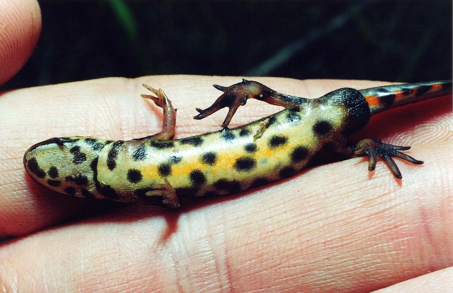
A close-up view of a smooth newt lying on a person's palm, showing its yellow and black spotted belly.
A smooth newt, an amphibian species found within the wetlands of Rezerwat przyrody Bagno Przecławskie.

Bagno Przecławskie Nature Reserve ecosystems, habitats, and plant life

The reserve protects a small but ecologically rich peatland complex in which multiple wetland communities occur in close proximity. The most distinctive habitats include floating bog mats, raised bog communities, and boggy pine forest. These habitats together support a wide range of plant species adapted to acidic, waterlogged conditions, including several sundews, cottongrasses, cranberries, bog asphodel, and bog rosemary. The presence of multiple sundew species on a site of this size is a strong indicator that the peatland retains its characteristic nutrient-poor, bog-forming conditions.

Beyond the open bog, the surrounding forest includes typical lowland wetland species such as alder buckthorn and birch. Pockets of Sphagnum-rich vegetation anchor the hydrology of the site, allowing the peatland to retain water and weather seasonal changes. The combination of open, waterlogged surfaces and forested transition zones creates a habitat mosaic capable of supporting both specialist bog species and more generalist woodland wildlife. Because the reserve lies outside larger landscape protection areas, it functions as an independent refuge for peatland communities in an otherwise heavily altered lowland region.

Bagno Przecławskie Nature Reserve wildlife and species highlights

The reserve's wildlife reflects the character of its peatland and bog forest habitats. Amphibians are well represented, with species such as the smooth newt, great crested newt, fire-bellied toad, common toad, green toad, European tree frog, pool frog, and water frog all documented within the site. Reptiles include the sand lizard, viviparous lizard, slow worm, and common European adder, which find refuges in the warmer edges of the surrounding forest.

The birdlife combines woodland species associated with the surrounding bog forest and open-ground species that use the open bog and bog pools. Woodpeckers such as the middle and black woodpeckers, forest birds including the Eurasian jay, Eurasian bullfinch, yellowhammer, European robin, common chaffinch, wood lark, tree pipit, great tit, coal tit, and crested tit, and open-country species such as the corncrake, black stork, common snipe, common greenshank, and mallard all have been recorded. The mix reflects a humid mosaic where forest edges meet open wetland. Mammals reported from the area include small insectivores and bats such as the common pipistrelle and serotine bat, small rodents, hedgehogs, squirrels, water shrews, and larger mammals including the grey wolf, red fox, raccoon dog, European badger, pine marten, stoat, least weasel, wild boar, roe deer, and red deer. The presence of predators such as wolves and badgers alongside smaller wetland species points to the continuity of relatively undisturbed habitat around the reserve.

Bagno Przecławskie Nature Reserve conservation status and protection priorities

Bagno Przecławskie plays a meaningful conservation role in the Sandomierz Basin, where peatland habitats have been heavily reduced by centuries of drainage and peat extraction. By protecting an intact mosaic of floating bog, raised bog, and bog forest on roughly 25 hectares, the reserve preserves ecological conditions that have become increasingly rare in the surrounding lowlands. It functions as an independent refuge, as it lies outside larger landscape protection areas, giving it particular importance for species that depend on continuous bog habitat.

A noteworthy feature is the presence of two ecological use sites within the reserve's boundaries, a rare situation in Poland. This layered form of protection reflects the value placed on each component habitat and allows more targeted conservation management of individual ecological units. The reserve combines active conservation measures, including vegetation monitoring and habitat management, with strict protection in the most sensitive areas. Conservation tasks defined for the 2016-2021 period emphasized tracking changes in peatland vegetation and securing the visitor trail, ensuring that public access does not compromise the most fragile parts of the bog.

Top sights and standout views in Bagno Przecławskie Nature Reserve

The reserve preserves a small but ecologically rich peatland in the Sandomierz Basin, with floating bog mats, raised bog communities, and bog pine forest all within a compact area. Its combination of active and strict protection, the rare presence of two ecological use sites within one reserve, and the surviving traces of former peat extraction give the site a distinctive character. The species assemblage, which includes multiple sundews, characteristic bog plants, amphibians, birds such as the black stork and corncrake, and mammals ranging from bats to wolves, reflects the strong ecological continuity of this lowland wetland refuge.

Best time to visit Bagno Przecławskie Nature Reserve

Late spring and early summer are generally favourable for visiting the reserve, when bog flora such as cottongrasses, cranberries, and sundews are most active and amphibian presence around the bog pools is easiest to observe. Late summer and early autumn also offer peaceful conditions and softer light over the bog surface, though some sections of the trail may become wetter after periods of rain. The reserve can be visited comfortably during daylight hours along its marked footpath, making it a quiet destination for those interested in wetland landscapes rather than a high-traffic attraction.

Monthly climate preview

Long term representative coordinate measurements of monthly temperature and precipitation patterns

Rezerwat przyrody Bagno Przecławskie Climate Normals and Annual Temperature Rhythm

Historical data records a measured annual rhythm ranging from freezing winter lows to warm summer maximums alongside varying monthly precipitation levels at a representative coordinate. Reviewing the complete twelve month profile helps analyze detailed temperature swings and precipitation variations across the protected landscape.
Annual mean9 °C
-3 °C20 °C
Jan-3°
Feb-2°
Mar
Apr
May14°
Jun18°
Jul20°
Aug20°
Sep15°
Oct
Nov
Dec-2°
Warmest month
July

20.1 °C

Coolest month
January

-3.4 °C

Wettest month
July

3.3 mm/day

Driest month
December

1.3 mm/day

Park location guide

Geography guide, regional context, and park location map for Bagno Przecławskie Nature Reserve

Bagno Przecławskie Nature Reserve park geography, regions, and map view in Poland

Understand where Bagno Przecławskie Nature Reserve sits in Poland through a broader geographic reading of the surrounding landscape, nearby location context, and its mapped position within the national park landscape.

How Bagno Przecławskie Nature Reserve fits into Poland

Poland, officially the Republic of Poland, is a Central European country spanning from the Baltic Sea in the north to the Carpathian Mountains in the south. It borders Germany, Czech Republic, Slovakia, Ukraine, Belarus, Lithuania, and Kaliningrad Oblast. The country has a temperate climate, diverse landscapes, and is known for its rich history, cultural heritage, and strong economic position within the EU.

Wider geography shaping Bagno Przecławskie Nature Reserve in Poland

Poland occupies 312,696 km2 in Central Europe, extending from the Baltic Sea coast in the north to the Sudetes and Carpathian Mountains in the south. It borders Germany to the west, Czech Republic and Slovakia to the south, Ukraine and Belarus to the east, and Lithuania and Kaliningrad Oblast to the northeast. The landscape includes lowland plains, uplands, and mountain ranges.

Map view of Bagno Przecławskie Nature Reserve

Use this park location map to pinpoint Bagno Przecławskie Nature Reserve in Poland, understand its exact geographic position, and read its mapped placement within the surrounding landscape more clearly.

Pigeon | © OpenStreetMap contributors

Location context for Bagno Przecławskie Nature Reserve

Podkarpackie Voivodeship

Visual reference collection highlighting lowland peatland habitats and bog forest terrain

Rezerwat przyrody Bagno Przecławskie Photos, Scenery, and Wetland Landscapes

Visual records illustrate the protected terrain, open peatland communities, and surrounding bog forest that define the Sandomierz Basin ecosystem. Field photography captures floating bog mats, shallow pools, and moisture tolerant vegetation for comprehensive habitat study.

A peaceful landscape view of a nature reserve, showing a wetland area with grasses in the foreground, calm dark water, and a dense mixed forest of pine and birch trees in the background under a clear sky.

A close up view of several interrupted clubmoss plants with upright, pale cylindrical strobilus cones rising from the dense green needle-like foliage.

A close-up view of a smooth newt lying on a person's palm, showing its yellow and black spotted belly.

Park atlas

Compare regional wetlands, protected landscapes, and connected lowland habitats

Parks Near Rezerwat przyrody Bagno Przecławskie And Surrounding Lowland Reserves

Browse other protected areas and nature reserves located throughout the surrounding Sandomierz Basin lowlands. Expanding the geographic comparison reveals broader regional wetland habitats and connected conservation landscapes.
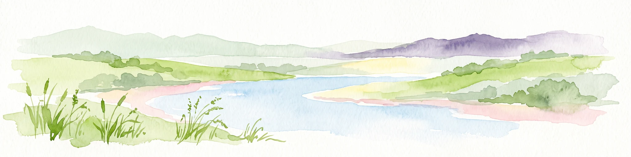
Watercolor illustration of a winding stream flowing through a green valley with rolling hills in the background and reeds in the foreground.
Nature reservePoland
About 27 km away#1 closest

Northeast

Rezerwat przyrody Dolina Smarkatej: Protected River Landscape and Wetland Geography in Poland

Mapping fluvial corridors in the Sandomierz Forest

Rezerwat przyrody Dolina Smarkatej protects a unique stretch of free-flowing lowland river in southeastern Poland. This nature reserve sustains critical wetland ecosystems, including oxbow lakes and peat bogs, while providing a protected corridor for freshwater biodiversity within the broader Sandomierz Forest region.

Area
0.559 km²
Established
2024
Protected landscapeTarnobrzeska Dolina Wisły
About 28 km away#2 closest

North

Tarnobrzeska Dolina Wisły Protected Landscape: Mapped Riverine Geography and Habitat Corridor

A sprawling Vistula valley floodplain site in southeastern Poland.

The Tarnobrzeska Dolina Wisły protected area encompasses a 4,060-hectare corridor of rare lowland habitats. This map-focused site highlights an ecologically active river system composed of riparian forests, shifting banks, and extensive wetlands that define the regional geography of the middle Vistula basin.

Area
40.597 km²
Established
2011
Scope
Terrestrial
Water
Major water bodies
Protected areaPodkarpackie Voivodeship
About 29 km away#3 closest

South

Wisłoka z dopływami Protected Area: River Valley Landscape and Carpathian Foothills Atlas

Freshwater habitat mapping in southern Poland

Wisłoka z dopływami covers a long, ecologically rich segment of the Wisłoka river valley in the Carpathian foothills. This protected area connects diverse riparian, floodplain, and alluvial forests, serving as a critical habitat for six Annex II fish species and sixteen distinct riparian woodland types.

Area
26.51 km²
Established
2011
Relief
Mixed relief
Scope
Terrestrial
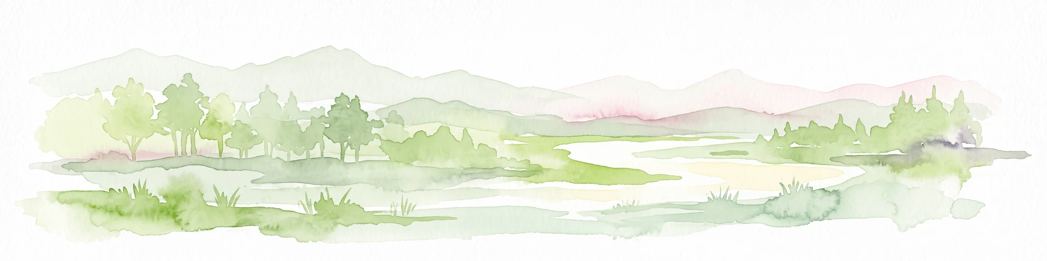
A soft watercolor painting of a serene river landscape with green trees in the background and rolling hills in the distance.
Nature reserveLesser Poland Voivodeship
About 34 km away#4 closest

Southwest

Rezerwat przyrody Debrza Nature Reserve: Map, Geography, and Protected Forest Boundaries

Lesser Poland Voivodeship deciduous forest and ancient oak habitat

Rezerwat przyrody Debrza offers a concentrated look at the grad forest community, featuring an old-growth canopy of oak and linden trees. Located in the Tarnów Plateau, this nature reserve provides a critical study of lowland deciduous ecosystems and protected plant species, serving as a rare example of pre-industrial woodland structure preserved near a major city.

Area
0.095 km²
Established
1995
Relief
Upland
Scope
Terrestrial
Nature reserveświętokrzyskie
About 38 km away#5 closest

North

Ostoja Żyznów Protected Landscape: Loess Ravines and River Valleys of Świętokrzyskie

A dense mosaic of xerothermic grasslands and mixed forest ecosystems

Ostoja Żyznów protects a compact yet ecologically rich region characterized by deep loess gullies and the meandering paths of the Koprzywianka and Kacanka rivers. The area creates a striking transitional landscape, shifting from flat agricultural plateaus to steep, forest-covered ravines and cliff-like river walls. This site offers significant value for understanding regional biodiversity, featuring a rare combination of warm-dry grasslands and moisture-dependent peatland habitats in the heart of Poland.

Area
44.8 km²
Established
2011
Relief
Mixed relief
Climate
Temperate
Nature reservePodkarpackie Voivodeship
About 39 km away#6 closest

Southeast

Wisłok Środkowy z Dopływami Protected Nature Reserve in the Podkarpackie Voivodeship

River corridor geography and riparian ecosystem analysis

Wisłok Środkowy z Dopływami serves as a crucial Natura 2000 site, safeguarding the middle course of the Wisłok River and the Stobnica tributary. This nature reserve provides essential habitat for various protected fish species and butterfly populations within a terrain shaped by the transition between the Jasielsko-Krośnieńska Basin and the Carpathian foothills. The area represents a significant riparian landscape, offering a window into the natural freshwater geography of southeastern Poland.

Area
10.646 km²
Established
2011
Relief
Upland
Scope
Terrestrial
Nature reserveLesser Poland Voivodeship
About 43 km away#7 closest

Southwest

Ostoja w Paśmie Brzanki: Protected Beech Forest and Foothill Geography in Lesser Poland

A Natura 2000 nature reserve in the Polish Carpathian foothills

Located within the Lesser Poland Voivodeship, Ostoja w Paśmie Brzanki consists of dense, continuous beech woodlands draped over the rounded ridges of the Brzanka Range. This nature reserve serves as an essential ecological refuge, combining rare sycamore communities and riparian strips that support diverse amphibian populations across its forested ravine landscapes.

Area
7.889 km²
Established
2011
Relief
Upland
Water
Minor water
Protected landscapeŚwiętokrzyskie Voivodeship
About 45 km away#8 closest

Northwest

Szaniecki Park Krajobrazowy: Protected Landscape Atlas and Regional Map Context

Exploring xerothermic habitats across the Ponidzie plateau

Szaniecki Park Krajobrazowy anchors conservation efforts across the Płaskowyż Szaniecki and the Garb Pińczowski ridge. This detailed profile tracks the regional geography, calcareous soil influence, and the protection of rare steppe flora within the broader Świętokrzyskie Voivodeship landscape framework.

Area
112.896 km²
Established
1986
Relief
Upland
Climate
Temperate

Common questions about visiting, size, designation, and location context for Bagno Przecławskie Nature Reserve

Bagno Przecławskie Nature Reserve FAQs for park facts, access, geography, and protected area context

Find quick answers about Bagno Przecławskie Nature Reserve, including protected-area facts, park geography, trail and visitor context, and how the park fits into its surrounding country and regional landscape.
MoriAtlas Explorer

Continue Your Protected Areas Search Across the Global Atlas

Deepen your exploration by continuing the structured search for national parks and protected areas worldwide. Utilize the comprehensive filtering capabilities to compare different conservation landscapes and refine your understanding of global park geography. Discover more about the distribution and characteristics of protected natural areas.

Global natural geography