Mori Atlas logo
Wildlife reserveBaie-de-Brador Migratory Bird Sanctuary

Tracing the geographic boundaries and subarctic coastal terrain of a vital Atlantic migratory corridor.

Baie-de-Brador Migratory Bird Sanctuary: A Protected Marine and Island Landscape in Quebec

Baie-de-Brador Migratory Bird Sanctuary serves as a significant protected area at the junction of the Gulf of St. Lawrence and the Strait of Belle Isle. Comprised of the rocky outcrops of Île aux Perroquets and Île Greenly, this wildlife reserve safeguards a crucial seabird nesting zone within a vast, cold marine environment. The sanctuary extends well beyond the land into the surrounding Atlantic waters, creating a unique coastal habitat defined by strong tidal exchanges and harsh maritime conditions.

migratory bird sanctuaryseabird colonyisland sanctuaryGulf of St. LawrenceLower North Shore QuebecAtlantic maritime

Baie-de-Brador Migratory Bird Sanctuary

Wildlife reserve

Park overview

Structured park overview, official facts, and landscape profile for Baie-de-Brador Migratory Bird Sanctuary

Baie-de-Brador Migratory Bird Sanctuary park facts, protected area profile, and essential visitor context

Review the core facts for Baie-de-Brador Migratory Bird Sanctuary, including designation, size, terrain, visitor scale, habitats, and operating context in one park-focused overview.

About Baie-de-Brador Migratory Bird Sanctuary

The Baie-de-Brador Migratory Bird Sanctuary sits at a strategic junction between the Gulf of St. Lawrence and the Strait of Belle Isle, on Quebec's Lower North Shore near the Labrador border. It is built around two islands at the mouth of Brador Bay: Île aux Perroquets, about two kilometers northwest of Lourdes-de-Blanc-Sablon, and Île Greenly, about two kilometers to the south of the same village.

These small, exposed islands provide the kind of predator-free, cliffed, and rocky coastal habitat that colonial seabirds depend on for nesting. The sanctuary's design reflects this role. While the land area is limited, the protected zone extends outward as a 500-meter marine band surrounding the islands, creating a continuous habitat around the breeding colonies rather than confining protection to the dry land alone.

Established in the mid-1920s as one of Canada's early Migratory Bird Sanctuaries, the site illustrates the historical approach of combining island seabird reserves with marine buffers in the Gulf of St. Lawrence. Today it sits within the Important Bird Area (ZICO Baie de Brador) framework and within the broader network of islands of the Estuary and Gulf of St. Lawrence, giving it both national and regional conservation significance.

The sanctuary is remote and relatively inaccessible, with Blanc-Sablon and Sept-Îles acting as the closest reference communities. Its setting, between open Atlantic waters and the inner Gulf of St. Lawrence, places it along a heavily used migratory corridor, which reinforces its value as a stopover and breeding area for seabirds in this part of eastern Canada.

Quick facts and research context for Baie-de-Brador Migratory Bird Sanctuary

The Baie-de-Brador Migratory Bird Sanctuary is a federal Canadian Migratory Bird Sanctuary administered by the Canadian Wildlife Service and located in the Blanc-Sablon municipality on Quebec's Lower North Shore. It covers roughly 561 hectares, of which about 458 hectares is marine waters extending as a buffer around the islands.

The sanctuary was created on 7 September 1925 and is classified as a strict nature reserve under IUCN Category Ia. It lies on Île aux Perroquets and Île Greenly within the Baie de Brador and forms part of the Important Bird Area network for the protection of migratory and nesting seabirds in the Gulf of St. Lawrence.

Protection and recognition

Examine the documented conservation framework and official recognition records for this protected area.

Baie-de-Brador Migratory Bird Sanctuary Protection Status and Formal Designation Record

Baie-de-Brador Migratory Bird Sanctuary maintains recorded protection metrics within the global database alongside formal registry data. Reviewers can examine the verified conservation status and international designation records associated with this protected landscape.

Protection details

WDPA ID
555704293
Park context

Deeper park guide and search-rich context for Baie-de-Brador Migratory Bird Sanctuary

Baie-de-Brador Migratory Bird Sanctuary history, landscape, wildlife, and travel context

Explore Baie-de-Brador Migratory Bird Sanctuary through its history, landscape character, ecosystems, wildlife, conservation priorities, cultural context, and seasonal travel timing in a structured park guide built for atlas discovery and search intent.

Why Baie-de-Brador Migratory Bird Sanctuary stands out

The sanctuary is best known for protecting a major seabird nesting colony on Île aux Perroquets and Île Greenly, two small islands just offshore from Lourdes-de-Blanc-Sablon. Its large marine component underscores its role as both a breeding refuge and a protected feeding zone in subarctic waters. The remoteness of its Lower North Shore location, combined with its long history of formal protection dating back to 1925, also distinguishes it as one of the older Migratory Bird Sanctuaries in Quebec and an established component of Atlantic Canada's colonial seabird conservation network.

Baie-de-Brador Migratory Bird Sanctuary history and protected-area timeline

The Baie-de-Brador Migratory Bird Sanctuary was formally created on 7 September 1925, placing it among the earliest wave of Canadian Migratory Bird Sanctuaries established under federal wildlife protection legislation in the early twentieth century. Its early establishment reflected growing recognition during that period of the importance of offshore islands in the Gulf of St. Lawrence as nesting habitat for colonial seabirds, and the need to shield those sites from disturbance and exploitation.

From its inception, the sanctuary was managed by the Canadian Wildlife Service, the federal authority responsible for migratory bird protection in Canada. Over time its status was reinforced through international recognition as an Important Bird Area (ZICO Baie de Brador) and through inclusion in regional island conservation frameworks covering the Estuary and Gulf of St. Lawrence.

The sanctuary's history mirrors Canada's broader twentieth-century trajectory of expanding marine and island protection around seabird colonies, moving from simple land-based protection toward combined terrestrial and marine reserves with surrounding buffer zones. The persistence of the sanctuary for nearly a century underscores the durability of this protection model in remote northern coastal environments.

Baie-de-Brador Migratory Bird Sanctuary landscape and geographic character

The landscape of the Baie-de-Brador Migratory Bird Sanctuary is a cold, low, and ocean-dominated environment typical of Quebec's Lower North Shore. The sanctuary's land component consists of the small rocky islands of Île aux Perroquets and Île Greenly, which rise only modestly above the surrounding sea and are shaped by wave exposure, sea spray, and the harsh subarctic maritime climate.

Around these islands, the protected landscape extends into a marine band roughly 500 meters wide. This sea space is the dominant feature of the sanctuary by area, transforming what would otherwise be tiny seabird rocks into a substantial zoned marine landscape. The terrain of the broader region alternates between steep coastal cliffs, sheltered coves, and open Atlantic-influenced channels of the Strait of Belle Isle.

The setting is visually austere and windswept, with little vegetation on the islands themselves and a horizon defined primarily by sea, fog, and the distant coastline of the Labrador side of the strait. Strong tidal exchange between the Gulf of St. Lawrence and the Atlantic Ocean shapes both the local marine environment and the seabird foraging opportunities around the islands.

Baie-de-Brador Migratory Bird Sanctuary ecosystems, habitats, and plant life

Ecologically, the Baie-de-Brador Migratory Bird Sanctuary is a marine-and-island ecosystem shaped by the meeting of the Gulf of St. Lawrence and the Atlantic Ocean through the Strait of Belle Isle. The terrestrial portion is limited to low rocky islands with sparse vegetation tolerant of salt spray, wind, and nesting seabird pressure, while the larger marine portion supports the cold, productive waters typical of subarctic Atlantic coastlines.

These waters and islands together form a habitat mosaic recognized as an Important Bird Area for migratory bird conservation. The combination of isolated islands free of terrestrial predators and surrounding productive sea space creates conditions that sustain nesting seabirds during the breeding season and provide feeding habitat throughout the rest of the year.

The ecotonic position of the sanctuary, where boreal and Arctic-like marine influences converge, also gives it a distinct biogeographic character compared to purely inner Gulf sites. Salinity, temperature, and tidal flow patterns here reflect Atlantic rather than purely estuarine conditions, influencing both the marine food web and the bird communities that depend on it.

Baie-de-Brador Migratory Bird Sanctuary wildlife and species highlights

The wildlife values of the sanctuary are centered on colonial seabirds that nest on Île aux Perroquets and Île Greenly. These islands function as a refuge from terrestrial predators and human disturbance, allowing large numbers of nesting birds to reproduce in a confined but protected space.

The surrounding marine zone forms the foraging habitat for these seabirds, providing access to fish and other marine prey in the cold, productive waters of the Strait of Belle Isle and the northeastern Gulf of St. Lawrence. The sanctuary's recognition as an Important Bird Area reflects the consistent presence of migratory and nesting bird concentrations that meet qualifying thresholds for conservation attention.

Beyond seabirds, the wildlife profile is shaped by the broader Lower North Shore and Gulf of St. Lawrence island ecosystem, in which migratory waterfowl, shorebirds, and marine fauna also use these waters seasonally. The sanctuary thus serves both as a breeding seabird stronghold and as a seasonal habitat for a wider community of migratory birds typical of this region.

Baie-de-Brador Migratory Bird Sanctuary conservation status and protection priorities

The Baie-de-Brador Migratory Bird Sanctuary is managed as a strict nature reserve (IUCN Category Ia) by the Canadian Wildlife Service, giving it one of the highest levels of formal protection available in the Canadian protected-area system. This category reflects the sanctuary's role in preserving ecologically sensitive seabird nesting habitat with minimal human interference.

Its conservation value is reinforced by recognition as a ZICO Important Bird Area (Baie de Brador), placing it within an international framework for identifying and protecting key sites for migratory birds. The combination of island land habitat and an encircling marine buffer zone of approximately 500 meters is designed to protect both nesting sites and the adjacent foraging waters that breeding seabirds rely on.

By integrating the sanctuary into the broader network of islands of the Estuary and Gulf of St. Lawrence, Canadian conservation authorities have ensured that Baie-de-Brador contributes to a connected regional approach to seabird and marine habitat protection rather than functioning as an isolated site. This landscape-level framing supports long-term resilience for migratory bird populations using the Gulf of St. Lawrence corridor.

Baie-de-Brador Migratory Bird Sanctuary cultural meaning and human context

The sanctuary lies within the municipality of Blanc-Sablon, one of the easternmost French-speaking communities on the Quebec coast. The nearby village of Lourdes-de-Blanc-Sablon reflects the long history of settlement along the Lower North Shore, a region historically shaped by fishing, maritime trade, and seasonal interactions with coastal resources.

Local communities have longstanding relationships with the Gulf of St. Lawrence and the Strait of Belle Isle as a working maritime space. The establishment of the bird sanctuary in 1925 represents an early formal recognition that some of these waters and islands required permanent protection from disturbance in order to sustain their seabird populations, in a region where human use of the coast has always been intensive.

Although the sanctuary itself is a federal conservation designation rather than a cultural site, its location within a culturally distinct coastal Quebec region gives it an implicit local dimension rooted in the maritime identity of the Lower North Shore.

Top sights and standout views in Baie-de-Brador Migratory Bird Sanctuary

The sanctuary's standout features include its dual-island composition on Île aux Perroquets and Île Greenly, its exceptionally large marine-to-land ratio, and its early twentieth-century protection history. Designated in 1925, it ranks among Quebec's oldest Migratory Bird Sanctuaries and combines land-based seabird protection with an encircling 500-meter marine buffer zone.

Its position at the junction of the Gulf of St. Lawrence and the Strait of Belle Isle gives it a uniquely transitional marine character, while its ZICO Important Bird Area designation links it to international migratory bird conservation priorities. Together these qualities make it a compact but ecologically significant node in the eastern Canadian seabird protection network.

Best time to visit Baie-de-Brador Migratory Bird Sanctuary

The most ecologically meaningful period for considering the sanctuary is the seabird breeding season, when colonial nesting activity on Île aux Perroquets and Île Greenly is at its peak and the surrounding marine band is most intensively used by foraging birds. This seasonal peak typically aligns with the warmer months along the Lower North Shore, when sea conditions are more navigable and bird activity around the islands is most visible from the surrounding waters.

Outside the breeding season, the waters of the Strait of Belle Isle and the northeastern Gulf of St. Lawrence remain a dynamic cold-ocean environment characterized by strong tidal exchange, frequent fog, and harsh weather. Conditions here are generally least favorable for shoreline-based observation but remain ecologically active for wintering and migrating marine birds. Any visit to the area must contend with the remote nature of the Lower North Shore and limited infrastructure around Blanc-Sablon.

Monthly climate preview

Long-term representative point measurements for temperature and precipitation patterns

Baie-de-Brador Migratory Bird Sanctuary Climate Normals and Annual Temperature Rhythm

Representative coordinate records outline sustained sub-zero winter temperatures alongside moderate summer maximums and steady daily precipitation throughout the year. Reviewing the complete twelve-month climate profile reveals full statistical breakdowns for monthly temperature ranges and precipitation averages.
Annual mean1 °C
-13 °C14 °C
Jan-13°
Feb-13°
Mar-8°
Apr-2°
May
Jun
Jul13°
Aug14°
Sep10°
Oct
Nov-2°
Dec-8°
Warmest month
August

14 °C

Coolest month
January

-13 °C

Wettest month
September

3.8 mm/day

Driest month
April

2.7 mm/day

Park location guide

Geography guide, regional context, and park location map for Baie-de-Brador Migratory Bird Sanctuary

Baie-de-Brador Migratory Bird Sanctuary park geography, regions, and map view in Canada

Understand where Baie-de-Brador Migratory Bird Sanctuary sits in Canada through a broader geographic reading of the surrounding landscape, nearby location context, and its mapped position within the national park landscape.

How Baie-de-Brador Migratory Bird Sanctuary fits into Canada

Canada is a federal parliamentary constitutional monarchy spanning North America from the Atlantic to the Pacific and Arctic Oceans. With a population of over 41 million, it is officially bilingual in English and French at the federal level. The country gained independence from the United Kingdom through a gradual process culminating in 1982.

Wider geography shaping Baie-de-Brador Migratory Bird Sanctuary in Canada

Canada occupies the northern portion of North America, sharing its longest international border with the United States. The country extends from the Atlantic Ocean to the Pacific Ocean and northward into the Arctic Ocean, giving it the longest coastline of any nation.

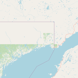
Map view of Baie-de-Brador Migratory Bird Sanctuary

Use this park location map to pinpoint Baie-de-Brador Migratory Bird Sanctuary in Canada, understand its exact geographic position, and read its mapped placement within the surrounding landscape more clearly.

Pigeon | © OpenStreetMap contributors

Location context for Baie-de-Brador Migratory Bird Sanctuary

Quebec
Park atlas

Compare adjacent coastal landscapes and regional marine reserves in eastern Canada.

Parks Near Baie-de-Brador Migratory Bird Sanctuary and Related Protected Areas

Browsing other protected areas near Baie-de-Brador Migratory Bird Sanctuary reveals connected marine ecosystems and regional seabird habitats along the Quebec coast. Expanding the park comparison provides a broader geographic understanding of subarctic island conservation networks in the Gulf of St. Lawrence.
National parkCanada
About 162 km away#1 closest

South

Gros Morne National Park: A Canadian National Park for Geographic Exploration

Discover its mapped protected boundaries and regional landscape context.

Explore Gros Morne National Park, a designated National Park within Canada, offering deep insights into its protected landscape and geographic significance. This page details its mapped boundaries and natural terrain, providing essential context for understanding its role within Canada's broader atlas of protected areas. Engage with the specific geography of this park to deepen your knowledge of natural landscapes and conservation.

Area
1,805 km²
Established
2005
IUCN
II
Relief
Mountain
National parkNewfoundland and Labrador
About 199 km away#2 closest

Northwest

Mealy Mountains National Park Reserve: National Park Protected Landscape and Map Boundaries

Explore the geography and natural terrain of Newfoundland and Labrador.

Mealy Mountains National Park Reserve represents a key protected landscape within Newfoundland and Labrador, offering detailed insights for atlas-based discovery. This national park's geographic scope and mapped boundaries are crucial for understanding its regional context and natural terrain. Explore the structured facts and landscape characteristics that define this significant protected area, providing a clear view of its protected-land identity.

Area
10,700 km²
Established
2015
IUCN
II
Relief
Mountain
Wildlife reserveQuebec
About 250 km away#3 closest

Southwest

Refuge d'oiseaux migrateurs de la Baie-des-Loups Protected Area and Coastal Map

Marine-focused wildlife reserve on the Quebec coast

This wildlife reserve protects essential island and offshore foraging grounds in the Gulf of St. Lawrence. Its geography highlights the intersection of protected land and marine environments, creating a critical habitat for North Atlantic seabird populations along the Quebec lower North Shore.

Area
38.72 km²
Established
1925
IUCN
Ia
National parkNewfoundland and Labrador
About 382 km away#4 closest

Southeast

Terra Nova National Park: National Park Protected Landscape and Regional Geography

Explore mapped boundaries and landscape context.

Terra Nova National Park represents a significant protected area with a distinct geographic footprint within Newfoundland and Labrador. This page provides a detailed atlas-style view of its mapped landscape and protected land status, highlighting its role in the regional geography and Canada's network of natural reserves.

Area
399 km²
Established
1957
IUCN
II
Visitors
45.2K annual
National parkMinganie Regional County Municipality
About 425 km away#5 closest

West

Mingan Archipelago National Park Reserve: Mapped Protected Landscape

Discover its national park geography in Minganie

Mingan Archipelago National Park Reserve is a designated national park offering a distinct protected landscape within the Minganie Regional County Municipality. This entry provides core geographic context and mapped details crucial for atlas exploration. Understand the park's boundaries and its regional landscape setting for comprehensive discovery of Canada's protected natural areas.

Area
151 km²
Established
1984
IUCN
II
Visitors
44K annual
Wildlife reserveMinganie
About 443 km away#6 closest

West

Refuge d'oiseaux migrateurs de Betchouane: Wildlife Reserve and Coastal Geography

Mapped protected island terrain in the Minganie region.

The Refuge d'oiseaux migrateurs de Betchouane comprises a cluster of small islands and surrounding marine environments along the north shore of the Gulf of St. Lawrence. This wildlife reserve serves as a critical nesting site, showcasing the intersection of Precambrian geology and marine conservation. Gain a clear understanding of the sanctuary boundaries and the island-focused terrain that defines this unique protected sector of the Minganie coastline.

Area
4.35 km²
Established
1925
IUCN
Ia
Relief
Lowland
Wildlife reserveFrance
About 512 km away#7 closest

Southwest

Réserve nationale de faune de l'Île-Saint-Paul Wildlife Reserve and Regional Geography

Mapping the protected landscapes of France

The Réserve nationale de faune de l'Île-Saint-Paul provides a focused look at isolated terrain and coastal environmental protection. As a designated wildlife reserve in France, it offers a distinct opportunity to study boundary-driven conservation and regional geography through a mapping perspective that highlights its remote natural character.

Established
2025
Relief
Lowland
Climate
Temperate
Access
Access unknown
A wide watercolor illustration showing a landscape with green coniferous trees, tall grasses in the foreground, and soft rolling dunes in pastel pink and yellow hues in the background.
Wildlife reserveQuebec
About 521 km away#8 closest

Southwest

Réserve nationale de faune de la pointe de l'Est: Quebec Coastal Wildlife Reserve Atlas

A mapped complex of parabolic dunes, lagoons, and migratory bird habitats

Located on the Magdalen Islands, Réserve nationale de faune de la pointe de l'Est safeguards an exceptional coastal landscape defined by wind-shaped barrier spits and extensive sand dunes. This protected area offers critical insight into the geography of the Gulf of Saint Lawrence, protecting diverse habitats ranging from salt marshes to rare parabolic dune formations and freshwater wetlands.

Area
7.2 km²
Established
1978
IUCN
III
Relief
Lowland

Common questions about visiting, size, designation, and location context for Baie-de-Brador Migratory Bird Sanctuary

Baie-de-Brador Migratory Bird Sanctuary FAQs for park facts, access, geography, and protected area context

Find quick answers about Baie-de-Brador Migratory Bird Sanctuary, including protected-area facts, park geography, trail and visitor context, and how the park fits into its surrounding country and regional landscape.
MoriAtlas Explorer

Continue Your Protected Areas Search Across the Global Atlas

Deepen your exploration by continuing the structured search for national parks and protected areas worldwide. Utilize the comprehensive filtering capabilities to compare different conservation landscapes and refine your understanding of global park geography. Discover more about the distribution and characteristics of protected natural areas.

Global natural geography