Mori Atlas logo
National parkMingan Archipelago National Park Reserve

Discover the mapped boundaries and regional geography of this Quebec national park.

Mingan Archipelago National Park Reserve: Protected Landscape & Geographic Context

Mingan Archipelago National Park Reserve represents a key protected national park within the Minganie Regional County Municipality, offering a unique opportunity for geographic exploration. This page serves as an atlas-focused entry point, detailing the park's mapped landscape and its specific place within the regional geography of Quebec. Understand the protected area's identity and its context for structured discovery and landscape comparison.

Coastal IslandsLimestone FormationsSeabird ColoniesSubarctic EnvironmentMarine EcosystemsGeological Heritage

Mingan Archipelago National Park Reserve

National park

Park overview

Structured park overview, official facts, and landscape profile for Mingan Archipelago National Park Reserve

Mingan Archipelago National Park Reserve park facts, protected area profile, and essential visitor context

Review the core facts for Mingan Archipelago National Park Reserve, including designation, size, terrain, visitor scale, habitats, and operating context in one park-focused overview.

About Mingan Archipelago National Park Reserve

Mingan Archipelago National Park Reserve represents a remarkable convergence of geological, ecological, and cultural significance along Quebec's northern coast. The reserve protects a distributed chain of islands and rock formations that stretch across the Gulf of St. Lawrence, creating a complex marine and terrestrial protected area. The landscape is dominated by dramatic limestone formations that have been shaped by coastal erosion processes over millions of years, resulting in the iconic monoliths that define the archipelago's visual identity. These formations arise from the Ordovician sedimentary bedrock that underlies the region, with the Romaine and Mingan formations providing the geological foundation for the islands' distinctive character. The reserve encompasses several distinct ecosystem types that coexist within the limited land area of the islands, making it an ecological mosaic of remarkable density. Beyond its natural significance, the archipelago holds cultural importance, with evidence of human occupation spanning at least 2,000 years and historical connections to European maritime activity dating to the sixteenth century. The area was designated as a heritage site by Quebec in 1978, recognizing its outstanding value, and was later established as a national park reserve in 1984.

Quick facts and research context for Mingan Archipelago National Park Reserve

Mingan Archipelago National Park Reserve covers 151 square kilometers along Quebec's northern Gulf of St. Lawrence coast in the Côte-Nord region. The reserve was established in 1984 and is governed by Parks Canada, protecting a chain of islands characterized by Ordovician limestone formations and dramatic erosion monoliths. The area supports subarctic vegetation at the southern edge of its typical distribution, with boreal forest elements including black spruce dominating the island landscapes. The archipelago is renowned for its significant seabird populations, particularly Arctic terns, common terns, and common eiders, which represent the largest concentrations of these species in the St. Lawrence region. Human activity in the area dates back at least 2,000 years, with First Nations, and later European visitors including Basques, exploiting the rich marine resources of these waters.

Protection and recognition

Tracing the official conservation boundaries, management scope, and legal designations of Canada's coastal island wilderness

Mingan Archipelago National Park Reserve Protection Status and Conservation Designations

Browse the official protection status and designated boundaries established for Mingan Archipelago National Park Reserve. Analyzing geographic management structures offers clear context on how the archipelago's unique coastal terrain and limestone monoliths are legally preserved.

Protection details

Protection scope
Mixed
Transboundary protection
No
Park context

Deeper park guide and search-rich context for Mingan Archipelago National Park Reserve

Mingan Archipelago National Park Reserve history, landscape, wildlife, and travel context

Explore Mingan Archipelago National Park Reserve through its history, landscape character, ecosystems, wildlife, conservation priorities, cultural context, and seasonal travel timing in a structured park guide built for atlas discovery and search intent.

Why Mingan Archipelago National Park Reserve stands out

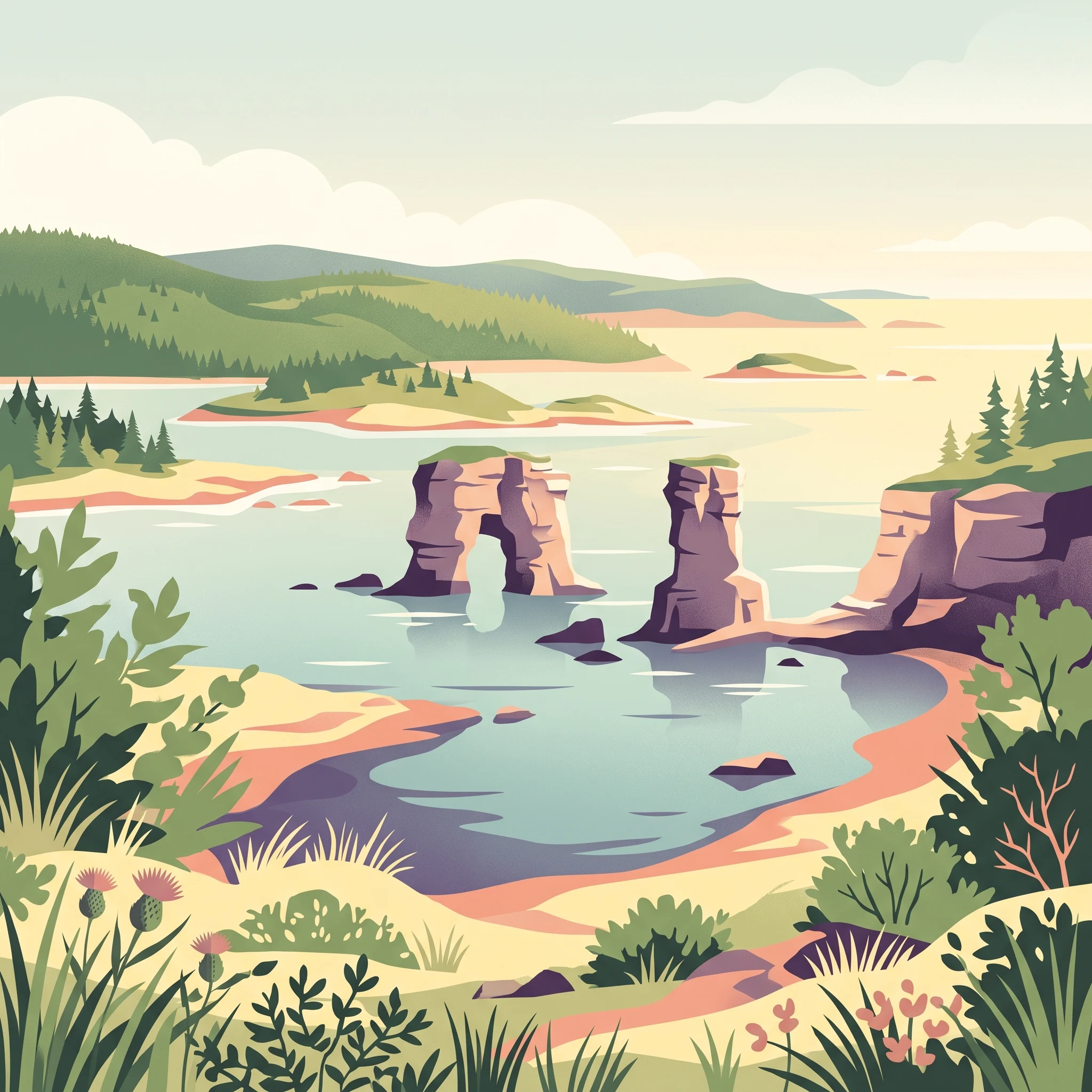
Mingan Archipelago is best known for its extraordinary limestone monoliths, which form the largest concentration of erosion-formed rock pillars in Canada. These dramatic stone towers, carved by millennia of coastal erosion, create a striking and almost otherworldly landscape across the archipelago's islands. The reserve is also famous for its significant seabird colonies, particularly the substantial populations of Arctic terns, common terns, and common eiders that nest on the islands. The geological importance of the area is further underscored by important Ordovician fossil sites within the sedimentary rock formations. Additionally, the archipelago is recognized for its unique combination of subarctic and boreal ecosystems that exist in this coastal setting, including the rare Mingan thistle and other flora adapted to the limestone-rich soils.

Mingan Archipelago National Park Reserve history and protected-area timeline

The Mingan Archipelago region has a rich human history extending back至少 two millennia. First Nations peoples were drawn to the area for its abundant marine resources, engaging in mollusc harvesting, salmon fishing, and seal hunting throughout the archipelago. European interest in the region began in the sixteenth century when Spanish, Portuguese, and Basque visitors arrived to exploit the marine wealth of the Gulf of St. Lawrence. The Basques, in particular, were notably active in the archipelago, conducting cod fishing and whale hunting operations. Archaeological investigations carried out by Parks Canada in 1986 on Mingan Island Nue and Mingan Harbour Island revealed the remains of stone ovens used by Basque whalers to process marine mammal blubber, with evidence suggesting use during the seventeenth and eighteenth centuries. The modern accessibility of the region was transformed by the construction of Highway 138, which was completed to Havre-Saint-Pierre in 1976, opening the previously isolated coastal area. Following this development, conservation advocates proposed establishing the archipelago as a protected area, leading to its formal designation as a national park reserve in 1984, coinciding with the 450th anniversary of Jacques Cartier's arrival in New France.

Mingan Archipelago National Park Reserve landscape and geographic character

The Mingan Archipelago presents a dramatic coastal landscape defined by its extensive chain of islands, islets, rock formations, cays, and limestone reefs scattered across the Gulf of St. Lawrence. The most visually striking feature of the archipelago is its remarkable concentration of erosion monoliths, towering limestone pillars that have been carved by wind and wave action from the Ordovician sedimentary bedrock. These formations create an almost surreal terrain, particularly on islands such as Niapiskau where the monoliths dominate the shoreline and rise dramatically from the surrounding seascape. The underlying geology consists of Ordovician sedimentary rocks divided into two distinct formations: the lower Romaine Formation, composed primarily of dolomite with some shale and possibly sandstone, and the upper Mingan Formation featuring conglomerate, sandstone, shale, and limestone. The horizontal stratification of these calcareous rocks exerts a profound influence on the landscape character and the vegetation patterns throughout the archipelago. The islands support boreal forest vegetation despite their coastal setting, with black spruce as the dominant tree species, while the proximity to cold Labrador currents contributes to the distinctive subarctic environmental character that sets this region apart from typical boreal landscapes.

Mingan Archipelago National Park Reserve ecosystems, habitats, and plant life

The natural environment of Mingan Archipelago represents a distinctive blend of boreal and subarctic elements existing at the southern edge of their typical geographic range. The vegetation belongs to the Chibougamau-Natashquan boreal forest region, dominated by black spruce, though the high latitude and proximity to cold ocean currents create conditions that support subarctic plant communities more typical of regions further north. The entirely calcareous nature of the underlying limestone bedrock profoundly influences the flora, creating conditions favorable to a remarkable diversity of plant life. The archipelago supports approximately 350 vascular plant species, including two rare endemic taxa: Cirsium foliosum var. Minganense and Cypripedium passerinum var. Minganense, both named for their association with this region. The Mingan thistle represents one of the distinctive plant species found here. Bryophyte diversity includes approximately 150 species, while lichen diversity encompasses around 152 species, with 29 representing new additions to regional catalogues. This botanical richness exists within a relatively limited land area, making the archipelago an ecological hotspot of significant conservation value.

Mingan Archipelago National Park Reserve wildlife and species highlights

The wildlife of Mingan Archipelago reflects the diverse habitats present across the marine, coastal, and terrestrial environments of the reserve. Nearly 200 bird species have been recorded in the area, including significant seabird colonies representing the largest concentrations of Arctic terns, common terns, and common eiders in the St. Lawrence region. The islands support diverse avifauna including warblers, ospreys, passerines, razorbills, waders, bald eagles, Atlantic puffins, and Barrow's goldeneye. Marine mammals are well-represented in the surrounding waters, with three species of seal commonly found: grey seal, harbor seal, and harp seal. The waters beyond the archipelago support several cetacean species attracted by the abundant marine life, including Atlantic white-sided dolphins, harbor porpoises, common minke whales, humpback whales, and fin whales. Terrestrial mammals on the islands include North American beaver, North American river otter, muskrat, red fox, American red squirrel, snowshoe hare, and ermine, with occasional visits from black bears and moose on coastal islands.

Mingan Archipelago National Park Reserve conservation status and protection priorities

Mingan Archipelago National Park Reserve holds IUCN Category II protected area status, reflecting its significance as a national park preserving outstanding natural and cultural values. The reserve protects what is recognized as the most significant concentration of erosion monoliths in Canada, a landscape feature of national importance. The geological significance of the area is further emphasized by important Ordovician fossil sites within the sedimentary formations. The ecological importance of the archipelago is substantial, given the unique blend of subarctic and boreal ecosystems existing in a coastal island setting, with the calcareous bedrock supporting plant communities of remarkable diversity including endemic taxa. The designation of the archipelago as a Quebec heritage site in 1978 acknowledged its outstanding value, while the subsequent establishment as a national park reserve in 1984 provided stronger federal protection under Parks Canada management. The reserve's long coastline and island habitats provide critical protection for significant seabird populations that depend on these coastal environments for nesting.

Mingan Archipelago National Park Reserve cultural meaning and human context

The Mingan Archipelago holds cultural significance spanning thousands of years of human interaction with this coastal landscape. The region's First Nations peoples, particularly the Mi'kmaq and other indigenous groups, maintained long-standing connections to the area, drawn by the abundant marine resources that the Gulf of St. Lawrence provided. These communities engaged in traditional activities including mollusc harvesting, salmon fishing, and seal hunting that shaped their relationship with the archipelago over millennia. European exploration and exploitation began in the sixteenth century when Spanish, Portuguese, and Basque visitors arrived to harvest the rich marine resources of the region. The Basque whaling operations left tangible archaeological evidence on the islands, with stone ovens used for processing whale blubber dating to the seventeenth and eighteenth centuries. The construction of Highway 138 in 1976 transformed the region's accessibility, enabling the conservation movement that led to the park's establishment in 1984. The area also bears the name of the Commission de toponymie du Québec in recognition of its importance as part of the historic route associated with Jacques Cartier's 1534 voyage.

Top sights and standout views in Mingan Archipelago National Park Reserve

The defining highlights of Mingan Archipelago center on its extraordinary combination of geological, ecological, and cultural features within a relatively compact protected area. The limestone monoliths represent Canada's most significant concentration of these erosion-formed rock formations, creating an iconic landscape that defines the archipelago's visual character. The seabird populations, particularly the large colonies of Arctic terns, common terns, and common eiders, represent the most significant concentrations of these species anywhere in the St. Lawrence, making the reserve a destination of particular interest for ornithological observation. The Ordovician fossil heritage embedded in the sedimentary formations provides important scientific insight into ancient marine environments. The botanical diversity, including endemic species such as the Mingan thistle adapted to the unique limestone terrain, adds ecological dimension to the reserve's significance. The cultural layers spanning First Nations occupation through Basque whaling history to modern conservation create a rich historical narrative that complements the natural values.

Best time to visit Mingan Archipelago National Park Reserve

The optimal time to experience Mingan Archipelago depends on what visitors hope to observe, though the summer months of July and August generally offer the most accessible conditions for exploring the islands. During this period, the boreal and subarctic vegetation reaches its full development, wildlife activity is at its peak, and boat access to the islands is most reliable given the ice-free conditions. The seabird nesting season reaches its height in early summer, offering excellent opportunities to observe the significant colonies of terns and eiders that characterize the reserve. The dramatic limestone monoliths can be appreciated throughout the open water season, though the interplay of light and rock creates particularly compelling visual conditions during calm summer evenings. Visitors seeking to avoid the peak season might consider late spring or early fall, though access conditions become more constrained and some services may be limited. The subarctic climate means that even summer temperatures remain moderate, and visitors should be prepared for variable coastal conditions.
Park guides

Targeted research questions and seasonal timing for the limestone islands

Mingan Archipelago National Park Reserve Focused Guides and Coastal Resources

Selected readings provide focused answers regarding coastal access and maritime conditions across the reserve. Published materials examine optimal timing for exploring limestone pillars and seabird nesting habitats during summer months.
Monthly climate preview

Long term temperature and precipitation cycles across the subarctic coastal islands

Climate Normals and Weather by Month for Mingan Archipelago National Park Reserve

Long term averages at a representative coastal elevation of thirty-two meters show a distinct subarctic temperature cycle, ranging from cold winter means below minus ten degrees Celsius to mild summer peaks around fifteen degrees. Reviewing the complete monthly profile reveals crucial variations in daily precipitation averages and seasonal minimums across the archipelago.
Annual mean3 °C
-11 °C16 °C
Jan-10°
Feb-11°
Mar-6°
Apr
May
Jun11°
Jul15°
Aug16°
Sep12°
Oct
Nov
Dec-6°
Warmest month
August

15.6 °C

Coolest month
February

-10.6 °C

Wettest month
October

3.4 mm/day

Driest month
February

2 mm/day

Park location guide

Geography guide, regional context, and park location map for Mingan Archipelago National Park Reserve

Mingan Archipelago National Park Reserve park geography, regions, and map view in Canada

Understand where Mingan Archipelago National Park Reserve sits in Canada through a broader geographic reading of the surrounding landscape, nearby location context, and its mapped position within the national park landscape.

How Mingan Archipelago National Park Reserve fits into Canada

Canada is a federal parliamentary constitutional monarchy spanning North America from the Atlantic to the Pacific and Arctic Oceans. With a population of over 41 million, it is officially bilingual in English and French at the federal level. The country gained independence from the United Kingdom through a gradual process culminating in 1982.

Wider geography shaping Mingan Archipelago National Park Reserve in Canada

Canada occupies the northern portion of North America, sharing its longest international border with the United States. The country extends from the Atlantic Ocean to the Pacific Ocean and northward into the Arctic Ocean, giving it the longest coastline of any nation.

Map view of Mingan Archipelago National Park Reserve

Use this park location map to pinpoint Mingan Archipelago National Park Reserve in Canada, understand its exact geographic position, and read its mapped placement within the surrounding landscape more clearly.

Pigeon | © OpenStreetMap contributors

Location context for Mingan Archipelago National Park Reserve

Minganie Regional County MunicipalityQuebec
Recorded earthquake history

View the Recorded Earthquake History for Mingan Archipelago National Park Reserve

Browse the historical collection of seismic events recorded in the vicinity of Mingan Archipelago National Park Reserve. MoriAtlas provides a structured, map-based look at regional earthquake data, including event magnitude and epicentre proximity for the archipelago's unique coastal environment.

Mingan Archipelago National Park Reserve Earthquake History

Catalogued events

3 events

Strongest magnitude

Magnitude 4.4

Most recent event

Sep 16, 2001

This history includes earthquakes recorded inside the park or within 50 km of its borders

Park atlas

Compare protected coastal landscapes and park geography across the broader Gulf of St. Lawrence region.

Discover Other National Parks and Protected Areas Near Mingan Archipelago National Park Reserve

After exploring Mingan Archipelago National Park Reserve's unique limestone formations and subarctic environments, you can browse other coastal protected areas and diverse landscapes across the broader Gulf of St. Lawrence. A geographic comparison reveals varied conservation landscapes, enabling you to trace the regional spread of geological heritage, seabird colonies, and marine ecosystems.
Wildlife reserveMinganie
Mapped location lies within the park boundary#1 closest

Southwest

Refuge d'oiseaux migrateurs de Betchouane: Wildlife Reserve and Coastal Geography

Mapped protected island terrain in the Minganie region.

The Refuge d'oiseaux migrateurs de Betchouane comprises a cluster of small islands and surrounding marine environments along the north shore of the Gulf of St. Lawrence. This wildlife reserve serves as a critical nesting site, showcasing the intersection of Precambrian geology and marine conservation. Gain a clear understanding of the sanctuary boundaries and the island-focused terrain that defines this unique protected sector of the Minganie coastline.

Area
4.35 km²
Established
1925
IUCN
Ia
Relief
Lowland
National parkQuebec
136 km away#2 closest

Southwest

Forillon National Park: Quebec National Park Protected Landscape and Geography

Explore mapped park boundaries and regional terrain.

Forillon National Park represents a crucial component of Quebec's protected lands, offering a rich subject for geographic discovery and atlas exploration. This national park's specific landscape characteristics and mapped boundaries provide essential context for understanding its role within the wider regional geography of Canada. Dive into the mapped terrain and protected area details that make Forillon National Park a unique element in any natural landscape atlas.

Area
244 km²
Established
1970
IUCN
II
Visitors
164.1K annual
Wildlife reserveQuebec
191 km away#3 closest

East

Refuge d'oiseaux migrateurs de la Baie-des-Loups Protected Area and Coastal Map

Marine-focused wildlife reserve on the Quebec coast

This wildlife reserve protects essential island and offshore foraging grounds in the Gulf of St. Lawrence. Its geography highlights the intersection of protected land and marine environments, creating a critical habitat for North Atlantic seabird populations along the Quebec lower North Shore.

Area
38.72 km²
Established
1925
IUCN
Ia
Wildlife reserveQuebec
About 314 km away#4 closest

Southeast

Réserve nationale de faune de la pointe de l'Est: Quebec Coastal Wildlife Reserve Atlas

A mapped complex of parabolic dunes, lagoons, and migratory bird habitats

Located on the Magdalen Islands, Réserve nationale de faune de la pointe de l'Est safeguards an exceptional coastal landscape defined by wind-shaped barrier spits and extensive sand dunes. This protected area offers critical insight into the geography of the Gulf of Saint Lawrence, protecting diverse habitats ranging from salt marshes to rare parabolic dune formations and freshwater wetlands.

Area
7.2 km²
Established
1978
IUCN
III
Relief
Lowland
Wildlife reserveNew Brunswick
About 343 km away#5 closest

Southwest

Île-du-Portage National Wildlife Area: Geographic Overview and Protected Island Mapping

A vital estuarine reserve on the New Brunswick coast

Study the coastal terrain of Île-du-Portage National Wildlife Area, an uninhabited island reserve situated at the junction of the Miramichi River and the Northumberland Strait. This overview focuses on the island's role as one of five National Wildlife Areas in New Brunswick, highlighting its significance within the broader estuarine geography and coastal maritime history of the Atlantic region.

Area
3.49 km²
Established
1979
IUCN
Ia
Relief
Lowland
National parkCanada
360 km away#6 closest

East

Gros Morne National Park: A Canadian National Park for Geographic Exploration

Discover its mapped protected boundaries and regional landscape context.

Explore Gros Morne National Park, a designated National Park within Canada, offering deep insights into its protected landscape and geographic significance. This page details its mapped boundaries and natural terrain, providing essential context for understanding its role within Canada's broader atlas of protected areas. Engage with the specific geography of this park to deepen your knowledge of natural landscapes and conservation.

Area
1,805 km²
Established
2005
IUCN
II
Relief
Mountain
National parkNew Brunswick
363 km away#7 closest

South

Kouchibouguac National Park: New Brunswick Protected Landscape Atlas

Mapped protected area boundaries and regional geography.

Kouchibouguac National Park is a designated national park offering a rich canvas for geographic discovery. This entry focuses on understanding its protected landscape, detailing its specific mapped boundaries within New Brunswick. It serves as a vital component for atlas exploration, providing the context needed to grasp the park's natural terrain and its significance within the regional geography.

Area
238 km²
Established
1969
IUCN
II
Visitors
243.5K annual
National parkPrince Edward Island
About 392 km away#8 closest

South

Pituamkek National Park Reserve: Prince Edward Island National Park Atlas Exploration

Mapped protected area and regional geographic context.

Pituamkek National Park Reserve offers a unique opportunity for atlas-driven discovery, focusing on its protected status as a national park on Prince Edward Island. The page details the park's geographic setting and its role within the broader landscape context of Canada. Explore its specific mapped boundaries and understand its contribution to the network of protected natural areas, providing essential data for geographic research and landscape analysis.

Area
30 km²
Established
2024
IUCN
II
Relief
Lowland

Common questions about visiting, size, designation, and location context for Mingan Archipelago National Park Reserve

Mingan Archipelago National Park Reserve FAQs for park facts, access, geography, and protected area context

Find quick answers about Mingan Archipelago National Park Reserve, including protected-area facts, park geography, trail and visitor context, and how the park fits into its surrounding country and regional landscape.
MoriAtlas Explorer

Continue Your Protected Areas Search Across the Global Atlas

Deepen your exploration by continuing the structured search for national parks and protected areas worldwide. Utilize the comprehensive filtering capabilities to compare different conservation landscapes and refine your understanding of global park geography. Discover more about the distribution and characteristics of protected natural areas.

Global natural geography