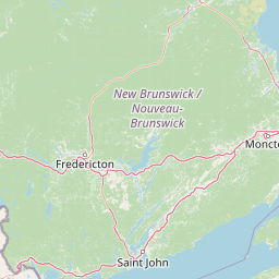
Why Fundy National Park stands out
Fundy National Park is best known for the world's highest tides, which regularly exceed 15 metres in height and completely transform the coastal landscape twice daily. At low tide, visitors can walk across the exposed ocean floor, exploring tide pools teeming with marine life including dog whelks, periwinkles, and various seaweeds. At high tide, the same area vanishes under deep salt water. Beyond the tides, the park is celebrated for its rugged coastline rising to the Canadian Highlands, its network of over twenty-five waterfalls, and the scenic hiking trails such as Dickson Falls that wind through the forested terrain. The park also features a distinctive red-painted covered bridge at Point Wolfe and a nine-hole golf course set against the coastal backdrop.
Fundy National Park history and protected-area timeline
The territory that now comprises Fundy National Park has a complex human history spanning indigenous occupation, colonial settlement, and eventual protected-area establishment. The Mi'kmaq and Maliseet peoples inhabited the area historically, though evidence suggests their presence was temporary given the limited archaeological remains of permanent settlement. In the late 1600s and early 1700s, Acadian settlers established communities in the surrounding region, including the settlement of Chipoudy, which was founded in 1710 and persisted until the Expulsion of the Acadians by the British. Permanent European settlement of the region did not begin until 1825, when immigrants from Scotland, Ireland, and England arrived. The plateau lands proved unsuitable for agriculture and were largely abandoned within a generation, while coastal villages like Point Wolfe thrived on fishing, sawmills, and small shipyards. The logging industry ultimately depleted the region's timber resources by the late 19th and early 20th centuries, causing widespread emigration. The proposal for a national park in New Brunswick originated from a petition by the New Brunswick Fish and Game Association in 1927, with initial candidate sites including Mount Carleton and Albert County. After years of debate between federal and provincial authorities over site selection, the Albert County location was chosen following the Second World War. Land expropriation proceeded more smoothly than in other Atlantic Canadian parks, with the province purchasing Crown land from a Maine forestry company for $325,000 and compensating private landowners at a total cost exceeding $850,000. The park was officially created on April 10, 1948, and received substantial federal investment of over $2.2 million for development between 1948 and 1950, reflecting the growing importance of national parks in Canada's post-war conservation agenda.
Fundy National Park landscape and geographic character
Fundy National Park presents a dramatic landscape that transitions sharply from sea level to highland elevations within a relatively short distance. The Bay of Fundy coastline features towering cliffs and rocky shores that are shaped by the world's highest tides, with tidal ranges exceeding 15 metres. At low tide, extensive mudflats and rocky platforms are exposed along the shoreline, revealing the ocean floor to visitors who can walk among tide pools and examine marine life. At high tide, the same areas disappear beneath deep water, completely transforming the coastal character twice daily. The land rises from the coastal zone into the Canadian Highlands, creating a backdrop of forested slopes and steep valleys. More than twenty-five waterfalls cascade down these slopes, flowing from the higher elevations directly to the sea. The park contains several rivers including the Point Wolfe River, Broad River, and Upper Salmon River, each carving valleys through the terrain. Bog habitats, such as the Caribou Plains area, add further landscape diversity with their distinctive vegetation and wet conditions. The park's interior features a network of trails that traverse this varied topography, offering views from coastal overlooks down to forested river valleys.
Fundy National Park ecosystems, habitats, and plant life
Fundy National Park protects a ecologically diverse landscape situated within the New England-Acadian forest ecoregion, encompassing multiple distinct habitat types within its 207 square kilometre boundaries. The park's flora is remarkably diverse, with 658 species of vascular plants, 276 species of bryophytes, and more than 400 species of lichens documented within its boundaries. The forests represent a mixed-wood ecosystem dominated by red spruce, balsam fir, yellow birch, white birch, sugar maple, and red maple. The forest floor is carpeted with moss, wood fern, and bunchberry, creating a lush understory. The park contains some of the last pure stands of red spruce in eastern North America, representing the boreal element of the forest cover. Bog habitats support distinctive plant communities including sphagnum moss, black spruce, and eastern larch, with three species of carnivorous plants found in the Caribou Plains bog: pitcher plant, sundew, and bladderwort. Rare plant species include bird's-eye primrose found along coastal cliffs, as well as slender spikemoss, squashberry, green spleenwort, and fir clubmoss in riparian areas. The park is situated across two distinct ecoregions, with the southern section experiencing cool, wet summers and mild, rainy winters, while the northern section has warmer, rainier summers and mild, snowy winters.
Fundy National Park wildlife and species highlights
Fundy National Park supports a rich community of wildlife, with 38 mammal species, over 260 bird species, and diverse reptile and amphibian populations documented within its boundaries. The most commonly encountered mammals include eastern moose, white-tailed deer, eastern coyotes, chipmunks, red squirrels, and snowshoe hares, while more nocturnal species include various mice and shrews, raccoons, black bears, North American beavers, and northern flying squirrels. Bats have been increasingly spotted in the park, leading to the installation of ultrasonic bat monitors in 2020. The park's bird population includes approximately 95 nesting species among the more than 260 species recorded in the area. Common bird species include various warblers, pileated woodpeckers, juncos, white-winged crossbills, great blue herons, cormorants, semipalmated sandpipers, and semipalmated plovers. The peregrine falcon, which had been extirpated from the area by the park's creation in 1948, has been successfully reintroduced. Reptile species include four nonpoisonous snake varieties: green snakes, red-bellied snakes, ring-necked snakes, and eastern garter snakes. Amphibians are represented by American toads, leopard frogs, pickerel frogs, green frogs, and bullfrogs, along with seven salamander species including yellow-spotted salamanders, red-backed salamanders, northern two-lined salamanders, and eastern newts.
Fundy National Park conservation status and protection priorities
Fundy National Park plays a significant role in conservation within the New England-Acadian forest ecoregion, protecting representative examples of coastal, forest, and bog ecosystems that have been altered across much of the surrounding landscape. The park serves as a refuge for several species at risk, with particular focus on the endangered Inner Bay of Fundy Atlantic salmon population, which is monitored regularly as part of ongoing conservation efforts. Species such as martens, fishers, brook trout, eel, and moose are also monitored within the park boundaries. Recent conservation projects have prioritized restoring aquatic connectivity, including the removal of the Bennett Lake Dam, installation of new culverts, and restoration of Dickson Brook to improve fish passage and habitat availability. The park's old-growth red spruce stands represent increasingly rare forest communities in eastern North America, and their protection within the park boundary contributes to conservation of this limited forest type. The bog habitats, with their unique carnivorous plant communities and specialized vegetation, represent another conservation priority within the park's diverse landscape.
Fundy National Park cultural meaning and human context
The human history of what is now Fundy National Park reflects the broader settlement patterns of southeastern New Brunswick, though the land was never heavily populated due to the limitations of the terrain and the relatively late arrival of permanent European settlement. Indigenous groups including the Mi'kmaq and Maliseet used the area, though apparently on a temporary basis rather than establishing permanent villages. Acadian settlement in the late 1600s and early 1700s represented the first agricultural presence, though these communities were disrupted by the British expulsion of the Acadians in the mid-18th century. Permanent European settlement did not begin until 1825, with immigrants from Scotland, Ireland, and England establishing farms and villages in the region. The coastal settlement of Point Wolfe became the most prosperous community, supporting fishing, sawmills, and small shipyards. When the park was created in the 1940s, several small communities including Hastings, Upper Salmon River, and Butland Settlement were expropriated, with former residents relocating primarily to the nearby village of Alma. The park contains two covered bridges that reflect the region's traditional bridge-building heritage: the Forty Five River #1 covered bridge built in 1914 and the Point Wolfe Bridge rebuilt in 1992.
Top sights and standout views in Fundy National Park
Fundy National Park offers visitors a unique combination of natural phenomena and recreational opportunities centered on the world's highest tides and rugged Bay of Fundy coastline. The tidal experience itself is the park's defining feature, with visitors able to walk on the exposed ocean floor at low tide and witness the dramatic disappearance of the shoreline under up to 15 metres of water at high tide. The network of over 25 hiking trails, including the popular Dickson Falls trail, provides access to the park's waterfalls, forest landscapes, and coastal viewpoints. The Caribou Plains trail and boardwalk offers a unique opportunity to explore upland forest and bog habitats. The distinctive red-painted covered bridge at Point Wolfe remains an iconic landmark within the park. Winter visitors can enjoy cross-country skiing, snowshoeing, and winter walking on groomed trails, with the Chignecto Ski Club maintaining the ski routes. The park's position on the Bay of Fundy provides views across to the Nova Scotia coastline, while the Dobson Trail and Fundy Footpath extend beyond the park boundary for those seeking longer backcountry adventures.
Best time to visit Fundy National Park
Fundy National Park offers distinct experiences across the seasons, each with its own character and appeal. Summer months bring the most stable weather and full access to all trails, campgrounds, and visitor facilities, making it the peak season for hiking, wildlife viewing, and exploring the tidal phenomenon. The warm months allow for the full experience of the park's amenities including the heated saltwater swimming pool and the golf course. Autumn transforms the park with vibrant foliage as the mixed-wood forests display their fall colours, particularly spectacular in the maple and birch stands. Fall also brings migrant bird species as populations move through the region. Winter offers a completely different experience as the park remains open for day use, with cross-country skiing and snowshoeing available on groomed trails through the snowy landscape. The winter season provides a quiet, contemplative experience of the park's terrain, though facilities and trail access are more limited. Spring brings the renewal of vegetation and is marked by the bloom of wildflowers including Carolina springbeauty and trout-lily in the hardwood forests.