
Mori Atlas logo
Protected areaBegtrup Vig

Examining the ecological boundaries and terrain of the Djursland Peninsula in Eastern Jutland

Begtrup Vig: A Detailed Look at the Glacial Coastal Landscapes and Protected Area Geography

Begtrup Vig serves as a vital protected area within the Mols Bjerge framework, showcasing a complex coastal geography shaped by ice-age processes. This region features a fifteen-kilometer shoreline of mixed sand and stone, framed by the rolling hills of the Mols peninsula and the striking Helgenæs isthmus. Users can examine the structured terrain, from the sheltered inner meadows of the bay to the western reaches of Skødshoved, providing a comprehensive atlas perspective on this significant Danish habitat.

coastal bayNatura 2000EU habitat areaNationalpark Mols Bjergeglacial landscapeDjursland
A digital illustration showing a tranquil landscape with a waterfall cascading from a rocky cliff into a river, which flows toward a sandy shore and a calm bay under a soft sun.

Begtrup Vig

Protected area

Park overview

Structured park overview, official facts, and landscape profile for Begtrup Vig

Begtrup Vig park facts, protected area profile, and essential visitor context

Review the core facts for Begtrup Vig, including designation, size, terrain, visitor scale, habitats, and operating context in one park-focused overview.

About Begtrup Vig

Begtrup Vig is a Danish coastal bay of significant geographic and ecological character, opening from the southern edge of Djursland into the waters of the Aarhus Bight. The bay sits at the interface between two of the region's most distinctive landforms: the glacial hills of Mols to the north and west, and the long peninsula of Helgenæs to the east and south. This setting gives the bay a contained, almost inland quality in its inner reaches while still connecting clearly to the larger maritime landscape of the Kattegat.

The surrounding terrain reflects the powerful influence of the last ice age. Glacial movement shaped the rolling hills and varied topography that today frame Begtrup Vig, creating the alternating high points, slopes, and low-lying meadows that define the coastal scenery. From elevated vantage points such as Trehøje, visitors can see how the bay sits within a layered landscape where glacial hills, cultivated fields, small coastal settlements, and open water combine into a single continuous panorama.

Ecologically, Begtrup Vig carries formal recognition beyond its visual appeal. The inner part of the bay is part of the Natura 2000 site designated as area 51, which covers Begtrup Vig and coastal zones around Helgenæs, and the site also qualifies as an EU habitat area. The same area is incorporated into the broader Nationalpark Mols Bjerge, linking the bay to one of Denmark's most significant protected landscapes and reinforcing its conservation standing.

On the ground, Begtrup Vig functions as a low-key recreational and residential coastal environment. Three related holiday-home areas are located around its shores, at Strands near the northern entrance of the bay, at Dragsmur toward the south, and at Kongsgårde on Helgenæs. The bay's roughly fifteen kilometers of coastline mix sandy beaches with small coves and stony sections, providing a varied walking and bathing environment that supports a modest but persistent tourism and second-home culture.

Historical traces add a quieter layer to the bay's profile. Near Dragsmur, where the tongue of land between Mols and Helgenæs narrows, remains of Olaf Rye's Skanse still mark the landscape. This wartime redoubt links Begtrup Vig to Denmark's broader 19th-century military history and gives the area an additional, more reflective dimension alongside its natural and recreational character.

Quick facts and research context for Begtrup Vig

Begtrup Vig is a bay of the Aarhus Bight, located on the southern edge of Djursland in central eastern Jutland, Denmark. Its inner waters and adjacent coastal areas form part of the EU-protected Natura 2000 site no. 51, classified as an EU habitat area, and the same area falls within the broader boundaries of Nationalpark Mols Bjerge. The bay's inner section is bordered by meadows, fields, and the small island Rønnen, while its outer edges open toward the peninsula of Helgenæs and the Kattegat.

The coastline runs for roughly fifteen kilometers, alternating between sand and stones, supporting three connected holiday-home areas at Strands, Dragsmur, and Kongsgårde. The nearest major town is Ebeltoft, about twenty kilometers to the east, and Aarhus lies around forty kilometers to the west. Adjacent coastal features include Ebeltoft Vig, Knebel Vig, and the wider Aarhus Bight.

Protection and recognition

Analysis of mixed protection frameworks and official designation records for Begtrup Vig

Begtrup Vig Protection Status and Documented Conservation Scope

Documented protection records for Begtrup Vig outline a mixed conservation scope and governance framework. Structured geographic data provides clear insight into official designation parameters and international recognition sources.

Protection details

Protection scope
Mixed
Transboundary protection
No
Park context

Deeper park guide and search-rich context for Begtrup Vig

Begtrup Vig history, landscape, wildlife, and travel context

Explore Begtrup Vig through its history, landscape character, ecosystems, wildlife, conservation priorities, cultural context, and seasonal travel timing in a structured park guide built for atlas discovery and search intent.

Why Begtrup Vig stands out

Begtrup Vig is most recognized for its scenic, glacially shaped coastal landscape along the southern shore of Djursland and as a quiet bay destination framed by the Helgenæs peninsula. The bay is noted for its varied shoreline of mixed sand and stone, the sheltered inner waters surrounded by meadows and farmland, and its position within both a Natura 2000 habitat area and the larger Nationalpark Mols Bjerge framework. The bay also draws attention for its sweeping views, with elevated viewpoints such as Trehøje offering panoramas across the water toward Helgenæs, northern Samsø, and the Kattegat. The wartime remains of Olaf Rye's Skanse near Dragsmur add a discreet but persistent cultural and historical thread to the bay's identity, distinguishing it from purely natural coastal landmarks in the region.
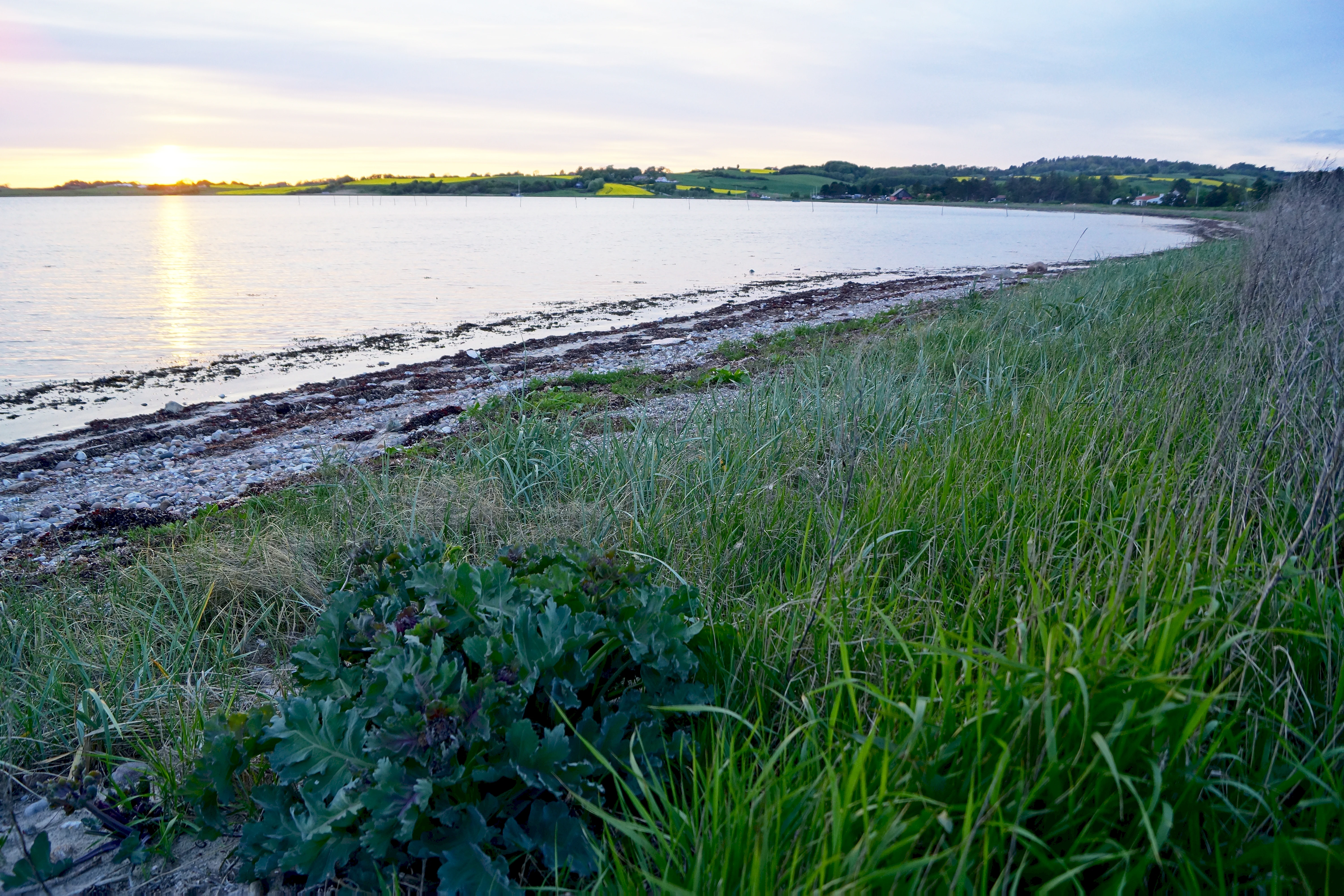
A wide angle view of the Begtrup Vig coastline in Denmark at sunset, featuring a grassy foreground, a sandy shore, and the calm bay water.
A peaceful sunset view over the coastline of Begtrup Vig.

Begtrup Vig history and protected-area timeline

The coastal setting of Begtrup Vig carries layered historical traces, though the bay itself is primarily known as a natural and recreational feature rather than a major historical stage. The most explicit historical referent in the landscape is Olaf Rye's Skanse near Dragsmur, a wartime redoubt located where the land bridge between Mols and Helgenæs pinches in at the eastern edge of the bay. While details of its construction and strategic role are limited in the available sources, its survival as a recognizable feature on the coast connects Begtrup Vig to Denmark's longer tradition of coastal fortifications.

Beyond this specific fortification, the bay reflects broader patterns of rural coastal development in eastern Jutland. Land use around the inner bay has long been shaped by the surrounding meadows and fields, with small settlements such as Begtrup and Strands anchoring the northern coastline. The later addition of holiday-home areas at Strands, Dragsmur, and Kongsgårde on Helgenæs marks a 20th-century shift in the bay's role from a purely working agricultural coastline toward a mixed residential and tourism-oriented landscape, a transition typical of many Danish coastal areas during the rise of second-home culture.

Begtrup Vig landscape and geographic character

Begtrup Vig is fundamentally a landscape shaped by glacial action. The bay lies within a coastal terrain whose hills, slopes, and contours were formed by the movement of ice during the last ice age, producing a varied and rolling topography that frames the water on multiple sides. This glacial legacy is especially visible along the northern edges of the bay, where the land becomes more hilly and gives way to pastoral and settled landscapes around the villages of Begtrup and Strands.

To the west, the coastline bends southward and forms the peninsula of Skødshoved, whose southern tip is marked by Mols Hoved. This peninsula creates a natural western boundary for the bay and contributes to its sheltered, defined shape. On the eastern and southern sides, the long form of Helgenæs closes the bay, with the narrow Dragsmur isthmus acting as a hinge between Mols and the peninsula. Tangen creates one of the most visually striking elements of the bay's landscape, connecting rolling glacial hills on one side to the open peninsular terrain of Helgenæs on the other.

The shoreline itself runs for approximately fifteen kilometers and alternates between sandy stretches and small coves and stony sections. Toward the inner bay, especially around Rønnen and Stavsøre, the character becomes softer and more pastoral, with meadows and fields framing the water. This contrast between rugged glacial hills, peninsular coastal points, soft meadow-lined inner waters, and a varied stony-and-sandy shore gives Begtrup Vig a layered and visually rich coastal landscape despite its modest scale.
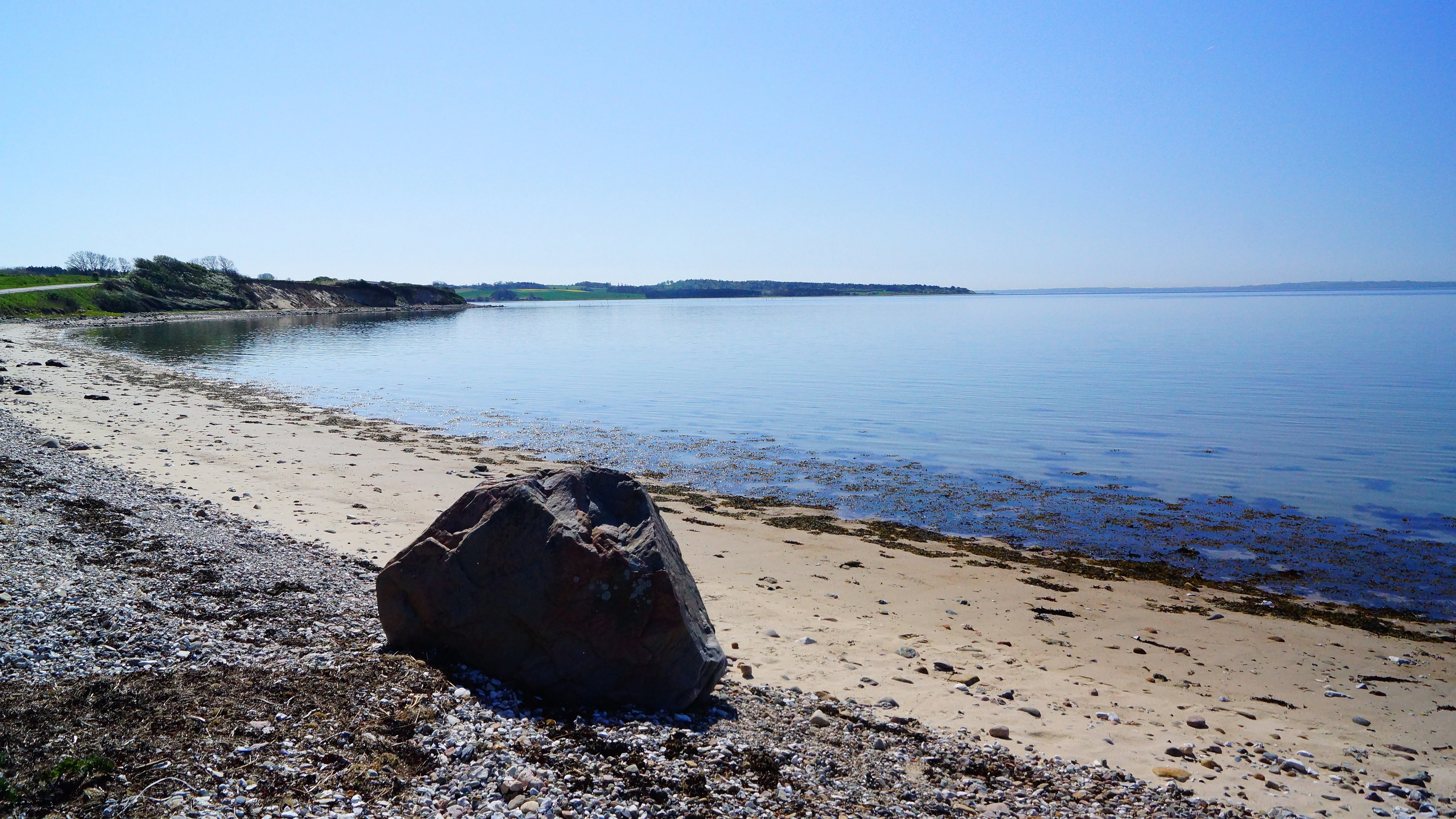
A wide coastal landscape showing a sandy beach and calm water under a clear blue sky, with a large boulder in the immediate foreground.
A peaceful coastal view of Begtrup Vig in Denmark.

Begtrup Vig ecosystems, habitats, and plant life

The natural character of Begtrup Vig is closely tied to its protected status and to the ecological transitions between land and sea that define inner Danish coastal bays. The inner section of the bay, together with adjacent coastal areas around Helgenæs, forms part of Natura 2000 area 51 and is also classified as an EU habitat area, recognizing the biological value of its shoreline, meadows, and shallow marine environments.

Ecologically, the bay functions as a meeting point between terrestrial and marine habitats. The inner bay is fringed by meadows, fields, and low-lying wetland-influenced edges, while small islets such as Rønnen add microhabitats within the water itself. The mix of soft sediment shorelines toward the inner bay and exposed stony and sandy sections further out provides varied habitat conditions for invertebrates, shore flora, and the birdlife that depends on shallow coastal zones in Denmark. The bay's incorporation into Nationalpark Mols Bjerge further reinforces its ecological importance within a broader landscape of protected glacial hills, heaths, and coastal flats.
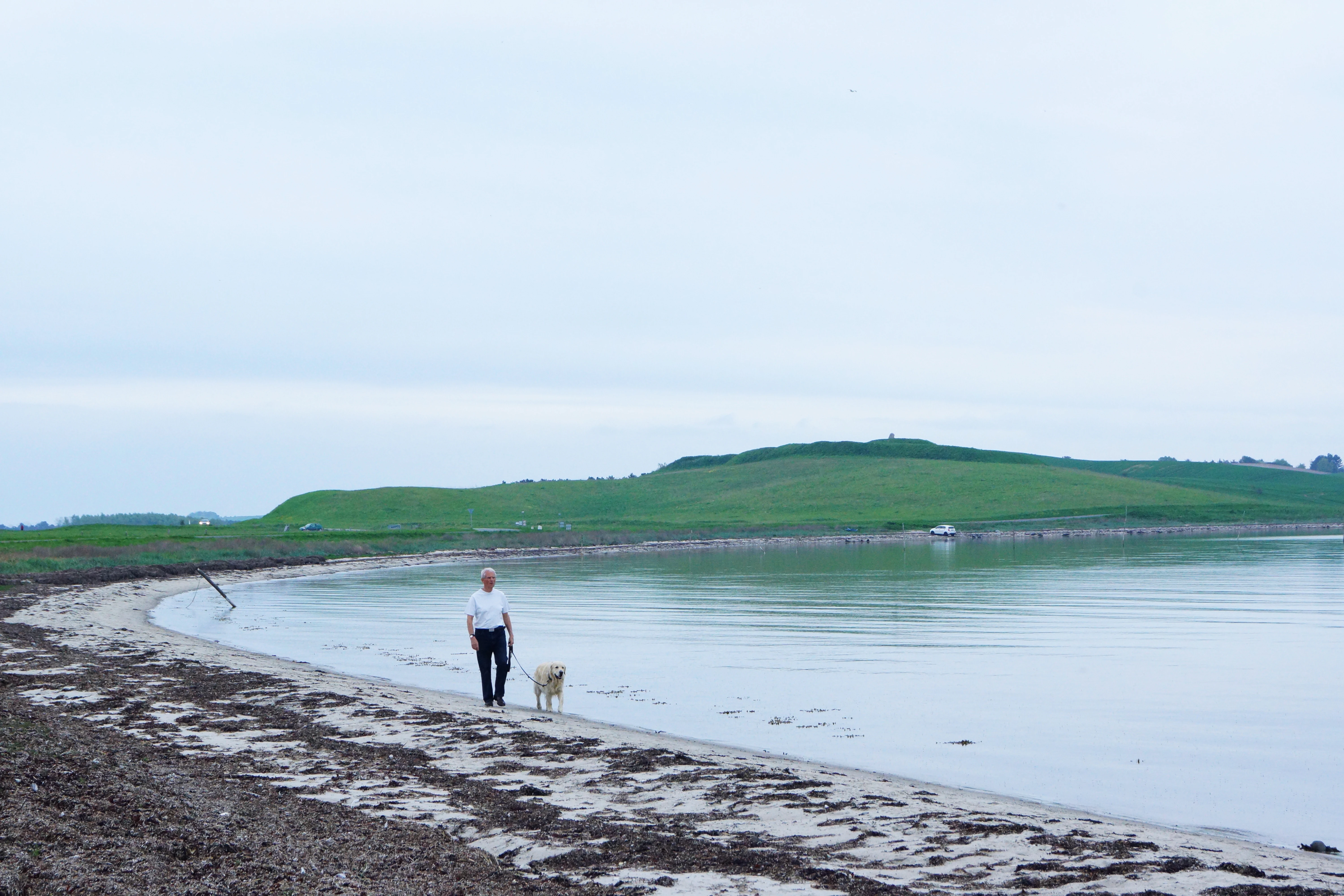
A man in a white shirt and dark pants walking a light-colored dog on a leashed path along a calm, shallow bay with a grassy shoreline.
A person walks their dog along the quiet coastline at Begtrup Vig.

Begtrup Vig wildlife and species highlights

Begtrup Vig's wildlife character is shaped by the combination of shallow inner bay waters, meadow-lined shores, stony and sandy coastline, and its position within a Natura 2000 habitat area. The bay's sheltered inner waters and varied shoreline create conditions favorable to waterbirds, shorebirds, and the smaller invertebrate communities that such species depend on in Danish coastal environments.

The mosaic of meadows, fields, and small wetland edges around the inner bay supports typical coastal farmland and pastoral bird communities, while the more open outer reaches toward the Kattegat add a different ecological context. The smaller coastal features, including the islet Rønnen and the narrow shoreline strips around Stavsøre, function as stepping-stone habitats within the larger protected landscape of Nationalpark Mols Bjerge, contributing to the overall biodiversity pattern of the Molslandet coast.
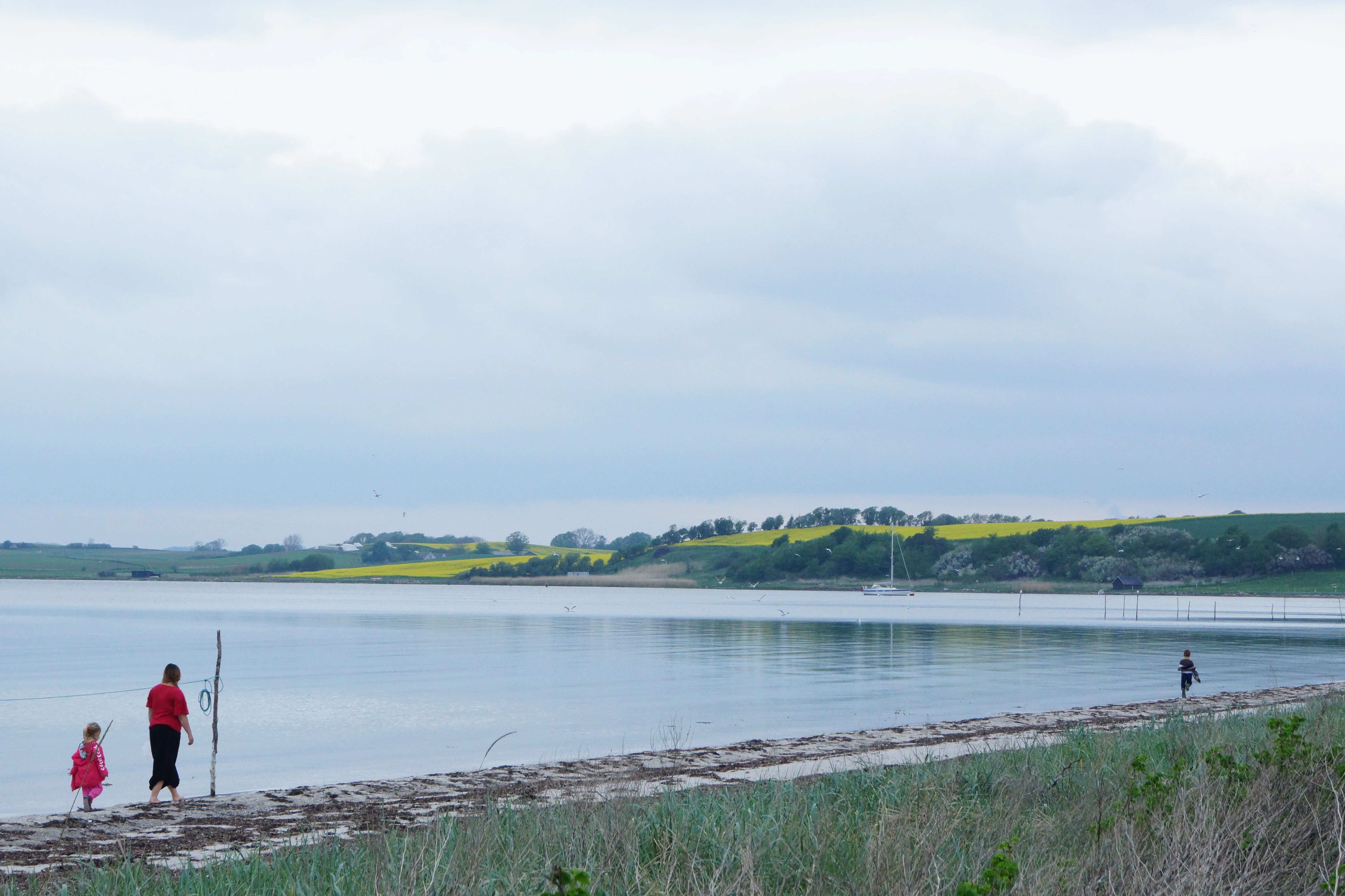
A wide view of a calm bay with a pebbled beach in the foreground and rolling, yellow-flowered green hills on the far shore under a cloudy sky.
Visitors walking along the coastal shoreline of Begtrup Vig.

Begtrup Vig conservation status and protection priorities

Conservation significance is central to Begtrup Vig's identity. The inner bay, together with surrounding coastal zones on Helgenæs, is designated as part of Natura 2000 area 51, Begtrup Vig og kystområder ved Helgenæs, and the same site is officially recognized as an EU habitat area. This designation reflects the ecological value of the bay's shoreline habitats, shallow marine zones, and adjacent terrestrial transitions.

At a national level, the same area is integrated into Nationalpark Mols Bjerge, one of Denmark's most significant protected landscapes. This dual designation, European-level Natura 2000 recognition and inclusion in a national park framework, places Begtrup Vig within a layered conservation system that links the bay's ecology to the broader glacial, heath, and coastal ecosystems of Djursland. The bay thus serves not only as a local natural landmark but also as a component of larger, internationally connected conservation efforts along the eastern Jutland coast.

Begtrup Vig cultural meaning and human context

Begtrup Vig carries a modest but distinctive cultural profile rooted in its coastal agricultural heritage and the slow shift toward recreational use that has shaped much of Djursland's southern shore. Settlements such as Begtrup and Strands reflect a long tradition of small-scale coastal farming communities adapted to the varied glacial terrain overlooking the bay.

The 20th-century addition of connected holiday-home areas at Strands, Dragsmur, and Kongsgårde has extended this cultural identity into a second-home and tourism context, integrating the bay into the broader lifestyle patterns of Danish coastal recreation. The surviving remains of Olaf Rye's Skanse near Dragsmur add a thin but tangible historical layer, linking the bay to Denmark's military coastal history and giving the landscape a secondary cultural reference point beyond its purely rural and recreational character.
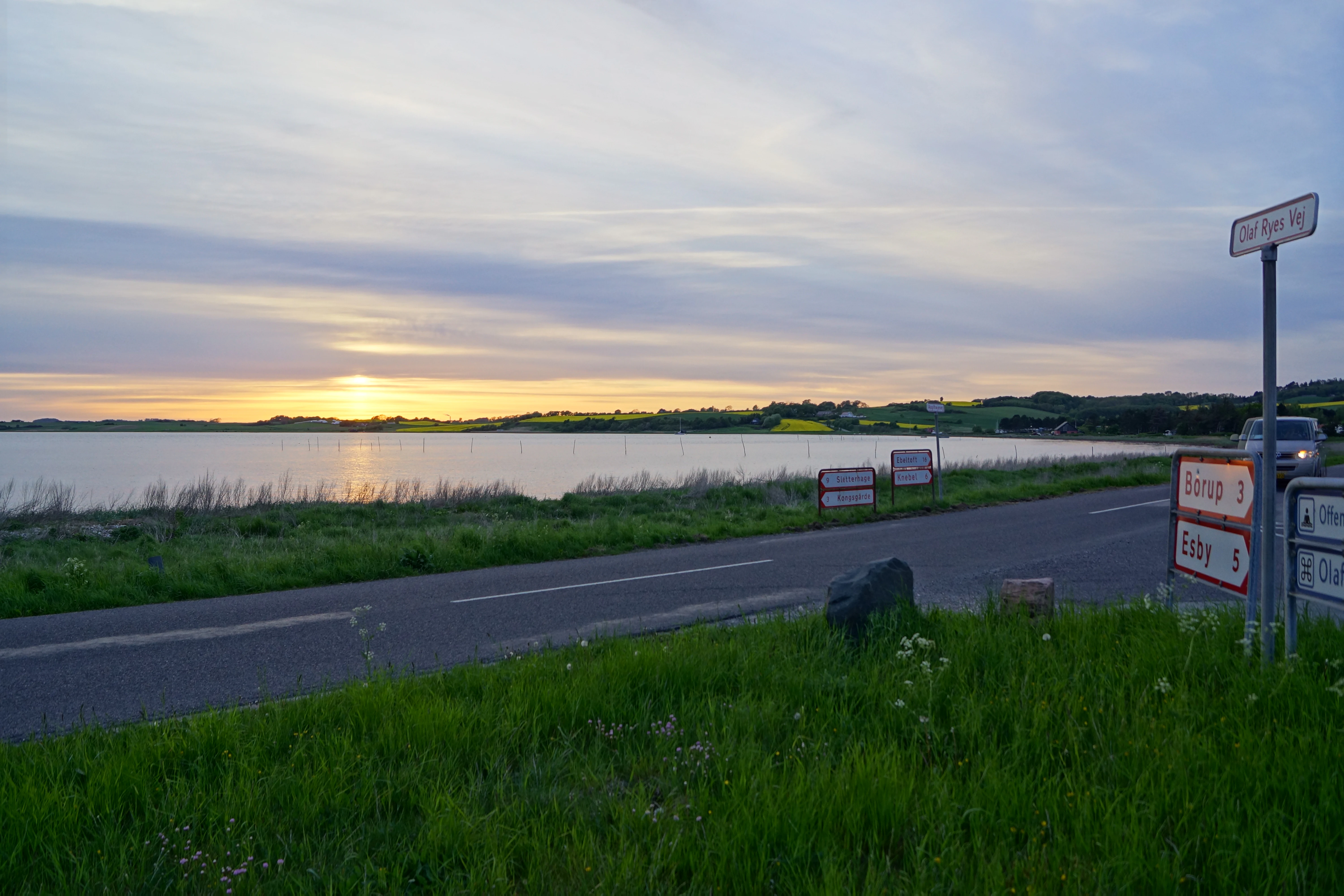
A wide shot showing a sunset over the calm waters of Begtrup Vig with a road running alongside the coast and several road signs on the right.
Sunset view over the coastal waters of Begtrup Vig with road signs in the foreground.

Top sights and standout views in Begtrup Vig

Begtrup Vig combines concentrated ecological and cultural value within a compact coastal frame. Its inclusion in Natura 2000 area 51 and Nationalpark Mols Bjerge marks it as a meaningful unit within Denmark's protected coastal network, while its glacially shaped terrain gives it continuous visual interest from elevated viewpoints such as Trehøje. The roughly fifteen-kilometer shoreline, alternating sand and stone, provides one of the bay's most accessible highlights.

The peninsula of Skødshoved and its tip Mols Hoved form a striking western landmark, while the narrow Dragsmur isthmus linking Mols and Helgenæs adds both scenic and historical character through the remains of Olaf Rye's Skanse. The presence of three connected holiday-home areas and the bay's proximity to both Ebeltoft and Aarhus round out its profile as a coastal landscape that balances ecological importance with quiet residential and recreational use.

Best time to visit Begtrup Vig

The character of Begtrup Vig shifts gently with the Danish seasons, and the most rewarding visits typically align with the warmer months when the bay's mixed sandy and stony shores are most inviting for walking and bathing. Late spring through early autumn generally offers the most favorable conditions for experiencing the full coastal palette, from soft meadow scenery around the inner bay to the open Kattegat vistas toward Helgenæs and northern Samsø.

In summer the bay takes on its most active recreational atmosphere, while shoulder seasons can offer quieter shoreline walking and crisper visibility from elevated viewpoints such as Trehøje. Winter visits carry a different appeal, with the dramatic glacial hills and shifting light over the bay creating a more subdued but atmospheric coastal landscape. As with much of the eastern Jutland coast, weather and light change quickly here, and visitors benefit from flexible timing rather than fixed seasonal assumptions.


Monthly climate preview

Analyzing long-term monthly averages across the representative coordinate in Denmark

Begtrup Vig Climate Normals: Measured Temperature and Precipitation Rhythms

Historical data records monthly temperatures ranging from sub-zero winter minimums to warm summer maximums alongside consistent daily precipitation averages at Begtrup Vig. Examining the complete twelve-month climatology profile reveals precise seasonal shifts and long-term weather patterns across the landscape.
Annual mean9 °C
2 °C17 °C
Jan
Feb
Mar
Apr
May11°
Jun15°
Jul17°
Aug17°
Sep14°
Oct10°
Nov
Dec
Warmest month
August

17.5 °C

Coolest month
February

1.5 °C

Wettest month
August

2.5 mm/day

Driest month
April

1.3 mm/day

Park location guide

Geography guide, regional context, and park location map for Begtrup Vig

Begtrup Vig park geography, regions, and map view in Denmark

Understand where Begtrup Vig sits in Denmark through a broader geographic reading of the surrounding landscape, nearby location context, and its mapped position within the national park landscape.

How Begtrup Vig fits into Denmark

Denmark is a constitutional monarchy and Nordic country in Northern Europe. It is the southernmost of the Scandinavian countries, bordering Germany to the south, Norway to the north, and Sweden to the southwest. The country consists of the Jutland peninsula and an archipelago of islands, with Copenhagen as its capital and largest city. Denmark has a population of over 6 million and is characterized by flat, arable land, sandy coasts, and a temperate climate.

Wider geography shaping Begtrup Vig in Denmark

Denmark occupies the Jutland peninsula and roughly 406 islands in Northern Europe. It is situated between the North Sea to the west and the Baltic Sea to the east. The country borders Germany to the south and is connected to Sweden via the Øresund Bridge. Denmark is predominantly flat terrain with low elevation, the highest point being Møllehøj at 170.86 meters.

Map view of Begtrup Vig

Use this park location map to pinpoint Begtrup Vig in Denmark, understand its exact geographic position, and read its mapped placement within the surrounding landscape more clearly.

Pigeon | © OpenStreetMap contributors

Visualizing glacial terrain, protected shorelines, and habitat character across the bay

Begtrup Vig Photos and Coastal Landscape Views

Photographic records reveal the distinct glacial topography, sandy shores, and sheltered meadow habitats defining the Begtrup Vig coastal environment. Visual exploration helps clarify the protected landscape character and marine geography stretching along the southern coast of Djursland.

A wide angle view of the Begtrup Vig coastline in Denmark at sunset, featuring a grassy foreground, a sandy shore, and the calm bay water.

A wide, elevated landscape view featuring rolling fields in shades of gold and green, leading to a bay with a distant peninsula under a pale sky.

A wide coastal landscape showing a sandy beach and calm water under a clear blue sky, with a large boulder in the immediate foreground.

A man in a white shirt and dark pants walking a light-colored dog on a leashed path along a calm, shallow bay with a grassy shoreline.

A wide view of a calm bay with a pebbled beach in the foreground and rolling, yellow-flowered green hills on the far shore under a cloudy sky.

A small rowboat rests on the grassy shore of a calm, wide bay under an overcast sky.

A wide shot showing a sunset over the calm waters of Begtrup Vig with a road running alongside the coast and several road signs on the right.

Park atlas

Compare adjacent coastal terrain, glacial habitats, and regional Danish nature areas.

Explore Parks Near Begtrup Vig and Surrounding Protected Landscapes

Browsing parks near Begtrup Vig reveals connected coastal reserves and regional protected landscapes across the surrounding region. Comparing these nearby natural areas provides broader geographic context for the coastal habitats of eastern Jutland.
Watercolor illustration showing rolling hills, a lake, pink flowering trees, and distant mountains
National parkDenmark
Mapped location lies within the park boundary#1 closest

North

Mols Bjerge National Park: Glacial Geography and Protected Terrain in Central Jutland

Mapping the coastal cliffs and rolling heathland of Denmark

Mols Bjerge National Park protects a sweeping mosaic of glacial hills, woodlands, and coastal zones on the Djursland peninsula. With a landscape shaped by ancient ice sheets, the park offers a detailed view into Denmark's geological history, preserved ancient barrows, and rich botanical diversity along the Kattegat sea.

Area
180 km²
Established
2009
IUCN
II
Relief
Upland
A horizontal watercolor illustration showing a calm coastal bay with grassy banks, winding water channels, and rolling hills in the background under a soft yellow sky.
Protected areaRegion Midtjylland
About 2.4 km away#2 closest

East

Natura 2000-område nr. 51 Begtrup Vig og kystområder ved Helgenæs Geography and Maps

Coastal grasslands and marine habitats in Region Midtjylland

Examine the complex terrain of Natura 2000-område nr. 51 Begtrup Vig og kystområder ved Helgenæs, an expansive protected area characterized by its diverse coastal cliff systems and large calcareous grasslands. This site documents the evolution of the Kattegat shoreline through its unique recurved spits and lifted seabed formations, providing a window into the natural landscape history of the Helgenæs peninsula.

Area
17.71 km²
Established
2011
Relief
Lowland
Climate
Temperate
Nature reserveRegion Midtjylland
About 5.7 km away#3 closest

North

Tved Kær Nature Reserve: Protected Coastal Habitat Geography in Region Midtjylland

Exploring lime-rich fens and coastal cliff terrain.

Tved Kær represents a compact but ecologically dense protected area in Denmark, known for its rare calcareous fen and seepage vegetation. Situated near the village of Tved, this nature reserve integrates coastal cliffs and raised seabed to form a distinct habitat mosaic within the Mols peninsula, serving as a vital site for rare orchid species and lime-rich soil preservation.

Area
0.06 km²
Established
1981
Relief
Lowland
Climate
Temperate
Watercolor painting of a panoramic landscape featuring green rolling hills, light foliage, and patches of pink wildflowers in the foreground.
National parkCentral Jutland
About 10 km away#4 closest

North

Nationalpark Mols Bjerge: A Geographic Overview of Central Jutland's Glacial Landscape

Mapped terrain, dead-ice hills, and prehistoric monuments

Nationalpark Mols Bjerge offers a deep look into the glacial heritage of Central Jutland. The area features steep, sun-exposed slopes, heathland, and coastal fringes that provide a unique perspective on the Danish landscape. By examining the park's mapped boundaries, one can identify the convergence of geological landforms and ancient cultural history preserved within this protected environment.

Relief
Mountain
Access
Easy access
Water
Major water bodies
Nature reserveRegion Midtjylland
About 15 km away#5 closest

Northeast

Stubbe Sø Nature Reserve: A Geographic Exploration of Djursland Protected Landscapes

Mapping the wetlands, forest fringes, and mire systems of eastern Jutland.

Stubbe Sø is a central protected feature within the landscape of eastern Jutland, comprising a large shallow lake surrounded by alder-birch shorelines and coniferous plantations. This nature reserve offers deep insight into the glaciated terrain and wetland mosaic of the Djursland peninsula, providing an essential geographic reference for understanding local conservation habitats and regional waterbird migration corridors.

Area
7.78 km²
Established
1963
Relief
Lowland
Climate
Temperate
Watercolor painting depicting a gentle, rolling green landscape leading to a distant blue sea under a pale sky.
Protected areaRegion Midtjylland
About 17 km away#6 closest

South

Nordby Bakker Protected Area: Glacial Moraine and Grasslands in Region Midtjylland

Coastal cliffs, dunes, and rare calcareous ecosystems

Nordby Bakker preserves one of the largest continuous dry grassland complexes in Denmark, set upon a prominent glacial terminal moraine. Located at the northern tip of Samsø, this protected area features a unique synthesis of coastal dunes, beach ridges, and inland lakes that support a distinct array of rare plant and insect species within the central Kattegat region.

Area
6.28 km²
Relief
Upland
Climate
Temperate
Scope
Mixed
Protected areaRegion Midtjylland
About 20 km away#7 closest

Southwest

Kysing Fjord Protected Area: Coastal Lagoon and Saltmarsh Geography in Region Midtjylland

Mapped coastal lagoon and wetland protected area

Kysing Fjord serves as a significant coastal lagoon system on the eastern Jutland coast. This protected area in Region Midtjylland integrates shallow lagoon waters, saltmarsh meadows, and riverine terrain, offering a precise look at managed coastal landscapes and their ecological importance for wintering bird populations.

Area
3.7 km²
Established
1942
Relief
Lowland
Climate
Temperate
A wide watercolor illustration of a lake surrounded by green trees and rolling hills, with a small tree and pink flowers in the foreground.
Nature reserveAarhus Kommune
About 23 km away#8 closest

West

Brabrand Sø Nature Reserve: Mapped Geography of an Aarhus Glacial Tunnel Valley

Protected freshwater wetlands and urban green corridors in Denmark

Brabrand Sø represents a rare, shallow freshwater lake and wetland complex located at the edge of the Aarhus urban fabric. This nature reserve, formed within a post-glacial tunnel valley, remains a cornerstone of the regional landscape through its integration of bird habitats, drinking-water protection, and open meadow terrain. The area offers a profound look at how peri-urban green infrastructure sustains both ecological health and geological character in the Aarhus Kommune region.

Area
1.54 km²
Established
1959
Relief
Lowland
Climate
Temperate

Common questions about visiting, size, designation, and location context for Begtrup Vig

Begtrup Vig FAQs for park facts, access, geography, and protected area context

Find quick answers about Begtrup Vig, including protected-area facts, park geography, trail and visitor context, and how the park fits into its surrounding country and regional landscape.
MoriAtlas Explorer

Continue Your Protected Areas Search Across the Global Atlas

Deepen your exploration by continuing the structured search for national parks and protected areas worldwide. Utilize the comprehensive filtering capabilities to compare different conservation landscapes and refine your understanding of global park geography. Discover more about the distribution and characteristics of protected natural areas.

Global natural geography