
Why Besar Island stands out
Besar Island is best known for the contrast between its quiet, clean beaches of powdery white sand and its protected marine surroundings. The island forms part of an offshore cluster in the South China Sea where calm, clear waters meet forested tropical interior terrain. Its defining identity, however, is ecological rather than purely scenic. The gazetted marine park status of the surrounding waters sets Besar Island apart from many other small Malaysian islands, providing a framework for preserving roughly 60 species of marine life within a fixed buffer zone. Together, the beaches, fringing marine habitats, and inland tropical vegetation give the island its reputation as a relatively unspoiled island environment off the Johor coast.
Besar Island history and protected-area timeline
The documented public history of Besar Island is sparse, with most surviving knowledge tied to local legend, settlement patterns, and the eventual gazetting of its surrounding waters as a marine park. Oral tradition on the island links its older name, Pulau Babi Besar, to a legend involving a fisherman's wife who, after craving and eating seaweed during pregnancy, was said to have been transformed into a mermaid. Her husband, enraged by the event, reportedly cursed the island as "pulau babi," meaning "pig island." Over time, this earlier name persisted alongside the more widely used Pulau Besar.
The more concrete historical milestone for Besar Island is its administrative recognition and the marine park designation of its surrounding waters. The Johor government formally gazetted the waters around the island as a marine park in order to preserve marine biodiversity and regulate human activity that could damage sensitive reef and seabed habitats. This step marked a shift toward treating Besar Island not only as a local fishing settlement and visitor destination, but also as an officially protected marine environment within the Mersing island chain.
Besar Island landscape and geographic character
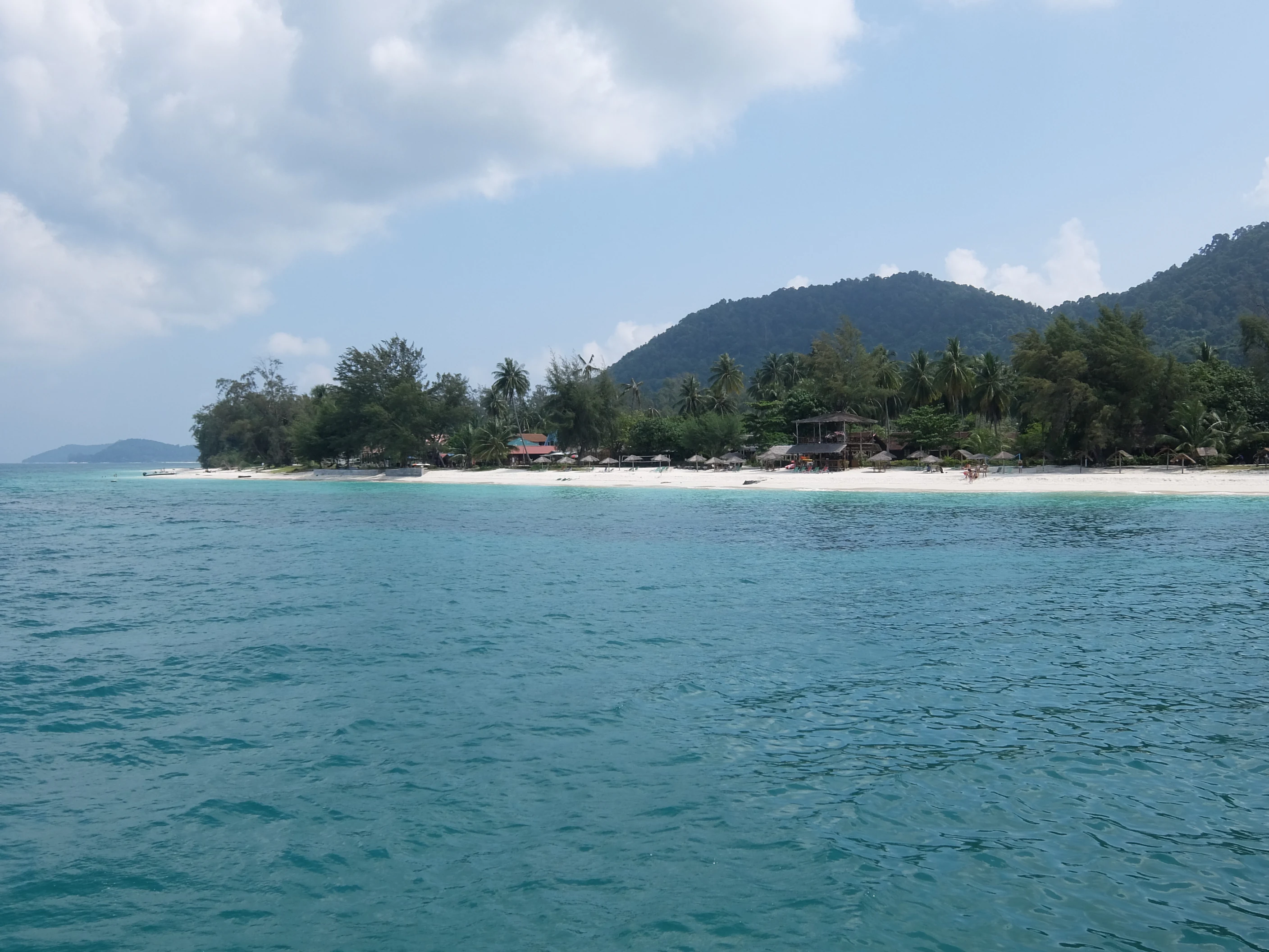
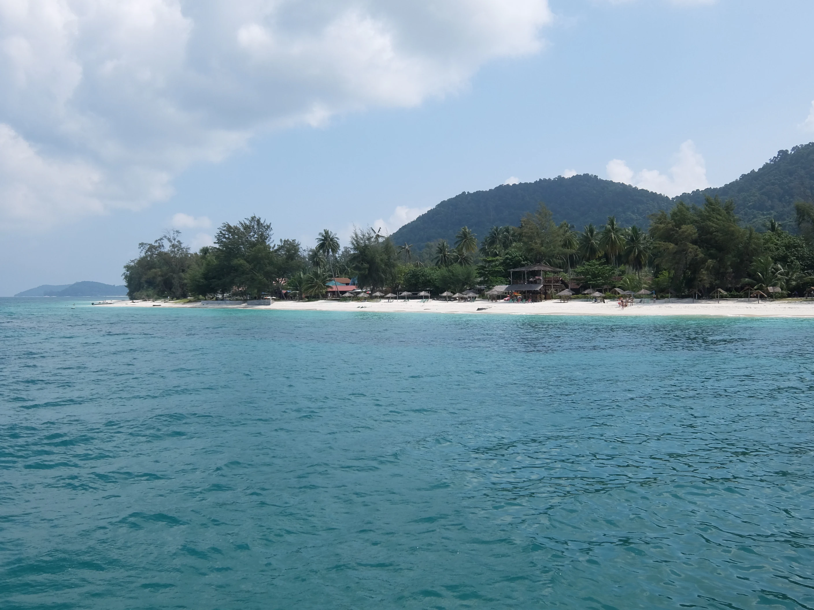
The landscape of Besar Island is shaped by its position as a small offshore island in the South China Sea. Its coastline is defined by quiet beaches of fine, powdery white sand, washed by clear, azure-toned waters. Because the island faces open sea, wave action tends to keep its beaches clean of muddy silt, contributing to the bright, sharply defined shoreline that surrounds much of the island.
Inland, the terrain rises into a hilly interior covered with tropical vegetation. The island's highest point reaches roughly 258 metres above sea level, and from these uplands the land slopes back down to the coastline, producing a compact profile of forested ridges meeting sandy bays. Coconut palms and other coastal trees frame the shore, while dense tropical jungle fills the interior, giving the island a transition from open beachscape to closed-canopy forest over relatively short distances.
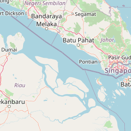
The wider seascape around Besar Island is equally important to its character. Fringing reefs, shallow reef flats, and deeper offshore waters extend outward from the island. The neighbouring islands of Rawa, Sibu, Mensirip, Hujung, and Tinggi form a closely related island cluster, and together they create a varied marine and coastal landscape in which open sandy stretches, coral habitats, and sheltered bays alternate across relatively short stretches of sea.
Besar Island ecosystems, habitats, and plant life
Besar Island's natural character is defined by the close relationship between its terrestrial vegetation and its surrounding marine environment. On land, the island supports a mix of coastal coconut palms and interior tropical jungle, including wild edible plants used traditionally as greens. This vegetation produces a layered habitat structure, with beachside palm groves giving way to denser forest on the island's slopes and uplands.
Offshore, the marine environment is the most ecologically significant component of the island. The waters around Besar Island are recognised for supporting roughly 60 species of marine life, a figure cited in local descriptions of the surrounding marine park. Reef-associated species, seabed communities, and open-water species are all thought to be represented in this count, although detailed species-level documentation is limited. The combination of clean water, fringing reef structures, and proximity to open sea creates conditions that support a varied marine community.
The presence of both forest and reef within such a compact area gives Besar Island a layered natural profile. Visitors and residents move between beach, jungle trail, and reef environments within short distances, and the island's gazetted marine park status reflects an effort to maintain this ecological balance in the face of growing recreational and fishing pressure common to islands along the Johor coast.
Besar Island wildlife and species highlights
Wildlife information for Besar Island is general rather than species-specific, with both source pages emphasising the marine environment rather than terrestrial fauna. The waters around the island are noted for supporting an estimated 60 species of marine life, a figure that serves as the primary wildlife reference for the island in available descriptions. This richness is the explicit reason the surrounding waters were gazetted as a marine park.
Terrestrial wildlife is mentioned only broadly through references to the island's tropical jungle and wild vegetation, including edible wild greens known locally as ulam, which suggest an active understorey of edible plant species and the foraging use of forest resources by local communities. The presence of coconut palms, dense forest cover, and a relatively undisturbed interior hint at potential habitat for typical small-island tropical fauna, including birds, reptiles, and insects, although specific species are not documented in the source material.
Because the island's marine species count and gazetted protection are the most concretely supported wildlife-related facts, Besar Island's wildlife profile is most usefully understood in marine terms. The marine park framework exists specifically to prevent the loss or degradation of the reef and seabed habitats that support these species.
Besar Island conservation status and protection priorities
Conservation is the most clearly defined aspect of Besar Island's modern identity. The Johor state government has gazetted the waters around the island as a marine park, establishing a regulated zone that extends roughly two nautical miles from the island's shoreline. The stated purpose of this designation is to protect approximately 60 species of marine life from human activities that could damage their natural habitats.
Within this marine park zone, restrictions are placed on activities such as scuba diving and fishing where they could harm reef structures, seabed habitats, or sensitive marine species. This regulatory framework treats the waters around Besar Island not as open commons but as a managed ecological buffer, distinguishing the island from many smaller offshore islands in Malaysia that lack similar formal marine protection.
The conservation significance of Besar Island should be understood in regional context. It lies within the Mersing island chain off the east coast of Johor, an area where increasing tourism, fishing pressure, and coastal development have created growing ecological strain. By gazetting the waters around Besar Island, the state government has created a small but clearly defined protected marine space within that broader regional system.
Besar Island cultural meaning and human context
Besar Island has a small but long-established Malay fishing community that gives the island its human cultural identity. Several coastal villages, including Atap Zing, Batu Hitam, Busong, Teluk Bakau, Teluk Kampa, and Teluk Penagat, are distributed around the island's shoreline, and their residents have historically depended on the sea for their livelihoods. The folk description of the population as orang laut, or sea people, reflects this longstanding orientation toward marine-based subsistence.
Culturally, the island is also marked by the legend attached to its older name, Pulau Babi Besar. According to oral tradition, the original name was tied to a story of a fisherman's wife who, after eating seaweed during pregnancy, was said to have been transformed into a mermaid, prompting her husband to curse the island as "pulau babi." Although the modern preference is to use Pulau Besar, the older naming tradition persists in local memory and remains part of how residents understand the island's origins.
Today, the interaction between this traditional fishing community, the growing visitor economy, and the marine park framework defines the island's cultural context. The marine park regulations, in particular, shape how residents and visitors can use the surrounding waters, creating a tension between traditional livelihoods and contemporary conservation expectations.
Top sights and standout views in Besar Island
Besar Island stands out for its gazetted marine park, a designation that few equally small Malaysian offshore islands share. Roughly 60 species of marine life are recognised within a two-nautical-mile protected zone around the island, giving Besar Island a stronger conservation profile than its size alone would suggest.
Equally notable is the island's coastal landscape: powdery white sand beaches, clear azure waters, and a backdrop of forested hills. The combination of beach, reef, and jungle within a compact island creates an unusually concentrated tropical island environment along the Johor coast.
Best time to visit Besar Island
Besar Island sits within a typical Southeast Asian maritime tropical climate, where conditions vary primarily between drier periods and the monsoon season rather than between sharply contrasting seasons. During drier months, the seas around the island tend to be calmer and the open-sea conditions that keep its beaches clean of silt are especially visible, supporting clearer waters and more stable conditions for beach and reef activities.
During the monsoon and transitional periods, seas around the island become rougher, visibility in coastal waters can drop, and access by boat from Mersing Town can become less reliable. The island's character is best appreciated when the surrounding waters are calm and clear, allowing both its beaches and the protected marine zone to be experienced under favourable conditions.