Mori Atlas logo
Marine protected areaBoddam

Exploring the protected marine boundaries and rugged landscape heritage of the southern Shetland Mainland

Boddam Marine Protected Area: Mapping the Coastal Ecology and Shetland Regional Geography

(Boddam Nature Conservation Marine Protected Area)

The Boddam Marine Protected Area sits at the southern tip of the Shetland archipelago, serving as a critical biological foundation for North Atlantic marine life. This protected zone is defined by exceptionally reliable sandeel stocks that sustain local populations of fish, seals, and cetaceans within the narrow, sheltered waters of the local voe. Beyond the marine environment, the area encompasses a historic coastal landscape marked by traditional crofting heritage and weathered northern bedrock. This geographic record traces the environmental connectivity between the Shetland coastline and the surrounding sea, offering a detailed perspective on one of Scotland's significant conservation zones.

marine protected areaShetlandNorth Atlanticsandeelsseabirdsmarine wildlife

Boddam

Marine protected area

Park overview

Structured park overview, official facts, and landscape profile for Boddam Marine Protected Area

Boddam Marine Protected Area park facts, protected area profile, and essential visitor context

Review the core facts for Boddam Marine Protected Area, including designation, size, terrain, visitor scale, habitats, and operating context in one park-focused overview.

About Boddam Marine Protected Area

Boddam is situated at the southern end of Mainland, the largest island in the Shetland archipelago, off the north coast of Scotland. While the settlement itself is small, comprising a cluster of croft houses and a historic slaughterhouse at the head of the voe, it sits within a coastal landscape of low, undulating hills, weathered rock, crofting in-bye land, and inlets that are typical of the southern Shetland mainland. The air is shaped by the North Atlantic, the climate is cool and exposed to frequent sea winds, and the surrounding terrain is a mosaic of rough pasture, peatland fragments, and rocky shoreline.

The name Boddam also extends informally to the neighbouring estates of Hillock, Dalsetter Wynd, and Turniebrae, spreading well beyond the core hamlet. These marginal crofting communities share a common maritime heritage, with the Croft House Museum interpreting everyday life in southern Shetland and the nearby Norse horizontal mill offering a tangible reminder of how Viking-era technology was adapted and preserved in these islands. The village's place on the map was also cemented by its role as the Shetland terminal of the 1870 undersea telegraph cable from Orkney, an episode that tied this remote corner of Scotland into wider UK communications for the first time.

Today, Boddam attracts attention primarily because of what lies beyond its shoreline. The waters of the voe and the surrounding sea are recognised as the most dependable sandeel ground in Shetland, and that single fact has reshaped the location's identity from a quiet crofting settlement and fishing landing into an ecologically significant marine site. The Boddam Nature Conservation Marine Protected Area exists to safeguard the conditions that allow these sandeel populations, and the broader marine community they support, to persist.

Quick facts and research context for Boddam Marine Protected Area

Boddam is a small coastal village on the south Mainland of Shetland, within the civil parish of Dunrossness. It sits at the head of a sheltered sea inlet, or voe, along a coastline shaped by the North Atlantic.

The waters offshore host what is widely regarded as the most reliable sandeel population in Shetland, a foundation species that supports commercially important fish, breeding and feeding seabirds, seals, and cetaceans. The marine area has been formally recognised through a Nature Conservation Marine Protected Area designation.

Park context

Deeper park guide and search-rich context for Boddam Marine Protected Area

Boddam Marine Protected Area history, landscape, wildlife, and travel context

Explore Boddam Marine Protected Area through its history, landscape character, ecosystems, wildlife, conservation priorities, cultural context, and seasonal travel timing in a structured park guide built for atlas discovery and search intent.

Why Boddam Marine Protected Area stands out

Boddam is best known for its remarkable concentration of sandeels, small schooling fish that form an essential link in the marine food web of the North Atlantic. Because this particular stretch of sea off southern Shetland consistently holds the most dependable sandeel stocks in the entire island group, it functions as a year-round feeding ground that ripples far up the food chain. The predictable presence of sandeels at Boddam means the area is a favoured feeding zone for predatory fish, for colonies of breeding and wintering seabirds drawn from the cliffs and stacks of southern Shetland, and for marine mammals such as seals and dolphins that patrol the voe and adjacent open water. It is this ecological richness, grounded in the humble sandeel, that gives Boddam its regional significance.

Boddam Marine Protected Area history and protected-area timeline

Boddam has a long-running relationship with the sea, both as a fishing landing and as a base for crofting families spreading across the south Shetland mainland. The presence of a working Norse horizontal mill, a wind-driven grinding structure of Viking origin, points to a continuous occupation of this coastal stretch stretching back many centuries. Crofting traditions, recognising the often harsh conditions of Shetland, shaped how the small community's fields and houses were arranged around the head of the voe.

A pivotal moment in the village's modern history came in 1870, when the Orkney and Shetland Islands Telegraph Company selected Boddam as the landfall site for its undersea telegraph cable from Orkney. This new line gave the Shetland Islands telegraphic communication for the first time, linking this remote stretch of the southern mainland to the wider UK communications network and consolidating Boddam's role as a node of connectivity at the southern tip of Shetland.

In more recent times, the marine waters off Boddam have taken on a broader, regional significance. The consistent presence of sandeels has drawn the attention of conservation scientists, fishermen, and policy makers, culminating in the formal designation of the area as a Nature Conservation Marine Protected Area. This relatively modern layer of protection reflects a recognition that the small fish schooling in Boddam's waters underpin the wider North Atlantic food web that the surrounding islands depend upon.

Boddam Marine Protected Area landscape and geographic character

The Boddam coastline lies at the foot of the low, irregular hills of southern Mainland, Shetland, a landscape shaped by long exposure to wind and weather from the surrounding sea. The beach at Boddam is a small curved stretch of shingle and sand typical of the Shetland archipelago, edged by dark, weathered rock on the headlands and overlooked by rough grazings and peat-stained slopes. The voe itself is a narrow, sheltered inlet where the hills step right down to the tidal water, creating a quiet basin of still sea amid the frequent winds.

Further afield, the senses of the area are welded to the Shetland archipelago experience, with expansive sea views to neighbouring South Shetland islands, long horizons offshore, and an ever-changing interplay of sea, sky, and low bedrock. The neighbouring settlements of Hillock, Dalsetter Wynd, and Turniebrae form part of the same landscape envelope, their crofts and farm buildings haunching along the contours of the land above coves and strands. Although the topography never rises dramatically, the constant Atlantic setting creates a distinct sense of edge and isolation that is central to the place's atmosphere.

Boddam Marine Protected Area ecosystems, habitats, and plant life

The defining habitat of Boddam is the marine environment of its voe and adjacent coastal waters. The seabed and water column here support a robust population of sandeels, which themselves reflect the broader productivity of North Atlantic shelf waters around Shetland. Where sandeels thrive, the entire marine ecosystem becomes richer, attracting predator fish, supporting breeding seabirds drawn from local colonies, and drawing in marine mammals such as seals and cetaceans.

On the adjoining shore, the terrestrial habitats are typical of southern Shetland: rough maritime grassland on the slopes, patches of coastal heath on the higher ground, exposed peat and lichen-covered rock on the cliffs, and brackish edges where streams meet the tide. The combination of arable but thin grazing, sea-salt influence, and persistent wind makes for hardy, low-growing vegetation, with the crofting landscape and natural sea-edge habitats woven together almost seamlessly into one continuous coastal system.

Boddam Marine Protected Area wildlife and species highlights

Marine life is the headline wildlife interest at Boddam, with sandeels at the foundation of nearly every wildlife encounter in or near the voe. These small fish attract feeding flocks of seabirds drawn from the cliffs and stacks elsewhere in Shetland, including species known to congregate where sandeel stocks are dependable. Hunt feeders can often be seen working the tide lines and slicks of the voe when the small fish are present.

Beneath the surface, sandeels support predatory fish, while seals use the sheltered water to haul out and forage. Whales and dolphins are also attracted to the productive water column, with their presence reinforcing Boddam's reputation as an unusually rich local patch of the Shetland marine environment. On the lands beside the voe, the wildlife seen is more typical of southern Shetland crofting and shore margins, with breeding shorebirds along the beach and rough pasture species in the surrounding fields and moorland fringes.

Boddam Marine Protected Area conservation status and protection priorities

The Boddam Nature Conservation Marine Protected Area was created because the marine environment here is considered important at the regional scale of the entire Shetland archipelago. The protected area places a formal recognition on the waters off Boddam, giving conservation interests priority alongside existing fishing and marine activity. Its underlying purpose is to safeguard conditions that allow the sandeel population to persist in unusually high density, an ecological foundation on which many other species depend.

Because sandeels are central to the North Atlantic food web and feed commercially important fish as well as seabirds and marine mammals, the Boddam MPA acts as one of the better-documented examples of a small protected marine site that punches well above its weight ecologically. The designation reflects a precautionary approach to managing fishery pressures and disturbance of seabirds and cetaceans, and it gives Boddam a stronger profile in the wider Scottish network of Nature Conservation Marine Protected Areas. The significance of the place is anchored in the fact that its waters support species and ecological processes far beyond its own coastline.

Boddam Marine Protected Area cultural meaning and human context

Boddam's culture is rooted in the Shetland crofting and fishing tradition that has defined southern Mainland life for generations. The Croft House Museum at Boddam preserves the everyday material culture of the crofting past, while the working Norse horizontal mill nearby remains a powerful reminder of the deep Norse heritage that runs through the islands. Together, these sites connect the present-day village to a layered history that extends back to Viking-era settlement.

The arrival of the undersea telegraph cable from Orkney in 1870 brought Boddam abruptly into contact with wider developments in communications and infrastructure, marking the community's place as a point of arrival for new technology in Shetland. Today, Boddam retains the atmosphere of a small working coastal settlement where contemporary crofting, fishing, and the rhythms of conservation and marine science overlap with this older maritime heritage.

Top sights and standout views in Boddam Marine Protected Area

The Boddam Marine Protected Area is anchored by the most reliable sandeel stocks in the Shetland archipelago, a small, steady foundation that underwrites an outsized density of fish, seabirds, seals, and cetaceans in the local waters.

Onshore, the highlights cluster around the village itself: a working Norse mill, the Croft House Museum interpreting crofting life, and a sweeping southern Mainland coastline that opens to views across the Shetland archipelago. The combination of compact crofting heritage and unusually productive marine ecology sets Boddam apart as a small but significant protected area within Scotland's Nature Conservation MPA network.

Best time to visit Boddam Marine Protected Area

Seasonal conditions in Shetland strongly influence the character of a visit to Boddam. Spring and summer bring the longest days, mildest air, and the busiest breeding and feeding activity in the marine environment, when seabird activity around the voe is at its peak and the surrounding crofting landscape is in active use. Autumn brings shifting light, migratory seabird passage, and often the most dramatic interplay of sea and sky along the southern Mainland coast.

Winter visits are very much about Shetland's own seasonal qualities: short days, intense Atlantic weather, and a quieter but still lively marine environment that supports wintering seabirds and marine mammals. Daylight, temperature, and weather vary sharply, so visitors should expect conditions to shape what is accessible at any given time of year. For those interested in the area's chief wildlife draw, sandeels and the species that depend on them, late spring through autumn tends to be the most rewarding window.
Monthly climate preview

Long-term monthly temperature averages and precipitation patterns for Shetland

Boddam Climate Normals, Annual Temperature and Precipitation Rhythm

Long-term measurements for Boddam document a sustained annual rhythm of temperature and daily precipitation across representative coordinates in Shetland. Examining the complete twelve-month record clarifies monthly averages and multi-year climate baselines.
Annual mean9 °C
6 °C13 °C
Jan
Feb
Mar
Apr
May
Jun10°
Jul12°
Aug13°
Sep12°
Oct10°
Nov
Dec
Warmest month
August

13.1 °C

Coolest month
February

5.9 °C

Wettest month
November

4 mm/day

Driest month
May

1.8 mm/day

Park location guide

Geography guide, regional context, and park location map for Boddam Marine Protected Area

Boddam Marine Protected Area park geography, regions, and map view in United Kingdom

Understand where Boddam Marine Protected Area sits in United Kingdom through a broader geographic reading of the surrounding landscape, nearby location context, and its mapped position within the national park landscape.

How Boddam Marine Protected Area fits into United Kingdom

The United Kingdom is a parliamentary constitutional monarchy located in northwestern Europe, consisting of four constituent countries: England, Scotland, Wales, and Northern Ireland. As a major global power with over 69 million residents, it maintains significant international influence in politics, economics, and culture.

Wider geography shaping Boddam Marine Protected Area in United Kingdom

The United Kingdom is an island nation located in northwestern Europe, surrounded by the Atlantic Ocean, North Sea, English Channel, Celtic Sea, and Irish Sea. It shares a land border with the Republic of Ireland to the west. The territory includes the island of Great Britain, the northeastern portion of Ireland, and most of the smaller British Isles islands.

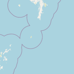
Map view of Boddam Marine Protected Area

Use this park location map to pinpoint Boddam Marine Protected Area in United Kingdom, understand its exact geographic position, and read its mapped placement within the surrounding landscape more clearly.

Pigeon | © OpenStreetMap contributors

Location context for Boddam Marine Protected Area

Shetland
Park atlas

Discover adjacent marine reserves and coastal habitats across southern Shetland

Explore Parks Near Boddam and Compare Regional Protected Landscapes

Browsing other protected areas near Boddam reveals broader ecological patterns and coastal marine environments across the surrounding region. Comparing these nearby nature reserves helps contextualize the unique marine productivity and sheltered voes of southern Shetland.
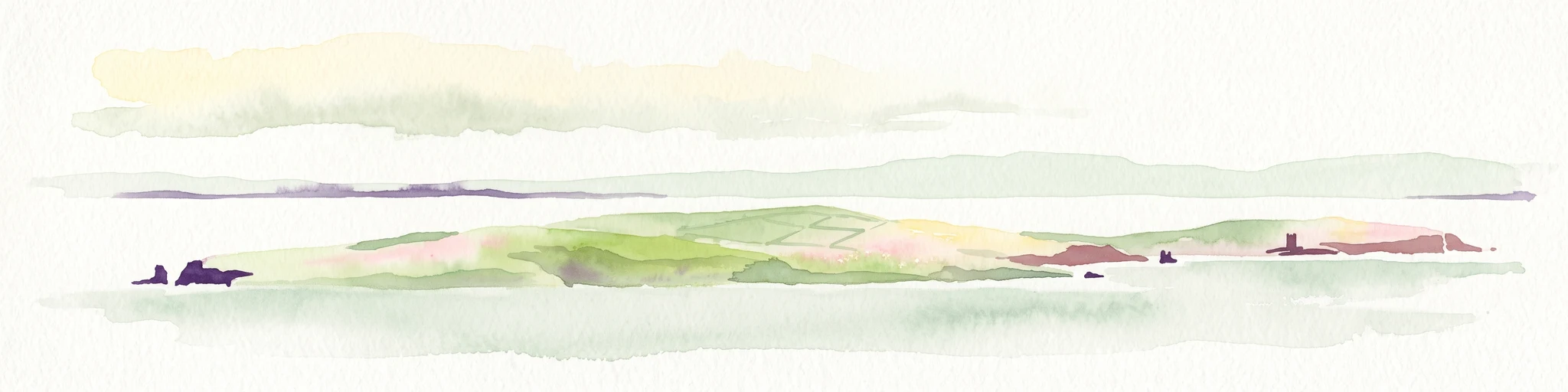
A soft watercolor painting of the island of Mousa in Shetland, depicting green and tan grassy hills surrounded by water, with the tall stone silhouette of the Mousa Broch visible on the island.
Wildlife reserveShetland Islands
About 10 km away#1 closest

Northeast

Mousa, Shetland Wildlife Reserve: Mapping the Geography of a Northern Coastal Protected Area

Ancient broch ruins and critical island wildlife habitat

Mousa, Shetland provides a unique look at isolated island geography, featuring layered sedimentary geology and a high-density seabird ecosystem. Gain geographic insight into this protected site, encompassing historical Iron Age structures alongside vital nesting grounds located within the broader marine landscape of the Shetland archipelago.

Area
1.8 km²
Relief
Lowland
Climate
Temperate
Access
Moderate access
Wildlife reserveShetland Islands
About 71 km away#2 closest

North

Fetlar Wildlife Reserve and North Isles Geography: A Detailed Protected Area Overview

Coastal terrain and ecological sanctuary in the Shetland Islands

Fetlar is a remarkable protected landscape in the Shetland Islands, famously known as the Garden of Shetland for its unusually fertile soil and plant diversity. This geographic entry documents the island's role as a critical seabird refuge and its complex coastal environment, providing essential context on the physical boundaries and historical landmarks like the Funzie Girt that define this North Atlantic isle.

Area
40.78 km²
Relief
Upland
Climate
Temperate
Access
Moderate access
Wildlife reserveOrkney
About 123 km away#3 closest

Southwest

Rousay Wildlife Reserve: Mapped Geography and Protected Landscapes in the Orkney Archipelago

Island moorlands, coastal cliffs, and freshwater loch ecosystems.

Rousay represents a critical protected area within the Orkney islands, characterized by its elevated moorland summits and dramatic shorelines. The mapped terrain reveals complex interactions between marine sounds and terrestrial habitats, offering a deep look into the regional geography and conservation status of this northern sanctuary.

Area
48.6 km²
Relief
Upland
Climate
Temperate
Access
Moderate access
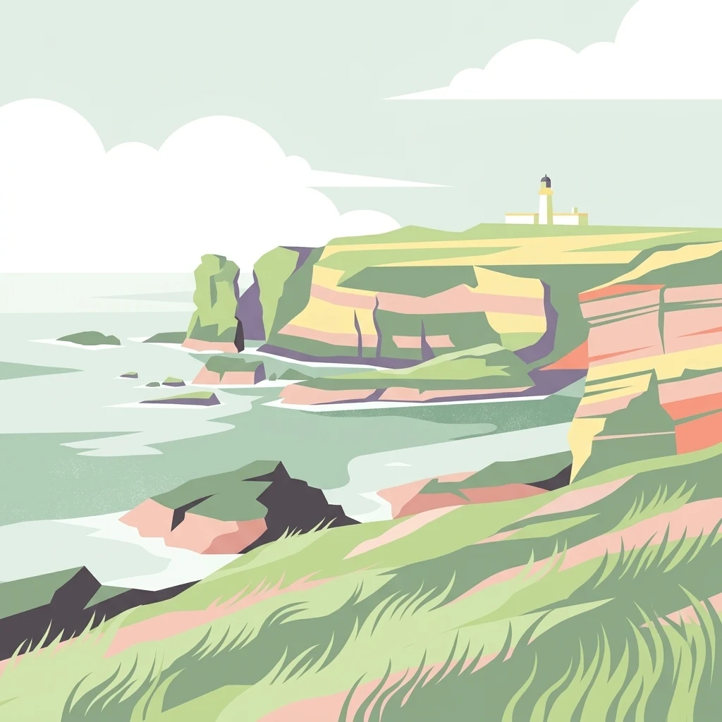
A minimalist, stylized vector illustration of coastal cliffs meeting the sea, with a lighthouse visible in the distance on top of the headland.
Marine protected areaHighland
About 190 km away#4 closest

Southwest

Noss Head Marine Protected Area: Highland Coastal and Benthic Geography

Exploring the rocky cliffs and offshore mussel habitats of Northern Scotland.

Noss Head is a notable marine protected area located on the Caithness coast of the Scottish Highlands. The site is defined by its rugged coastal cliffs and an expansive, nationally important horse mussel bed that occupies the seabed at depths between 35 and 45 metres. This area represents a core study in North Atlantic benthic ecology and dramatic maritime landforms.

Area
8 km²
Established
2014
IUCN
IV
Relief
Lowland
Nature reserveScotland
About 194 km away#5 closest

Southwest

East Caithness Cliffs Nature Reserve: Regional Geography and Coastal Protected Area Atlas

Coastal sandstone cliffs and maritime heath habitats in northern Scotland.

Examine the layered conservation architecture and physical geography of East Caithness Cliffs. This site serves as a prime example of protected northern coastal terrain, where sandstone formations and maritime heath support vast seabird populations across a mosaic of land and sea boundaries.

Area
116.96 km²
Established
1996
Relief
Upland
Climate
Temperate
Marine protected areaScotland
About 206 km away#6 closest

Northwest

Faroe-Shetland Sponge Belt MPA: Geographic Overview and Submarine Landscape Mapping

A deep-sea marine protected area in the Faroe-Shetland Channel

Delve into the geography of the Faroe-Shetland Sponge Belt MPA, where unique deep-sea sponge communities define the seafloor at depths between 400 and 600 meters. This site showcases the influence of hydrodynamic interactions between the North Atlantic and the Norwegian Sea on marine habitat distribution, offering a detailed look at offshore conservation within the Scottish maritime territory.

Area
5,278 km²
Established
2014
Relief
Lowland
Climate
Subpolar
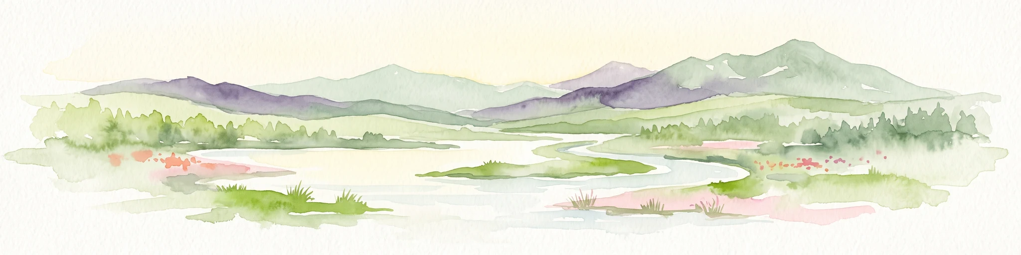
A watercolor painting showing a wide, sweeping landscape of green hills, a winding stream, and flat boggy terrain under a soft, light-colored sky.
Nature reserveScotland
About 219 km away#7 closest

Southwest

Flow Country: Geography and Protected Landscape Analysis of Scotland's Blanket Bog

Northern Scotland's vast, waterlogged peatland ecosystem.

The Flow Country is defined by its extensive, open peatland terrain stretching across Caithness and Sutherland. This nature reserve serves as a critical geographic study area for understanding blanket bog formation, carbon storage, and the restoration of fragile wetland habitats in northern Europe.

Area
4,000 km²
Relief
Lowland
Scope
Terrestrial
Water
Water-dominated
Marine protected areaScotland
About 268 km away#8 closest

Southeast

Norwegian Boundary Sediment Plain: A Deep Marine Protected Area in the North Sea

Submerged sand and gravel seabed habitats at the Scottish border.

Located at the outer limits of Scottish waters, the Norwegian Boundary Sediment Plain represents a specialized Marine Protected Area. It features a vast, flat sedimentary seafloor dominated by sand and gravel. This deep-water environment supports ancient benthic populations and offers a unique perspective on the stable, cold-water ecosystems found in the northern North Sea.

Area
164 km²
Established
2014
Relief
Lowland
Scope
Marine

Common questions about visiting, size, designation, and location context for Boddam Marine Protected Area

Boddam Marine Protected Area FAQs for park facts, access, geography, and protected area context

Find quick answers about Boddam Marine Protected Area, including protected-area facts, park geography, trail and visitor context, and how the park fits into its surrounding country and regional landscape.
MoriAtlas Explorer

Continue Your Protected Areas Search Across the Global Atlas

Deepen your exploration by continuing the structured search for national parks and protected areas worldwide. Utilize the comprehensive filtering capabilities to compare different conservation landscapes and refine your understanding of global park geography. Discover more about the distribution and characteristics of protected natural areas.

Global natural geography