
Mori Atlas logo
Protected areaBosque Protector Cerro Blanco

Mapping the topographic ridges and Tumbesian dry forest biodiversity of the Chongon-Colonche mountain range

Bosque Protector Cerro Blanco: A Critical Protected Forest Landscape within the Guayas Coastal Region

Bosque Protector Cerro Blanco represents a vital protected landscape, preserving one of the most extensive remnants of tropical dry forest in coastal Ecuador. Located within the Guayas region, the reserve covers approximately 6,000 hectares of ridges and valleys in the Chongon-Colonche mountain range. This mapped area acts as a regional biodiversity stronghold, supporting hundreds of endemic bird species and vascular plants adapted to the seasonal rhythms of the Tumbesian ecoregion.

tropical dry forestTumbesian ecoregionbirdwatchingendemic speciesChongón-Colonche rangecoastal Ecuador
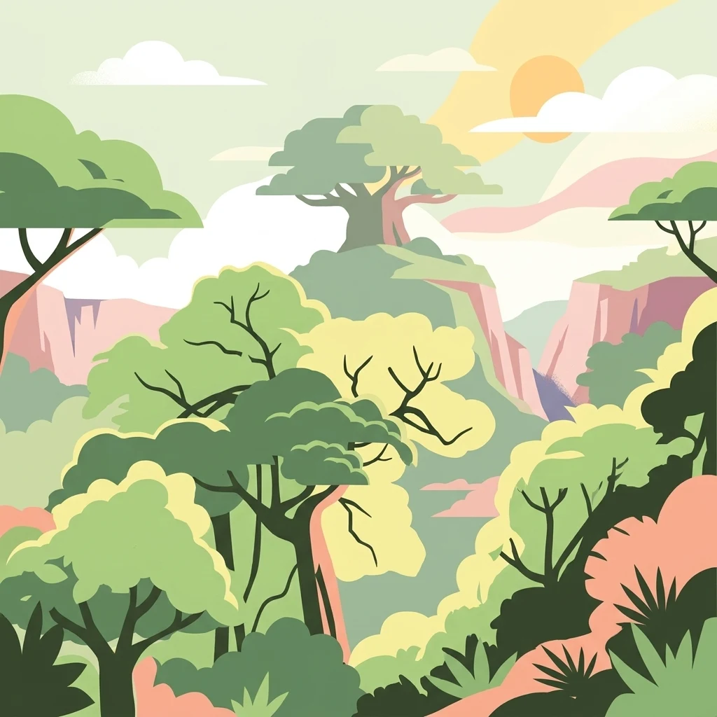
A stylized graphic illustration of a tropical forest featuring various tree shapes, layers of hills in the background, and a pale sun in a soft-toned sky.

Bosque Protector Cerro Blanco

Protected area

Park overview

Structured park overview, official facts, and landscape profile for Bosque Protector Cerro Blanco

Bosque Protector Cerro Blanco park facts, protected area profile, and essential visitor context

Review the core facts for Bosque Protector Cerro Blanco, including designation, size, terrain, visitor scale, habitats, and operating context in one park-focused overview.

About Bosque Protector Cerro Blanco

Bosque Protector Cerro Blanco is a privately owned but institutionally managed protected forest on Ecuador's central coast, occupying a section of the Chongón-Colonche mountain range on the outskirts of Guayaquil. Created as a protected area in 1992, it preserves one of the largest and most intact blocks of tropical dry forest remaining in the country, an ecosystem type that has been heavily reduced by agriculture, grazing, firewood cutting, and urban expansion across the Pacific coast of South America.

The reserve is owned by the cement company Holcim Ecuador and managed by the nonprofit Fundación Pro-Bosque, an arrangement that has shaped the area in notable ways. While the dominant land use is biodiversity conservation and ecological restoration, portions of the property are also used for ecotourism, environmental education, and reforestation programs, allowing the site to function simultaneously as a conservation refuge and a public engagement space for one of Ecuador's most urbanized regions. Tens of thousands of hectares of once-similar forest have disappeared from the surrounding landscape, which makes the protected forest a critical reservoir of species and ecological processes tied to the dry-forest biome.

Ecologically, the protected area is defined by the seasonal rhythms of Tumbesian dry forest: a canopy and understory adapted to extended dry periods, punctuated by wet-season flushes of vegetation, flowering, and animal activity. This ecological framework supports rich communities of birds, mammals, reptiles, amphibians, and plants, including a substantial number of regional endemics. The reserve's proximity to Quito and Guayaquil-sized population centers, combined with its legal protection and active stewardship, gives it an outsized importance for dry-forest conservation at a national and regional level.

For visitors and researchers, Bosque Protector Cerro Blanco represents both a working conservation landscape and an accessible window into a forest type that has largely vanished elsewhere on Ecuador's coast. Trails, viewpoints, and educational programs make the reserve an entry point for understanding the Tumbesian dry-forest ecoregion, the species it shelters, and the pressures that have shaped its past and continue to threaten its future.

Quick facts and research context for Bosque Protector Cerro Blanco

Bosque Protector Cerro Blanco is a protected forest in Guayas Province, on Ecuador's central coast, situated within the Chongón-Colonche range near the city of Guayaquil. It was legally designated a Bosque Protector on April 20, 1992, and covers roughly 6,078 hectares of tropical dry forest belonging to the Tumbesian ecoregion.

The reserve is privately owned by Holcim Ecuador but managed since the early 1990s by Fundación Pro-Bosque, a nonprofit conservation organization. It is classified nationally as a Bosque Protector, a category that allows regulated uses alongside strict biodiversity conservation. The site hosts significant populations of endemic and threatened birds and plants, and receives a sizable share of school and educational visitors, reflecting its role as both a refuge and an outdoor classroom for the surrounding region.

Protection and recognition

Documented terrestrial protection scope and official recognition details

Bosque Protector Cerro Blanco Protection Status and Designation Records

Bosque Protector Cerro Blanco maintains a defined terrestrial protection scope within the regional conservation network. Documented status records outline the established legal boundaries and management designations governing the protected natural area.

Protection details

Protection scope
Terrestrial
Transboundary protection
No
Park context

Deeper park guide and search-rich context for Bosque Protector Cerro Blanco

Bosque Protector Cerro Blanco history, landscape, wildlife, and travel context

Explore Bosque Protector Cerro Blanco through its history, landscape character, ecosystems, wildlife, conservation priorities, cultural context, and seasonal travel timing in a structured park guide built for atlas discovery and search intent.

Why Bosque Protector Cerro Blanco stands out

Cerro Blanco is best known for safeguarding one of the most extensive surviving stretches of Tumbesian tropical dry forest in Ecuador, an ecosystem historically cleared across much of the coastal lowlands. Within that setting, the reserve is especially associated with populations of the Guayaquil parrot, a coastal subspecies classified as critically endangered and considered a natural symbol of Guayaquil itself. It is also recognized as a stronghold of regional endemism, hosting dozens of bird species endemic to the Tumbesian ecoregion and a flora in which roughly one in five recorded vascular plants is endemic to the dry-forest zone. The combination of dry-forest conservation, accessible urban-edge location, and an active education and ecotourism program gives the reserve a distinctive profile among Ecuadorian protected areas.
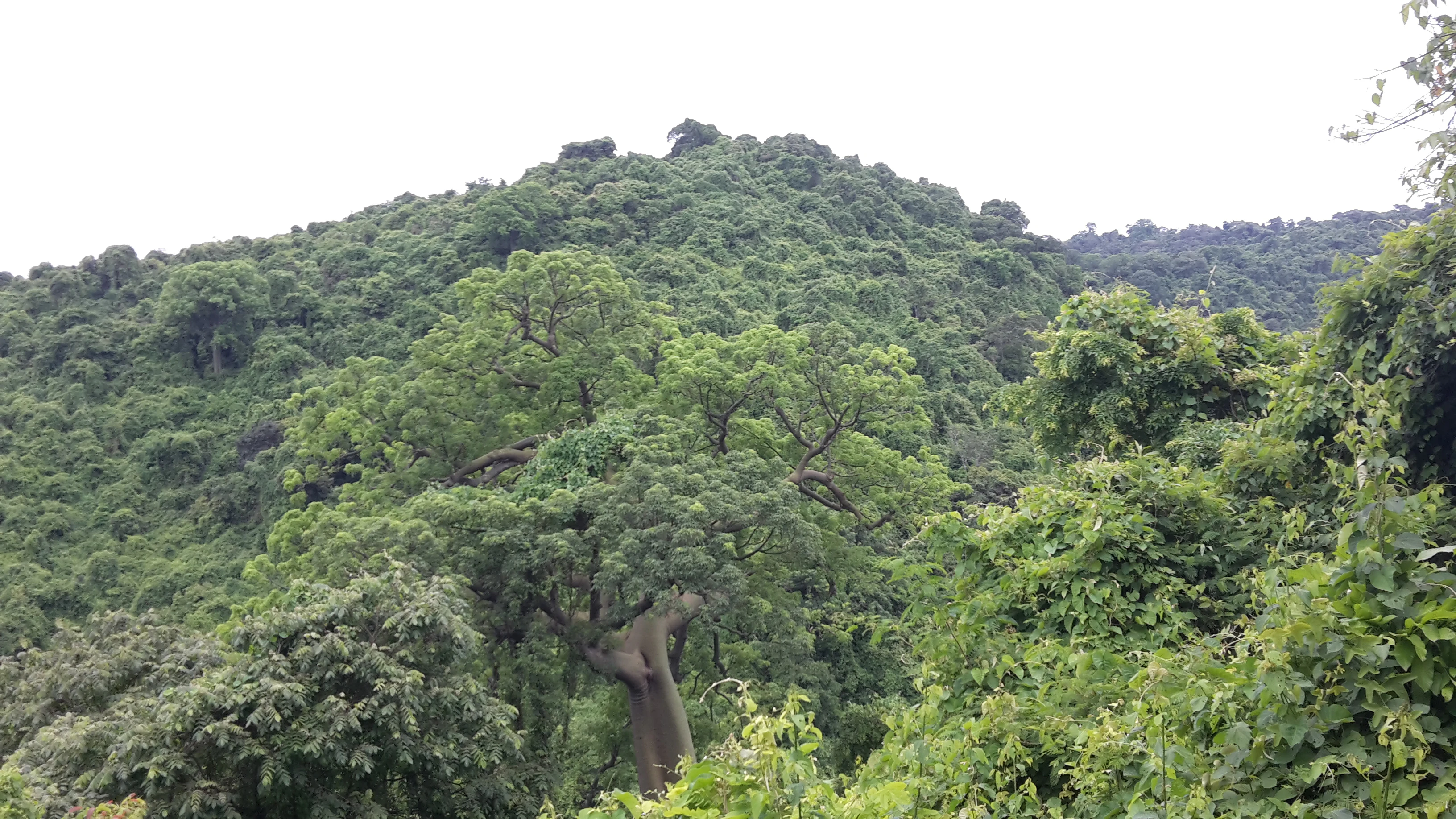
A lush, green forested hillside in Ecuador with a large, prominent tree standing out in the foreground.
The dense tropical dry forest covering the hills of Bosque Protector Cerro Blanco.

Bosque Protector Cerro Blanco history and protected-area timeline

Bosque Protector Cerro Blanco was formally established as a protected forest on April 20, 1992, when the Ecuadorian state recognized the area as a Bosque Protector. This designation placed the reserve within Ecuador's national system of protected areas while keeping the land under private ownership, reflecting a model in which industrial companies and conservation organizations collaborate to maintain ecologically important areas.

The reserve had existed before the formal designation, but its conservation trajectory took shape after the creation of Fundación Pro-Bosque, the nonprofit that took on day-to-day management on land associated with Holcim Ecuador's operations. Since then, the foundation has overseen protection efforts including ranger patrols, biodiversity monitoring, habitat restoration, and public education programs aimed at schools and communities in nearby Guayaquil.

The surrounding region has a longer and more complex environmental history. Tropical dry forests along Ecuador's coast were once extensive, but centuries of agricultural expansion, charcoal production, grazing, and urban growth have reduced them to scattered fragments. In that context, the protection of Cerro Blanco represents both a response to historic forest loss and an early experiment in keeping a large, ecologically meaningful fragment intact through private land stewardship combined with public-interest management.

Bosque Protector Cerro Blanco landscape and geographic character

The reserve sits within the Chongón-Colonche range, a coastal mountain system that runs along the western edge of Guayas Province. Topographically, the protected area blends ridges and foothills with intervening valleys, creating a varied terrain that rises and falls across the several thousand hectares of forest cover. Slopes, drainages, and seasonal watercourses shape how vegetation, sunlight, and moisture are distributed across the property.

Climatically, the landscape is governed by a tropical dry-forest regime. Rainfall is seasonal and consistently lower than in the humid forests on the opposite side of the Andes, producing long dry periods during which many trees lose their leaves, followed by wetter months in which the canopy greens up quickly. This seasonal rhythm is one of the defining features of the landscape and has produced a vegetation mosaic adapted to alternating stress and renewal.

Views from higher points within the reserve look out over forested ridges and, in places, toward the coastal lowlands and the expanding edge of Guayaquil. The juxtaposition of intact forest with roads, quarries, and urban development on the reserve's periphery is part of the contemporary landscape reality, a visual reminder of how much surrounding dry forest has been lost and how important geographic context remains to the reserve's identity.

Bosque Protector Cerro Blanco ecosystems, habitats, and plant life

Ecologically, Bosque Protector Cerro Blanco is defined by its status as a major representative of the Tumbesian tropical dry forest ecoregion, a globally recognized biome that extends across parts of coastal Ecuador and Peru. The dry-forest ecosystem is shaped by seasonal drought, deciduous and semi-deciduous tree cover, and a flora that has evolved to cope with months of water scarcity. Surveys of the reserve have recorded more than 500 species of vascular plants, with around 100 of these considered endemic to the broader dry-forest region.

The plant community includes commercially and culturally significant species such as guayacán, balsa, laurel costeño, guachapelí, amarillo, and ceibo, many of which have historically been logged across the coastal lowlands. Local inventories also identified species used for firewood, medicinal purposes, ornamental planting, charcoal, animal forage, and fiber, underscoring how deeply intertwined the dry forest has been with rural livelihoods in the region.

In addition to its terrestrial flora, the reserve includes vegetation patterns typical of coastal dry-forest mosaics, with transitions between denser canopy on more sheltered slopes and more open or disturbed vegetation in drier or previously impacted areas. Reforestation initiatives within the property have sought to rebuild forest cover in zones affected by historical extraction and land use, contributing to habitat continuity in a region where fragmentation is otherwise severe.

Bosque Protector Cerro Blanco wildlife and species highlights

The reserve is perhaps most famous for its birds. Roughly 320 bird species have been recorded in the reserve, including about 24 species endemic to the Tumbesian ecoregion and nine species considered globally threatened. The flagship is the Guayaquil subspecies of the great green macaw, locally known as papagayo de Guayaquil, a coastal form classified as critically endangered and recognized as a natural symbol of the city. Other threatened birds recorded in the area include the grey-backed hawk and the saffron-bellied siskin, both of which add to the reserve's regional conservation significance.

Beyond birds, Bosque Protector Cerro Blanco supports around 60 mammal species, with bats accounting for roughly 19 of these and including species such as Artibeus, Sturnira, Glossophaga, and Carollia. The reserve also has documented presence of the jaguar, placing the protected area within the coastal network of territories where this wide-ranging predator continues to survive adjacent to major human populations.

Reptile and amphibian diversity is also substantial, with around 37 reptile species and 20 amphibian species recorded, alongside a noteworthy invertebrate community, including 77 evaluated butterfly species. The combination of dry-forest specialists, Tumbesian endemics, and wide-ranging mammals gives the reserve a wildlife profile that mixes regional uniqueness with broader Neotropical character.

Bosque Protector Cerro Blanco conservation status and protection priorities

Bosque Protector Cerro Blanco is widely regarded as one of the most important surviving fragments of tropical dry forest in Ecuador, an ecosystem that has lost much of its original extent to agriculture, urban expansion, and resource extraction. Its formal designation as a Bosque Protector in 1992 gave it legal standing within the national system of protected areas, while its management by Fundación Pro-Bosque added an operational layer of ranger-based protection, biodiversity monitoring, and habitat restoration.

Conservation work in the reserve has focused on maintaining forest cover, restoring degraded patches, and reducing direct threats such as illegal logging, hunting, unauthorized burning, feral dog impacts, and unregulated access. Reforestation programs have worked to re-establish native species in mined or otherwise altered areas, attempting to reconnect forest cover across sections of the property.

The reserve also faces ongoing and structural pressures. Its proximity to urban Guayaquil, road networks, and quarrying operations keeps it within a zone of strong land-use conflict, while risks such as illegal mining, encroachment, wildfire, and potential new road construction remain active concerns. In this context, the conservation significance of Cerro Blanco extends beyond its borders, serving as a refuge, demonstration site, and source population for the broader Tumbesian dry-forest landscape.

Bosque Protector Cerro Blanco cultural meaning and human context

The dry forests protected at Cerro Blanco have long been part of the subsistence and economic life of communities on Ecuador's coast. Local inventories of useful plants recorded species valued for timber, firewood, medicine, food, ornament, charcoal, fiber, forage, and live fencing, reflecting a deep historical entanglement between rural communities and the surrounding dry-forest landscape.

The reserve's proximity to Guayaquil also gives it an unusual cultural role: it functions as a major outdoor classroom for urban children and youth, with a substantial share of the thousands of annual visitors coming as students on environmental education visits. This positions Cerro Blanco not only as a biodiversity site but also as a shared ecological reference point for one of Ecuador's largest metropolitan regions.

At a broader level, the protected forest and the Guayaquil parrot subspecies it supports carry regional symbolic weight, since the parrot is regarded as a natural emblem of the city. That intersection of local identity, biodiversity, and conservation gives the reserve a cultural resonance that goes beyond its strictly ecological function.

Top sights and standout views in Bosque Protector Cerro Blanco

Cerro Blanco's standout quality is the sheer scale of intact dry forest it preserves within a coastal landscape that has otherwise been heavily cleared. Its 320 recorded bird species, including threatened Tumbesian endemics and the critically endangered Guayaquil parrot, make it a focal point for regional bird conservation, while its roughly 500 vascular plant species give the reserve strong botanical value.

The management model itself is also a defining feature: a privately owned industrial site run by a nonprofit foundation for biodiversity, education, reforestation, and ecotourism. The reserve's role as an accessible natural area next to Guayaquil gives it an unusually direct connection between conservation outcomes and the daily life of one of Ecuador's largest cities.

Best time to visit Bosque Protector Cerro Blanco

The character of a visit to Bosque Protector Cerro Blanco is shaped strongly by the seasonal rhythm of the Tumbesian dry forest. During the dry months, the canopy thins as many trees shed their leaves, wildlife concentrates around remaining moisture sources, and visibility through the forest improves, offering a different kind of birding and landscape experience marked by stark, open forest structure.

In the wetter months, the same forest transforms: the canopy leafs out, flowering and fruiting intensify, and bird activity tends to peak as species respond to renewed food availability. For visitors primarily interested in birdwatching, lush forest scenery, and active wildlife, the wet season typically delivers the most dynamic conditions, while the dry season rewards those interested in forest structure, easier walking, and a more open landscape feel. Either season reflects the ecosystem's defining seasonal cycle, which is part of what makes the reserve distinctive.

Monthly climate preview

Examine long-term representative temperature ranges and precipitation rhythm across twelve months.

Bosque Protector Cerro Blanco Climate Normals and Monthly Weather Patterns

Representative coordinates track measured monthly temperature fluctuations and shifting precipitation amounts across the protected landscape. Detailed twelve-month climate normals provide complete historical data for comparative ecological analysis.
Annual mean27 °C
26 °C28 °C
Jan27°
Feb27°
Mar26°
Apr27°
May27°
Jun27°
Jul27°
Aug27°
Sep27°
Oct27°
Nov27°
Dec28°
Warmest month
December

27.6 °C

Coolest month
March

26.3 °C

Wettest month
February

8.4 mm/day

Driest month
August

0.1 mm/day

Park location guide

Geography guide, regional context, and park location map for Bosque Protector Cerro Blanco

Bosque Protector Cerro Blanco park geography, regions, and map view in Ecuador

Understand where Bosque Protector Cerro Blanco sits in Ecuador through a broader geographic reading of the surrounding landscape, nearby location context, and its mapped position within the national park landscape.

How Bosque Protector Cerro Blanco fits into Ecuador

Ecuador is a presidential republic located in northwestern South America, with Quito as its capital and Guayaquil as its largest city. The country spans 283,561 km² and encompasses the Galápagos Islands, a volcanic archipelago famous for unique wildlife that helped shape Darwin's theory of evolution. Ecuador is a plurinational state with Spanish as the official language, though Kichwa and Shuar are recognized for indigenous peoples.

Wider geography shaping Bosque Protector Cerro Blanco in Ecuador

Ecuador is located in northwestern South America along the Pacific coast. It shares borders with Colombia to the north and Peru to the east and south. The country includes the Galápagos Islands, a volcanic archipelago in the Pacific Ocean approximately 1,000 km west of the mainland. The territory encompasses diverse terrain including the Amazon rainforest in the east, the Andean highlands in the center, and coastal plains along the Pacific.

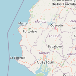
Map view of Bosque Protector Cerro Blanco

Use this park location map to pinpoint Bosque Protector Cerro Blanco in Ecuador, understand its exact geographic position, and read its mapped placement within the surrounding landscape more clearly.

Pigeon | © OpenStreetMap contributors

Location context for Bosque Protector Cerro Blanco

Guayas

Visual exploration of tropical dry forest terrain, ridges, and regional habitats

Bosque Protector Cerro Blanco Landscape Photos and Protected Forest Scenery

Visual records illustrate the rugged terrain, seasonal forest canopy, and endemic habitats preserved across the reserve. Photographic documentation reveals the distinct ecological character of coastal Ecuador through detailed views of forested ridges and native vegetation.

A lush, green forested hillside in Ecuador with a large, prominent tree standing out in the foreground.

A dark, hairy tarantula climbing vertically on the textured bark of a tree surrounded by green leaves and forest floor debris.

Park atlas

Compare regional dry forest reserves and coastal mountain landscapes

Parks Near Bosque Protector Cerro Blanco and Surrounding Protected Areas

Browse other parks near Bosque Protector Cerro Blanco to evaluate adjacent tropical dry forest habitats and coastal reserves. Expanding the protected area comparison reveals wider regional conservation networks across western Ecuador.
Nature reserveGuayas
About 6.4 km away#1 closest

Northeast

Bosque Protector La Prosperina Nature Reserve and Coastal Ecuador Forest Geography

Protected dry forest habitat and regional geographic terrain

Bosque Protector La Prosperina represents a critical survival of Ecuador's equatorial dry forest within the Guayas province. This nature reserve offers deep insight into seasonal ravine networks, drought-adapted vegetation, and the structural dynamics of fragmented coastal landscapes near Guayaquil.

Area
2.424 km²
Established
1994
Relief
Upland
Climate
Tropical
Wildlife reserveGuayas
About 11 km away#2 closest

Southeast

Reserva de producción de fauna Manglares El Salado: Coastal Geography and Protected Lands

A mangrove-dominated wildlife reserve in Guayas, Ecuador.

Analyze the protected landscape of Reserva de producción de fauna Manglares El Salado, which spans extensive mangrove forests and estuarine waters within the Guayas province. This wildlife reserve showcases a unique transition between intertidal mangrove zones, salt flats, and remnants of tropical dry forest, providing essential habitat context for the Gulf of Guayaquil coastal region.

Area
53.09 km²
Established
2002
IUCN
VI
Relief
Lowland
A pale, soft watercolor painting showing a stylized, rolling landscape with light green, pink, and yellow hues representing hills and trees.
Nature reserveGuayas Province
About 28 km away#3 closest

Southeast

Reserva ecológica Manglares Churute: Mapping a Coastal Nature Reserve in Guayas Province

An ecological mosaic of mangrove forests, estuaries, and forested ridges.

Spanning from the inner Gulf of Guayaquil into the Churute hill range, Reserva ecológica Manglares Churute acts as an essential protected area within Ecuador. The region contains one of the country's most significant mangrove complexes, complemented by freshwater lagoons and unique fog-affected forest summits that support diverse wildlife populations and endemic vegetation.

Area
471.74 km²
Established
1979
IUCN
Ia
Relief
Mixed relief
Wildlife reserveGuayas
About 48 km away#4 closest

Southwest

Refugio de Vida Silvestre Manglares El Morro: Protected Coastal Landscape and Map

A strategic marine and mangrove ecosystem in the Guayas Province

The landscape of Refugio de Vida Silvestre Manglares El Morro consists of continuous mangrove forests and rocky farallones, linked by a complex network of tidal channels. This wildlife refuge serves as an essential marine habitat at the threshold of the Gulf of Guayaquil, showcasing the interplay between tidal aquatic systems and coastal vegetation across the southwestern Ecuadorian region.

Area
101.3 km²
Established
2007
IUCN
Ib
Visitors
23K annual
A horizontal watercolor painting showing a pale green and soft pink landscape with rolling hills in the background, a flat expanse of light green vegetation in the midground, and a suggestion of water in the foreground.
Marine protected areaSanta Elena
About 90 km away#5 closest

West

Reserva Marina El Pelado: Coastal Marine Protected Area and Underwater Reef Geography

Oceanic convergence zone within the Santa Elena province

Reserva Marina El Pelado features a distinct maritime landscape defined by thirteen submarine shoals, octocoral forests, and coastal mangrove systems. Located within the Santa Elena province, this protected area serves as an essential biological laboratory where tropical and temperate current systems collide, shaping a complex mosaic of rocky reefs and diverse marine habitats.

Area
131.55 km²
Established
2012
IUCN
VI
Relief
Lowland
National parkManabí Province
About 91 km away#6 closest

Northwest

Machalilla National Park: Protected Area and Geographic Context in Manabí Province

Explore mapped natural landscapes and regional geography.

Delve into Machalilla National Park, a protected national park situated in Ecuador's Manabí Province. This page provides a focused view on its protected landscape character, emphasizing its geographic setting and mapped natural terrain. Understand how Machalilla National Park fits into the regional geography, offering a distinct case study for protected-area discovery and landscape atlas exploration.

Area
750.59 km²
Established
1979
IUCN
II
Wildlife reserveLos Rios
About 95 km away#7 closest

Northeast

Refugio de Vida Silvestre Samama Mumbes: Foothill Forest and Protected Area Map

Mapping the western Andean slopes and Chocó forest fragments

Refugio de Vida Silvestre Samama Mumbes protects one of the final remnants of the Chocó Ecuatorial forest in the Ecuadorian Andes. This reserve encompasses steep, dissected ridges and vital river catchments, supporting endemic orchids, birds, and amphibians within a highly modified regional landscape. Gain deeper insight into its forest boundaries and watershed contribution.

Area
21.456 km²
Established
2016
IUCN
IV
Relief
Mountain
Watercolor painting of a mountain landscape with a lake, rolling hills, and coniferous trees in soft green and yellow tones.
National parkAzuay
About 102 km away#8 closest

Southeast

Parque nacional Cajas: Mapping the Glacial Lakes and Paramo of the Ecuadorian Andes

Geographic analysis of high-elevation protected lands

Parque nacional Cajas encompasses a rugged, glacial-sculpted plateau characterized by cushion vegetation, boggy wetlands, and frequent fog. This protected area offers deep insight into the highland Andean geography of Azuay, where water bodies and mountain ridges intersect to form an essential ecological and cultural corridor for the region.

Area
293.89 km²
Established
1977
IUCN
II
Visitors
53K annual

Common questions about visiting, size, designation, and location context for Bosque Protector Cerro Blanco

Bosque Protector Cerro Blanco FAQs for park facts, access, geography, and protected area context

Find quick answers about Bosque Protector Cerro Blanco, including protected-area facts, park geography, trail and visitor context, and how the park fits into its surrounding country and regional landscape.
MoriAtlas Explorer

Continue Your Protected Areas Search Across the Global Atlas

Deepen your exploration by continuing the structured search for national parks and protected areas worldwide. Utilize the comprehensive filtering capabilities to compare different conservation landscapes and refine your understanding of global park geography. Discover more about the distribution and characteristics of protected natural areas.

Global natural geography