

Mori Atlas logo
Nature reserveBroken Head Nature Reserve

Understanding the coastal terrain, sandstone headlands, and cultural heritage of this New South Wales reserve.

Broken Head Nature Reserve: Mapped Geography and Protected Littoral Rainforest Landscapes

Broken Head Nature Reserve preserves a vital 98 hectare segment of littoral rainforest along the coast of New South Wales. The landscape features a distinct transition between dense, closed-canopy forest, weathered sandstone headlands, and sheltered beaches such as Kings Beach. Beyond its ecological significance as a rare coastal refuge, the area holds deep cultural importance within the traditional Country of the Arakwal people and serves as a long-standing heritage site for Australian communities.

littoral rainforestcoastal reserveNorthern RiversByron Bay regionlittoral rainforest protectionrainforest walks
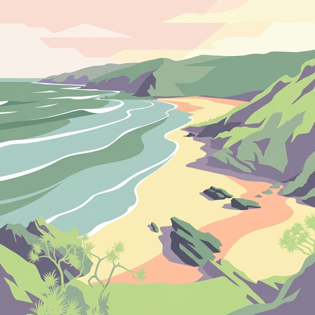
A stylized illustration showing a sandy beach meeting the ocean, flanked by grassy green hills and cliffs under a soft-colored sky.

Broken Head Nature Reserve

Nature reserve

Park overview

Structured park overview, official facts, and landscape profile for Broken Head Nature Reserve

Broken Head Nature Reserve park facts, protected area profile, and essential visitor context

Review the core facts for Broken Head Nature Reserve, including designation, size, terrain, visitor scale, habitats, and operating context in one park-focused overview.

About Broken Head Nature Reserve

Broken Head Nature Reserve is a compact but ecologically and culturally significant protected area on the far north coast of New South Wales, Australia. Set on the Broken Head promontory a short distance south of Cape Byron, the reserve protects a 98-hectare block of littoral rainforest that runs almost directly down to the ocean. Littoral rainforest, sometimes called coastal lowland rainforest, grows on substrates immediately behind the beach, where salt spray, wind, and sandy soils create a distinctive combination of plants adapted to both maritime and tropical influences. In New South Wales, this forest type has been heavily reduced, with most former stands lost to clearing for sugar cane, urban expansion, and historical sand mining, making surviving sites such as Broken Head particularly valuable for conservation.

The reserve is part of a broader protected-area network managed by the NSW National Parks and Wildlife Service, and it sits within the traditional Country of the Arakwal people of the Bundjalung Nation. The Arakwal continue to maintain cultural connections to the headland, rainforest, and beaches, and the area's Aboriginal heritage is recognized as an integral part of the reserve's identity. Walking tracks through the forest link scenic lookouts and pockets of beach, allowing visitors to experience the close transition from closed rainforest canopy to open sand and surf that defines the site.

Beyond its ecological profile, Broken Head Nature Reserve carries a distinctive social history through Kings Beach, which lies within its boundaries. Since at least the 1930s, the beach has been used for nude bathing, and from the early 1970s onward it became a recognized gathering place for gay men and, later, broader LGBTQIA+ communities at a time when homosexuality was still criminalized in New South Wales. During the HIV/AIDS crisis, the beach took on an additional role as a site of memorials and quiet reflection, and it has been referenced in Australian queer publications as a significant regional space, comparable in spirit to other well-known naturist and queer beaches around the world. The combination of intact coastal rainforest, Aboriginal cultural heritage, and modern LGBTQIA+ cultural history makes Broken Head a multi-layered protected landscape.

The reserve also functions as a recreational gateway for visitors to the Byron Bay area, offering rainforest walks, whale watching opportunities along its lookouts, and access to fishing from relatively pristine beaches. Kings Beach was officially gazetted in 1982, formalizing the area's protected status, and the reserve continues to attract visitors interested in both natural heritage and the quieter, more contemplative character of the Broken Head coastline.

Quick facts and research context for Broken Head Nature Reserve

Broken Head Nature Reserve lies in the Northern Rivers region of New South Wales, Australia, near Byron Bay and Cape Byron, the easternmost point of the mainland. It is classified as a strict nature reserve (IUCN Category Ia) and is managed by the NSW National Parks and Wildlife Service. The reserve covers approximately 98 hectares and protects a continuous stand of littoral rainforest, one of the most threatened forest types in New South Wales.

The reserve is notable for combining ecological protection with significant cultural heritage. It sits within the traditional lands of the Arakwal people of the Bundjalung Nation, and its Kings Beach section has decades of history as a gathering and reflection site for LGBTQIA+ communities in regional Australia.

Protection and recognition

Documented terrestrial protection scope and official recognition details

Broken Head Nature Reserve Protection Status and International Recognition

Broken Head Nature Reserve holds a documented terrestrial protection scope within its designated conservation boundaries. Available administrative records outline official management parameters and international recognition frameworks.

Protection details

Protection scope
Terrestrial
Transboundary protection
No
Park context

Deeper park guide and search-rich context for Broken Head Nature Reserve

Broken Head Nature Reserve history, landscape, wildlife, and travel context

Explore Broken Head Nature Reserve through its history, landscape character, ecosystems, wildlife, conservation priorities, cultural context, and seasonal travel timing in a structured park guide built for atlas discovery and search intent.

Why Broken Head Nature Reserve stands out

Broken Head Nature Reserve is best known for protecting one of the few remaining intact stands of littoral rainforest in New South Wales, a coastal rainforest community that clings to the sand dunes and headlands directly behind the beach. The reserve offers a rare glimpse of what much of the New South Wales coast looked like before widespread clearing for agriculture, housing, and sand mining. It is also well known for Kings Beach, a quiet beach within the reserve that has been recognized as one of Australia's significant LGBTQIA+ gathering places, with a cultural history stretching back to the 1930s and a particularly meaningful role during the HIV/AIDS crisis of the 1980s and 1990s.
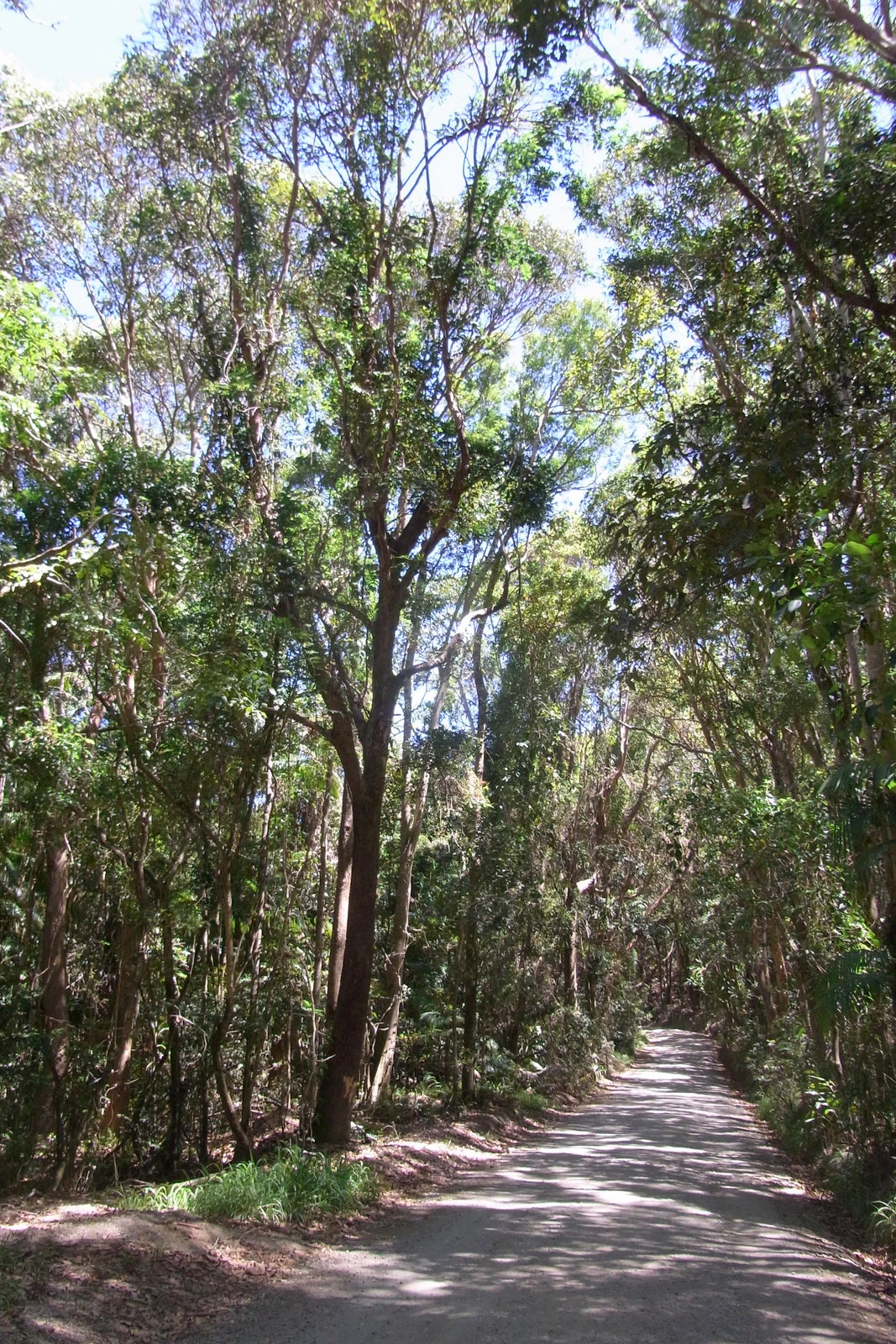
A dirt hiking trail disappears into the distance through a lush, green littoral rainforest with tall trees and thick vegetation.
A narrow trail winds through the dense, intact littoral rainforest of Broken Head Nature Reserve.

Broken Head Nature Reserve history and protected-area timeline

The natural and cultural history of Broken Head Nature Reserve extends well beyond its formal gazettal as a protected area. The landscape has long been part of the Country of the Arakwal people, whose connections to the headland, rainforest, and sea continue today. European-era use of the broader Broken Head area gradually intensified through the twentieth century, and much of the surrounding littoral rainforest on the New South Wales coast was lost during this period to agricultural clearing, housing development, and sand mining, leaving the surviving stand at Broken Head particularly important.

Kings Beach, situated within the reserve, was officially gazetted as a beach in 1982, formalizing its status under reserve management. Records of nude bathing at the beach date back to 1934, when Byron Shire Council noted public concern over nudity and the lack of formal control. From the early 1970s onward, the beach attracted LGBTQIA+ visitors, and during the 1980s and 1990s it took on a more visible role as a queer space, including as a place for memorials and ash scatterings during the HIV/AIDS crisis. The beach was referenced in Australian publications such as Outrage (1984) and Campaign Australia (1987), and was later listed in The Pink Guide in the early 2000s.

In more recent years, management of the beach and its surroundings has become a point of community debate. In 2011, a request for lifesaving equipment at the beach was reportedly denied, with critics raising concerns about possible homophobia, and the equipment was installed the following year after public pressure. In 2013, a proposal to close the Kings Beach carpark was reversed following an online petition. Following the closure of Tyagarah Beach as a clothing-optional site in 2024, NSW National Parks and Wildlife Service increased enforcement against nudity at Kings Beach, and a 2025 consultation titled No More Beating Around the Bush invited community feedback. A 2025 nomination to include Kings Beach on the NSW State Heritage Register under the Heritage Act 1977 was ultimately rejected in May 2025.

Broken Head Nature Reserve landscape and geographic character

The landscape of Broken Head Nature Reserve is defined by the close meeting of subtropical littoral rainforest, eroded sandstone headlands, and open beaches along the far north coast of New South Wales. The Broken Head promontory itself forms the structural spine of the reserve, with low, rounded cliffs and weathered slopes that drop toward small bays and coves. Behind the shoreline, dunes and low ridges support the closed-canopy rainforest that gives the reserve its ecological character.

Within the reserve, the terrain transitions rapidly between environments. Forest tracks lead through shaded rainforest gullies before opening onto exposed sandstone platforms and beach fronts. The result is a compressed landscape where dense vegetation, rocky outcrops, sand, and surf sit within a very short distance of one another. Kings Beach, the reserve's most well-known beach, is hidden from the road and reached only on foot through this coastal forest, reinforcing the sense of a sheltered, intact coastal environment. The Broken Head coastline is widely regarded as one of the more scenic and relatively untouched stretches near Byron Bay.

Broken Head Nature Reserve ecosystems, habitats, and plant life

Broken Head Nature Reserve protects one of the more ecologically coherent examples of New South Wales littoral rainforest, a forest type that occurs in a narrow coastal band where subtropical rainforest merges with maritime influence. Unlike the broader lowland rainforests of the region, littoral rainforest grows in sandy or shallow soils immediately behind the beach, where exposure to salt, wind, and occasional fire has shaped a distinct assemblage of trees, shrubs, climbers, and palms.

The reserve's canopy and understorey include tuckeroo, broad-leaf lilly pilly, native elm, pear-fruited tamarind, Bennett's ash, Bangalow palm, rusty rose walnut, and hoop pine, with the rare scented acronychia potentially occurring here as well. Climbers such as whip vine and lawyer cane are a particularly conspicuous feature of the forest, weaving through the canopy and along track edges. Disturbed sections of the reserve are affected by invasive lantana, which remains a significant management challenge. As a continuous block of intact littoral rainforest adjacent to functioning Aboriginal cultural sites and beaches, the reserve offers both ecological and cultural continuity that has been lost across much of the New South Wales coast.

Broken Head Nature Reserve wildlife and species highlights

Because of the small scale of the reserve and the focus of available source material on flora and cultural history, detailed wildlife information is limited. The reserve's littoral rainforest and coastal heath provide habitat for typical Northern Rivers fauna, and the broader Byron Shire area is known for rich birdlife, with the reserve's mix of forest and open headland supporting migratory and resident species. Kings Beach and adjacent waters are periodically used for whale watching, as the Broken Head coastline lies along the recognized humpback whale migration route, though specific wildlife inventories for the reserve itself are not detailed in available sources.

Broken Head Nature Reserve conservation status and protection priorities

Broken Head Nature Reserve is a conservation site of regional and state-level importance because it protects one of the remaining intact stands of littoral rainforest in New South Wales, a forest type that has been extensively cleared elsewhere along the coast. The classification of the reserve as a strict nature reserve under the IUCN framework reflects its focus on preserving ecological integrity rather than accommodating high-intensity recreation, and the area is managed to maintain the continuity of forest cover, protect shoreline processes, and safeguard cultural values.

Management attention in recent years has focused on balancing ecological protection, cultural recognition, and public access. Invasive species, particularly lantana, remain an ongoing issue in disturbed sections of the forest, while pressure from coastal development, recreation, and community expectations around beach use has shaped recent planning decisions. The reserve's ecological value is reinforced by its connection to broader Northern Rivers conservation networks and its location near Cape Byron, anchoring a corridor of protected coastal landscapes on Australia's eastern edge.

Broken Head Nature Reserve cultural meaning and human context

Broken Head Nature Reserve holds layered cultural significance. The headland, forest, and beaches are part of the traditional Country of the Arakwal people, one of the Bundjalung Nation groups whose connection to the area long predates colonial settlement. This Indigenous heritage is integral to the reserve's identity and continues to inform how the landscape is understood and cared for.

Alongside its Aboriginal heritage, the reserve carries significant modern cultural history through Kings Beach. Used for nude bathing since at least the 1930s and recognized as a gathering place for LGBTQIA+ communities from the 1970s onward, Kings Beach has functioned as a rare regional space of safety, identity, and reflection. During the HIV/AIDS crisis it served as a site of memorials, and it has been referenced in Australian queer publications as a culturally important naturist beach. The intersection of Aboriginal cultural heritage and decades of LGBTQIA+ community history makes the reserve a culturally layered site, even as formal heritage recognition for its queer history has so far not been secured.

Top sights and standout views in Broken Head Nature Reserve

The reserve's most distinctive feature is its intact littoral rainforest, a forest type that runs from behind the dunes almost to the cliff edges and has largely vanished elsewhere in New South Wales. Walking tracks connect the forest to beaches such as Kings Beach, giving visitors the unusual experience of stepping directly from closed rainforest onto open sand and surf.

Equally significant is the cultural layering of Broken Head. The land sits within the traditional Country of the Arakwal people of the Bundjalung Nation, while Kings Beach has decades of history as an LGBTQIA+ gathering place, including as a memorial site during the HIV/AIDS crisis. Combined with whale watching opportunities along the headland and access to relatively quiet beaches, these elements make Broken Head Nature Reserve a place of exceptional ecological and cultural value along Australia's easternmost coast.

Best time to visit Broken Head Nature Reserve

The Northern Rivers region has a mild subtropical climate, with warm, humid summers and mild, drier winters. Cooler months, from late autumn through early spring, are often considered the most comfortable for rainforest walking, with lower humidity and fewer biting insects, while still offering pleasant conditions for beach visits. Summer brings warmer seas and a more vibrant coastal atmosphere, but also higher rainfall and stronger sun exposure in open sections.

Whale watching is generally associated with the annual humpback migration along the east coast, with peak movements typically occurring during the winter months into early spring, when cooler offshore waters bring the whales closer to the coast. As with any coastal reserve in New South Wales, conditions vary year to year, and visitors often find that shoulder seasons offer a quieter experience of both the rainforest and the beaches.

Monthly climate preview

Long-term monthly temperature and precipitation patterns recorded for New South Wales

Broken Head Nature Reserve Climate Normals and Average Temperature Profiles

Historical climate observations outline the measured annual temperature rhythm and monthly precipitation variations across the representative coordinate for Broken Head Nature Reserve. Examining the full twelve-month dataset provides detailed context on long-term weather patterns and baseline environmental conditions.
Annual mean21 °C
18 °C25 °C
Jan25°
Feb25°
Mar24°
Apr23°
May21°
Jun19°
Jul18°
Aug18°
Sep20°
Oct21°
Nov22°
Dec24°
Warmest month
February

24.8 °C

Coolest month
July

17.8 °C

Wettest month
February

5.9 mm/day

Driest month
September

1.3 mm/day

Park location guide

Geography guide, regional context, and park location map for Broken Head Nature Reserve

Broken Head Nature Reserve park geography, regions, and map view in Australia

Understand where Broken Head Nature Reserve sits in Australia through a broader geographic reading of the surrounding landscape, nearby location context, and its mapped position within the national park landscape.

How Broken Head Nature Reserve fits into Australia

Australia is a constitutional monarchy and federal parliamentary democracy comprising six states and ten territories. With a population of nearly 28 million, it is one of the world's most urbanised countries, with most people concentrated on the eastern seaboard. The country has a high Human Development Index and is known for its cultural diversity, ancient Aboriginal heritage, and unique wildlife.

Wider geography shaping Broken Head Nature Reserve in Australia

Australia occupies the entire Australian continent, the island of Tasmania, and numerous smaller islands. It is the world's flattest and driest inhabited continent, featuring vast deserts in the interior (the Outback), tropical rainforests along the eastern coast, and a coastline bordering the Indian and Pacific Oceans.

Map view of Broken Head Nature Reserve

Use this park location map to pinpoint Broken Head Nature Reserve in Australia, understand its exact geographic position, and read its mapped placement within the surrounding landscape more clearly.

Pigeon | © OpenStreetMap contributors

Location context for Broken Head Nature Reserve

New South Wales

Visual reference of littoral rainforest habitats and headland terrain

Broken Head Nature Reserve Photos and Coastal Landscape Scenery

Visual documentation reveals the dense closed-canopy littoral rainforests, eroded sandstone promontories, and sheltered ocean beaches defining the coastal sanctuary. Detailed photography helps researchers and visitors examine the protected terrain, native vegetation communities, and raw geography of the Northern Rivers coastline.

A dirt hiking trail disappears into the distance through a lush, green littoral rainforest with tall trees and thick vegetation.

Black and white historical photograph looking down a rugged coastline towards a small beach and headland in New South Wales, Australia.

Park atlas

Compare adjacent coastal reserves and regional protected habitats across New South Wales

Parks Near Broken Head Nature Reserve and Surrounding Protected Coastal Landscapes

Browse nearby protected areas sharing the distinctive littoral rainforest ecology and headland terrain of Broken Head Nature Reserve. Comparing adjacent coastal reserves provides broader geographic context for the Northern Rivers region.
National parkNew South Wales
About 5 km away#1 closest

North

Arakwal National Park: National Park Protected Landscape in New South Wales

Explore mapped boundaries and regional geography.

Arakwal National Park stands as a protected national park, offering insights into its distinct landscape and geographic setting within New South Wales. This resource provides detailed information focused on the park's mapped boundaries and its role as a conservation landscape. Users can explore the regional geography and understand the specific protected-area context that defines Arakwal National Park, contributing to a broader atlas understanding.

Area
1.99 km²
Established
2001
IUCN
II
Relief
Lowland
Nature reserveNew South Wales
About 6 km away#2 closest

Northwest

Hayters Hill Nature Reserve: A Significant Big Scrub Rainforest Remnant in New South Wales

Protected subtropical forest in the Northern Rivers hinterland

Hayters Hill Nature Reserve represents a critical protected fragment of the original Big Scrub subtropical rainforests. Situated on elevated ground near Byron Bay, this nature reserve offers insight into the regional topography and the conservation of lowland forest ecosystems in the Northern Rivers area of New South Wales.

Area
0.08 km²
Established
1989
IUCN
IV
Relief
Upland
Marine protected areaNew South Wales
About 7.4 km away#3 closest

Northeast

Cape Byron Marine Park: Protected Marine Geography and Coastal Landscapes in New South Wales

Subtropical marine sanctuary and reef biodiversity atlas

Spanning from the Brunswick River to Lennox Head, Cape Byron Marine Park serves as a vital protected area on the Australian east coast. Analyze its coastal geography, including tidal estuaries, sandy surf beaches, and significant submerged reef structures that support a convergence of subtropical and temperate marine life.

Area
220 km²
Established
2002
Relief
Lowland
Climate
Subtropical
Nature reserveNew South Wales
About 12 km away#4 closest

North

Nguthungulli Julian Rocks Nature Reserve: Atlas of Coastal Protected Marine Landscapes

Geographic overview of basalt islands and Tasman Sea marine environments.

Nguthungulli Julian Rocks Nature Reserve represents a rare convergence of marine geography off the coast of New South Wales. These two rocky islets provide a dense, structured habitat where warm and cool currents meet. The reserve acts as a focal point for understanding regional coastal conservation, Indigenous cultural heritage, and the intricate, submerged basalt formations that define this significant Australian protected area.

Area
40.47 km²
Established
1961
IUCN
Ia
Relief
Lowland
Nature reserveNew South Wales
About 13 km away#5 closest

North

Tyagarah Nature Reserve: A Protected Coastal Landscape Atlas in Northern New South Wales

Coastal dunes, endangered ecosystems, and whale migration geography.

Located along the Pacific coast of New South Wales, Tyagarah Nature Reserve features seven kilometers of undeveloped beach backed by a mosaic of stable dunes and wetland habitats. The area provides a critical sanctuary for numerous threatened plant species and serves as a premier vantage point for tracking migrating humpback whales from the shore. This site represents a convergence of Indigenous cultural history and vital coastal conservation landscapes in the Byron Shire.

Area
8.75 km²
Relief
Lowland
Climate
Subtropical
Scope
Terrestrial
Nature reserveNew South Wales
About 19 km away#6 closest

West

Andrew Johnston Big Scrub Nature Reserve: Mapped Protected Landscapes in New South Wales

Botanical significance within the Northern Rivers volcanic terrain

Andrew Johnston Big Scrub Nature Reserve serves as a primary example of remnant subtropical lowland rainforest in Australia. This protected area offers insight into the region's volcanic geography and high-rainfall forest ecosystems, providing a critical refuge for biodiversity on fertile basaltic soils within the broader New South Wales landscape.

Area
0.21 km²
Established
1993
IUCN
IV
Relief
Upland
Nature reserveNew South Wales
About 21 km away#7 closest

North

Brunswick Heads Nature Reserve: Protected Littoral Rainforest and Coastal Geography

Northern Rivers coastal terrain and protected ecosystem mapping

Spanning 221 hectares, Brunswick Heads Nature Reserve protects one of the few remaining littoral rainforest stands in New South Wales. The reserve features a dense, sheltered rainforest interior that contrasts with open sandy beaches and tidal estuarine flats, creating a high-density habitat mosaic for rare plants and threatened shorebird populations.

Area
2.21 km²
Established
1979
IUCN
IV
Relief
Lowland
National parkNew South Wales
About 24 km away#8 closest

Northwest

Nightcap National Park: New South Wales Protected Landscape and Geographic Atlas

Mapping the protected area boundaries and natural terrain.

Nightcap National Park is a key protected landscape within New South Wales, Australia, offering distinct opportunities for geographic exploration. This entry provides critical details about its mapped boundaries, surrounding regional terrain, and its role as a national park. Understand the park's specific environmental context and its contribution to the broader atlas of protected lands in the region, ideal for detailed map-based discovery.

Area
81 km²
Established
1983
IUCN
II
Relief
Mountain

Common questions about visiting, size, designation, and location context for Broken Head Nature Reserve

Broken Head Nature Reserve FAQs for park facts, access, geography, and protected area context

Find quick answers about Broken Head Nature Reserve, including protected-area facts, park geography, trail and visitor context, and how the park fits into its surrounding country and regional landscape.
MoriAtlas Explorer

Continue Your Protected Areas Search Across the Global Atlas

Deepen your exploration by continuing the structured search for national parks and protected areas worldwide. Utilize the comprehensive filtering capabilities to compare different conservation landscapes and refine your understanding of global park geography. Discover more about the distribution and characteristics of protected natural areas.

Global natural geography