

Mori Atlas logo
Wildlife reserveBrookfield Conservation Park

Examining the semi-arid mallee terrain and endangered species refuge near the Murraylands

Brookfield Conservation Park Protected Landscape and Regional Geography in South Australia

Brookfield Conservation Park serves as a crucial wildlife reserve within the semi-arid Murray-Mallee region of South Australia. The protected landscape consists of gently undulating terrain covered in low eucalypts, arid woodland, and hardy bluebush shrubland. This habitat provides a specialized refuge for the endangered southern hairy-nosed wombat, while preserving historical traces of the area's colonial pastoral and charcoal-producing past.

conservation parksouth australiamallee habitatarid woodlandsemi-arid landscapesouthern hairy-nosed wombat
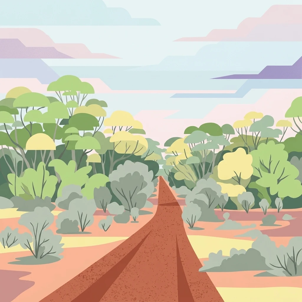
A flat-style digital illustration of a reddish dirt road stretching into the distance through a landscape of low-growing shrubs and scattered trees under a pale sky.

Brookfield Conservation Park

Wildlife reserve

Park overview

Structured park overview, official facts, and landscape profile for Brookfield Conservation Park

Brookfield Conservation Park park facts, protected area profile, and essential visitor context

Review the core facts for Brookfield Conservation Park, including designation, size, terrain, visitor scale, habitats, and operating context in one park-focused overview.

About Brookfield Conservation Park

Brookfield Conservation Park is a South Australian conservation reserve dedicated to protecting the habitat of the endangered southern hairy-nosed wombat. The park lies in the semi-arid interior of the state, about 130 kilometers northeast of Adelaide and not far from Blanchetown, placing it in the transition zone between agricultural Murraylands and the broader mallee belt that stretches across southern South Australia.

Despite its modest footprint, the park carries real ecological weight. Its three main habitats, open mallee eucalyptus, arid woodland of sugarwood and dryland tea-tree, and arid shrubland dominated by bluebush, together form a compact but representative sample of the dry-country ecosystems found along the eastern flank of the Mount Lofty Ranges and into the Murray-Mallee region. These vegetation communities are increasingly fragmented across the landscape, making well-managed reserves like Brookfield especially important for the species that rely on them.

The reserve's strongest identity is zoological rather than scenic. It holds one of the more secure populations of the southern hairy-nosed wombat in South Australia, and that connection unusually links the park back to an American zoo: in 1971 the Forest Park Foundation of Peoria, Illinois, together with the Chicago Zoological Society, funded the purchase of what was then Glen Leslie Station as a conservation reserve for the species. The land was eventually gifted to the Government of South Australia and proclaimed as Brookfield Conservation Park in 1978.

Today, the park remains a working conservation site rather than a major tourism destination. The area is used by researchers, conservation volunteers, and visitors interested in mallee wildlife, with features such as the Charcoal Pits Walk offering a glimpse into both the landscape's natural and pastoral history.

Quick facts and research context for Brookfield Conservation Park

Brookfield Conservation Park is a South Australian conservation park located about 130 km northeast of Adelaide and closest to the township of Blanchetown. It was formally proclaimed on 6 July 1978 under the National Parks and Wildlife Act 1972 and is managed by the Department for Environment and Water in partnership with Conservation Volunteers Australia. The reserve protects an important population of the endangered southern hairy-nosed wombat and encompasses mallee, arid woodland, and arid shrubland habitat.

Protection and recognition

Documented terrestrial protection scope and international recognition facts

Brookfield Conservation Park Protection Status and Mapped Designation Records

Brookfield Conservation Park maintains a registered terrestrial protection scope within the global database of conserved natural areas. Structured designation records outline official management frameworks and recognized conservation history.

Protection details

Protection scope
Terrestrial
Park context

Deeper park guide and search-rich context for Brookfield Conservation Park

Brookfield Conservation Park history, landscape, wildlife, and travel context

Explore Brookfield Conservation Park through its history, landscape character, ecosystems, wildlife, conservation priorities, cultural context, and seasonal travel timing in a structured park guide built for atlas discovery and search intent.

Why Brookfield Conservation Park stands out

Brookfield Conservation Park is best known for its role as a dedicated refuge for the southern hairy-nosed wombat, one of Australia's most endangered large marsupials. The reserve was specifically acquired and set aside to safeguard this species, and its mix of open mallee, arid woodland, and bluebush shrubland provides exactly the kind of refuge habitat the species depends on. Beyond wombats, the park is also recognized for the diversity of birds and small mammals that share its semi-arid habitat. Fairywrens, mallee-fowl, ringneck parrots, and ground cuckoo-shrikes share the landscape with kangaroos, dunnarts, and echidnas, giving the small park a disproportionately rich animal community.
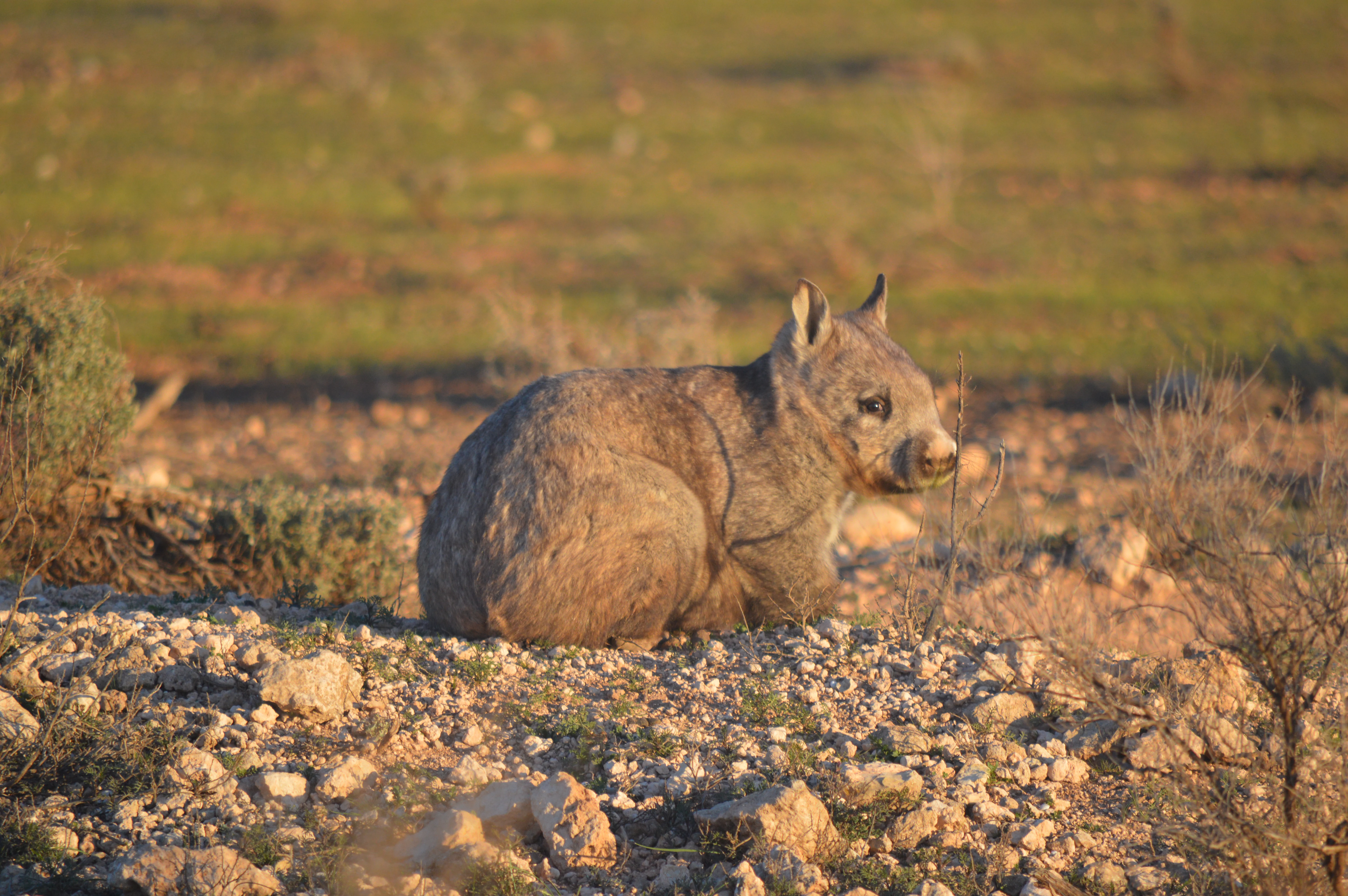
A southern hairy-nosed wombat sitting on rocky ground in a dry grassland environment.
A southern hairy-nosed wombat in the arid woodland environment of Brookfield Conservation Park.

Brookfield Conservation Park history and protected-area timeline

The land that is now Brookfield Conservation Park was first settled in 1836 as a pastoral lease, beginning the long history of European land use in what would later become a wildlife reserve. Pioneer farming families ran sheep on the property, keeping flocks in brush yards overnight while shepherds lived in simple slab huts. The station grew into a significant pastoral operation, eventually named Glen Leslie Station, and at its peak grazed up to two thousand sheep across the mallee landscape.

During its years as Glen Leslie Station, the property also saw heavy cutting of eucalyptus mallee for wood and charcoal, leaving a permanent imprint on the landscape. Remnants of old charcoal-burning pits remain visible in the park today and form the basis of the Charcoal Pits Walk, a reminder of the area's industrial-pastoral past.

The turning point came in 1971, when the Forest Park Foundation of Peoria, Illinois, contributed a 55,000 dollar donation that allowed the Chicago Zoological Society to purchase the station. Rather than continuing as grazing land, the property was acquired explicitly as a conservation reserve for the southern hairy-nosed wombat, a species then already under threat. In tribute to the zoo that funded the purchase, the property was renamed Brookfield Zoo Wombat Reserve after the Brookfield Zoo near Chicago.

Six years after the purchase, the reserve was transferred to the Government of South Australia. On 6 July 1978, it was formally proclaimed as Brookfield Conservation Park under the National Parks and Wildlife Act 1972, becoming a permanent part of the state's protected-area system. From 2008 onward, on-the-ground management has been carried out in partnership with Conservation Volunteers Australia, linking the park's day-to-day care to a national volunteer conservation network.

Brookfield Conservation Park landscape and geographic character

Brookfield Conservation Park sits in the semi-arid country of South Australia's Murray-Mallee region, northeast of Adelaide and inland from the higher ground of the Mount Lofty Ranges. The terrain is gently undulating, shaped by long weathering cycles and the erosion patterns typical of dry inland Australia, with a mix of open flats and low rises running through the reserve. The climate is hot and dry, with summer heat and cool winters that produce the kind of sparse, sun-exposed environment favored by mallee vegetation.

The defining feature of the landscape is its mallee character: low, multi-stemmed eucalyptus trees that form open canopies rather than closed forest. Large areas of open mallee give way to patches of taller arid woodland, where trees such as sugarwood and dryland tea-tree rise above a more continuous shrub layer. Between these woodland patches, broad stretches of arid shrubland are dominated by bluebush, a hardy chenopod shrub that turns the ground silver-green for much of the year.

The park's landscape also carries visible traces of its pastoral past. Dirt roads cut through the reserve, old fence lines still trace former paddock boundaries, and the remains of charcoal-burning pits lie scattered through the mallee, evidence of the colonial-era clearing and charcoal production that once supported nearby settlements. A short trail, the Charcoal Pits Walk, leads visitors past some of these old workings, with both natural and cultural features in view.
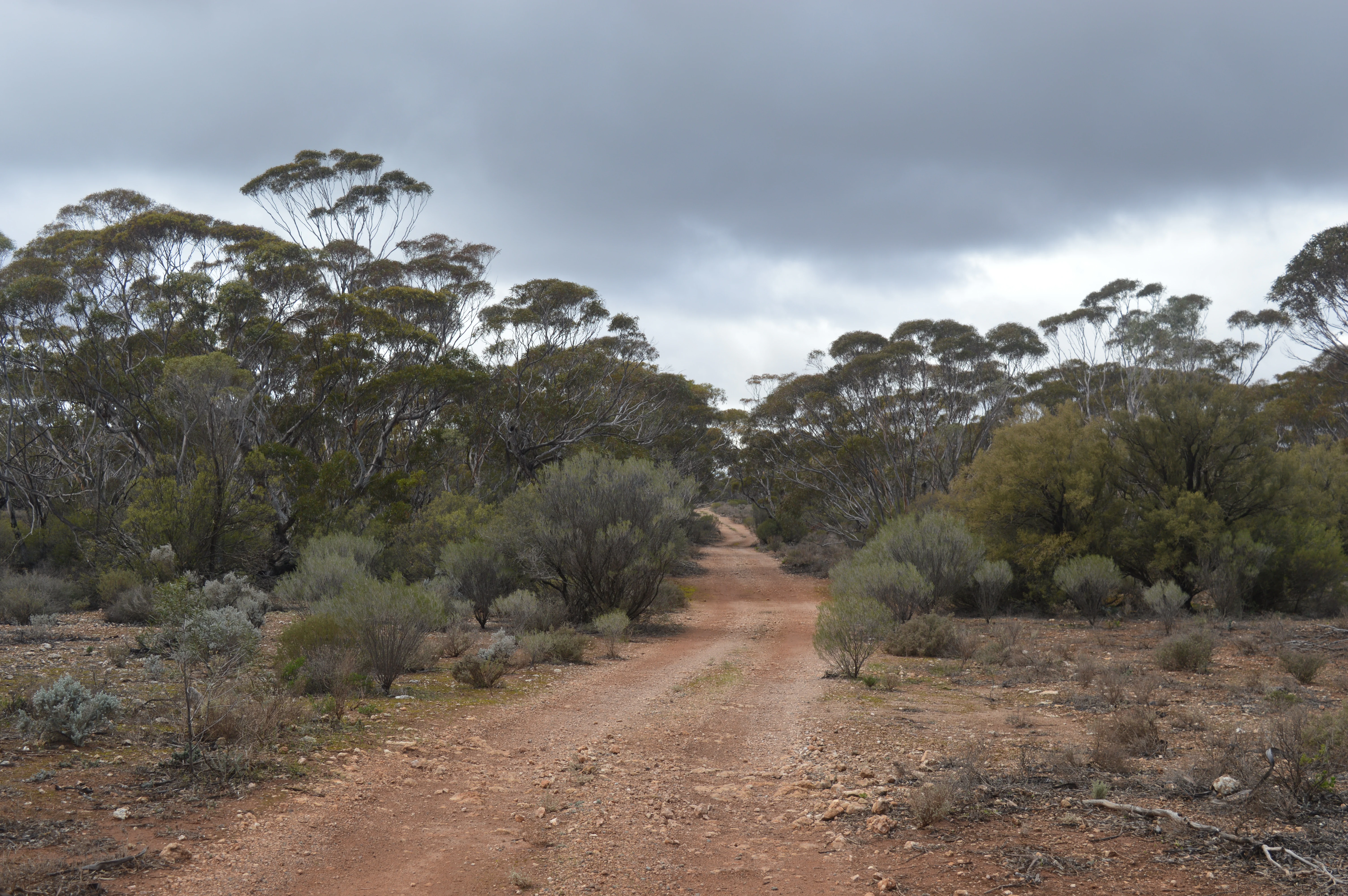
A red dirt road stretching through sparse woodland and shrubbery under a cloudy sky in South Australia.
An unpaved access road winding through the arid woodland habitat of Brookfield Conservation Park.

Brookfield Conservation Park ecosystems, habitats, and plant life

The vegetation of Brookfield Conservation Park is shaped by the dryness of the surrounding landscape and the long history of grazing and woodcutting that preceded its protection. Despite that history, the park still supports three clearly defined habitat types that together represent key elements of South Australia's mallee and arid woodland systems.

The dominant habitat is open mallee eucalyptus, in which low multi-stemmed eucalypts form an irregular canopy over sandy and loamy soils. This kind of habitat is particularly important for the southern hairy-nosed wombats, whose burrow systems thread through the loose soils beneath the trees. The second habitat, arid woodland, includes scattered taller trees such as sugarwood and dryland tea-tree, providing a structurally more complex layer above the shrubland. The third habitat, arid shrubland, is dominated by bluebush and other chenopod shrubs, which stabilize the soil and create dense ground cover between the trees.

Together, these habitats form a mosaic of dry-country vegetation that supports a notably high diversity of fauna for a park of this size. The mallee ground layer, the woodland mid-story, and the shrubland understory each host different communities of birds, mammals, and reptiles, and the boundaries between habitat types create the kind of ecotonal richness that mallee-country wildlife depends on.
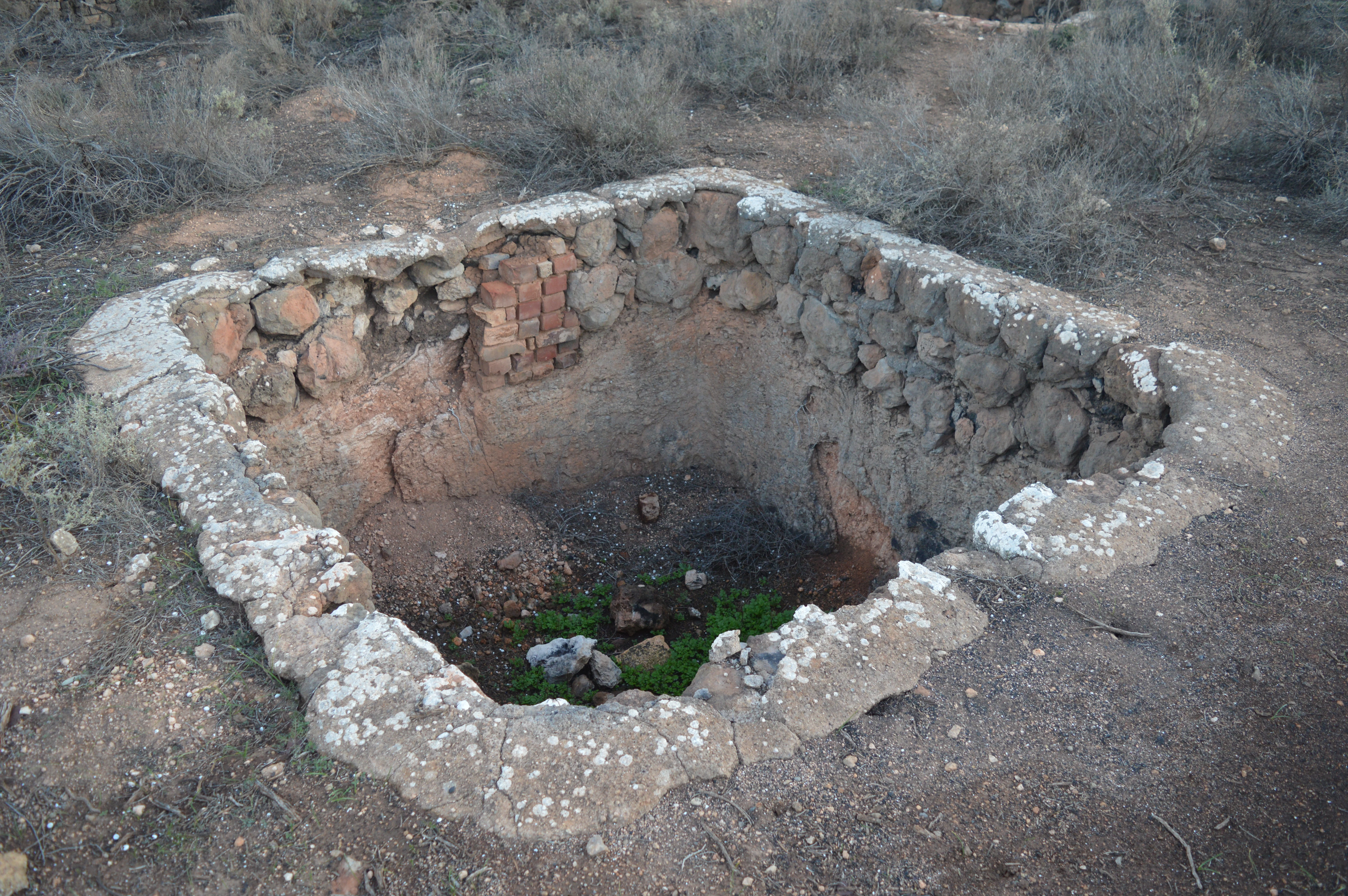
A square, stone and brick lined pit built into the ground, showing signs of abandonment and age, surrounded by dry, arid landscape vegetation.
The remains of a historical charcoal pit at Brookfield Conservation Park.

Brookfield Conservation Park wildlife and species highlights

Brookfield Conservation Park is most famous for its population of the endangered southern hairy-nosed wombat. This is one of the key reasons the land was purchased as a conservation reserve in the 1970s, and the species remains the central focus of the park's ecological identity. Wombats burrow extensively through the soft soils of the park's mallee and shrubland areas, creating an underground network that shapes much of the landscape's daytime character.

Beyond wombats, the park supports a strong community of small and medium-sized mammals that thrive in arid woodland and shrubland environments. Fat-tailed dunnarts and common dunnarts are recorded in the undergrowth, along with short-beaked echidnas, which forage across the open mallee flats. Red kangaroos and western grey kangaroos are also present, moving through the park especially during the cooler parts of the day and adding to the broader sense of dry-country fauna.

The birdlife of Brookfield reflects the richness typical of South Australian mallee. Two species of fairywren, the splendid fairywren and the purple-backed fairywren, occupy the shrubby understory, while emus roam the more open stretches. Other characteristic species include ground cuckoo-shrikes, Australian owlet-nightjars, malleefowl, galahs, Australian ringnecks, crested bellbirds, mulga parrots, black-eared cuckoos, Gilbert's whistlers, elegant parrots, red-backed kingfishers, hooded robins, and bush stone-curlews. Reptiles add another layer to the wildlife, with sand goannas patrolling the sandy soils, eastern brown snakes present in the leaf litter, and central bearded dragons active in the more open, sun-warmed areas.

Brookfield Conservation Park conservation status and protection priorities

Brookfield Conservation Park is a focused conservation reserve, set aside primarily to safeguard the habitat of the endangered southern hairy-nosed wombat. Its proclamation under the National Parks and Wildlife Act 1972 gave the property formal, long-term protection from clearing, grazing, and other threatening processes, marking a decisive break from its earlier life as a working pastoral station.

The park's conservation value lies in the combination of intact mallee habitat, arid woodland, and bluebush shrubland within a single protected area, plus the population of southern hairy-nosed wombats that anchors the reserve's identity. By keeping these habitat types together, Brookfield helps maintain ecological processes for a wider community of dry-country species, including small marsupials, ground-nesting birds, and reptiles that depend on a mosaic landscape rather than a single vegetation type.

From 2008 onward, the park has been managed in partnership with Conservation Volunteers Australia, an arrangement that brings organized volunteer effort to tasks such as habitat monitoring, track surveys, and infrastructure work. This collaborative management model supports the park's ongoing role as both a wombat refuge and a practical site for conservation research and on-ground work in South Australia's semi-arid country.

Brookfield Conservation Park cultural meaning and human context

The cultural story of Brookfield Conservation Park is closely tied to its evolution from pastoral land to wildlife reserve. For more than a century before proclamation, the property was used for sheep grazing, woodcutting, and charcoal production, activities that shaped both the vegetation and the small-scale industrial archaeology visible today. Old charcoal pits, fence lines, and the routes that once connected the station to nearby settlements are reminders of this working history.

The reserve also carries an unusual cross-cultural dimension. Its conservation origins lie with the Forest Park Foundation of Peoria, Illinois, and the Chicago Zoological Society, whose funding allowed the purchase of the former Glen Leslie Station in 1971. The renaming to Brookfield Zoo Wombat Reserve reflected the role of Brookfield Zoo near Chicago in supporting the acquisition and exemplifies the early international cooperation that helped build the modern Australian conservation estate.

Top sights and standout views in Brookfield Conservation Park

Brookfield Conservation Park stands out for the strength of its wombat population and the rare chance it offers to see southern hairy-nosed wombats in protected mallee habitat. It is also notable for the unusually diverse mix of birds and small mammals that share its dry-country landscapes, including fairywrens, malleefowl, dunnarts, and kangaroos.

Among its more distinctive features are the surviving charcoal pits that dot the landscape, remnants of the park's pastoral and industrial past and the focus of its Charcoal Pits Walk. Combined with its international backstory as a wombat reserve funded from the United States, these traces give the park a layered identity linking ecology, history, and global conservation effort.

Best time to visit Brookfield Conservation Park

The best time to experience Brookfield Conservation Park is during the cooler months of late autumn, winter, and early spring, when daytime temperatures are milder and wildlife is more active through the middle of the day. Southern hairy-nosed wombats, kangaroos, and many of the smaller mammals and birds are easier to observe in these conditions, and the mallee landscape is at its most pleasant for walking.

Summer in the Murray-Mallee region is hot and dry, with very high temperatures that can make extended time outdoors uncomfortable and reduce the activity of many animals, which stay in burrows or shaded cover. Winter days can be cool, especially in the mornings and evenings, but offer clear skies, soft light across the mallee, and good opportunities to see ground-dwelling birds and reptiles once the day warms up. The transitional seasons of spring and early autumn are often particularly rewarding, when mild temperatures, blooming shrubs, and active wildlife combine to show the park at its most alive.

Monthly climate preview

Long-term representative temperature ranges and precipitation averages across twelve months

Brookfield Conservation Park Climate Normals and Monthly Weather Patterns

Representative coordinates record measured monthly variations in long-term temperature and precipitation across the protected terrain. Accessing the complete monthly profile provides detailed historical baseline data for analytical conservation research.
Annual mean16 °C
9 °C24 °C
Jan24°
Feb24°
Mar20°
Apr17°
May13°
Jun10°
Jul
Aug10°
Sep13°
Oct16°
Nov19°
Dec22°
Warmest month
January

24 °C

Coolest month
July

9.2 °C

Wettest month
June

1.5 mm/day

Driest month
January

0.6 mm/day

Park location guide

Geography guide, regional context, and park location map for Brookfield Conservation Park

Brookfield Conservation Park park geography, regions, and map view in Australia

Understand where Brookfield Conservation Park sits in Australia through a broader geographic reading of the surrounding landscape, nearby location context, and its mapped position within the national park landscape.

How Brookfield Conservation Park fits into Australia

Australia is a constitutional monarchy and federal parliamentary democracy comprising six states and ten territories. With a population of nearly 28 million, it is one of the world's most urbanised countries, with most people concentrated on the eastern seaboard. The country has a high Human Development Index and is known for its cultural diversity, ancient Aboriginal heritage, and unique wildlife.

Wider geography shaping Brookfield Conservation Park in Australia

Australia occupies the entire Australian continent, the island of Tasmania, and numerous smaller islands. It is the world's flattest and driest inhabited continent, featuring vast deserts in the interior (the Outback), tropical rainforests along the eastern coast, and a coastline bordering the Indian and Pacific Oceans.

Map view of Brookfield Conservation Park

Use this park location map to pinpoint Brookfield Conservation Park in Australia, understand its exact geographic position, and read its mapped placement within the surrounding landscape more clearly.

Pigeon | © OpenStreetMap contributors

Location context for Brookfield Conservation Park

South Australia

Visual reference of arid woodland habitats and protected sanctuary terrain

Brookfield Conservation Park Photos and Mallee Landscape Scenery

Visual documentation reveals the dry mallee vegetation, open bluebush shrublands, and arid woodland terrain defining this protected South Australian refuge. Examining field photographs helps researchers and visitors understand the natural environment supporting endangered southern hairy-nosed wombats.

A southern hairy-nosed wombat sitting on rocky ground in a dry grassland environment.

Two pink and grey galah birds perched side by side on a thin, leafless tree branch against a clear blue sky.

A red dirt road stretching through sparse woodland and shrubbery under a cloudy sky in South Australia.

A square, stone and brick lined pit built into the ground, showing signs of abandonment and age, surrounded by dry, arid landscape vegetation.

Park atlas

Compare regional mallee reserves and connected arid wildlife habitats

Explore Parks Near Brookfield Conservation Park and Surrounding Protected Lands

Browse protected areas sharing the dry mallee terrain and semi-arid ecosystem characteristics of Brookfield Conservation Park. Comparing adjacent conservation reserves reveals broader regional biodiversity patterns across the Murray-Mallee interior.
Wildlife reserveSouth Australia
About 18 km away#1 closest

South

Yookamurra Sanctuary: A Wildlife Reserve within the Murraylands Geography of South Australia

Mapped protected landscape and arid-zone conservation terrain

Yookamurra Sanctuary acts as a protected island of native vegetation within the heavily modified agricultural landscape of South Australia. Defined by its gently undulating terrain and calcrete-influenced mallee woodlands, this reserve provides a essential habitat for arid-zone fauna. The sanctuary offers a focused look at how private conservation maintains biodiversity in the transitional zone between the Mount Lofty Ranges and the Murray River.

Area
50.55 km²
IUCN
IV
Relief
Lowland
Climate
Mediterranean
Wildlife reserveSouth Australia
About 44 km away#2 closest

Northeast

Hogwash Bend Conservation Park: Protected Riverland Habitat and Geographic Overview

A vital wildlife reserve anchoring riparian and mallee ecosystems

Located near Cadell in South Australia, Hogwash Bend Conservation Park secures a unique cross-section of river red gum forest and dryland mallee. The reserve serves as a targeted breeding refuge for the vulnerable eastern Regent Parrot, illustrating the importance of localized conservation within the broader Murray River corridor.

Area
4.02 km²
Established
2012
IUCN
III
Relief
Lowland
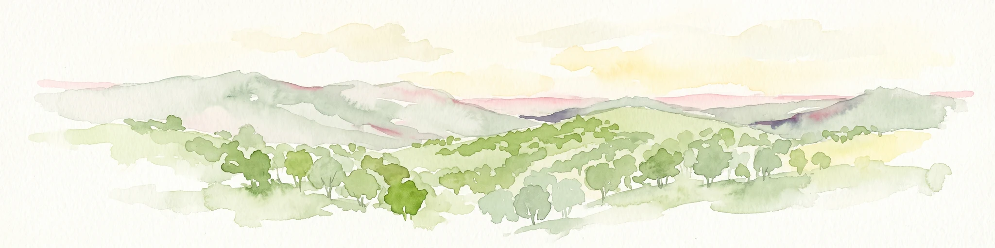
Watercolor painting of a rolling, hilly landscape with sparse trees against a pale, soft-toned sky.
Nature reserveSouth Australia
About 49 km away#3 closest

Southwest

Kaiserstuhl Conservation Park: Protected Nature Reserve in the Barossa Ranges

Mapping the forest ridges and hill country of South Australia

Kaiserstuhl Conservation Park preserves a distinctive segment of forested ridge and valley terrain within the Mount Crawford Forest. Situated near the Heysen Trail in South Australia, this nature reserve focuses on the protection of its 600-metre namesake peak, providing a clear geographic landmark within the eastern Barossa Ranges.

Area
4.35 km²
Established
1979
IUCN
III
Visitors
7.5K annual
Nature reserveSouth Australia
About 64 km away#4 closest

Southwest

Hale Conservation Park: Nature Reserve and Geological Landmark in South Australia

Protected forest landscapes in the Mount Lofty Ranges

Located near Williamstown, Hale Conservation Park preserves a rugged stretch of hilly terrain representative of the broader Mount Lofty Ranges. This nature reserve serves as a sanctuary for stringybark forest and provides scientists and map enthusiasts with clear evidence of a regional geological unconformity.

Area
1.89 km²
Established
1964
IUCN
III
Relief
Mountain
Nature reserveSouth Australia
About 66 km away#5 closest

Southwest

Cromer Conservation Park: Mapped Protected Landscapes of the South Australian Adelaide Hills

An undisturbed remnant of native eucalypt forest and rare shrub heath

Cromer Conservation Park functions as a significant ecological island in South Australia, preserving 44 hectares of natural vegetation largely untouched by historical land use. This reserve offers a focused look at the moist, undulating terrain of the Mount Lofty Ranges, providing essential habitat for rare species like the blue star sun-orchid and supporting a dense mosaic of native shrubs beneath an open forest canopy.

Area
0.44 km²
Established
1976
IUCN
III
Relief
Upland
Nature reserveSouth Australia
About 69 km away#6 closest

South

Ettrick Conservation Park: Protected Mallee Woodlands and Grassland Remnants

A vital conservation landscape in the South Australian Murray-Darling Basin.

Ettrick Conservation Park acts as an ecological sanctuary within South Australia by protecting rare tussock grasslands and open mallee eucalypt woodland. This protected area offers insight into the original vegetation patterns of the region, supporting ground-dwelling bird species and showcasing a critical fragment of semi-arid terrain amidst a largely cleared agricultural landscape.

Area
4.79 km²
Established
2013
IUCN
VI
Relief
Lowland
Wildlife reserveSouth Australia
About 79 km away#7 closest

Northeast

Taylorville Station Wildlife Reserve: Mallee Woodland Map and Regional Geography

Protected mallee landscapes in the Murray-Mallee, South Australia.

Taylorville Station provides a critical refuge for mallee-dependent species within its 92 square kilometres of semi-arid woodland. As a cornerstone of the Riverland Biosphere Reserve, this protected area in South Australia offers a unique look at the ecological significance of the Murray-Mallee region's persistent eucalypt vegetation and habitat management frameworks.

Area
92.6 km²
Established
2005
IUCN
IV
Visitors
2.7K annual
Nature reserveSouth Australia
About 80 km away#8 closest

Southwest

Charleston Conservation Park: Geography and Woodland Transitions in the Adelaide Hills

Explore protected terrain in South Australia

Charleston Conservation Park stands as an important ecological remnant in the Adelaide Hills. Its 54 hectares offer a concentrated look at woodland associations ranging from sheoak groves to blue gum forest and silver banksia stands. Use this atlas resource to understand the park's topography, its role in the Mount Lofty Ranges, and its contribution to regional conservation efforts.

Area
0.54 km²
Established
1976
IUCN
III
Relief
Upland

Common questions about visiting, size, designation, and location context for Brookfield Conservation Park

Brookfield Conservation Park FAQs for park facts, access, geography, and protected area context

Find quick answers about Brookfield Conservation Park, including protected-area facts, park geography, trail and visitor context, and how the park fits into its surrounding country and regional landscape.
MoriAtlas Explorer

Continue Your Protected Areas Search Across the Global Atlas

Deepen your exploration by continuing the structured search for national parks and protected areas worldwide. Utilize the comprehensive filtering capabilities to compare different conservation landscapes and refine your understanding of global park geography. Discover more about the distribution and characteristics of protected natural areas.

Global natural geography