
Why Bruchbach-Otterbachniederung stands out
Bruchbach-Otterbachniederung is best known as one of the most important floodplain nature reserves along the Upper Rhine, celebrated for its extensive network of streams, ditches, and still waters running through meadows and wet woodland. The Otterbach between Jockgrim and Kandel is regarded as a particularly valuable near-natural flowing water system of regional significance, while the broader reserve protects a connected mosaic of reed beds, wet meadows, tall herb vegetation, and sedge-dominated habitats that have become rare in intensively used landscapes. The reserve is also recognized for its role as the largest nature reserve in both the Germersheim and Südliche Weinstraße districts, and for its position at the edge of the Bienwald, one of the largest contiguous forest areas in the southern Upper Rhine. This combination of intact floodplain hydrology, diverse wetland vegetation, and adjacent forest makes it a key reference site for floodplain ecology in southwestern Germany and a refuge for threatened flora and fauna in the region.
Bruchbach-Otterbachniederung history and protected-area timeline
Bruchbach-Otterbachniederung was officially designated as a nature reserve (Naturschutzgebiet) on 17 August 1988 through a formal protection ordinance of the state of Rhineland-Palatinate. The designation brought together a patchwork of stream valleys, meadows, wet woodlands, and adjacent lowlands that had long been recognized for their ecological value, formalizing their protection under the German nature conservation framework.
The reserve was established against the backdrop of widespread loss and degradation of floodplain habitats across the Upper Rhine plain during the nineteenth and twentieth centuries, when streams were straightened, wetlands drained for agriculture, and large stretches of original Auenlandschaft were fragmented. By protecting the Bruchbach and Otterbach valleys and their floodplain surroundings in a single coordinated designation, Rhineland-Palatinate sought to safeguard a representative example of these increasingly rare environments.
Since its establishment, the reserve has continued to serve as a reference area for floodplain and wetland conservation in the southern Rhine region. It is registered internationally in the World Database on Protected Areas, where it appears with WDPA ID 64667 under the reference NSG-7300-103. Its continued designation as the largest nature reserve in both Germersheim and Südliche Weinstraße districts reflects the enduring recognition of its landscape and ecological significance within Rhineland-Palatinate's protected-area network.
Bruchbach-Otterbachniederung landscape and geographic character
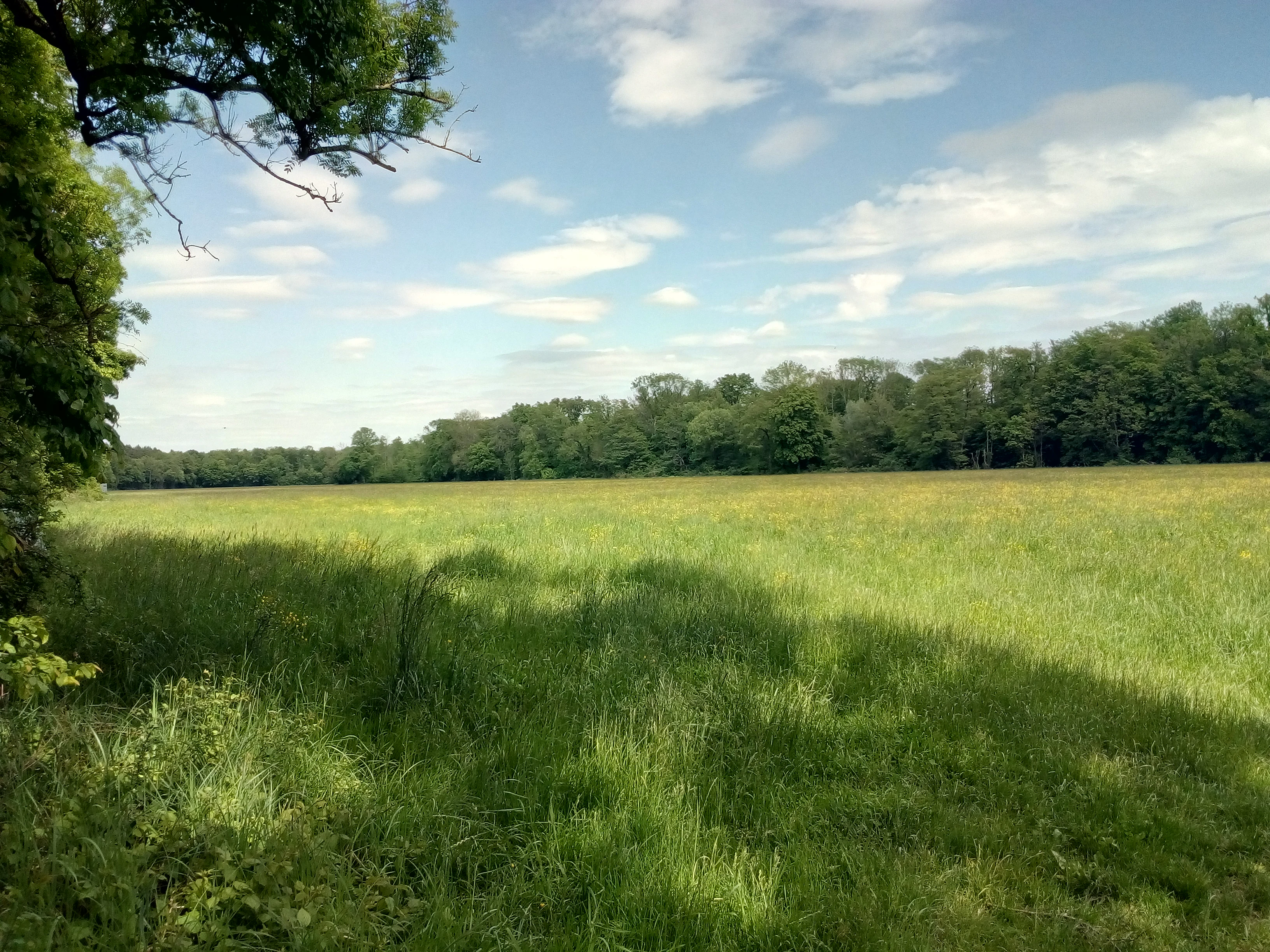
The landscape of Bruchbach-Otterbachniederung is defined by the lowland valleys of the Bruchbach and Otterbach, two streams that shape a broad, gently undulating floodplain in the southern Upper Rhine plain. The reserve sits at relatively low elevation along the Rhine lowlands, framed by agricultural land and bordered to one side by the Bienwald, one of the largest contiguous forest complexes in the southern Rhine region. The transition between open floodplain and the edge of the Bienwald gives the area a distinctive mosaic character.
The hydrological network is a central feature of the landscape. The area combines near-natural stream sections, historically straightened channels, an extensive system of drainage ditches, and numerous still water bodies. The course of the Otterbach between Jockgrim and Kandel stands out as a particularly valuable flowing water system with regional significance, supporting both aquatic and riparian habitats. Wet meadows, marshy floodplain depressions, reed beds, and tall herb fringes follow the streams and ditches, creating long linear corridors of wet vegetation through the otherwise drier surroundings.
Alongside its open wetlands, the reserve also includes patches of near-natural woodland, mainly along the valley edges and in transitional zones toward the Bienwald. These woodland sections, combined with large sedge communities and structurally rich herbaceous vegetation, give the reserve a varied topography of low ridges, shallow depressions, and water-filled hollows. The overall impression is of a quiet, low-lying rural landscape where the rhythm of the terrain is set by the movement of water rather than by dramatic relief.
Bruchbach-Otterbachniederung ecosystems, habitats, and plant life
Bruchbach-Otterbachniederung is ecologically distinguished by its dense concentration of wetland and floodplain habitats within a single protected area. The reserve combines reed beds (Röhrichte), moist and wet meadows (Feucht- and Nasswiesen), tall herb communities (Hochstaudenfluren), extensive stands of large sedges (Großseggenriede), and near-natural forest patches, all arranged around an intricate network of streams, ditches, and still waters.
Hydrology is the central organizing factor of these habitats. Seasonal and groundwater dynamics influence which plant communities dominate particular stretches of the valley, and the variation between flowing waters, standing waters, moist grasslands, and wet woodland creates finely graduated ecological transitions. The result is a habitat mosaic that supports a wide spectrum of wetland-dependent plants and animals, including both widespread species and those that have become rare in the intensively used agricultural matrix of the surrounding Rhine plain.
The proximity of the reserve to the Bienwald forest strengthens its ecological role. Together, the floodplain and the forest edge provide complementary habitat types, allowing species to move between wetland, woodland, and transitional environments. This connectivity enhances the value of Bruchbach-Otterbachniederung as a refuge for wetland biodiversity and as a structural component of the broader ecological network of the southern Upper Rhine.
Bruchbach-Otterbachniederung wildlife and species highlights
While detailed species inventories for Bruchbach-Otterbachniederung are documented in specialist albums rather than in general sources, the reserve is consistently described as a significant refuge for native flora and fauna in the Upper Rhine region. The combination of streams, ditches, still waters, reed beds, wet meadows, and forest patches provides habitats for amphibians, aquatic invertebrates, wetland birds, and a range of mammals associated with the floodplain-forest transition.
The near-natural stretch of the Otterbach between Jockgrim and Kandel is highlighted as especially important for flowing-water fauna, while reed beds and sedge stands offer cover and nesting opportunities for bird species typical of large marshland complexes. The wet meadows and tall herb fringes provide foraging habitat for insects and the animals that depend on them, supporting an ecological chain characteristic of intact floodplain systems.
Rather than being defined by a single charismatic species, the reserve's wildlife value lies in the persistence of these habitat structures at a regional scale. As one of the largest nature reserves in both Germersheim and Südliche Weinstraße districts, it preserves the environmental conditions under which characteristic Rhine floodplain wildlife communities can continue to exist in the southern Upper Rhine.
Bruchbach-Otterbachniederung conservation status and protection priorities
Bruchbach-Otterbachniederung was explicitly designated to preserve the valley systems of the Bruchbach and Otterbach together with their associated biotopes as a refuge for threatened animal species, as a habitat for certain wild plant species and their associated communities, and as an area of scientific significance. These three stated conservation aims frame the reserve as both a practical refuge for biodiversity and a long-term reference site for ecological research and monitoring.
At the national level, the reserve is classified as a Naturschutzgebiet under the German nature conservation framework, while internationally it is listed as an IUCN Category V Protected Landscape/Seascape and is registered in the World Database on Protected Areas. This dual recognition reflects both its formal legal protection under Rhineland-Palatinate law and its significance in international datasets of protected landscapes.
From a conservation-strategy perspective, Bruchbach-Otterbachniederung is important because it safeguards one of the few remaining substantial floodplain corridors in the southern Upper Rhine. By keeping a continuous strip of wet meadows, reed beds, and near-natural woodland alongside intact stream sections, the reserve contributes to habitat connectivity between the Rhine plain and the Bienwald forest. Its strict protective regime, including restrictions on leaving marked paths, is designed to limit disturbance and to maintain the conditions under which the characteristic floodplain communities can persist over the long term.
Bruchbach-Otterbachniederung cultural meaning and human context
The landscape of Bruchbach-Otterbachniederung is closely tied to the traditional rural culture of the Upper Rhine plain, where communities have long coexisted with streams, wet meadows, and marginal floodplain land. Several municipalities whose territory the reserve crosses, including Jockgrim, Kandel, Minfeld, Freckenfield, Schaidt, Steinfeld, Kapsweyer, and Schweighofen, have histories shaped by small-scale agriculture, meadow use, and the management of lowland watercourses that drain toward the Rhine.
The presence of the Otterbachbruchweg, a hiking trail that allows visitors to experience the reserve on foot, reflects a regional tradition of integrating protected wetland landscapes with low-impact public access. This combination of conservation, rural land use, and quiet recreational pathways is characteristic of how Rhineland-Palatinate has approached floodplain protection in border regions such as this one, where German and French cultural landscapes meet around Wissembourg and the Bienwald.
Top sights and standout views in Bruchbach-Otterbachniederung
Bruchbach-Otterbachniederung stands out as the largest nature reserve in both the Germersheim and Südliche Weinstraße districts, giving it a regional weight that few other protected areas in the southern Upper Rhine can match. Its three-section structure stretches from Rheinzabern all the way to the French border near Wissembourg, anchoring a continuous corridor of floodplain habitat in the Rhine lowlands.
Among its most distinctive features are the near-natural course of the Otterbach between Jockgrim and Kandel, the dense network of streams, ditches, and still waters, and the mosaic of reed beds, wet meadows, tall herb fringes, and sedge stands that surround them. Combined with patches of near-natural forest at the edge of the Bienwald, these elements make Bruchbach-Otterbachniederung a defining example of preserved Auenlandschaft and a key refuge for wetland biodiversity in Rhineland-Palatinate.
Best time to visit Bruchbach-Otterbachniederung
As a lowland floodplain reserve in the Upper Rhine plain, Bruchbach-Otterbachniederung changes its character primarily through the rhythms of water and vegetation rather than through dramatic seasonal extremes. Spring and early summer are typically the most rewarding period for experiencing the area, when wet meadows and tall herb communities are at their lushest and the network of streams and ditches carries active seasonal flow. The reed beds and sedge stands also develop their fullest structure in the warmer months, when wetland vegetation is most visually expressive.
For those interested in floodplain atmosphere, late spring and early summer tend to combine accessible paths with rich wetland vegetation. The reserve's strict protection rules, including the requirement to stay on marked trails such as the Otterbachbruchweg, apply throughout the year and shape the visiting experience in every season.