
Mori Atlas logo
Nature reserveBühlchen bei Weißenbach

A distinct calcareous grassland ecosystem and juniper habitat in the Werra-Meißner-Kreis region.

Bühlchen bei Weißenbach Nature Reserve: Mapped Geography and Protected Limestone Landscapes

Bühlchen bei Weißenbach serves as a vital protected landscape within the Werra-Meißner-Kreis district of northern Hesse, Germany. This compact nature reserve preserves an ecologically rich mosaic of shell limestone outcrops, juniper thickets, and rare calcareous grassland species that have flourished through historical grazing management. The terrain provides a significant geographic anchor for regional biodiversity conservation within the broader Meißner highlands.

nature reservecalcareous grasslandMagerrasenjuniper heathorchid habitatlimestone hill
A stylized flat-art illustration showing a sunlit meadow filled with wildflowers, with evergreen trees and rolling hills in the background under a pastel sky.

Bühlchen bei Weißenbach

Nature reserve

Park overview

Structured park overview, official facts, and landscape profile for Bühlchen bei Weißenbach

Bühlchen bei Weißenbach park facts, protected area profile, and essential visitor context

Review the core facts for Bühlchen bei Weißenbach, including designation, size, terrain, visitor scale, habitats, and operating context in one park-focused overview.

About Bühlchen bei Weißenbach

The nature reserve of Bühlchen bei Weißenbach occupies a modest but ecologically distinctive position on the northern edge of the Meißner highlands in northern Hesse. It centres on a Muschelkalk hilltop that rises to roughly 537 metres, surrounded by a forested landscape that is otherwise dominated by the beech-mixed woodlands typical of the Osthessisches Bergland. The hill's shallow, humus-poor soils made it unsuitable for productive agriculture, which in turn allowed a centuries-long tradition of extensive mowing and grazing by sheep and goats to leave a thin, species-rich vegetation cover.

That historical land use is the key to the reserve's identity today. The grazing pressure, combined with the naturally low nutrient status of limestone soils, has produced a Magerrasen, or nutrient-poor grassland, that is among the most botanically diverse habitat types in central Europe. Where many similar sites have been lost to intensification or abandonment, the Bühlchen has retained a network of juniper stands and open flowering turf that still supports orchids, gentians, and many other specialised calcareous plants.

In conservation terms, the site functions as one node in a wider Natura 2000 network. It is part of the Fauna-Flora-Habitat area Meißner und Meißner Vorland, which protects beech forests, hedgerows, and additional grassland patches across the broader Meißner landscape, and it also lies within the Vogelschutzgebiet Meißner, an EU bird protection area that covers much of the surrounding woodland and cliffs. While the reserve itself is smaller than eight hectares, its overlapping designations, its long protection history, and its role in the Junge Meißner conservation network give it significance well beyond its geographic footprint.

Quick facts and research context for Bühlchen bei Weißenbach

Bühlchen bei Weißenbach is a nature reserve in the Werra-Meißner district of northern Hesse, covering less than eight hectares on a Muschelkalk hilltop at roughly 490 to 537 metres elevation. It belongs administratively to the town of Großalmerode, lying just south of the village of Weißenbach.

The area was first protected as a natural monument in 1938 and re-designated as a formal nature reserve in 1985. It lies within the Geo-Naturpark Frau-Holle-Land and forms part of the larger Natura 2000 site Meißner und Meißner Vorland, contributing calcareous grassland habitat to both an EU Fauna-Flora-Habitat area and the Vogelschutzgebiet Meißner.

Protection and recognition

Explore documented terrestrial protection scopes and international recognition records for Bühlchen bei Weißenbach.

Bühlchen bei Weißenbach Protection Status and Official Designated Area Records

Bühlchen bei Weißenbach maintains structured terrestrial protection status details and verifiable database identifiers for geographic tracking. Official conservation records outline the documented management scope and regulatory framework associated with this protected landscape.

Protection details

Protection scope
Terrestrial
Transboundary protection
No
WDPA ID
162632
Park context

Deeper park guide and search-rich context for Bühlchen bei Weißenbach

Bühlchen bei Weißenbach history, landscape, wildlife, and travel context

Explore Bühlchen bei Weißenbach through its history, landscape character, ecosystems, wildlife, conservation priorities, cultural context, and seasonal travel timing in a structured park guide built for atlas discovery and search intent.

Why Bühlchen bei Weißenbach stands out

Bühlchen bei Weißenbach is best known for one of the most flower-rich examples of calcareous Magerrasen (nutrient-poor limestone grassland) in the Meißner region, with a characteristic mix of juniper thickets, orchids, gentians, and other rare herbs growing over a shell limestone summit. The reserve is also recognised as a textbook example of a cultural landscape shaped by historical sheep and goat grazing, where juniper persists precisely because grazing animals avoid it, and where conservation depends on maintaining some form of extensive grazing to prevent the grassland from being overtaken by scrub.
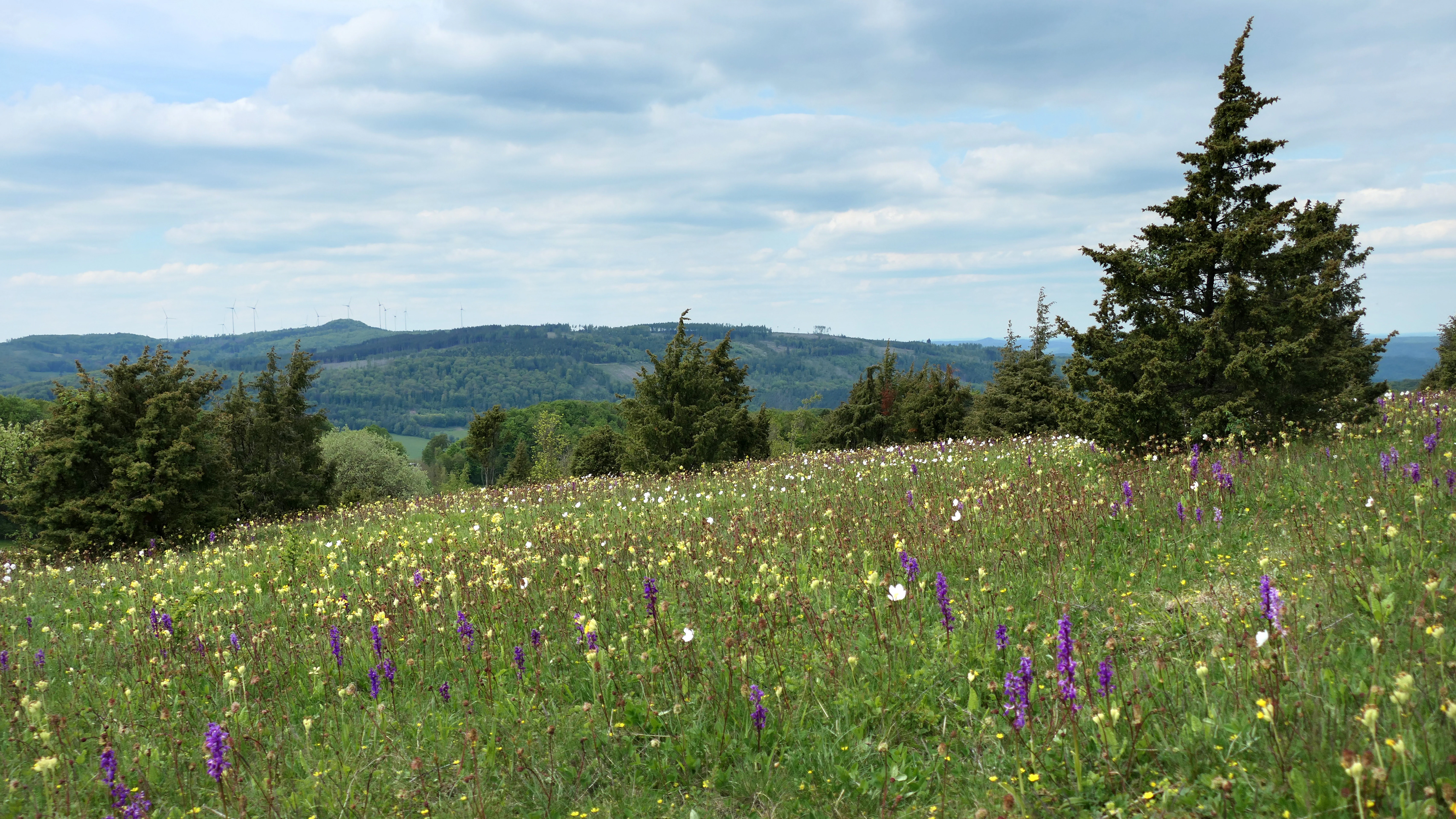
A gentle grassy hill covered with purple and yellow wildflowers and scattered juniper trees, with a distant view of wooded hills under a cloudy sky.
A wildflower meadow and juniper bushes at the Bühlchen bei Weißenbach nature reserve.

Bühlchen bei Weißenbach history and protected-area timeline

The Bühlchen bei Weißenbach received its first formal protection in 1938, when the 1st amendment ordinance for the protection of natural monuments in the former Kreis Witzenhausen entered the juniper-heath area on the hill into the natural monument register under entry number 83, granting it protection under the Reich Nature Conservation Law of that era.

In the post-war decades, growing awareness of biodiversity loss on traditional grasslands prompted the state of Hesse to grant the site a higher level of protection. On 30 October 1985, the Bezirksdirektion für Forsten und Naturschutz at the Kassel regional government declared the Magerrasen slopes on the hill a formal Naturschutzgebiet, with the explicit aim of preserving the lime-poor grassland and its rare, partly endangered animal and plant species. The national identifier 1636012 and WDPA code 162632 were assigned to the site at that point.

A further protection layer arrived with the implementation of the European Union's Habitats Directive. In April 1999 the surrounding landscape was notified to the European Commission as part of the Fauna-Flora-Habitat area Meißner und Meißner Vorland, which integrates the Bühlchen into a roughly 2,041 hectare Natura 2000 complex. A companion Vogelschutzgebiet Meißner, covering nearly 3,720 hectares, was also designated through the same process. A consolidated Hessian Natura 2000 ordinance in January 2008 brought these overlapping regimes into a single legal framework, securing the site's status into the present day.

Bühlchen bei Weißenbach landscape and geographic character

The Bühlchen bei Weißenbach is a small, rounded hilltop that rises modestly above the surrounding terrain near the village of Weißenbach, south of Großalmerode. Geologically, the summit is formed of Muschelkalk, a Triassic-age shell limestone that characteristically outcrops as a thin bench over the more easily eroded layers below, producing a hill with relatively flat, rocky shoulders rather than steep flanks.

The hill stands at the transition between three natural landscape units recognised in German geographic classification: the Nördliche Meißnervorländer to the north, the Hoher Meißner massif to the south, and the Velmeder Tal to the west. All three are sub-units of the Fulda-Werra-Bergland, which in turn belongs to the broader Osthessisches Bergland, the eastern Hesse uplands. The position of the Bühlchen at this junction gives it open views across the ridgelines of the Kaufunger Wald to the north and back toward the higher Meißner slopes to the south.

Soils across the summit are shallow and humus-poor. Where the underlying limestone breaks through, there are stony, rubbly pockets that support a colourful mosaic of crevice plants and lichens. The combination of open ground, juniper clumps, and surrounding beech forest gives the site a distinctive semi-open appearance, very different from either the closed woodland typical of the Kaufunger Wald or the agricultural lowlands in the wider Werra-Meißner district.
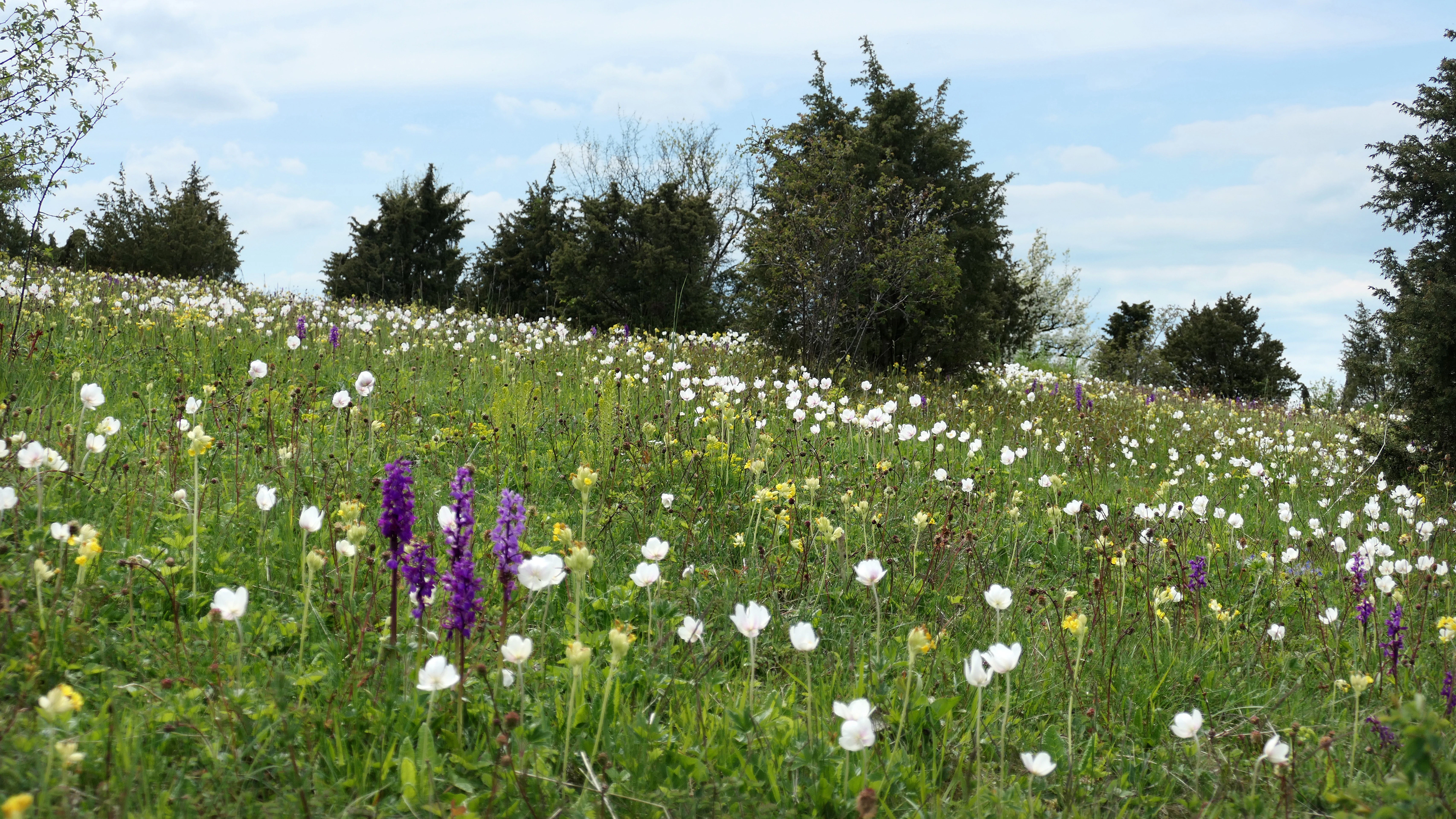
A sloped meadow filled with white and purple wildflowers under a light blue cloudy sky, dotted with dark green juniper trees.
A wildflower meadow in the Bühlchen bei Weißenbach nature reserve, featuring purple orchids and white anemones among scattered juniper shrubs.

Bühlchen bei Weißenbach ecosystems, habitats, and plant life

Ecologically, Bühlchen bei Weißenbach is dominated by calcareous Magerrasen (lime-rich nutrient-poor grassland), a habitat type that is among the most species-rich in central Europe. The defining plant communities belong to the Kalkmagerrasen basenreicher Standorte, characterised by low-growing grasses, scattered juniper shrubs, and a rich layer of flowering herbs adapted to dry, base-rich, low-nutrient conditions across much of the year.

Typical species recorded include a striking set of orchids: Frauenschuh (Cypripedium calceolus), Fliegen-Ragwurz (Ophrys insectifera), Stattliches Knabenkraut (Orchis mascula), and the particularly noteworthy Dreizähniges Knabenkraut (Neotinea tridentata), for which Hesse has special conservation responsibility given its distributional position in central Europe. The flowering matrix also includes Fransen- and Deutscher Enzian (Gentianella ciliata and Gentianella germanica), Kugelige Teufelskralle (Globularia bisnagarica), Sumpf-Kreuzblume (Polygala amarella), Wiesen-Leinblatt (Thesium pyrenaicum), Natternzunge (Ophioglossum vulgatum), Große Sommerwurz (Orobanche elatior), Vogelfuß-Segge (Carex ornithopoda), Großes Windröschen (Anemone sylvestris), Katzenpfötchen (Antennaria dioica), and Kleinblütige Rose (Rosa micrantha).

Where the underlying limestone breaks into stony rubble, the open soil supports a Bunte Erdflechtengesellschaft, a colourful community of ground lichens that thrives on dry, sunny mineral surfaces. Junipers (Juniperus communis) dominate the structural appearance of the site; because sheep and goats leave juniper foliage largely untouched, the species has become a living signature of the site's grazing history. Many of the species recorded on the Bühlchen and comparable half-dry grassland patches across the Meißner region are listed on the German Red List, several as strongly endangered or otherwise threatened.
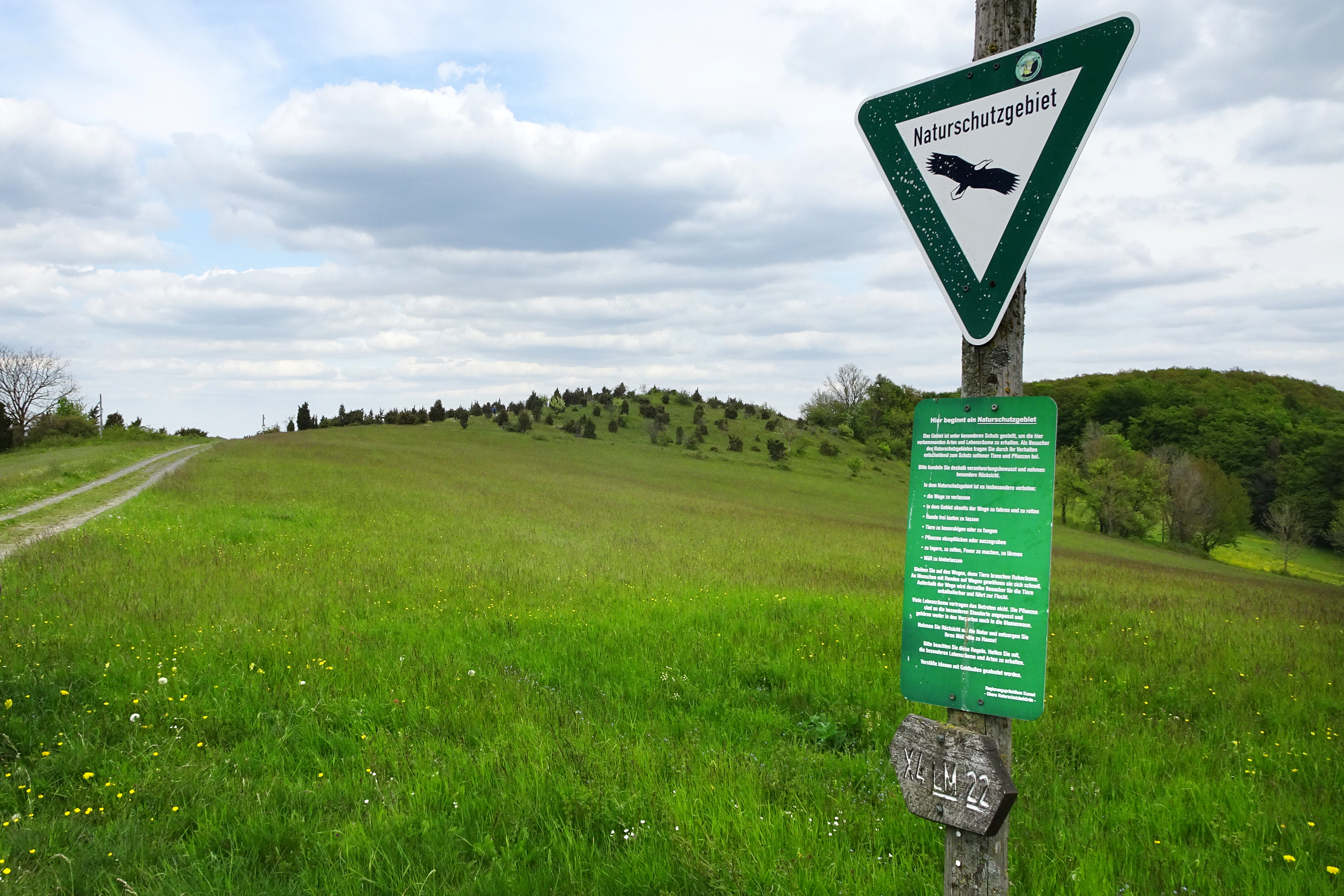
A green triangle nature reserve sign on a wooden post in the foreground, with a grassy hill and trees in the background.
A nature reserve sign marks the entrance to the Bühlchen bei Weißenbach landscape.

Bühlchen bei Weißenbach wildlife and species highlights

The Bühlchen itself is primarily a botanical rather than zoological reserve, but its open conditions nonetheless support a meaningful entomological fauna. The dense carpet of grassland flowers provides the resource base for numerous Tagfalter (butterflies) and Widderchen (burnet moths), whose presence is closely tied to the persistence of the Magerrasen under continued grazing management.

The wider Meißner bird protection area that surrounds the reserve is more important for birds, particularly forest and cliff-nesting species such as Sperlingskauz and Raufußkauz (pygmy and Tengmalm's owls), Rotmilan (red kite), Schwarzstorch (black stork), Wespenbussard (European honey buzzard), Schwarz- and Grauspecht (black and grey woodpeckers), Raubwürger (great grey shrike), and Neuntöter (red-backed shrike), together with Uhu (eagle owl) and Wanderfalke (peregrine falcon) on the broader area's breeding cliffs.

The bird community directly on the Bühlchen is more modest, dominated by smaller passerines associated with the juniper scrub and ecotone between grassland and forest. Recorded species include Grasmücken (warblers), Heckenbraunelle (hedge accentor), and Goldammer (yellowhammer), along with other typical edge-habitat birds. Larger game species on and around the reserve remain subject to limited individual hunting under the terms of the nature reserve ordinance.
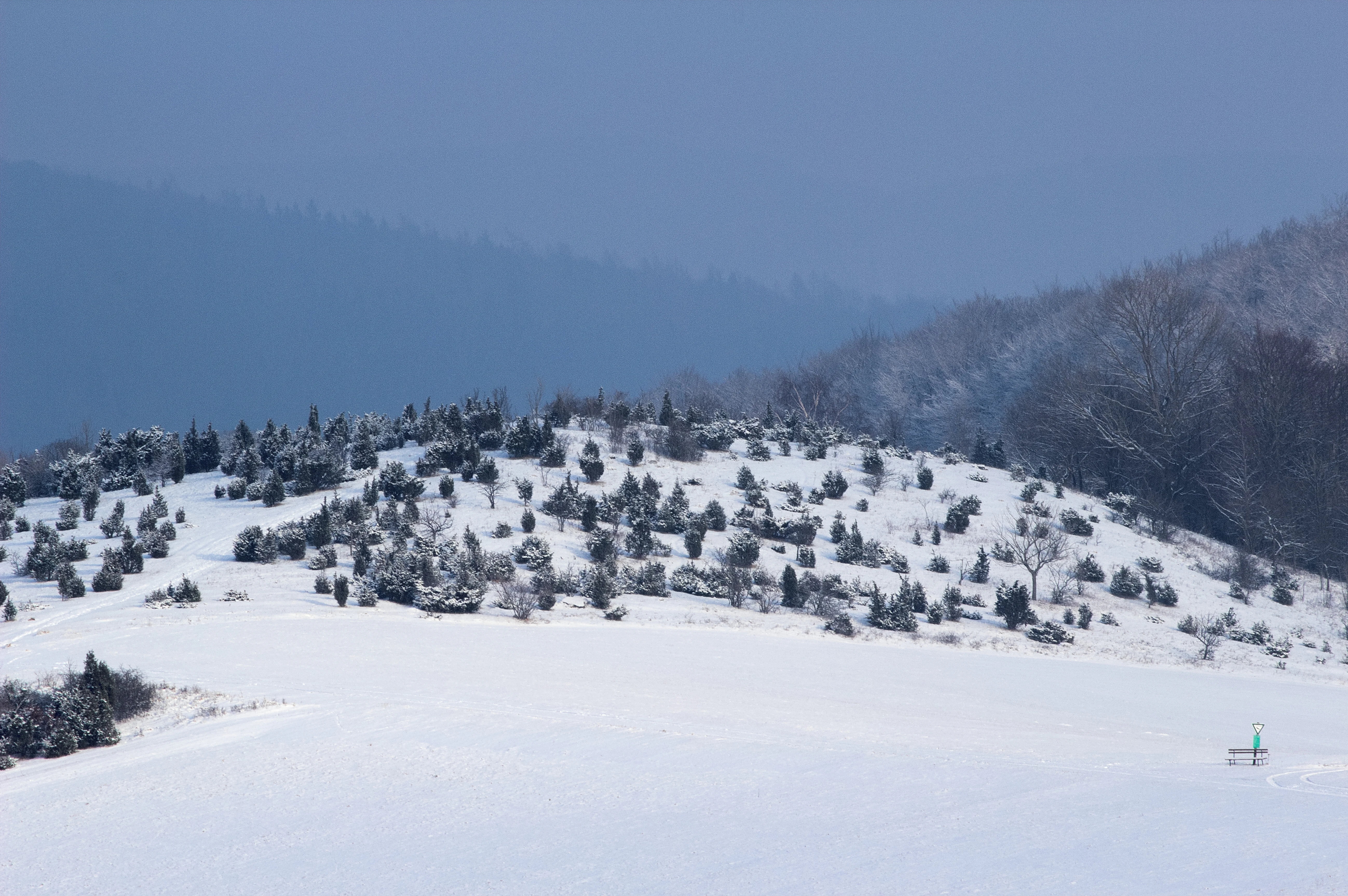
A snow-covered hillside dotted with small evergreen trees, likely junipers, under a cloudy, overcast winter sky.
A winter view of the juniper-covered slopes of the Bühlchen bei Weißenbach nature reserve.

Bühlchen bei Weißenbach conservation status and protection priorities

Bühlchen bei Weißenbach sits at the intersection of several overlapping conservation frameworks. At the national level it is a formal Naturschutzgebiet under Hessian law; at the European level it is part of two Natura 2000 designations, the Fauna-Flora-Habitat area Meißner und Meißner Vorland (area 4725-306) and the Vogelschutzgebiet Meißner (area 4725-401); and at the landscape level it lies within the Geo-Naturpark Frau-Holle-Land, which promotes sustainable tourism alongside conservation objectives.

The central conservation concern is the long-term maintenance of the calcareous Magerrasen. Without continued extensive grazing or compatible mowing, juniper scrub rapidly gives way to taller shrubs and eventually to woodland closure (Verbuschung), which would eliminate the open, flower-rich habitat on which the reserve's rare species depend. To address this, ongoing management includes targeted conservation measures and a grazing project designed to keep the open character of the grasslands into the future.

A particular conservation focus is the Dreizähniges Knabenkraut (Neotinea tridentata), for which Hesse bears special responsibility because of the species' areographic position. The wider FFH area, which integrates the Bühlchen with the larger Naturschutzgebiet Meißner, the Quellgebiet der Weißen Gelster, the Kripp- und Hielöcher, and other open and woodland habitats, adds further protection for beech forests, hedgerow landscapes, montane meadows, Nardus grasslands, calcareous fens, transition mires, and basalt blockfields at a regional scale.

Bühlchen bei Weißenbach cultural meaning and human context

The cultural identity of the Bühlchen bei Weißenbach is inseparable from the historical agricultural practice of Hutung, the communal grazing of sheep and goats on marginal land that was once widespread across central German uplands. Although that pastoral economy has largely faded, the plant composition of the reserve, with its strong juniper component and open, low-growing structure, is a direct living trace of this older land-use system.

In a broader sense, the site contributes to the cultural landscape identity of the Frau-Holle-Land region, an area strongly associated with the fairy tale of Frau Holle as collected by the Brothers Grimm. The Meißner massif and its surroundings hold a special place in Hessian folklore and regional identity, and the Bühlchen's conservation efforts sit within the cultural frame of the Geo-Naturpark Frau-Holle-Land, whose branding ties natural and cultural heritage together.

Today, the relationship between people and the Bühlchen is one of careful stewardship rather than intensive use. Some grassland patches are still mown or grazed extensively, the site is crossed by the certified premium hiking trail P8 of the Frau-Holle-Land Naturpark, and ongoing conservation grazing projects link the reserve back to the very practice that originally created it.

Top sights and standout views in Bühlchen bei Weißenbach

A 537-metre Muschelkalk summit crowned with one of Hesse's most diverse calcareous Magerrasen, featuring juniper thickets, multiple orchid species, gentians, and a long list of Red-Listed grassland plants compressed into less than eight hectares.

A layered conservation profile in which a single small reserve is at once a Hessian Naturschutzgebiet, part of the EU Natura 2000 network through both an FFH and a Vogelschutzgebiet, and a focal point of wider Meißner biodiversity conservation. A rare surviving example of a juniper-rich Hutung landscape shaped by centuries of sheep and goat grazing and now actively maintained through conservation management.

Best time to visit Bühlchen bei Weißenbach

Late spring, around May, is widely regarded as the most rewarding time to visit Bühlchen bei Weißenbach. At that point the Magerrasen come into their fullest floral display, with Großes Windröschen, Knabenkräuter, and Schlüsselblumen all contributing to a dense carpet of colour across the open slopes, and the air around the juniper stands is typically busy with day-flying butterflies. Early summer carries the best view of many of the orchids and gentians, while the juniper clusters remain a structural feature of the landscape through every season.

Because the reserve sits on an exposed hilltop, weather conditions can shift quickly; cooler, windier periods can shorten the apparent flowering window even at the peak of the season. Walking the certified premium trail P8 of the Geo-Naturpark Frau-Holle-Land, which crosses the Bühlchen and links viewpoints toward the Kaufunger Wald and the Meißner, is considered a moderately demanding outing because of the hilltop climb rather than any technical difficulty.

Monthly climate preview

Long-term representative monthly temperature and precipitation data for Bühlchen bei Weißenbach

Bühlchen bei Weißenbach Climate Normals and Temperature Patterns

Historical NASA climate data records the measured annual temperature progression alongside consistent monthly precipitation distributions for Bühlchen bei Weißenbach. Reviewing the complete twelve-month profile provides detailed meteorological context regarding long-term average conditions at this representative coordinate.
Annual mean8 °C
-1 °C18 °C
Jan-1°
Feb
Mar
Apr
May12°
Jun16°
Jul18°
Aug18°
Sep14°
Oct
Nov
Dec
Warmest month
July

18.3 °C

Coolest month
January

-1.1 °C

Wettest month
July

2.6 mm/day

Driest month
April

1.4 mm/day

Park location guide

Geography guide, regional context, and park location map for Bühlchen bei Weißenbach

Bühlchen bei Weißenbach park geography, regions, and map view in Germany

Understand where Bühlchen bei Weißenbach sits in Germany through a broader geographic reading of the surrounding landscape, nearby location context, and its mapped position within the national park landscape.

How Bühlchen bei Weißenbach fits into Germany

Germany is a federal republic in Western and Central Europe with a population of over 83 million across sixteen constituent states. It is Europe's largest economy by nominal GDP and a major global exporter and importer. The capital is Berlin, and the country borders Denmark, Poland, Czech Republic, Austria, Switzerland, France, Luxembourg, Belgium, and the Netherlands.

Wider geography shaping Bühlchen bei Weißenbach in Germany

Germany is located in Western and Central Europe, spanning 357,022 km². It borders Denmark to the north, Poland and the Czech Republic to the east, Austria and Switzerland to the south, and France, Luxembourg, Belgium, and the Netherlands to the west. The country has coastlines on the Baltic Sea and North Sea to the north, with the Alps located in the southern region.

Map view of Bühlchen bei Weißenbach

Use this park location map to pinpoint Bühlchen bei Weißenbach in Germany, understand its exact geographic position, and read its mapped placement within the surrounding landscape more clearly.

Pigeon | © OpenStreetMap contributors

Location context for Bühlchen bei Weißenbach

Werra-Meißner-Kreis

Visualizing the limestone grassland habitats and protected terrain of northern Hesse

Bühlchen bei Weißenbach Photos and Landscape Scenery

Visual records reveal the distinctive shell limestone summit, juniper thickets, and rare calcareous flora defining Bühlchen bei Weißenbach. Photographic documentation provides clear insight into the protected landscape character and ecological diversity of the Meißner region.

A gentle grassy hill covered with purple and yellow wildflowers and scattered juniper trees, with a distant view of wooded hills under a cloudy sky.

A sloped, grassy meadow filled with white, yellow, and purple wildflowers, interspersed with scattered dark green juniper trees under a cloudy sky.

A sloped meadow filled with white and purple wildflowers under a light blue cloudy sky, dotted with dark green juniper trees.

A green triangle nature reserve sign on a wooden post in the foreground, with a grassy hill and trees in the background.

A snow-covered hillside dotted with small evergreen trees, likely junipers, under a cloudy, overcast winter sky.

Park atlas

Compare adjacent limestone reserves and regional upland landscapes

Parks Near Bühlchen bei Weißenbach and Surrounding Protected Areas

Continue exploring protected areas near Bühlchen bei Weißenbach to discover similar limestone grasslands and juniper heaths across the Meißner uplands. Comparing adjacent conservation sites reveals the broader ecological patterns shaping regional habitat networks and semi-open terrain.
Watercolor painting of a mountain landscape with green slopes, coniferous forests, and rocky outcroppings under a soft, light-filled sky.
Nature reserveHesse
Mapped location lies within the park boundary#1 closest

Southeast

Meißner Nature Reserve in Northern Hesse: Mapping the Hoher Meißner Basaltic Massif

A comprehensive look at forest wilderness, bogs, and volcanic geology

Covering roughly 930 hectares, the Meißner nature reserve in northern Hesse protects an ecologically distinct upland landscape. The area features a significant basalt plateau, ancient scree slopes, mountain meadows, and hanging spring bogs, offering a prime example of protected central German topography and forest wilderness.

Area
9.322 km²
Established
1989
IUCN
IV
Relief
Mountain
A horizontal watercolor painting showing a soft, muted landscape with rolling hills, a central open area, and clusters of green trees under a pale sky.
Nature reserveWerra-Meißner-Kreis
About 4.1 km away#2 closest

East

Kripp- und Hielöcher Nature Reserve: Karst Geography and Protected Land in Werra-Meißner-Kreis

Geology-focused nature reserve featuring gypsum sinkholes and dry grasslands.

Kripp- und Hielöcher provides a rare look at Zechstein gypsum karst in Hesse. The reserve is split into two distinct areas, the Kripplöcher and Hielöcher, showcasing natural rock monuments, active karst springs, and a historical cultural landscape maintained through centuries of traditional land use.

Area
0.17 km²
Relief
Upland
Climate
Temperate
Access
Moderate access
A watercolor painting showing a soft, green landscape with gentle rolling hills, small clusters of trees, and a small meandering stream, framed by delicate wild flowers in the foreground.
Nature reserveWerra-Meißner-Kreis
About 4.2 km away#3 closest

Southwest

Quellgebiet der Weißen Gelster: Nature Reserve Geography and Protected Area Mapping

Calcareous spring mires and wet meadows in Werra-Meißner-Kreis

Located at the foot of the Meinetsberg, Quellgebiet der Weißen Gelster features a series of groundwater-dependent habitats including Davall's sedge fens and golden oat meadows. The reserve represents a key segment of the regional protected-area network, preserving rare vegetation types on Keuper bedrock within a characteristic upland agricultural valley.

Area
0.115 km²
Established
1991
IUCN
IV
Relief
Upland
A horizontal watercolor illustration depicting rolling green hills, scattered trees, and soft mountain silhouettes against a pale sky.
Protected areaGermany
About 7.3 km away#4 closest

North

Kalkmagerrasen bei Roßbach: Protected Calcareous Grassland and Juniper Landscape in Germany

Geographic atlas and protected area overview in Hesse

Kalkmagerrasen bei Roßbach consists of five distinct plots that protect rare Enzian Schillergras Rasen communities on shallow Zechstein limestone soils. This site remains a critical stronghold for diverse orchid populations and protected butterfly species within the Werra Meißner region. The mosaic of juniper, flowering herbs, and historic cherry orchards creates a unique Mediterranean character rarely found in central German hill country.

Area
0.551 km²
Established
1996
Relief
Upland
Climate
Temperate
A soft, minimalist watercolor painting of rolling hills and trees set against a white background.
Nature reserveHessen
About 7.9 km away#5 closest

East

Bilstein im Höllental: Protected Diabase Cliff and Ravine Forest in Hessen

Geological landscape and Natura 2000 protected area

Discover the geographic significance of Bilstein im Höllental, a nature reserve in the Werra-Meißner-Kreis that showcases a rare juxtaposition of warm rock refuges and cool, shaded ravine environments. The reserve protects significant cliff-dwelling plant communities and traces of medieval history upon its 284-meter diabase summit, providing a focused example of geological resistance shaping valley terrain.

Area
0.032 km²
Established
1960
IUCN
IV
Relief
Mountain
Watercolor illustration showing rolling green hills, small clusters of trees, and tall grasses in the foreground against a soft white background.
Nature reserveWerra-Meißner-Kreis
About 8.4 km away#6 closest

Southwest

Reichenbacher Kalkberge Nature Reserve: Geographic and Protected Landscape Analysis

Muschelkalk limestone hills and orchid-rich grassland habitats

An essential look at the Reichenbacher Kalkberge protected area, where limestone-based forest stands meet rare semi-dry meadows. Gain geographic insight into the terrain, the medieval castle ruin surroundings, and the protected habitat mosaic that defines this distinctive part of the Geo-Naturpark Frau-Holle-Land.

Area
1.503 km²
Established
1996
IUCN
IV
Relief
Mountain
Watercolor painting of a pastoral landscape with light green hills in the distance, a field with flowering pink trees, and a pale green meadow in the foreground.
Nature reserveWerra-Meißner-Kreis
About 8.8 km away#7 closest

North

Ebenhöhe-Liebenberg Nature Reserve: Geography and Protected Habitat Mapping

Protected calcareous forests and dry grassland mosaic

Explore the mapped boundaries and natural terrain of the Ebenhöhe-Liebenberg nature reserve. This site provides a critical habitat mosaic including orchid-rich beech woodlands, nutrient-poor grasslands, and sandstone outcrops that form a significant conservation area within the Hessian highlands.

Area
142.48 km²
Established
1995
IUCN
IV
Relief
Upland
A wide watercolor illustration of a rolling landscape with green fields, patches of pink flowers, and distant purple hills under a pale sky.
Nature reserveWerra-Meißner-Kreis
About 11 km away#8 closest

East

Jestädter Weinberg: Protected Zechstein Cliffs and Werra River Valley Mosaic

A botanical and geological hotspot in northern Hesse

Jestädter Weinberg represents a critical protected landscape defined by its steep dolomite rock faces and sun-exposed slopes. This nature reserve provides an essential habitat for orchids and diverse insect populations, bridging the gap between high-altitude limestone ridges and the riparian meadows of the Werra river valley.

Area
0.6 km²
Established
1924
IUCN
IV
Relief
Upland

Common questions about visiting, size, designation, and location context for Bühlchen bei Weißenbach

Bühlchen bei Weißenbach FAQs for park facts, access, geography, and protected area context

Find quick answers about Bühlchen bei Weißenbach, including protected-area facts, park geography, trail and visitor context, and how the park fits into its surrounding country and regional landscape.
MoriAtlas Explorer

Continue Your Protected Areas Search Across the Global Atlas

Deepen your exploration by continuing the structured search for national parks and protected areas worldwide. Utilize the comprehensive filtering capabilities to compare different conservation landscapes and refine your understanding of global park geography. Discover more about the distribution and characteristics of protected natural areas.

Global natural geography