
Why Bühlertal Vellberg-Geislingen stands out
The site is best known for its coherent, near-natural mosaic of valley habitats along the meandering Bühler river, where species-rich hay meadows, wet tall-herb fringes, calcareous seepage springs, lime-rich rock outcrops, caves, floodplain woodland, and mixed hillside beech forests occur in close proximity. It is also an important occurrence area for several Habitats Directive species, including the thick-shelled river mussel, the stone crayfish, the souffie dace (Strömer), the bullhead, the yellow-bellied toad, and several bat species such as the barbastelle and Bechstein's bat. The sheer concentration of Annex I habitat types and Annex II species within a single compact valley underpins its recognized conservation value.
Bühlertal Vellberg-Geislingen history and protected-area timeline
The site originated as one of Baden-Württemberg's submissions to the European Commission under the Fauna-Flora-Habitat Directive (Richtlinie 92/43/EWG), prepared by the Regierungspräsidium Stuttgart in 2004. The proposal was made as part of the statewide selection of areas of community importance that would later form the backbone of the Natura 2000 network in Germany.
Although scientifically proposed in 2004, the area did not receive formal legal protection until more than a decade later. The decisive step came on 30 October 2018, when the Regierungspräsidium Stuttgart issued a general decree (Verordnung) formally designating it as a Gebiet von gemeinschaftlicher Bedeutung (Site of Community Importance). This decree entered into force on 11 January 2019, establishing the FFH-Gebiet Bühlertal Vellberg-Geislingen as a legally binding protected area with site code DE-6924-341.
Within its boundaries lies the Naturschutzgebiet Unteres Bühlertal, a stricter national-level nature reserve that predates the FFH area and continues to serve as a tightly regulated conservation core along the lower Bühler. The layered relationship between the older reserve designation and the newer EU-level FFH designation reflects the gradual, multi-instrument approach to conservation in the Schwäbisch Hall region.
Bühlertal Vellberg-Geislingen landscape and geographic character
The protected area is shaped by the deeply incised valley of the Bühler river, which meanders in tight loops between Vellberg and the Kocher. The valley floor alternates between narrow gorges and broader alluvial flats where the river spreads out and forms small gravel banks, cut-off meanders, and side channels. Near Geislingen am Kocher, the Bühler discharges into the larger Kocher river, producing a conspicuous lowland confluence landscape at the western edge of the area.
Above the valley floor, the landscape rises to the Schwäbisch-Fränkische Waldberge, a chain of forested ridges built on Keuper and Liassic sedimentary rocks. The valley walls show a marked Keuperstufenrand, a stepped geological margin that supports a transition from floodplain habitats on the valley floor to dry calcareous grasslands and mixed forests on sun-exposed slopes. The presence of calcareous rock outcrops adds locally dramatic cliff and scree features.
Caves are a notable recurring feature of the site: eight caves are recorded within the area, set into the limestone formations along the valley's geology. Calcareous tufa springs emerge where carbonate-rich groundwater reaches the surface, often forming small terraced deposits along the slopes. Elsewhere, the valley opens out into the agricultural plains of the Kocher-Jagst-Ebenen and the Hohenloher und Haller Ebene, where traditionally mown meadows and grazing land stretch toward the horizon.
Bühlertal Vellberg-Geislingen ecosystems, habitats, and plant life
Ecologically, Bühlertal Vellberg-Geislingen is defined by the strong gradient between river, slope, and plateau, which produces a notable concentration of habitat types within a relatively compact area. Annex I lowland hay meadows (code 6510) are among the most extensive habitat types, occupying over 58 hectares. These species-rich meadows, traditionally mown for hay, are a stronghold for meadow-dependent flora and pollinators, including the dark large blue butterfly.
Forests make up a substantial share of the site. Mixed slope and gorge forests of the Tilio-Acerion type (code 9180) extend across about 49 hectares, while floodplain forests of alder, ash, and willow (code 91E0) cover around 18 hectares of wet valley-bottom ground. Smaller tracts of woodruff beech forest (code 9130) appear on more stable slope soils, adding a further layer of forest diversity. Calcareous rock with fissure vegetation (code 8210) and small calcareous grasslands (code 6210) occupy rocky outcrops and dry slopes.
River and spring habitats are equally important. The Bühler itself is classified as a lowland-to-mountain river with Ranunculion and Callitricho-Batrachion vegetation (code 3260), covering nearly 20 hectares of water surface. Calcareous tufa springs (code 7220), a rare and highly specialized habitat, form small but ecologically significant deposits where groundwater emerges on the valley slopes. Together, these habitats form a near-continuous ecological gradient from cave and spring systems in the upper valley down to the floodplain forest at the Kocher confluence.
Bühlertal Vellberg-Geislingen wildlife and species highlights
The FFH-Gebiet has a species inventory that includes several Habitats Directive Annex II species considered of community interest. The river itself supports the thick-shelled river mussel (Unio crassus) and the stone crayfish (Austropotamobius torrentium), both of which depend on clean, well-oxygenated freshwater with stable bed sediments.
Fish fauna includes the Strömer (Telestes souffia agassizi), a small cyprinid endemic to the upper Danube system, as well as the bullhead (Cottus gobio), a bottom-dwelling species that relies on coarse gravel substrates. Wet meadows and small water features provide habitat for the yellow-bellied toad (Bombina variegata), an amphibian that requires a network of shallow, sun-exposed pools for breeding.
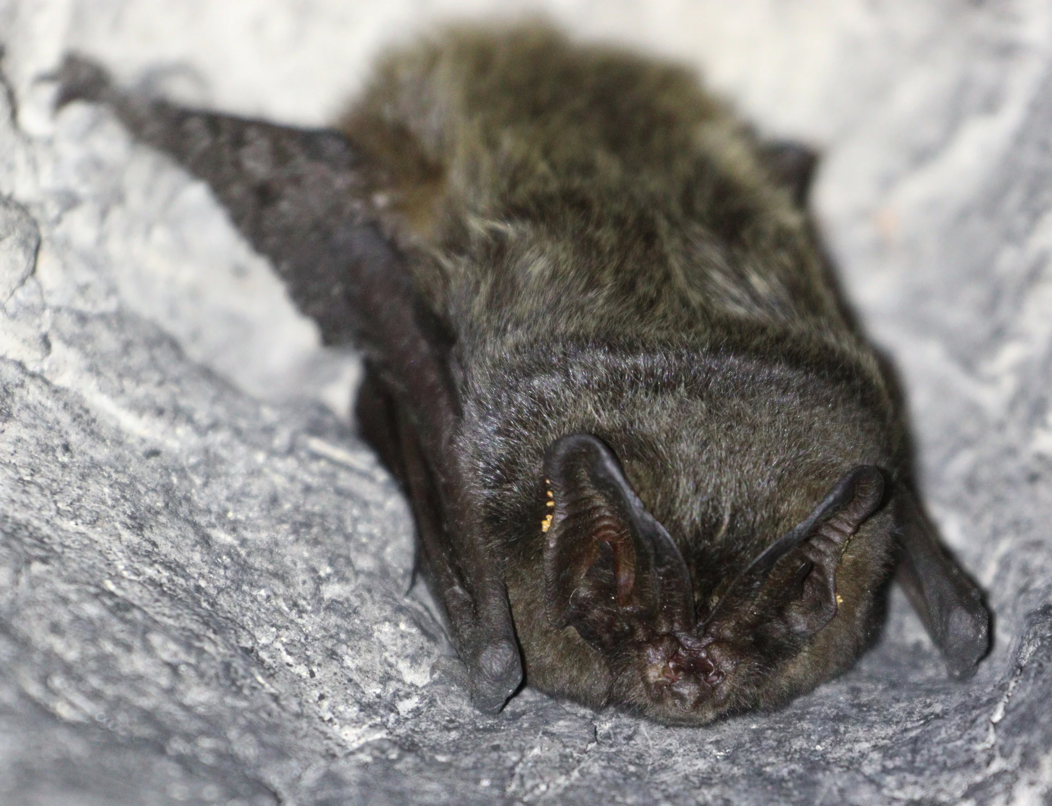
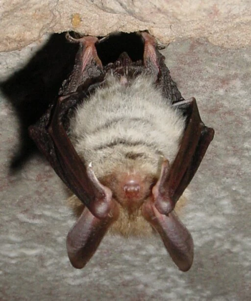
Moths and butterflies are represented by the dark large blue (Maculinea nausithous), which is closely tied to species-rich hay meadows with great burnet (Sanguisorba officinalis), and by the Jersey tiger moth (Euplagia quadripunctaria). The valley's caves and mature forests support several bat species of conservation concern, including the barbastelle (Barbastella barbastellus), Bechstein's bat (Myotis bechsteinii), and the greater mouse-eared bat (Myotis myotis).
Bühlertal Vellberg-Geislingen conservation status and protection priorities
Conservation significance at Bühlertal Vellberg-Geislingen rests on the rare combination of a near-natural river system, extensive semi-natural meadows, and intact mixed forests all linked within one continuous valley. The site functions as a key conservation corridor along the Bühler river, connecting upland forest habitats in the Schwäbisch-Fränkische Waldberge with the broader river network of the Kocher.
The legal foundation is the EU Habitats Directive, which obligates Germany to maintain or restore favourable conservation status for the Annex I habitat types and Annex II species present. At the national level, this is implemented through the Verordnung of 30 October 2018, which formally defines the site boundaries and the required protection standards. The presence of the Naturschutzgebiet Unteres Bühlertal within the larger FFH area further strengthens protection in the lower valley.
The site also plays a regional role within the Landkreis Schwäbisch Hall's Natura 2000 network, complementing other FFH areas along the Jagst and Kocher rivers. Together with neighbouring sites such as Oberes Bühlertal, Kochertal Schwäbisch Hall-Künzelsau, and Schwäbisch Haller Bucht, it forms part of an interconnected conservation landscape across northeastern Baden-Württemberg, supporting habitat connectivity, species dispersal, and the long-term viability of stream-dependent communities.
Bühlertal Vellberg-Geislingen cultural meaning and human context
The Bühlertal sits within a region long shaped by traditional agricultural land use, where small-scale dairy farming and hay-making have historically maintained open meadows along the valley floor. These meadows, now recognized as species-rich lowland hay meadows under the Habitats Directive, are a direct legacy of generations of extensive, low-intensity farming rather than modern intensive agriculture.
The valley also lies between the historic town of Schwäbisch Hall and the smaller market town of Vellberg, both of which have medieval roots and strong traditions tied to the rivers Kocher and Bühler. Cave sites within the area add a further, more ancient cultural dimension, as caves in the Keuper and limestone formations of the region have often held archaeological and historical significance. The protected landscape thus represents not only natural value but also the rural cultural heritage of the Schwäbisch-Fränkische Waldberge.
Top sights and standout views in Bühlertal Vellberg-Geislingen
One of the most concentrated habitat mosaics among the FFH sites of Landkreis Schwäbisch Hall, with a near-natural meandering river system, species-rich hay meadows, and mixed slope forests all in one valley. The site also stands out for its combination of rare habitats such as calcareous tufa springs and forested caves with threatened freshwater species like the thick-shelled river mussel and the stone crayfish.
Best time to visit Bühlertal Vellberg-Geislingen
The valley's character changes with the seasons in ways that reward different kinds of visitors. Late spring and early summer bring peak flowering of the species-rich lowland hay meadows, which are central to the site's identity. Summer offers the fullest greenness of the slope forests and the most active period for insects along the riverbanks.
Autumn is often the most atmospheric time, when the mixed forests of beech, ash, and lime turn color above the still-flowing Bühler, and many of the meadow habitats are in late-season mown fallow. Winter is generally quieter, but the frozen or low-water river and bare deciduous woods can give the steep valley walls and cave entrances a particularly stark photographic appeal. Cave visits and most grassland observations, however, depend on safe terrain conditions in winter.