

Mori Atlas logo
Nature reserveCalectasia Conservation Park

Understanding the mapped boundaries and unique stranded dune ecology of this South Australian nature reserve

Calectasia Conservation Park: A Detailed Geographic Survey of Protected Landscapes in Wattle Range

Calectasia Conservation Park represents a specialized protected landscape within the Wattle Range region of South Australia. Spanning a small but ecologically significant area, this reserve features a complex mosaic of stranded dune systems, seasonal freshwater wetlands, and brown stringybark woodlands. Our geographic analysis highlights the park's function as a dedicated habitat for rare native flora and its role within the broader geomorphic history of the Limestone Coast.

South Australia conservation parksmall protected areastranded dune systemseasonal swampfreshwater wetlandbrown stringybark woodland

Calectasia Conservation Park

Nature reserve

Park overview

Structured park overview, official facts, and landscape profile for Calectasia Conservation Park

Calectasia Conservation Park park facts, protected area profile, and essential visitor context

Review the core facts for Calectasia Conservation Park, including designation, size, terrain, visitor scale, habitats, and operating context in one park-focused overview.

About Calectasia Conservation Park

Calectasia Conservation Park is one of South Australia's smaller conservation reserves, located in the southeastern part of the state within the Wattle Range council area. The park occupies land to the south of the Robe to Penola Road, in section 157 of the Hundred of Short, and covers just 14 hectares. Despite its compact size, the reserve concentrates a remarkable amount of ecological interest into a small footprint, combining a stranded dune system remnant, a seasonal swamp, and habitat for several characteristic native species.

The landscape of the reserve is divided into roughly three ecological zones. The southern portion supports a brown stringybark woodland with an understorey of austral grass trees, while the northern portion carries a lower brown stringybark woodland interspersed with scattered desert banksias and a dense heath understorey. Between these two woodland areas lies a low-lying section that accounts for around 70 percent of the park and fills with water during the wetter months, forming a seasonal swamp dominated by introduced grassland species in drier conditions. This mosaic of dry dune woodland and seasonally inundated ground is unusual within such a small reserve.

The park's primary conservation focus is the blue tinsel lily, which grows in the northeastern part of the reserve. A protective enclosure has been constructed around its main stand, and a vermin proof fence surrounds the entire conservation park to support the survival of this population. Beyond the lily, the seasonal swamp provides habitat for water birds and eastern swamp rats, extending the reserve's ecological importance into its wet-phase conditions.

The reserve was created early in South Australia's modern system of protected areas, first proclaimed under the National Parks Act 1966 and later renamed under the National Parks and Wildlife Act 1972. Today it is managed by the Department for Environment and Water as a Category IV protected area, with its management intensity directed primarily at the persistence of the blue tinsel lily and the integrity of its dune-swamp habitat mosaic.

Quick facts and research context for Calectasia Conservation Park

Calectasia Conservation Park is a 14 hectare protected area in the Wattle Range locality of southeastern South Australia, located about 25 kilometres west of Penola and roughly 320 kilometres southeast of Adelaide. Originally proclaimed in 1967 as the Calectasia National Parks Reserve, it was renamed under legislation in 1972 and is governed by South Australia's Department for Environment and Water.

The park is classified as an IUCN Category IV habitat and species management area. Its defining features include a stranded dune system, a low-lying seasonal swamp that covers most of the reserve, surrounding brown stringybalk woodland with grass tree and desert banksia, and a protected population of the blue tinsel lily, a species regarded as rare in South Australia.

Protection and recognition

Terrestrial protected area classification and recognized designation data

Calectasia Conservation Park Protection Status and Mapped Land Scope

Calectasia Conservation Park maintains a documented terrestrial protection status within the regional reserve network. Official records outline the assigned conservation scope and international designation framework without speculative management claims.

Protection details

Protection scope
Terrestrial
Park context

Deeper park guide and search-rich context for Calectasia Conservation Park

Calectasia Conservation Park history, landscape, wildlife, and travel context

Explore Calectasia Conservation Park through its history, landscape character, ecosystems, wildlife, conservation priorities, cultural context, and seasonal travel timing in a structured park guide built for atlas discovery and search intent.

Why Calectasia Conservation Park stands out

Calectasia Conservation Park is best known for protecting a population of the blue tinsel lily, a striking native plant that has become rare in South Australia. The reserve also preserves a remnant stranded dune landscape divided between seasonal swampland and brown stringybark woodland, giving the small park a distinct combination of dry dune habitat and seasonally inundated ground within the same boundary. The park's fenced enclosure around the main stand of blue tinsel lily, together with a vermin proof perimeter fence, highlights the species-specific management approach that defines the reserve. The seasonal swamp component also gives the park a secondary role in supporting water birds and small native mammals, even at its modest size.

Calectasia Conservation Park history and protected-area timeline

Calectasia Conservation Park has its origins in the late 1960s wave of conservation reserve creation that accompanied South Australia's early national parks legislation. The land that now forms the reserve was first given protected status on 7 September 1967 when it was proclaimed as the Calectasia National Parks Reserve under the state's National Parks Act 1966.

In 1972, South Australia reorganised its conservation framework with the proclamation of the National Parks and Wildlife Act 1972. As part of this restructuring, the original reserve was renamed Calectasia Conservation Park on 27 April 1972, reflecting the new statute and its repeal of earlier conservation acts. The rename marked the reserve's transition from a national parks reserve classification to a conservation park designation, a category used for smaller areas with focused habitat or species management goals.

By 1980, the reserve's significance was formally described in its entry on the Register of the National Estate, a now defunct national register of environmentally significant places. The statement recorded that the conservation park preserved a population of the blue tinsel lily, which was noted as rare in South Australia, along with a small seasonal swamp of importance for water birds and eastern swamp rats. In February 1983, the reserve lay within the area affected by the Ash Wednesday bushfires, an event that shaped the broader vegetation of the region.

Calectasia Conservation Park landscape and geographic character

The physical landscape of Calectasia Conservation Park is dominated by a stranded dune system remnant, a relict surface feature that records the broader geomorphic history of southeastern South Australia. The reserve's dune ridges and hollows are divided by a central low-lying area which, although it makes up the majority of the park's surface, sits at a level that fills with water for much of the year.

In the south of the reserve, the dune surface supports an open brown stringybark woodland with an understorey of austral grass trees, a combination typical of mature sandy-land vegetation in this part of South Australia. Further north, the woodland becomes lower in stature and incorporates scattered desert banksias along with a denser heath understorey, indicating a shift in soils and possibly exposure across the dune system. The transition between these two woodland expressions is one of the reserve's clearest landscape features, despite the small area involved.

Calectasia Conservation Park ecosystems, habitats, and plant life

Ecologically, Calectasia Conservation Park represents a compressed mosaic of three quite different habitat types. The dune ridges carry dry sclerophyll woodland dominated by brown stringybark, with associated species such as austral grass tree and desert banksia, and a heath understorey on the northern portion of the reserve. The low-lying central area, which fills seasonally, shifts the ecological character toward a wetland system that supports water birds and small ground-dwelling mammals during its inundated phases.

The most distinctive ecological feature of the reserve is its population of blue tinsel lily, which occurs in the northeastern section of the park and is the subject of targeted in-situ protection through a dedicated enclosure and a vermin proof boundary fence. The conservation park's classification as an IUCN Category IV protected area reflects this species and habitat management emphasis, in which the active preservation of particular ecological values takes precedence over broad landscape preservation.

Calectasia Conservation Park wildlife and species highlights

Wildlife values at Calectasia Conservation Park are strongly tied to the reserve's seasonal swamp and its surrounding woodland. During the wetter months, the low-lying central area of the park functions as a small freshwater habitat that supports water birds, and historical descriptions of the reserve also note the presence of eastern swamp rats in this seasonally inundated zone.

The dry woodland parts of the reserve support a more typical range of birds and small mammals associated with brown stringybark woodland and heath understorey habitat, including the nectar sources provided by grass trees and desert banksias. While the reserve's small size limits the diversity of large or wide-ranging fauna, the combination of woodland and seasonal swampland gives it a role in supporting both resident and seasonally visiting species within the broader Wattle Range landscape.

Calectasia Conservation Park conservation status and protection priorities

Calectasia Conservation Park is primarily a species and habitat management reserve, and its conservation importance is unusually high relative to its size. The park's formal entry on the now-defunct Register of the National Estate in 1980 explicitly recognised the reserve as protecting a population of the blue tinsel lily, a species regarded as rare in South Australia, as well as a small seasonal swamp of importance for water birds and eastern swamp rats.

This priority has been reinforced physically through a protective enclosure around the main stand of the blue tinsel lily in the northeast of the reserve and through a vermin proof fence around the entire park boundary. The IUCN Category IV classification of the reserve further reflects its role as a habitat or species management area rather than a large-scale wilderness or ecosystem protection reserve. Together, these features make Calectasia Conservation Park a focused conservation asset within South Australia's protected-area system, even though it occupies only 14 hectares of land.

Top sights and standout views in Calectasia Conservation Park

A key highlight of Calectasia Conservation Park is the contrast within a single small reserve between stranded dune woodland and a seasonally inundated swampland, with the latter covering around 70 percent of the park. This juxtaposition gives the reserve a layered landscape character that is rare in conservation parks of its size.

Equally notable is the reserve's role in conserving the blue tinsel lily through direct intervention, including a dedicated protective enclosure and a vermin proof perimeter fence. Combined with its long protection history stretching back to 1967, these features make the park a compact but well-targeted example of South Australia's species and habitat management approach.

Best time to visit Calectasia Conservation Park

Calectasia Conservation Park is a small habitat and species management reserve rather than a developed visitor destination, and source material does not provide strong seasonal visitation information. The park's seasonal swamp is dry for parts of the year and fills during the wetter months, so visitors interested in observing its wetland character would naturally find that phase of the year more rewarding, while those interested in the woodland and dune landscape may find drier periods more accessible. As a conservation-focused reserve, any visit should prioritise the protection of the enclosed blue tinsel lily population and the integrity of the swampland habitat.
Monthly climate preview

Long-term temperature ranges and monthly precipitation averages for Wattle Range

Calectasia Conservation Park Climate Normals and Annual Weather Patterns

Representative coordinate records show measured monthly temperature variation alongside long-term precipitation averages across the protected area. Examining the full twelve-month profile reveals detailed historical climate rhythms and comprehensive regional norms.
Annual mean14 °C
9 °C20 °C
Jan20°
Feb20°
Mar18°
Apr15°
May12°
Jun10°
Jul
Aug10°
Sep11°
Oct13°
Nov15°
Dec18°
Warmest month
February

19.8 °C

Coolest month
July

9.1 °C

Wettest month
July

2.9 mm/day

Driest month
February

0.7 mm/day

Park location guide

Geography guide, regional context, and park location map for Calectasia Conservation Park

Calectasia Conservation Park park geography, regions, and map view in Australia

Understand where Calectasia Conservation Park sits in Australia through a broader geographic reading of the surrounding landscape, nearby location context, and its mapped position within the national park landscape.

How Calectasia Conservation Park fits into Australia

Australia is a constitutional monarchy and federal parliamentary democracy comprising six states and ten territories. With a population of nearly 28 million, it is one of the world's most urbanised countries, with most people concentrated on the eastern seaboard. The country has a high Human Development Index and is known for its cultural diversity, ancient Aboriginal heritage, and unique wildlife.

Wider geography shaping Calectasia Conservation Park in Australia

Australia occupies the entire Australian continent, the island of Tasmania, and numerous smaller islands. It is the world's flattest and driest inhabited continent, featuring vast deserts in the interior (the Outback), tropical rainforests along the eastern coast, and a coastline bordering the Indian and Pacific Oceans.

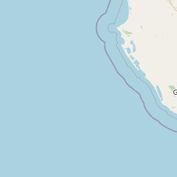
Map view of Calectasia Conservation Park

Use this park location map to pinpoint Calectasia Conservation Park in Australia, understand its exact geographic position, and read its mapped placement within the surrounding landscape more clearly.

Pigeon | © OpenStreetMap contributors

Location context for Calectasia Conservation Park

South AustraliaWattle Range
Park atlas

Compare surrounding regional geography and connected South Australian conservation reserves

Other Parks and Protected Areas Near Calectasia Conservation Park

Browsing other protected areas near Calectasia Conservation Park reveals broader regional conservation patterns across southeastern South Australia. Examining adjacent reserves provides valuable geographic context for understanding local dune woodland and wetland habitats.
Wildlife reserveSouth Australia
About 23 km away#1 closest

North

Big Heath Conservation Park: Mapping Protected Landscapes in South Australia

A strict nature reserve of woodland and wetland mosaics.

Big Heath Conservation Park represents a significant protected area in the Limestone Coast region of South Australia. The terrain is characterized by a gently undulating plain where subtle variations in elevation and soil composition create a distinct patchwork of eucalypt woodlands, sandy heath, and seasonal depressions linked to regional hydrological drainage systems.

Area
24.72 km²
Established
1964
IUCN
Ia
Relief
Lowland
Nature reserveSouth Australia
About 25 km away#2 closest

West

Furner Conservation Park Geography and Protected Woodland Atlas for South Australia

A study of forest remnants, sandy rises, and coastal dune topography

Furner Conservation Park preserves a significant mosaic of native woodlands within the Limestone Coast region. The terrain shifts between sandy rises and stony calcarenite ridges, supporting distinct forest communities that offer a vital look into the natural history and regional geography of South Australia.

Area
2.89 km²
Established
1973
IUCN
III
Relief
Upland
Nature reserveSouth Australia
About 32 km away#3 closest

Northeast

Hacks Lagoon Conservation Park: Wetland Landscape and Protected Area Geography

A vital Ramsar wetland site in the South Australia Limestone Coast region

Hacks Lagoon Conservation Park provides a protected freshwater sanctuary amidst the rural plains of South Australia. This nature reserve sustains a diverse wetland habitat, encompassing open water, marshes, and seasonally flooded zones that support critical waterbird populations within an internationally recognized ecological system.

Area
2.02 km²
Established
1967
IUCN
IV
Relief
Lowland
Nature reserveSouth Australia
About 34 km away#4 closest

Northeast

Glen Roy Conservation Park: Geography and Protected Landscape Atlas

Nature reserve terrain in south-east South Australia

Glen Roy Conservation Park stands as a significant protected remnant in south-eastern South Australia, encompassing a diverse array of calcarenite dune ridges, bleached sand dunes, and seasonal interdunal swamps. The park area is managed for its ecological variety, featuring distinct vegetation associations ranging from brown stringybark open forest to river red gum woodland and closed heathland.

Area
5.44 km²
Established
1970
IUCN
III
Relief
Lowland
National parkSouth Australia
About 38 km away#5 closest

Northeast

Naracoorte Caves National Park: Detailed Map and Protected Landscape Context in South Australia

Explore its unique protected geography and natural terrain.

Naracoorte Caves National Park represents a vital protected area within the diverse geography of South Australia. This entry provides an atlas-driven perspective, highlighting its identity as a national park, its mapped landscapes, and its regional significance. Engage with structured information detailing the park's protected status and geographic features, offering a clear view of its contribution to South Australia's natural heritage.

Area
6.6 km²
Established
2001
IUCN
II
Visitors
90.8K annual
National parkSouth Australia
About 38 km away#6 closest

Southwest

Canunda National Park: South Australia's Protected Landscape and Geographic Atlas

Explore mapped boundaries and regional natural geography.

Canunda National Park in South Australia is presented here as a distinct protected landscape. This detail page focuses on its geographic setting, providing insights into its mapped boundaries and its role within the regional atlas context. Understand the park's natural geography and its protected status for informed exploration.

Area
96.24 km²
Established
1959
IUCN
VI
Relief
Lowland
Nature reserveSouth Australia
About 40 km away#7 closest

South

Gower Conservation Park: A Protected Eucalypt Forest Reserve in South Australia

Mapped terrain, calcarenite dunes, and native woodland ecosystems

Gower Conservation Park preserves a representative stand of native eucalypt forest on a backdrop of ancient, consolidated calcarenite dunes. Located in the lower south east of South Australia, the area stands as a significant ecological remnant featuring stringybark woodlands, limestone outcrops, and diverse understorey vegetation that reflect the historic character of the surrounding regional geography.

Area
0.4 km²
Established
1971
IUCN
III
Relief
Upland
Nature reserveSouth Australia
About 57 km away#8 closest

North

Fairview Conservation Park: Protected Nature Reserve and Limestone Coast Geography

Mapped wetlands, sandy ridges, and woodlands in southeastern South Australia

Explore the geographic framework of Fairview Conservation Park, a nature reserve in South Australia's Limestone Coast. The protected area features a unique intersection of semi-permanent lagoons, periodically inundated flats, and varied woodland vegetation including blue gum and manna gum, offering a clear window into the regional geological and ecological character of the area.

Area
13.94 km²
Established
1960
IUCN
Ia
Relief
Lowland

Common questions about visiting, size, designation, and location context for Calectasia Conservation Park

Calectasia Conservation Park FAQs for park facts, access, geography, and protected area context

Find quick answers about Calectasia Conservation Park, including protected-area facts, park geography, trail and visitor context, and how the park fits into its surrounding country and regional landscape.
MoriAtlas Explorer

Continue Your Protected Areas Search Across the Global Atlas

Deepen your exploration by continuing the structured search for national parks and protected areas worldwide. Utilize the comprehensive filtering capabilities to compare different conservation landscapes and refine your understanding of global park geography. Discover more about the distribution and characteristics of protected natural areas.

Global natural geography