
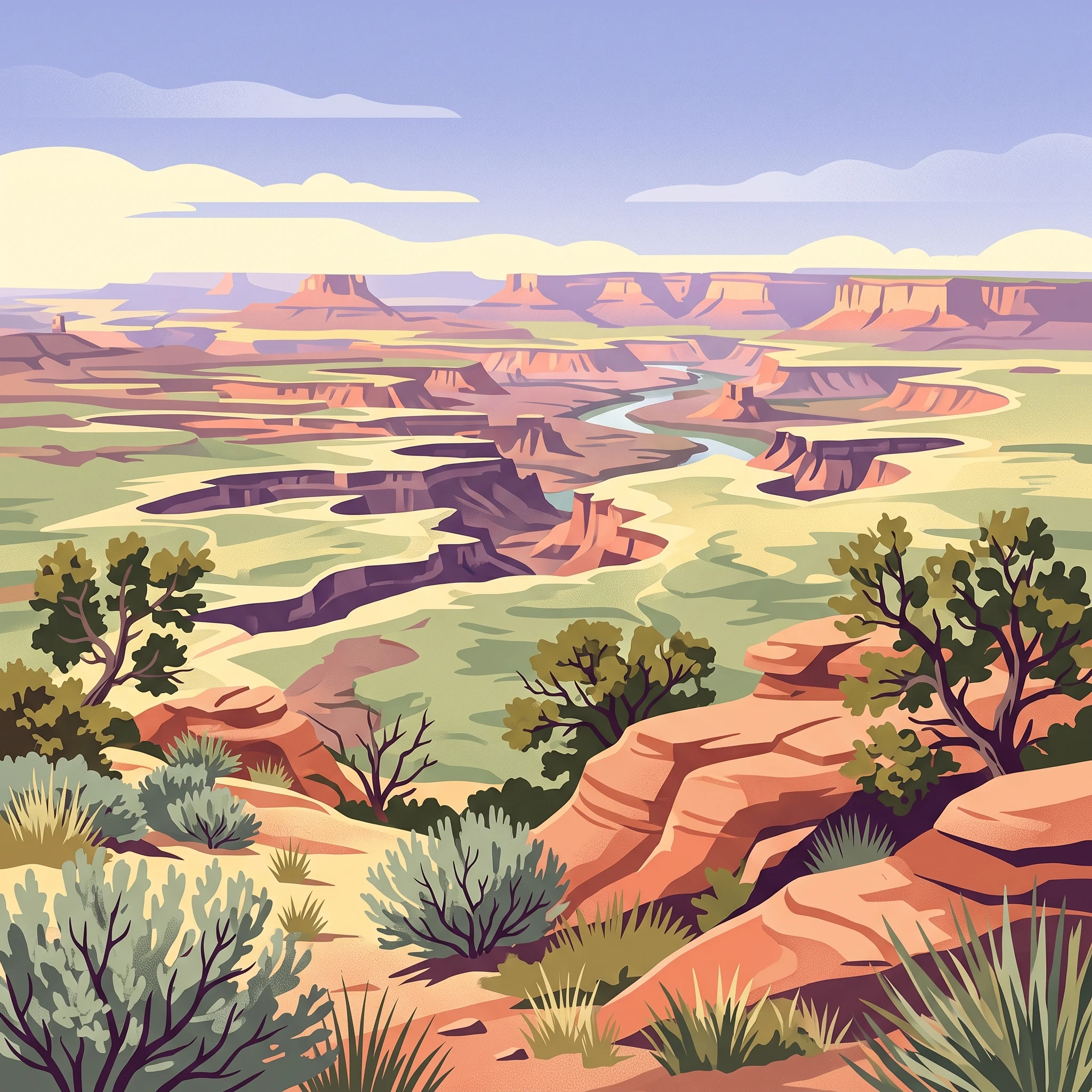
Trip Timing Orientation
When to Visit Canyonlands National Park: Key Factors for Timing Your Trip
Deciding on the best time to visit Canyonlands National Park requires a clear understanding of the dramatic temperature shifts inherent in high desert environments. The ideal window for most travelers falls within the moderate spring and autumn months, when daytime temperatures typically reach levels that facilitate comfortable hiking and backcountry navigation. Because this national park is located on the Colorado Plateau, daily temperature fluctuations can span significant ranges, often exceeding 20 degrees Celsius between a sun-drenched afternoon and a crisp, cold desert night, regardless of the season.
Balancing Temperature and Exposure
Canyonlands does not experience a singular uniform climate. Instead, the park presents a cycle defined by extreme heat and intense solar exposure during the summer, contrasting with the freezing, often biting conditions of winter. During the peak of summer, daytime maximums frequently rise well above 35 degrees Celsius, making mid-day exertion strenuous and hazardous for those unprepared for the arid heat. Conversely, the winter months bring regular freezing temperatures, particularly overnight, when the park elevation contributes to cold air settling into the canyons. These conditions demand that visitors prioritize weather windows that align with their tolerance for either extreme heat or deep cold.
Navigating the Influence of Elevation and Geography
The park's rugged landscape, defined by mesas, canyons, and buttes, acts as a heat sink and a wind funnel. Because the climate normals for the region show that wind speeds and humidity levels remain relatively low, the physical environment does not provide the natural cooling or shielding found in forested or coastal areas. This lack of moderating factors means the intensity of the sun is the primary driver of comfort. Visitors planning their trip must account for the fact that exposure remains high throughout the year, meaning that even during mild periods, the direct sunlight remains powerful. The geography dictates that those wishing to explore the deeper districts or the riverside areas will face different microclimates than those remaining on the Island in the Sky mesas.
Seasonal Variability in Precipitation
While the park is largely arid, planning should consider the seasonal distribution of precipitation. The late summer period often brings the risk of localized, high-intensity monsoon storms. These events are distinct from the steady rains found in other climates and can lead to rapid flash flooding in narrow canyon drainages. Understanding these weather phases is as important as tracking average monthly temperatures, as the impact of a sudden storm can fundamentally alter the safety and accessibility of backcountry trails and low-lying roads. By weighing these seasonal patterns against your planned activities, you can better select a time that balances favorable trail conditions with necessary environmental precautions.
Seasonal Comparison
Best Months to Visit Canyonlands National Park for Different Travel Styles
Balancing Comfort and Exploration Through the Calendar
The most rewarding visits to Canyonlands occur when daylight hours and thermal conditions align for extended outdoor activity. Because the park features significant elevation changes and exposed, high-desert terrain, timing your trip is less about avoiding specific crowds and more about navigating the physiological impact of the environment. The following windows offer the best balance of safety and accessibility for different travel styles.
The Spring Window: April and May
For many, the period from April through May represents the most predictable and comfortable window for exploring the diverse landscapes of the park. During these months, the daily temperature range begins to moderate, with average highs climbing from roughly 25 degrees Celsius in April to near 30 degrees Celsius by the end of May. The primary advantage of this season is the combination of increasing daylight,which provides ample time for longer hikes in the Needles or Island in the Sky districts,and the lack of the extreme heat that dominates the summer months. The trade-off for these milder days is that spring can bring increased wind, which occasionally impacts travel across exposed mesa tops.
The Autumn Window: Mid-September Through October
If your priority is stable, dry, and cooler weather for intense backcountry exploration, the mid-September through October window is ideal. As the summer heat wanes, average maximum temperatures drop from the mid-30s in September to the mid-20s by October. This period captures the transition from the humid late-summer monsoon season into a more stable climate pattern. Visitors during this time enjoy lower humidity levels and reduced risk of the sudden afternoon thunderstorms that can create hazardous conditions in the park’s many canyons and dry washes. This is a favored time for those looking to traverse the White Rim Road or engage in extensive photography, as the light remains crisp and the temperature drops rapidly at night, providing relief after sunset.
Managing the Extremes: Winter and Summer
Visiting outside of these primary shoulder seasons requires specific preparation for environmental extremes.
- Summer (June to August): Travelers who visit during these months face average maximums that frequently exceed 35 degrees Celsius. The intense solar exposure at high altitude makes strenuous activity dangerous during the middle of the day. This period is best suited for those who can plan their activities during the very early morning or late evening hours.
- Winter (December to February): While this is the coldest time of year, with mean temperatures often dipping below zero, it offers a stark, quiet atmosphere. The trade-off is the significant risk of freezing nights and the occasional, unpredictable layer of snow or ice. Even minimal frozen precipitation can render unpaved roads and steep trails treacherous, requiring visitors to remain highly flexible regarding their daily itinerary.
Annual Climate Overview
Canyonlands National Park Weather and Climate by Month
Understanding the climate of this high-desert environment requires looking beyond simple annual averages to the daily extremes that define the visitor experience. These climate normals, recorded at an elevation of approximately 1790 meters, represent long-term trends rather than localized forecasts for the canyons or current conditions at the park entrance. Visitors should expect significant temperature fluctuations, which can often exceed 20 degrees Celsius between the daily minimum and maximum, regardless of the season.
The Shift Toward Spring and Summer Heat
As the winter lows of December and January begin to recede, the park experiences a rapid transition. By April, the average daily maximum temperature climbs to approximately 25 degrees Celsius, while daylight hours extend significantly from roughly 9 hours in mid-winter to over 13 hours. This period represents a key pivot in park accessibility, as temperatures remain manageable for outdoor movement before the persistent heat of summer takes hold. By May, the average daily maximum reaches 30 degrees Celsius, marking the start of a period where daytime exposure requires careful planning. The progression from the relatively humid conditions of winter, which see relative humidity levels often exceeding 60 percent, toward the arid summer months,where humidity drops to near 25 percent in June,underscores the drying effect of the high-desert sun on the plateau.
Peak Heat and the Monsoon Influence
June through August represents the thermal peak of the year. July records the highest average daily maximum, sitting at roughly 37 degrees Celsius. During these months, the wind speed generally decreases compared to the spring months, creating stagnant air conditions that can amplify the perceived heat for those navigating exposed sandstone surfaces. While these months are characterized by minimal precipitation in the early summer, August typically sees a slight rise in moisture levels as the regional monsoon cycle begins. This increase in atmospheric humidity, while still low compared to coastal regions, often correlates with the potential for sudden, intense storm activity typical of the Southwest, which can impact drainage patterns throughout the canyon systems.
Cooling Trends and Autumn Transitions
September acts as a bridge back to more moderate conditions, with average maximums falling to about 32 degrees Celsius. The decline in daylight hours, dropping from 14 hours in June to roughly 12 hours by September, signals the end of the long summer days. As the year progresses into October, the temperature drop becomes pronounced, with average minimums sinking below freezing toward the end of the month. This period is historically the most stable in terms of precipitation, though the cooler nights necessitate significant changes in gear requirements. The humidity begins to climb again in November and December, mirroring the increase in wind patterns as the park prepares for the colder winter cycle.
Interpreting Daily Temperature Swings
It is essential to recognize that the mean temperatures provided are averages and do not represent the extreme peaks a visitor might encounter on a specific day. The high-desert geography of the park results in rapid cooling once the sun drops below the canyon rims. Even during months with warm daytime averages, nighttime temperatures frequently drop near or below freezing, particularly at higher elevations. Travelers should use these long-term normals to frame their expectations for seasonal shifts, while always checking current regional forecasts immediately before departure, as specific site conditions inside the Maze or Needles districts will vary significantly from these base climate records.
Seasonal Climate Patterns
Defining Seasonal Weather Transitions and Climate Shifts in Canyonlands
The High Desert Climatic Rhythm
Canyonlands National Park does not follow a standard four-season progression. Instead, the park operates on a binary cycle defined by the extreme divergence between intense solar heating and cold, arid nights. This high desert environment creates three distinct climatic phases that dictate how the landscape feels and how visitors must prepare for the environment.
The Temperate Windows of Spring and Fall
The most accessible periods of the year are the transitional windows of mid-April through May and mid-September through October. These months are defined by moderate daytime temperatures that allow for sustained outdoor activity. In the spring, you will encounter a gradual climb toward warmer days, though nights remain consistently cool or cold. This period is marked by an increase in wind velocity, as shifting pressure systems move across the Colorado Plateau. Fall offers a different dynamic, as the landscape cools down from the summer peak. The air becomes notably crisp, and the diurnal temperature range remains significant. These windows represent the most stable periods for planning, though they are not free from localized weather volatility.
The Summer Heat and Monsoon Phase
Beginning in June and extending through August, the park enters its most intense thermal phase. Daytime maximums regularly reach or exceed 35 degrees Celsius. This period is defined by high solar exposure and an extreme lack of ambient moisture, which can make physical exertion dangerous without careful planning. The latter half of this phase, from late July through August, is frequently influenced by the North American Monsoon. While these storms do not guarantee widespread rainfall, they bring an increased frequency of localized, intense thunderstorm cells. These events can trigger rapid changes in air pressure, wind direction, and the sudden development of flash floods in narrow drainage areas. Visitors should treat this as a distinct period where the risk profile shifts from heat-induced fatigue to acute weather hazards.
The Winter Cold and Plateau Stability
From November through March, the park settles into a cold, quiet period characterized by long, clear nights and low average daily temperatures. While snowfall is not a constant occurrence, the presence of frozen ground or residual ice in shaded canyons significantly alters trail conditions. During this phase, the park landscape experiences the least amount of thermal fluctuation compared to the summer months, but the primary environmental constraint becomes the vulnerability to freezing temperatures. This season is defined by dormancy rather than dramatic weather events, offering a starkly different experience from the high-activity months of spring and fall. These transitions occur gradually, meaning that the boundaries between these phases are often marked by a week or two of unpredictable, swinging conditions where daytime warmth can quickly vanish as the sun sets behind the mesas.
Seasonal experiences
Experiencing the landscapes and activities of Canyonlands throughout the year
Balancing activity intensity with desert climate shifts
The ability to explore Canyonlands depends heavily on aligning your chosen activities with the park's cyclical climate. Because much of the terrain involves exposed slickrock and canyon bottoms, your experience will differ significantly depending on whether you visit during the temperate shoulder seasons or the extreme thermal phases of summer and winter. High-intensity activities, such as long hikes in the Needles District or multi-day backcountry trips, are most feasible when temperature and daylight windows are widest, typically during the peak of spring and autumn.
Hiking and surface exposure across the districts
For those focusing on foot-based exploration, such as the Grand View Point Trail or the strenuous trek to the Confluence, timing is a critical safety and comfort factor. In the spring (April and May), longer daylight hours provide the necessary buffer for extended backcountry routes, while milder mean temperatures prevent the risks associated with rapid overheating. Conversely, summer hiking requires a strict adherence to early-morning starts. By noon, solar exposure on exposed surfaces like the Syncline Loop or Whale Rock can make prolonged exertion physically taxing regardless of one's fitness level. In the autumn, the cooling trends allow for more consistent activity throughout the day, though visitors should remain aware that the desert air loses heat quickly once the sun drops behind the canyon walls, necessitating a change in gear by late afternoon.
Navigating primitive roads and technical terrain
Vehicle-based exploration, particularly on technical routes like Elephant Hill, the White Rim Road, or the challenging passages in the Maze, is constrained by both moisture and temperature. The Flint Trail and other backcountry routes rely on stable road surfaces that can become treacherous if wet. While precipitation averages are generally low throughout the year, the late-summer monsoon period can introduce sudden, localized mud or washouts, especially in canyon-bottom roads like those in Horse Canyon where quicksand and deep water are documented. If you plan to traverse these areas, spring and autumn offer the most reliable conditions. These months avoid the extreme winter cold that leads to road closures and the deep, dusty, or potentially muddy extremes of the wetter summer months.
Accessing rock art and archaeological sites
Features such as the Great Gallery in Horseshoe Canyon or the various ruins scattered through the Needles District are best visited when the environment supports comfortable, lower-intensity pacing. Because these sites often involve walking through sandy washes or across open slickrock, the moderate heat of late spring or early autumn is ideal. These periods allow for leisurely observation of cultural sites without the environmental pressure of high-intensity heat management. Visitors should note that access to remote galleries often requires traversing long, exposed approach trails, making the planning of one's visit around seasonal daylight cycles essential for safe return before sunset.
Visitor Priorities
Timing Your Visit to Canyonlands National Park Based on Travel Preferences
Selecting Dates for Trail-Based Exploration
For travelers prioritizing hiking, the most reliable period occurs during the spring months of April and May or the autumn window of late September through October. During these months, daytime highs typically range from 20 to 30 degrees Celsius, providing the necessary thermal comfort for extended treks in exposed terrain like the Needles district or the hike toward Druid Arch. The primary trade-off involves early-season wind or late-season potential for cold snaps. Because these trails often lack shade, planning for the cooler shoulder months is essential to avoid the significant physiological stress of summer daytime highs that frequently exceed 35 degrees Celsius.
Targeting the Warmest and Driest Windows
If your primary goal is to avoid precipitation and favor high temperatures, June and July represent the warmest months with mean temperatures consistently above 21 degrees Celsius. June is notably the driest month, offering the highest probability of clear, stable conditions for those who want to avoid the periodic moisture associated with the late-summer monsoon. However, the trade-off for these conditions is extreme heat; the average daily maximum in July reaches 37.52 degrees Celsius. During this time, strenuous physical activity is severely constrained by the risk of heat exhaustion, meaning that while the weather is dry, the ability to engage in daytime exploration is significantly diminished compared to the spring.
Maximizing Available Daylight for Deep-Canyon Exploration
Visitors seeking the longest days for navigating remote routes or complex 4WD paths benefit from the period surrounding the summer solstice. June provides approximately 14.6 hours of daylight, offering an extended timeframe to manage the travel distance required for remote districts like the Maze or the backcountry trails of the Needles. While daylight is abundant, this also coincides with the peak heat of the year. Travelers must reconcile the need for more time with the inability to safely hike during the hottest midday hours. Planning during these months requires a disciplined approach, moving during the early morning and late evening while staying under shelter during the period of peak solar intensity.
Avoiding Thermal Extremes for Moderate Walking
Travelers who prefer moderate, cool-weather walking without the intense cold of winter nights should target the transition periods of late April or early October. These windows offer a distinct balance: the humidity remains low, typically between 35 and 43 percent, and the wind speeds are relatively stable compared to the gustier spring transition. The primary compromise here is the diurnal temperature shift. Even when afternoons reach a comfortable 20 to 25 degrees Celsius, overnight lows can drop near or below freezing, especially in higher-elevation areas of the Island in the Sky. Successful exploration during these periods requires a layered approach to clothing to account for the rapid temperature drops that occur immediately following sunset.
Access and Logistics
Seasonal Access and Practical Planning for Canyonlands National Park
Accessing the four distinct districts of the park requires significant advance planning, as the logistical requirements vary dramatically between the developed Island in the Sky area and the remote wilderness found in the Maze. Because the park spans over 337,000 acres of high-desert terrain, access is heavily dependent on specific road infrastructure that remains vulnerable to weather events. Always verify the current status of roads, trail conditions, and facility accessibility on the official National Park Service website before starting your journey, as local conditions can change rapidly regardless of seasonal climate averages.
District-Specific Access Considerations
The Island in the Sky district, located closest to Moab, serves as the primary entry point for most visitors and is typically the most accessible year-round. Paved roads leading from Highway 191 to the visitor center and major overlooks are maintained regularly, though they remain subject to temporary closures during severe winter storms. The Needles district is accessed via Highway 211, which is a paved road that ends within the park boundaries. While this district receives fewer visitors than Island in the Sky, road access here is generally reliable during the mild spring and fall seasons.
In contrast, the Maze district represents one of the most inaccessible regions in the country. Reaching the outskirts of the Maze often involves hours of driving on unpaved, two-wheel-drive dirt roads, followed by further travel on high-clearance four-wheel-drive routes to enter the canyons. These backcountry roads are not maintained for standard passenger vehicles and can become impassable during wet periods, including the monsoon season when flash flooding is a risk. Travelers planning to explore the Maze or remote sections of the White Rim Road must ensure they possess the appropriate vehicle, necessary navigation tools, and a self-reliant strategy for emergencies.
Permits and Operational Planning
Many backcountry activities, including overnight trips, 4WD excursions, and river trips, require specific permits that must be secured in advance. Operational requirements for these permits, along with reservation systems for campsites or backcountry zones, are subject to change by park authorities. Do not assume that historical access levels or previous permit processes remain valid for your planned dates. Instead, consult the current National Park Service regulations for the exact timing of permit applications, vehicle requirements for backcountry routes, and any specific group-size limitations. Relying on unofficial third-party guides for operational procedures can result in being unprepared for changing park policies or closures.
Safety and Preparation
Seasonal Safety and Preparation for Canyonlands National Park
Navigating High Desert Thermal Risks
Preparation for a visit to the park centers on the extreme diurnal temperature swings and low humidity inherent to this high-desert environment. Even when seasonal averages appear moderate, the rapid shift between daily highs and nighttime lows requires a flexible approach to clothing and physical exertion. In peak summer months, average daily maximums often exceed 35 degrees Celsius, creating significant heat-related stress for hikers. Conversely, during the transition months of April and October, visitors may experience comfortable midday temperatures while facing sub-freezing conditions at night. Always verify current weather forecasts for the specific district you plan to visit, as conditions on the Island in the Sky mesas can differ significantly from those in the deep, sheltered canyons or the remote Maze district.
Managing Exposure and Daylight Constraints
Exposure management is the primary safety concern for any visitor moving beyond developed viewpoints. The combination of intense solar radiation and minimal shade throughout the park requires proactive protection regardless of the season. Because daylight hours vary significantly throughout the year, ranging from approximately 9 hours in December to over 14 hours in June, trip planning must account for the duration of sunlight available for navigation and rescue. During shorter winter days, visitors must account for the rapid loss of light that follows sunset, which obscures trails and makes navigation through complex canyon terrain dangerous. Always plan your return to a trailhead well before sunset and ensure you have reliable light sources in case of unforeseen delays.
Essential Considerations for Variable Terrain
Terrain-specific preparation is vital for safe exploration. The park's distinct red and white sandstone landscapes are prone to rapid changes during precipitation events. While rainfall may appear infrequent based on annual averages, the desert's hard-packed soil creates high runoff potential. Even minor rain events can lead to swift-moving water in narrow canyons, posing a severe hazard to hikers. Before heading into any drainage, consult official park alerts and ranger stations for recent storm activity or potential flood warnings. Furthermore, during winter and shoulder seasons, the combination of moisture and freezing temperatures can create slick, icy surfaces on exposed trails and access roads. While these conditions are not universal, they require visitors to remain vigilant about road status and trail footing, prioritizing safety over predetermined itineraries. Always check official National Park Service sources for the most current route status, permit requirements, and safety bulletins before departing.
Trip Decision Framework
Choosing Your Ideal Visit Date for Canyonlands National Park
Navigating the Trade-offs of Your Desert Trip
Finalizing your visit date for Canyonlands relies on recognizing that no single season provides perfect conditions for every traveler. The core decision remains a trade-off between the temperate, high-visibility windows of spring and fall and the environmental extremes of the high desert summer and winter. Because the park features such a vast, eroded landscape with limited infrastructure, your chosen timing directly influences your exposure to temperature swings, daylight duration, and road accessibility.
Matching Personal Priorities to Seasonal Realities
If your primary goal is extended outdoor activity like hiking or mountain biking on the White Rim Road, the spring months of April and May or the autumn window of late September through October offer the most stable thermal environment. During these periods, the diurnal temperature shift remains manageable, avoiding the physiological strain of the desert sun and the risks associated with freezing overnight temperatures. However, choosing these seasons requires accepting that popular areas near Island in the Sky may experience higher visitor density. If you prioritize solitude and can tolerate more challenging weather, the winter months provide a stark, quiet experience, provided you are prepared for road closures and the logistical requirements of extreme cold.
Moving from Planning to Real-Time Readiness
While historical climate normals provide a reliable baseline for what you can expect during your chosen month, they do not function as a predictive forecast for your specific dates. High-desert weather remains inherently volatile, and flash flood risks during the late summer monsoons or sudden, icy conditions in winter can materialize regardless of long-term trends. Before finalizing your departure, you must verify the current status of your intended routes, backcountry permit availability, and operational alerts through official National Park Service channels. By treating the climatic data as a planning framework rather than a guarantee, you can build a more resilient itinerary that accounts for the reality of this rugged landscape. Your final decision rests on identifying which of these seasonal compromises aligns with your personal safety threshold and your desire to experience the park either in its most accessible or its most isolated states.