

Mori Atlas logo
Protected landscapeCasuarina Coastal Reserve

Tracing the coastal terrain and estuarine boundaries of this unique Northern Territory protected area

Casuarina Coastal Reserve: Mapped Protected Landscapes and Tropical Shoreline Geography

Casuarina Coastal Reserve forms a vital protected landscape along the shoreline of Darwin, spanning the tropical interface between Rapid Creek and Buffalo Creek. This geographic expanse encompasses sandy ocean beaches, dune systems, monsoon vine thickets, and dense mangrove estuaries. The reserve stands as a significant conservation feature within the Northern Territory, showcasing a layered mosaic of coastal habitats and sandstone formations that define this distinct Australian region.

coastal reservemangrovesbeachsandstone cliffstropical woodlandpaperbark forest
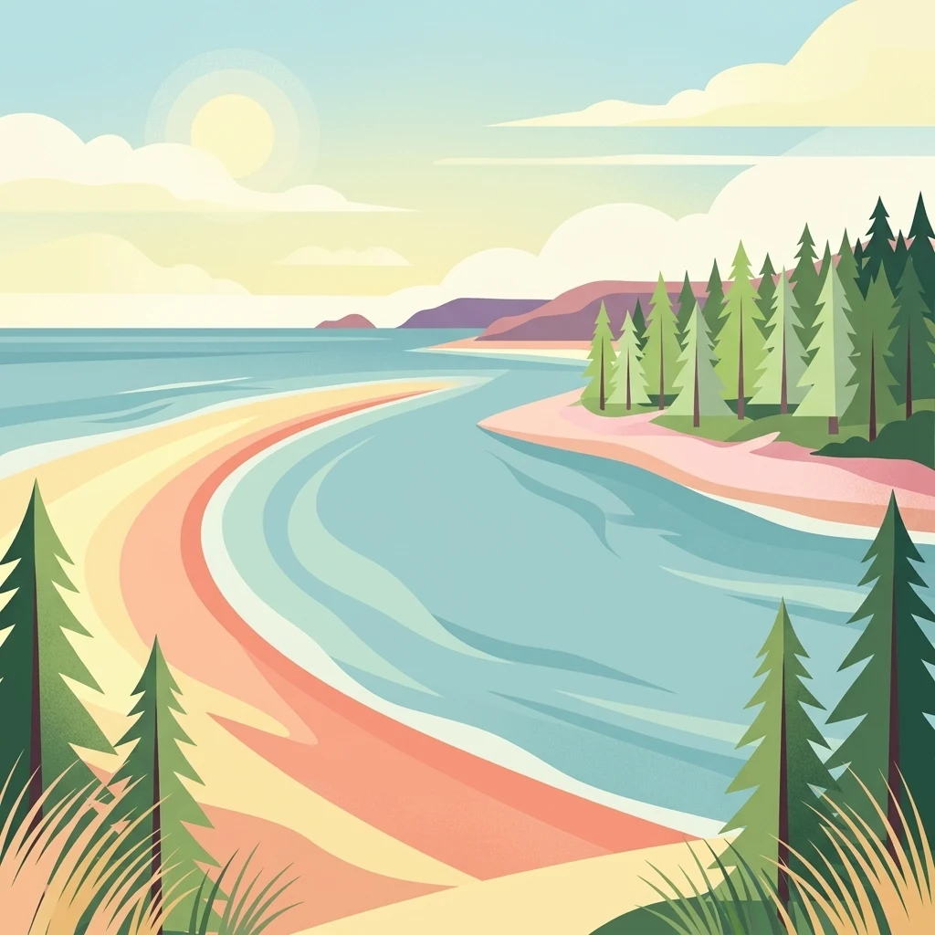
A digital illustration of a calm coastline with a sandy beach meeting clear blue water, lined by a pine forest and soft hills under a sunny sky.

Casuarina Coastal Reserve

Protected landscape

Park overview

Structured park overview, official facts, and landscape profile for Casuarina Coastal Reserve

Casuarina Coastal Reserve park facts, protected area profile, and essential visitor context

Review the core facts for Casuarina Coastal Reserve, including designation, size, terrain, visitor scale, habitats, and operating context in one park-focused overview.

About Casuarina Coastal Reserve

Casuarina Coastal Reserve anchors a long stretch of northern Darwin's coastline, forming a green and ecological buffer between the city's suburban edge and the Timor Sea. The reserve is not a remote wilderness; instead it offers an unusual blend of urban accessibility and ecological complexity, protecting habitats that would otherwise be vulnerable to coastal development pressure.

Geographically, the reserve follows the shore from Rapid Creek in the south-west to Buffalo Creek in the north-east. Within that corridor it gathers an unusually complete cross-section of Darwin-area coastal environments. Open ocean beaches give way to sheltered creek mouths lined with mangroves, while inland dunes and low sandstone escarpments support Casuarina woodland, paperbark forest, and relict patches of monsoon vine thicket. The reserve's habitats are interwoven rather than separated, which gives it a layered ecological character uncommon in small protected areas.

As a protected landscape, Casuarina Coastal Reserve serves several overlapping roles. It conserves tropical coastal ecosystems, including mangrove systems that function as fish nurseries and shoreline stabilizers. It protects vegetation communities adapted to Darwin's monsoonal climate, where long dry seasons alternate with intense wet-season rainfall and cyclonic weather. It also provides a heavily used recreational space for Darwin residents, including beach access points, lookouts, walking areas, and a long-established boat launching site on Buffalo Creek.

The reserve is also a cultural landscape. It sits within the Country and waterways of the Larrakia nation, the Aboriginal people whose connection to this coastline long predates European settlement. The combination of continuing Larrakia cultural association, Commonwealth-era land acquisition, and Northern Territory conservation management gives the reserve a layered human history that sits alongside its natural values.

Quick facts and research context for Casuarina Coastal Reserve

Casuarina Coastal Reserve is located in northern Darwin in Australia's Northern Territory, on Larrakia Country. It covers about 1,361 hectares of contiguous coastal land and sea-country between Rapid Creek and Buffalo Creek, including roughly eight kilometres of beach backed by Casuarina trees and sandstone cliffs.

The reserve is classified as an IUCN Category V protected landscape/seascape and has been under conservation management since it was acquired by the Commonwealth of Australia in 1978. It is governed by the Parks and Wildlife Commission of the Northern Territory and is one of the most heavily visited protected areas in the region, reflecting both its proximity to Darwin and the diversity of habitats it protects.

Protection and recognition

Explore documented protected area management and official recognition frameworks

Casuarina Coastal Reserve Protection Status and Governance

Casuarina Coastal Reserve maintains a mixed protection scope governed by established conservation frameworks and regional oversight. Official designation records provide structured insight into administrative boundaries and international status.

Protection details

Protection scope
Mixed
Transboundary protection
No
Park context

Deeper park guide and search-rich context for Casuarina Coastal Reserve

Casuarina Coastal Reserve history, landscape, wildlife, and travel context

Explore Casuarina Coastal Reserve through its history, landscape character, ecosystems, wildlife, conservation priorities, cultural context, and seasonal travel timing in a structured park guide built for atlas discovery and search intent.

Why Casuarina Coastal Reserve stands out

Casuarina Coastal Reserve is best known for the tight proximity of distinctly different tropical coastal habitats within a single protected area. Sandy surfing and swimming beaches sit beside mangrove-lined creek estuaries, paperbark forest, and monsoon vine thicket, all framed by low sandstone cliffs and the iconic she-oak Casuarina trees that give the area its name. The reserve is also recognized as a rich urban-edge wildlife corridor, supporting raptors such as ospreys and sea eagles, saltwater crocodiles, and small native mammals that survive within the forest patches. For visitors and residents of Darwin, it functions as both a recreational coastline and a working example of mangrove and tropical woodland conservation in a tropical capital city.
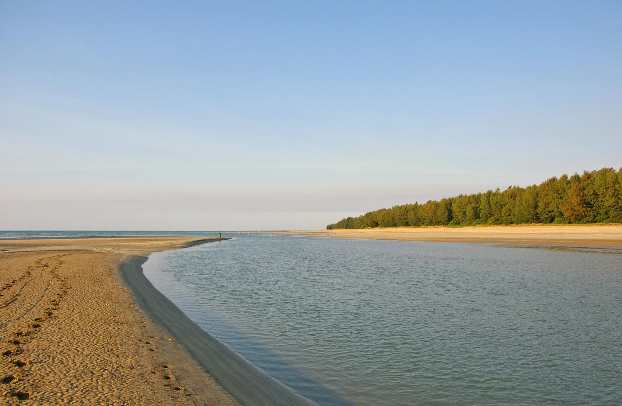
A wide coastal landscape at low tide showing a sandy creek estuary meeting the sea, with a forest line along the shore.
The mouth of Sandy Creek at low tide in Casuarina Coastal Reserve.

Casuarina Coastal Reserve history and protected-area timeline

The coastal corridor that is now Casuarina Coastal Reserve has a history that long predates its formal protection. As the Country and waterways of the Larrakia nation, the area was part of an enduring Indigenous landscape shaped by traditional knowledge, seasonal movement, and connection to the sea, creeks, and forests.

In the modern era, the Buffalo Creek boat ramp was built in the early 1970s, signalling growing recreational use of what was still largely undeveloped Darwin coastline. The reserve area was subsequently acquired by the Commonwealth of Australia in 1978, establishing the formal foundation of the protected area.

During the 1980s the boat ramp was upgraded and a carpark and toilets were constructed nearby, formalising public access to the coast. In 2001 visitor facilities were further upgraded and the reserve's second management plan was completed, reflecting continued effort to balance heavy public use with habitat protection along this urban-edge coastline.

Casuarina Coastal Reserve landscape and geographic character

Casuarina Coastal Reserve's landscape is built around the interface between land and sea in tropical northern Australia. The reserve includes roughly eight kilometres of sandy ocean beach, much of it backed by Casuarina trees, whose fine, needle-like foliage gives the foreshore a distinctive feathery character.

Behind the beach, low sandstone cliffs and rocky outcrops rise above the sand in places, exposing the pale rubble and weathered surfaces of the underlying geology. Inland from this coastal edge, the terrain shifts into dune systems, flat coastal plains, and the floodplains and margins of the two creeks that define the reserve's boundaries, Rapid Creek and Buffalo Creek.

The mouth of Buffalo Creek is one of the most distinctive landscape features of the reserve. Here the tidal estuary opens into the sea through a channel lined with mangroves, creating a sheltered, often mirror-flat water body bordered by dense green forest. The combination of open beach, cliff sections, mangrove-lined creeks, and forested dunes gives the reserve a varied topography within a relatively narrow coastal strip.

Casuarina Coastal Reserve ecosystems, habitats, and plant life

Casuarina Coastal Reserve protects a mosaic of tropical coastal habitats that together reflect the ecological character of Darwin's northern shoreline. The dominant vegetation types include Casuarina-dominated coastal woodland on the dune fringe, mangrove forests along the tidal creeks and estuary edges, paperbark forest on seasonally wetter ground, and patches of monsoon vine thicket in sheltered inland pockets.

Mangroves are a defining ecological feature of the reserve. They line the tidal sections of Rapid Creek and Buffalo Creek and dominate the Buffalo Creek estuary, where their tangled prop roots create sheltered habitat for fish, crustaceans, and shorebirds. These forests also serve as natural shoreline buffers, stabilising sediments and protecting inland vegetation from storm surge.

Inland from the mangroves, paperbark forests occupy areas with seasonal freshwater influence, while the denser, more sheltered monsoon vine thickets represent some of the most ecologically distinctive patches in the reserve, often supporting a richer mix of plant species than the surrounding Casuarina woodland. Together these vegetation communities reflect the monsoonal climate of the Top End, with its pronounced wet and dry seasons shaping water availability, leaf litter cycles, and breeding patterns across the ecosystem.

Casuarina Coastal Reserve wildlife and species highlights

Casuarina Coastal Reserve's wildlife reflects the overlap of marine, estuarine, and terrestrial habitats within a single small protected area. The reserve's birdlife is one of its most visible wildlife assets. Ospreys and white-bellied sea eagles hunt along the beach and over the estuary, while cormorants and various gull species forage in the tidal shallows and along the shoreline. These raptor and seabird populations are characteristic of healthy tropical coastlines and indicate functioning fish populations in both the creek and nearshore waters.

The marine and estuarine environment supports a variety of marine life, including saltwater crocodiles, which are known to inhabit the creeks and estuary waters. Their presence is a reminder of the reserve's wild nature despite its urban setting. Mangrove-lined creeks also serve as nurseries for a range of fish and crustacean species that move between the estuary and the open sea.

On land, the reserve's forests sustain small native mammals. The northern brushtail possum and the northern brown bandicoot both thrive in the wooded areas, foraging in the leaf litter and understorey. The mosaic of habitats, including mangrove edges, paperbark stands, and denser vine thicket, offers these mammals shelter, food resources, and pathways for movement through the urban coastal landscape.

Casuarina Coastal Reserve conservation status and protection priorities

Casuarina Coastal Reserve is significant from a conservation perspective because it preserves a chain of interconnected tropical coastal ecosystems in an area under intense urban and recreational pressure. As one of the few large continuous protected areas along Darwin's northern coastline, it retains ecological functions that would otherwise be lost to incremental development.

The mangrove systems within the reserve are particularly important. They provide nursery habitat for commercially and ecologically significant fish and crustacean species, filter sediments and nutrients from runoff, and stabilise the shoreline against tropical storm surges. Protecting these mangrove systems within a managed reserve helps maintain estuarine productivity along this section of the Northern Territory coast.

The reserve's habitat mosaic, combining Casuarina woodland, paperbark forest, and monsoon vine thicket, also conserves biodiversity at the landscape scale. Rather than protecting a single vegetation type, the reserve maintains the transitions and edges between habitats, which often support richer species assemblages than any one habitat alone. Its status as an IUCN Category V protected landscape/seascape reflects the management intent of balancing nature conservation, scenic value, and public use within the same area.

Casuarina Coastal Reserve cultural meaning and human context

Casuarina Coastal Reserve lies on the traditional Country and waterways of the Larrakia nation, the Aboriginal people of the Darwin coastal region. For the Larrakia, this stretch of coast, including the creeks, beaches, and forested dunes, has long been a living cultural landscape embedded in stories, seasonal practice, and continuing connection to the sea and land.

Recognition of Larrakia Country is part of how the reserve is described and understood today. Beyond formal acknowledgment, the presence of culturally significant landscapes, such as the Buffalo Creek estuary and surrounding mangroves, underlines the importance of including Indigenous perspectives in the ongoing management of the reserve. The reserve's conservation framework therefore sits alongside a longer, continuing cultural relationship between Larrakia people and this coastline.

Top sights and standout views in Casuarina Coastal Reserve

Casuarina Coastal Reserve's standout qualities come from the density and variety of its tropical coastal habitats within easy reach of central Darwin. The reserve compresses sandy beaches, low sandstone cliffs, mangrove-lined creeks, paperbark forest, and monsoon vine thicket into a single continuous protected strip, creating an unusually rich ecological shoreline in an urban-edge setting.

For visitors, the highlights include the beach and dune landscape of the Casuarina-fringed coast, the sheltered tidal scenes of the Buffalo Creek estuary mouth, and the chance to observe characteristic Top End wildlife such as ospreys, sea eagles, and saltwater crocodiles within a capital-city reserve. For conservation, the reserve's significance lies in protecting functioning estuarine and mangrove systems, native mammal populations, and a layered coastal vegetation mosaic on Larrakia Country.

Best time to visit Casuarina Coastal Reserve

Casuarina Coastal Reserve can be appreciated at any time of year, but the seasonal character of tropical northern Australia strongly shapes the experience. During the dry season, roughly from May to September, conditions are generally drier, cooler, and more comfortable for walking the beach, exploring creek edges, and birdwatching. Skies are often clear, and the contrast between blue water, pale cliffs, and green Casuarina woodland is especially vivid.

The wet season, roughly from November to March, brings heavy monsoon rains, high humidity, and the risk of tropical cyclones. Beach and creek environments can look dramatically different at this time, with greener vegetation, fuller creeks, more active shorebird and raptor activity, and stronger tidal flows through the Buffalo Creek estuary. Visitors during this period should expect more changeable conditions, but the landscape often appears at its most lush and ecologically active.

Monthly climate preview

Measured monthly temperature ranges and precipitation rhythm from NASA records

Casuarina Coastal Reserve Climate Normals and Annual Weather Patterns

Representative coordinate data for Casuarina Coastal Reserve shows consistent warm temperatures alongside distinct monthly precipitation variations across the year. Reviewing the complete twelve month climatology profile provides precise baseline records for analyzing long term environmental conditions.
Annual mean28 °C
26 °C30 °C
Jan29°
Feb28°
Mar29°
Apr28°
May27°
Jun26°
Jul26°
Aug27°
Sep29°
Oct30°
Nov30°
Dec29°
Warmest month
November

30.1 °C

Coolest month
June

25.6 °C

Wettest month
January

12.9 mm/day

Driest month
July

0 mm/day

Park location guide

Geography guide, regional context, and park location map for Casuarina Coastal Reserve

Casuarina Coastal Reserve park geography, regions, and map view in Australia

Understand where Casuarina Coastal Reserve sits in Australia through a broader geographic reading of the surrounding landscape, nearby location context, and its mapped position within the national park landscape.

How Casuarina Coastal Reserve fits into Australia

Australia is a constitutional monarchy and federal parliamentary democracy comprising six states and ten territories. With a population of nearly 28 million, it is one of the world's most urbanised countries, with most people concentrated on the eastern seaboard. The country has a high Human Development Index and is known for its cultural diversity, ancient Aboriginal heritage, and unique wildlife.

Wider geography shaping Casuarina Coastal Reserve in Australia

Australia occupies the entire Australian continent, the island of Tasmania, and numerous smaller islands. It is the world's flattest and driest inhabited continent, featuring vast deserts in the interior (the Outback), tropical rainforests along the eastern coast, and a coastline bordering the Indian and Pacific Oceans.

Map view of Casuarina Coastal Reserve

Use this park location map to pinpoint Casuarina Coastal Reserve in Australia, understand its exact geographic position, and read its mapped placement within the surrounding landscape more clearly.

Pigeon | © OpenStreetMap contributors

Location context for Casuarina Coastal Reserve

Northern Territory

Visual reference guide for tropical coastal habitats, sandstone cliffs, and tidal estuaries

Casuarina Coastal Reserve Photos and Landscape Scenery Exploration

Visual documentation of Casuarina Coastal Reserve reveals the complex interface between marine waters and tropical northern Australian landforms. Photographic records capture sandy beaches, mangrove creeks, and paperbark woodlands to clarify the protected area environment.

A wide coastal landscape at low tide showing a sandy creek estuary meeting the sea, with a forest line along the shore.

Park atlas

Compare adjacent tropical coastal landscapes and regional nature reserves

Explore Protected Areas and Parks Near Casuarina Coastal Reserve

Continue browsing other protected areas near Casuarina Coastal Reserve to examine related tropical coastal ecosystems and regional wildlife corridors. Comparing adjacent coastal reserves provides broader geographic context for northern Australian shoreline habitats.
Nature reserveNorthern Territory
About 8.7 km away#1 closest

Southeast

Holmes Jungle Nature Park: An Essential Protected Area in Australia's Northern Territory

Mapping the monsoon forest and tropical creek corridors near Darwin.

Holmes Jungle Nature Park is a significant nature reserve providing a rare, continuous green corridor within suburban Darwin. This protected landscape is defined by its thick monsoon forest, layered vegetation, and the Pine Creek waterway, serving as a vital link between inland tropical habitats and the tidal zones of the Shoal Bay catchment. Learn about its geographic role in preserving lowland biodiversity in the Top End.

Area
2.51 km²
Established
1976
IUCN
V
Relief
Lowland
National parkNorthern Territory
About 11 km away#2 closest

South

Charles Darwin National Park: Discover its Mapped Landscape, WWII Bunkers, and Larrakia Heritage

Northern Territory protected area with significant historical and geographic context.

Charles Darwin National Park represents a distinct protected landscape in Australia's Northern Territory, offering a rich tapestry of natural beauty and historical significance. This national park is renowned for its well-preserved World War II concrete bunker complex, serving as a direct link to Australia's wartime past. Beyond its military history, the park encompasses tropical savanna woodlands and coastal terrains that provide panoramic views of Darwin Harbour. Its indigenous heritage, including ancient shell middens, highlights thousands of years of Larrakia land use, making it a layered geographic and cultural discovery point.

Area
13.03 km²
Established
1998
IUCN
II
Climate
Tropical
A soft watercolor painting showing a pinkish lagoon surrounded by green vegetation and rolling hills in the distance.
Wildlife reserveNorthern Territory
About 13 km away#3 closest

Southeast

Knuckey Lagoons Conservation Reserve: Geographic Profile and Protected Wetland Map

Tropical lagoon habitat within the Northern Territory landscape

This wildlife reserve preserves an essential tropical lagoon and wetland environment on the suburban edge of Darwin. Established in 1966, it maintains a fragment of the seasonal coastal plain character within a heavily developed corridor, serving as an important case for localized habitat management in the Northern Territory.

Area
1.25 km²
Established
1966
IUCN
IV
Relief
Lowland
Wildlife reserveNorthern Territory
About 22 km away#4 closest

Southeast

Howard Springs Hunting Reserve: Mapped Protected Landscape and Regional Geography

Wildlife reserve terrain within the Howard Sand Plains

Howard Springs Hunting Reserve is a specifically managed wildlife reserve in Australia's Northern Territory, positioned within the Howard Sand Plains. This area serves as a vital component of a larger interconnected landscape that flows from inland wetlands toward the Shoal Bay coastal environment. Providing a unique look at sustainable-use protected lands, this resource offers geographic insights into how the reserve interacts with adjacent conservation corridors in the Darwin region.

Area
16.05 km²
Established
1984
IUCN
VI
Relief
Lowland
Nature reserveNorthern Territory
About 22 km away#5 closest

Southeast

Howard Springs Nature Park: Protected Landscape Maps and Regional Geography in Northern Territory

Detailed overview of tropical springs and monsoon forest terrain.

Howard Springs Nature Park offers a concentrated look at the unique Top End landscape through its permanent freshwater springs and bordering paperbark wetlands. Located near Darwin, this reserve provides essential habitat for waterfowl and serves as a primary example of protected inland spring systems within the Australian Northern Territory geography.

Area
2.86 km²
Established
1952
IUCN
V
Relief
Lowland
Protected areaNorthern Territory
About 22 km away#6 closest

East

Shoal Bay Coastal Reserve Protected Landscape Mapping and Geographic Context

Coastal wetlands and eucalypt woodland in Northern Territory

Shoal Bay Coastal Reserve protects an expansive coastal fringe characterized by large tidal mud-flats and surrounding saline wetlands. This Northern Territory site offers a complex landscape where monsoon vine forests and woodland-covered uplands meet tidal substrates, providing significant habitat for migratory waterbirds.

Area
123 km²
Established
2000
IUCN
VI
Relief
Lowland
Protected landscapeNorthern Territory
About 36 km away#7 closest

Northeast

Vernon Islands Conservation Reserve: Northern Territory Coastal Protected Landscape and Island Geography

Tropical reef and island system in the Northern Territory

Vernon Islands Conservation Reserve stands as a protected landscape encompassing three distinct islands and the exposed Knight Reef. Located in the tropical waters near Darwin, this area defines a crucial marine and intertidal seascape within the Northern Territory, shaped by complex tidal dynamics and significant Aboriginal land tenure history.

Area
81.58 km²
Established
1974
IUCN
V
Relief
Lowland
Wildlife reserveNorthern Territory
About 38 km away#8 closest

Southeast

Black Jungle Conservation Reserve: Map, Geography, and Protected Landscape Context

Protected tropical savanna and floodplain wetlands in Northern Territory

Situated in the Northern Territory, Black Jungle Conservation Reserve preserves an essential link within the Adelaide River Coastal Floodplain. This wildlife reserve features rare spring-fed monsoon rainforests set against a backdrop of open eucalypt savanna, providing a protected sanctuary for internationally significant waterbird populations and saltwater crocodiles within a complex mosaic of tidal and seasonal wetlands.

Area
49.51 km²
Established
1986
IUCN
VI
Relief
Lowland

Common questions about visiting, size, designation, and location context for Casuarina Coastal Reserve

Casuarina Coastal Reserve FAQs for park facts, access, geography, and protected area context

Find quick answers about Casuarina Coastal Reserve, including protected-area facts, park geography, trail and visitor context, and how the park fits into its surrounding country and regional landscape.
MoriAtlas Explorer

Continue Your Protected Areas Search Across the Global Atlas

Deepen your exploration by continuing the structured search for national parks and protected areas worldwide. Utilize the comprehensive filtering capabilities to compare different conservation landscapes and refine your understanding of global park geography. Discover more about the distribution and characteristics of protected natural areas.

Global natural geography