
Mori Atlas logo
National parkParque nacional Cayambe-Coca

Mapping the altitudinal gradient from equatorial glaciers to Amazonian forest ecosystems

Parque nacional Cayambe-Coca: Analyzing the Volcanic Landscapes and Andean Geography

Parque nacional Cayambe-Coca encompasses a vast ecological transition across the northern Andes, stretching from the snow capped summit of Volcán Cayambe down to the moist foothills of the Amazon basin. This protected area features diverse terrain including páramo wetlands, glacial valleys, and active volcanic cones like Volcán Reventador. Through this mapped landscape, examine the complex hydrological systems, high altitude lakes, and unique mountain ecosystems that define this critical region of Ecuador.

Andean páramocloud forestglaciersactive volcanoesmontane forestswetlands
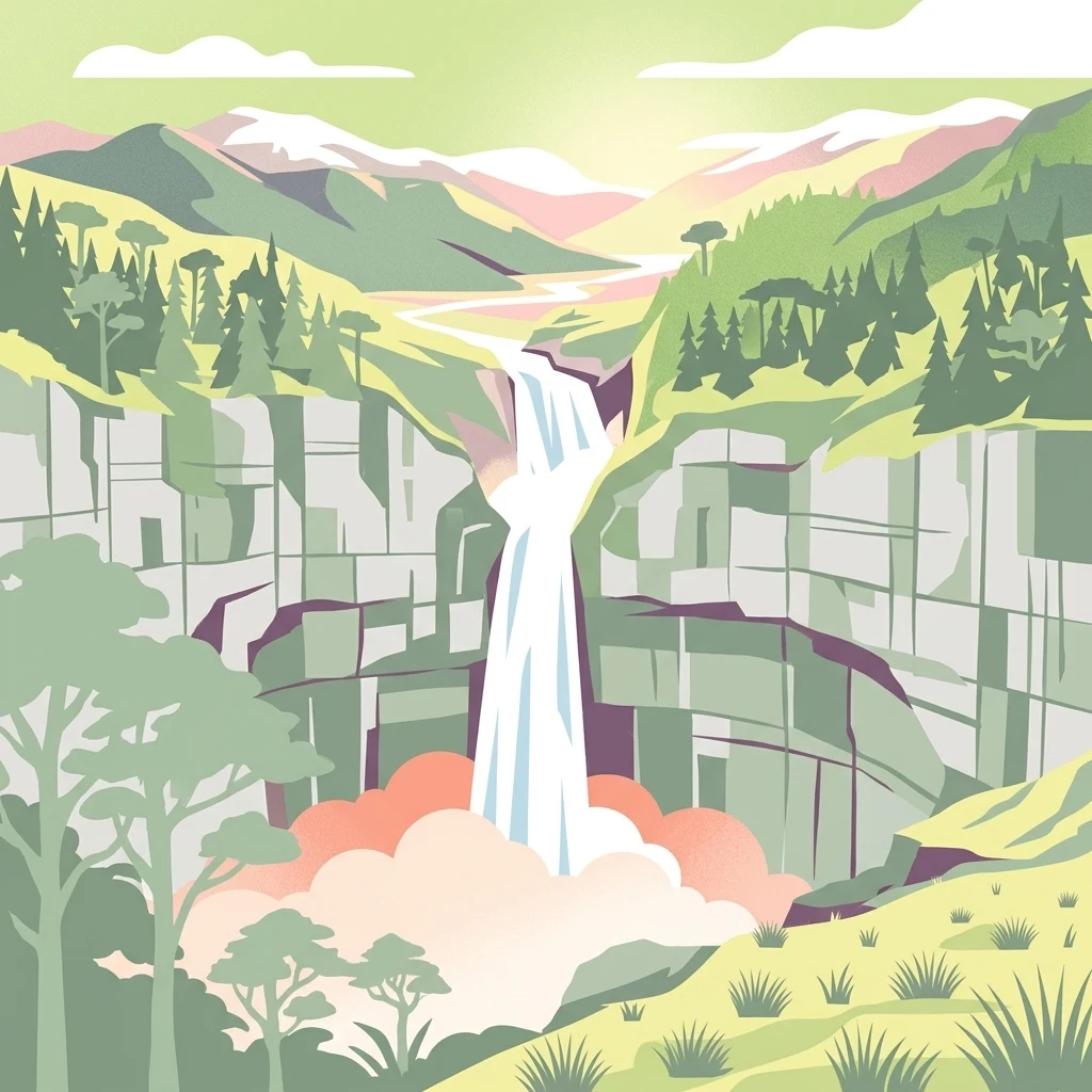
An illustration showing a tall waterfall falling over sheer, blocky cliffs into a misty base, surrounded by evergreen trees and mountains under a light sky.

Parque nacional Cayambe-Coca

National park

Park overview

Structured park overview, official facts, and landscape profile for Cayambe-Coca National Park

Cayambe-Coca National Park park facts, protected area profile, and essential visitor context

Review the core facts for Cayambe-Coca National Park, including designation, size, terrain, visitor scale, habitats, and operating context in one park-focused overview.

About Cayambe-Coca National Park

Cayambe-Coca National Park is a vast Andean-to-Amazon protected area in northern Ecuador, encompassing elevations that range from the glacial heights of the Cayambe volcano to montane cloud forests and warm, humid forests in the upper Amazon basin. The park is located in the western range of the Andes, specifically in the eastern Cordillera, and extends east toward the foothills of the Amazon region. Its size and ecological complexity have made it one of the most significant natural reserves in the country, both for conservation and for understanding Andean environmental gradients.

The park's landscapes are defined by extreme vertical variation. The western side features the snow-capped Cayambe volcano, an active stratovolcano that reaches 5,790 meters in elevation and supports a glacial cap above 4,600 meters. The eastern side includes Volcán Reventador, one of Ecuador's most active volcanoes, along with peaks such as Cerro Puntas and Saraurcu. Between these extremes, the terrain transitions through glacial valleys, cirques, moraines, U and V-shaped valleys, and high-altitude plains, eventually giving way to humid, dissected lowlands in the Amazon direction.

Ecosystems inside the park reflect this altitudinal transition. Some 66 percent of the area is covered by native evergreen forests, including montane and piemontano belts of the northern Eastern Cordillera, while about 26 percent consists of various páramo ecosystems dominated by bunch grasses, cushion plants, and shrubs. Aquatic environments, including lakes such as Puruhanta and San Marcos, as well as the Papallacta wetland complex, contribute additional ecological richness. On the wetter western slopes of the Eastern Cordillera, rainfall can exceed 5,000 mm per year, while temperatures vary from near-freezing conditions in the uplands to warm, tropical values in the eastern lowlands.

Hydrologically, Cayambe-Coca is exceptionally important. About 92 percent of the park contributes to the Napo watershed, supporting rivers such as the Quijos, Coca, Cosanga, Oyacachi, and Aguarico, while smaller portions contribute to the Mira and Esmeraldas basins. This water source feeds downstream communities and ecosystems well beyond the park boundaries. Culturally, the park also harbors indigenous communities, including Kichwa people around Oyacachi and Cofán communities in Sucumbíos, who maintain traditional relationships with these landscapes.

Quick facts and research context for Cayambe-Coca National Park

Cayambe-Coca National Park is administered by Ecuador's Ministry of the Environment, Water and Ecological Transition through the National System of Protected Areas, and was established on 17 November 1970. It covers more than 400,000 hectares across four provinces: Imbabura, Pichincha, Napo, and Sucumbíos, making it one of the country's largest national parks.

The park spans two major watersheds, supplying both the Pacific and Amazon systems, and feeds rivers such as the Quijos, Coca, Aguarico, Esmeraldas, and Mira. It is also designated as a Ramsar wetland site and recognized as an Important Bird and Biodiversity Area, underscoring its national and international conservation importance.

Protection and recognition

Documented terrestrial protection scope and conservation designation facts

Parque nacional Cayambe-Coca Protection Status and International Recognition

Parque nacional Cayambe-Coca maintains a recorded terrestrial protection scope within the national park network. Verified administrative records outline the official conservation status and management parameters associated with this protected landscape.

Protection details

Protection scope
Terrestrial
Transboundary protection
No
Park context

Deeper park guide and search-rich context for Cayambe-Coca National Park

Cayambe-Coca National Park history, landscape, wildlife, and travel context

Explore Cayambe-Coca National Park through its history, landscape character, ecosystems, wildlife, conservation priorities, cultural context, and seasonal travel timing in a structured park guide built for atlas discovery and search intent.

Why Cayambe-Coca National Park stands out

Cayambe-Coca is best known for the enormous altitudinal range that spans from the icy summit of Volcán Cayambe, the only place on the equator with a permanent snow cover, down to the warm, wet foothills of the Amazon. This single transect contains glaciers, páramos, Polylepis woodlands, montane cloud forests, and evergreen lowland forests, making the park a living cross-section of the northern Andes. The park is also renowned for active volcanic scenery centered on the frequently erupting Volcán Reventador, the diverse páramo wetlands of Papallacta, and the now-iconic San Rafael waterfall on the Quijos river. Its combination of two volcanoes, the Cayambe massif with its glaciers, and an extraordinarily rich bird fauna has made it a flagship protected area in northern Ecuador.
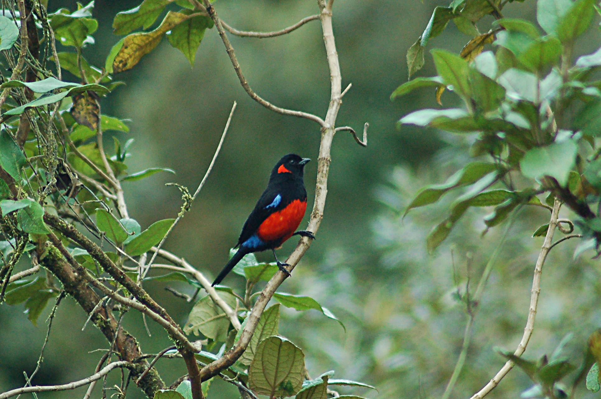
A Scarlet-bellied Mountain-Tanager bird with black, red, and blue plumage perched on a thin branch in a forest setting.
A Scarlet-bellied Mountain-Tanager perched on a branch within the Andean forest ecosystem.

Cayambe-Coca National Park history and protected-area timeline

Cayambe-Coca National Park was officially created on 17 November 1970 through an interministerial agreement that was published in the official registry on 20 November 1970. The park was established under Ecuador's national protected areas system to conserve the distinctive Andean and Amazonian ecosystems of the northeastern region of the country.

In the years following its establishment, the park's boundaries and administrative framework were modified, with notable updates recorded in 1979 and 2010. Over time, recognition of its international importance grew, leading to the designation of parts of the park, such as the Ñucanchi Turupamba wetlands, as Ramsar sites and the recognition of the broader area as an Important Bird and Biodiversity Area. These milestones reflect the park's evolving role in both national conservation policy and international environmental frameworks.

Cayambe-Coca National Park landscape and geographic character

The physical geography of Cayambe-Coca is dominated by the Andes, particularly the Eastern Cordillera and its transition toward the Amazon basin. About 52 percent of the park consists of mountainous terrain, 6 percent of volcanic relief, and roughly 4 percent of hilly terrain, with smaller percentages of glacial, fluvial, and erosional landscapes. Glacial features include cirques, roches moutonnées, and moraines, especially around Volcán Cayambe, where an ice cap of around 22 square kilometers still persists.

Volcanic scenery is among the park's most striking features. Volcán Cayambe, an andesitic stratovolcano composed of lava domes and volcanic edifices, towers over the western side of the park. On the eastern edge, Volcán Reventador displays an elongated cone with slopes of approximately 34 degrees, composed of andesites and basaltic andesites, and remains one of Ecuador's most continuously active volcanoes. Between them, peaks such as Cerro Puntas (4,452 m) and Saraurcu (4,725 m) add to the mountainous complexity.

Fluvial landscapes are equally prominent. The park hosts dramatic river gorges, U-shaped glacial valleys, V-shaped fluvial valleys, hanging valleys, and fluvio-glacial valleys. Toward the northeast, the terrain transitions into dissected cuestas and mesas typical of Amazonian foothills. Lakes such as Puruhanta and San Marcos, along with the San Rafael waterfall (once one of Ecuador's tallest at about 131 m, before its collapse), provide additional focal points within the park's varied scenery.
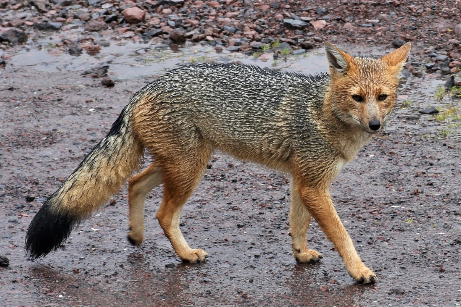
A side profile view of an Andean fox standing on damp, rocky ground in a high-altitude Andean environment.
An Andean fox, also known as a culpeo, walks across a rocky paramo path in Cayambe-Coca National Park.

Cayambe-Coca National Park ecosystems, habitats, and plant life

The park contains ten major ecosystems according to Ecuador's national classification system, four of which are páramo ecosystems and the rest native forests. Native evergreen forests dominate, constituting roughly two-thirds of the park's area, while páramos cover about one-quarter. These include lower montane evergreen forests, upper montane evergreen forests, low montane evergreen forests, and piemontano evergreen forests along the Andean front, with characteristic species such as Polylepis in high-altitude woodland patches and epiphytic bromeliads such as Puya hamata in the paramos.

High-elevation páramos are notable for ichu bunch grasses, ferns, clubmosses, cushion plant communities, and unique wetland complexes. Around Papallacta and the broader park's western highlands, superhumid páramo herblands and shrublands fill extensive areas. These highland pastures contrast with the dense montane cloud forests on the slopes below, which are characterized by persistent humidity and high biodiversity. Wetland systems, including the Ñucanchi Turupamba complex, support unique vegetation types such as flooded páramo herblands.

This altitudinal and climatic diversity has produced significant endemism: studies suggest that more than a hundred plant species found within the park may be endemic. This ecological richness has earned Cayambe-Coca recognition as both a Ramsar site and an Important Bird and Biodiversity Area, situating it among Ecuador's most ecologically valuable reserves.
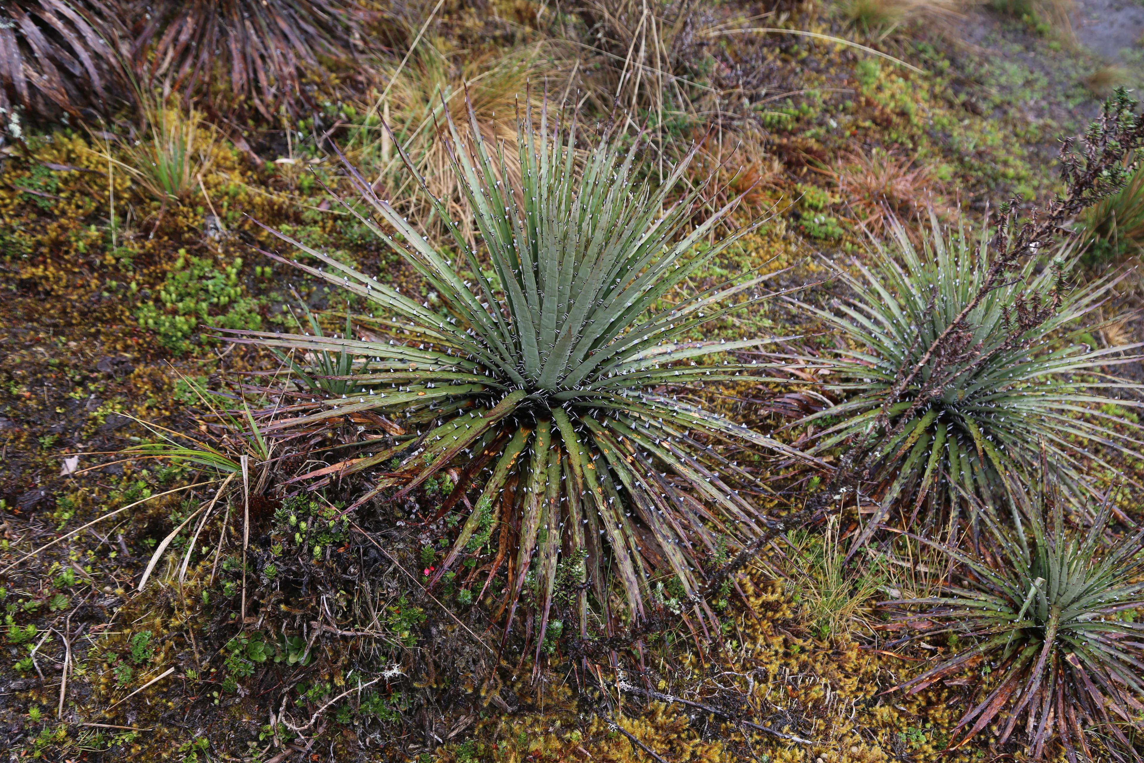
Several spiky Puya hamata plants with green pointed leaves growing in a low-lying paramo landscape.
Puya hamata plants growing in the Andean paramo ecosystem of Cayambe-Coca National Park.

Cayambe-Coca National Park wildlife and species highlights

Cayambe-Coca's wildlife is shaped by the park's altitudinal gradient, offering habitats for species ranging from highland Andean specialists to lowland Amazonian forms. Birdlife is especially rich, with approximately 395 recorded species and a strong likelihood of further discoveries in unexplored Andean slopes. Among the most notable are the Andean Condor, the Black-and-chestnut Eagle, the Andean Cock-of-the-rock, the Giant Conebill, the Grey-breasted Mountain Toucan, the Military Macaw, the Masked Mountain Tanager, and the Spot-winged Parrotlet.

Mammals are also diverse, with around 106 recorded species. Notable large mammals include the Andean bear (the only bear species in South America), the Andean fox, the Colombian weasel, the short-eared dog, and various deer species including the red brocket, the small red brocket of the páramos, and the northern pudu. The northern zone of the park supports twelve primate species and large populations of globally threatened mammals, making it an important area for mammal conservation.

Herpetofauna is similarly diverse, with approximately 116 amphibian species and around 140 reptile species recorded. Representative amphibians include the Jambato toad, the Andean marsupial frog, the Sumaco triangular-headed frog, the Jondachi stream frog, and various Pristimantis species. Reptile diversity peaks in the tropical and subtropical elevations and includes lizards such as Anolis trachyderma and water lizards, as well as snail-eating snakes that specialize on mollusks.
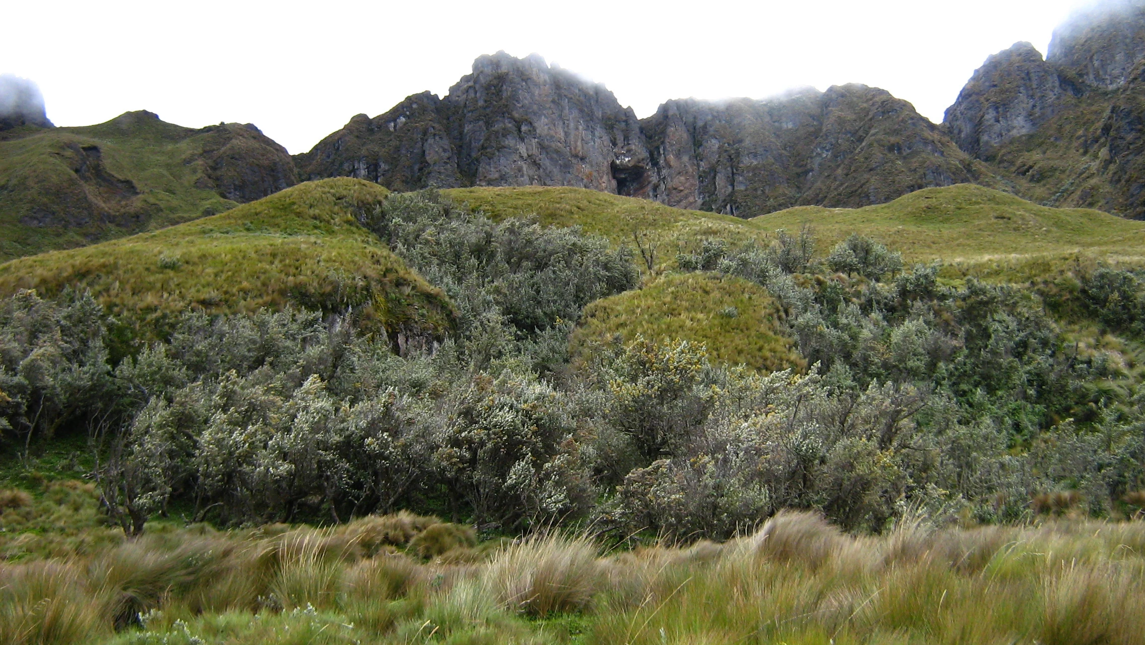
A mountainous landscape showing jagged rocky peaks in the background above rolling green slopes and patches of small trees, with tall grasses in the foreground.
The rugged crags of Cerro Puntas rising above high altitude paramo vegetation in Cayambe-Coca National Park.

Cayambe-Coca National Park conservation status and protection priorities

Cayambe-Coca holds substantial conservation significance at both national and international levels. As one of Ecuador's largest national parks, it protects a continuous ecological corridor linking the high Andes with the Amazon basin, ensuring connectivity across multiple ecosystems that would otherwise face fragmentation pressure. Its recognition as a Ramsar wetland site, through the Ñucanchi Turupamba wetland complex, underscores its importance for waterbirds and hydrological services.

The park also serves as an Important Bird and Biodiversity Area, reflecting its exceptional value for avian conservation. Its altitudinal range sustains habitats for many endemic and threatened species, including the Andean bear, the Andean Condor, and endangered amphibians such as the Jambato toad. By protecting headwaters of the Napo, Coca, Quijos, and other major rivers, the park contributes to downstream water security, sediment regulation, and ecological stability well beyond its boundaries.

Management of the park involves not only biodiversity protection but also engagement with the indigenous communities that inhabit parts of the territory, whose traditional practices are integral to landscape stewardship. These combined ecological, hydrological, and cultural functions make Cayambe-Coca a cornerstone of Ecuador's protected-area system.

Cayambe-Coca National Park cultural meaning and human context

Cayambe-Coca is home to indigenous communities whose presence and traditions are closely tied to the protected landscape. In the western Andean sector, Kichwa communities such as those around Oyacachi maintain longstanding relationships with the highland environment and the páramo ecosystems that surround their settlements. On the eastern side of the park, in the province of Sucumbíos, Cofán communities such as that of Sinangoe live within the forested foothills, preserving traditional knowledge of the rainforest and its resources.

The park also contains pre-Inca archaeological heritage, including Pambamarca and the so-called Temple of the Sun and the Moon at Puntiatsil, which reflect the deep human history of the Cayambe area and its connection to the broader Andean cultural landscape. Sections of the Inca road system pass through the park, linking this heritage to wider networks of Andean exchange and pilgrimage.
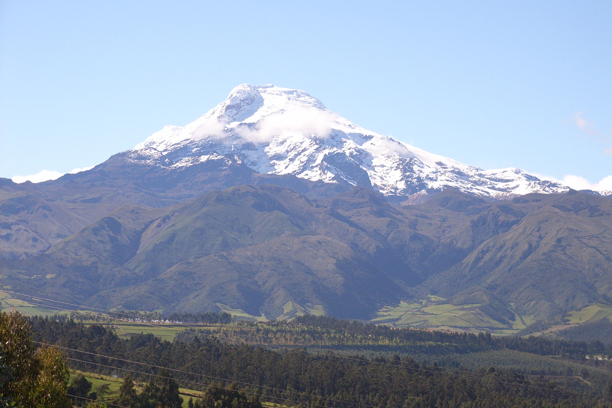
A wide shot of the snow-covered Cayambe volcano peak rising above green mountainous slopes and foothills.
The snow-capped summit of the Cayambe volcano in Cayambe-Coca National Park, Ecuador.

Top sights and standout views in Cayambe-Coca National Park

Andean-to-Amazon gradient crossing more than 5,000 meters of elevation; the glacier-capped Volcán Cayambe, the only major snow-covered peak on the equator; the continuously erupting Volcán Reventador; the extensive Papallacta páramo wetlands recognized under the Ramsar Convention; the San Rafael waterfall on the Quijos river; glacial lakes such as Puruhanta and San Marcos; páramo and Polylepis ecosystems; montane cloud forests that descend toward the Amazon basin; rich avifauna including the Andean Condor, the Giant Conebill, and the Grey-breasted Mountain Toucan; and the presence of indigenous Kichwa and Cofán communities whose cultures are interwoven with the park.
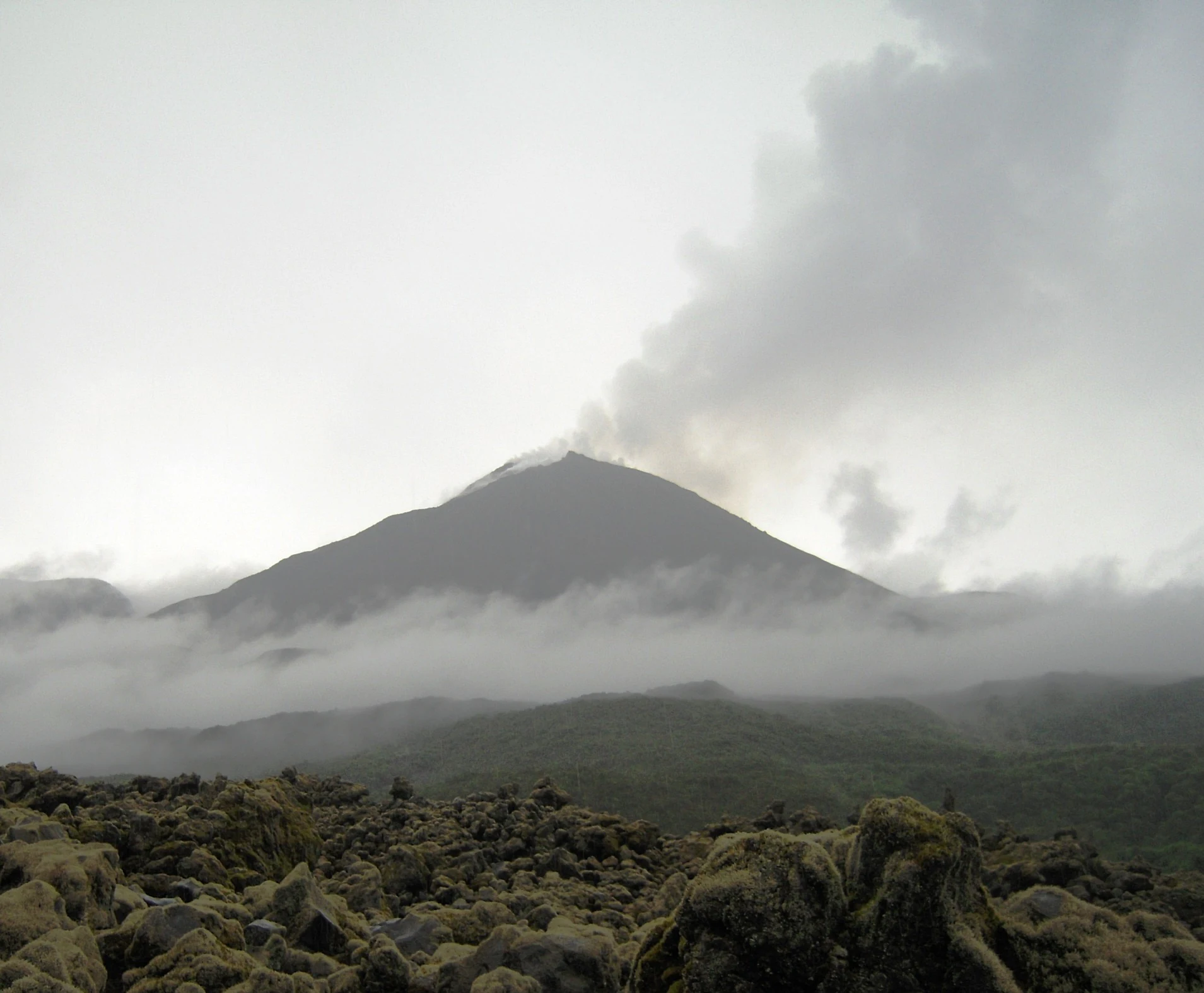
A wide shot of the conical El Reventador volcano under an overcast sky, with a plume of smoke and ash rising from the summit and low clouds surrounding the base, in front of a rocky volcanic foreground.
The El Reventador volcano erupting with a plume of ash and gas, seen from the surrounding lava field.

Best time to visit Cayambe-Coca National Park

The climate of Cayambe-Coca varies dramatically with elevation, so the best period for a visit depends largely on which part of the park one hopes to experience. The high-altitude sectors around Volcán Cayambe and the páramos are typically clearer during the drier months, generally from about June to September, when mountain views are more reliable and hiking conditions on páramo trails are more favorable.

For the lower forests and Amazonian foothills, the wetter months can make trails muddy and rivers swell, but they also bring lush vegetation and heightened bird activity. Visitors interested in cloud forest birdwatching often find that transitional periods between dry and wet seasons offer a balance of manageable weather and rich biodiversity. Anyone planning to approach the higher elevations should be prepared for cold temperatures and rapidly changing weather regardless of season.
Monthly climate preview

Long-term temperature ranges and monthly precipitation recorded at a representative coordinate

Parque nacional Cayambe-Coca Climate Normals and Annual Weather Patterns

Historical data reveals consistent monthly temperature averages alongside recorded precipitation rates across the representative coordinate in Parque nacional Cayambe-Coca. Examining the complete twelve-month climatology profile provides deeper insight into measured baseline patterns without relying on live forecasts.
Annual mean18 °C
17 °C19 °C
Jan19°
Feb19°
Mar19°
Apr18°
May18°
Jun17°
Jul17°
Aug18°
Sep19°
Oct19°
Nov19°
Dec18°
Warmest month
October

18.8 °C

Coolest month
July

17 °C

Wettest month
April

4.8 mm/day

Driest month
August

2 mm/day

Park location guide

Geography guide, regional context, and park location map for Cayambe-Coca National Park

Cayambe-Coca National Park park geography, regions, and map view in Ecuador

Understand where Cayambe-Coca National Park sits in Ecuador through a broader geographic reading of the surrounding landscape, nearby location context, and its mapped position within the national park landscape.

How Cayambe-Coca National Park fits into Ecuador

Ecuador is a presidential republic located in northwestern South America, with Quito as its capital and Guayaquil as its largest city. The country spans 283,561 km² and encompasses the Galápagos Islands, a volcanic archipelago famous for unique wildlife that helped shape Darwin's theory of evolution. Ecuador is a plurinational state with Spanish as the official language, though Kichwa and Shuar are recognized for indigenous peoples.

Wider geography shaping Cayambe-Coca National Park in Ecuador

Ecuador is located in northwestern South America along the Pacific coast. It shares borders with Colombia to the north and Peru to the east and south. The country includes the Galápagos Islands, a volcanic archipelago in the Pacific Ocean approximately 1,000 km west of the mainland. The territory encompasses diverse terrain including the Amazon rainforest in the east, the Andean highlands in the center, and coastal plains along the Pacific.

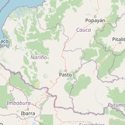
Map view of Cayambe-Coca National Park

Use this park location map to pinpoint Cayambe-Coca National Park in Ecuador, understand its exact geographic position, and read its mapped placement within the surrounding landscape more clearly.

Pigeon | © OpenStreetMap contributors

Location context for Cayambe-Coca National Park

ImbaburaNapoPichinchaSucumbíos

Visual reference of Andean peaks, glacial valleys, and cloud forest habitats

Parque nacional Cayambe-Coca Photos and Mapped Landscape Scenery

Visual records reveal the dramatic elevation gradient of Parque nacional Cayambe-Coca, spanning from equatorial ice caps down to Amazonian foothills. Photographic documentation captures volcanic relief, páramo wetlands, and varied terrain across the protected area.

A Scarlet-bellied Mountain-Tanager bird with black, red, and blue plumage perched on a thin branch in a forest setting.

A high-angle view of a massive waterfall cascading over a vertical cliff into a misty pool, surrounded by dense green forest.

A side profile view of an Andean fox standing on damp, rocky ground in a high-altitude Andean environment.

Several spiky Puya hamata plants with green pointed leaves growing in a low-lying paramo landscape.

A mountainous landscape showing jagged rocky peaks in the background above rolling green slopes and patches of small trees, with tall grasses in the foreground.

A wide view of a high altitude paramo landscape featuring a lake surrounded by rolling grassy hills and mountains obscured by low clouds.

A wide shot of the snow-covered Cayambe volcano peak rising above green mountainous slopes and foothills.

A wide shot of the conical El Reventador volcano under an overcast sky, with a plume of smoke and ash rising from the summit and low clouds surrounding the base, in front of a rocky volcanic foreground.

Park atlas

Compare surrounding regional geography and connected Andean conservation landscapes.

Parks Near Parque nacional Cayambe-Coca and Related Protected Areas

Browse national parks and protected areas adjacent to Parque nacional Cayambe-Coca to examine overlapping Andean ecosystems and volcanic terrain. Extending the geographic review connects high altitude páramo zones with broader regional park networks.
National parkEcuador
About 36 km away#1 closest

Southeast

Sumaco Napo-Galeras National Park: Ecuador's Volcanic National Park Landscape

Explore protected areas and biodiversity in the Andean-Amazon transition.

Sumaco Napo-Galeras National Park protects a dramatic volcanic landscape in Ecuador, showcasing a significant elevation gradient that supports diverse cloud forest and Amazonian rainforest habitats. This national park is recognized for its endemic species and rich avifauna, offering a compelling case study for understanding protected land geography and ecological transitions within South America.

Area
2,067.49 km²
Established
1994
IUCN
II
Relief
Mountain
Nature reserveSucumbíos
About 47 km away#2 closest

Northeast

Reserva Ecológica Cofán-Bermejo: Mapping Amazonian and Andean Biodiversity Landscapes

Indigenous-led conservation in the Sucumbíos river headwaters.

Reserva Ecológica Cofán-Bermejo encompasses a remarkable altitudinal range from 400 to 2,200 meters, protecting intact river basins and transitional ecosystems. This nature reserve offers deep insight into the convergence of Amazonian and Andean flora, functioning as a vital refuge for threatened megafauna and rare bird populations within an indigenous-managed territory.

Area
549.47 km²
Established
2002
IUCN
Ia
Relief
Mountain
Watercolor illustration of a winding path through a green landscape with snow capped mountains in the distance against a pink sky.
National parkNapo
About 56 km away#3 closest

South

Parque nacional Antisana: Volcanic Terrain and Andean Protected Area Geography

High-altitude ecosystems spanning Napo and the Andean corridor

Spanning the rugged Cordillera Real, Parque nacional Antisana protects a vast sweep of volcanic terrain dominated by its central stratovolcano. From glacial fields to the water-retention capacity of its páramo wetlands, the area represents a crucial node in Ecuador's conservation network, providing a sanctuary for Andean condors and diverse montane species.

Area
1,205.81 km²
Established
1993
IUCN
Ia
Relief
Mountain
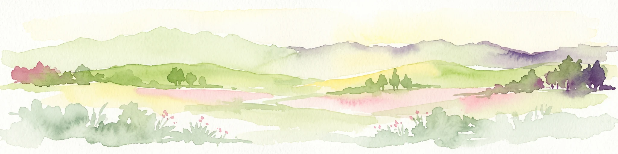
A horizontal watercolor painting showing layers of rolling green hills, a pink-toned foreground meadow, and distant hazy mountain ridgelines against a light background.
National parkImbabura
About 66 km away#4 closest

Northwest

Cotacachi Cayapas National Park: A Study of Andean and Chocó Protected Geographic Landscapes

Exploring the extreme vertical transition across the northern Ecuadorian Andes

Cotacachi Cayapas National Park stands as a vital protected area, linking high-altitude páramo around Volcán Cotacachi to the lowland forests of the Chocó. The park features the iconic Laguna de Cuicocha and a dramatic range of ecosystems that define its complex terrain. This resource offers a clear look at the park's boundaries, geological features, and the distinct ecological zones that make it a central pillar of northern Ecuadorian geography.

Area
2,609.61 km²
Established
1968
IUCN
II
Visitors
50.2K annual
Nature reserveCarchi Province
About 69 km away#5 closest

North

Reserva ecológica El Ángel: High-Andean Protected Landscape and Geography Map

Exploring páramo ecosystems in Carchi Province, Ecuador

Reserva ecológica El Ángel is a crucial conservation area in the northern Andes, defined by its high-altitude páramo, volcanic geology, and extensive wetland network. It serves as a vital hydrological heart for Carchi Province, supporting diverse highland vegetation including dense stands of giant frailejón and ancient Polylepis forests across a dramatic, glacially-sculpted terrain.

Area
165.41 km²
Established
1992
IUCN
Ia
Relief
Mountain
Watercolor illustration showing a panoramic view of a wide valley with green hills, a small stream, and forested clusters, rendered in a light and airy style.
Nature reservePichincha
About 74 km away#6 closest

West

Reserva Geobotánica Pululahua: Protected Volcanic Caldera and Highland Ecosystems

A distinct geobotanical reserve in the Pichincha region of the Ecuadorian Andes.

Reserva Geobotánica Pululahua is a protected natural area centered on a massive, 12-kilometer-wide volcanic caldera. Its landscape features three prominent lava domes and a rare altitudinal gradient of vegetation, spanning from semi-dry mountain shrubland to dense cloud forest. This reserve serves as a critical study of volcanic geology and human-landscape interaction in the high Andes, offering a concentrated look at Ecuador's vertical ecological zonation.

Area
34.417 km²
Established
1966
Relief
Mountain
Climate
Subtropical
A pale, minimalist watercolor painting showing a wide, grassy field leading to distant, low mountain hills under a bright, light sky.
Wildlife reservePichincha
About 95 km away#7 closest

Southwest

Refugio de Vida Silvestre Pasochoa: Volcanic Crater and Andean Forest Protected Area

Geographic atlas of the Pichincha volcanic highlands

Located in the Pichincha province, Refugio de Vida Silvestre Pasochoa protects an essential highland habitat defined by its steep volcanic crater walls and dense bamboo stands. This area provides a scientific reference for inter-Andean vegetation, featuring a sharp contrast between forested inner slopes and surrounding agricultural landscapes. Map the ecological gradient of this protected refuge and explore its role within the broader northern Andean geographic context.

Area
9.799 km²
Established
1996
IUCN
Ib
Relief
Mountain
National parkCotopaxi Province
About 99 km away#8 closest

Southwest

Cotopaxi National Park: Ecuador's Mapped Protected Landscape and Regional Geography

Explore the geographic context of this national park.

Cotopaxi National Park represents a key protected landscape within Ecuador, located in Cotopaxi Province. This page facilitates detailed exploration of the park's mapped boundaries and its contribution to the regional geography. Understand the specific characteristics of this national park as part of a broader atlas of protected areas and natural terrains.

Area
333.93 km²
Established
1975
IUCN
II
Relief
Mountain

Common questions about visiting, size, designation, and location context for Cayambe-Coca National Park

Cayambe-Coca National Park FAQs for park facts, access, geography, and protected area context

Find quick answers about Cayambe-Coca National Park, including protected-area facts, park geography, trail and visitor context, and how the park fits into its surrounding country and regional landscape.
MoriAtlas Explorer

Continue Your Protected Areas Search Across the Global Atlas

Deepen your exploration by continuing the structured search for national parks and protected areas worldwide. Utilize the comprehensive filtering capabilities to compare different conservation landscapes and refine your understanding of global park geography. Discover more about the distribution and characteristics of protected natural areas.

Global natural geography