Mori Atlas logo
National parkChaguaramas

A detailed geographic look at the peninsular terrain and natural boundaries defining this coastal area

Chaguaramas National Park: Exploring the Coastal Geography and Protected Landscapes of Northwestern Trinidad

Chaguaramas occupies a distinct coastal promontory on the northwestern tip of Trinidad, where the land narrows between the Caribbean Sea and the Gulf of Paria. Established as a protected national park, the area represents a unique intersection of tropical coastal terrain and the foothills of the Northern Range. This record provides a structured geographic analysis of the park boundaries and the peninsular landscape within the broader context of the Diego Martin region.

Caribbean coastpeninsulacoastal scenerytropical dry forestNorthern Range foothillsnational park

Chaguaramas

National park

Park overview

Structured park overview, official facts, and landscape profile for Chaguaramas

Chaguaramas park facts, protected area profile, and essential visitor context

Review the core facts for Chaguaramas, including designation, size, terrain, visitor scale, habitats, and operating context in one park-focused overview.

About Chaguaramas

Chaguaramas lies at the northwestern extremity of Trinidad, in the Diego Martín region of the Republic of Trinidad and Tobago. The locality occupies a low-lying coastal promontory that defines part of the island's westerly approach, where the Northern Range meets the sea. Its geography gives Chaguaramas a clear maritime identity: the Caribbean Sea lies to the north and west, the Gulf of Paria to the south, and the neighboring communities of Bagatelle, Covigne, Rich Plain, and Carenage form its eastern land border.

Beyond the physical setting, Chaguaramas carries a layered political and institutional history that extends well beyond the borders of Trinidad. The locality served as the capital of the West Indies Federation, an early experiment in uniting several British Caribbean territories, which did not last into the 1960s. A decade later, in 1973, Chaguaramas lent its name to the treaty that established the Caribbean Community and Common Market, known as Caricom, anchoring the area in the institutional memory of the wider region.

In 1961 a national park was established at Chaguaramas, layering an environmental identity onto a place otherwise defined by politics and coastlines. The result is a locality whose significance is partly ecological, through its protected landscapes and coastal terrain, and partly symbolic, as a recurring reference point in twentieth-century Caribbean cooperation. Today, Chaguaramas remains a small but recognizable community within Diego Martín, with a footprint in regional history disproportionate to its modest population.

Quick facts and research context for Chaguaramas

Chaguaramas is a small coastal locality on the northwestern peninsula of Trinidad. It belongs administratively to the Diego Martín regional area within Trinidad and Tobago. The community sits on an isthmus-like promontory that opens onto both the Caribbean Sea and the Gulf of Paria, giving it maritime exposure on two sides. In 1961 the Chaguaramas national park was established here, and the locality is also historically significant as the site that gave its name to the Treaty of Chaguaramas founding Caricom in 1973.

Protection and recognition

Terrestrial protected area framework and international recognition details

Chaguaramas Protection Status and Documented Conservation Scope

Chaguaramas maintains a documented terrestrial protection scope that establishes its baseline conservation framework and management boundaries. Verified records outline current administrative designations and international recognition parameters associated with the protected landscape.

Protection details

Protection scope
Terrestrial
Park context

Deeper park guide and search-rich context for Chaguaramas

Chaguaramas history, landscape, wildlife, and travel context

Explore Chaguaramas through its history, landscape character, ecosystems, wildlife, conservation priorities, cultural context, and seasonal travel timing in a structured park guide built for atlas discovery and search intent.

Why Chaguaramas stands out

Chaguaramas is best known for two quite different legacies. First, as the place whose name was chosen in 1973 for the treaty establishing Caricom, the Caribbean Community and Common Market, making the locality an enduring symbol of regional Caribbean integration. Second, as the former capital of the West Indies Federation, the short-lived political union of British Caribbean territories that dissolved in the early 1960s. The locality is also recognized for its coastal-geographic setting at the northwestern edge of Trinidad, where the land narrows toward the sea and is flanked by Caribbean and Gulf of Paria waters. The presence of the Chaguaramas national park, established in 1961, adds a protected natural-area identity that complements its political and historical name recognition.

Chaguaramas history and protected-area timeline

Chaguaramas entered the wider historical record in the twentieth century as a capital of the West Indies Federation, the political union that attempted to combine several British Caribbean territories into a single state. The federation's tenure in Chaguaramas ended when the union dissolved in the early 1960s, but the locality retained its symbolic standing in Caribbean political memory.

In 1961 the Chaguaramas national park was established, giving the area an enduring environmental designation alongside its political associations. Twelve years later, in 1973, the Treaty of Chaguaramas was signed and named after the locality. That treaty created the Caribbean Community and Common Market, Caricom, replacing the earlier Caribbean Free Trade Association and giving the region's economic cooperation a permanent institutional form. Chaguaramas's place in Caribbean history thus rests on two distinct milestones, one political-experimental and one institutional-foundational.

Chaguaramas landscape and geographic character

Chaguaramas sits on a narrow coastal promontory at the northwestern tip of Trinidad, shaped by the convergence of two water bodies. To the north and west opens the Caribbean Sea, while the Gulf of Paria stretches along its southern flank. This dual maritime exposure produces a peninsula-like character, with land pinched between sea channels and edged with low coastal terrain.

Inland, the Northern Range foothills rise behind the community, anchoring the locality to the broader mountainous spine of northern Trinidad. The result is a landscape in which coastal flats and gently rising hills meet the sea along multiple shorelines, with the neighboring settlements of Bagatelle, Covigne, Rich Plain, and Carenage marking the eastern limit of Chaguaramas's land footprint. The combination of coastal exposure, peninsular geometry, and proximity to forested northern terrain defines the area's natural scenery.

Chaguaramas ecosystems, habitats, and plant life

The natural character of Chaguaramas is shaped by its coastal geography and its position at the edge of the Northern Range. Marine influence dominates the seaward side, while drier coastal vegetation typical of northwestern Trinidad is likely along the exposed stretches where land meets the Caribbean and the Gulf of Paria. Inland, the transition toward the Northern Range hills supports more wooded cover, giving the locality a gradient of habitats between sea, lowland, and foothill ecosystems.

The presence of the Chaguaramas national park, established in 1961, indicates that the surrounding ecosystems carry recognized conservation value. The combination of shoreline, coastal woodland, and access to upland terrain makes the locality a transitional zone between dry coastal environments and the wetter forests further south along the Northern Range.

Chaguaramas wildlife and species highlights

The diversified coastal-and-foothill setting of Chaguaramas supports a range of wildlife typical of northwestern Trinidad. Shoreline habitats along the Caribbean Sea and the Gulf of Paria typically host wading birds and seabirds associated with these waters, while the inland transition toward the Northern Range holds forest-dependent birdlife. Because the locality sits at the interface of marine, coastal, and lowland forest environments, animals present here tend to be those adapted to wet-dry tropical transitions rather than strictly montane or strictly marine species.

Chaguaramas conservation status and protection priorities

Chaguaramas's principal conservation landmark is the national park established there in 1961, which gave the locality a protected natural-area designation at a time when Trinidad was formalizing its system of protected landscapes. The park's location at the mouth of the Northern Range, where coastal ecosystems meet foothill forest, gives it value as a transitional conservation zone linking marine shoreline to upland habitat.

The locality's dual maritime exposure, bordered by the Caribbean Sea and the Gulf of Paria, also places it in a region where coastal land use and habitat protection intersect directly. The persistence of the park's designation suggests that Chaguaramas continues to be regarded as a meaningful natural asset within Trinidad and Tobago's protected-area framework.

Chaguaramas cultural meaning and human context

Chaguaramas's cultural identity is unusually layered for a small coastal locality. Its role as the former capital of the West Indies Federation and as the place name behind the 1973 treaty founding Caricom gives it a standing in Caribbean institutional memory that no longer depends on day-to-day community life. The name "Chaguaramas" itself carries indigenous and Spanish-colonial linguistic traces, reflecting the layered cultural heritage of Trinidad.

At the local level, Chaguaramas functions as part of the broader Diego Martín region, with neighboring communities such as Carenage, Bagatelle, Covigne, and Rich Plain forming its everyday social surroundings. The community's identity is therefore both rooted in Trinidadian coastal life and outward-looking toward the wider Caribbean, a duality that the national park and the historical-political legacy continue to reinforce.

Top sights and standout views in Chaguaramas

Chaguaramas stands out as one of the few localities in the Caribbean whose name is recognized across the entire region because of the 1973 treaty that established Caricom. This political-institutional association gives the place a symbolic weight that goes well beyond its modest size on the northwestern coast of Trinidad.

At the same time, Chaguaramas retains a strong identity as a coastal peninsular community framed by the Caribbean Sea and the Gulf of Paria, and as a protected natural area through the national park created in 1961. The combination of political symbolism, coastal geography, and protected-area status makes Chaguaramas distinctive among Trinidad's localities.

Best time to visit Chaguaramas

Chaguaramas's coastal position on northwestern Trinidad means that the dry season tends to offer clearer skies and calmer conditions for appreciating its sea-facing landscape, while the wetter months bring lusher vegetation along the transition toward the Northern Range foothills. Birdwatching and general nature observation around the national park are likely to be rewarding whenever coastal and forest-edge habitats are most active, which in Trinidadian tropical conditions typically aligns with the transitional periods between wet and dry phases rather than any single calendar window. Because the park's coastal exposure makes weather-sensitive activities more comfortable in drier periods, planning around those months tends to produce a more settled visit experience.

Monthly climate preview

Long term representative point averages and monthly climate patterns

Chaguaramas Climate Normals, Annual Temperature and Precipitation Rhythm

Chaguaramas exhibits a measured annual temperature range from 26.44 degrees Celsius to 28.26 degrees Celsius alongside distinct monthly precipitation variations across the sampled point. Accessing the complete twelve month climatology profile provides deeper insight into long term weather by month records for the region.
Annual mean27 °C
26 °C28 °C
Jan26°
Feb26°
Mar27°
Apr28°
May28°
Jun28°
Jul28°
Aug28°
Sep28°
Oct28°
Nov28°
Dec27°
Warmest month
September

28.3 °C

Coolest month
January

26.4 °C

Wettest month
June

5.8 mm/day

Driest month
March

1.1 mm/day

Park location guide

Geography guide, regional context, and park location map for Chaguaramas

Chaguaramas park geography, regions, and map view in Trinidad and Tobago

Understand where Chaguaramas sits in Trinidad and Tobago through a broader geographic reading of the surrounding landscape, nearby location context, and its mapped position within the national park landscape.

How Chaguaramas fits into Trinidad and Tobago

Trinidad and Tobago is the southernmost island nation in the Caribbean, consisting of the islands of Trinidad and Tobago plus smaller islets. Originally inhabited by indigenous peoples, the islands came under Spanish rule and later British control before gaining independence in 1962 and becoming a republic in 1976. Unlike many Caribbean nations, Trinidad and Tobago's economy is primarily industrial, driven by significant oil and gas reserves rather than tourism.

Wider geography shaping Chaguaramas in Trinidad and Tobago

Trinidad and Tobago lies approximately 6 nautical miles north of Venezuela, making it the southernmost island nation in the Caribbean. Trinidad is the larger and more populous island, while Tobago lies to the northeast. The islands are situated between the Caribbean Sea and the Atlantic Ocean, with Grenada 70 nautical miles to the south and Barbados 155 nautical miles to the southwest.

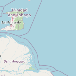
Map view of Chaguaramas

Use this park location map to pinpoint Chaguaramas in Trinidad and Tobago, understand its exact geographic position, and read its mapped placement within the surrounding landscape more clearly.

Pigeon | © OpenStreetMap contributors

Location context for Chaguaramas

Diego Martin
Park atlas

Continue comparing coastal protected areas and regional island geography

Explore Parks Near Chaguaramas and Surrounding Protected Landscapes

Compare Chaguaramas with other coastal protected areas across the surrounding region to examine distinct tropical terrain and maritime boundaries. Expanding beyond individual reserve profiles helps place coastal peninsular ecosystems into a broader geographic framework.
National parkSucre
About 23 km away#1 closest

West

Península de Paria National Park: Venezuela's Protected Landscape Geography and Atlas Context

Explore mapped park boundaries and regional geographic setting.

Discover Península de Paria National Park, a vital protected area within the Sucre region of Venezuela. This page offers a detailed look at the park's geographic identity, focusing on its mapped boundaries and its significance as a national park for atlas-based exploration. Understand its landscape context and its contribution to Venezuela's network of protected lands, providing a clear geographic overview for researchers and explorers.

Area
375 km²
Established
1978
IUCN
II
Relief
Mountain
National parkDelta Amacuro
About 85 km away#2 closest

South

Parque nacional Mariusa: A Detailed Geographic Study of Orinoco Delta Wetlands

Mapped tidal channels and protected wetland geography

Located in Delta Amacuro, Parque nacional Mariusa represents a key protected area where the Orinoco River meets the Atlantic. Its geography is defined by a dynamic system of caños, seasonally flooded rainforests, and mangrove forests that support high ecological complexity. This atlas entry provides an overview of the park boundaries and the physical terrain that shapes this critical Venezuelan protected landscape.

Area
3,310 km²
Established
1991
IUCN
II
Water
Water-dominated
National parkSucre State
About 110 km away#3 closest

West

Turuépano National Park: National Park Protected Landscape and Geographic Context

Explore the mapped boundaries and natural terrain of Sucre State's national park.

Investigate Turuépano National Park, a protected national park situated within Sucre State, Venezuela. This entry provides detailed geographic context and information on its mapped protected-area boundaries, essential for understanding its role in the region's natural landscape atlas. Explore the specific terrain and protected land features that define this significant Venezuelan park.

Area
726 km²
Established
1991
IUCN
II
Relief
Lowland
National parkVenezuela
About 136 km away#4 closest

South

Mariusa National Park: Protected Orinoco Delta Wetlands and River Geography

A vast tidal river delta ecosystem in eastern Venezuela.

Mariusa National Park protects an essential segment of the Orinoco River Delta, characterized by its labyrinthine network of tidal channels and dense swamp forests. This protected area spans approximately 3,310 square kilometers of flooded landscape, where freshwater river systems interact with daily Atlantic tidal flows to maintain a globally significant wetland environment.

Area
3,310 km²
Established
1991
Relief
Lowland
Climate
Tropical
A horizontal watercolor illustration showing soft green rolling hills in the background, with lush green trees and a winding path in the foreground.
Nature reserveGrenada
About 164 km away#5 closest

North

Mount St. Catherine Forest Reserve: Protected Volcanic Landscapes and Cloud Forest Geography

Highland terrain and watershed ecosystems in Grenada

Spanning 934 hectares across Grenada's central massif, Mount St. Catherine Forest Reserve protects the island's tallest peak and most vital watershed catchment zones. This area features a dramatic volcanic landscape characterized by steep ravines, thermal springs, and an altitudinal transition from mature rainforest to fragile elfin woodland at the summit.

Area
9.34 km²
Relief
Mountain
Climate
Tropical
Access
Moderate access
National parkSaint Patrick
About 170 km away#6 closest

North

Levera National Park: Protected Wetlands, Coastal Lagoons, and Offshore Cays in Saint Patrick

Coastal geography and ecological landscape mapping

Levera National Park serves as a central protected area in Saint Patrick, defined by its rare combination of coastal lagoons, mangrove fringes, and dry bush woodland. This geography bridges inland habitats with a chain of offshore islets, providing a critical perspective on the island's coastal ecosystem and biodiversity patterns within the broader Caribbean region.

Area
5.18 km²
Relief
Lowland
Scope
Mixed
Water
Major water bodies
National parkMonagas
About 181 km away#7 closest

West

Cueva del Guácharo National Park: Venezuela's Protected Natural Landscape

Mapping protected areas and natural terrain in Monagas.

Cueva del Guácharo National Park represents a distinct protected landscape within Venezuela's Monagas region. This entry provides essential context for understanding the park's geographic scope, mapped boundaries, and role as a national park. It is designed to facilitate detailed atlas exploration of protected natural areas and their regional landscape context, offering a foundation for understanding Venezuela's conservation geography.

Area
627 km²
Established
1975
IUCN
II
Relief
Mountain
Nature reserveEstado Bolívar
About 231 km away#8 closest

South

Reserva forestal de Imataca: Geographic Overview of a Major Venezuelan Nature Reserve

Mapping the Sierra de Imataca and regional forest ecosystems

Reserva forestal de Imataca serves as a key conservation zone, characterized by the Sierra de Imataca and a dense network of major rivers. This large-scale protected area provides an essential look at the tropical wilderness and upland forest terrain found within Estado Bolivar, mapping out a significant slice of the Venezuelan Guayana region.

Area
38,219 km²
Established
1961
Relief
Mountain
Climate
Tropical

Common questions about visiting, size, designation, and location context for Chaguaramas

Chaguaramas FAQs for park facts, access, geography, and protected area context

Find quick answers about Chaguaramas, including protected-area facts, park geography, trail and visitor context, and how the park fits into its surrounding country and regional landscape.
MoriAtlas Explorer

Continue Your Protected Areas Search Across the Global Atlas

Deepen your exploration by continuing the structured search for national parks and protected areas worldwide. Utilize the comprehensive filtering capabilities to compare different conservation landscapes and refine your understanding of global park geography. Discover more about the distribution and characteristics of protected natural areas.

Global natural geography