
Mori Atlas logo
Protected areaClark Peninsula

Exposed rocky terrain and glacial moraines framing significant polar seabird breeding habitats

Clark Peninsula: Protected Coastal Geography and Antarctic Landscape Mapping in Wilkes Land

Clark Peninsula stands as a distinct rocky landform protruding from the continental ice sheet of Wilkes Land into the Southern Ocean. This protected area features a complex coastline of coves and reefs, providing essential ice-free ground for monitored Adélie penguin colonies and diverse polar seabird populations. The geography reveals a stark contrast between the stable rocky coastline, the Løken Moraines, and the surrounding expanse of Antarctic glacial ice.

Antarctic Specially Protected AreaImportant Bird AreaAdélie penguinsseabird breeding coloniesrocky coastlineWilkes Land

Clark Peninsula

Protected area

Park overview

Structured park overview, official facts, and landscape profile for Clark Peninsula

Clark Peninsula park facts, protected area profile, and essential visitor context

Review the core facts for Clark Peninsula, including designation, size, terrain, visitor scale, habitats, and operating context in one park-focused overview.

About Clark Peninsula

Clark Peninsula is a small but ecologically important rocky outcrop on the Budd Coast of Wilkes Land in East Antarctica. Positioned just a few kilometers from Australia's Casey Station and on the northern side of Newcomb Bay, the peninsula spans roughly 3 kilometers in both length and width and provides about 9.4 square kilometers of exposed terrain amid the surrounding continental ice. Its accessibility from Casey Station and its unusual abundance of ice-free ground have made it a focal point for biological research in this sector of Antarctica.

The peninsula's ecological significance stems largely from its seabird colonies. Large numbers of Adélie penguins breed here, supported by the rocky coastal slopes and the relative proximity of open water during the breeding season. Beyond the penguins, the site regularly hosts breeding south polar skuas, Wilson's storm petrels, and snow petrels, giving the area an unusually rich seabird community for its size. The peninsula's plant communities have likewise been the subject of long-term monitoring, contributing to broader understanding of vegetation establishment and survival in the extreme Antarctic environment.

Because of these research values, Clark Peninsula has been designated Antarctic Specially Protected Area No. 136 under the Antarctic Treaty System. The same qualities have earned it recognition as an Important Bird Area by BirdLife International. Together, these designations reflect a longstanding scientific and conservation interest in the site, distinguishing Clark Peninsula from many other coastal stretches along the Budd Coast and placing it among the more intensively monitored wildlife sites in East Antarctica.

Quick facts and research context for Clark Peninsula

Clark Peninsula lies on the Budd Coast of Wilkes Land in East Antarctica, north of Newcomb Bay and just a few kilometers from Australia's Casey Station. It covers roughly 9.4 square kilometers of ice-free rocky terrain attached to the continental ice sheet. The site is protected as Antarctic Specially Protected Area No. 136 and recognized as an Important Bird Area by BirdLife International, principally because of its large Adélie penguin breeding colonies and supporting seabird populations.

Protection and recognition

Examine the documented conservation scope and formal designation records for Clark Peninsula.

Clark Peninsula Protection Status and International Recognition Data

Consolidated protection data outlines the mixed management scope and formal designation framework established for Clark Peninsula. Factual conservation metrics trace available administrative records without assuming unverified international recognition sources.

Protection details

Protection scope
Mixed
Transboundary protection
No
Park context

Deeper park guide and search-rich context for Clark Peninsula

Clark Peninsula history, landscape, wildlife, and travel context

Explore Clark Peninsula through its history, landscape character, ecosystems, wildlife, conservation priorities, cultural context, and seasonal travel timing in a structured park guide built for atlas discovery and search intent.

Why Clark Peninsula stands out

Clark Peninsula is best known for its large and long-studied Adélie penguin breeding colonies. It hosts one of the most monitored Adélie populations in the Wilkes Land sector, supported by ice-free ground in an otherwise heavily glaciated coastal landscape. The peninsula is also recognized for its broader seabird diversity, including breeding south polar skuas, Wilson's storm petrels, and snow petrels, making it an important site for polar ecological research.

Clark Peninsula history and protected-area timeline

Clark Peninsula was first mapped from aerial photographs taken by the United States Navy's Operation Highjump in February 1947. At that stage, the landmass was thought to be an island connected to the continental ice by a steep snow ramp overlying Budd Coast. Further aerial photography by the 2nd Soviet Antarctic Expedition in 1956 and by the Australian National Antarctic Research Expeditions in 1956 and 1962 helped refine understanding of the feature.

The actual nature of the landform was resolved in 1957 by the Wilkes Station party, whose headquarters were on Clark Peninsula. Led by Scientific Station Leader Carl R. Eklund, the team carried out ground surveys that confirmed the site was a peninsula rather than an island, and named many of its coastal features, typically after members of the Wilkes Station party. The peninsula itself was named by the Advisory Committee on Antarctic Names in honor of Captain John E. Clark, captain of USS Currituck, the flagship of the western task group of Operation Highjump during 1946 to 1947.

Since then, the peninsula has developed a parallel identity as a focus of biological research. Long-term studies of its plant communities and Adélie penguin breeding colonies have underpinned its later designation as Antarctic Specially Protected Area No. 136 and as an Important Bird Area, giving the site a continuous thread from early cartographic discovery through to modern polar conservation.

Clark Peninsula landscape and geographic character

Clark Peninsula is a compact rocky landform that pushes westward from the continental ice of Wilkes Land into the waters of Newcomb Bay and the wider Southern Ocean. The peninsula's westernmost extremity, Stonehocker Point, is a rocky promontory that also hosted the former Wilkes Station, and around it the coast is broken into a series of coves including Stevenson Cove, Powell Cove, and Noonan Cove, alternating with named points such as Blakeney Point and Whitney Point. The combination of exposed rock and surrounding ice gives the peninsula a distinctive contrast with the smoother ice sheet that dominates the Budd Coast interior.

Inland from the coast, at the base of the peninsula, lie the Løken Moraines, a north to south trending line of moraines formed from accumulations of glacial debris. These glacial features indicate the broader ice-flow history of the area and frame the boundary between the rocky peninsula and the continental ice that once overrode it. Offshore, narrow rock reefs such as Dahl Reef and Gibney Reef add to the marine coastal character of the site, with some exposures uncovered at low tide. Together, these features make Clark Peninsula a relatively detailed and well-mapped piece of Antarctic coastline within the Wilkes Land region.

Clark Peninsula ecosystems, habitats, and plant life

The natural character of Clark Peninsula is shaped by the contrast between its ice-free rocky ground and the surrounding continental ice and ocean. This unusual abundance of exposed terrain in a heavily glaciated setting has allowed terrestrial vegetation to establish patches of plant communities, which have been the subject of long-term monitoring studies. These plant communities, while sparse by global standards, are ecologically important within an Antarctic context because they support organisms that rely on the limited ice-free areas available along the coast.

The coastal fringe of the peninsula supports a layered habitat system in which rocky slopes, small coves, low reefs, and adjacent waters interact. This habitat mosaic provides nesting habitat for seabirds and foraging access to the sea, allowing multiple species to coexist within a relatively small area. The interplay between land, sea ice, and ocean makes Clark Peninsula a useful natural laboratory for studying how Antarctic ecosystems function where exposed land is available.

Clark Peninsula wildlife and species highlights

Seabirds are the most conspicuous wildlife feature of Clark Peninsula, with large numbers of Adélie penguins forming the dominant breeding colony. These penguins are the primary reason the site has been recognized as an Important Bird Area and have been the focus of extensive long-term research and monitoring. Beyond the penguins, the peninsula supports breeding populations of south polar skuas, Wilson's storm petrels, and snow petrels, giving the breeding bird community both density and diversity for such a small area.

The combination of accessible coastal terrain and proximity to Casey Station has made it possible for these colonies to be observed and counted repeatedly over multiple decades. This continuity of study is itself part of the wildlife significance of the site, since it allows researchers to track long-term trends in penguin and seabird populations in East Antarctica through periods of environmental change.

Clark Peninsula conservation status and protection priorities

Clark Peninsula is protected under the Antarctic Treaty System as Antarctic Specially Protected Area No. 136. The designation reflects the value of long-term and ongoing research and monitoring programs carried out on the peninsula's plant communities and on its Adélie penguin breeding colonies. By giving formal protection to roughly 9.4 square kilometers of rocky terrain, the designation helps shield these biological assets from disturbance that could compromise decades of accumulated data.

In parallel, the site has been recognized as an Important Bird Area by BirdLife International because of its large breeding populations of seabirds. This dual designation, alongside its proximity to Casey Station and its historical role as the location of Wilkes Station, places the peninsula among the more carefully managed wildlife sites in the Wilkes Land region of East Antarctica. The conservation framework around Clark Peninsula is thus closely tied to scientific research, treating the site as both a refuge and an outdoor laboratory for Antarctic ecology.

Clark Peninsula cultural meaning and human context

The cultural dimension of Clark Peninsula is closely tied to the human history of Antarctic exploration rather than to any long-standing human settlement. Its mapping by Operation Highjump, its ground-truthing by the 1957 Wilkes Station party, and its role as the site of Wilkes Station all reflect the early Cold War era of Antarctic geopolitical activity. Many of the peninsula's coastal features carry the names of expedition members, photographers, scientists, and naval personnel, giving the landscape a layered record of 20th century polar science.

Top sights and standout views in Clark Peninsula

The standout features of Clark Peninsula are its large and intensively studied Adélie penguin breeding colonies, set within a small but ecologically important area of ice-free rocky terrain along the Budd Coast. The peninsula's protected status under the Antarctic Treaty System, together with its recognition as an Important Bird Area, reflects the unusual concentration of long-term research and seabird breeding within a compact coastal area. Its proximity to Casey Station has helped sustain decades of monitoring, distinguishing it from many other stretches of the Wilkes Land coastline.

Best time to visit Clark Peninsula

As a protected research site rather than a conventional visitor destination, Clark Peninsula is most relevant from a seasonal standpoint in the context of wildlife observation and scientific fieldwork. The austral summer, broadly from late spring through early autumn, is the period when Adélie penguins and other seabirds are present at their breeding colonies, sea ice conditions are more workable, and conditions on the ground are least harsh for research parties. Winter brings extreme cold, prolonged darkness, and expanded sea ice, sharply reducing both biological activity and practical access. Anyone considering a visit or research program in the area would face the same logistical constraints faced by Casey Station personnel.
Monthly climate preview

Long-term temperature and precipitation patterns sampled from representative coordinates

Clark Peninsula Climate Normals and Monthly Weather Records in Antarctica

Representative coordinates record sustained subzero temperatures alongside measured monthly precipitation values across the coordinate point. Examining the comprehensive twelve-month record reveals detailed annual climate rhythms and long-term averages for the terrain.
Annual mean-10 °C
-15 °C-2 °C
Jan-2°
Feb-4°
Mar-8°
Apr-12°
May-15°
Jun-15°
Jul-15°
Aug-15°
Sep-14°
Oct-12°
Nov-6°
Dec-3°
Warmest month
January

-2 °C

Coolest month
August

-15.5 °C

Wettest month
July

1.8 mm/day

Driest month
January

1.1 mm/day

Park location guide

Geography guide, regional context, and park location map for Clark Peninsula

Clark Peninsula park geography, regions, and map view in Antarctica

Understand where Clark Peninsula sits in Antarctica through a broader geographic reading of the surrounding landscape, nearby location context, and its mapped position within the national park landscape.

How Clark Peninsula fits into Antarctica

Centered on the South Pole, Antarctica is the highest, driest, coldest and windiest continent. Almost all of its land is buried beneath ice, yet its coasts and surrounding ocean sustain globally significant colonies of penguins, seals and seabirds.

Wider geography shaping Clark Peninsula in Antarctica

The continent surrounds the geographic South Pole and is separated from other landmasses by the Southern Ocean. A vast ice sheet conceals mountain ranges, basins and plains, exceeds four kilometres in thickness in places and flows outward through glaciers and floating ice shelves. The Transantarctic Mountains divide East and West Antarctica, while the Antarctic Peninsula reaches north toward South America.

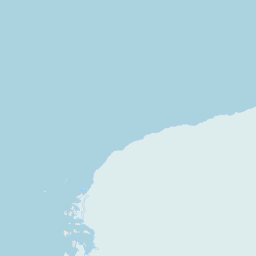
Map view of Clark Peninsula

Use this park location map to pinpoint Clark Peninsula in Antarctica, understand its exact geographic position, and read its mapped placement within the surrounding landscape more clearly.

Pigeon | © OpenStreetMap contributors
Park atlas

Compare adjacent coastal terrain, glacial features, and polar reserves

Other Parks Near Clark Peninsula and Surrounding Protected Landscapes

Browse protected areas near Clark Peninsula to examine related coastal terrain and polar research sites across the surrounding region. Extending the comparison helps map regional protected landscapes and ice-free habitats beyond individual coastal landforms.
Protected areaAntarctica
About 14 km away#1 closest

South

Ardery Island: Protected Coastal Geography and Antarctic Seabird Habitats

Rugged terrain and avian conservation in the Windmill Islands

Ardery Island represents a compact, rocky protected area within the Antarctic landscape. Known for its steep cliffs and essential seabird colonies, this island serves as a focal point for ecological study along the Budd Coast, offering a distinct example of high-latitude coastal geography.

Relief
Upland
Climate
Polar
Access
Remote access
Scope
Mixed
Protected areaAntarctica
About 18 km away#2 closest

West

Frazier Islands Protected Area: Geographic Boundaries and Antarctic Coastal Context

Rocky island terrain within the Vincennes Bay coastal region

Examine the rugged profile of the Frazier Islands, a group of three ice-free rocky outcrops rising from the Southern Ocean. Their protected status and specialized role as a rare continental seabird breeding ground offer a distinct lens into the regional geography and conservation landscapes of East Antarctica.

Relief
Lowland
Climate
Polar
Access
Remote access
Scope
Marine
A pale, minimalist watercolor illustration of soft rolling green hills, a tree line, and a body of water in the foreground, against a plain white background.
Protected areaAustralian Antarctic Territory
About 1,409 km away#3 closest

East

Mawson's Huts Protected Area: Antarctic Heritage and Coastal Geographic Landscape

Historic polar structures in the Australian Antarctic Territory

Located at Cape Denison, Mawson's Huts represents a rare preserved footprint of the Heroic Era of Antarctic exploration. The site encompasses specialized scientific buildings set against a challenging coastal landscape, offering insight into the logistical history of polar science within the Australian Antarctic Territory.

Established
1912
Relief
Lowland
Climate
Polar
Access
Remote access
Protected areaEast Antarctica
About 1,444 km away#4 closest

Southwest

Amanda Bay Protected Area: Geography and Coastal Ice Mapping in East Antarctica

Glacial inlets, emperor penguin colonies, and stable sea ice

Amanda Bay offers a focused look at the remote East Antarctic coastline, characterized by the Hovde Glacier, Flatnes Ice Tongue, and recurring stable sea ice. This protected area serves as a vital habitat for thousands of emperor penguins and illustrates the complex relationship between glacial cliffs and coastal marine environments across the Prydz Bay margin.

Area
18 km²
Established
1957
Relief
Lowland
Climate
Polar
Protected areaMac. Robertson Land
About 1,879 km away#5 closest

Southwest

Scullin Monolith Protected Area in East Antarctica: Coastal Geography and Habitat Atlas

Ice-free coastal terrain and regional seabird breeding grounds

Scullin Monolith represents a singular landmark of exposed rock along the glaciated coastline of Mac. Robertson Land. Stretching from Mikkelsen Peak toward Douglas Bay, this crescent-shaped promontory remains essential for understanding East Antarctic coastal geography and the dense avian populations that rely on its rare snow-free terrain and protective vertical cliffs.

Established
1931
Relief
Upland
Climate
Polar
Access
Remote access
Protected areaMac. Robertson Land
About 2,053 km away#6 closest

Southwest

Rookery Islands Protected Area: Mac. Robertson Land Polar Landscape Atlas

Coastal rocky terrain and international seabird conservation zone

Located in western Holme Bay, the Rookery Islands form a protected rocky archipelago along the Mawson Coast. This site functions as a key reference area for polar seabird populations, including Adélie penguins and southern giant petrels, while providing a clear contrast to the high-relief mountain ranges of the Antarctic mainland.

Area
0.89 km²
Relief
Lowland
Climate
Polar
Access
Remote access
Wildlife reserveAntarctica
About 2,125 km away#7 closest

Southwest

Taylor Rookery Wildlife Reserve: Antarctic Protected Landscape and Research Site

Mapping a unique land-based penguin colony on the Mawson Coast.

Located on the Mawson Coast of East Antarctica, Taylor Rookery is a protected wildlife reserve of high scientific importance. This site serves as a vital benchmark for emperor penguin population studies, featuring a rare landscape of rocky outcrops that support land-based breeding. Its unique geography, framed by Taylor Glacier and the Colbeck Archipelago, provides a stable environment for observing one of the most monitored polar colonies in the region.

Area
0.26 km²
Relief
Lowland
Climate
Polar
Access
Remote access
Marine protected areaAustralia
About 2,560 km away#8 closest

East

Macquarie Island Marine Park: Subantarctic Seafloor and Marine Conservation Geography

A remote Australian marine protected area and ocean atlas

This expansive marine protected area encompasses deep ocean habitats and productive surface waters in the remote subantarctic. The park features diverse seafloor topography, such as abyssal plains and submarine canyons, while providing vital foraging grounds for penguins, seals, and diverse marine wildlife across the southwest Pacific.

Area
475,465 km²
Established
1999
IUCN
IV
Relief
Lowland

Common questions about visiting, size, designation, and location context for Clark Peninsula

Clark Peninsula FAQs for park facts, access, geography, and protected area context

Find quick answers about Clark Peninsula, including protected-area facts, park geography, trail and visitor context, and how the park fits into its surrounding country and regional landscape.
MoriAtlas Explorer

Continue Your Protected Areas Search Across the Global Atlas

Deepen your exploration by continuing the structured search for national parks and protected areas worldwide. Utilize the comprehensive filtering capabilities to compare different conservation landscapes and refine your understanding of global park geography. Discover more about the distribution and characteristics of protected natural areas.

Global natural geography
