

Mori Atlas logo
State or regional parkClinton Conservation Park

Discover the ecological zonation of tidal flats, estuaries, and protected dunes along the Gulf St Vincent coastline.

Clinton Conservation Park: Mapping the Coastal Wetlands and Mangrove Forests of South Australia

Clinton Conservation Park preserves a largely undisturbed coastal swamp complex at the northern reaches of Gulf St Vincent. This protected area connects the Yorke Peninsula shoreline with the saltflats south of Port Wakefield, featuring a unique mosaic of mangrove forests, samphire salt marshes, and estuarine environments. As a critical habitat for migratory wading birds and fish, the park provides an essential look at the natural coastal morphology of South Australia.

mangrovessamphire flatssaltmarshcoastal wetlandstidal flatsestuarine habitat
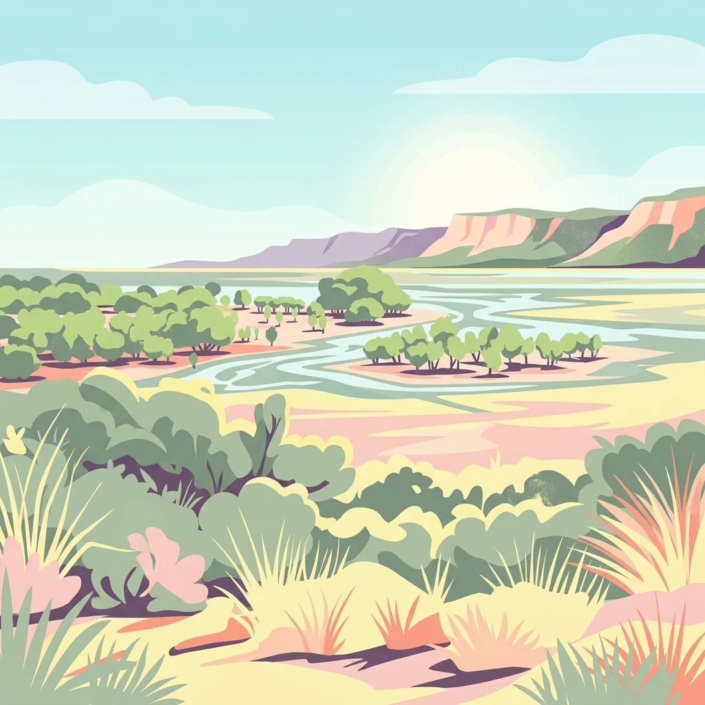
A stylized illustration showing a coastal landscape with green mangrove trees growing in shallow water and saltflats, with pink and green cliffs in the background under a pale blue sky.

Clinton Conservation Park

State or regional park

Park overview

Structured park overview, official facts, and landscape profile for Clinton Conservation Park

Clinton Conservation Park park facts, protected area profile, and essential visitor context

Review the core facts for Clinton Conservation Park, including designation, size, terrain, visitor scale, habitats, and operating context in one park-focused overview.

About Clinton Conservation Park

Clinton Conservation Park protects a stretch of South Australian coastline at the very top of Gulf St Vincent, where the waters of the gulf narrow into a shallow, tidal head bordered by low-lying flats. The park is unusual in straddling the gulf itself, running from the coastal community of Clinton on the Yorke Peninsula eastward to Port Wakefield and then southward toward Sandy Point. This geography places the conservation park at the transition between marine gulf waters, estuarine river systems, and terrestrial coastal dunes, allowing a compact area to contain a wide range of interlinked habitats.

At the heart of the park is the head-of-gulf wetland and the estuary of the Wakefield River, two environments that together define the area's ecological identity. Extensive intertidal flats, colonized by samphire and surrounded by grey mangrove forest, give way to low backing dunes that rise gently from the shore. Because much of the surrounding coast has been altered by agriculture, settlement, and development, the park's largely undisturbed coastal swamp complex has become a regionally significant refuge.

As a formally gazetted conservation park under South Australian legislation, the area receives structured protection aimed at maintaining the integrity of its mangrove and saltflat communities. Its recognition under international and national frameworks, including IUCN Category III status, reflects the value of the park's landforms and ecological processes rather than simply its scenery. For visitors and researchers alike, the conservation park offers an accessible example of the coastal wetland systems that once characterized much of the northern Gulf St Vincent shoreline.

Quick facts and research context for Clinton Conservation Park

Clinton Conservation Park lies on the coast at the northern tip of Gulf St Vincent in South Australia, spanning the western shoreline near Clinton on the Yorke Peninsula and lowlands extending south of Port Wakefield toward Sandy Point. It was originally proclaimed as Clinton National Park in 1970 under the National Parks Act 1966 and later re-proclaimed under the National Parks and Wildlife Act 1972, and it is managed by the Department for Environment and Water. Covering roughly 19 square kilometers, the park is classified as an IUCN Category III protected area and was listed on the former Register of the National Estate. Its conservation value is closely tied to the head-of-gulf wetland and Wakefield River estuary, which together support mangrove, samphire, and saltflat ecosystems that are increasingly uncommon in the region.

Protection and recognition

Documented terrestrial protection scope and conservation status records

Clinton Conservation Park Protection Status and Territorial Designation

Clinton Conservation Park maintains a documented terrestrial protection scope within its designated natural landscape. Official records outline the established management boundaries and conservation status details associated with this protected area.

Protection details

Protection scope
Terrestrial
Transboundary protection
No
Park context

Deeper park guide and search-rich context for Clinton Conservation Park

Clinton Conservation Park history, landscape, wildlife, and travel context

Explore Clinton Conservation Park through its history, landscape character, ecosystems, wildlife, conservation priorities, cultural context, and seasonal travel timing in a structured park guide built for atlas discovery and search intent.

Why Clinton Conservation Park stands out

Clinton Conservation Park is best known for preserving one of South Australia's major mangrove and saltflat associations, particularly the dense stands of grey mangrove (Avicennia marina) and samphire (Arthrocnemum) salt marsh communities that ring the upper reaches of Gulf St Vincent. The tidal flats at the head of the gulf, combined with the sheltered estuary of the Wakefield River, form a near-complete coastal swamp complex that remains essentially undisturbed. This combination of mangrove forest, samphire flats, and low backing dunes is the defining ecological signature of the park. These habitats not only give the area its distinctive landscape character but also underpin its importance for fish breeding and migratory wading birds, making the park a key node in the broader coastal wetland network of the region.
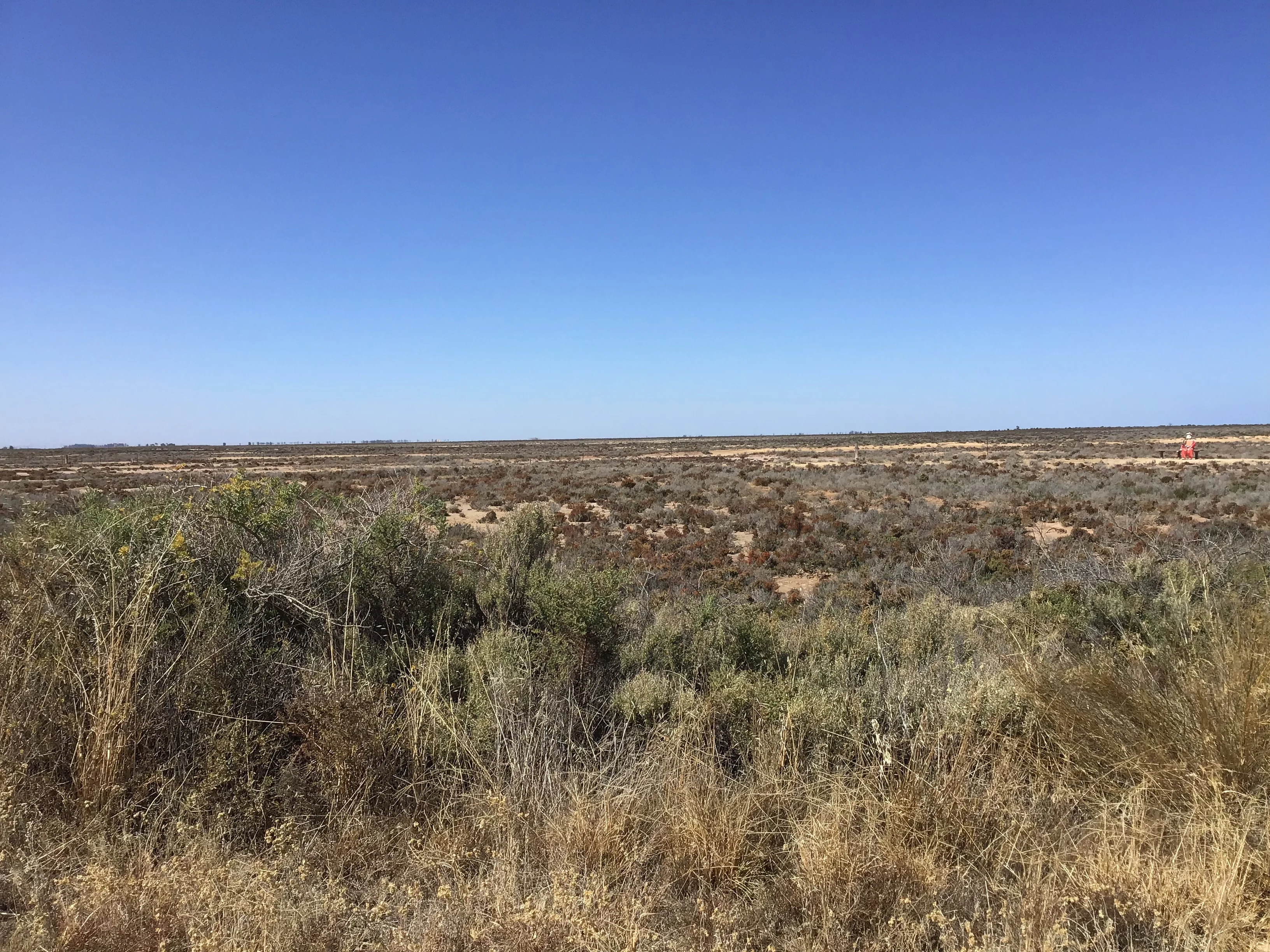
A wide shot of flat, arid terrain covered in low green and brown scrub vegetation stretching to a distant horizon under a clear blue sky.
Flat scrubland landscape within Clinton Conservation Park under a clear blue sky.

Clinton Conservation Park history and protected-area timeline

Clinton Conservation Park has its origins in the early 1970s wave of formal nature conservation in South Australia. It was first proclaimed on 10 September 1970 as Clinton National Park under the National Parks Act 1966, reflecting the era's emphasis on designating representative coastal and natural areas as national parks.

When South Australia's broader conservation framework was reorganized through the National Parks and Wildlife Act 1972, the park was re-proclaimed under the new legislation, and its classification shifted from national park to conservation park, a designation applied where the primary values are the protection of particular habitats, landforms, or ecological communities rather than full-scale wilderness management. This change aligned the park's legal status more closely with its actual role as a refuge for mangrove and saltflat habitats.

Throughout the 1970s and into the 1980s, the conservation significance of the area was increasingly articulated in official documents. A 1980 description highlighted the park as preserving one of the major mangrove and saltflat associations in the state and emphasized that the full coastal swamp complex, including its backing dune, remained essentially undisturbed. The park was accordingly included on the Register of the National Estate, formalizing its recognition as a nationally significant natural area, and it continues to be managed as a conservation park focused on habitat preservation rather than recreation-led use.

Clinton Conservation Park landscape and geographic character

The landscape of Clinton Conservation Park is shaped by the shallow, tidal head of Gulf St Vincent. Wide intertidal flats dominate much of the visible terrain, periodically exposed and reflooded by the tides. Along the edges of these flats, low samphire-covered saltmarshes form a transitional band between open water and the slightly higher ground inland.

Further inland, the flats give way to a low backing dune system that rises only gently above the surrounding plain. These dunes carry their own distinctive vegetation, distinct from the salt-tolerant samphire communities below, and provide a subtle but consistent topographic boundary along the park's landward edge. At the western end of the park, the shoreline near Clinton is fringed by mangroves, with the tangled canopy of grey mangrove trees standing in contrast to the open flats elsewhere in the system.

Where the Wakefield River reaches the sea near Port Wakefield, the landscape shifts again, with the freshwater influence of the river creating a small estuarine environment. Sandy Point and the coast south of Port Wakefield extend this mosaic further, blending mangrove, samphire, and dune communities into a continuous coastal corridor. Taken together, these features give the park a quiet, low-relief character defined more by ecological zonation than by dramatic elevation changes.

Clinton Conservation Park ecosystems, habitats, and plant life

Clinton Conservation Park's ecological character is built around the interaction of tidal, estuarine, and dune environments at the head of Gulf St Vincent. Samphire saltmarshes, dominated by species of Arthrocnemum, occupy the regularly inundated margins of the tidal flats, while stands of grey mangrove (Avicennia marina) line the sheltered stretches of coast and the lower reaches of the Wakefield River estuary.

These plant communities together create a layered coastal wetland system, moving from open tidal mud and sand, through samphire flats, into mangrove forest, and finally up into the low coastal dunes. Where the Wakefield River meets the gulf, the mixing of fresh and salt water adds a further ecological dimension, supporting a productive estuarine zone. The dune vegetation above the saltflats helps stabilize the boundary between wetland and terrestrial habitats and carries plant species adapted to drier, sandier conditions.

Because mangrove and samphire environments have been markedly reduced elsewhere in South Australia, the relative completeness of these associations within the park is itself a defining ecological feature. The park does not simply contain fragments of these habitats; it preserves a functioning sequence of coastal swamp types, making it an important reference site for the regional ecology of Gulf St Vincent.

Clinton Conservation Park wildlife and species highlights

The wildlife significance of Clinton Conservation Park is closely tied to its mosaic of tidal flats, mangroves, and estuarine waters. The head-of-gulf wetland and the Wakefield River estuary together provide shelter and feeding grounds for a wide variety of marine and estuarine fauna, with the mangrove-lined shores and samphire flats acting as important nursery areas for fish and invertebrates.

Migratory wading birds are among the park's most prominent seasonal inhabitants, with the exposed tidal flats offering rich feeding opportunities as the tides move in and out. The combination of mangrove roosts, open mudflats, and shallow water makes the area attractive to both shorebirds and waterbirds, including species that rely on the broader migratory pathway along the southern Australian coastline. The presence of such birdlife reinforces the park's regional importance as a coastal wetland refuge.

Beyond birds, the estuarine and marine environments support a range of fish species whose juvenile stages benefit from the sheltered conditions, and the surrounding saltflat and dune habitats host smaller fauna adapted to saline and exposed environments. While the park is not primarily framed as a terrestrial wildlife reserve, its near-undisturbed condition allows the ecological links between the marine, intertidal, and terrestrial zones to function more completely than in many nearby coastal areas.

Clinton Conservation Park conservation status and protection priorities

Clinton Conservation Park is primarily valued for what it preserves rather than for recreational or scenic qualities alone. Samphire saltmarshes and mangrove forests have been significantly reduced across South Australia, and the park protects one of the state's major remaining concentrations of these communities. This makes the area disproportionately important for the long-term survival of these habitats at a regional scale.

The conservation importance of the park is explicitly tied to the head-of-gulf wetland and the Wakefield River estuary, recognized as a significant fish nursery and a key site for migratory wading birds. By safeguarding the full coastal swamp complex, including its backing dune, the park maintains ecological processes such as tidal flooding, sediment deposition, and nutrient cycling that underpin these habitats. Its classification as an IUCN Category III protected area reflects the significance of the natural features being conserved.

Inclusion on the former Register of the National Estate further underscored national recognition of the park's conservation values. Management by the Department for Environment and Water focuses on maintaining the integrity of the mangrove and saltflat systems, limiting disturbance, and ensuring that the connectivity between tidal flats, estuary, and dunes continues to function as a coherent ecological unit.

Top sights and standout views in Clinton Conservation Park

Clinton Conservation Park's standout feature is the near-complete sequence of mangrove and samphire habitats preserved at the head of Gulf St Vincent, a coastal wetland system that has been heavily depleted elsewhere in South Australia. The park's mangrove forests, samphire flats, and low backing dunes form a continuous ecological corridor that still functions largely as it would have historically.

Equally notable is the role of the Wakefield River estuary within the park, which links freshwater, estuarine, and marine environments in a single protected area. This estuarine influence, combined with the tidal flats, makes the park a regionally important nursery for fish and a reliable stopover for migratory wading birds. Together, these qualities define the park as a compact but ecologically rich refuge on an otherwise heavily modified coastline.

Best time to visit Clinton Conservation Park

Clinton Conservation Park is a coastal wetland reserve whose character shifts meaningfully with the tides and seasons. Visits focused on birdwatching and observing the tidal flats are most rewarding when exposed mudflats are widespread, allowing migratory and resident wading birds to feed in large numbers along the edges of mangroves and samphire stands. Cooler months of the year, when many migratory shorebirds are present in the region, tend to offer the richest opportunities for observing birdlife on the flats.

Warmer, drier periods of the year highlight the saltbush and samphire vegetation above the tidal zone, giving the park a more open, sun-bleached appearance and making the different plant communities easier to distinguish across the landscape. Because the park is low-lying and shaped by tidal processes, calm weather and daylight hours around low tide generally make it easier to read the mosaic of mangroves, saltflats, and backing dunes that define the area.
Monthly climate preview

Track monthly temperature ranges and precipitation averages across the protected landscape

Clinton Conservation Park Climate Normals and Annual Weather Patterns

Long-term representative measurements outline the annual temperature extremes and monthly precipitation rhythms recorded across Clinton Conservation Park. Examining the complete twelve-month climate profile provides detailed historical data for understanding regional environmental patterns.
Annual mean17 °C
11 °C24 °C
Jan24°
Feb24°
Mar21°
Apr18°
May14°
Jun11°
Jul11°
Aug11°
Sep14°
Oct16°
Nov20°
Dec22°
Warmest month
January

24.2 °C

Coolest month
July

10.6 °C

Wettest month
June

1.8 mm/day

Driest month
January

0.6 mm/day

Park location guide

Geography guide, regional context, and park location map for Clinton Conservation Park

Clinton Conservation Park park geography, regions, and map view in Australia

Understand where Clinton Conservation Park sits in Australia through a broader geographic reading of the surrounding landscape, nearby location context, and its mapped position within the national park landscape.

How Clinton Conservation Park fits into Australia

Australia is a constitutional monarchy and federal parliamentary democracy comprising six states and ten territories. With a population of nearly 28 million, it is one of the world's most urbanised countries, with most people concentrated on the eastern seaboard. The country has a high Human Development Index and is known for its cultural diversity, ancient Aboriginal heritage, and unique wildlife.

Wider geography shaping Clinton Conservation Park in Australia

Australia occupies the entire Australian continent, the island of Tasmania, and numerous smaller islands. It is the world's flattest and driest inhabited continent, featuring vast deserts in the interior (the Outback), tropical rainforests along the eastern coast, and a coastline bordering the Indian and Pacific Oceans.

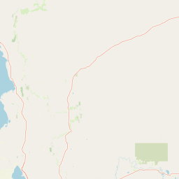
Map view of Clinton Conservation Park

Use this park location map to pinpoint Clinton Conservation Park in Australia, understand its exact geographic position, and read its mapped placement within the surrounding landscape more clearly.

Pigeon | © OpenStreetMap contributors

Location context for Clinton Conservation Park

South Australia

Visual reference for tidal flats, mangroves, and coastal wetland habitats

Clinton Conservation Park Photos and Protected Landscape Scenery

Browse detailed photographs showcasing the distinct terrain and vegetation patterns across Clinton Conservation Park. Visual documentation reveals the ecological zonation of mangrove forests, samphire saltflats, and estuarine environments along the gulf coastline.

A wide shot of flat, arid terrain covered in low green and brown scrub vegetation stretching to a distant horizon under a clear blue sky.

Wide landscape view of a coastal wetland with dry brown ground in the foreground, green mangrove trees in shallow water, and a calm sea under a clear blue sky.

Park atlas

Compare adjacent wetland reserves, tidal flats, and regional protected landscapes

Explore Parks Near Clinton Conservation Park and Surrounding Coastal Protected Areas

Browse other parks near Clinton Conservation Park to compare regional coastal wetlands, tidal flats, and estuarine reserves across the surrounding shoreline. Evaluating adjacent protected landscapes helps trace broader ecological patterns and coastal habitat connectivity throughout the region.
Wildlife reserveSouth Australia
About 53 km away#1 closest

West

Bird Islands Conservation Park: A Protected Coastal Landscape in South Australia

Key wildlife reserve on the Spencer Gulf coastline

Bird Islands Conservation Park represents a vital coastal habitat within South Australia. Covering islands and mainland sections near Wallaroo, the area integrates sand dunes, intertidal flats, and mangrove woodlands. This conservation site provides essential refuge for migratory shorebirds while maintaining a complex link between marine and terrestrial ecosystems on the Yorke Peninsula.

Area
3.69 km²
Established
1968
IUCN
VI
Relief
Lowland
National parkAustralia
About 58 km away#2 closest

Southeast

Adelaide International Bird Sanctuary National Park, Winaityinaityi Pangkara National Park: Protected Landscape and Geographic Context

Explore the mapped natural terrain of this Australian protected area.

This national park page offers detailed insights into Adelaide International Bird Sanctuary National Park, Winaityinaityi Pangkara, focusing on its protected status and geographic attributes. Understand the park's placement within Australia, its mapped boundaries, and the natural landscape features that define it. It serves as a vital entry point for atlas-driven discovery of protected areas, emphasizing the geographical context of this significant national park.

Access
Access unknown
Season
Seasonal
Natural monumentSouth Australia
About 71 km away#3 closest

North

Clements Gap Conservation Park: A South Australian Natural Monument and Cultural Landscape

Mapping bushland corridors and historic heritage in the Mid North region.

Clements Gap Conservation Park occupies a 7.9 square kilometre footprint, offering a glimpse into the natural terrain of the Mid North region. The area functions as a protected monument that preserves native bushland alongside the built traces of a historic township, showcasing the layered human and environmental geography characteristic of the Spencer Gulf hinterland.

Area
7.9 km²
Established
1963
IUCN
III
Relief
Upland
Nature reserveSouth Australia
About 77 km away#4 closest

Southwest

Goose Island Conservation Park: Marine Nature Reserve Geography and Protected Island Boundaries

Spencer Gulf offshore refuge and seabird breeding habitat

Goose Island Conservation Park consists of a scattered ring of islands and rocky outcrops in the Spencer Gulf. This nature reserve provides a secluded, wind-swept environment that serves as a vital sanctuary for breeding black-faced cormorant populations and Australian sea lions. The area is defined by its marine-weathered terrain and offshore isolation, acting as a protected link in the broader coastal geography of South Australia.

Area
0.35 km²
Established
1972
IUCN
III
Visitors
300 annual
Nature reserveSouth Australia
About 95 km away#5 closest

Southeast

Hale Conservation Park: Nature Reserve and Geological Landmark in South Australia

Protected forest landscapes in the Mount Lofty Ranges

Located near Williamstown, Hale Conservation Park preserves a rugged stretch of hilly terrain representative of the broader Mount Lofty Ranges. This nature reserve serves as a sanctuary for stringybark forest and provides scientists and map enthusiasts with clear evidence of a regional geological unconformity.

Area
1.89 km²
Established
1964
IUCN
III
Relief
Mountain
Watercolor painting of a rolling, hilly landscape with sparse trees against a pale, soft-toned sky.
Nature reserveSouth Australia
About 95 km away#6 closest

Southeast

Kaiserstuhl Conservation Park: Protected Nature Reserve in the Barossa Ranges

Mapping the forest ridges and hill country of South Australia

Kaiserstuhl Conservation Park preserves a distinctive segment of forested ridge and valley terrain within the Mount Crawford Forest. Situated near the Heysen Trail in South Australia, this nature reserve focuses on the protection of its 600-metre namesake peak, providing a clear geographic landmark within the eastern Barossa Ranges.

Area
4.35 km²
Established
1979
IUCN
III
Visitors
7.5K annual
Protected landscapeSouth Australia
About 98 km away#7 closest

Southeast

Black Hill Conservation Park: Mount Lofty Ranges Protected Area and Regional Geography

Bushland ridge lines and trail networks near Adelaide

Examine the geography of Black Hill Conservation Park, a significant protected landscape defined by its steep ridges and 467-metre summit. This area serves as a key bushland anchor in the Mount Lofty Ranges, featuring complex trail systems and specialized heathland habitats. Gain insights into the natural terrain, regional connectivity, and protected boundary characteristics of this essential conservation zone in South Australia.

Area
7.58 km²
Established
1972
IUCN
III
Relief
Mountain
Nature reserveSouth Australia
About 103 km away#8 closest

Southeast

Cudlee Creek Conservation Park: Geography, Protected Boundaries, and South Australian Terrain

Adelaide Hills nature reserve with riparian forest and eucalypt woodland habitat

Cudlee Creek Conservation Park provides a clear look at the Adelaide Hills landscape through its mix of steep stringybark forest and River Torrens riparian habitat. This small nature reserve serves as an important regional reference site for native plant communities and bird habitat within the context of a heavily altered agricultural landscape in South Australia.

Area
0.49 km²
Established
1971
IUCN
III
Relief
Upland

Common questions about visiting, size, designation, and location context for Clinton Conservation Park

Clinton Conservation Park FAQs for park facts, access, geography, and protected area context

Find quick answers about Clinton Conservation Park, including protected-area facts, park geography, trail and visitor context, and how the park fits into its surrounding country and regional landscape.
MoriAtlas Explorer

Continue Your Protected Areas Search Across the Global Atlas

Deepen your exploration by continuing the structured search for national parks and protected areas worldwide. Utilize the comprehensive filtering capabilities to compare different conservation landscapes and refine your understanding of global park geography. Discover more about the distribution and characteristics of protected natural areas.

Global natural geography