Mori Atlas logo
Wildlife reserveRéserve nationale de faune de l'Île-Country

Geographic overview of offshore island habitats and colonial seabird nesting refuge boundaries.

Réserve nationale de faune de l'Île-Country: Mapping Nova Scotia Coastal Protected Landscapes

(Country Island National Wildlife Area)

Réserve nationale de faune de l'Île-Country represents a critical coastal protected area situated along the southeastern shore of Nova Scotia. This atlas entry details the island's unique geomorphology, including its raised cobble beaches, sheltered meadows, and stunted coniferous woodland pockets. The reserve serves as an essential breeding refuge within the Canadian Atlantic coastline, demonstrating the importance of small-scale geography in sustaining colonial seabird populations.

national wildlife areaisland reserveseabird colonytern nestingstorm-petrelatlantic coast

Réserve nationale de faune de l'Île-Country

Wildlife reserve

Park overview

Structured park overview, official facts, and landscape profile for Country Island National Wildlife Area

Country Island National Wildlife Area park facts, protected area profile, and essential visitor context

Review the core facts for Country Island National Wildlife Area, including designation, size, terrain, visitor scale, habitats, and operating context in one park-focused overview.

About Country Island National Wildlife Area

The Country Island National Wildlife Area is a recently designated protected area on a small island off the southeastern coast of Nova Scotia, in the municipality of Guysborough. Although the reserve covers only about 21 hectares, it represents an outsized conservation investment because Country Island hosts breeding populations of seabirds that are rare, threatened, or ecologically important across the wider North Atlantic.

Country Island lies roughly 15 kilometers east of Port Bickerton along a coast characterized by coves, headlands, and small offshore islands. The protected area encompasses nearly the entire island, with only the lighthouse and a small associated footprint excluded from the designation. The terrain of the island includes raised cobble beaches formed by post-glacial uplift, open grassy and shrubby meadows, low dense thickets, and small coniferous woodlands. These varied habitats, packed into a compact area, support strikingly high densities of breeding birds and create the conditions that made the island a target for formal protection.

The reserve was established on 16 December 2024, following decades during which the island's importance for nesting seabirds was recognized but the land remained vulnerable. A research station was built on the island in 2024 to support ongoing monitoring of the colonies, in particular the small but globally significant Roseate Tern population. The site's designation as a National Wildlife Area, managed by the Canadian Wildlife Service, marks its formal inclusion in Canada's national system of habitat-focused protected areas and confirms a long-term conservation commitment to the island's bird populations.

In management terms, the reserve sits within the broader family of Canadian National Wildlife Areas that prioritize the protection of habitat for species of conservation concern rather than public recreation. Country Island's profile as a working conservation site, with active research infrastructure and strictly limited access, sets the tone for how the protected area is used and experienced, with protection of breeding birds taking precedence over visitor use.

Quick facts and research context for Country Island National Wildlife Area

The Country Island National Wildlife Area is a 21-hectare protected coastal island in Guysborough County, on the southeastern shore of Nova Scotia, about 15 kilometers east of Port Bickerton. It was formally designated as a National Wildlife Area on 16 December 2024 and is managed by the Canadian Wildlife Service. The reserve protects nearly all of Country Island, excluding the lighthouse parcel, and preserves cobble beaches, meadows, shrub thickets, and small conifer stands that together support globally significant seabird breeding populations. Country Island is particularly notable for hosting roughly a quarter of Canada's nesting Roseate Terns and an estimated 30,000 Leach's Storm-Petrels.

Protection and recognition

Examine the terrestrial protection scope and 2024 designation history for this protected landscape

Réserve nationale de faune de l'Île-Country Protection Status and Designated Area Record

Terrestrial protection status for Réserve nationale de faune de l'Île-Country is established through official records dating from its 2024 designation. Evaluating this documented framework provides clear insight into the management scope and administrative context governing the natural area.

Protection details

Protection scope
Terrestrial
Designated year
2024
Transboundary protection
No
Park context

Deeper park guide and search-rich context for Country Island National Wildlife Area

Country Island National Wildlife Area history, landscape, wildlife, and travel context

Explore Country Island National Wildlife Area through its history, landscape character, ecosystems, wildlife, conservation priorities, cultural context, and seasonal travel timing in a structured park guide built for atlas discovery and search intent.

Why Country Island National Wildlife Area stands out

Country Island National Wildlife Area is best known as one of the most important seabird breeding islands on the Atlantic coast of Canada. Despite its tiny size, the reserve supports roughly 25 percent of Canada's breeding population of the Roseate Tern, a species listed as endangered in Canada, and an estimated 30,000 Leach's Storm-Petrels forming one of the densest storm-petrel colonies in the region. The reserve is also known for the variety of colonial nesting seabirds and shorebirds that share the island during the breeding season, including Arctic Terns, Common Terns, Common Eiders, and Semipalmated Plovers. Its combination of small-island geography, varied coastal microhabitats, and minimal human disturbance makes it a textbook example of why small offshore islands matter disproportionately to seabird conservation in Atlantic Canada.

Country Island National Wildlife Area history and protected-area timeline

Country Island has a long human history that is modest but distinct. In addition to the lighthouse, the island once hosted a farm, although the farm buildings were demolished during the twentieth century. The current lighthouse on the island was constructed in 1963 and 1964, replacing earlier navigational aids that had served vessels moving along Nova Scotia's eastern shore.

Conservation attention to the island grew in the 1990s and 2000s, when Country Island was recognized as an Important Bird Area. This designation helped prevent the sale of public lands on the island and effectively froze further development, preserving the site at a time when its seabird values were becoming better understood.

In July 2023, the Government of Canada announced its intention to formally designate Country Island as a National Wildlife Area, signaling the transition from informal recognition to permanent federal protection. A research station was constructed on the island in 2024 to support monitoring and stewardship of the bird colonies. On 16 December 2024, the island was officially designated as the Country Island National Wildlife Area, administered by the Canadian Wildlife Service.

Country Island National Wildlife Area landscape and geographic character

Country Island is a small coastal island along Nova Scotia's southeastern shore, set in a region of low headlands, sheltered coves, and scattered offshore islands. Despite its small total area, the island displays an unusually varied set of coastal landforms within a compact footprint.

A defining feature of the island's landscape is its system of raised cobble beaches, formed as the coast rebounded following the last glaciation. These elevated beaches ring parts of the island and provide well-drained, sparsely vegetated substrates that are attractive to ground-nesting seabirds. Inland from the cobble ridges, the island supports open meadows, low shrubby areas dominated by berry-bearing species such as raspberry and chokeberry, and small pockets of stunted coniferous woodland. The mix of open grassy cover, low woody cover, and rocky shorelines gives the island a layered visual character typical of Atlantic seabird nesting islands.

Country Island National Wildlife Area ecosystems, habitats, and plant life

The ecological identity of Country Island is shaped by the interplay between coastal exposure, thin soils, and a long history of minimal human disturbance. Vegetation is dominated by hardy, low-growing species adapted to salt spray, wind, and acidic soils. Cinnamon fern, red raspberry, black chokeberry, bayberry, white spruce, and black crowberry are among the characteristic plants recorded on the island.

The combination of open meadows, shrub thickets, small conifer stands, and raised cobble beaches creates a mosaic of nesting and roosting habitats. This habitat diversity, on a small island with few terrestrial predators, underpins the exceptional seabird densities that gave rise to the reserve's protection. The island's ecology essentially mirrors the broader pattern of small Atlantic islands that function as natural refuges for colonial seabirds, offering a combination of isolation, suitable nesting substrate, and limited disturbance that mainland coastal areas rarely match.

Country Island National Wildlife Area wildlife and species highlights

The wildlife profile of the Country Island National Wildlife Area is overwhelmingly defined by its colonial seabirds. The island hosts roughly 25 percent of the Canadian breeding population of the Roseate Tern, an endangered species in Canada, with the colony comprising around 20 nesting pairs. The island also supports an estimated 30,000 Leach's Storm-Petrels, forming one of the largest known colonies of this species along this stretch of coast.

Beyond these two flagship species, Country Island serves as a nesting colony for several other seabirds and shorebirds, including Arctic Tern, Common Tern, Common Eider, Savannah Sparrow, and Semipalmated Plover. Additional species recorded on the island include American Black Duck, American Robin, Black Guillemot, Gray Catbird, Great Black-backed Gull, Great Cormorant, Herring Gull, Northern Gannet, Red-breasted Merganser, Semipalmated Plover, Song Sparrow, and Spotted Sandpiper. The cumulative effect is a dense, layered seabird community that makes Country Island one of the most ornithologically rich small islands in Nova Scotia.

Country Island National Wildlife Area conservation status and protection priorities

From a conservation perspective, the Country Island National Wildlife Area protects one of the most important seabird nesting sites in eastern Canada on a very small land base. Its formal designation as a National Wildlife Area places it inside Canada's federal system of habitat-based protected areas, administered by the Canadian Wildlife Service, and locks in long-term protection of the island's bird habitats.

The reserve's conservation value rests on the island's role in safeguarding the Roseate Tern, a species whose Canadian breeding population is small and highly vulnerable, and in supporting one of the largest known Leach's Storm-Petrel colonies in the region. By protecting the entire island ecosystem, including its cobble beaches, meadows, and shrub thickets, the reserve also buffers other nesting species such as Arctic Terns, Common Terns, and Common Eiders from the kinds of disturbance that mainland and road-accessible coastlines increasingly face.

The earlier Important Bird Area designation, followed by the 2024 National Wildlife Area status, reflects a layered conservation strategy: first avoiding further land alienation, then formalizing federal protection and investing in a research station that supports active monitoring of the colonies. This combination of legal protection and ongoing research strengthens the reserve's role as a working site for seabird conservation in Atlantic Canada.

Country Island National Wildlife Area cultural meaning and human context

The cultural context of Country Island is closely tied to its maritime and lighthouse heritage. The island once supported a small farm in addition to the lighthouse, although the farm buildings were demolished during the twentieth century. The current lighthouse, built in 1963 and 1964, continues to mark the island as a working part of Nova Scotia's navigational landscape rather than an abandoned outpost.

The island's recent history reflects a gradual shift from a place of small-scale human activity to a site defined primarily by conservation. The community understanding of Country Island today is shaped less by its farmstead past than by its current role as a protected seabird island, with a research station now standing where farming and lighthouse keeping once defined its human footprint.

Top sights and standout views in Country Island National Wildlife Area

The standout features of the Country Island National Wildlife Area include its disproportionate importance to Canada's Roseate Tern population, hosting roughly a quarter of the national breeding total on a tiny island, and its massive Leach's Storm-Petrel colony of about 30,000 birds.

Equally distinctive is the island's compact mosaic of raised cobble beaches, meadows, shrub thickets, and small conifer stands, which together create the layered habitat structure that supports such a diverse colonial seabird community. The reserve's combination of recent federal designation, active research infrastructure, and strict access protections makes it a flagship example of how small Atlantic islands are being integrated into Canada's national conservation framework.

Best time to visit Country Island National Wildlife Area

The Country Island National Wildlife Area is a strictly managed conservation site, and public access to the island is restricted in order to protect nesting seabirds. For visitors interested in the area's wildlife value, the late spring and summer months correspond to the seabird breeding season, when terns, storm-petrels, and other colonial species are present on the island in their highest numbers.

Outside the breeding season, the surrounding waters and nearby mainland viewpoints along Nova Scotia's eastern shore remain quieter but scenic, with cooler temperatures, reduced biological activity, and a more subdued atmosphere. Anyone considering visiting the area should be aware that the island itself is not a typical visitor destination and is managed primarily for habitat protection and research rather than recreation.
Monthly climate preview

Long-term monthly temperature averages and precipitation measurements for Nova Scotia

Réserve nationale de faune de l'Île-Country Climate Normals and Temperature Patterns

Historical data records monthly shifts in temperature and precipitation across a representative point at ten meters of elevation. Examining the complete twelve-month normals provides deeper context regarding long-term climatic rhythms.
Annual mean7 °C
-2 °C18 °C
Jan-2°
Feb-2°
Mar-1°
Apr
May
Jun11°
Jul16°
Aug18°
Sep16°
Oct11°
Nov
Dec
Warmest month
August

18.4 °C

Coolest month
February

-2.5 °C

Wettest month
December

3.9 mm/day

Driest month
July

2.7 mm/day

Park location guide

Geography guide, regional context, and park location map for Country Island National Wildlife Area

Country Island National Wildlife Area park geography, regions, and map view in Canada

Understand where Country Island National Wildlife Area sits in Canada through a broader geographic reading of the surrounding landscape, nearby location context, and its mapped position within the national park landscape.

How Country Island National Wildlife Area fits into Canada

Canada is a federal parliamentary constitutional monarchy spanning North America from the Atlantic to the Pacific and Arctic Oceans. With a population of over 41 million, it is officially bilingual in English and French at the federal level. The country gained independence from the United Kingdom through a gradual process culminating in 1982.

Wider geography shaping Country Island National Wildlife Area in Canada

Canada occupies the northern portion of North America, sharing its longest international border with the United States. The country extends from the Atlantic Ocean to the Pacific Ocean and northward into the Arctic Ocean, giving it the longest coastline of any nation.

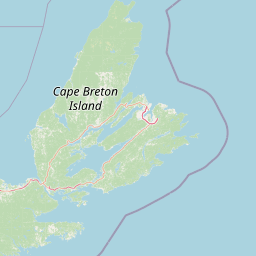
Map view of Country Island National Wildlife Area

Use this park location map to pinpoint Country Island National Wildlife Area in Canada, understand its exact geographic position, and read its mapped placement within the surrounding landscape more clearly.

Pigeon | © OpenStreetMap contributors

Location context for Country Island National Wildlife Area

Nova Scotia
Park atlas

Compare surrounding coastal landscapes and regional wildlife reserves in Atlantic Canada

Explore Protected Areas and Parks Near Réserve nationale de faune de l'Île-Country

Compare adjacent coastal island habitats and regional wildlife reserves following your review of Réserve nationale de faune de l'Île-Country. Expanding your geographical perspective reveals connected conservation networks across nearby Atlantic shores.
Wildlife reserveNova Scotia
About 142 km away#1 closest

North

Sea Wolf Island National Wildlife Area: Protected Sandstone Cliffs and Seabird Sanctuary

Coastal maritime geography and nesting habitats in Nova Scotia

Sea Wolf Island National Wildlife Area constitutes a remote sandstone sanctuary in the Gulf of St. Lawrence. Characterized by steep, eroded cliff faces and isolated terrain, this Canadian protected area remains a significant site for colonial seabird nesting, specifically supporting populations of Great Cormorants and Razorbills within the Atlantic marine ecosystem.

Area
0.76 km²
Established
1982
IUCN
Ia
National parkCanada
About 165 km away#2 closest

Southeast

Sable Island National Park Reserve National Park: Mapped Protected Landscape and Geographic Context

Explore protected area boundaries and natural terrain in this Canadian national park.

Delve into the atlas-focused details of Sable Island National Park Reserve, a Canadian national park defined by its protected landscape identity. Understand its position within the broader geography of Canada, exploring its mapped terrain and the significance of its protected status for informed discovery. This entry provides core geographic and park data.

Area
30 km²
Established
2013
IUCN
II
Visitors
806 annual
National parkPrince Edward Island
About 172 km away#3 closest

Northwest

Prince Edward Island National Park: A Mapped Protected Landscape within Canada's Maritime Region

Discover its geographic context and natural terrain.

Prince Edward Island National Park offers a distinct protected area for exploration within the Canadian Maritimes. As a national park, it represents a commitment to preserving specific natural landscapes and their geographic characteristics. This resource provides insight into its mapped boundaries, regional setting on Prince Edward Island, and its contribution to the broader atlas of protected lands.

Area
27 km²
Established
1937
IUCN
II
Relief
Lowland
Wildlife reserveNova Scotia
About 172 km away#4 closest

Northeast

Réserve nationale de faune du Lac-Big Glace Bay: Coastal Geography and Protected Land Map

Wildlife reserve and coastal sanctuary in Nova Scotia

This protected area centers on a brackish coastal lagoon and a dynamic barrier beach system on the Atlantic coast of Nova Scotia. The reserve provides a critical migratory stopover for waterfowl, with terrain that transitions from exposed sandy shores to regenerated coastal forests on reclaimed land, offering a unique example of maritime ecological restoration.

Area
3.9 km²
Established
2022
IUCN
IV
Relief
Lowland
National parkNova Scotia
About 176 km away#5 closest

North

Cape Breton Highlands National Park: Mapped Protected Landscape in Nova Scotia

Discover its national park geography and natural terrain.

Uncover the protected landscape identity of Cape Breton Highlands National Park, a national park situated in Nova Scotia. This atlas-focused content details its mapped boundaries, regional geographic context, and natural terrain. It serves as a definitive resource for understanding the park's protected-area status and its contribution to the mapped natural landscapes of the region.

Area
949 km²
Established
1936
IUCN
II
Visitors
277.2K annual
A horizontal watercolor painting showing a pale green and soft pink landscape with distant hills, a calm body of water, and a tree-lined shore.
Wildlife reserveNew Brunswick
About 213 km away#6 closest

Northwest

Réserve nationale de faune du Cap-Jourimain: Protected Coastal Wetlands and Wildlife Maps

Essential geographic context for a strategic New Brunswick wildlife reserve

Examine the mapped boundaries and complex ecosystem transitions of Réserve nationale de faune du Cap-Jourimain. This federally protected area in New Brunswick offers a distinct look at coastal marshlands, tidal flats, and island topography situated at the narrowest point of the Northumberland Strait.

Area
6.617 km²
Established
1980
IUCN
IV
Relief
Lowland
A soft watercolor painting showing a coastal landscape with green low-lying vegetation, a stretch of water, and rolling hills in the distance under a pale sky.
Wildlife reserveNova Scotia
About 214 km away#7 closest

West

Boot Island National Wildlife Area: Mapping Coastal Conservation in Nova Scotia

Protecting intertidal mudflats and migratory bird habitats

Located in the Southern Bight of the Minas Basin, Boot Island National Wildlife Area serves as a key protected refuge within the Bay of Fundy. This reserve safeguards essential coastal and marshland habitats that support migratory bird populations, offering a focused look at how specific island geography functions within a larger, dynamic estuarine wetland system.

Area
1.07 km²
Established
1979
IUCN
Ia
Relief
Lowland
Watercolor painting of a tranquil marshy wetland with calm water, sparse dead trees, and distant hills under a light, hazy sky.
Wildlife reserveNova Scotia
About 225 km away#8 closest

West

Amherst Point Migratory Bird Sanctuary: Wetland Protected Landscape and Map Explorer

Nova Scotia Wildlife Reserve and Managed Marshland Habitat

Amherst Point Migratory Bird Sanctuary protects a significant freshwater marsh and ponded wetland network in Nova Scotia. This reserve is defined by its engineered diked impoundments and role as a crucial stopover for migratory birds in the Atlantic flyway, offering a clear window into managed wetland conservation and coastal marsh terrain.

Area
4.33 km²
Established
1947
IUCN
IV

Common questions about visiting, size, designation, and location context for Country Island National Wildlife Area

Country Island National Wildlife Area FAQs for park facts, access, geography, and protected area context

Find quick answers about Country Island National Wildlife Area, including protected-area facts, park geography, trail and visitor context, and how the park fits into its surrounding country and regional landscape.
MoriAtlas Explorer

Continue Your Protected Areas Search Across the Global Atlas

Deepen your exploration by continuing the structured search for national parks and protected areas worldwide. Utilize the comprehensive filtering capabilities to compare different conservation landscapes and refine your understanding of global park geography. Discover more about the distribution and characteristics of protected natural areas.

Global natural geography