
Why Dankmarshäuser Rhäden stands out
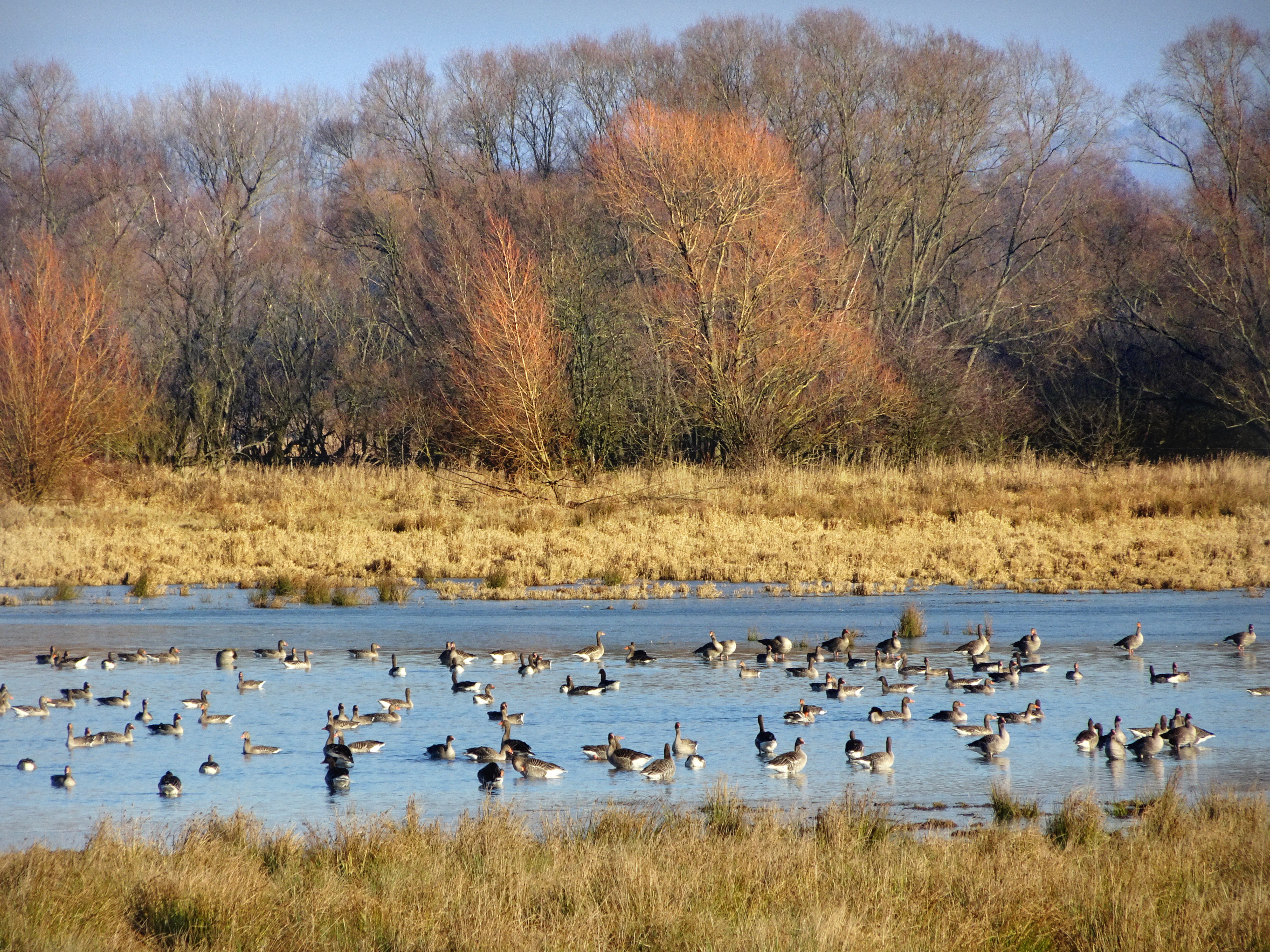
The Dankmarshäuser Rhäden is best known as a wetland bird sanctuary within the Middle Werra valley, particularly for its combination of breeding waterbirds, meadow-nesting waders and large numbers of migratory and wintering waterfowl. Greylag geese winter here in notable flocks, while species such as lapwing, snipe, common redshank-related marshland waders, shoveler and garganey ducks, white stork, marsh harrier, red kite and penduline tit are characteristic of the site. It is also distinguished as a textbook example of wet grassland restoration: what was a drained, intensively farmed agricultural depression through the second half of the 20th century has been intentionally re-flooded using adjustable weir systems, allowing shallow mudflats and shallow-water resting zones to be re-created each spring for passing waders. The mosaic of nutrient-rich and nutrient-poor standing waters, reedbed fringes, wet meadows and developing floodplain forest gives the area a strong ecological identity of an actively managed, semi-natural floodplain in central Germany.
Dankmarshäuser Rhäden history and protected-area timeline
The geological and human history of the Rhäden spans several thousand years. In prehistoric times, between roughly 3000 and 500 BCE, a sizeable lake is believed to have occupied the basin. Evidence from Bronze Age and pre-Roman Iron Age settlements around its shores suggests that the fish-rich lake and the nearby Werra attracted human habitation; after the start of the Common Era, written records become scarce, but the lake evidently silted up gradually and by around 1530 the area was referred to in documents as an old pond. A surviving order from that period forbade the inhabitants of Obersuhl from fishing, hunting and collecting eggs there. Up to modern drainage, the Rhäden was a marshland with reedbeds, willow and alder scrub, and small open water patches.
A decisive transformation came with large-scale drainage in 1859 and 1860, commissioned by the communities of Obersuhl, Bosserode and Dankmarshausen to secure hay and green fodder for local cavalry units. In 1934 the drainage ditches were deepened, intensifying the drying-out. During the GDR era, the Hessian side of the depression became too difficult to drain because of the new border fortifications, and from the early 1970s water levels there were deliberately raised again, regenerating a wetland; the drier Thuringian side, however, continued to be drained by pumping and farmed as arable land up to the boundary strip.
The decisive conservation turning point came after reunification. From 1990 to 1995 the area was provisionally secured under the names Werraaue östlich Dankmarshausen and Schleifenmühle, and on 16 May 1995 the Thuringian State Administrative Office in Weimar formally designated the Dankmarshäuser Rhäden as a state nature reserve. Pumping was halted, drainage was abandoned, and the resulting rewetting forced an end to most arable use. A land consolidation procedure (the first in Thuringia explicitly aimed at implementing nature conservation goals) reorganised property rights so that most of the reserve became public land. In 2008 the area became an EU Habitats Directive site under the Natura 2000 network, and it is also part of the larger EU Birds Directive site Werra-Aue zwischen Breitungen und Creuzburg.
Dankmarshäuser Rhäden landscape and geographic character
Physically, the Dankmarshäuser Rhäden is a shallow subsidence basin, around 2.5 kilometres long and of variable width, set into the Berkaer Becken of the Salzunger Werrabergland natural region. The basin floor lies between about 216 and 230 metres above sea level, with the lowest parts toward the regional watershed that separates the depression from the modern Werra river. To the south and west the terrain rises gently into loess-covered slopes of Pleistocene origin, with rendzina and brown earth soils, while the basin itself is characterised by gley soils over a near-surface water table.
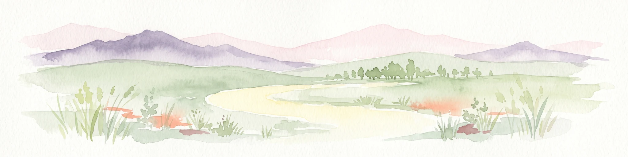
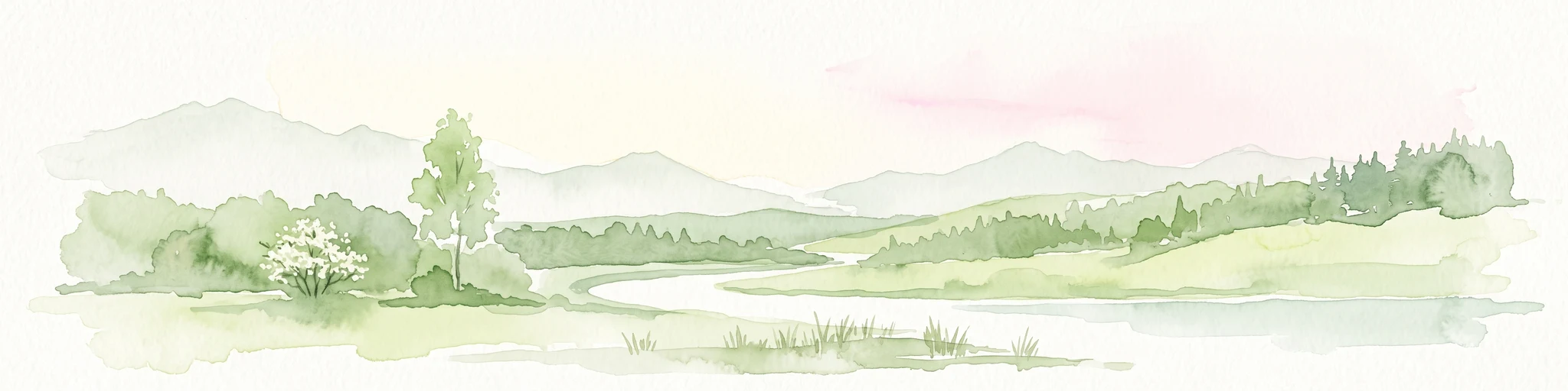
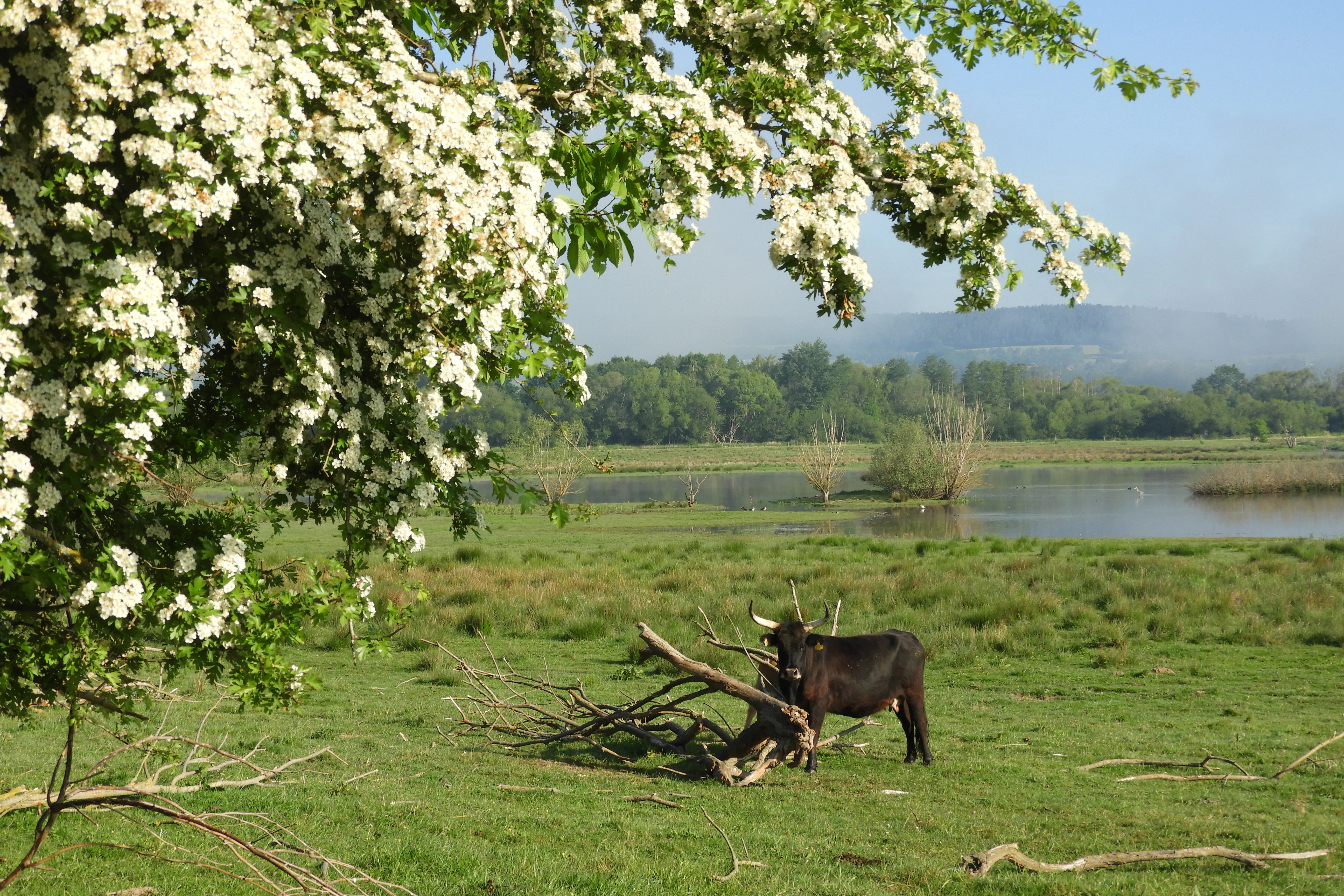
The topographic character is dominated by flatness and water: a network of ditches, ponds, temporary pools and the meandering Suhl/Rhedengraben stream crosses the area. Reedbeds line the channels, while wet meadows, grazed grassland and rough pasture occupy much of the open basin floor. Linear woodland strips, planted orchards, individual trees and small clumps of broadleaved woodland punctuate the otherwise open countryside, partly following the line of the former border strip.
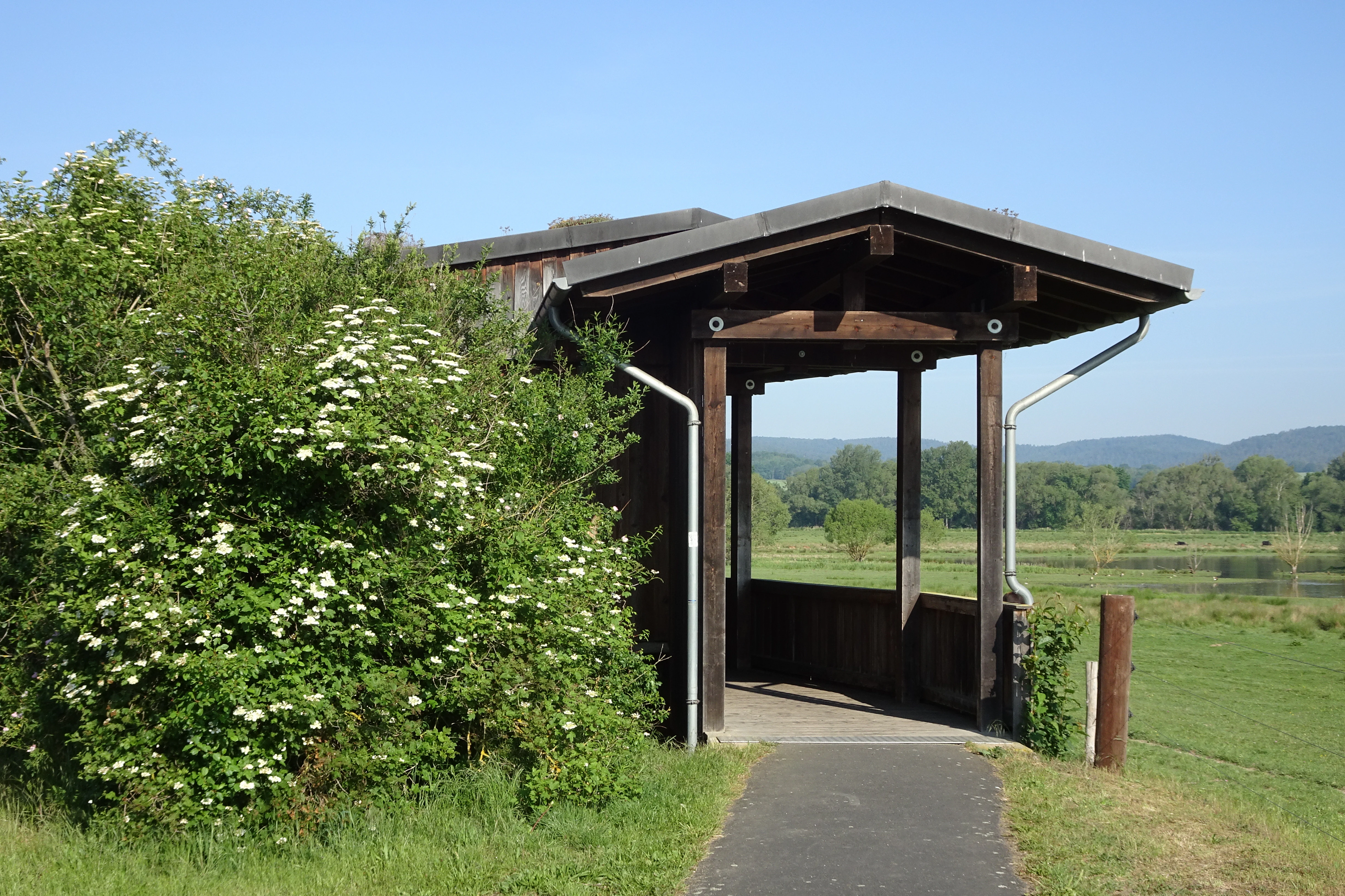
The defining scenic impression is of an open, windswept floodplain with seasonal flooding, distant low ridges, the constant presence of waterfowl, and visible traces of its history as a former no-go border zone: the relic drainage ditch system, the old boundary line retained as a strip of scrub and tall herbs, and the long sightlines across the regulated meadow landscape. Four bird observation hides, including the An der Trift stand visible from the public paths, allow visitors to take in this landscape without disturbing the birds.
Dankmarshäuser Rhäden ecosystems, habitats, and plant life
Ecologically, the Rhäden is a floodplain wetland of unusually high habitat diversity for its size. The mosaic includes nutrient-rich standing waters with pondweed and frogbit communities, nutrient-poor standing waters with shoreweed and dwarf rush communities, silted-up transitional zones between open water and reedbed, reed-fringed ditches dominated by reed canary grass, common reed and pondweed submerged vegetation, tall herb communities and ruderal vegetation along the former border strip, and mesic oat-grass meadows on the slightly drier fringes.
Particularly characteristic are the seasonally flooded wet meadows: a controllable weir system allows water levels to be raised in spring, creating the shallow water and exposed mud that allow characteristic water-knotweed/bidens tall herb communities, water-plantain small reedbed patches, marsh rush, slender sedge and reed canary grass to develop in subsequent drawdown. These wet grasslands are the primary foraging and resting habitat for waterfowl and the rooted substrate for many of the area's characteristic invertebrate and plant communities.
The area also includes planted orchard meadows (Streuobstwiesen) and developing floodplain woodland, with the residual alder and willow scrub that survived the drainage era. The Thuringian administration and its partners have continued adding broadleaved trees, floodplain woodland patches and structured open land with hedgerows, woodlots and scattered trees, creating a fine-grained habitat mosaic rather than a uniform marsh.
Dankmarshäuser Rhäden wildlife and species highlights
The Rhäden's wildlife value is dominated by its birdlife. The site's standard Natura 2000 data form identifies it as ecologically complementary to the directly adjoining Hessian reserve, with particular importance for several threatened bird species listed under Annex I of the Birds Directive and the Habitats Directive. These include sedge warbler, garganey, common teal, garganey (knäkente), little ringed plover, white stork, marsh harrier, house martin, barn swallow, common snipe, red-backed shrike, red kite, penduline tit and northern lapwing. The reserve is also a regionally important stopover for more general meadow and waterbird species.
Over a hundred bird species are recorded annually during the migration seasons. The wetland serves as both breeding habitat and as a staging and wintering ground for waterfowl moving along north-south and southwestern flyways between northern/eastern European breeding areas and wintering grounds in southern Europe and western Asia. Greylag geese winter here in particularly visible flocks, and the spring flooding regime is specifically designed to attract migratory waders by creating fresh mudflats and safe shallow-water roosts.
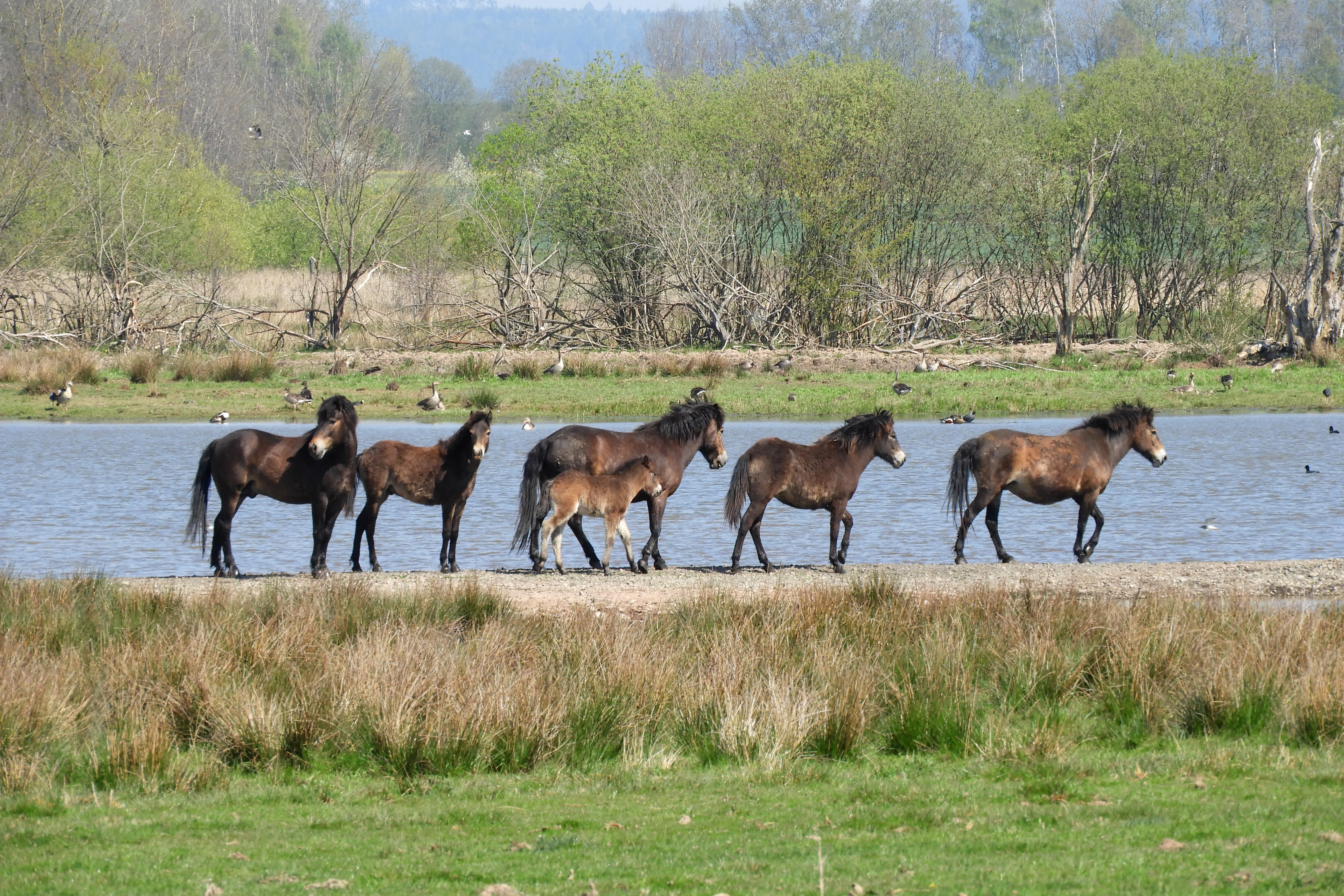
Beyond birds, the reserve supports notable populations of European tree frog and natterjack toad (both Annex IV species under the Habitats Directive), a remarkable grasshopper fauna including short-winged bush-cricket, marsh grasshopper and sickle-bearing bush-cricket, and a documented set of dragonfly species associated with standing waters. Grassland management using Exmoor ponies, Heck cattle and, since 2021, water buffalo, has reshaped sections of the meadow into a more open, structured mosaic with isolated trees and scrub patches that benefit ground-nesting birds and amphibians.
Dankmarshäuser Rhäden conservation status and protection priorities
Conservation significance at the Rhäden operates at three nested levels. At the local and state level, the area is a Thuringian nature reserve originally secured as the union of two provisional orders (Werraaue östlich Dankmarshausen and Schleifenmühle) and formally designated in May 1995; this designation forced the cessation of pumping and rewetted the basin, initiating the recovery of wet habitats that had been drained since the mid-19th century. The biotope-level protection under Germany's federal nature conservation law means that critical habitats are legally protected simply by virtue of their type.
At the European level, the reserve forms the Thuringian share of an EU Habitats Directive site (DE-5026-305, 111 hectares) under Natura 2000, with formally listed habitat types of nutrient-rich standing waters with pondweed or frogbit communities and species-rich dry grasslands of the lowlands. It is also part of the much larger EU Birds Directive special protection area Werra-Aue zwischen Breitungen und Creuzburg, whose conservation objectives cover around 80 bird species and explicitly aim to maintain the near-natural Werra floodplain as a breeding and stopover habitat.
At the landscape level, the Rhäden is a key node in the Green Belt (Grünes Band Deutschland) along the former inner-German border, designated by the Thuringian Landtag in November 2018 as a National Natural Monument (Nationales Naturmonument). The reserve is embedded in an explicit biotope network with neighbouring Thuringian and Hessian reserves, intended to counter the 'island effect' that threatens fragmented wetland populations in modern agricultural landscapes.
Dankmarshäuser Rhäden cultural meaning and human context
The cultural dimension of the Rhäden is inseparable from its border history. Because the wetland sat directly on the inner-German border corridor, decades of restricted access contributed unintentionally to its ecological recovery: drainage infrastructure fell into disuse on the Hessian side, the landscape was abandoned, and wet habitats re-formed spontaneously. After 1990, the land consolidation process that underpinned the nature reserve was explicitly noted as the first in Thuringia to use land reform as a tool for implementing conservation goals, while compensating former owners with land outside the reserve.
There is also longer human history visible in the landscape. Prehistoric settlement evidence around the former Bronze Age and Iron Age lake suggests that the basin supported human communities for thousands of years before it was drained; the first written reference (around 1530) speaks of the Rhäden as an old pond and contains a fishing and hunting ban for local residents, indicating that the area was already managed as a shared resource. The 19th-century drainage was carried out in the name of supplying hay and green fodder to nearby cavalry garrisons, a foregrounding of the site's long-standing strategic and utilitarian role in the Werra valley.
Top sights and standout views in Dankmarshäuser Rhäden
The Dankmarshäuser Rhäden's profile is built around six interlocking strengths: it is a restored floodplain wetland in the Middle Werra valley, with actively managed water levels that re-create seasonal mudflats; it is a recognised stronghold for breeding meadow birds, waterbirds and wintering waterfowl in Thuringia and Hesse; it is a cross-border reserve that complements the larger Hessian Rhäden immediately to the west; it sits within the Green Belt, the former border strip now declared a National Natural Monument; it hosts multiple layers of formal protection (Thuringian nature reserve, Natura 2000 FFH site, EU Birds Directive site); and it is a working example of grazing-based wetland management using hardy livestock (Exmoor ponies, Heck cattle, water buffalo) integrated with a land-consolidation process designed primarily for conservation.
Best time to visit Dankmarshäuser Rhäden
The most rewarding times to visit the Rhäden are spring and late autumn, when seasonal flooding, spring passage and autumn migration bring the highest diversity of waterbirds, waders and wildfowl into the basin; greylag geese are particularly visible in winter, and the bird observation hides are intended to be used throughout the year. Summers are warm with modest rainfall and are well suited to observing breeding bird species and the meadow management with hardy livestock. The climate of the Middle Werra valley is moderate but already quite continental, with cool winters, occasional ice days, and warm summers that can occasionally reach 30 degrees Celsius.