
Mori Atlas logo
Nature reserveDolina Rzeki Brdy Nature Reserve

Mapping the geomorphology of the Brda River corridor in northern Poland

Dolina Rzeki Brdy Nature Reserve: An Atlas of Protected River Valleys and Glacial Terrain

(Rezerwat przyrody Dolina Rzeki Brdy)

Dolina Rzeki Brdy Nature Reserve protects a dynamic, deeply incised river valley carved by the Brda River through the sandy outwash plains of the historic Tuchola Forest. This protected area serves as a showcase of glacial-river morphology, featuring a complex mosaic of meanders, oxbow lakes, steep scarps, and diverse floodplain forests. The terrain reflects centuries of fluvial processes, creating a layered landscape where sandy terraces and riparian woodlands sustain significant biodiversity within the Kuyavian-Pomeranian Voivodeship.

river valleyriparian forestfloodplain forestBrda RiverTuchola Forestlowland landscape
An illustration showing a calm, light-colored river flowing through a forested valley with a distant waterfall and lush greenery.

Dolina Rzeki Brdy Nature Reserve

Nature reserve

Park overview

Structured park overview, official facts, and landscape profile for Dolina Rzeki Brdy Nature Reserve

Dolina Rzeki Brdy Nature Reserve park facts, protected area profile, and essential visitor context

Review the core facts for Dolina Rzeki Brdy Nature Reserve, including designation, size, terrain, visitor scale, habitats, and operating context in one park-focused overview.

About Dolina Rzeki Brdy Nature Reserve

Dolina Rzeki Brdy Nature Reserve is a corridor-shaped protected area dedicating to conserving one of the most scenic and ecologically valuable stretches of the Brda River in northern Poland. It lies within the vast Tuchola Forest complex, an area defined by post-glacial sandy outwash plains, river valleys, and extensive pine and mixed woodland. Rather than protecting a single habitat type, the reserve was designated to preserve the entire natural system of the Brda valley, including its channel dynamics, valley landforms, and the forests that have developed along it.

The valley itself was shaped by the interplay of glacial inheritance and ongoing river processes. As the Brda flows through the reserve, it crosses a sandr landscape and has cut a distinct valley with terraces, short gorge-like sections of glacial channel origin, and steep, often high slopes. The river continuously reshapes its course through bank erosion, deposition, and the growth of aquatic vegetation, producing a shifting mosaic of meanders, side channels, sandbars, and small islands. Steep scarps, rocky ledges, boulder-strewn banks, and windthrown trees lying across the channel add further structural variety and create some of the more demanding conditions along the river.

Ecologically, the reserve supports a remarkably diverse mosaic of forest communities for a river valley. Along the Brda, the most natural stands are floodplain forests of alder and elm, which thrive on the periodically flooded lower terraces. Higher terraces and slopes carry subcontinental fresh pine forest, pine-dominated boreal-like communities, and oak-hornbeam forests whose composition shifts with elevation and exposure. The result is a layered forest landscape where habitat conditions change over short distances, supporting a wide range of plant species, including several protected orchids and trees such as white helleborine, bird's-nest orchid, twayblade, and wild service tree.

The reserve is integrated into a larger protected landscape framework. It lies wholly within the Tuchola Landscape Park, and its territory is divided between the Tuchola and Woziwoda forest districts. Management applies strict, active, and landscape protection regimes, balancing the need to conserve natural processes with the requirement to maintain habitat conditions and protect the scenic quality of the valley. Numerous natural monuments are scattered across the reserve, marking individually notable trees and other features that contribute to its landscape value.

Although primarily a conservation area, the reserve is closely interwoven with the recreational life of the region. The Brda is one of the most popular canoeing rivers in Poland, and the section within the reserve, while among the most demanding due to boulders and fallen trees, is also intensely paddled as part of the classic Bydgoszcz to Swornegacie route. Pedestrian, cycling, and local tourist trails connect the valley to nearby towns such as Tuchola, Cekcyn, and Woziwoda, placing the reserve at the heart of outdoor activity in the Tuchola Forest.

Quick facts and research context for Dolina Rzeki Brdy Nature Reserve

Dolina Rzeki Brdy is a landscape nature reserve in the Tuchola Forest region of the Kuyavian-Pomeranian Voivodeship, covering a long corridor of the Brda River between the villages of Woziwoda and Piła-Młyn. Established in 1994 by order of the Minister of Environmental Protection, Natural Resources, and Forestry, it sits within the Tuchola Landscape Park and is administered across two forest districts. The reserve operates under strict, active, and landscape protection regimes, reflecting the multiple conservation values of the valley.

Protection and recognition

Examine the terrestrial protected area designation and management scope for Dolina Rzeki Brdy Nature Reserve.

Dolina Rzeki Brdy Nature Reserve Protection Status and Governance

Terrestrial conservation records for Dolina Rzeki Brdy Nature Reserve compile official protection status and management scope details into a unified reference view. Structured park data provides clear geographic context regarding the designated territory and baseline conservation boundaries.

Protection details

Protection scope
Terrestrial
Transboundary protection
No
Park context

Deeper park guide and search-rich context for Dolina Rzeki Brdy Nature Reserve

Dolina Rzeki Brdy Nature Reserve history, landscape, wildlife, and travel context

Explore Dolina Rzeki Brdy Nature Reserve through its history, landscape character, ecosystems, wildlife, conservation priorities, cultural context, and seasonal travel timing in a structured park guide built for atlas discovery and search intent.

Why Dolina Rzeki Brdy Nature Reserve stands out

The reserve is best known for protecting a geomorphologically dynamic section of the Brda River, where the watercourse carves a deep, terrace-flanked valley through sand outwash plains. It is distinguished by classic river-valley landforms including meanders, oxbow lakes, river islands, sandbars, steep scarps, boulder fields, and fallen trees spanning the channel. The combination of these landscape features with well-preserved floodplain, slope, and pine forests gives the reserve its strong identity as a showcase of lowland glacial-river morphology in the Tuchola Forest.
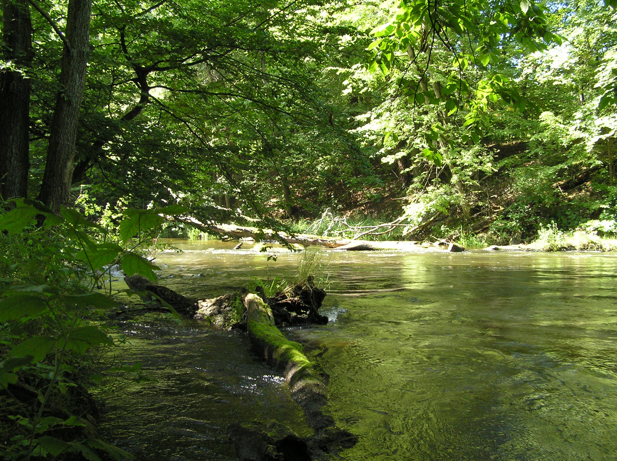
A peaceful river flowing through a lush, green deciduous forest in the Piekiełko area, with a large moss-covered log resting in the foreground water.
The Piekiełko area along the Brda River, featuring dense forest and a natural, mossy riverbank.

Dolina Rzeki Brdy Nature Reserve history and protected-area timeline

Dolina Rzeki Brdy Nature Reserve was created in 1994 under an order of the Minister of Environmental Protection, Natural Resources, and Forestry, issued on 12 September of that year and published in the Polish Monitor of Laws. Its establishment reflected a growing recognition of the scientific, educational, scenic, and recreational value of the Brda valley within the broader Tuchola Forest.

Because the reserve was conceived as a landscape-level protection area rather than a narrow species-focused site, its founding marked an important step in formalizing protection for the entire functioning river-valley system, including its landforms, riparian habitats, and forest cover. Since its creation, the reserve has been managed within the framework of the surrounding Tuchola Landscape Park and across the Tuchola and Woziwoda forest districts, applying a combination of strict, active, and landscape protection regimes to maintain the valley's natural character.

Dolina Rzeki Brdy Nature Reserve landscape and geographic character

The defining feature of the reserve is the long, deeply incised valley of the Brda River. The river crosses an outwash sand plain, cutting through sandy deposits left by retreating glaciers and producing a valley with a clearly developed system of terraces. In some sections the valley adopts a short, canyon-like breakthrough character influenced by former subglacial channels, while in others it broadens into a meander zone with sweeping curves, abandoned loops, and shifting deposits.

The river itself is highly dynamic. Its channel pattern is shaped by ongoing bank erosion, the deposition of sand and gravel, and the growth of aquatic vegetation. Meanders, oxbow lakes, small wooded islands, and sandbars form and reform along its length, creating a constantly evolving mosaic of aquatic and riparian features. Steep scarps and exposed cliff faces line parts of the valley, often accompanied by boulder-strewn slopes and accumulations of fallen trees where windthrown trunks have blocked or deflected the channel. The result is a landscape that is at once rugged and fluid, alternating between confined channel reaches and open, softly meandering sections.

Beyond the immediate river corridor, the surrounding slopes and terraces add further three-dimensional structure. Higher terraces support drier, more stable forest communities, while lower terraces closer to the water carry periodically flooded wet-ground woodland. The combination of these elements gives the valley a layered cross-section in which geology, fluvial processes, and forest cover interact visibly.

Dolina Rzeki Brdy Nature Reserve ecosystems, habitats, and plant life

The reserve's ecological character is built on the close relationship between river processes and forest succession. The Brda valley hosts one of the most diverse forest mosaics in the Tuchola region, with distinct communities occupying different terraces and slope positions. The most natural and ecologically valuable stands are floodplain forests of alder and elm, which develop on the periodically flooded lower terraces and depend on the natural flooding regime of the river.

Above the floodplain zone, subcontinental fresh pine forests and other pine-dominated communities occupy the drier outwash sands, while slope oak-hornbeam forests and subcontinental oak-hornbeam stands clothe the valley sides. This vertical and lateral variation in moisture, soil fertility, and exposure produces a habitat gradient that supports a rich woodland flora, including several protected species. Notable plants documented in the reserve include white helleborine, bird's-nest orchid, twayblade, and wild service tree, alongside many other woodland and wetland specialists.

The combination of moving water, varied banks, stagnant oxbow pools, boulder fields, deadwood, forest interior, and forest edge creates a wide range of niches. Aquatic and semi-aquatic habitats support fish and amphibians, while the forest mosaic provides breeding, feeding, and sheltering conditions for a notably diverse bird and mammal community. Natural monuments, including individual remarkable trees, are distributed across the reserve, marking further points of habitat continuity and landscape character.

Dolina Rzeki Brdy Nature Reserve wildlife and species highlights

The Brda valley's habitat diversity is reflected in unusually rich wildlife records for a river-valley reserve. Surveys have identified a substantial fish community, a notable set of amphibians and reptiles, and a particularly strong bird presence, alongside a diverse mammal fauna that includes species strongly tied to healthy riverine woodland.

Among fish, the reserve is significant for populations including brown trout, which depend on the cooler, well-oxygenated stretches of the Brda. Amphibians and reptiles are present across the range of wetland, aquatic, and forest-edge habitats provided by the valley and its slopes. The bird community is the most extensively documented component, reflecting the structural richness of the valley: standing and flowing water provide habitat for waterfowl, while deadwood-rich forests and valley cliffs offer nesting and hunting conditions for raptors and a wide array of woodland species.

Notable breeding and visitor species documented in the reserve include the black stork, the common goldeneye, the common merganser, the honey buzzard, the black kite, the red kite, the common buzzard, the osprey, the Eurasian hobby, the corncrake, the solitary sandpiper, and the common kingfisher, alongside many typical riparian and forest songbirds such as the grey wagtail. Mammal records include both aquatic species, such as the European beaver and the European otter, and forest-dwelling species such as the hazel dormouse, giving the reserve an unusually complete guild of river-valley mammals. Together, these communities make the reserve an important stronghold for wildlife within the wider Tuchola Forest.

Dolina Rzeki Brdy Nature Reserve conservation status and protection priorities

The reserve's conservation value lies in its role as a protected showcase of a functioning glacial-river valley system. By safeguarding the natural dynamics of the Brda, including its erosion, deposition, flooding, and channel-shifting processes, the reserve preserves ecological processes that are otherwise rare in intensively managed lowland landscapes. These processes sustain the floodplain forests, riparian habitats, and species-rich aquatic communities that depend on the river behaving according to its natural rhythm.

The protected area is also significant for the conservation of forest biodiversity. The floodplain alder and elm woods, slope oak-hornbeam forests, and outwash pine forests each represent habitat types of high conservation importance in their own right, and their occurrence together in one valley system increases the overall value of the reserve for woodland species. The presence of protected plants, natural monuments, and rare fauna reinforces this conservation profile.

Because the reserve lies within the Tuchola Landscape Park, its protection operates within a larger network of complementary conservation designations. The application of strict, active, and landscape protection regimes reflects the need to protect both sensitive natural features and the broader scenic integrity of the valley. In this way, the reserve contributes not only to local biodiversity conservation but also to maintaining the ecological coherence of one of Poland's most important lowland forest complexes.

Dolina Rzeki Brdy Nature Reserve cultural meaning and human context

The reserve is closely tied to the regional identity of the Tuchola Forest, a historic landscape long associated with forestry, river transport, and outdoor life in northern Poland. The Brda River itself has for generations been both a working river and a recreational one, supporting traditional uses such as timber floating and fishing while also serving as a focus for local communities scattered across the forest.

Crossing the reserve are long-established tourist trails, including a section of the Brda foot trail running from Bydgoszcz toward Swornegacie, established hiking routes such as the B. Nowodworski trail linking Tuchola and Cekcyn, and a network of cycling routes including the Greenway Northern Necklace and local loops around Cekcyn and Woziwoda. These routes reflect an enduring cultural tradition of river- and forest-based recreation in the region, connecting the reserve's natural heritage with the everyday outdoor culture of surrounding towns and villages.

Top sights and standout views in Dolina Rzeki Brdy Nature Reserve

The reserve's strongest point of identity is the combination of active river geomorphology and intact valley forests. Meanders, oxbow lakes, river islands, steep scarps, boulder fields, and windthrown trees spanning the channel all occur within a single protected corridor, while alder and elm floodplain forests, pine-dominated outwash forests, and oak-hornbeam slope forests create a layered and ecologically rich woodland landscape.

Best time to visit Dolina Rzeki Brdy Nature Reserve

The Brda valley can be visited meaningfully across the warm half of the year, when river activity, forest conditions, and trail access are most favorable. Late spring and early summer highlight the contrast between the fresh green of the floodplain forests and the still-flowing river, and they are also when many breeding birds are most active along the valley. Midsummer draws canoeists onto the Brda's channels and brings the full recreational character of the reserve into focus. Early autumn adds color to the mixed forests and can be a quieter period along the trails. Seasonal conditions should always be considered in light of the fact that the Brda within the reserve is among the more demanding stretches of the river due to boulders and fallen trees in the channel.
Monthly climate preview

Long term representative point measurements tracking monthly temperature and precipitation rhythm

Dolina Rzeki Brdy Nature Reserve Climate Normals and Annual Temperature Patterns

Representative coordinate records show mean monthly temperatures ranging from subzero winter minimums to warm summer highs alongside steady daily precipitation rates. Examining the full twelve month profile reveals detailed seasonal fluctuations across the protected landscape.
Annual mean8 °C
-3 °C19 °C
Jan-3°
Feb-2°
Mar
Apr
May13°
Jun17°
Jul19°
Aug19°
Sep14°
Oct
Nov
Dec-1°
Warmest month
July

19.4 °C

Coolest month
January

-3 °C

Wettest month
July

2.6 mm/day

Driest month
April

1.2 mm/day

Park location guide

Geography guide, regional context, and park location map for Dolina Rzeki Brdy Nature Reserve

Dolina Rzeki Brdy Nature Reserve park geography, regions, and map view in Poland

Understand where Dolina Rzeki Brdy Nature Reserve sits in Poland through a broader geographic reading of the surrounding landscape, nearby location context, and its mapped position within the national park landscape.

How Dolina Rzeki Brdy Nature Reserve fits into Poland

Poland, officially the Republic of Poland, is a Central European country spanning from the Baltic Sea in the north to the Carpathian Mountains in the south. It borders Germany, Czech Republic, Slovakia, Ukraine, Belarus, Lithuania, and Kaliningrad Oblast. The country has a temperate climate, diverse landscapes, and is known for its rich history, cultural heritage, and strong economic position within the EU.

Wider geography shaping Dolina Rzeki Brdy Nature Reserve in Poland

Poland occupies 312,696 km2 in Central Europe, extending from the Baltic Sea coast in the north to the Sudetes and Carpathian Mountains in the south. It borders Germany to the west, Czech Republic and Slovakia to the south, Ukraine and Belarus to the east, and Lithuania and Kaliningrad Oblast to the northeast. The landscape includes lowland plains, uplands, and mountain ranges.

Map view of Dolina Rzeki Brdy Nature Reserve

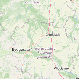
Use this park location map to pinpoint Dolina Rzeki Brdy Nature Reserve in Poland, understand its exact geographic position, and read its mapped placement within the surrounding landscape more clearly.

Pigeon | © OpenStreetMap contributors

Location context for Dolina Rzeki Brdy Nature Reserve

Kuyavian-Pomeranian Voivodeship

Visualizing the river valley, riparian forests, and glacial terrain of northern Poland

Dolina Rzeki Brdy Nature Reserve Photos and Landscape Scenery

Visual documentation captures the dynamic meanders, steep scarps, and wooded terraces that define the Brda River corridor. Examining these protected habitats provides deeper insight into the geomorphology and forest mosaic of the Tuchola Forest region.

A peaceful river flowing through a lush, green deciduous forest in the Piekiełko area, with a large moss-covered log resting in the foreground water.

Park atlas

Compare surrounding river valleys, lowland forests, and regional conservation landscapes

Explore Protected Areas and Parks Near Dolina Rzeki Brdy Nature Reserve

Browse other protected areas near Dolina Rzeki Brdy Nature Reserve to evaluate comparable river valley terrain, glacial outwash plains, and lowland forest ecosystems. Continuing the geographical comparison across northern Poland reveals broader patterns in regional park topography and protected landscape design.
Protected landscapeKuyavian-Pomeranian Voivodeship
Mapped location lies within the park boundary#1 closest

North

Tuchola Landscape Park: Mapped Protected Area and Riverine Geography in Poland

Pine-covered outwash plains and the meandering Brda River corridor

Covering a significant portion of northern Poland, Tuchola Landscape Park protects a distinctive postglacial landscape of sandy plains and dense pine forests. The park geography is anchored by the Brda River, which flows through a series of rapids and breakthroughs before reaching deep into the surrounding pine-clad outwash plain. Detailed map data provides insight into the park's eight nature reserves, which preserve critical wetland, bog, and riverine habitats.

Area
369.83 km²
Established
1985
Relief
Lowland
Climate
Temperate
Nature reserveKuyavian-Pomeranian Voivodeship
About 9.3 km away#2 closest

North

Rezerwat przyrody Jezioro Zdręczno: Mapped Wetland Landscapes and Protected Areas

Wetland habitat and peatland geography in Kuyavian-Pomeranian Voivodeship.

Delve into the geography of Rezerwat przyrody Jezioro Zdręczno, a nature reserve encompassing an overgrown forest lake and expansive peat-forming bogs. This area preserves a sensitive wetland gradient characteristic of the Bory Tucholskie region. The reserve functions as an isolated refuge for relict plant species, offering significant insight into the hydrologically complex landscape of the Kuyavian-Pomeranian Voivodeship.

Area
0.222 km²
Established
1982
Relief
Lowland
Scope
Terrestrial
Protected landscapeKuyavian-Pomeranian Voivodeship
About 15 km away#3 closest

East

Wdecki Park Krajobrazowy: Protected Landscape Atlas and Regional Geography

Forest and river basin terrain in Poland

Examine the geographic foundation of Wdecki Park Krajobrazowy, a protected landscape characterized by the Wda River drainage, glacial erratics, and extensive pine forests. The area supports a rich variety of wetland flora, mires, and managed reservoirs such as the Żur, making it a significant conservation landmark within the wider Bory Tucholskie region of northern Poland.

Area
191.77 km²
Established
1993
Relief
Lowland
Climate
Temperate
A minimalist watercolor painting showing a calm lake or wetland surrounded by soft green trees and gentle hills under a light sky.
Protected areaKuyavian-Pomeranian Voivodeship
About 19 km away#4 closest

East

Sandr Wdy Protected Area: Glacial Geography and Wetland Habitats in Northern Poland

An essential reference area for Bory Tucholskie forest ecology.

Sandr Wdy is a distinctive Natura 2000 protected area shaped by post-glacial processes. The landscape features a flat outwash plain punctuated by lake basins, river valleys, and diverse mire systems. With multiple strict nature reserves integrated into its boundaries, the site provides a comprehensive view of how hydrological and soil conditions influence habitat distribution within the broader forest landscape of Poland.

Area
63.21 km²
Established
2011
Relief
Lowland
Climate
Temperate
Biosphere reserveKuyavian-Pomeranian Voivodeship
About 20 km away#5 closest

North

Rezerwat Biosfery Bory Tucholskie: Protected Forest and Regional Landscape Map

Key protected zones in the Kuyavian-Pomeranian Voivodeship

Rezerwat Biosfery Bory Tucholskie encompasses the largest continuous forest complex in Poland, structured into a formal UNESCO framework. The terrain features postglacial outwash plains, chain lakes, and rare yew reserves that create a distinct ecological mosaic. This overview details the park's geographic layout, surrounding landscape parks, and the connection between its core nature reserves and the wider regional basin.

Area
3,195 km²
Established
2010
Relief
Lowland
Climate
Temperate
A horizontal watercolor illustration showing a calm lake surrounded by greenery and distant rolling hills, with reeds in the foreground.
Nature reserveKuyavian-Pomeranian Voivodeship
About 21 km away#6 closest

East

Rezerwat przyrody Jezioro Piaseczno: Nature Reserve and Regional Landscape Geography

Protected post-glacial lake habitats within the Bory Tucholskie region.

Located in the Kuyavian-Pomeranian Voivodeship, this nature reserve protects a rare, high-purity glacial lake and its dense woodland surroundings. The area offers a detailed view of post-glacial landscape formation, featuring a complex mix of mires, alder-ash riparian forests, and dry coniferous stands that define the natural character of the Polish northern lake district.

Area
1.59 km²
Established
2001
Relief
Lowland
Climate
Temperate
Nature reservePomeranian Voivodeship
About 22 km away#7 closest

Northwest

Rezerwat przyrody Mętne: An Atlas View of Peatlands in the Pomeranian Voivodeship, Poland

A preserved mosaic of mires, bog ecosystems, and forest lake habitats.

Rezerwat przyrody Mętne is a specialized protected area in northern Poland, centered on the intricate peat-building processes of the Tuchola Forest. The reserve features rare dwarf birch populations and sensitive bog communities, functioning as a critical natural site for hydrological stability. Gain insights into the mapped extent of these mire habitats and their ecological integration within the wider Bory Tucholskie landscape.

Area
1.034 km²
Established
1963
Relief
Lowland
Scope
Terrestrial
Protected landscapePomeranian Voivodeship
About 26 km away#8 closest

Northwest

Zaborski Park Krajobrazowy: Geographic Profile of a Polish Protected Landscape Area

Tuchola Forest region, Pomeranian Voivodeship

Investigate the unique terrain of Zaborski Park Krajobrazowy, a protected landscape defined by its dense network of glacial lakes and sandy outwash plains. This territory provides a comprehensive view of northern Polish lowland geography, highlighting the ecological significance of its river valleys and relic forest habitats within the broader Tuchola Forest ecosystem.

Area
340.3 km²
Established
1990
Relief
Lowland
Climate
Temperate

Common questions about visiting, size, designation, and location context for Dolina Rzeki Brdy Nature Reserve

Dolina Rzeki Brdy Nature Reserve FAQs for park facts, access, geography, and protected area context

Find quick answers about Dolina Rzeki Brdy Nature Reserve, including protected-area facts, park geography, trail and visitor context, and how the park fits into its surrounding country and regional landscape.
MoriAtlas Explorer

Continue Your Protected Areas Search Across the Global Atlas

Deepen your exploration by continuing the structured search for national parks and protected areas worldwide. Utilize the comprehensive filtering capabilities to compare different conservation landscapes and refine your understanding of global park geography. Discover more about the distribution and characteristics of protected natural areas.

Global natural geography