
Mori Atlas logo
Protected areaSandr Wdy

A mosaic of post-glacial lake basins, river-incised valleys, and protected mires in the Bory Tucholskie.

Sandr Wdy Protected Area: Glacial Sandr Plain and Forested Wetland Ecology in Northern Poland

(Sandr Wdy (PLH 040017))

Sandr Wdy represents a significant protected habitat within the Bory Tucholskie forest complex, defined by its classic glacial outwash plain deeply incised by the Wda River. This area functions as a sanctuary for diverse ecological systems, ranging from raised peatlands and dystrophic lakes to inland sand grasslands and alder-ash forests. By preserving these near-natural patterns, the site serves as a vital reference area for the complex geography of northern Polish lowland terrain.

sandrglacial landscapeBory Tucholskiepine forestwetlandsraised bogs
A flat vector-style illustration showing a waterfall flowing into a calm body of water, flanked by pine trees and distant rolling hills in a soft, muted color palette.

Sandr Wdy

Protected area

Park overview

Structured park overview, official facts, and landscape profile for Sandr Wdy

Sandr Wdy park facts, protected area profile, and essential visitor context

Review the core facts for Sandr Wdy, including designation, size, terrain, visitor scale, habitats, and operating context in one park-focused overview.

About Sandr Wdy

Sandr Wdy is a habitat-oriented Special Area of Conservation in northern Poland, embedded in the Bory Tucholskie, one of the largest continuous forest complexes in the country. The site focuses on the conservation of natural habitat types listed under the EU Habitats Directive, and it is recognized both for its glacial landforms and for the unusually rich set of wetland, mire, and forest communities that have developed within them.

The protected landscape is shaped by the last Baltic glaciation, particularly its Pomeranian phase, leaving behind broad outwash plains of loose sand interspersed with gravels and stones. The Wda River and its tributaries have cut deeply into this sandr, producing steep valley slopes, glacial channels, and a chain of lakes and kettle bogs. Inland dunes and moraine hills add further relief, while the generally deep groundwater table shapes how vegetation establishes across the terrain.

Although the pine-dominated forests are largely the result of historical forestry management, the underlying ecological patterns remain close to natural. Sandy, nutrient-poor soils combine with the area's varied relief and dense hydrographic network to support an unusually broad range of rare and threatened habitats. These include dystrophic and eutrophic lakes with floating and submerged vegetation, raised bogs, transition mires, calcareous fens, inland sand grasslands, wet Molinia meadows, lowland hay meadows, oak-hornbeam forests, boggy pine and birch woodlands, and riparian forests dominated by willow, poplar, alder, and ash.

The conservation value of the area is reinforced by six nature reserves within or overlapping its boundaries: Zdrójno, Krzywe Koło w Pętli Wdy, Jezioro Piaseczno, Brzęki im. Zygmunta Czubińskiego, Dury, and Miedzno. Together, these reserves protect the area's most sensitive ecological assets, from old-growth forest stands to undisturbed peatlands and dystrophic lake systems.

Quick facts and research context for Sandr Wdy

Sandr Wdy is a Polish Natura 2000 habitat site (PLH 040017) located in the Bory Tucholskie, spanning parts of Świecie and Starogard counties. The site overlaps the core of the Wdecki Park Krajobrazowy and is managed across several state forest districts. It was formally adopted by the European Commission as a Site of Community Importance on 10 January 2011.

The protected area is defined by glacial sandr terrain, with scattered moraine features, inland dunes, river valleys, glacial channels, and kettle holes. Porous sandy soils, varied relief, and a well-developed hydrographic network support a concentration of rare habitats, from dystrophic lakes and raised bogs to sand grasslands and riparian forests.

Protection and recognition

Terrestrial conservation history, designation year, and Natura 2000 records.

Sandr Wdy Protection Status and International Recognition Details

Sandr Wdy holds documented terrestrial protection status established in 2011 alongside official Natura 2000 recognition records. Structured conservation data outlines the designation history and management scope associated with the protected landscape.

International recognition

Protection details

Protection scope
Terrestrial
Designated year
2011
Transboundary protection
No
Park context

Deeper park guide and search-rich context for Sandr Wdy

Sandr Wdy history, landscape, wildlife, and travel context

Explore Sandr Wdy through its history, landscape character, ecosystems, wildlife, conservation priorities, cultural context, and seasonal travel timing in a structured park guide built for atlas discovery and search intent.

Why Sandr Wdy stands out

Sandr Wdy is best known for its post-glacial sandr landscape, where flat outwash plains are deeply cut by the Wda River and its tributaries, creating a pattern of lakes, mires, and valley wetlands within a pine-forest setting. It stands out as one of the most ecologically valuable fragments of the Bory Tucholskie. The site is also recognized for the diversity of protected habitats it concentrates in a relatively compact area, including dystrophic lakes, raised and transitional peatlands, inland sand grasslands, wet Molinia meadows, and fragments of oak-hornbeam and alder-ash forests. Its cluster of strict nature reserves, including Dury, Miedzno, and Jezioro Piaseczno, reinforces its significance as a reference area for glacial lowland ecology in northern Poland.
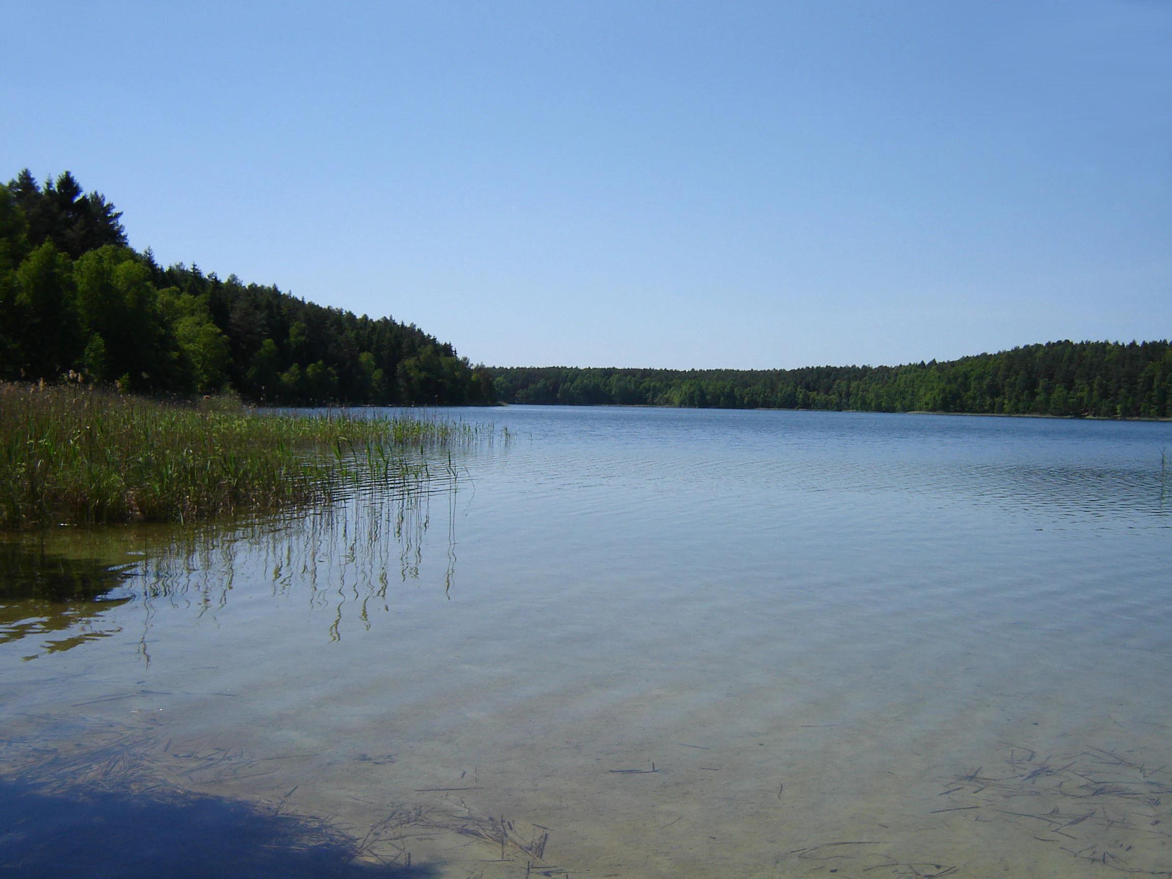
A calm, clear lake surrounded by dense green forest under a bright blue sky, with reeds along the shoreline.
A view of the serene waters of Piaseczno Lake, situated within the forested landscape of the protected area.

Sandr Wdy history and protected-area timeline

Sandr Wdy was formally established through a decision of the European Commission adopted on 10 January 2011, which approved the site as a Site of Community Importance under the Natura 2000 network. The site carries the official code PLH 040017 and was designated specifically as a Special Area of Conservation for habitats, reflecting the priority placed on the area's wetland, mire, and forest habitat types rather than on individual species.

Its designation followed the long-standing recognition of the surrounding Bory Tucholskie as a forest region of exceptional natural value in Poland. The earlier protected framework around the area was already extensive, with strict nature reserves such as Dury, Miedzno, Jezioro Piaseczno, Zdrójno, Krzywe Koło w Pętli Wdy, and Brzęki im. Zygmunta Czubiński having been established in earlier decades to safeguard the most sensitive forest, lake, and peatland communities within the broader landscape.

The post-2011 period has seen the site integrated into the wider Natura 2000 management framework, with forest management continuing under the relevant Regional Directorate of State Forests in Gdańsk through the Dąbrowa, Lubichowo, Osie, and Trzebciny forest districts.

Sandr Wdy landscape and geographic character

The landscape of Sandr Wdy is essentially a glacial sandr, a broad outwash plain built from loose sands with insertions of gravels and rounded stones, sloping gently southward and reaching roughly 104 to 106 meters above sea level near Błędno. The generally flat sandr surface is dissected by the deeply incised valley of the Wda River and by a network of glacial channels, kettle holes, and meltwater depressions.

Moraine remnants break the uniformity of the plain, especially inland dunes and patches of hummocky terrain, while the river valleys and glacial channels add depth and contrast to an otherwise low-relief landscape. The deep groundwater table across most of the sandr limits surface water outside wetlands and valleys, concentrating moisture-related landforms along the major drainage lines.

This combination of open sandr, valley mires, lake basins, and dune ridges gives the area its characteristic patchwork of dry pine forest, open peatland, and quiet water bodies, even though parts of the broader landscape have been shaped by long-term human use.
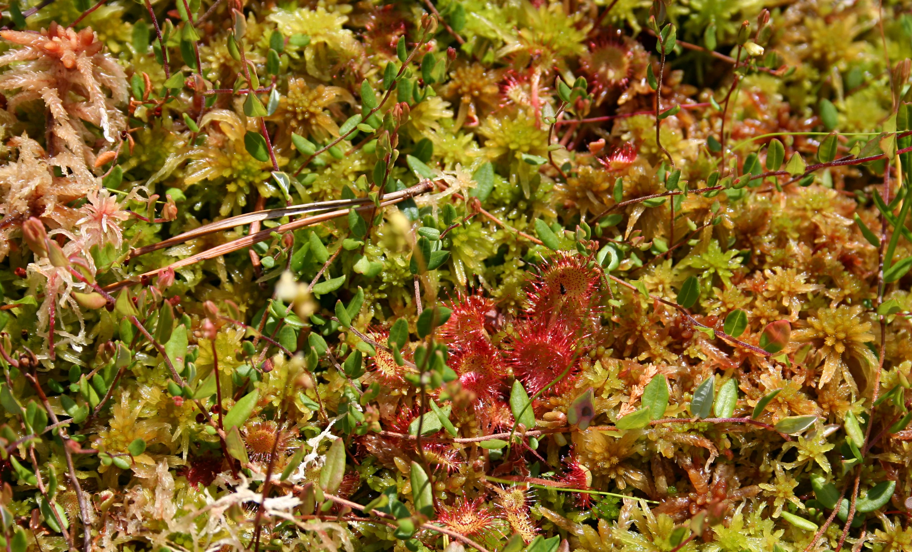
A high-angle close-up view of a peat bog surface showing dense green and brownish Sphagnum moss with scattered red round-leaved sundew plants.
A close-up view of Sphagnum moss and sundew plants in the Dury reserve.

Sandr Wdy ecosystems, habitats, and plant life

The ecological character of Sandr Wdy is defined by the interaction between nutrient-poor sandy soils, varied glacial topography, and a well-developed network of surface waters. The result is a concentration of habitats that are increasingly rare in the Polish lowlands, from open water bodies and peatlands to dry sand grasslands and diverse forest communities.

Aquatic and mire habitats form a core part of the site's identity. These include old river arms and natural eutrophic lakes with Nymphaeion and Potamion vegetation, dystrophic lakes typical of acidified humic waters, raised bogs with active Sphagnum-dominated peat-forming communities, transition mires and quaking bogs characteristic of the Scheuchzerio-Caricetea nigrae group, and calcareous fens attached to localized mineral-rich seepages.

Open and semi-open dry habitats are equally important, especially inland sand grasslands of the Koelerion glaucae type and wet, variable Molinia meadows, alongside traditionally managed lowland hay meadows of the Arrhenatherion elatioris type. Forest communities range from boggy pine and birch woodlands to central European oak-hornbeam forests and a full suite of riparian forests dominated by willow, poplar, alder, and ash, reflecting the gradient from dry sandr to permanently waterlogged valley floors.

Sandr Wdy wildlife and species highlights

The wildlife of Sandr Wdy reflects the diversity of its habitats, with particular strength in freshwater fauna, amphibians, and mammals associated with extensive forest and wetland complexes. Fish communities in the Wda and its tributaries include asp, vimba bream, white-finned gudgeon, European bitterling, spined loach, and brook lamprey, indicating relatively clean, structured river habitats.

Amphibians are well represented, with fire-bellied toad and the crested newt among the notable species breeding in the area's varied wetlands. Mammal fauna includes otter along the watercourses, gray wolf moving through the larger forest landscape, Eurasian beaver shaping wetland margins, and Western barbastelle bats foraging over forest and water edges. Moose also occur in the forested areas, while red kite is recorded as a breeding raptor.

Invertebrate interest is significant, with the bright jewel beetle (haczykowiec błyszczący), the scarce large blue butterfly (czerwończyk nieparek), and the green hawker (trzepla zielona) among the characteristic species, alongside thick-shelled river mussels. Among plants, Lipiennik Loesela is among the most valued species recorded for the site's open mire and sand grassland habitats.

Sandr Wdy conservation status and protection priorities

Sandr Wdy is one of the most ecologically valuable fragments of the Bory Tucholskie, and its conservation importance has been formally recognized through its inclusion in the European Natura 2000 network as a Site of Community Importance. Its designation focuses on the protection of natural habitat types rather than individual species, reflecting the outstanding concentration of mire, wetland, lake, grassland, and forest habitats within a single contiguous area.

The site overlaps the core of the Wdecki Park Krajobrazowy and contains six strict nature reserves: Zdrójno, Krzywe Koło w Pętli Wdy, Jezioro Piaseczno, Brzęki im. Zygmunta Czubińskiego, Dury, and Miedzno. This nested protection system gives additional security to the most sensitive elements of the landscape, particularly dystrophic lakes, active raised bogs, old river arms, and key forest stands.

From a broader conservation perspective, Sandr Wdy represents a reference area for glacial lowland ecosystems in northern Poland, where the combination of acidic sandy soils, deep glacial channels, and extensive mires creates habitat conditions difficult to replicate elsewhere under modern land use. Its continued integrity is therefore important both for regional biodiversity and for the connectivity of habitat networks across the Bory Tucholskie.

Top sights and standout views in Sandr Wdy

Sandr Wdy's strongest points of distinction lie in its combination of a classic glacial sandr plain deeply dissected by the Wda River, a dense network of dystrophic lakes, raised bogs, and kettle mires, and an unusually full suite of lowland forest types, all concentrated within a single Natura 2000 site. The overlapping strict nature reserves further reinforce its role as a sanctuary for undisturbed peatland and lake habitats.

Equally distinctive is the persistence of near-natural habitat patterns in a landscape shaped by historical forestry, demonstrating how pine-dominated forests can retain their underlying ecological character when soil and hydrological conditions are maintained. The result is an area that is simultaneously a working forest landscape and a significant stronghold for some of northern Poland's rarest mire and wetland habitats.
Monthly climate preview

Long-term representative measurements for Sandr Wdy climate by month

Sandr Wdy Climate Normals, Annual Temperature and Precipitation Rhythms

Representative baseline records for Sandr Wdy show measured variations in average temperature and monthly precipitation across a multi-year climatology period. Detailed twelve-month climate normals provide broader context for studying long-term meteorological patterns at this protected location.
Annual mean8 °C
-3 °C19 °C
Jan-3°
Feb-2°
Mar
Apr
May13°
Jun17°
Jul19°
Aug19°
Sep14°
Oct
Nov
Dec-1°
Warmest month
July

19.4 °C

Coolest month
January

-3 °C

Wettest month
July

2.6 mm/day

Driest month
April

1.2 mm/day

Park location guide

Geography guide, regional context, and park location map for Sandr Wdy

Sandr Wdy park geography, regions, and map view in Poland

Understand where Sandr Wdy sits in Poland through a broader geographic reading of the surrounding landscape, nearby location context, and its mapped position within the national park landscape.

How Sandr Wdy fits into Poland

Poland, officially the Republic of Poland, is a Central European country spanning from the Baltic Sea in the north to the Carpathian Mountains in the south. It borders Germany, Czech Republic, Slovakia, Ukraine, Belarus, Lithuania, and Kaliningrad Oblast. The country has a temperate climate, diverse landscapes, and is known for its rich history, cultural heritage, and strong economic position within the EU.

Wider geography shaping Sandr Wdy in Poland

Poland occupies 312,696 km2 in Central Europe, extending from the Baltic Sea coast in the north to the Sudetes and Carpathian Mountains in the south. It borders Germany to the west, Czech Republic and Slovakia to the south, Ukraine and Belarus to the east, and Lithuania and Kaliningrad Oblast to the northeast. The landscape includes lowland plains, uplands, and mountain ranges.

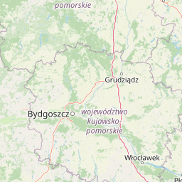
Map view of Sandr Wdy

Use this park location map to pinpoint Sandr Wdy in Poland, understand its exact geographic position, and read its mapped placement within the surrounding landscape more clearly.

Pigeon | © OpenStreetMap contributors

Location context for Sandr Wdy

Kuyavian-Pomeranian VoivodeshipPomeranian Voivodeship

Visualizing the post glacial outwash plain, river valleys, and pine forest habitats

Sandr Wdy Photos and Protected Landscape Scenery

Visual documentation of Sandr Wdy reveals the intricate topography of its glacial outwash plain and deeply incised river valleys. Examining these protected area views provides a clearer understanding of local mire habitats, pine forests, and post glacial terrain.

A calm, clear lake surrounded by dense green forest under a bright blue sky, with reeds along the shoreline.

A calm, dark-colored lake bordered by vibrant green grasses in the foreground and a dense line of pine trees in the background under a blue sky with scattered clouds.

A high-angle close-up view of a peat bog surface showing dense green and brownish Sphagnum moss with scattered red round-leaved sundew plants.

Park atlas

Compare adjacent glacial terrain and protected habitats across northern Poland

Explore Other Parks Near Sandr Wdy and Surrounding Protected Landscapes

Continue browsing other protected areas near Sandr Wdy to examine similar post-glacial outwash plains and river valleys. Comparing these adjacent forest ecosystems reveals broader regional patterns in lowland conservation and regional geography.
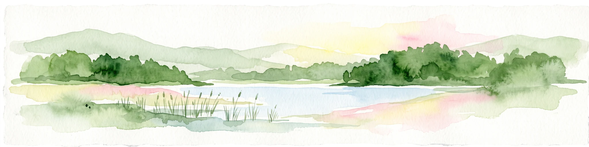
A watercolor painting showing a soft, atmospheric landscape with a winding body of water, green treelines, and patches of pinkish bog vegetation against a pale, warm sky.
Nature reserveKuyavian-Pomeranian Voivodeship
Mapped location lies within the park boundary#1 closest

Northwest

Dury Nature Reserve: Protected Wetland and Peatland Geography in Kuyavian-Pomeranian Voivodeship

Strictly protected dystrophic lake and bog habitats

Dury Nature Reserve is a specialized botanical and hydrological site in the Tuchola Forest. It preserves a distinct mosaic of four dystrophic lakes surrounded by peat bogs. The reserve is a core component of local wetland conservation, protecting rare bog species and maintaining the integrity of northern Polish forest ecosystems.

Area
0.13 km²
Established
1975
Relief
Lowland
Climate
Temperate
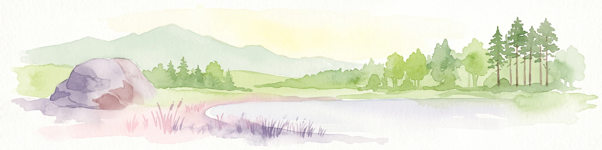
A horizontal watercolor illustration showing a calm lake surrounded by greenery and distant rolling hills, with reeds in the foreground.
Nature reserveKuyavian-Pomeranian Voivodeship
Mapped location lies within the park boundary#2 closest

Northwest

Rezerwat przyrody Jezioro Piaseczno: Nature Reserve and Regional Landscape Geography

Protected post-glacial lake habitats within the Bory Tucholskie region.

Located in the Kuyavian-Pomeranian Voivodeship, this nature reserve protects a rare, high-purity glacial lake and its dense woodland surroundings. The area offers a detailed view of post-glacial landscape formation, featuring a complex mix of mires, alder-ash riparian forests, and dry coniferous stands that define the natural character of the Polish northern lake district.

Area
1.59 km²
Established
2001
Relief
Lowland
Climate
Temperate
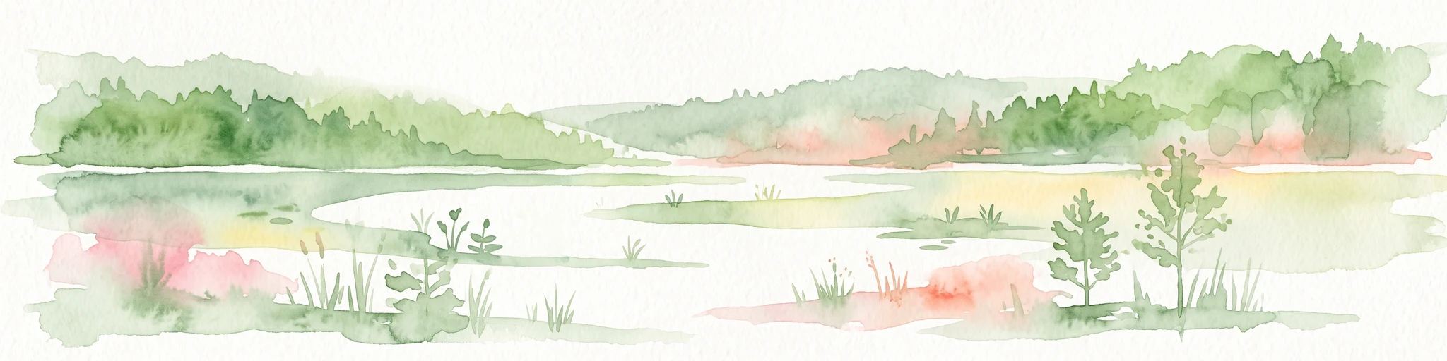
A panoramic watercolor illustration showing a calm lake bordered by pine trees and patches of pink shrubs under a pale sky.
Nature reservePoland
Mapped location lies within the park boundary#3 closest

North

Rezerwat przyrody Miedzno: Wetland and Peatland Protected Area in Northern Poland

Geographic atlas of the Miedzno nature reserve and its glacial valley.

Rezerwat przyrody Miedzno represents a vital ecological corridor in Poland, defined by its flow-through lake, alder-birch swamp forests, and rare marshland flora. This nature reserve, situated within the Wdecki Landscape Park, provides a detailed view into the post-glacial topography and avian conservation landscapes of the Bory Tucholskie mesoregion.

Area
0.885 km²
Established
1968
Relief
Lowland
Climate
Temperate
Protected landscapeKuyavian-Pomeranian Voivodeship
Park boundaries overlap#4 closest

West

Wdecki Park Krajobrazowy: Protected Landscape Atlas and Regional Geography

Forest and river basin terrain in Poland

Examine the geographic foundation of Wdecki Park Krajobrazowy, a protected landscape characterized by the Wda River drainage, glacial erratics, and extensive pine forests. The area supports a rich variety of wetland flora, mires, and managed reservoirs such as the Żur, making it a significant conservation landmark within the wider Bory Tucholskie region of northern Poland.

Area
191.77 km²
Established
1993
Relief
Lowland
Climate
Temperate
Nature reserveKuyavian-Pomeranian Voivodeship
About 1.7 km away#5 closest

North

Rezerwat przyrody Jezioro Łyse: Protected Peatland and Bog Lake Geography in Poland

Wetland ecosystems of the Tuchola Forest region

Rezerwat przyrody Jezioro Łyse represents a preserved 20.55 hectare peatland basin in the Kuyavian-Pomeranian Voivodeship. This nature reserve highlights the intersection of open water, bog pine forests, and sphagnum-dominated peatlands, providing a critical study of lowland wetland terrain and protected plant communities in northern Poland.

Area
0.206 km²
Established
2006
Relief
Lowland
Climate
Temperate
Nature reservePomeranian Voivodeship
About 6.7 km away#6 closest

Northeast

Rezerwat przyrody Jezioro Udzierz Nature Reserve Geographic and Ecological Overview

Wetland habitat mosaic in the Pomeranian Voivodeship

Rezerwat przyrody Jezioro Udzierz protects a compact yet biodiverse wetland mosaic centered on Lake Udzierz. Located in the heart of the Bory Tucholskie forest, the reserve integrates open water, reedbeds, peatlands, and wet meadows into a single, cohesive ecological unit. This detailed view examines the reserve's protected status, landscape composition, and its vital role as a refuge for bird species within the wider geography of northern Poland.

Area
2.299 km²
Established
2000
Relief
Lowland
Climate
Temperate
Protected landscapeKuyavian-Pomeranian Voivodeship
8.8 km away#7 closest

West

Tuchola Landscape Park: Mapped Protected Area and Riverine Geography in Poland

Pine-covered outwash plains and the meandering Brda River corridor

Covering a significant portion of northern Poland, Tuchola Landscape Park protects a distinctive postglacial landscape of sandy plains and dense pine forests. The park geography is anchored by the Brda River, which flows through a series of rapids and breakthroughs before reaching deep into the surrounding pine-clad outwash plain. Detailed map data provides insight into the park's eight nature reserves, which preserve critical wetland, bog, and riverine habitats.

Area
369.83 km²
Established
1985
Relief
Lowland
Climate
Temperate
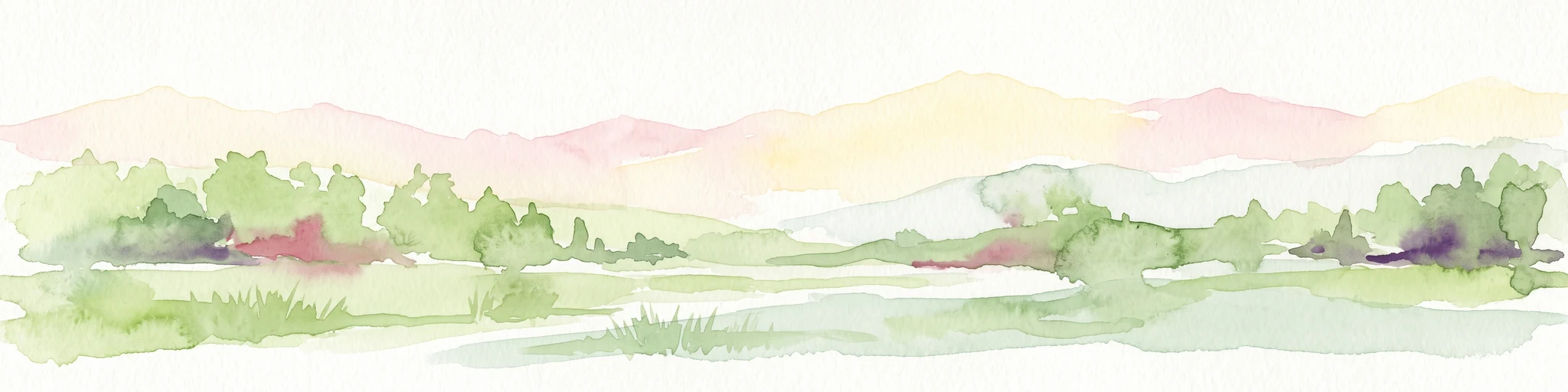
Watercolor painting of a wide, soft-focus river valley landscape with gentle hills, green vegetation, and a winding waterway.
Protected landscapeKuyavian-Pomeranian Voivodeship
19 km away#8 closest

South

Chełmiński Park Krajobrazowy: Geographic Overview of Protected Lands in Kuyavian-Pomeranian

Glacial moraine terrain and Vistula valley protected landscapes

Chełmiński Park Krajobrazowy preserves a compact, high-contrast landscape where glacial moraine hills meet the active river corridors of the Lower Vistula. The area is defined by its five distinct nature reserves that safeguard unique slope habitats, island-like floodplain forests, and post-glacial lake basins, offering an essential reference for studying the geomorphology of the Polish lowlands.

Area
223.36 km²
Established
1998
Scope
Terrestrial
Water
Major water bodies

Common questions about visiting, size, designation, and location context for Sandr Wdy

Sandr Wdy FAQs for park facts, access, geography, and protected area context

Find quick answers about Sandr Wdy, including protected-area facts, park geography, trail and visitor context, and how the park fits into its surrounding country and regional landscape.
MoriAtlas Explorer

Continue Your Protected Areas Search Across the Global Atlas

Deepen your exploration by continuing the structured search for national parks and protected areas worldwide. Utilize the comprehensive filtering capabilities to compare different conservation landscapes and refine your understanding of global park geography. Discover more about the distribution and characteristics of protected natural areas.

Global natural geography