
Mori Atlas logo
Wildlife reserveDolly Sods Wilderness

Mapping the sub-arctic terrain and unusual ecological recovery of this sprawling upland wildlife reserve.

Dolly Sods Wilderness: A High-Elevation Protected Landscape in the Allegheny Mountains of West Virginia

Dolly Sods Wilderness represents a unique federally designated protected area sitting atop the Allegheny Mountains of West Virginia. Spanning high-elevation plateaus along the Eastern Continental Divide, this wildlife reserve contains a diverse array of windswept heath barrens, sphagnum bogs, and sculpted red spruce forests. The terrain serves as a significant example of ecological regeneration following historic logging, now providing a vast, protected habitat that mirrors the character of more northern latitudes.

wilderness areaAppalachian plateauAllegheny Mountainshigh elevationsphagnum bogheath barren
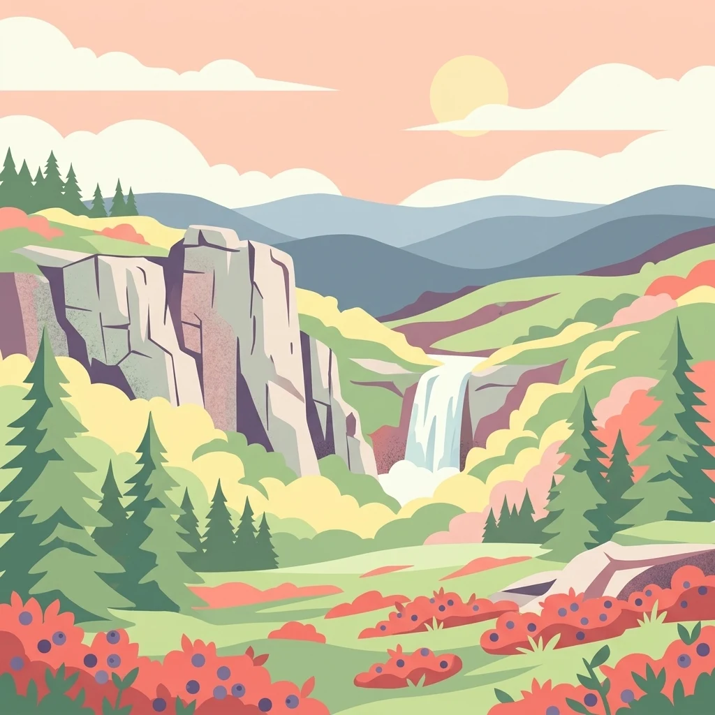
A flat-style digital illustration of a mountain valley featuring tall rocky cliffs, a waterfall, evergreen trees, and fields of wild berry bushes under a soft sunset sky.

Dolly Sods Wilderness

Wildlife reserve

Park overview

Structured park overview, official facts, and landscape profile for Dolly Sods Wilderness

Dolly Sods Wilderness park facts, protected area profile, and essential visitor context

Review the core facts for Dolly Sods Wilderness, including designation, size, terrain, visitor scale, habitats, and operating context in one park-focused overview.

About Dolly Sods Wilderness

Dolly Sods Wilderness is one of the most distinctive protected landscapes in the eastern United States. It occupies a high plateau along the Allegheny Front in eastern West Virginia and is part of the Monongahela National Forest. Although it lies at roughly 39 degrees north latitude, the combination of elevation, exposure, and ecological history gives the area an atmosphere more commonly associated with boreal or sub-alpine environments hundreds of miles to the north.

Geographically, the wilderness lies along the Eastern Continental Divide. Most of its surface drains westward through the North Fork of Red Creek into the Cheat, Monongahela, and ultimately the Mississippi River system, while the eastern flanks contribute to the South Branch of the Potomac and the Chesapeake Bay. The terrain includes exposed rocky plateau, canyon-like drainages cut by Red Creek, and prominent summits such as Blackbird Knob, Breathed Mountain, and Coal Knob. The Allegheny Front forms a dramatic eastern escarpment, with sandstone cliffs and conglomerate crags like Lion's Head Rock offering sweeping views.

Ecologically, Dolly Sods is a meeting point of northern and southern Appalachian systems. Open sphagnum bogs, heath barrens filled with blueberry, huckleberry, cranberry, rhododendron, and mountain laurel, and scattered stands of stunted red spruce all coexist with maturing northern hardwood forests in the protected coves and tributaries. The result is a mosaic of habitats unusually compressed into a single small wilderness area, which has made it a long-standing site of interest for botanists and ecologists studying succession, disturbance, and northern plant communities at the edge of their range.

Beyond its natural character, Dolly Sods carries a layered human history. It was first traversed by European surveyors in the 1740s, named for a German homesteader family, extensively logged and burned in the late nineteenth and early twentieth centuries, briefly used as a U.S. Army training range during World War II, and finally protected as a Wilderness Area in 1975 after advocacy by local residents, conservationists, and groups like The Nature Conservancy. It now draws visitors seeking remote terrain, unusual plant life, and a unique sense of being somewhere wild in the mid-Atlantic.

Quick facts and research context for Dolly Sods Wilderness

Dolly Sods Wilderness is located in the Allegheny Mountains of eastern West Virginia, primarily within Tucker County, and is administered by the U.S. Forest Service within the Monongahela National Forest.

It was established as a federally designated Wilderness Area on January 3, 1975, and encompasses one of the highest plateaus east of the Mississippi River, with much of its surface near 4,000 feet in elevation.

The wilderness sits astride the Eastern Continental Divide, so its waters flow both toward the Mississippi River system via the Cheat River and toward the Chesapeake Bay via the South Branch of the Potomac River. Ecologically, it is recognized for northern-boreal plant communities such as sphagnum bogs, heath barrens, flagged red spruce, and recovering high-elevation hardwood forests.

Protection and recognition

Documented terrestrial protection scope and historical designation data

Dolly Sods Wilderness Protection Status and Designation History

Dolly Sods Wilderness maintains a documented terrestrial protection status established in nineteen seventy five. Review the official designation history and management scope recorded for this protected area.

Protection details

Protection scope
Terrestrial
Designated year
1975
Transboundary protection
No
Park context

Deeper park guide and search-rich context for Dolly Sods Wilderness

Dolly Sods Wilderness history, landscape, wildlife, and travel context

Explore Dolly Sods Wilderness through its history, landscape character, ecosystems, wildlife, conservation priorities, cultural context, and seasonal travel timing in a structured park guide built for atlas discovery and search intent.

Why Dolly Sods Wilderness stands out

Dolly Sods is best known for the surprising northern character of its plant life and landscapes. It contains extensive sphagnum bogs, wind-pruned "flagged" red spruce, open heath barrens, exposed sandstone boulders, and grassy meadows that resemble areas of Canada or even Alaska rather than the central Appalachians. These features exist at unusually high elevation for the eastern United States, near 4,000 feet, where strong winds, harsh winters, acidic soils, and a history of fire and logging combine to maintain a tundra-like appearance. The wilderness is also recognized for its role in illustrating ecological recovery, since much of its current open landscape is a legacy of early twentieth-century clearcutting and repeated wildfires followed by decades of slow regeneration.
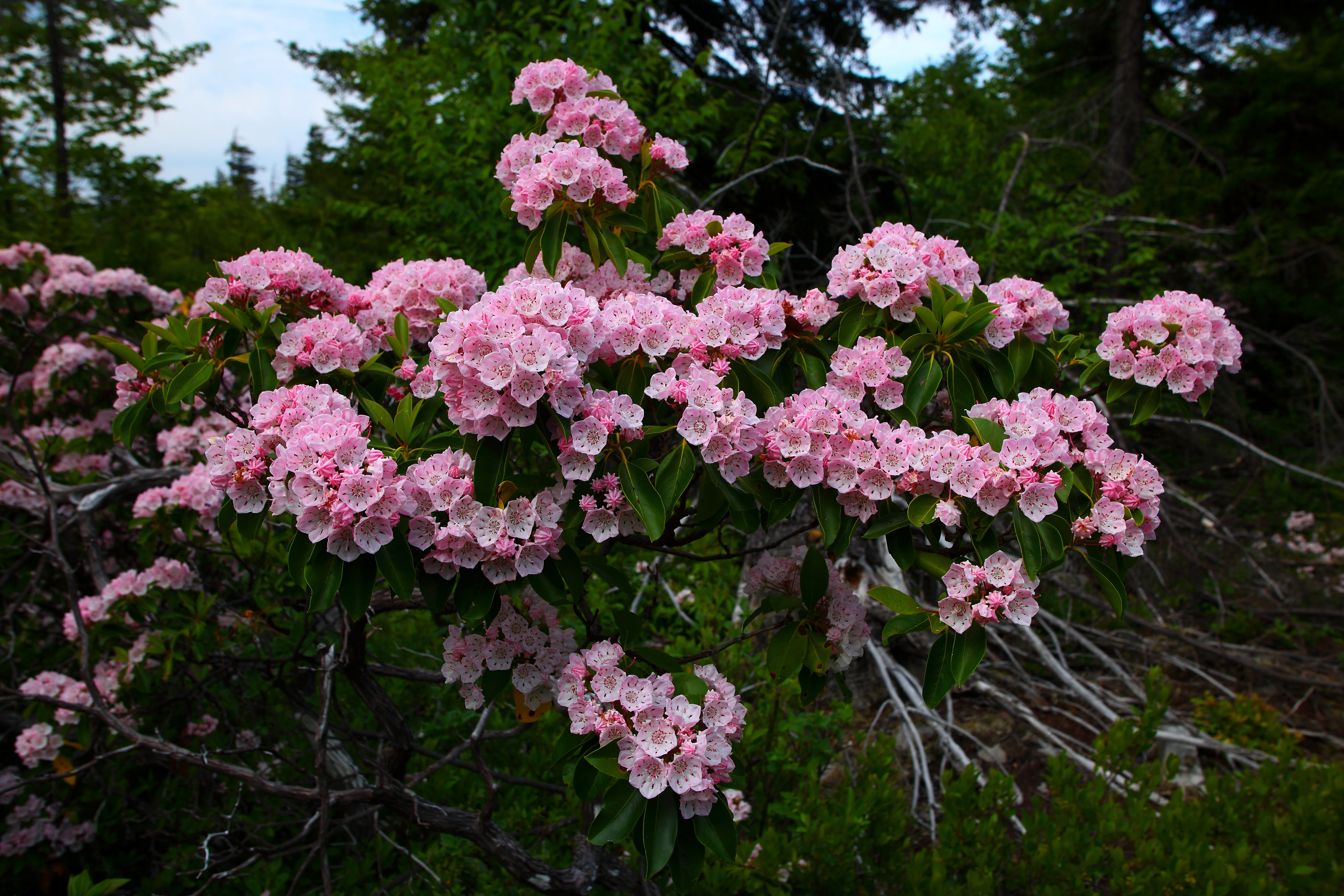
Close-up view of bright pink mountain laurel flowers blooming on a shrub against a backdrop of green forest foliage.
Clusters of pink mountain laurel blooms in the Dolly Sods Wilderness.

Dolly Sods Wilderness history and protected-area timeline

The history of Dolly Sods begins long before its formal protection. The first European surveyors, including Peter Jefferson and Thomas Lewis, passed along its margins in 1746 while delineating the Fairfax Line for Lord Fairfax's land grant. Throughout the nineteenth century, the high, exposed plateau was widely viewed as difficult and even ominous, with local settlers speaking of it in terms of bears, panthers, and dangerous laurel thickets. The name Dolly Sods itself comes from an eighteenth-century German immigrant, Johann Dahle (1749-1847), a former Hessian soldier captured at Yorktown, who settled nearby and grazed livestock on the open mountain meadows known locally as "sods."

The late nineteenth and early twentieth centuries brought dramatic industrial change. After the railroad arrived at nearby Davis in 1884, vast stands of spruce, hemlock, and black cherry were logged out through mills at places like Laneville and Dobbin. Clear-cutting removed the protective canopy, and sparks from locomotives and mill fires ignited the dried humus, leading to repeated devastating wildfires. The 1930 Dobbin Slashings Fire alone consumed nearly 25,000 acres. Overgrazing compounded the damage, leaving exposed rock, sparse soils, and a fragile, slow-recovering landscape.

Federal response came early. The Monongahela National Forest was created in 1915, and most of Dolly Sods was purchased by the federal government in 1916. After World War II, when the U.S. Army had briefly used parts of the area as an artillery and mortar range, interest grew in formal preservation. Local farmers had largely stopped grazing livestock by the mid-1960s, and The Nature Conservancy purchased the underlying coal rights in 1972, removing one of the major threats to the area. Dolly Sods was officially designated as a U.S. Wilderness Area on January 3, 1975, and was significantly expanded in 2009 with the addition of Dolly Sods North, bringing it to its present size.

Dolly Sods Wilderness landscape and geographic character

The landscape of Dolly Sods is defined by elevation and exposure. It is the highest plateau east of the Mississippi River, with much of its surface lying near 4,000 feet and prominent summits climbing toward 4,100 feet. The eastern edge drops sharply away along the Allegheny Front, while the interior consists of rolling, rocky uplands incised by the branching canyon of the North Fork of Red Creek.

The northern and higher sections, often called "the Sods," are characterized by open, windswept expanses of grass, heath shrubs, scattered flagged spruce, and exposed sandstone and conglomerate boulders. These upper reaches include plateau-like flats such as Rohrbaugh Plains and resemble tundra or sub-arctic barrens more than typical Appalachian forest. The southern portion is far more sheltered, with a dense network of canyons and ravines filled with cove hardwoods, rhododendron thickets, and recovering spruce stands. Sculptural features such as Lion's Head Rock and the cliffs along the Allegheny Front add dramatic vertical relief to the otherwise broad, plateau-like terrain.
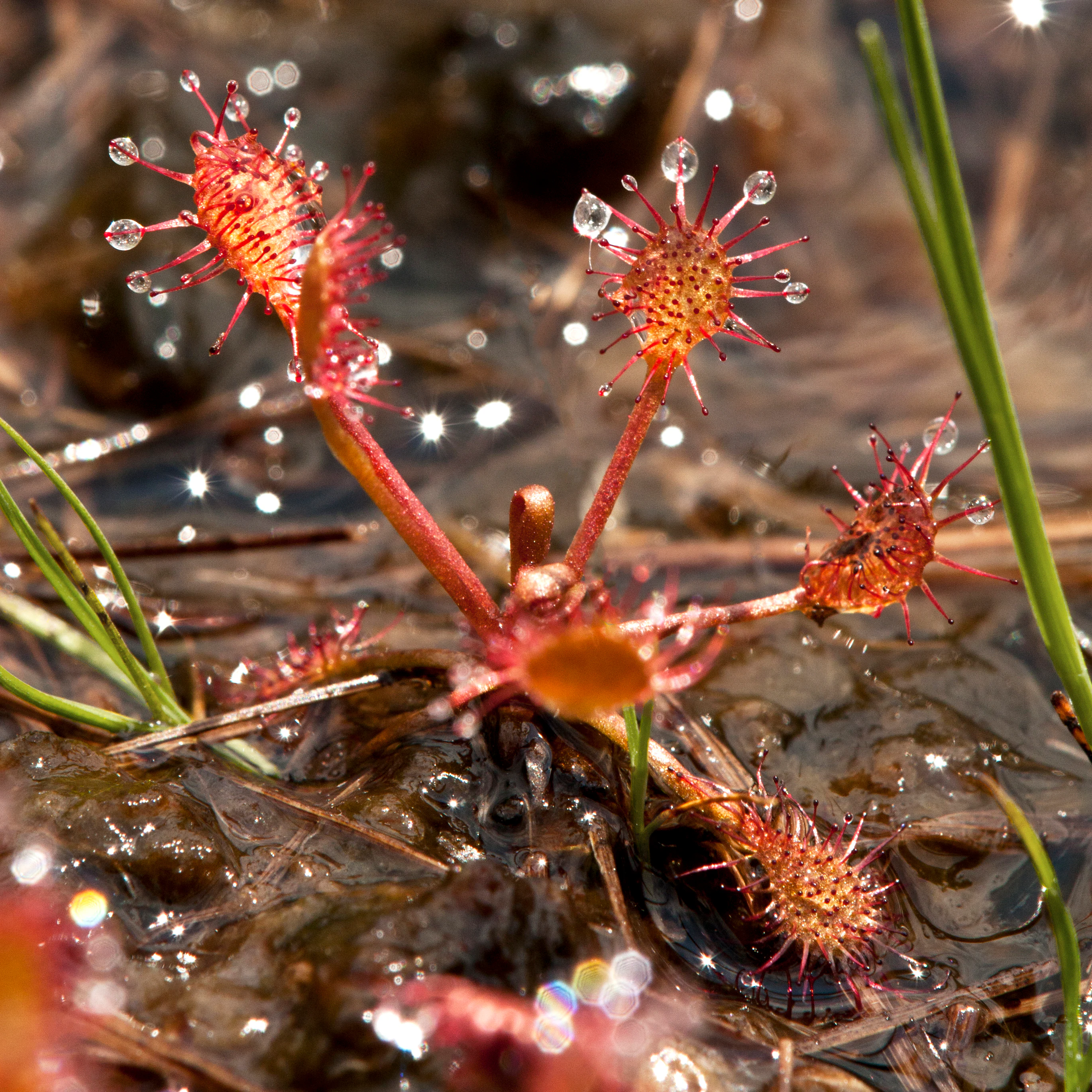
Close-up of a red sundew plant growing in wet, dark soil, with translucent droplets on its sticky, tentacled leaves.
A sundew plant in the Dolly Sods Wilderness, showcasing its unique glandular tentacles covered in dew-like droplets.

Dolly Sods Wilderness ecosystems, habitats, and plant life

Ecologically, Dolly Sods is a remarkable convergence of northern and Appalachian habitats in a very compact area. The wilderness contains extensive sphagnum bogs surrounded by spruce and speckled alder, open heath barrens dominated by members of the Ericaceae family, high-elevation grassy meadows, and lower-elevation hardwood and mixed forests. The "sods" themselves correspond to what ecologists elsewhere call grass balds: open mountain summits where exposure, soils, and ecological history have prevented forest closure.

Plant communities in the bogs include cotton grass, round-leaved sundew, reindeer moss, and orchids such as the pink lady's slipper, while the heath barrens feature blueberry, cranberry, huckleberry, mountain laurel, rose azalea, rosebay rhododendron, teaberry, Allegheny menziesia, and various Rosaceae species like chokeberry, serviceberry, and pin cherry. Forest communities include red spruce, yellow birch, sugar and red maple, eastern hemlock, black cherry, American beech, and hickory, along with the well-known wild onion known as ramp in deeper shaded areas. The result is a layered mosaic of recovering and stable plant communities that continues to draw botanical interest because of its unusual mix of northern and southern Appalachian species.
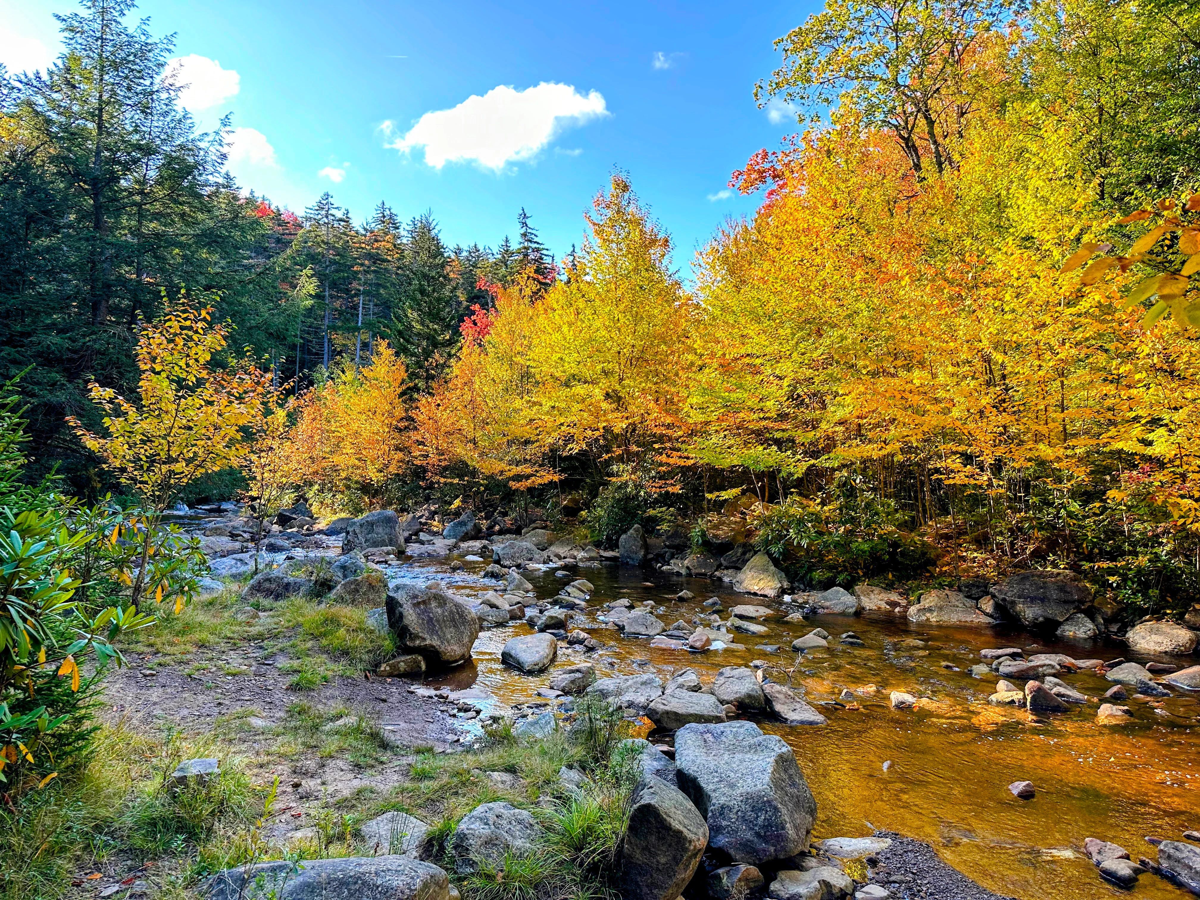
A clear shallow stream flows over smooth rocks through a forest with trees changing to yellow and gold autumn colors under a bright blue sky.
A rocky mountain stream winds through forest foliage displaying vibrant autumn colors in Dolly Sods Wilderness.

Dolly Sods Wilderness wildlife and species highlights

Dolly Sods supports a wildlife profile shaped by its high-elevation climate and northern character. Larger historic megafauna, including elk, bison, and mountain lion, were extirpated in the nineteenth century, though they survived here longer than in many other parts of the eastern United States. Today the most commonly encountered mammals are white-tailed deer, reintroduced in the 1930s and now abundant, as well as black bears, bobcats, red and gray foxes, beavers, groundhogs, wild turkey, and grouse. Beaver activity in the high-elevation drainages continually shapes the local hydrology.

Several species present in the area reach the southern edge of their range here, including the snowshoe hare, reflecting the boreal character of the climate and vegetation. The threatened Cheat Mountain salamander is also found within the wilderness. State wildlife agencies have at times explored the idea of restoring elk to the High Allegheny region, including Dolly Sods, which would further reinforce the area's reputation for unusual wildlife in the mid-Atlantic.
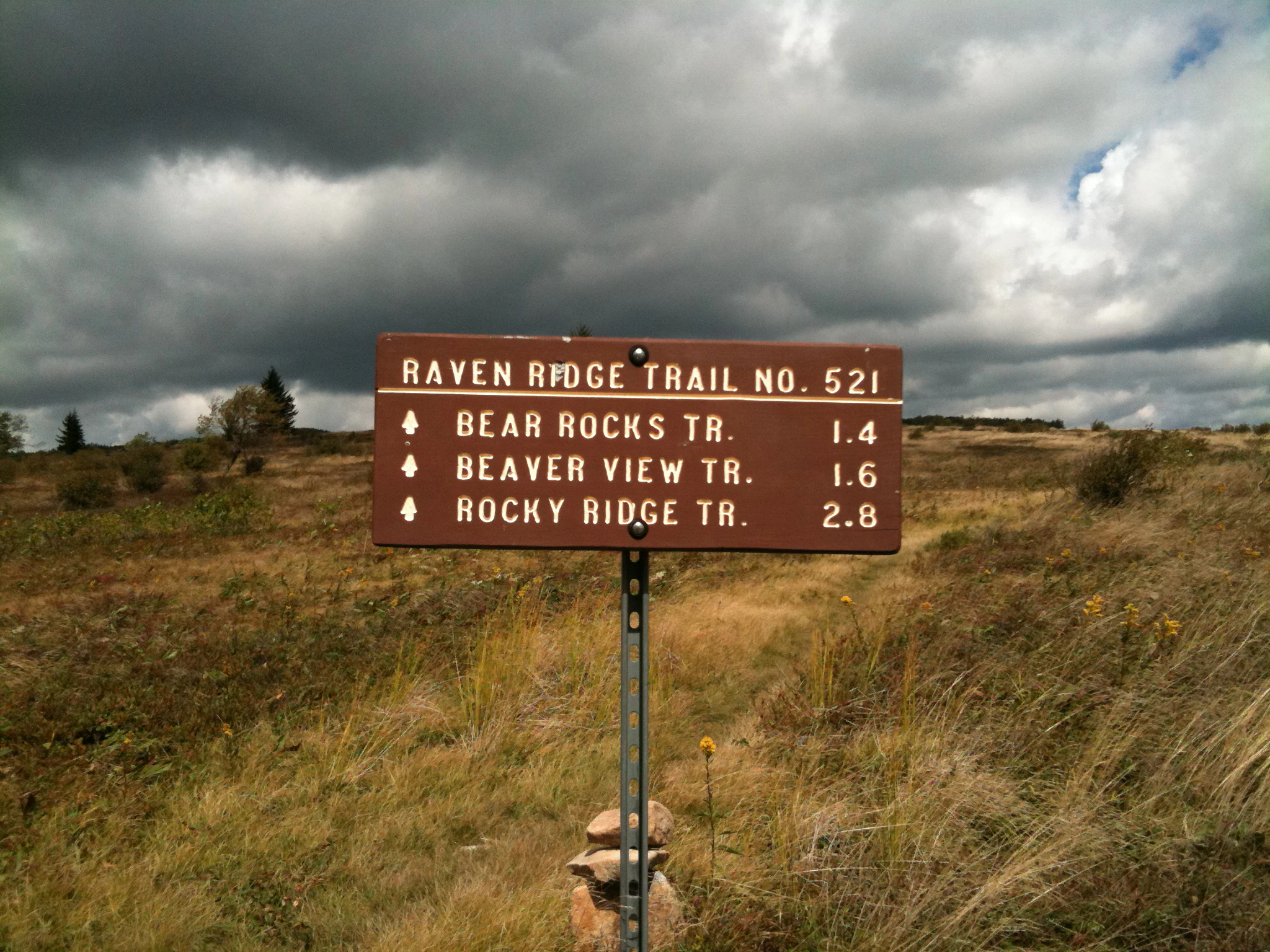
A brown U.S. Forest Service style trail sign standing in a grassy, open plateau area under a cloudy sky.
A brown trail marker in the Dolly Sods Wilderness listing Raven Ridge Trail, Bear Rocks Trail, Beaver View Trail, and Rocky Ridge Trail.

Dolly Sods Wilderness conservation status and protection priorities

Dolly Sods Wilderness carries significant conservation value as one of the few places in the eastern United States where northern, sub-alpine-like ecosystems survive at the edge of their range. Its combination of sphagnum bog, heath barren, flagged spruce, and recovering upland forest represents a high-priority landscape for understanding climate change effects, boreal species persistence, and the long-term recovery of disturbed Appalachian ecosystems.

The wilderness also stands as a major conservation success story. Decades of logging, wildfire, and overgrazing left the area visibly scarred through the early twentieth century. Federal purchase beginning in 1916, the creation of the Monongahela National Forest in 1915, designation as a Wilderness Area in 1975, and the 2009 expansion through the Omnibus Public Lands Management Act together represent a layered, multi-decade effort to protect the area from subdivision, highway development, strip-mining, and reservoir flooding. The Nature Conservancy's purchase of subsurface coal rights in the early 1970s was particularly important in removing the threat of mining beneath the plateau.

Dolly Sods Wilderness cultural meaning and human context

Dolly Sods has a cultural identity rooted in Appalachian place-names, German-settler heritage, and a long tradition of local land use. The name itself records the presence of Johann Dahle, a Hessian soldier turned homesteader whose family grazed sheep and cattle on the high mountain meadows. The term "sods" reflects an older regional vocabulary for open mountain pastures, tying the wilderness to a broader Appalachian tradition of highland grazing, blueberry and huckleberry harvesting, and small-scale mountain farming.

The wilderness has also become part of modern Appalachian outdoor culture and media. Its unusual landscapes have drawn growing numbers of hikers and photographers, and it features as a setting in the video game Fallout 76, reflecting its recognition as one of West Virginia's most iconic landscapes. The presence of the nearby Spruce Knob-Seneca Rocks National Recreation Area and adjoining wilderness areas further reinforces the region's identity as a major inland center for backcountry recreation in the eastern United States.
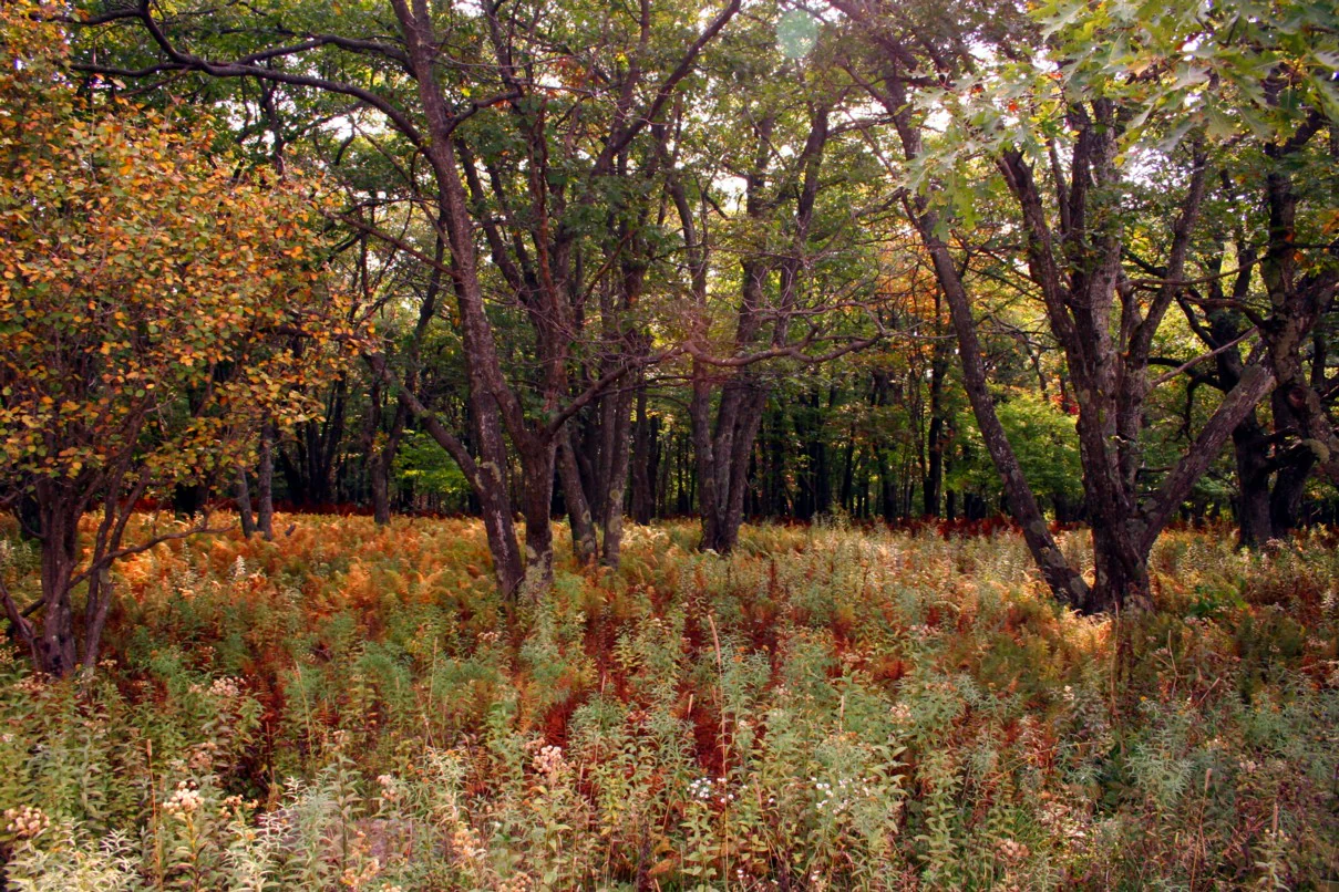
A forest scene in autumn featuring tall trees with thinning leaves and dense patches of ferns and shrubs on the forest floor in shades of orange, green, and brown.
Autumn foliage and forest undergrowth in the Dolly Sods Wilderness.

Top sights and standout views in Dolly Sods Wilderness

The wilderness's standout qualities include the unusual presence of sphagnum bogs and heath barrens far south of their typical range, the striking "flagged" red spruce shaped by high winds along the Allegheny Front, and the broad, tundra-like views from Bear Rocks and Lion's Head Rock. Its 47-mile trail network, much of it following old logging railroad grades, links rocky plateau, canyon forest, and bog in a single compact area.

Travelers also value Dolly Sods for seasonal contrasts: cool, fog-prone summers with frequent thunderstorms, snowy and deeply cold winters occasionally producing 20-foot drifts and dramatic rime ice, and well-known displays of mountain laurel bloom in late spring and brilliant fall foliage across the high plateaus.
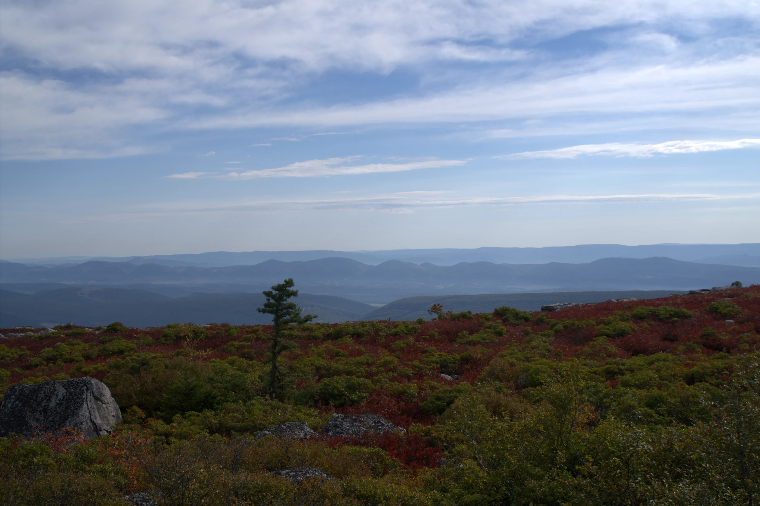
A wide landscape view of the Dolly Sods Wilderness plateau featuring low scrubby vegetation with autumn colors, a single evergreen tree, scattered gray boulders, and layered mountain ranges in the distance under a blue sky with light clouds.
A view overlooking the high-altitude plateau of the Dolly Sods Wilderness during autumn.

Best time to visit Dolly Sods Wilderness

Dolly Sods Wilderness is generally most inviting in the warmer months, when cool summer highs around 70 degrees Fahrenheit at high elevation make hiking comfortable and accessible. Late spring brings the bloom of mountain laurel across the higher meadows, while mid-summer is traditionally associated with blueberry and huckleberry picking in the heath barrens, and autumn delivers some of the most striking leaf color across the plateau and ravines.

Winter at Dolly Sods is genuinely severe, with heavy snowfall, extreme cold, dense fog, and high winds along the Allegheny Front. Some roads are typically closed seasonally, and conditions can change very rapidly. This means that, while winter offers an austere and atmospheric experience for experienced backcountry visitors, most recreational visitors find the late spring through fall window more rewarding and safer, especially when seeking clear views and full use of the trail network.

Monthly climate preview

Trace long-term temperature ranges and precipitation patterns across the protected landscape.

Dolly Sods Wilderness Climate Normals and Monthly Weather Records

Representative coordinates record measured monthly temperature swings and precipitation averages from 1991 through 2020 at an elevation of 713 meters. Access the complete twelve-month climate profile to compare detailed historical averages across the entire annual cycle.
Annual mean9 °C
-3 °C21 °C
Jan-3°
Feb-2°
Mar
Apr
May15°
Jun19°
Jul21°
Aug21°
Sep17°
Oct11°
Nov
Dec-1°
Warmest month
July

21.2 °C

Coolest month
January

-2.9 °C

Wettest month
May

3.8 mm/day

Driest month
October

2.4 mm/day

Park location guide

Geography guide, regional context, and park location map for Dolly Sods Wilderness

Dolly Sods Wilderness park geography, regions, and map view in United States of America

Understand where Dolly Sods Wilderness sits in United States of America through a broader geographic reading of the surrounding landscape, nearby location context, and its mapped position within the national park landscape.

How Dolly Sods Wilderness fits into United States of America

The United States of America is a federal presidential republic and one of the world's largest countries by area and population. It consists of 50 states across a vast territory spanning multiple time zones, with its capital in Washington, D.C. and largest city in New York City. The nation has a diverse economy, influential political system, and significant cultural and military presence globally.

Wider geography shaping Dolly Sods Wilderness in United States of America

The United States occupies a vast territory in North America, bordered by Canada to the north and Mexico to the south. The 48 contiguous states stretch from the Atlantic to the Pacific Ocean, while Alaska occupies the northwestern region and Hawaii is an archipelago in the Pacific. The country encompasses diverse terrain including the Rocky Mountains, Appalachian Mountains, Great Plains, and extensive river systems.

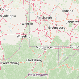
Map view of Dolly Sods Wilderness

Use this park location map to pinpoint Dolly Sods Wilderness in United States of America, understand its exact geographic position, and read its mapped placement within the surrounding landscape more clearly.

Pigeon | © OpenStreetMap contributors

Location context for Dolly Sods Wilderness

West Virginia

Visual reference for high-elevation plateaus, wind-pruned spruce, and rocky terrain.

Dolly Sods Wilderness Photos and Landscape Scenery

Visual records capture the distinctive topography, sub-alpine habitats, and exposed rocky plateaus defining the Dolly Sods Wilderness environment. Examining these protected area photographs reveals the unique northern plant communities, sphagnum bogs, and sweeping vistas characterizing the high Allegheny mountain terrain.

Close-up view of bright pink mountain laurel flowers blooming on a shrub against a backdrop of green forest foliage.

A small, rocky creek flowing through a dense forest with mossy rocks and green trees.

Close-up of a red sundew plant growing in wet, dark soil, with translucent droplets on its sticky, tentacled leaves.

A clear shallow stream flows over smooth rocks through a forest with trees changing to yellow and gold autumn colors under a bright blue sky.

A brown U.S. Forest Service style trail sign standing in a grassy, open plateau area under a cloudy sky.

A dirt hiking trail leads into a densely forested area with sunlight filtering through the canopy onto the forest floor, featuring rhododendrons and various deciduous trees.

A forest scene in autumn featuring tall trees with thinning leaves and dense patches of ferns and shrubs on the forest floor in shades of orange, green, and brown.

A wide landscape view of the Dolly Sods Wilderness plateau featuring low scrubby vegetation with autumn colors, a single evergreen tree, scattered gray boulders, and layered mountain ranges in the distance under a blue sky with light clouds.

A wide, low-angle view of a vast, boggy marshland in Dolly Sods Wilderness with vibrant red ground cover, patches of white cotton grass, and a distant line of dark evergreen trees.

A wide-angle, eye-level view of a hilly landscape in autumn, showing a dense forest canopy in shades of green, yellow, and vibrant red, with prominent grey rock outcrops in the foreground and along the distant ridges.

A wide view of a rolling plateau in autumn, covered in low, red and orange shrubs with distant forest hills behind.

A small, clear stream winds through a lush, green mountain plateau bordered by coniferous trees under a bright blue sky.

A foreground of grey, mossy boulders scattered across a clearing, with a vibrant autumn forest of red, orange, and green trees in the background.

A shallow, rocky creek flows through a dense forest with autumn foliage under a clear blue sky.

A close up view of a stacked, weathered gray sandstone rock formation in the foreground, with a hazy, green forested mountain slope in the background under an overcast sky.

A group of ferns with vibrant yellow, orange, and green fronds growing on a dark, mossy forest floor.

Park atlas

Compare regional mountain terrain, high plateaus, and connected forest reserves

Explore Parks Near Dolly Sods Wilderness and Surrounding Protected Landscapes

Continue geographic comparison by discovering other protected areas located near Dolly Sods Wilderness. Evaluating adjacent mountain terrain and upland ecosystems helps connect high-elevation habitats across the surrounding region.
Watercolor painting showing layers of soft green hills and mountain ridges fading into a light hazy background.
Protected landscapeWest Virginia
Park boundaries overlap#1 closest

West

Monongahela National Forest: Protected Appalachian Landscapes and Regional Geography

Mapping West Virginia wilderness and mountain terrain

Monongahela National Forest protects nearly one million acres of the central Appalachian Mountains. This massive federally managed landscape is defined by the Allegheny Front, the highest peak in the Allegheny range at Spruce Knob, and iconic geological formations like Seneca Rocks. The region represents a vital intersection of climate, hydrology, and biodiversity in the eastern United States, housing eight distinct wilderness areas and complex high-altitude ecosystems.

Area
3,727.8 km²
Established
1920
Visitors
3M annual
Relief
Mountain
A pale, abstract watercolor painting showing a wide view of soft, layered green and pink mountains with a few stylized trees in the lower right.
Wildlife reserveWest Virginia
2.4 km away#2 closest

Southwest

Roaring Plains West Wilderness: Geographic Overview and Protected Plateau Mapping

High-altitude wilderness and Appalachian watershed geography

Roaring Plains West Wilderness encompasses one of the largest high-elevation plateaus in the eastern United States. This protected area within West Virginia hosts dramatic rim-rock vistas and extensive sphagnum bogs, standing as a primary ecological feature along the Eastern Continental Divide. Examine the mapped terrain and environmental boundaries of this significant Allegheny Mountain preserve.

Area
27.6 km²
Established
2009
IUCN
Ib
Relief
Highland
Watercolor painting of a mountain landscape with soft green ridges and a pale pink sky above a light tan foreground.
Protected landscapeWest Virginia
About 14 km away#3 closest

South

Spruce Knob-Seneca Rocks National Recreation Area: West Virginia Mountain Landscapes

Mapped terrain of summits, cliffs, and river corridors

Spruce Knob-Seneca Rocks National Recreation Area stands as a unique protected landscape in eastern West Virginia. This area connects the high-elevation spruce forests of Spruce Knob with the vertical quartzite cliffs of Seneca Rocks and the remote depths of Smoke Hole Canyon. It remains a primary example of Appalachian high-country geography, offering a dense concentration of distinct natural features within the Monongahela National Forest.

Area
400 km²
Established
1965
Relief
Mountain
Climate
Temperate
Wildlife reserveWest Virginia
25 km away#4 closest

Southwest

Laurel Fork North Wilderness: Mapping Appalachian Forest and Mountain Terrain

Protected wilderness landscape in the West Virginia highlands.

Laurel Fork North Wilderness sits as a key conservation unit within the Monongahela National Forest. This protected territory preserves a complex of high-elevation hardwood forests and the stream-cut valley of Laurel Fork. By examining this region, users gain insight into the geography of Allegheny mountain wilderness and the persistent character of recovery-focused Appalachian landscapes.

Area
24.5 km²
Established
1983
IUCN
Ib
Relief
Mountain
A wide, panoramic watercolor illustration showing a row of green trees, faint mountains in the background, and grass reeds in the foreground left against a white background.
Wildlife reserveWest Virginia
35 km away#5 closest

Southwest

Laurel Fork South Wilderness: Protected Appalachian Highlands and Forested Terrain

High elevation forest and creek drainage geography

Laurel Fork South Wilderness features a dense, unbroken stretch of Appalachian forest within West Virginia. This protected landscape is defined by its deep narrow hollows and high ridgelines, representing a vital example of mid elevation mountain terrain and recovering forest ecosystems within the Monongahela National Forest.

Area
23.41 km²
Established
1983
IUCN
Ib
Relief
Mountain
Watercolor illustration depicting a serene mountain landscape with a winding river, rolling hills, and scattered trees against a light background.
Protected landscapeVirginia
About 60 km away#6 closest

Southeast

George Washington and Jefferson National Forests: Appalachian Protected Landscape Mapping

Explore mountain ridges, river valleys, and wilderness corridors in Virginia.

Covering one of the largest public forest blocks in the eastern United States, George Washington and Jefferson National Forests offer a unique look at the central Appalachian mountain terrain. The area includes extensive wilderness tracts, the Appalachian Trail corridor, and significant geological landmarks like the Breaks gorge. Analyze the protected landscape boundaries and topographic features that define this major regional watershed and forest network.

Area
7,247.65 km²
Established
1995
Relief
Mountain
Climate
Temperate
A soft watercolor illustration depicting a stream flowing through a forested valley with mountain ridgelines in the background.
Wildlife reserveUnited States of America
About 69 km away#7 closest

South

Ramseys Draft Wilderness: Appalachian Ridge and Valley Protected Landscape and Map Atlas

Examining wilderness boundaries and mountain stream geography in Virginia

Located in western Virginia, Ramseys Draft Wilderness is a federal protected area characterized by its extreme vertical relief and rugged Appalachian topography. Spanning from the main crest of Shenandoah Mountain to the valley floor, this wilderness serves as a vital corridor for high-elevation forest ecosystems, native brook trout, and neotropical migrant birds.

Area
26.38 km²
Established
1984
Relief
Mountain
Climate
Temperate
Watercolor painting of rolling hills, trees, and a river in a scenic landscape
National parkVirginia
82 km away#8 closest

Southeast

Shenandoah National Park: National Park Protected Landscape and Geography

Mapped terrain and protected area context in Virginia.

Shenandoah National Park is a designated national park in Virginia, offering a rich exploration of its protected landscape and geographic features. This page provides detailed atlas-oriented information, focusing on the park's mapped boundaries and its role within the regional geography. Discover the natural terrain and spatial identity of this important US protected area, ideal for understanding park landscapes.

Area
811.176 km²
Established
1935
IUCN
II
Visitors
1.7M annual

Common questions about visiting, size, designation, and location context for Dolly Sods Wilderness

Dolly Sods Wilderness FAQs for park facts, access, geography, and protected area context

Find quick answers about Dolly Sods Wilderness, including protected-area facts, park geography, trail and visitor context, and how the park fits into its surrounding country and regional landscape.
MoriAtlas Explorer

Continue Your Protected Areas Search Across the Global Atlas

Deepen your exploration by continuing the structured search for national parks and protected areas worldwide. Utilize the comprehensive filtering capabilities to compare different conservation landscapes and refine your understanding of global park geography. Discover more about the distribution and characteristics of protected natural areas.

Global natural geography