
Mori Atlas logo
Nature reserveDresdner Elbtalhänge

A detailed geographic study of steep ravines, sun-exposed forest slopes, and diverse upland terrain

Dresdner Elbtalhänge Nature Reserve: Mapped Geography and Protected Elbe Valley Landscapes

(Naturschutzgebiet Dresdner Elbtalhaenge)

Dresdner Elbtalhänge serves as a critical nature reserve along the Elbe valley in Sachsen, encompassing 203 hectares of steep wooded slopes, V-shaped side valleys, and exposed granite rock outcrops. The protected landscape bridges the gap between the Elbe floodplain and the Schoenfelder Hochland, creating a mosaic of warm, dry-adapted forest habitats and cool, shaded ravine microclimates. This area stands as a significant protected site within the European Natura 2000 network, preserving essential habitats for specialized flora and fauna within a complex regional geography.

river valley slopesmixed beech-oak forestdry-warm microclimateravine woodlandrock outcropsNatura 2000
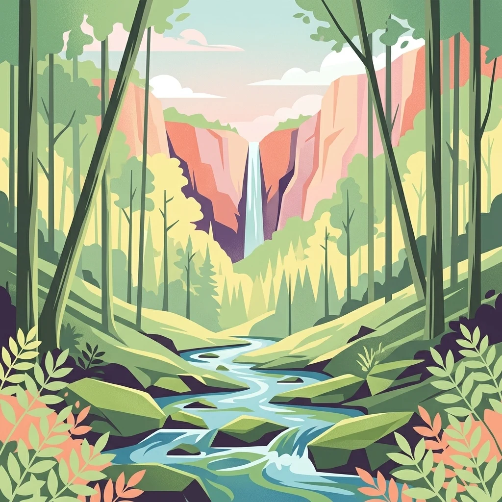
A digital illustration of a narrow waterfall falling between two steep cliff walls, leading into a rocky stream that flows towards the viewer through a forest of tall, thin trees.

Dresdner Elbtalhänge

Nature reserve

Park overview

Structured park overview, official facts, and landscape profile for Dresdner Elbtalhaenge

Dresdner Elbtalhaenge park facts, protected area profile, and essential visitor context

Review the core facts for Dresdner Elbtalhaenge, including designation, size, terrain, visitor scale, habitats, and operating context in one park-focused overview.

About Dresdner Elbtalhaenge

Dresdner Elbtalhaenge is a compact but ecologically rich nature reserve that captures one of the most distinctive transitions in the Dresden landscape: the sharp rise from the floodplain of the Elbe to the rolling uplands of the Schoenfelder Hochland. The reserve traces the right-bank slope of the Elbe valley for about 4.5 kilometers, anchoring a chain of forested ravines, sunlit rock faces, and meadow patches along the eastern edge of Dresden near Pillnitz.

The protected landscape is built on Zweiglimmergranodiorite bedrock, which surfaces in the upper slopes as open rock heads. Because the slopes face predominantly south to southwest, they catch unusually warm, dry conditions for the region, while the deeply cut side ravines hold cool, moist air and shaded, stable microclimates. This climatic contrast has shaped a varied forest pattern: colline beech-oak-hornbeam woods with massive, hollow-bearing ancient beeches dominate the middle slopes, while the upper edges carry drier birch-oak woods and thermophilic pine-oak stands, often with indicator species such as swallow-wort, Nottingham catchfly, Carthusian pink, and spiked grass-lily beneath the canopy.

Ecologically, the reserve is significant well beyond its modest size. It contributes to the European Natura 2000 network as part of the FFH site Elbtalhaenge zwischen Loschwitz und Bonnewitz, and its habitat targets include woodrush beech forests, bedstraw oak-hornbeam forests, ravine and slope-mixed forests, and alder-ash galleries along small streams. These habitats sustain a recorded breeding bird community of roughly 55 species, including honey buzzard, red kite, black woodpecker, grey-headed woodpecker, wryneck, and red-breasted flycatcher, alongside important bat colonies such as the greater mouse-eared bat and lesser horseshoe bat.

Quick facts and research context for Dresdner Elbtalhaenge

Dresdner Elbtalhaenge is a designated nature reserve (Naturschutzgebiet) in Saxony, situated predominantly within the city limits of Dresden with a small portion in the Landkreis Saechsische Schweiz-Osterzgebirge. It protects roughly 203 hectares of steep valley-slope woodland north of Pillnitz, Hosterwitz, and the surrounding villages, and is part of the Natura 2000 network under the FFH site Elbtalhaenge zwischen Loschwitz und Bonnewitz. The site is notable for its dry-warm microclimate on south-facing slopes combined with cool ravine conditions, supporting oak-beech, oak-hornbeam, and maple forests together with rock habitats and species-poor meadows. It was formally designated in 2007 under the ordinance of the Dresden regional presidency, taking in the older Borsberghaenge und Friedrichsgrund reserve.

Protection and recognition

Examine documented protection records and official geographic identifiers

Dresdner Elbtalhänge Protection Status and Designated Area Records

Examine recorded protection metrics and administrative data associated with Dresdner Elbtalhänge within the protected area database. Verified records outline official designation parameters and international database identifiers for comprehensive geographic analysis.

Protection details

WDPA ID
378065
Park context

Deeper park guide and search-rich context for Dresdner Elbtalhaenge

Dresdner Elbtalhaenge history, landscape, wildlife, and travel context

Explore Dresdner Elbtalhaenge through its history, landscape character, ecosystems, wildlife, conservation priorities, cultural context, and seasonal travel timing in a structured park guide built for atlas discovery and search intent.

Why Dresdner Elbtalhaenge stands out

The reserve is best known for its warm, dry, south-facing slope forests along the Elbe valley east of Dresden, an unusually continental microclimate within Saxony that supports rare vegetation otherwise more typical of warmer regions. Visitors and ecologists value the area for its mosaic of natural beech and oak-hornbeam woodlands, exposed granite rock outcrops, nutrient-rich dry grassland, and deeply incised ravines like the Keppgrund. It is also recognized as a Natura 2000 FFH site for species-rich beech, oak-hornbeam, and slope-mixed forests, as well as for its populations of protected bats and saproxylic beetles such as the Eremit beetle. The juxtaposition of open Elbe valley views, the baroque ensemble of Schloss Pillnitz, and steep wooded slopes gives the area a distinctive cultural-ecological landscape character.
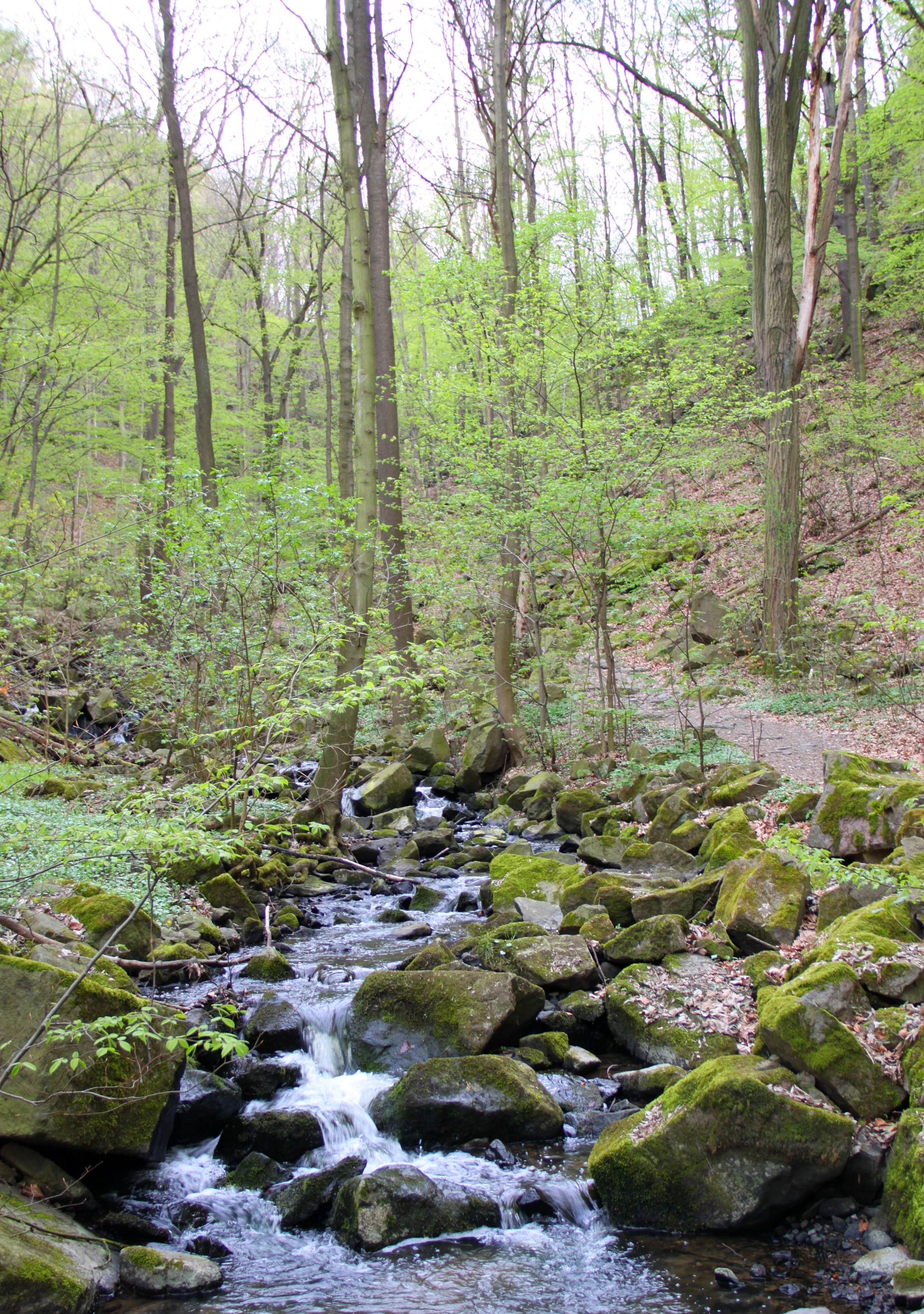
A babbling stream flows over large, moss-covered boulders in a lush, green deciduous forest, with a gentle slope and trees rising in the background.
A small stream flowing over moss-covered rocks through the deciduous forest of the Keppgrund valley during spring.

Dresdner Elbtalhaenge history and protected-area timeline

The Dresdner Elbtalhaenge were formally designated as a nature reserve in 2007 through an ordinance issued by the regional presidency of Dresden on 19 January 2007, consolidating and expanding earlier protective efforts in the area. Crucially, the new reserve incorporated the former Naturschutzgebiet Borsberghaenge und Friedrichsgrund, which had previously protected a portion of the same slope system under a different administrative framework. The 2007 designation therefore unified the protection of a roughly 4.5 kilometer stretch of the right-bank Elbe valley slope under a single ordinance with the identifier NSG D 104, bringing the total protected area to around 203 hectares.

The protected status builds on a much older human relationship with these slopes. Historical dry-stone wall remnants along the upper edges still mark where vineyards were cultivated on the climatically favored south-facing terraces until the phylloxera outbreak around 1900 ended viticulture in this part of the Elbe valley. Long before the nature reserve era, parts of the forest were managed as coppice with short rotations, leaving behind the characteristic stunted-growth form of sessile oak that can still be seen on the dry ridge sites today, often infected by the distinctive oak liver fungus (Fistulina hepatica). The Keppmuehle in the Keppgrund, a historic mill still standing within the reserve, is even said to have inspired Carl Maria von Weber when composing the Wolfsschluchtszene of his opera Der Freischuetz. In the 21st century, the reserve's management plan has shifted firmly toward close-to-nature forestry, emphasizing continuous cover, increased deadwood, and the creation of a roughly 80 hectare no-intervention total reserve within the steepest terrain.

Dresdner Elbtalhaenge landscape and geographic character

The landscape of the Dresdner Elbtalhaenge is defined by the steep transition between the flat Elbe floodplain and the uplands of the Schoenfelder Hochland. The protected area follows a narrow, north-west to south-east oriented ribbon along the right-bank valley edge, typically only 200 to 500 meters wide but extending over roughly 4.5 kilometers. The terrain combines sharply incised ravines, steep wooded slopes, exposed granite rock heads, and gentler ridges, all closely bound to the underlying Zweiglimmergranodiorite geology of the Westlausitz hill and upland region.

The most striking geomorphological elements are the so-called 'Gründe' and 'Kerbtaeler', the steep V-shaped side valleys that cut perpendicularly into the main slope. The wild, romantic Keppgrund, with its historic Keppmuehle, is one of the best-known examples, and comparable features include the Tiefer Grund near Borsberg and the Pressgrund near Rockau. Where the upper edges of the slopes have eroded, ancient rock outcrops emerge as open rocky ridges, providing habitat islands within broader forest cover.

From the upper margins of the reserve, broad vistas open out over the Dresdner Elbtalweitung, the wide section of the Elbe floodplain, with views toward the historic skyline of Dresden and across to the baroque ensemble of Schloss Pillnitz, its castle gardens, and the Lustgarten. These views are integral to the area's identity, linking the forest reserve visually and culturally to the wider Elbe valley cultural landscape of which it forms a part.

Dresdner Elbtalhaenge ecosystems, habitats, and plant life

The ecological character of the Dresdner Elbtalhaenge rests on an unusual pairing of microclimates. South- to southwest-facing slopes receive high insolation and are dominated by dry-warm conditions, while the steep side ravines hold cool, moist, sheltered air. This contrast creates a compressed but exceptionally varied range of forest, rock, and grassland habitats within a relatively small reserve.

On the warm ridges and upper slopes, the vegetation is shaped by relict pine stands, dry birch-oak woodland, and thermophilic pine-oak woodland of the Luzulo-Quercetum petraeae type, with characteristic understorey species such as swallow-wort, Nottingham catchfly, Carthusian pink, and the spiked grass-lily. The mid-slopes are dominated by colline beech-oak-hornbeam forest (Luzulo-Fagetum), often featuring very large, cavity-rich ancient beeches whose deadwood and hollows support specialized saproxylic species. The coolest, shaded ravines and stream courses support slope- and ravine-mixed forests dominated by sycamore maple, plus alder- and ash-dominated gallery woodland along small watercourses.

Open rock outcrops of two-mica granodiorite host a separate community of light-loving specialist plants, including northern spleenwort, upright hedge-nettle, mountain garlic, and earth sedge, often accompanied by stunted Scots pines. Where forest gives way to open ground, species-rich nutrient-poor meadows and semi-dry grasslands continue the habitat mosaic. Across the reserve, 35 species of butterflies have been recorded, alongside significant beetle fauna associated with old oaks, including the strictly protected Eremit beetle, the green rose chafer (Gnorimus nobilis), and several longhorn beetle species linked to sun-exposed hardwood.

Dresdner Elbtalhaenge wildlife and species highlights

Wildlife is a defining feature of the Dresdner Elbtalhaenge, reflecting the diversity of habitats packed into its narrow valley-slope setting. The reserve supports a recorded breeding bird community of around 55 species, with raptors such as the honey buzzard and red kite using the open airspace above the slopes, while cavity-rich old beeches and oaks provide nesting sites for black woodpecker, grey-headed woodpecker, wryneck, and the red-breasted flycatcher. The mix of forest, meadow, and rock also provides habitat for a range of butterfly and moth species, including specialists tied to oak such as the purple hairstreak and ilex hairstreak, and the scarce swallowtail, large tortoiseshell, and black-veined white-related dark meadow-knap bluulet moth.

The reserve is particularly important for protected mammals and invertebrates. Two bat species listed in Annex II of the EU Habitats Directive are known from the area, the greater mouse-eared bat (Myotis myotis) and the lesser horseshoe bat (Rhinolophus hipposideros), both reliant on the older tree hollows and sheltered ravine microclimates. Among the invertebrates, the saproxylic beetle fauna is especially rich, with the Eremit beetle (Osmoderma eremita) as the headline species, alongside a community of longhorn beetles and rose chafers associated with old oaks and extensive deadwood.

Reptiles and amphibians also benefit from the combination of woodland pools, rocky slopes, and warm edges. Notable herpetofaunal records include fire salamander, agile frog, and the smooth snake. The presence of small natural ponds within the management concept of the reserve reflects the importance of standing water as breeding habitat for these and other protected species.

Dresdner Elbtalhaenge conservation status and protection priorities

The Dresdner Elbtalhaenge carries strong conservation significance at multiple scales. Locally, it functions as a Naturschutzgebiet under Saxony's nature protection framework, with protection status corresponding to IUCN Category IV, Habitat/Species Management Area. Regionally, it sits within the Westlausitz hill and upland natural region and acts as a buffering landscape between the intensively used Dresdner Elbtalweitung and the Schoenfelder Hochland. At the European level, it is integrated into the Natura 2000 network through the Fauna-Flora-Habitat site Elbtalhaenge zwischen Loschwitz und Bonnewitz, with explicit conservation targets for woodrush beech forests, bedstraw oak-hornbeam forests, slope- and ravine-mixed forests, and alder-ash stream galleries.

The reserve's conservation value is closely tied to its climate-forest mosaic and its rich population of old and deadwood-rich trees. The 2007 ordinance and subsequent management plan therefore prioritize close-to-nature forestry in the form of small-scale selection harvesting to build permanent forest structure, the maintenance and enrichment of old beech and oak stands, and the deliberate increase of deadwood and tree cavities. To protect the steepest and most ecologically sensitive slopes and ravines, a roughly 80 hectare total reserve is recommended where forestry is effectively excluded entirely.

Alongside forest management, the conservation strategy emphasizes habitat protection for strictly protected flora and fauna. Three species in Annex II of the EU Habitats Directive (greater mouse-eared bat, lesser horseshoe bat, and Eremit beetle) are explicitly recognized as conservation targets, alongside rare thermophilic plants on the dry ridges and open rock communities. The maintenance and development of natural small ponds as breeding habitat, and the protection of semi-open nutrient-poor meadows, round out a conservation concept that links habitat preservation, deadwood enrichment, and visitor use as a recreational landscape around Dresden.

Dresdner Elbtalhaenge cultural meaning and human context

The Dresdner Elbtalhaenge lies at the interface between the city of Dresden and the eastern Elbe countryside, and its cultural imprint is strongly tied to the Elbe valley cultural landscape. Historic dry-stone wall remnants along the upper slopes bear witness to vineyard cultivation that once thrived on the warm south-facing terraces until the phylloxera outbreak around 1900 ended this use. The presence of historic mills such as the Keppmuehle in the Keppgrund, still preserved within the reserve, reflects centuries of small-scale rural land use inside what is today a strictly protected natural area.

The reserve is also embedded in an artistic and musical tradition. The reportedly inspiration that the Keppgrund gave to Carl Maria von Weber for the Wolfsschluchtszene of Der Freischuetz links the landscape to German Romantic opera history. Visually, the protected slopes remain inseparable from the broader Elbe valley setting, framing dramatic views toward the baroque ensemble of Schloss Pillnitz and across to the skyline of Dresden itself. Today the area continues its cultural role as a near-urban recreation landscape, serving as the main walking and countryside escape for the densely settled upper Elbe valley communities of Oberpoyritz, Pillnitz, Hosterwitz, and Niederpoyritz.

Top sights and standout views in Dresdner Elbtalhaenge

The Dresdner Elbtalhaenge packs an unusually concentrated set of natural and cultural features into a narrow corridor along the Elbe east of Dresden. Its strongest assets include the warm, south-facing oak and beech slope forests, the cool, species-rich ravine woodlands of the Keppgrund and other Kerbtaeler, and the open two-mica granodiorite rock outcrops with specialized thermophilic vegetation. Equally notable are the populations of strictly protected species such as the greater mouse-eared bat, the lesser horseshoe bat, the Eremit beetle, the fire salamander, and the smooth snake, all linked to old trees, deadwood, and intact ravine habitats.

Best time to visit Dresdner Elbtalhaenge

The Dresdner Elbtalhaenge can be experienced meaningfully in most seasons, but spring and early summer are particularly rewarding when woodland herbs and dry grassland flowers are at their peak and migrant and resident birds are most active. The broadleaf canopy provides cool, shaded walking conditions in high summer, while the south-facing slopes and open rock sites are most pleasant in cooler months when temperatures along the open ridge are moderate. Late autumn brings strong visibility for views across the Elbe floodplain toward Dresden and Schloss Pillnitz, and visit timing has only limited impact on the reserve's core conservation value, since access is regulated year-round by the protected-area framework.

Monthly climate preview

Long-term representative point measurements tracking annual temperature and precipitation rhythm

Dresdner Elbtalhänge Climate Normals and Measured Monthly Temperature Patterns

Dresdner Elbtalhänge records measured monthly temperature values ranging from sub-zero winter lows to warm summer maximums alongside consistent daily precipitation rates. Examining the complete twelve-month climatology profile reveals detailed variations across the representative coordinate.
Annual mean8 °C
-2 °C19 °C
Jan-2°
Feb-1°
Mar
Apr
May13°
Jun17°
Jul19°
Aug19°
Sep14°
Oct
Nov
Dec-1°
Warmest month
July

19.1 °C

Coolest month
January

-1.8 °C

Wettest month
July

2.8 mm/day

Driest month
April

1.3 mm/day

Park location guide

Geography guide, regional context, and park location map for Dresdner Elbtalhaenge

Dresdner Elbtalhaenge park geography, regions, and map view in Germany

Understand where Dresdner Elbtalhaenge sits in Germany through a broader geographic reading of the surrounding landscape, nearby location context, and its mapped position within the national park landscape.

How Dresdner Elbtalhaenge fits into Germany

Germany is a federal republic in Western and Central Europe with a population of over 83 million across sixteen constituent states. It is Europe's largest economy by nominal GDP and a major global exporter and importer. The capital is Berlin, and the country borders Denmark, Poland, Czech Republic, Austria, Switzerland, France, Luxembourg, Belgium, and the Netherlands.

Wider geography shaping Dresdner Elbtalhaenge in Germany

Germany is located in Western and Central Europe, spanning 357,022 km². It borders Denmark to the north, Poland and the Czech Republic to the east, Austria and Switzerland to the south, and France, Luxembourg, Belgium, and the Netherlands to the west. The country has coastlines on the Baltic Sea and North Sea to the north, with the Alps located in the southern region.

Map view of Dresdner Elbtalhaenge

Use this park location map to pinpoint Dresdner Elbtalhaenge in Germany, understand its exact geographic position, and read its mapped placement within the surrounding landscape more clearly.

Pigeon | © OpenStreetMap contributors

Location context for Dresdner Elbtalhaenge

Sachsen
Recorded earthquake history

Review the Historical Earthquake Catalogue for Dresdner Elbtalhänge

Examine documented seismic events in the vicinity of the Dresdner Elbtalhänge nature reserve. This catalogue from MoriAtlas organizes historical records by location and magnitude, providing a clear geographic view of seismic activity patterns across this part of the Elbe valley.

Dresdner Elbtalhänge Earthquake History

Catalogued events

13 events

Strongest magnitude

Magnitude 3.7

Most recent event

Apr 13, 1989

This history includes earthquakes recorded inside the park or within 50 km of its borders

Explore photographic records of steep Elbe valley slopes, wooded ravines, and exposed rock formations

Dresdner Elbtalhänge Photos and Scenery: Visualizing Valley Slopes and Protected Habitats

Visual documentation captures the varied terrain and microclimates defining the reserve along the Elbe valley. Examining photographic records reveals the intricate mosaic of warm slope forests, rocky ridges, and shaded ravines shaping the protected landscape.

A babbling stream flows over large, moss-covered boulders in a lush, green deciduous forest, with a gentle slope and trees rising in the background.

Park atlas

Compare regional valley reserves and connected terrain across Saxony

Parks Near Dresdner Elbtalhänge And Protected Landscapes

Browse protected areas and natural reserves situated near Dresdner Elbtalhänge along the Elbe valley. Comparing adjacent slope forests and upland terrain reveals broader ecological patterns across the regional landscape.
A pale, soft watercolor illustration showing a horizontal landscape of light green trees, shrubs, and rolling grassy plains on a white background.
Nature reserveGermany
About 1 km away#1 closest

Southwest

Elbinseln Pillnitz und Gauernitz: A Study in Protected Saxon River Landscapes

Examining floodplain geography and rare river island ecosystems

Located in the Elbe valley between Dresden and Meissen, Elbinseln Pillnitz und Gauernitz preserves the final natural river islands within the state of Saxony. This protected nature reserve anchors a vital network of alluvial soils, riparian woodlands, and unarmored riverbanks, offering a unique perspective on the dynamic floodplain geography of Germany's major river corridors.

Area
0.235 km²
Established
2006
IUCN
IV
Relief
Lowland
A watercolor illustration depicting rolling, soft hills and green vegetation with distant, faded mountains in the background, set against a plain white background.
Nature reserveGermany
About 6.7 km away#2 closest

South

Spargründe bei Dohna: Nature Reserve and Protected Valley Landscapes in Germany

Examining the crystalline ravines and forest ecosystems of the Saxon landscape

Spargründe bei Dohna stands as a distinct nature reserve at the northern margin of the Elbtalschiefergebirge. The site encompasses narrow, steeply-sided valleys carved into Dohna Granodiorite, creating a rugged terrain of rocky ridges and shaded deciduous woodland. This geographic overview examines the boundaries and natural features of the reserve, highlighting its role within the wider Müglitztal protected area network.

Area
0.373 km²
Relief
Upland
Climate
Temperate
Access
Easy access
Watercolor painting showing a landscape with green hills, trees, and a river winding through the scene
National parkGermany
8.4 km away#3 closest

East

Saxon Switzerland National Park: Protected Area Geography and Map Exploration

Discover its mapped boundaries and regional landscape context.

Saxon Switzerland National Park, a protected national park in Germany, offers a distinct focus for geographic and atlas-based discovery. This page details the park's specific protected landscape, its mapped boundaries, and its contribution to the regional geography. MoriAtlas allows for in-depth exploration of such natural areas, providing essential context for understanding their place within broader natural systems and mapped terrains.

Area
93.5 km²
Established
1990
IUCN
II
Visitors
1.7M annual
A pale, soft watercolor painting depicting a small arched bridge crossing a gentle stream within a rolling green valley.
Protected landscapeSaxony
About 13 km away#4 closest

North

Seifersdorfer Tal Protected Landscape and Cultural Heritage in Saxony

A historic garden monument and river valley ecosystem

The Seifersdorfer Tal is a protected landscape defining the Große Röder valley. Beyond its cultural status as one of Germany's earliest English-style landscape gardens, the area serves as a vital riverine corridor and nature reserve. The terrain offers a unique blend of rocky outcrops, wooded slopes, and meadows linked by historic footpaths and 18th-century allegorical monuments.

Area
2.88 km²
Established
1960
Relief
Upland
Climate
Temperate
Nature reserveFreistaat Sachsen
About 14 km away#5 closest

West

Windberg Nature Reserve: Mapping the Forested Ridge and Protected Landscape of Saxony

Geology, mining heritage, and protected oak-beech forest ecosystems

Windberg serves as the prominent local landmark for Freital, defined by its elongated forested plateau and complex tectonic geography. This nature reserve offers a study in the intersection of environmental conservation and human industrial history, featuring Saxony's deepest cave and varied habitats within the eastern Ore Mountains foothills.

Established
1967
Relief
Mountain
Climate
Temperate
Access
Easy access
A horizontal watercolor illustration showing a calm pond in the foreground, with lush green vegetation on the banks and rolling hills in the background under a soft sky.
Nature reserveMeißen
About 18 km away#6 closest

Northwest

Dippelsdorfer Teich Nature Reserve: Geographic Insights and Landscape Context

Historic Saxon pond management and regional protected landscape.

The Dippelsdorfer Teich serves as a primary example of historical pond construction and nature protection in the northern Dresden countryside. This 69 hectare reservoir captures a blend of ecological, cultural, and recreational values within the Meißen region. Users can examine its physical layout, the dam structure, and the integration of heritage transport within this managed lowland environment.

Area
0.69 km²
Established
1528
Relief
Lowland
Scope
Terrestrial
A watercolor painting showing a calm pond with a small island of green trees and distant rolling hills under a soft pink and yellow sky.
Nature reserveMeißen District
About 21 km away#7 closest

Northwest

Frauenteich Moritzburg: Mapping the Protected Wetland Landscapes of Meißen District

Glacial pond basins and diverse forest habitats in Saxony.

Frauenteich Moritzburg serves as a core component of Saxony's pond landscape, protecting a rich sequence of shoreline vegetation and open water. Its geography reflects the results of ancient glacial activity, creating a unique environment where sandy ridges and wet meadows coexist. This nature reserve provides essential refuge for bird populations, making it a focal point for understanding the natural, protected terrain within the broader Meißen District environment.

Area
2.02 km²
Established
1954
IUCN
IV
Relief
Lowland
Nature reserveSachsen
About 21 km away#8 closest

North

Waldmoore bei Großdittmannsdorf: A Protected Wetland Landscape in Sachsen, Germany

Mapping forest mires and rare swamp woodland habitats

Waldmoore bei Großdittmannsdorf represents a carefully maintained nature reserve in eastern Germany, spanning roughly 93 hectares of forest mire and bog structures. The site supports a rare transition of swamp woodland, sedge-rich wet stands, and spring flushes within the Laußnitzer Heide. As a designated Natura 2000 area, it plays a key role in safeguarding regional wetland connectivity and providing a refuge for specialist flora and fauna in the Saxon landscape.

Area
0.935 km²
Established
2000
IUCN
IV

Common questions about visiting, size, designation, and location context for Dresdner Elbtalhaenge

Dresdner Elbtalhaenge FAQs for park facts, access, geography, and protected area context

Find quick answers about Dresdner Elbtalhaenge, including protected-area facts, park geography, trail and visitor context, and how the park fits into its surrounding country and regional landscape.
MoriAtlas Explorer

Continue Your Protected Areas Search Across the Global Atlas

Deepen your exploration by continuing the structured search for national parks and protected areas worldwide. Utilize the comprehensive filtering capabilities to compare different conservation landscapes and refine your understanding of global park geography. Discover more about the distribution and characteristics of protected natural areas.

Global natural geography