Mori Atlas logo
Park earthquake history

Review documented seismic occurrences and historical epicentre proximity for this wilderness landscape

Recorded Earthquake History and Seismic Records Near the Eagle Cap Wilderness in Oregon

This historical catalogue aggregates recorded seismic events associated by distance with the Eagle Cap Wilderness in northeastern Oregon. The collection provides a searchable record of magnitude, depth, and epicentre coordinates to support landscape analysis and geographic understanding of the surrounding Wallowa Mountains. Access detailed event records and provenance data sourced from official seismic archives for the region.

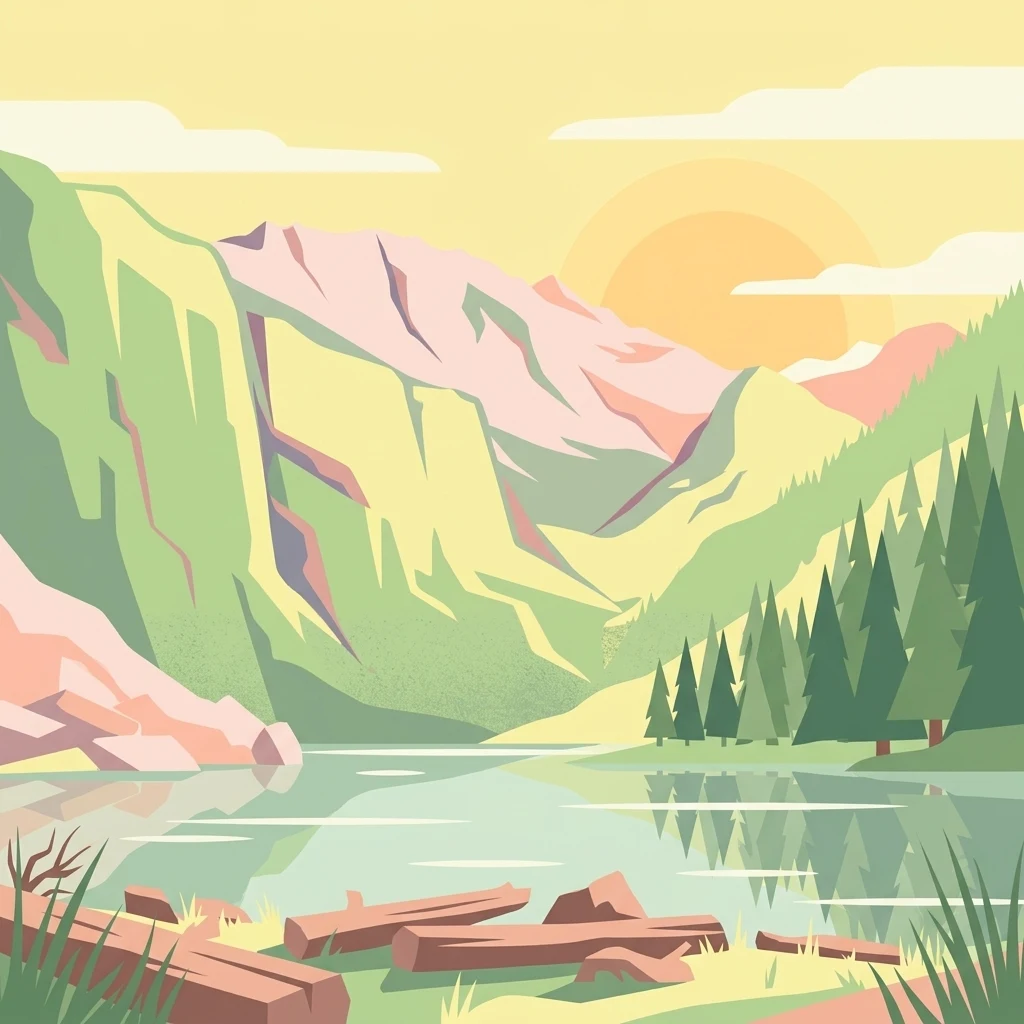
A flat-style digital illustration depicting a calm mountain lake with fallen logs in the foreground, pine trees on the shore, and rugged peaks under a soft sunset sky.

Oregon's largest wilderness area, set among the granite peaks and alpine lakes of the Wallowa Mountains.

Eagle Cap Wilderness

Eagle Cap Wilderness is a protected wilderness area in northeastern Oregon, situated within the Wallowa Mountains of the Wallowa Whitman National Forest. Established in 1940 and incorporated into the National Wilderness Preservation System in 1964, it is by far Oregon's largest wilderness area, spanning a vast landscape of granite peaks, glacial valleys, alpine meadows, and forested lower slopes. The wilderness is defined by its sharp elevation range, climbing from roughly 3,000 feet in the lower valleys to over 9,800 feet at the summit of Sacajawea Peak, with more than thirty summits rising above 8,000 feet. Its terrain includes high U shaped glacial valleys, dozens of named alpine lakes, and the headwaters of four designated Wild and Scenic Rivers, making it both a significant ecological anchor and a major destination for backcountry recreation. Eagle Cap is notable for combining rugged mountain scenery with deep cultural history. The Wallowa country has long been associated with the Nez Perce and other Indigenous peoples, and the wilderness today supports a rich mix of large mammals, raptors, and fish, including recolonizing wolf packs. Its blend of accessible trailheads and remote alpine terrain gives it a strong identity as one of the Pacific Northwest's defining high country wildernesses.

Location
United States of America
Park type
Wildlife reserve
Established
1940
Area
1,462.7 km²
Highest point
2,999 m
Explore Eagle Cap Wilderness Geography

Search Eagle Cap Wilderness records by magnitude, depth, date, and distance

Trace historical earthquake observations near Eagle Cap Wilderness

Earthquakes associated with Eagle Cap Wilderness are determined by epicentres and wilderness distance, not presumed occurrence inside it. Dates, magnitudes, depths, locations, distance measures, and sources provide historical context without attributing mountain or wilderness effects, claiming seismic causation, defining present hazard, or predicting events.

Sort by
Magnitude
Location

This page describes catalogued earthquakes associated with the park by epicentre location and distance. It does not establish causation, assess current danger, or predict future earthquakes.

No earthquake records match the current filters

Park atlas

Continue from Eagle Cap Wilderness earthquake history to new places

Browse other protected parks after Eagle Cap Wilderness

A separate group of protected parks follows the historical earthquake records for Eagle Cap Wilderness. The onward destinations are not evidence of shared mountains, wilderness designation, earthquake observations, geological context, proximity, seismic relevance, hazard, risk, or equivalent catalogue depth.
A watercolor painting of a wide, rolling landscape with green hills, a winding path or river, and soft mountains in the background against a white background.
Protected landscapeUnited States of America
Park boundaries overlap#1 closest

Northeast

Hells Canyon National Recreation Area: Geologic Boundaries and Snake River Corridor Atlas

Deep canyon terrain and archaeological heritage in the American Northwest

This protected landscape encompasses the profound depth of the Snake River gorge, featuring rugged basalt cliffs and diverse forested uplands. The area serves as a significant intersection of natural history and ancient cultural presence, providing a detailed look at the topographic complexity defining the Oregon and Idaho boundary region.

Area
2,641 km²
Established
1975
Relief
Mountain
Climate
Temperate
Protected landscapeOregon
Park boundaries overlap#2 closest

East

Wallowa-Whitman National Forest: A Geographic Overview of Northeastern Oregon Landscapes

Alpine wilderness, mountain ranges, and deep river gorges.

Wallowa-Whitman National Forest protects a vast, varied landscape of granite peaks, alpine meadows, and forested river canyons. This detailed overview covers the geographic significance of the Wallowa and Elkhorn mountains, the Hells Canyon corridor, and the surrounding wilderness regions within Oregon.

Area
9,682 km²
Established
1905
Visitors
505K annual
Relief
Mountain
Protected landscapeIdaho
17 km away#3 closest

East

Payette National Forest: Geographic Overview of Idaho's Rugged Mountain Wilderness

Protected granite landscapes and glacial basin geography

Encompassing a vast portion of central Idaho, Payette National Forest represents a significant protected wilderness corridor. The forest geography transitions from granite-based alpine peaks and deep river gorges to dense coniferous slopes, providing essential habitat and extensive trail connectivity throughout the Northern Rockies.

Area
9,419.55 km²
Established
1944
Relief
Mountain
Access
Access unknown
Protected landscapeOregon
About 39 km away#4 closest

Northwest

Umatilla National Forest: A Comprehensive Atlas of Blue Mountains Protected Landscapes

Explore mountain terrain, wilderness areas, and river-carved geography

Spanning over one million acres, Umatilla National Forest encompasses a complex array of river-cut canyons, high-country ridges, and substantial old-growth woodlands. This protected landscape offers a deep look into the ecological and physical character of the Blue Mountains, from the remote reaches of the Wenaha-Tucannon Wilderness to the headwaters of the Umatilla River.

Area
5,694 km²
Established
1908
Visitors
703K annual
Relief
Mountain
A horizontal watercolor painting showing a panoramic view of layered green and purple mountains under a pale sky, with coniferous trees in the foreground.
Protected landscapeOregon
84 km away#5 closest

Southwest

Malheur National Forest: Exploring Oregon's Vast Protected Mountain and Desert Landscape

A geographic study of the Blue Mountains and high desert terrain

Spanning over 1.4 million acres, Malheur National Forest represents a complex protected landscape in eastern Oregon. Its geography is defined by a central spine of the Strawberry Mountains, creating a transition zone between arid high desert ecosystems and dense coniferous forests. Known for large wilderness areas and extensive old growth stands, this forest serves as a vital point for understanding the interplay between topographic elevation and regional climate in the Pacific Northwest.

Area
5,929.81 km²
Established
1908
Visitors
242K annual
Relief
Mountain
A horizontal watercolor illustration depicting a winding river flowing through a forested valley surrounded by soft, hazy mountain silhouettes.
Wildlife reserveIdaho
93 km away#6 closest

East

Frank Church, River of No Return Wilderness: Idaho Protected Mountain and River Landscapes

Discover massive roadless geography and river-carved mountain terrain.

Spanning over 2.3 million acres in central Idaho, the Frank Church, River of No Return Wilderness represents one of the most significant intact roadless landscapes in the lower 48 states. This protected area features a complex mosaic of coniferous forests, high-altitude alpine ridges, and the steep, jagged canyons of the Salmon River, creating a unique geographic profile for regional exploration.

Area
9,578.21 km²
Established
1980
IUCN
Ib
Relief
Mountain
A pale, minimalist watercolor illustration showing rolling hills, sparse patches of vegetation, and soft, distant mountains against a light background.
Protected areaFranklin County
128 km away#7 closest

Northwest

Juniper Dunes Wilderness: Franklin County Protected Area and Landscape Atlas

An arid shrub-steppe and sand dune wilderness in the Columbia Basin.

Juniper Dunes Wilderness protects a rare ecological confluence of active sand dunes and gnarled western juniper groves within eastern Washington. This wilderness remains a significant study in arid-land geography and biogeographic isolation, providing a protected sanctuary for specialized flora and terrain formations within the broader Columbia Basin landscape.

Area
28.9 km²
Established
1984
IUCN
Ib
Relief
Lowland
Soft watercolor illustration of a rolling mountain landscape with a forested foreground and faded, distant peaks.
Protected landscapeIdaho
131 km away#8 closest

East

Salmon, Challis National Forest: Geography and Protected Land Map in Central Idaho

Extensive alpine ridges and wild river corridors

Spanning over 4.2 million acres, Salmon, Challis National Forest is a foundational protected landscape in Idaho. This area includes the highest peaks in the state, such as Borah Peak, and holds the majority of the Frank Church, River of No Return Wilderness. Utilize this atlas resource to examine the intricate mountain topography, expansive river systems, and the contiguous wild corridors that define this significant portion of the northern Rockies.

Area
17,142.2 km²
Established
1908
Relief
Mountain
Climate
Temperate
MoriAtlas Explorer

Examine the Mapped Terrain and Protected Boundaries of Eagle Cap Wilderness

Continue your geographic discovery of Oregon by analyzing the protected landscape of Eagle Cap Wilderness. MoriAtlas provides a structured look at the mountain ridges, glacial basins, and river headwaters that define this unique wildlife reserve. Examine the high country layout and regional context of this vast wilderness area.