
Mori Atlas logo
Nature reserveEispohl, Sandwehen und Heideweiher

Examining the ecological terrain, inland dunes, and heath pond networks of the Rekumer Geest

Eispohl, Sandwehen und Heideweiher: A Protected Geest Landscape in Bremen, Germany

(Naturschutzgebiet Eispohl, Sandwehen und Heideweiher)

Eispohl, Sandwehen und Heideweiher represents a significant nature reserve on the Rekumer Geest in northern Bremen, Germany. This protected area preserves a mosaic of inland dunes, dry and wet heathlands, and traditional wood pastures that characterize the historic north German landscape. The site features a distinctive chain of heath ponds which support rare amphibians and dragonflies, serving as an ecologically dense refuge for sand-dependent species across the sandy glacial upland.

nature reserveheathlandinland dunesGeest landscapeheath pondsBiodiversity
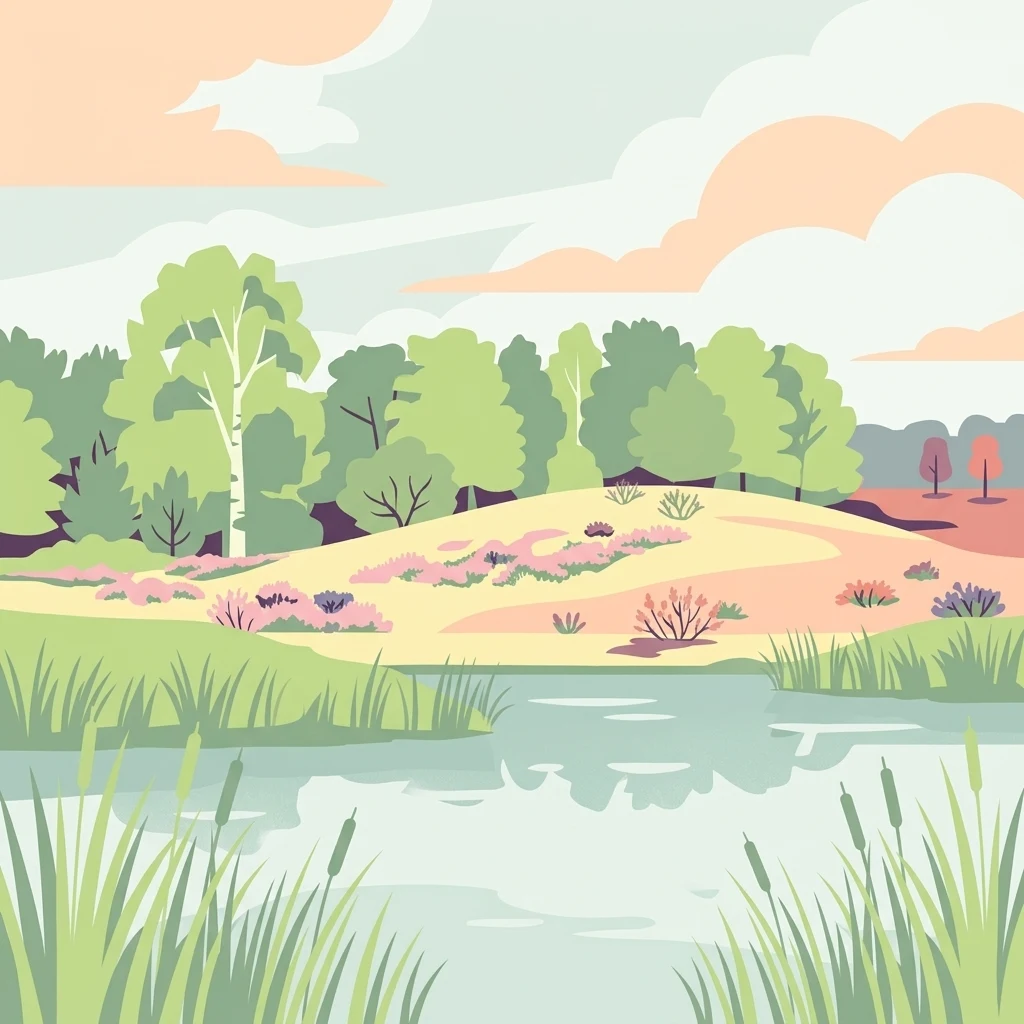
A flat-style digital illustration depicting a calm pond with tall grasses in the foreground, leading to sandy heathland with scattered shrubs, trees, and a distant treeline under a soft pastel sky.

Eispohl, Sandwehen und Heideweiher

Nature reserve

Park overview

Structured park overview, official facts, and landscape profile for Eispohl, Sandwehen und Heideweiher

Eispohl, Sandwehen und Heideweiher park facts, protected area profile, and essential visitor context

Review the core facts for Eispohl, Sandwehen und Heideweiher, including designation, size, terrain, visitor scale, habitats, and operating context in one park-focused overview.

About Eispohl, Sandwehen und Heideweiher

Eispohl, Sandwehen und Heideweiher is a compact nature reserve in the northern part of Bremen, protecting one of the last substantial fragments of an old heath and dune landscape that once stretched across the Rekumer Geest between Neuenkirchen, Schwanewede, and Lüssum. Today, this historic landscape survives only in small remnants, of which the Eispohl-Sandwehen area is the most significant on the Bremen side of the border.

The Geest itself is a sandy, slightly elevated terrain formed during the last glaciation, and the reserve's inland dunes belong to a tradition of open sandy landscapes that existed on these uplands long before modern land use pushed them back. The site therefore combines geological heritage with cultural heritage: the present-day pattern of heath, dune grassland, scattered woodland, and small pools is the result of centuries of grazing and Plaggen cutting, traditional practices that originally sustained these open Geest landscapes.

Within the reserve, the land is used in ways that consciously echo this past. Grassland is grazed extensively with livestock, woodland edges are kept open, and parts of the woodland serve as wood pasture. This combination of active management and ecological protection helps maintain the rare combination of dry dune vegetation, wet heath, and aquatic habitats that defines the site.

The reserve is also notable for its formal protection status. It is an officially designated Naturschutzgebiet under Bremen law, and it overlaps entirely with an EU Habitats Directive site. This dual status reflects both its local importance as a Bremen nature reserve and its wider significance within the European Natura 2000 network of protected areas.

Quick facts and research context for Eispohl, Sandwehen und Heideweiher

Eispohl, Sandwehen und Heideweiher is a Bremen nature reserve located in the Blumenthal district on the Rekumer Geest. It is registered in Bremen's nature protection book under number 8 and has been a protected area since 1 July 1988, with a significant enlargement in 2014 to its current size of roughly 35 hectares.

The reserve also contains the 23-hectare EU Habitats Directive site 'Heide und Heideweiher auf der Rekumer Geest', designated in 2004. Several small waterbodies, including the historically interesting Eispohl, are scattered through the dunes and heath. Elevation in the area ranges from about 21 to 30 meters above sea level, and the land rises from the surrounding lowlands as a classic sandy Geest terrace.

Protection and recognition

Terrestrial conservation status, designation history, and administrative scope.

Eispohl, Sandwehen und Heideweiher Protection Status and Designated Area Record

Eispohl, Sandwehen und Heideweiher maintains a recorded terrestrial protection status established in 2014. Structured tracking records outline the official designation history and management scope associated with this protected landscape.

Protection details

Protection scope
Terrestrial
Designated year
2014
Transboundary protection
No
WDPA ID
162904
Park context

Deeper park guide and search-rich context for Eispohl, Sandwehen und Heideweiher

Eispohl, Sandwehen und Heideweiher history, landscape, wildlife, and travel context

Explore Eispohl, Sandwehen und Heideweiher through its history, landscape character, ecosystems, wildlife, conservation priorities, cultural context, and seasonal travel timing in a structured park guide built for atlas discovery and search intent.

Why Eispohl, Sandwehen und Heideweiher stands out

The reserve is best known for its surviving inland dune ridges and heathland communities on the Rekumer Geest, together with a series of small heath ponds, including the ice-cutting Eispohl, that give the site much of its character. It is one of Bremen's most important examples of a sandy upland landscape shaped by historic sheep grazing and Plaggen cutting. The site is also recognized for its rich dragonfly fauna, including species that are rare elsewhere in Bremen, such as the king dragonfly, emerald dragonflies, and the northern and large whiteface damsels. The combination of dry dune grasslands, wet heath, heath ponds, mixed woodland, and grazed grassland in a compact area makes it a small but ecologically dense showcase of north-west German Geest habitats.
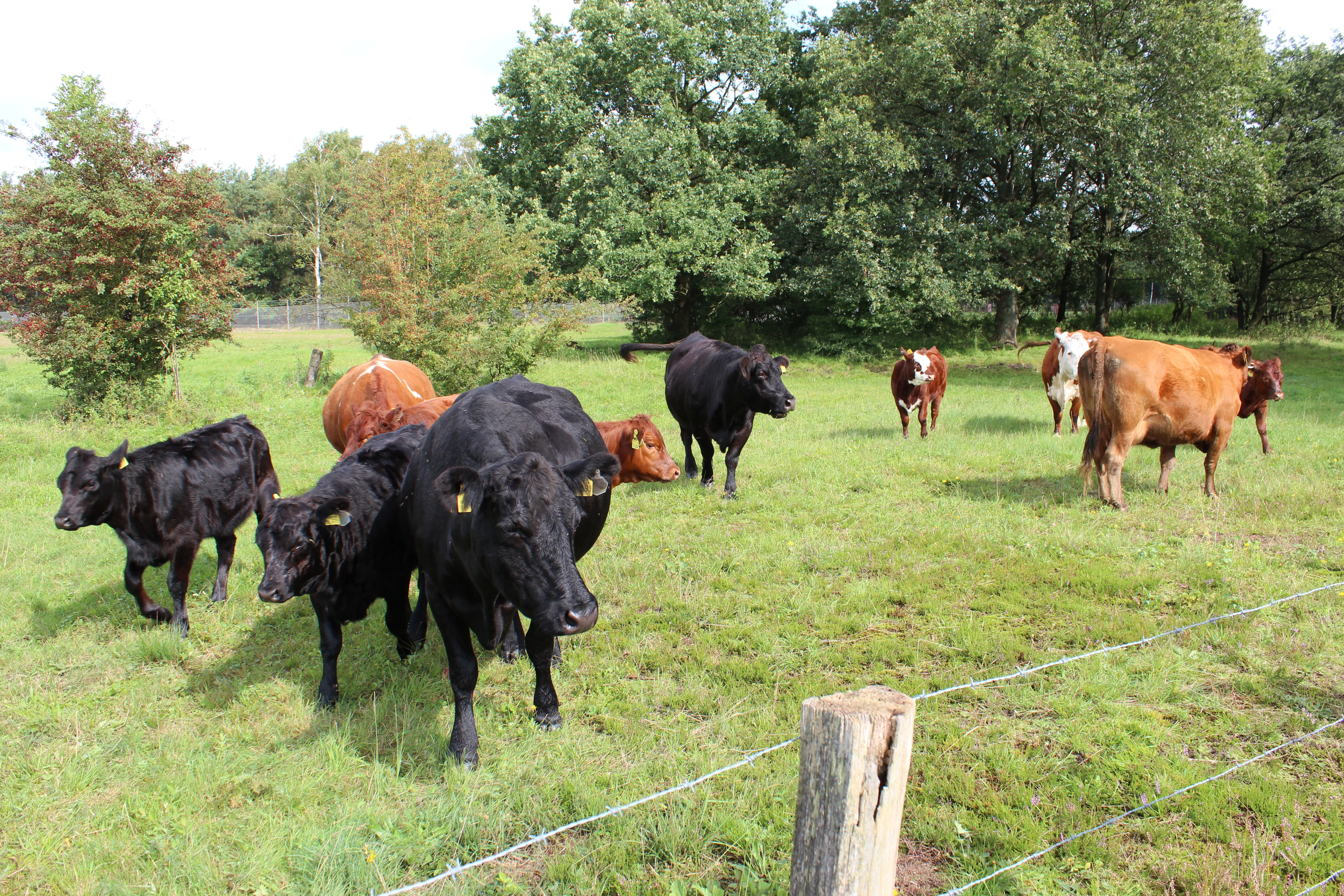
A small herd of cattle of various colors, including black, brown, and white, grazing in a grassy field in front of a line of green trees, with a wire fence in the foreground.
A small herd of cattle grazing in the Eispohl, Sandwehen und Heideweiher nature reserve, illustrating the landscape management practice used in the reserve.

Eispohl, Sandwehen und Heideweiher history and protected-area timeline

The area that is now the nature reserve was once part of an extensive heath and dune landscape on the Rekumer Geest, a sandy upland between Neuenkirchen, Schwanewede, and Lüssum. Like many Geest landscapes in north-western Germany, this open landscape was historically maintained by grazing, mostly with sheep, and by Plaggen cutting, a traditional practice of cutting turf and topsoil to use as bedding and fertilizer on cultivated fields.

The reserve's founding protection date is 1 July 1988, when the smaller 'Eispohl/Sandwehen' area, covering about 12.5 hectares, was formally designated as a Naturschutzgebiet. The site's history is also recorded in the historic name 'Eispohl', referring to a small pond whose ice was once cut in winter. Before the First World War, large blocks of ice were sawn from the frozen surface of the Eispohl and used to cool beer at the Rönnebeck brewery nearby.

In 2004, an area of about 23 hectares within the broader landscape was designated as an FFH (Habitats Directive) site under the name 'Heide und Heideweiher auf der Rekumer Geest', recognizing its significance for heath and pond habitats at European level. A significant expansion then followed on 25 March 2014, when the original reserve was enlarged to roughly 35 hectares. This expansion incorporated formerly landscape-protected areas into the stricter nature reserve regime, strengthening the legal protection of heath, dune, woodland, and pond habitats in the area.

Small traces of more recent history are also visible in the landscape: some of the reserve's minor waterbodies originated as bomb craters from the Second World War, an unintended legacy that has since been integrated into the ecological mosaic of the reserve.

Eispohl, Sandwehen und Heideweiher landscape and geographic character

The reserve sits on the Rekumer Geest, a sandy, slightly elevated terrain that rises above the surrounding lowlands between Bremen and the Weser marshland. Within this Geest setting, the protected area is defined by a striking combination of inland dunes, heath-covered flats, small ponds and pools, and mixed woodland, creating a variable landscape despite the relatively small size of the reserve.

Inland dunes form the geomorphological backbone of the site. These dry, sandy ridges support open dune vegetation and form the transition to the heath stretches around them. Heathland of varying moisture levels lines the dunes, while in the western part of the reserve a larger area of open grassland has been preserved. The mix gives the site a characteristically 'patchy' Geest appearance, with dry sandy ridges alternating with moister low-lying heath.

The waterbodies within the reserve are small but visually distinctive. The Eispohl itself, the Katzenpohl, the Farger Heideweiher, the Sandpohl, and the Grünlandblänke together create a chain of small standing waters, sometimes called heath ponds, that punctuate the otherwise dry sandy terrain. The gentle elevation difference across the site, from about 21 to 30 meters above sea level, is enough to produce clearly different vegetation patterns between drier and wetter locations, despite the compact geography of the reserve.
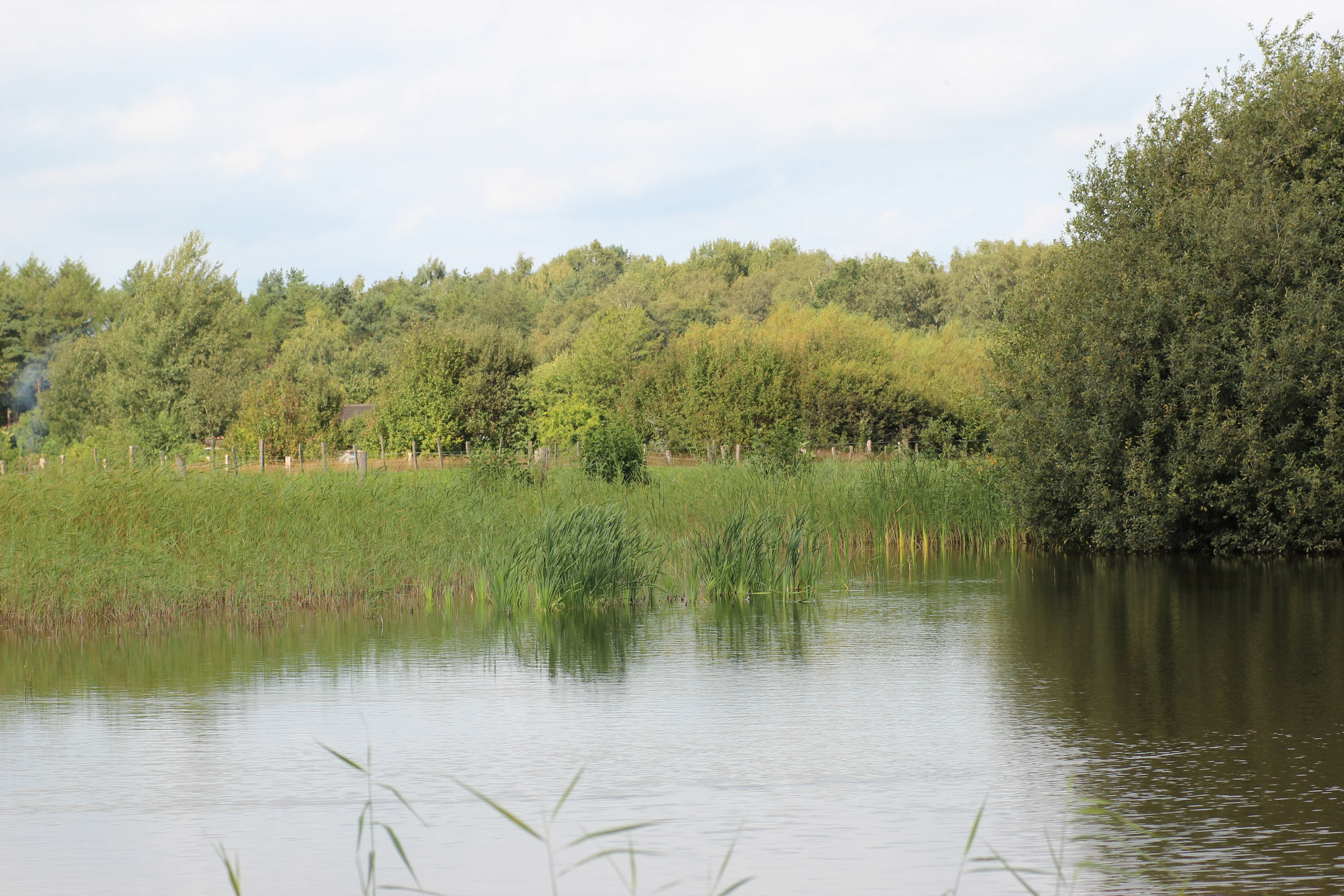
A small, calm pond with reeds and aquatic vegetation along the banks, surrounded by dense trees and shrubs under a cloudy sky.
A view of the Eispohl pond within the Eispohl, Sandwehen und Heideweiher nature reserve.

Eispohl, Sandwehen und Heideweiher ecosystems, habitats, and plant life

The ecological character of the reserve is built around a tight mosaic of dry and wet habitat types typical of the north German Geest. Although the area is small, the diversity of habitats within it is unusually high, which is the main reason for its European-level recognition under the Habitats Directive.

The forests inside the reserve include mixed oak woodland, beech woodland, and birch-pine forests. These woodland stands frame the open heath and dune areas and create important structural diversity. Around the edges and within the open heath, there are transitions into scrub, with trees and bushes gradually giving way to open vegetation.

On the dry dune ridges, pioneer vegetation has established on the sandy, nutrient-poor ground, including silver grass and small sedge pioneer grasslands, alongside heather and occasional hairy greenweed. These dry open habitats are complemented by wet heath and moor-like heath communities in the wetter parts of the reserve, where peat mosses, purple moor grass, bell heather, marsh gentian, and both round-leaved and intermediate sundews occur. Around pond margins, white and brown beak-sedge, hairy sedge, and thread rush thrive, while the ponds themselves support submerged plant communities including the small bladderwort, white water crowfoot, water lobelia, and a shoreweed-dominated shallow-water community.

Eispohl, Sandwehen und Heideweiher wildlife and species highlights

The reserve's wildlife reflects its strong habitat diversity: although the site is modest in size, it supports a rich community of amphibians, dragonflies, butterflies, grasshoppers, and birds associated with heath, dune, woodland, and pond habitats.

In and around the heath ponds, several amphibians find suitable breeding habitat. Common toads and common frogs are widespread, while moor frogs and garlic toads also occur. The smooth newt and the great crested newt also breed in the reserve's waters. The dry, warm habitats, including the open dune grasslands and the open woodland edges, are home to both the wood lizard and the sand lizard, reptiles that depend on well-insolated, sandy terrain.

The reserve is particularly notable for its dragonfly fauna, with around 25 species recorded. This assemblage includes various damselflies such as the bluets, mosaic damselflies, and darters, alongside species that are rare in the Bremen region altogether, including king dragonflies, emerald dragonflies, and the large and northern whiteface damselflies. Heath grasslands also support a notable insect community, including the blue-winged locust, sand wasps and digger wasps, wild bees, tiger beetles, ant lions, and various butterflies and spiders. Among the woodland birds, the honey buzzard and the raven, as well as several woodpecker species, breed in the dune woodlands of the reserve.

Eispohl, Sandwehen und Heideweiher conservation status and protection priorities

The reserve carries significant conservation weight both within Bremen and at the European level. Its designation as a Naturschutzgebiet under Bremen law, combined with its overlap with the Habitats Directive site 'Heide und Heideweiher auf der Rekumer Geest', reflects the fact that it preserves habitat types that have become rare across north-western Germany.

Heathlands and inland dunes have declined dramatically across the Geest region as a result of agricultural improvement, afforestation, and urban spread. What survives today in the Eispohl-Sandwehen reserve is therefore not just a fragment of a former widespread landscape, but a critical refuge for typical associated species. The presence of rare Bremen dragonflies such as king dragonflies, emerald dragonflies, and the northern and large whiteface damselflies within the reserve illustrates how disproportionately important these small Geest remnants can be for species that depend on a combination of heath, dune, and standing water.

Management of the reserve actively supports these conservation goals. Heath and dune grasslands are maintained through extensive grazing with livestock, and parts of the woodland are used as wood pasture, echoing traditional land use that shaped the original Geest landscape. This combination of legal protection and traditional management, supervised by Bremen's Senator for the Environment, is what allows the dry heath, wet heath, dune pioneer communities, and heath ponds to coexist within a small, heavily visited neighbourhood of Bremen.

Eispohl, Sandwehen und Heideweiher cultural meaning and human context

The cultural context of the reserve is closely tied to traditional north German Geest land use. For centuries, the sandy uplands around Bremen were shaped by sheep grazing and Plaggen cutting, practices that kept the landscape open and encouraged the spread of heath and dune vegetation. Areas like Eispohl-Sandwehen are essentially living relics of this older cultural landscape.

The site's names themselves carry this heritage. The 'Sandwehen' refers to inland dunes, a feature strongly tied to Geest geography, while 'Heideweiher' reflects the small heath ponds that are scattered across the Bremen Geest. The name 'Eispohl' is even more directly rooted in local history: from the pond, large blocks of ice were cut in winter before the First World War and used to cool the beer of the Rönnebeck brewery, a small but vivid example of how the Bremen landscape provided resources to nearby communities.

In the modern landscape, a different layer of cultural history is also visible: the reserve lies partly within the area of the Farge tank farm, an oil storage facility inherited from wartime and post-war infrastructure, and several small pools originated as Second World War bomb craters. Although these traces reflect a very different chapter in the area's history, they have been absorbed into the reserve's ecological mosaic, blending natural Geest heritage with 20th-century industrial and wartime legacies.

Top sights and standout views in Eispohl, Sandwehen und Heideweiher

Eispohl, Sandwehen und Heideweiher packs a remarkable range of Geest habitats into a compact Bremen location, from inland dunes and dry sand grasslands through oak, beech, and birch-pine woodland to wet heath and small heath ponds. This habitat density is what gives the reserve its conservation significance.

The heath ponds are a defining attraction, especially the historic Eispohl, while the dry dunes support rare Bremen dragonflies, sand lizards, and a rich suite of insects dependent on warm, exposed sandy ground. Grazing with cattle and traditional wood pasture use continue to shape the landscape, ensuring that this small Bremen reserve remains a vivid example of north German Geest heritage.

Best time to visit Eispohl, Sandwehen und Heideweiher

Late spring and summer are especially rewarding for visiting this kind of dry heath and dune landscape, when dragonflies are active around the heath ponds, sundews and bell heather flower in the wet heath, and the open dune grasslands are alive with butterflies, bees, and grasshoppers. Warm, dry days are best for spotting sand lizards and insect life on the sandy ridges.

Autumn and winter have their own appeal in the Geest environment, with cooler temperatures and softer light over the heath and dune areas, and the chance to see woodland birds such as woodpeckers and, with luck, a passing honey buzzard or raven. The site is more atmospheric than spectacular in winter, and a walk through the dunes in the colder months can show the broader structure of the landscape more clearly than in summer, when vegetation is at its densest.


Monthly climate preview

Long-term representative coordinate measurements of monthly temperature and precipitation patterns

Eispohl, Sandwehen und Heideweiher Climate Normals and Annual Temperature Rhythm

Historical data records a measured annual temperature range from near freezing winters to warmer summer peaks alongside steady precipitation rhythms across the coordinate. Reviewing twelve-month baseline normals provides clear context for evaluating regional weather patterns and long-term environmental conditions.
Annual mean9 °C
1 °C18 °C
Jan
Feb
Mar
Apr
May13°
Jun16°
Jul18°
Aug18°
Sep14°
Oct10°
Nov
Dec
Warmest month
July

18 °C

Coolest month
January

1 °C

Wettest month
July

2.5 mm/day

Driest month
April

1.4 mm/day

Park location guide

Geography guide, regional context, and park location map for Eispohl, Sandwehen und Heideweiher

Eispohl, Sandwehen und Heideweiher park geography, regions, and map view in Germany

Understand where Eispohl, Sandwehen und Heideweiher sits in Germany through a broader geographic reading of the surrounding landscape, nearby location context, and its mapped position within the national park landscape.

How Eispohl, Sandwehen und Heideweiher fits into Germany

Germany is a federal republic in Western and Central Europe with a population of over 83 million across sixteen constituent states. It is Europe's largest economy by nominal GDP and a major global exporter and importer. The capital is Berlin, and the country borders Denmark, Poland, Czech Republic, Austria, Switzerland, France, Luxembourg, Belgium, and the Netherlands.

Wider geography shaping Eispohl, Sandwehen und Heideweiher in Germany

Germany is located in Western and Central Europe, spanning 357,022 km². It borders Denmark to the north, Poland and the Czech Republic to the east, Austria and Switzerland to the south, and France, Luxembourg, Belgium, and the Netherlands to the west. The country has coastlines on the Baltic Sea and North Sea to the north, with the Alps located in the southern region.

Map view of Eispohl, Sandwehen und Heideweiher

Use this park location map to pinpoint Eispohl, Sandwehen und Heideweiher in Germany, understand its exact geographic position, and read its mapped placement within the surrounding landscape more clearly.

Pigeon | © OpenStreetMap contributors

Location context for Eispohl, Sandwehen und Heideweiher

Bremen

Visual exploration of inland dunes, heath ponds, and protected habitats

Eispohl, Sandwehen und Heideweiher Landscape Photography and Scenery

Visual documentation of Eispohl, Sandwehen und Heideweiher reveals the intricate terrain of sandy inland dunes, wet heathlands, and traditional heath ponds. Photographic records of the protected area offer clear insight into the diverse habitats and northern lowland scenery preserved across the Rekumer Geest.

A small herd of cattle of various colors, including black, brown, and white, grazing in a grassy field in front of a line of green trees, with a wire fence in the foreground.

A wide view of a sandy, grass and heather covered heathland with a line of trees in the background under a cloudy sky.

A small, calm pond with reeds and aquatic vegetation along the banks, surrounded by dense trees and shrubs under a cloudy sky.

Park atlas

Compare nearby regional nature reserves and connected sandy upland terrain.

Parks Near Eispohl, Sandwehen und Heideweiher and Surrounding Protected Landscapes

Browsing other protected areas near Eispohl, Sandwehen und Heideweiher reveals related lowland heath formations and glacial dune ecosystems across the surrounding region. Expanding the geographic comparison helps trace broader conservation patterns and regional park geography.
Nature reserveBremen
About 5.2 km away#1 closest

East

Hammersbecker Wiesen: Protected Nature Reserve and Meadow Landscape in Bremen

Ecological mosaic of wet meadows and stream valley terrain

Hammersbecker Wiesen encompasses 25.8 hectares of ecologically significant wet grassland and hedgerow habitats in Bremen. This nature reserve provides an essential refuge for diverse plant species and local amphibians within an urban-adjacent setting, illustrating the preserved character of traditional northern German meadow systems.

Area
0.258 km²
Established
1986
Nature reserveBremen
About 9.8 km away#2 closest

Southeast

Dunger See Nature Reserve: Mapped Protected Wetland and Landscape Geography in Bremen

A structured geographic look at the Werderland bird protection habitat.

Dunger See is a compact, ecologically diverse nature reserve in Bremen, shaped by intentional land management to provide critical nesting and wintering grounds for wildfowl. This protected area stands out for its indented shoreline, artificial island clusters, and surrounding woodland buffers that contrast with the open agricultural terrain of the wider Werderland landscape.

Area
0.33 km²
Established
1990
Relief
Lowland
Climate
Temperate
Nature reserveBremen
About 10 km away#3 closest

East

Ruschdahlmoor Nature Reserve: Deep Peatlands and Protected Wetland Geography in Bremen

Geological subsidence sinkhole and urban protected landscape

Ruschdahlmoor stands as a unique nature reserve in Bremen, Germany, distinguished by a peat-forming wetland developed inside a sinkhole over the Lesum salt dome. This protected area supports tall herb meadows, reed-fringed ponds, and rare peat-depth records, offering a dense, ecologically rich landscape context that remains a vital part of the city's natural geography.

Area
0.048 km²
Established
1991
IUCN
IV
Relief
Lowland
A horizontal watercolor painting showing a tranquil lake scene with green trees, low-lying hills in the distance, and grassy banks against a white background.
Nature reserveBremen
About 13 km away#4 closest

Southeast

Grambker Feldmarksee Nature Reserve: Mapping the Protected Landscapes of Bremen

A vital wetland sanctuary shaped by regional infrastructure and natural restoration

Grambker Feldmarksee offers a focused look at how post-industrial quarry sites evolve into ecologically dense nature reserves. This groundwater-fed lake in Bremen acts as a green island, showcasing mature woodland fringes and specialized wetland habitats that are integral to the local bird protection network.

Area
0.226 km²
Established
2009
Relief
Lowland
Climate
Temperate
Nature reserveLower Saxony
About 13 km away#5 closest

South

Stenumer Holz Nature Reserve: Protected Ancient Woodland Geography in Lower Saxony

A detailed map-based overview of ancient oak and beech forest ecosystems

Stenumer Holz functions as a critical nature reserve within the Oldenburg district, preserving an ancient broadleaf forest mosaic that stretches across 96 hectares of sandy-geest terrain. The area is defined by its diverse structural composition, including moist oak-hornbeam stands, drier Luzula beech ridges, and narrow alluvial corridors that support specialized woodland flora and old-growth ecological features.

Area
0.96 km²
Established
2018
Relief
Lowland
Climate
Temperate
Nature reserveBremen
About 13 km away#6 closest

East

Untere Wümme Nature Reserve: Riverine Biodiversity and Protected Tidal Landscapes in Bremen

Protected floodplain geography and tidal river habitats.

This nature reserve protects the meandering lower course of the Wümme river, showcasing one of northern Germany's few freshwater tidal systems. Spanning reedbeds, willow forests, and open mudflats, the reserve forms a vital corridor for migratory fish and waterfowl, reflecting a complex mosaic of protected riverine ecosystems and historic meadow landscapes.

Area
1.485 km²
Established
1991
Relief
Lowland
Climate
Temperate
Nature reserveLower Saxony
About 15 km away#7 closest

North

Südliches Hagener Königsmoor Nature Reserve: A Protected Peatland in Lower Saxony

Ecological mosaic of bog woodland and historical peat cuttings

Südliches Hagener Königsmoor is a protected nature reserve in Hagen im Bremischen, Lower Saxony. The terrain features a distinct mosaic of raised bog vegetation, drainage channels, and water-filled peat cuttings that anchor a rare remnant of the original lowland moor landscape against modern agricultural surroundings.

Area
0.85 km²
Established
1981
IUCN
IV
Protected landscapeNiedersachsen
About 16 km away#8 closest

Northwest

Dornebbe, Braker Sieltief und Colmarer Tief: Mapped Protected Landscape in Niedersachsen

Geographic atlas of tidal lowland waterways and coastal habitats

Dornebbe, Braker Sieltief und Colmarer Tief comprises a chain of slow-flowing streams and bank habitats essential to the coastal marshland geography of Niedersachsen. The area provides a structured look at multi-layered habitat protection, featuring dense reedbeds and aquatic corridors vital for regional biodiversity in the German tidal zone.

Area
0.33 km²
Established
2018

Common questions about visiting, size, designation, and location context for Eispohl, Sandwehen und Heideweiher

Eispohl, Sandwehen und Heideweiher FAQs for park facts, access, geography, and protected area context

Find quick answers about Eispohl, Sandwehen und Heideweiher, including protected-area facts, park geography, trail and visitor context, and how the park fits into its surrounding country and regional landscape.
MoriAtlas Explorer

Continue Your Protected Areas Search Across the Global Atlas

Deepen your exploration by continuing the structured search for national parks and protected areas worldwide. Utilize the comprehensive filtering capabilities to compare different conservation landscapes and refine your understanding of global park geography. Discover more about the distribution and characteristics of protected natural areas.

Global natural geography