
Trip Timing Fundamentals
When is the Best Time to Visit El Imposible National Park?
Navigating the Apaneca Ilamatepec Mountain Range
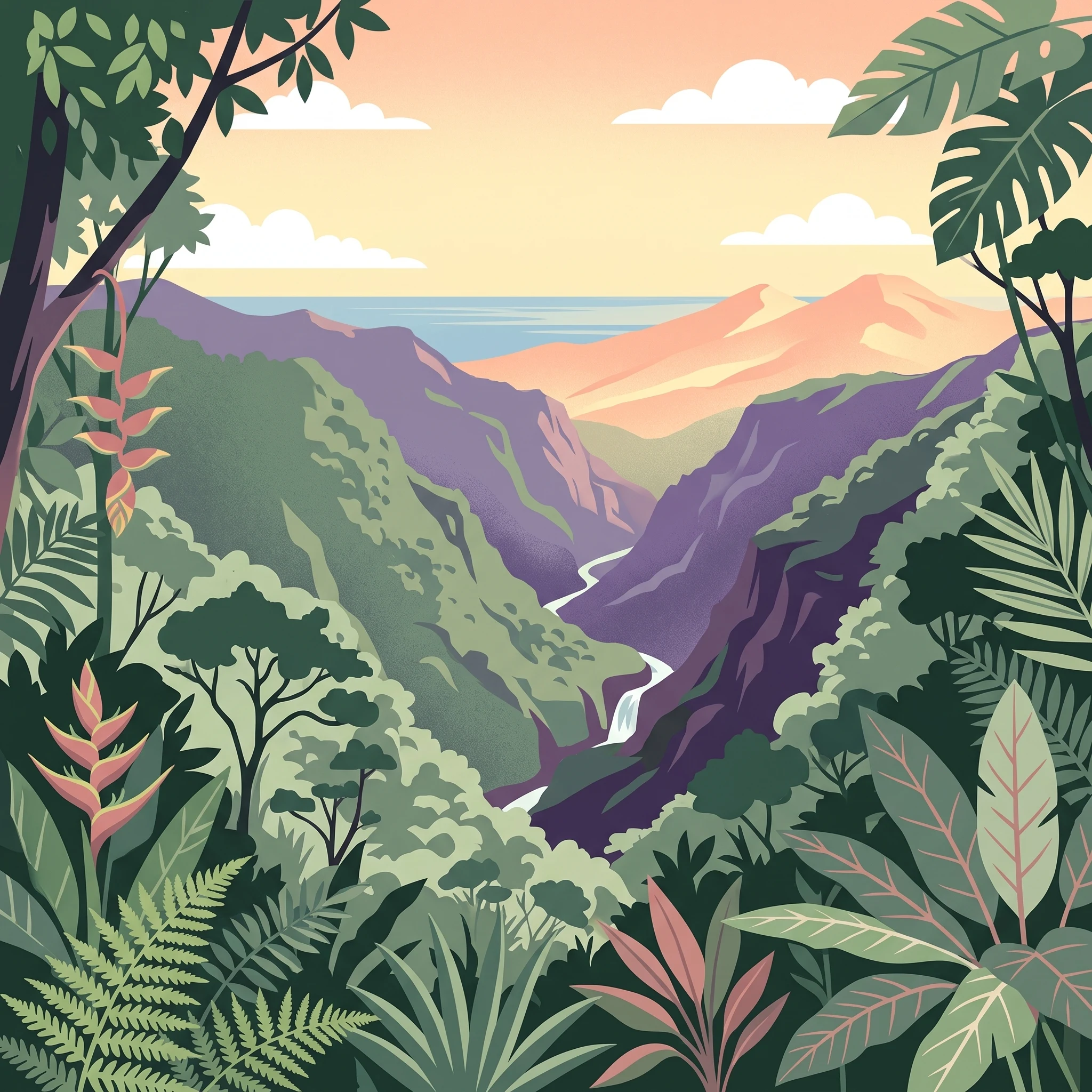
The best time to visit El Imposible National Park is during the dry season, which generally runs from November through April. This period offers the most reliable window for traversing the park's rugged terrain, as the significantly lower precipitation levels transform the steep, often challenging trails into more navigable paths. Visitors choosing these months prioritize clear skies and the sweeping, panoramic mountain vistas that the park is known for, particularly the elevated viewpoints that can reach out toward the Pacific Ocean. Because the park features dramatic gorges and elevation changes ranging from 250 to over 1,400 meters, this period provides the atmospheric stability necessary to safely appreciate its complex geography.
Balancing Weather with Landscape Vibrancy
While the dry months provide superior conditions for hiking and outdoor visibility, the wet season from May through October offers a different, equally valid experience for those willing to navigate more intense conditions. During these months, the park transforms into an exceptionally lush, vibrant environment fueled by frequent rainfall. While rain may increase trail difficulty and obscure distant views, it sustains the vital river systems and cascades that define the park's diverse tropical forest ecosystems. For visitors whose primary goal is to observe the deep, green density of the forest or witness the dramatic hydrological power of the park’s eight river systems, the wet season is arguably more representative of the park’s natural essence. However, this comes with the inherent trade-off of higher humidity and the potential for temporary trail obstacles that necessitate a more cautious approach to backcountry exploration.
Primary Climatic Trade-offs
Understanding when to visit requires weighing your specific travel priorities against the predictable shift in the park's climate. The dry season is characterized by a notable reduction in daily rainfall and lower humidity, which creates a drier, more comfortable microclimate for physically demanding excursions. Conversely, as the calendar moves toward the peak rainfall months in September, the increased moisture impacts not only the trail conditions but also the overall logistics of visiting a remote, mountainous protected area. Rather than seeking a single ideal month, prospective visitors should decide whether their priority is technical trail accessibility and expansive scenic views or the immersive experience of a thriving, high-moisture tropical mountain environment. Whatever window you choose, keep in mind that the park's rugged nature means that localized weather patterns in the Apaneca Ilamatepec range can vary significantly from broader regional reports, making flexibility an essential part of any successful itinerary.
Seasonal Comparison
Best Months to Visit El Imposible National Park for Every Traveler
Dry Season Hiking and Panoramic Visibility (November to April)
For travelers whose primary goal is accessing the rugged trail network of the Apaneca Ilamatepec Mountain Range, the months from November through April represent the most reliable window. During this period, precipitation levels are at their lowest, allowing for safer passage through the steep terrain and gorges that historically defined the region. Hikers visiting between January and March benefit from exceptionally dry conditions, which clarify the atmosphere and enhance the likelihood of capturing distant views of the Pacific Ocean from high-elevation viewpoints. The trade-off for this stability is a drier forest landscape, where some vegetation may appear less vibrant, and daytime temperatures can climb toward their annual peaks, particularly as the season progresses into April. Visitors should be prepared for higher daytime sun exposure on exposed ridges compared to the shaded canopy, necessitating careful management of hydration and sun protection.
Lush Landscapes and Tropical Humidity (May to October)
Travelers who prioritize photography, lush foliage, and the experience of a tropical cloud forest may find the period between May and October more rewarding. While this window encompasses the period of higher precipitation, it transforms the landscape into a deep, vivid green that sustains the park's immense biodiversity. September and October typically see the highest relative humidity and rainfall, which can make trail surfaces slick and increase the complexity of navigation. The trade-off during these months is a reduced chance of sweeping vistas, as cloud cover often settles over the higher elevations of the park. However, the cooling effect of frequent rain and the presence of cascading water in the eight river systems create a dynamic, immersive experience that is less common in the drier months. This season is best suited for those who are prepared for muddy conditions and prioritize the ecological density of the forest over long-range mountain vistas.
Choosing Between Environmental Priorities
Deciding when to visit often comes down to a trade-off between clarity and vitality. If your travel objective includes identifying pumas or black-crested eagles, bear in mind that animal activity often depends more on patience and quiet movement than specific calendar dates, though the moderate humidity and milder temperatures of early November or late April can offer a middle-ground experience. Readers should monitor regional weather patterns, as the transition periods between the primary dry and wet seasons are inherently variable. Always prioritize safety by checking current park alerts before planning hikes into remote sections of the park, regardless of the month chosen.
Climate Data
Annual Weather and Climate Patterns at El Imposible National Park
Thermal Patterns and the Impact of Tropical Elevation
El Imposible experiences a temperature regime defined more by altitude and cloud cover than by significant seasonal shifts in latitude. Mean daily temperatures fluctuate narrowly, typically ranging between 23°C and 27°C throughout the year. The most notable thermal variance occurs during the transition from the end of the dry season into the early wet season. April typically marks the peak of the annual heat, with maximum daily temperatures often reaching 35°C as the sun remains high and precipitation levels are still low. Following this peak, the arrival of the rains in May and June naturally tempers daytime highs through increased cloud cover and humidity, leading to a more moderate thermal profile through the remainder of the year. It is important to note that these values represent long-term climate normals sampled at approximately 600 meters. Visitors moving toward higher reaches of the Apaneca Ilamatepec range may experience cooler conditions than the averages suggest, while those descending into deep, sheltered gorges may encounter pockets of intensified heat and reduced airflow.
Moisture Regimes and Seasonal Transitions
Rainfall is the most significant differentiator for planning a visit to the park. The annual cycle shifts from an arid window, where precipitation is negligible at less than 1 mm per day between December and March, to a intense period of moisture starting in May. June and September stand out as particularly wet months, with averages exceeding 6 mm of rain per day. This sharp contrast drives the physical state of the park trails and the visibility of its river systems. During the months of high rainfall, relative humidity levels often climb above 80 percent, which can significantly alter the physical sensation of the climate, making physical exertion feel more demanding. The dry season transition,beginning in November,is marked by a swift drop in humidity and a sharp decrease in rainfall, which creates the firm trail conditions most sought after for extensive hiking.
Wind, Daylight, and Atmospheric Clarity
Beyond temperature and rainfall, wind and daylight patterns play a subtle but crucial role in how the park environment feels. Wind speeds are generally most consistent during the height of the dry season, particularly in January and December, when they average above 5 m/s. These breezy conditions can assist in dispersing humidity and keeping viewpoints clearer during the drier months. In contrast, the middle of the wet season, specifically from June through September, features lower average wind speeds, which can lead to more stagnant, humid conditions within the forest canopy.
Daylight hours follow a modest annual curve, extending from a minimum of 11.2 hours in December to a maximum of 12.8 hours in June. While this variance of approximately 90 minutes may seem slight, it directly influences the available time for daylight-dependent navigation within the dense forest. Because these values are long-term climate normals, they serve as a guide to the general environmental character of the park rather than a guarantee of specific weather for any given trip. Readers should always check local weather forecasts and official park alerts closer to their arrival, as microclimates within the mountainous terrain can produce conditions that differ significantly from these regional averages.
Seasonal Weather Cycles
Defining the Dry and Rainy Seasons in El Imposible National Park
The Primary Distinction: Dry versus Rainy Phases
El Imposible National Park operates on a binary climate rhythm rather than the traditional four-season model found in temperate zones. The year is effectively bifurcated into a dry period, spanning from November through April, and a pronounced rainy period, which dominates from May through October. This division is the single most important factor for planning, as the park's topography,defined by steep volcanic gorges and high-gradient river systems,reacts sharply to precipitation levels.
The Dry Season: November to April
The dry season begins to take hold in November, as wind speeds increase and humidity levels begin a steady, months-long decline. Travelers visiting during the heart of this period, typically from January to March, will encounter the lowest precipitation levels of the year. This window is marked by relatively stable atmospheric conditions, which are ideal for exploring the park’s rugged terrain. Humidity is at its annual low during March, often dipping toward 60 percent, which makes the strenuous hikes through the mountainous landscape significantly more manageable than during the humid months.
While this period is labeled dry, visitors should note the subtle shift that occurs as the season progresses. The early months of November and December retain some moisture from the tail end of the rainy cycle, often resulting in lingering green landscapes. As the season matures toward April, the landscape becomes drier and the heat reaches its peak. April is a pivotal transition month where temperatures climb to their annual maximums, creating a hot, dusty environment that necessitates careful hydration and heat management for all-day trail activities.
The Rainy Season: May to October
The transition into the rainy season is often sudden, characterized by a sharp rise in daily precipitation that occurs as early as May. From June through September, the park enters its most saturated phase. During these months, the relative humidity consistently remains above 80 percent, and the frequency of rainfall increases significantly. This influx of water transforms the forest, feeding the eight river systems and creating the vibrant, lush environment for which the area is famous. However, this moisture also increases the risk of mud on trails and creates challenging navigation conditions within the steep gorges.
Visitors should view the rainy season as a period of atmospheric volatility. While the landscape is at its most verdant, the combination of high humidity and persistent rain creates a heavy, damp atmosphere. The drop in average maximum temperatures,typically falling to just below 30 degrees Celsius by September and October,provides a cooler feeling compared to the intense heat of the late dry season, yet this is offset by the constant presence of surface moisture. This phase is not a complete closure of the park, but it does fundamentally alter the physical experience of moving through the Apaneca Ilamatepec range, as terrain that is traversable in February may become slick and prone to washout by August.
Seasonal Experiences
What Visiting El Imposible National Park Is Like Throughout the Year
Navigating Trail Conditions Through the Seasonal Cycle
The diverse terrain of El Imposible, which climbs from 250 meters to over 1,400 meters, reacts distinctly to the shift between dry and wet months. During the dry season months of November through April, the park's well-marked trail network, including routes like Cerro Leon and Los Enganches, remains generally stable. The lack of significant rainfall during this window minimizes the prevalence of mud on steep slopes, making the navigation of the rugged volcanic mountain landscape more predictable. For visitors prioritizing consistent access to the higher altitude paths, this period offers the most reliable footing.
Conversely, the transition into the rainy season, beginning in May and peaking in precipitation through September, introduces significant challenges for trail stability. The park's tropical forest floor becomes saturated, increasing the risk of slippery conditions on technical sections of the trails. While the rainfall supports the lush growth of the forest, it also necessitates more cautious pace and appropriate footwear for hikers. During this time, the paths traversing the river systems and steep gorges require careful assessment, as high water levels can impact the accessibility of certain creek crossings and low-lying trail segments.
Seasonal Shifts in Aquatic Experiences and Watershed Health
The eight river systems of the park serve as a defining feature of the local landscape, and their character changes significantly throughout the year. The presence of the Tepemechin fish in the park's streams acts as an indicator of water purity, a detail often appreciated by those visiting the cooler, shaded pools. In the dry season, the flow in these river systems is reduced, which makes the pozas at Piedra Sellada more accessible for wading and cooling off after a hike. This lower water volume often provides clearer water conditions, though the trade-off is a reduction in the flow at cascades compared to the height of the rainy months.
As the rainy season progresses, the water features gain energy and volume. The increase in precipitation from June through September revitalizes the river corridors, creating a more dynamic and lush environment. While this period is less ideal for swimming due to increased flow and potential turbidity, it is the peak time for witnessing the hydrological power of the watershed that feeds the coastal mangroves. Visitors should note that water levels can shift rapidly; those planning to explore areas near riverbanks should prioritize safety and be prepared for changing access conditions based on recent weather events.
Wildlife Observation and Forest Vitality
El Imposible is a sanctuary for significant biodiversity, including pumas, the elusive oncilla, and the black-crested eagle. The timing of your visit may influence the environment in which you look for these species. During the dry months, the forest canopy is relatively more stable, and the reduced vegetation density near the ground can occasionally provide clearer lines of sight along trails. However, the wet season transforms the forest into a highly verdant, humid ecosystem. This increase in moisture drives the proliferation of plant life and insect activity, which in turn supports the complex food web that sustains the park's larger mammals and bird populations. While wildlife encounters are always a matter of patience and local movement, the density of the forest during the post-rain periods offers an immersive experience in one of Central America’s most intact tropical remnants.
Visitor Priorities
Timing Your Visit to El Imposible National Park Based on Travel Priorities
Balancing Heat and Trail Conditions for Hikers
For those primarily focused on traversing the park's network of trails, the period from December through February offers the most stable conditions. During these months, precipitation levels are at their annual lowest, generally falling below 0.5 mm per day. This minimal rainfall ensures that the steep, rugged paths characteristic of the Apaneca Ilamatepec range remain firm, reducing the risks associated with mud-slicked descents into the park's characteristic gorges. While the air temperature remains warm, the relative humidity during this window drops to its lowest annual point, often below 70 percent. This combination of dry air and solid footing provides the most reliable environment for long-distance hiking. The primary trade-off is the lack of forest vibrancy; the vegetation may appear sparser as the landscape enters a dormant stage during the peak of the dry season.
Targeting Cooler Walking Weather
If your priority is to mitigate the heat typically associated with the tropical forest environment, the months of November and December are your best options. As the rainy season concludes, average maximum temperatures hover around 30 degrees Celsius, which is significantly more manageable than the heat peaks experienced in April, when daily maximums can climb toward 35 degrees Celsius. These months benefit from a consistent breeze that persists after the monsoon-like rains of September and October have faded. By choosing late autumn or early winter, you gain a comfortable thermal profile for physical exertion. The main compromise here is the possibility of residual moisture on the trails, as the ground can remain saturated for several weeks following the conclusion of the heavy rains.
Prioritizing Landscape Immersion and Photography
Visitors who prioritize lush, verdant landscapes and the full flow of the park's river systems should look toward the transition period of May and June. While these months see an increase in precipitation, they follow the hottest, driest time of the year, resulting in a sudden, dramatic rejuvenation of the forest foliage. The relative humidity begins to climb toward 80 percent, creating the atmospheric, cloud-draped aesthetic often associated with high-altitude tropical forests. This is an excellent time for those interested in the park's hydrological features, such as the cascades and the pools at Piedra Sellada. The trade-off is immediate: you must be prepared for more frequent rainfall and potentially difficult trail conditions. Waterproof gear is mandatory during this window, and one must remain flexible, as afternoon showers can frequently obscure visibility at higher elevations, temporarily hiding the sweeping views that stretch toward the Pacific.
Visitor Access and Logistics
Seasonal Access Requirements and Planning for El Imposible National Park
Accessing El Imposible National Park requires advance preparation, as the park is a remote protected area rather than a high-traffic urban attraction. While the mountain terrain is physically accessible year-round, your ease of movement depends heavily on seasonal weather cycles. The dry season, running from November through April, generally offers more consistent road and trail conditions, reducing the likelihood of travel delays caused by mud or washed-out paths. During the rainy season, specifically from June through September, heavy precipitation can complicate ground transport on rural roads surrounding the Apaneca Ilamatepec range.
Navigating Regional Transport
Reaching the park typically involves a combination of regional bus travel and local connections. Most visitors travelling independently use the bus system to reach the town of Cara Sucia. From the transit hub of Sonsonate, bus routes heading toward the Guatemalan border are frequent, but schedules for the final leg into the park can be irregular. While some local routes may offer service toward the San Benito entrance, rely on current local information rather than pre-printed schedules. If you are not using a private vehicle, account for the need to negotiate short-distance taxi or informal transit to reach specific park entry points. Because transport options are subject to change, verify the most current routes with local tourism offices or your accommodation provider in nearby municipalities before you depart.
Entry Procedures and Park Management
El Imposible is a managed national park, meaning visitors should expect to encounter established entry points, which may require registration or the payment of an entrance fee. These procedures are subject to updates by the park authority, which manages forest conservation and visitor safety. Never assume that historical entrance gate operations or permit requirements are still in effect. Before finalizing your itinerary, check the official website of the Ministry of Environment and Natural Resources or contact the park administration directly to confirm current operating hours, entrance regulations, and any potential closures for maintenance or weather-related protection of wildlife corridors.
Verifying Operational Status
Environmental conditions can dictate the day-to-day accessibility of the park’s eight river systems and deep gorges. Significant rainfall can lead to temporary closures of specific trails if authorities deem the ground unstable. Because these decisions are reactive to real-time climate impacts, always consult current park alerts or weather warnings on the morning of your planned visit. Prioritize flexibility in your schedule, especially if you are traveling during the wetter months, to ensure you are not caught off guard by changing trail or road access status.
Safety and Preparation
Seasonal Safety and Trail Preparation at El Imposible National Park
Preparing for Changing Trail Conditions
Safety in the rugged terrain of this park is dictated primarily by the seasonal moisture cycle. During the transition from the dry season into the wetter months starting in May, trail surfaces can quickly shift from stable, dry ground to slick, muddy paths. The steep topography, which defines the landscape of this region, exacerbates these conditions. Hikers should anticipate that trails that are easy to traverse in January or February may become significantly more demanding as precipitation increases throughout the summer and early autumn. Prior to starting any hike, always consult with park rangers regarding specific route conditions, as recent weather events can render certain paths hazardous regardless of the time of year.
Managing Heat and Sun Exposure
While the park is characterized by its tropical mountain climate, temperatures remain significant, particularly during the dry months from March through May. Average maximums during this period frequently reach into the mid-thirties Celsius. Because the sun is intense in this latitude, visitors should plan their activities to avoid the peak heat of the day. Early morning starts are not just beneficial for wildlife spotting, but are a critical safety measure to reduce prolonged exposure to high temperatures and direct sunlight. It is essential to monitor your own physical condition and recognize that the high humidity often present, even in the dry season, reduces the body's ability to cool itself effectively.
Navigating Seasonal Hazards and Daylight Constraints
Daylight hours fluctuate throughout the year, with the shortest days occurring in November and December at approximately 11.2 hours. While the variation is not extreme, it is sufficient to impact planning for longer hikes. Always ensure that your route selection is realistic for the available daylight, allowing ample time to return to the trailhead or your accommodation well before dusk. Navigating the forest floor or uneven terrain in fading light increases the risk of trips and falls significantly. Furthermore, during the rainy months of June through September, afternoon thunderstorms can develop rapidly. These events often bring sudden heavy rainfall that can make river crossings difficult and significantly alter the stability of the terrain. If you observe darkening skies or sudden wind shifts, prioritize returning to a safe, established area rather than continuing toward more remote sections of the park. Always check official daily weather forecasts and heed any warnings posted by park authorities regarding trail closures or restricted zones, as these are the most reliable indicators of current safety risks.
Finalizing Your Visit
Deciding on the Ideal Time to Experience El Imposible National Park
Evaluating Your Personal Priorities for El Imposible
Choosing the right dates for your visit requires balancing physical comfort against the specific landscape experiences you seek. The core decision hinges on your tolerance for rain versus your desire for clear, panoramic views of the Apaneca Ilamatepec mountains. If your primary goal is consistent trail access for long-distance hiking, the dry window from November to April offers the most stable footing and reliable weather. During these months, the diminished humidity and lower precipitation levels reduce the risk of trail closures and mud-related delays, allowing for a more predictable daily itinerary. Conversely, travelers seeking to witness the park at its most vibrant should consider the rainy season, despite the increased challenges.
Reconciling Climate Patterns with Travel Goals
Those who prioritize lush, verdant scenery and high biodiversity will find the transition into the rainy season, specifically May and June, particularly rewarding. While higher rainfall brings increased humidity and more frequent, localized showers, it also transforms the forest into a dense, thriving ecosystem that is less susceptible to the heat spikes of late dry season months like March and April. The trade-off is clear: you gain a deeper, more atmospheric immersion in the tropical environment, but you sacrifice the panoramic clarity often found on the mountain ridges during the drier, windier months at the start of the year.
Making a Final Selection
Ultimately, there is no universally perfect time for every visitor because the park responds so dynamically to the annual hydrological cycle. If you are preparing for a trip, view the seasonal patterns as a framework rather than a rigid calendar. The dry season is generally more suitable for those restricted by specific time frames who need to minimize the potential for travel disruption. However, those visiting during the transition months or the heart of the wet season will often experience a quieter, more solitary park environment, provided they are prepared for the realities of wet, tropical conditions. Before finalizing your dates or booking transport, always verify current operating status and trail accessibility with park authorities. Remember that climate normals indicate long-term trends rather than daily forecasts, and specific weather events can deviate significantly from annual averages.