

Mori Atlas logo
Nature reserveFairview Conservation Park

Mapping the seasonal wetlands, limestone ridges, and woodland mosaic of this protected nature reserve

Fairview Conservation Park in South Australia: A Detailed Map and Protected Landscape Overview

Fairview Conservation Park serves as a protected nature reserve in the Limestone Coast region of South Australia. The landscape encompasses a complex mosaic of semi-permanent lagoons, seasonally inundated flats, and undulating sandy and limestone ridges. This detailed atlas entry provides insights into the park's terrain, mapped boundaries, and ecological character as a dedicated sanctuary for wetland and woodland habitats north of Lucindale.

wetlandslagoonslimestone coastsandy flatslimestone ridgesblue gum woodland

Fairview Conservation Park

Nature reserve

Park overview

Structured park overview, official facts, and landscape profile for Fairview Conservation Park

Fairview Conservation Park park facts, protected area profile, and essential visitor context

Review the core facts for Fairview Conservation Park, including designation, size, terrain, visitor scale, habitats, and operating context in one park-focused overview.

About Fairview Conservation Park

Fairview Conservation Park occupies a modest footprint within the Limestone Coast region of southeastern South Australia, a landscape shaped by ancient marine geology, sand movement, and seasonal waterlogging. Sitting north of the small service town of Lucindale, the reserve lies within rural pastoral land and represents one of the many smaller conservation parks that punctuate the South Australian protected-area network.

The park's defining character lies in the interplay between its aquatic and terrestrial environments. Two semi-permanent lagoons anchor the landscape, fringed by an association of South Australian swamp paperbark and sedges that thrives along the sandy lagoon margins. Beyond these waterbodies, the terrain transitions into extensive seasonally inundated flats, sandy flats and ridges, and underlying limestone ridges, producing a patchwork of habitats within a relatively compact area.

Vegetation patterns respond closely to this landform mosaic. Open heath and tussock grasslands occupy the seasonally inundated flats, while the better-drained sandy flats and limestone ridges support a low open woodland of South Australian blue gum and rough-barked manna gum. The result is a reserve that captures, on a small scale, the ecological complexity typical of the Limestone Coast.

Although the conservation park is classified as an IUCN Category Ia strict nature reserve, suggesting an emphasis on ecological protection rather than intensive recreation, it still provides modest opportunities for low-key nature-based activities. The reserve is part of South Australia's broader system of parks managed for biodiversity conservation, landscape protection, and the long-term preservation of regionally distinctive vegetation communities.

Protection and recognition

Documented terrestrial protection scope and historical designation data

Fairview Conservation Park Protection Status and Designation History

Terrestrial protection status for Fairview Conservation Park establishes a formal 1972 establishment baseline for the managed area. Structured records trace the documented designation history and management scope without supplementary international recognition sources.

Protection details

Protection scope
Terrestrial
Designated year
1972
Transboundary protection
No
Park context

Deeper park guide and search-rich context for Fairview Conservation Park

Fairview Conservation Park history, landscape, wildlife, and travel context

Explore Fairview Conservation Park through its history, landscape character, ecosystems, wildlife, conservation priorities, cultural context, and seasonal travel timing in a structured park guide built for atlas discovery and search intent.

Why Fairview Conservation Park stands out

Fairview Conservation Park is best known for its distinctive combination of semi-permanent freshwater lagoons and seasonal wetland flats set against a backdrop of sandy flats and limestone ridges. The reserve is also notable for preserving a South Australian swamp paperbark-dominated lagoon margin community, which is unusual within the broader South Australian protected-area estate. It is further recognised for its low open woodland of blue gum and manna gum across the limestone and sandy terrain, an ecosystem that reflects the Limestone Coast's characteristic blend of calcareous geology, woodland, and wetland habitats.

Fairview Conservation Park history and protected-area timeline

The land that today forms Fairview Conservation Park was first set aside as a wildlife reserve on 13 October 1960, when sections 93 and 98 in the Hundred of Woolumbool were constituted under the Crown Lands Act 1929. This designation reflected the early post-war Australian approach of protecting smaller parcels of bushland through wildlife reserve status rather than as fully fledged national parks.

On 9 November 1967, those same sections were proclaimed under the National Parks Act 1966 as Fairview National Park, elevating the site's formal protection status. This renewed recognition coincided with a broader period in which South Australia was formalising many of its smaller reserves into a unified national park estate.

The reserve underwent its most significant legislative change on 27 April 1972, when the National Parks and Wildlife Act 1972 came into force. Under this act, the area was reclassified as a conservation park, placing it within the new tier of protected-area categories that distinguished between national parks and conservation parks. In 1984, an adjacent parcel of land, section 61 in the Hundred of Woolumbool, was added to the south of the original reserve, expanding its footprint. By 2016, the conservation park covered an area of approximately 13.94 square kilometres.

Fairview Conservation Park landscape and geographic character

The physical landscape of Fairview Conservation Park is defined by a varied mosaic of landforms that reflect the broader character of South Australia's Limestone Coast. The reserve includes two semi-permanent lagoons, which serve as focal features within the otherwise flat country and provide the wetter core of the protected area.

Surrounding the lagoons are extensive seasonally inundated flats, areas that fill with water during wetter months and revert to dry ground in drier periods. These flats grade into sandy flats and ridges, where wind-deposited sediments create gently undulating terrain, as well as limestone ridges that hint at the calcareous geology underlying much of the region. The combination of waterbodies, flats, and ridges produces a small but texturally rich environment that shifts visibly with seasonal conditions.

Fairview Conservation Park ecosystems, habitats, and plant life

Ecologically, Fairview Conservation Park reflects the transitional character of the Limestone Coast, where calcareous geology, sandy soils, and seasonal water tables come together to support a range of distinct vegetation communities. The lagoons and their margins are dominated by a South Australian swamp paperbark association underwritten by sedges and fringed by sandy, low-energy lagoon edges.

Away from the water, the seasonally inundated flats support open heath and tussock grasslands, plant communities adapted to periodic flooding and drying. On the better-drained sandy flats and limestone ridges, the vegetation shifts into a low open woodland dominated by South Australian blue gum and rough-barked manna gum. This layering of wetland, heath, grassland, and woodland vegetation within a relatively small area gives the reserve notable ecological diversity for its size.

Fairview Conservation Park conservation status and protection priorities

Fairview Conservation Park plays a meaningful, if modest, role within South Australia's protected-area network. The reserve preserves a regionally distinctive vegetation mosaic across its lagoons, flats, and ridges, including the South Australian swamp paperbark community that characterises the lagoon margins. This combination of habitats within a small area makes the park a useful reference site for the Limestone Coast's ecological character.

Classified as an IUCN Category Ia strict nature reserve, the conservation park is managed with a strong focus on ecological preservation rather than on providing high-volume visitor infrastructure. Its designation reflects the wider South Australian conservation framework, in which conservation parks protect examples of native vegetation and habitat while complementing the higher-profile national parks across the state.

Top sights and standout views in Fairview Conservation Park

Two semi-permanent lagoons fringed by South Australian swamp paperbark; seasonally inundated flats supporting open heath and tussock grassland; sandy flats and limestone ridges carrying low open woodland of blue gum and manna gum; and its location within the Limestone Coast region of southeastern South Australia, roughly 17 kilometres north of Lucindale.

Best time to visit Fairview Conservation Park

Seasonal conditions strongly shape the character of Fairview Conservation Park. During wetter months, the lagoons fill and the seasonal flats become inundated, producing a greener, more water-rich landscape and attracting waterbirds. In drier periods, the flats revert to open heath and the lagoon margins contract, emphasising the contrast between the wetland core and the surrounding woodland. Visitors interested in wetland scenery, waterbirds, or wildflower displays in heathland will find the park most visually rewarding after periods of winter or spring rainfall, while those drawn to woodland walks may prefer the drier months when tracks are firmer and the lagoon-edge birdlife is concentrated around shrinking waterbodies.
Monthly climate preview

Long-term representative temperature and precipitation rhythms across the conservation landscape

Fairview Conservation Park Climate Normals and Annual Weather Patterns

Fairview Conservation Park records sustained seasonal variations in average temperature and monthly precipitation across the monitored coordinate. Analyzing the complete twelve-month profile reveals detailed baseline climate normals and monthly meteorological trends.
Annual mean15 °C
9 °C21 °C
Jan21°
Feb21°
Mar19°
Apr15°
May12°
Jun10°
Jul
Aug
Sep11°
Oct14°
Nov17°
Dec19°
Warmest month
January

21.4 °C

Coolest month
July

8.9 °C

Wettest month
June

2.4 mm/day

Driest month
February

0.6 mm/day

Park location guide

Geography guide, regional context, and park location map for Fairview Conservation Park

Fairview Conservation Park park geography, regions, and map view in Australia

Understand where Fairview Conservation Park sits in Australia through a broader geographic reading of the surrounding landscape, nearby location context, and its mapped position within the national park landscape.

How Fairview Conservation Park fits into Australia

Australia is a constitutional monarchy and federal parliamentary democracy comprising six states and ten territories. With a population of nearly 28 million, it is one of the world's most urbanised countries, with most people concentrated on the eastern seaboard. The country has a high Human Development Index and is known for its cultural diversity, ancient Aboriginal heritage, and unique wildlife.

Wider geography shaping Fairview Conservation Park in Australia

Australia occupies the entire Australian continent, the island of Tasmania, and numerous smaller islands. It is the world's flattest and driest inhabited continent, featuring vast deserts in the interior (the Outback), tropical rainforests along the eastern coast, and a coastline bordering the Indian and Pacific Oceans.

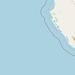
Map view of Fairview Conservation Park

Use this park location map to pinpoint Fairview Conservation Park in Australia, understand its exact geographic position, and read its mapped placement within the surrounding landscape more clearly.

Pigeon | © OpenStreetMap contributors

Location context for Fairview Conservation Park

South Australia
Recorded earthquake history

Browse the Historical Earthquake Catalogue for Fairview Conservation Park

MoriAtlas offers a direct view into the recorded seismic history surrounding Fairview Conservation Park. Investigate past seismic events, including magnitude and depth, to better understand the geological context of the Limestone Coast environment and its associated earthquake records.

Fairview Conservation Park Earthquake History

Catalogued events

1 event

Strongest magnitude

Magnitude 3.4

Most recent event

Nov 8, 1989

This history includes earthquakes recorded inside the park or within 50 km of its borders

Park atlas

Compare regional wetland reserves and surrounding Limestone Coast conservation landscapes.

Other Protected Areas and Parks Near Fairview Conservation Park in South Australia

Browse adjacent protected areas and regional reserves to compare the distinctive wetland flats, sandy ridges, and woodland habitats found around Fairview Conservation Park. Extending the geographic review helps map the broader ecological patterns shaping southeastern South Australia.
Nature reserveSouth Australia
About 23 km away#1 closest

East

Grass Tree Conservation Park: A Protected Nature Reserve in South Australia

Geography and native woodland map exploration.

Grass Tree Conservation Park is a 16 hectare nature reserve in the Limestone Coast of South Australia, focused on the protection of iconic grass trees. The reserve captures a landscape of calcarenite dunes and diverse forest communities, including brown stringybark and pink gum. Through its protected status, it offers valuable insight into the native vegetation and sandy terrain typical of the West Naracoorte Range.

Area
0.16 km²
Established
1972
IUCN
III
Relief
Lowland
Wildlife reserveSouth Australia
25 km away#2 closest

South

Big Heath Conservation Park: Mapping Protected Landscapes in South Australia

A strict nature reserve of woodland and wetland mosaics.

Big Heath Conservation Park represents a significant protected area in the Limestone Coast region of South Australia. The terrain is characterized by a gently undulating plain where subtle variations in elevation and soil composition create a distinct patchwork of eucalypt woodlands, sandy heath, and seasonal depressions linked to regional hydrological drainage systems.

Area
24.72 km²
Established
1964
IUCN
Ia
Relief
Lowland
State or regional parkSouth Australia
35 km away#3 closest

North

Desert Camp Conservation Park: Geographic Overview and Protected Area Atlas

Interdunal plains and pink gum woodland in South Australia

Examine the unique geomorphology and protected vegetation of Desert Camp Conservation Park. This record details the park's characteristic sandy duplex soils, low dune ridges, and granite outcrops, offering insight into the specific ecosystems preserved within this South Australian regional conservation area.

Area
0.51 km²
Established
1967
IUCN
III
Relief
Lowland
National parkSouth Australia
36 km away#4 closest

Southeast

Naracoorte Caves National Park: Detailed Map and Protected Landscape Context in South Australia

Explore its unique protected geography and natural terrain.

Naracoorte Caves National Park represents a vital protected area within the diverse geography of South Australia. This entry provides an atlas-driven perspective, highlighting its identity as a national park, its mapped landscapes, and its regional significance. Engage with structured information detailing the park's protected status and geographic features, offering a clear view of its contribution to South Australia's natural heritage.

Area
6.6 km²
Established
2001
IUCN
II
Visitors
90.8K annual
Nature reserveSouth Australia
37 km away#5 closest

Southeast

Hacks Lagoon Conservation Park: Wetland Landscape and Protected Area Geography

A vital Ramsar wetland site in the South Australia Limestone Coast region

Hacks Lagoon Conservation Park provides a protected freshwater sanctuary amidst the rural plains of South Australia. This nature reserve sustains a diverse wetland habitat, encompassing open water, marshes, and seasonally flooded zones that support critical waterbird populations within an internationally recognized ecological system.

Area
2.02 km²
Established
1967
IUCN
IV
Relief
Lowland
Nature reserveSouth Australia
About 41 km away#6 closest

Northwest

Jip Jip Conservation Park: Geologic Formations and Protected Biodiversity in South Australia

A compact reserve of granite outcrops and sandy woodland habitats.

Jip Jip Conservation Park preserves a distinctive cluster of granite outcrops known as the Jip Jip Rocks. The park is significant for its diverse plant life, including rare ferns, and its role as a sanctuary for bird species and small marsupials within the broader South Australian landscape.

Area
1.4 km²
Established
1967
IUCN
III
Relief
Upland
Nature reserveSouth Australia
About 42 km away#7 closest

Northeast

Geegeela Conservation Park: Mapped Geography and Protected Area Data

Ecological restoration and woodland habitat in South Australia

Geegeela Conservation Park stands as a significant nature reserve within the Limestone Coast of South Australia. Covering over eight square kilometres, this area protects a regenerating mosaic of desert banksia heath and stringybark woodland, offering a critical refuge for local bird species and nationally endangered fauna within the surrounding rural landscape.

Area
8.58 km²
Established
2005
IUCN
III
Relief
Lowland
Nature reserveSouth Australia
50 km away#8 closest

West

Butcher Gap Conservation Park: A Protected Coastal Reserve in South Australia

Examining the dune-and-wetland geography along Lacepede Bay

Butcher Gap Conservation Park protects a unique, tightly layered coastal environment characterized by shifting foredunes, saline basins, and paperbark-fringed wetlands. This nature reserve provides essential habitat for migratory shorebirds and illustrates the complex geological and biological patterns defining this stretch of the South Australian Limestone Coast.

Area
1.8 km²
Established
1990
IUCN
III
Relief
Lowland

Common questions about visiting, size, designation, and location context for Fairview Conservation Park

Fairview Conservation Park FAQs for park facts, access, geography, and protected area context

Find quick answers about Fairview Conservation Park, including protected-area facts, park geography, trail and visitor context, and how the park fits into its surrounding country and regional landscape.
MoriAtlas Explorer

Continue Your Protected Areas Search Across the Global Atlas

Deepen your exploration by continuing the structured search for national parks and protected areas worldwide. Utilize the comprehensive filtering capabilities to compare different conservation landscapes and refine your understanding of global park geography. Discover more about the distribution and characteristics of protected natural areas.

Global natural geography