
Mori Atlas logo
Nature reserveFensham Reserve

A critical sanctuary for endangered freshwater species and ancient podocarp forest in the southern North Island

Fensham Reserve Nature Reserve: Mapping Rare Lowland Forest and Wetlands in the Wairarapa Region

(John Fensham Memorial Sanctuary)

Fensham Reserve stands as a preserved island of indigenous nature within the open agricultural landscape of the Wairarapa region in New Zealand. This protected area safeguards a diversity of habitats, including rare kahikatea and pukatea forest, centuries-old swamp podocarps, and wetlands supporting the endangered brown mudfish. The reserve functions as a living archive of the original valley forest character, offering clear insight into the ecological connectivity between lowland remnants and the wider Tararua mountain terrain.

native forestlowland forestkahikateapukateatotarablack beech
An illustration of a natural scene framed by tall trees and ferns in the foreground, looking out toward distant green mountains and a cascading waterfall flowing over a cliff face into a river.

Fensham Reserve

Nature reserve

Park overview

Structured park overview, official facts, and landscape profile for Fensham Reserve

Fensham Reserve park facts, protected area profile, and essential visitor context

Review the core facts for Fensham Reserve, including designation, size, terrain, visitor scale, habitats, and operating context in one park-focused overview.

About Fensham Reserve

Fensham Reserve sits in the rolling farmland landscape of the southern Wairarapa, on the eastern side of the Tararua Range and within the catchment of the Mangātarere Stream. Although it covers a relatively modest 48 hectares, the reserve punches well above its weight ecologically because much of the original lowland forest of the Wairarapa has been converted to pasture. The reserve functions essentially as a fragment of the forest that once covered the surrounding plains, preserved through deliberate protection at a time when clearing was the norm.

The forest within Fensham Reserve is varied and layered. Black beech is the dominant canopy species across much of the reserve, but scattered patches of other forest types give the site exceptional botanical importance. These include kahikatea–pukatea forest and tōtara–tītoki forest, both of which are regionally threatened in the Wellington Region. The reserve's wetland and swamp margins contain kahikatea and other podocarp trees that local conservationists believe may be as much as 700 years old, representing a continuity of forest cover that is extremely rare at this altitude and latitude.

Beyond the primary forest, 19 hectares of regenerating native vegetation and three hectares of wetland extend the reserve's ecological footprint. The regenerating areas include black beech, tōtara, and mānuka, showing how the site continues to recover and diversify under active management. Together, the reserve and these surrounding zones form the bulk of the Fensham Key Native Ecosystem recognised by the Wellington Regional Council, an area classified in the two highest categories of threatened ecosystem status.

Fensham Reserve's management rests with Forest & Bird, New Zealand's largest independent conservation organisation, and a dedicated local volunteer group has overseen day-to-day care for decades. The group's work earned a conservation award in 2002, and in 2024 it proposed extending a wildlife corridor from the reserve toward nearby Tararua Forest Park to counter the biodiversity decline caused by the reserve's isolation within farmland. This long-running community involvement gives Fensham Reserve a character that is as much about people and stewardship as it is about trees and wildlife.

Quick facts and research context for Fensham Reserve

Fensham Reserve is a 48-hectare protected native forest remnant in the Wairarapa region of New Zealand's North Island, situated about 4.7 kilometres north-west of Carterton. It is owned and managed by the Royal Forest and Bird Protection Society, an arrangement dating to 1957 when the land was gifted to the organisation, and it was formally declared protected private land in 2001 under the Reserves Act 1977.

Ecologically, the reserve contains a mix of primary black beech forest, regionally threatened kahikatea–pukatea and tōtara–tītoki forest types, swamp forest with trees that may be around 700 years old, regenerating forest, and small wetlands. It forms the core of the Fensham Key Native Ecosystem, an area classified as containing some of the most depleted indigenous vegetation types in the Wellington region.

Protection and recognition

Terrestrial protected area framework and designation records established in 2001

Fensham Reserve Protection Status and Designated Area History

Fensham Reserve maintains documented terrestrial protection status established through official designation records from 2001. Certified conservation management context tracks the geographic footprint and formal recognition history for this protected landscape.

Protection details

Protection scope
Terrestrial
Designated year
2001
Transboundary protection
No
Park context

Deeper park guide and search-rich context for Fensham Reserve

Fensham Reserve history, landscape, wildlife, and travel context

Explore Fensham Reserve through its history, landscape character, ecosystems, wildlife, conservation priorities, cultural context, and seasonal travel timing in a structured park guide built for atlas discovery and search intent.

Why Fensham Reserve stands out

Fensham Reserve is best known for protecting rare lowland and swamp forest types that have largely vanished from the surrounding Wairarapa landscape. Its stands of kahikatea, pukatea, tōtara, and tītoki represent indigenous vegetation categories now reduced to less than 10 to 20 percent of their original extent in New Zealand, making the reserve an important reference site for lowland forest ecology in the southern North Island. The reserve is also notable for its swamp forest, where individual podocarp trees are estimated to be several centuries old, and for its wetlands, which shelter the endangered brown mudfish. Together, these features give Fensham Reserve a strong identity as a sanctuary for forest types and freshwater species that have been heavily impacted by surrounding land clearance.
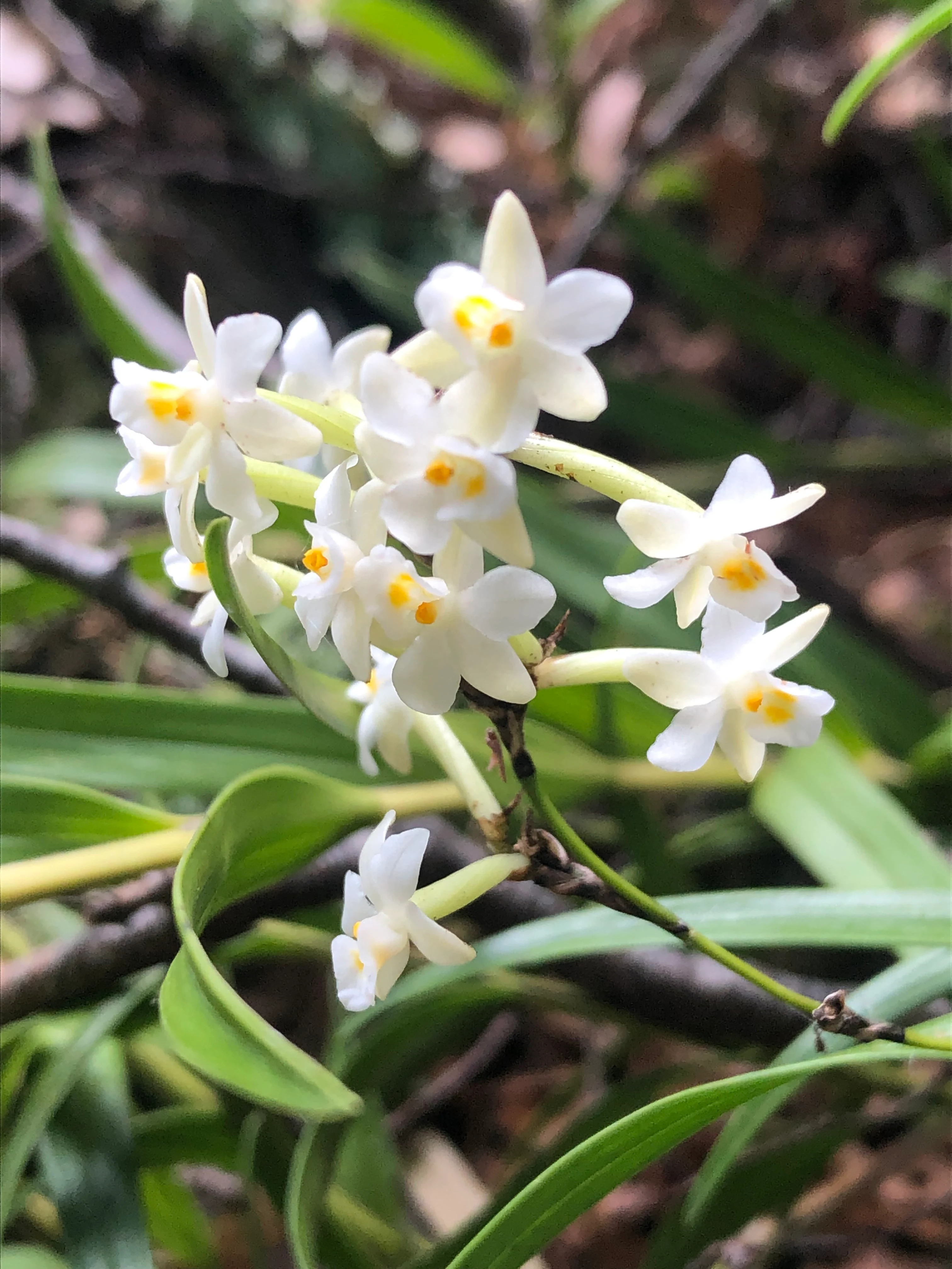
A cluster of small, white, star-shaped flowers with yellow centers, known as Earina autumnalis, growing among green leaves in a forest environment.
A close up view of Earina autumnalis, a native New Zealand orchid found in Fensham Reserve.

Fensham Reserve history and protected-area timeline

The protection of Fensham Reserve has its roots in a single decision made in 1883, when John Fensham purchased the land with the explicit aim of keeping its forest standing. At a time when lowland Wairarapa bush was being cleared for farming, this deliberate act of preservation preserved a block of forest that would otherwise almost certainly have been logged. The land remained in the Fensham family for several generations, illustrating how personal decisions across decades can shape long-term ecological outcomes.

In 1957, John Fensham's daughter Ruby gifted the land to the Royal Forest and Bird Protection Society of New Zealand, ensuring that the forest would be protected by an institution rather than relying on continuing family ownership. The legal title was finalised on her death in 1978. The reserve's formal legal protection came in 2001, when the New Zealand Government declared it protected private land under the scenic reserves provisions of the Reserves Act 1977.

Since then, Fensham Reserve has developed a strong volunteer-driven stewardship culture. The local Forest & Bird group responsible for the reserve received an award in 2002 for outstanding contributions to conservation, recognising ongoing work in planting, track maintenance, predator control, and ecological monitoring. In 2024, the group proposed extending the reserve's ecological value by creating a wildlife corridor linking it with the nearby Tararua Forest Park through land associated with the former Belvedere Hall, an initiative driven by concerns over biodiversity decline caused by the reserve's isolation inside farmland.

Fensham Reserve landscape and geographic character

Fensham Reserve lies in a gently undulating lowland setting at the eastern foot of the Tararua Range, in the southern Wairarapa valley. Surrounded predominantly by open farmland, the reserve appears as a dense island of native forest viewed from surrounding roads and tracks. Topographically, the terrain is modest and accessible, with a loop walking track and connecting cross-tracks plus boardwalks over the wettest sections, allowing visitors to pass through very different forest and wetland environments within a short walk.

A defining feature of the reserve's landscape is the contrast between dry upland forest on higher ground and low-lying swamp forest in the valley bottoms. The swamp forest contains kahikatea and other podocarps of remarkable age, giving a sense of the original forest character before clearance. The Carrington Water Race, a historic irrigation channel that channels water from the Mangātarere Stream, passes through the reserve, adding a long-standing human element to what otherwise reads as a natural landscape. Viewpoints within the reserve offer framed views across the forest canopy, reinforcing the sense of a sheltered interior world distinct from the open agricultural land outside its boundary.
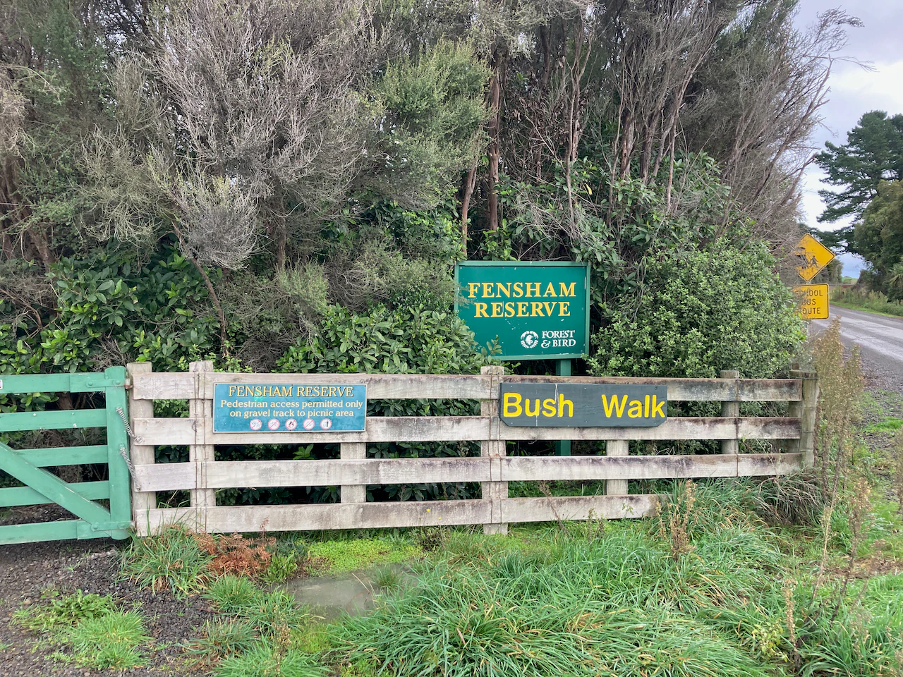
A green and white wooden gate marks the entrance to Fensham Reserve, featuring signage for the park name and bush walk.
The main entrance signage and gate at Fensham Reserve in the Wairarapa region of New Zealand.

Fensham Reserve ecosystems, habitats, and plant life

The ecological character of Fensham Reserve is defined by the coexistence of several forest types that have become rare at a regional scale. Dominant black beech forest gives way in places to kahikatea–pukatea forest and tōtara–tītoki forest, all of which are categorised as threatened in the Wellington Region. The reserve's swamp forest supports podocarp individuals that may be around 700 years old, providing an exceptional record of long-term forest continuity in a landscape where ancient trees are unusual.

Around the primary forest, 19 hectares of regenerating native vegetation demonstrate the dynamics of forest recovery in a lowland setting. This regenerating zone includes black beech, tōtara, and mānuka, with ground-layer species such as the native orchid Earina autumnalis visible on the forest floor. The reserve's three hectares of wetland add a third ecological dimension, supporting specialised aquatic and semi-aquatic flora and fauna, including the endangered brown mudfish. The diversity of habitats within a small footprint gives the reserve a richly layered ecological profile unusual for a lowland fragment.
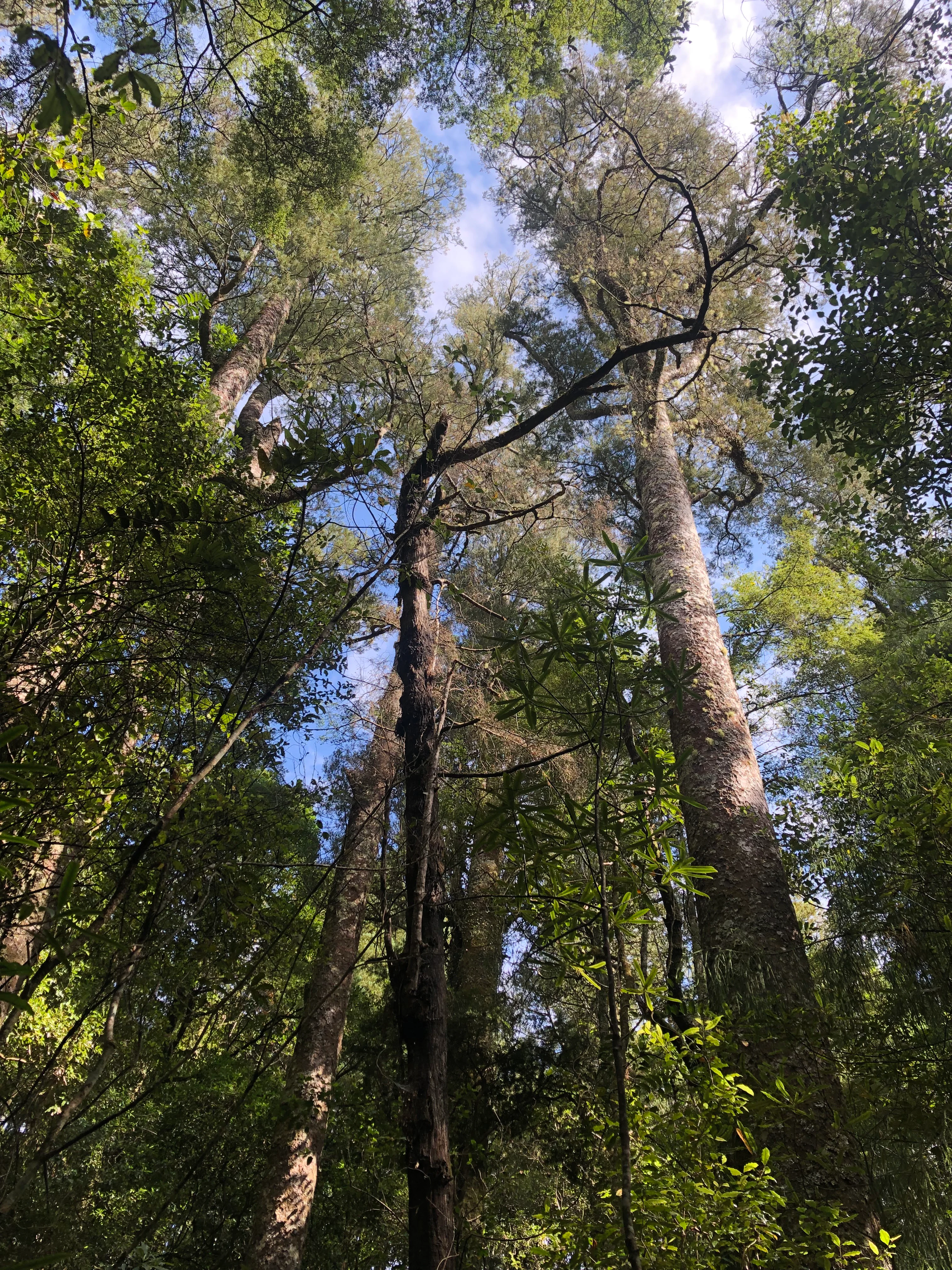
Looking upward through the dense forest canopy, several tall, mature trees reach toward a patch of blue sky visible through the leaves.
A view looking up into the canopy of a mature kahikatea stand in Fensham Reserve.

Fensham Reserve wildlife and species highlights

The reserve's birdlife is one of its most accessible features for visitors and includes several of New Zealand's most recognisable native forest species. Common sightings include kererū (New Zealand wood pigeon), bellbird, tūī, kākā, grey warbler, New Zealand fantail, and sacred kingfisher. The presence of kākā in particular reflects the relatively mature forest structure, as these forest parrots depend on large old trees for feeding and nesting.

A particularly significant wildlife feature is the presence of the brown mudfish (Neochanna apoda), an endangered freshwater species found in the reserve's wetland areas. Brown mudfish have disappeared from many of their former habitats due to drainage and land-use change, so protected wetlands such as Fensham play an important role in safeguarding remaining populations. Combined with the bird community, the reserve supports a small but ecologically meaningful representation of lowland North Island wildlife.
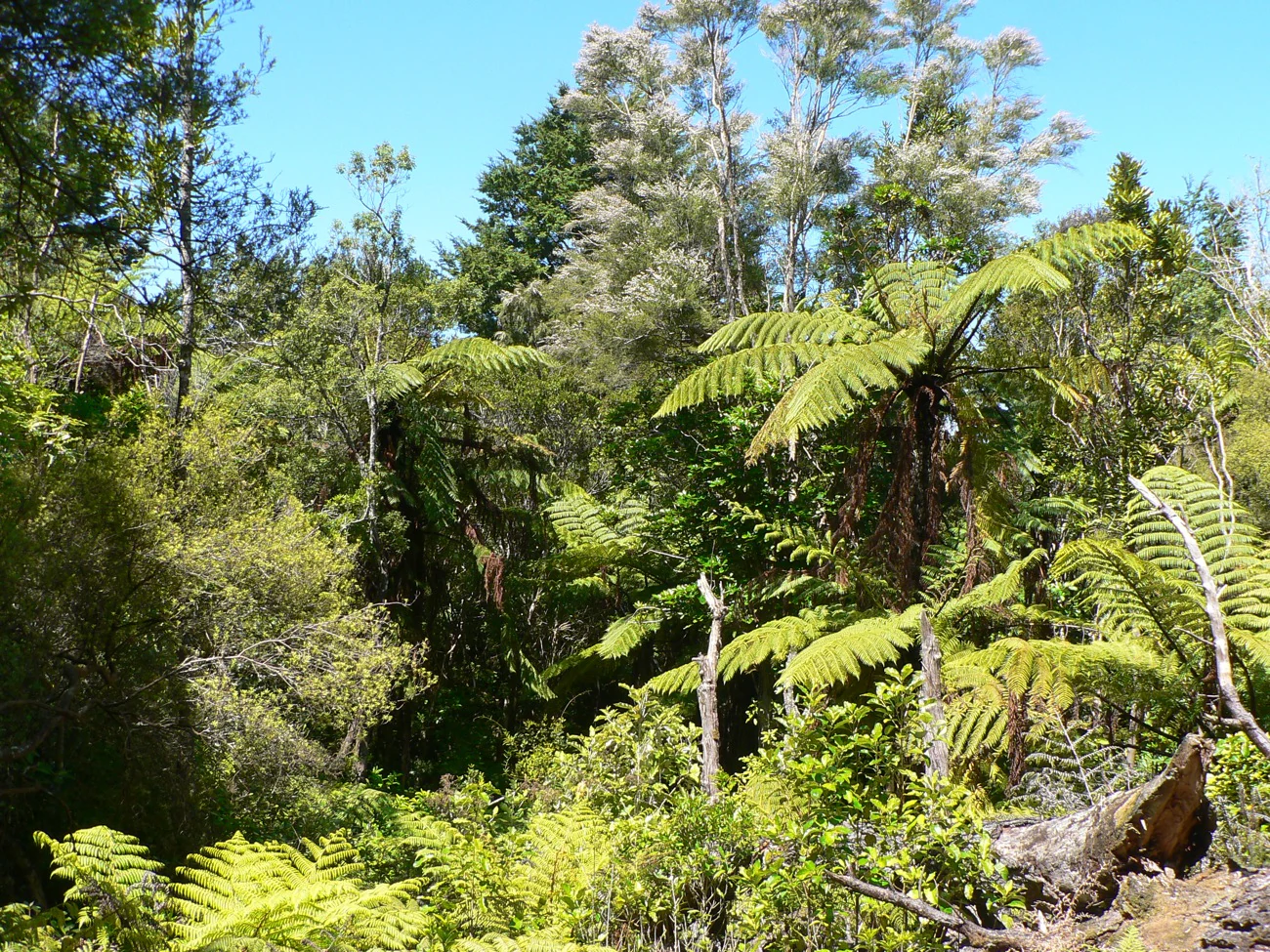
A sunny view of a dense native forest in New Zealand with prominent tree ferns and various native tree species under a clear sky.
Dense native bush and fern vegetation within Fensham Reserve.

Fensham Reserve conservation status and protection priorities

Fensham Reserve holds substantial conservation value because it preserves indigenous vegetation types that have been reduced to a small fraction of their original extent. The reserve forms the core of the Fensham Key Native Ecosystem, with surrounding land classified in the two highest categories of threatened ecosystem status, meaning that less than 10 to 20 percent of the original vegetation of these land types remains nationally. Within this framework, every hectare of mature kahikatea, pukatea, tōtara, and black beech forest represents a regionally significant contribution to biodiversity protection.

The reserve's wetlands are highly valued for supporting the endangered brown mudfish, a species that has been lost from many modified catchments. The site's formal protection under the Reserves Act 1977 and ongoing management by Forest & Bird provide a stable institutional framework for long-term conservation. The 2024 wildlife corridor proposal, aimed at linking Fensham Reserve with the much larger Tararua Forest Park, reflects a broader recognition that even high-quality protected fragments can suffer biodiversity decline if they remain isolated, and points to a future in which the reserve plays a central role in landscape-scale ecological connectivity.

Fensham Reserve cultural meaning and human context

Fensham Reserve carries a strong story of personal and community-led conservation rather than a deep pre-existing human cultural landscape heritage. The reserve exists because of the deliberate decision by the Fensham family to protect indigenous forest in the late nineteenth century, at a time when clearing bush for pastoral farming was standard practice in the Wairarapa. This longstanding sense of stewardship was then carried forward by Forest & Bird volunteers, whose ongoing work has shaped the reserve's modern identity.

The Carrington Water Race, which passes through the reserve, adds another layer of human history, representing more than a century of rural water engineering linking the Tararua hill streams to surrounding farmland. Together, these threads give Fensham Reserve a layered cultural narrative about people choosing, over multiple generations, to set aside land and labour for the long-term benefit of native forest and wildlife.

Top sights and standout views in Fensham Reserve

Fensham Reserve's strongest points of distinction are the rare forest types it protects, particularly the kahikatea–pukatea and tōtara–tītoki associations, and the unusually old swamp-forest podocarps that may reach 700 years in age. Its wetlands supporting the endangered brown mudfish give it a freshwater conservation dimension beyond what its small size would suggest, and its role as the core of the Fensham Key Native Ecosystem embeds it firmly in regional biodiversity policy.

Equally important is its long-running protection story, from the original 1883 purchase by John Fensham through its eventual gift to Forest & Bird in 1957 and ongoing volunteer-led stewardship. The recent wildlife corridor proposal toward Tararua Forest Park adds a forward-looking conservation focus, making the reserve a notable example of how a small fragment can be central to larger landscape-scale ecological thinking in the southern North Island.

Best time to visit Fensham Reserve

Fensham Reserve is open year-round and offers different experiences depending on the season. Spring and early summer bring active birdlife, blossoming native flora such as the ground orchid Earina autumnalis, and the fresh green tones of regenerating forest. Autumn highlights the changing colours and textures of mature beech and podocarp forest, while winter offers a quieter, more atmospheric experience with cool, damp conditions that underscore the swamp forest character.

Because the reserve's trail network includes boardwalks over wet areas, visitors should be prepared for damp ground conditions whenever the weather has been wet. The compact size of the reserve and the short distance from Carterton make it well suited to a half-day visit in any season, particularly for those interested in observing lowland forest and resident native birds.
Monthly climate preview

Long term monthly averages for temperature and precipitation in Wairarapa

Fensham Reserve Climate Normals and Annual Temperature Patterns

Fensham Reserve exhibits a measured annual rhythm of recorded temperatures and daily precipitation based on multi-year coordinates. Reviewing the complete twelve-month profile provides deeper context for monthly climate variations across the protected landscape.
Annual mean12 °C
7 °C17 °C
Jan17°
Feb17°
Mar15°
Apr12°
May10°
Jun
Jul
Aug
Sep
Oct11°
Nov12°
Dec15°
Warmest month
February

16.9 °C

Coolest month
July

7.3 °C

Wettest month
June

3.2 mm/day

Driest month
January

1.8 mm/day

Park location guide

Geography guide, regional context, and park location map for Fensham Reserve

Fensham Reserve park geography, regions, and map view in New Zealand

Understand where Fensham Reserve sits in New Zealand through a broader geographic reading of the surrounding landscape, nearby location context, and its mapped position within the national park landscape.

How Fensham Reserve fits into New Zealand

New Zealand is an island nation in the southwestern Pacific Ocean comprising two main islands and numerous smaller islands. Located east of Australia across the Tasman Sea, it features varied topography with the Southern Alps running along the South Island and volcanic terrain on the North Island. The country was settled by Maori people between 1280 and 1350, followed by European exploration beginning in 1642, and became a Dominion in 1907 before gaining full independence in 1947.

Wider geography shaping Fensham Reserve in New Zealand

New Zealand lies in the southwestern Pacific Ocean, east of Australia across the Tasman Sea. The country consists of two main islands, the North Island and South Island, plus over 600 smaller islands. The North Island features volcanic plateaus and hills while the South Island is dominated by the Southern Alps mountain range. The country has a long coastline and is surrounded by the Pacific Ocean.

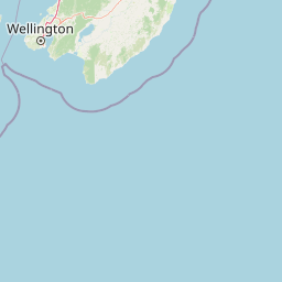
Map view of Fensham Reserve

Use this park location map to pinpoint Fensham Reserve in New Zealand, understand its exact geographic position, and read its mapped placement within the surrounding landscape more clearly.

Pigeon | © OpenStreetMap contributors

Location context for Fensham Reserve

Wairarapa

Visual reference collection highlighting lowland forest habitats and wetland terrain.

Fensham Reserve Photos: Exploring the Landscapes and Native Forest Scenery

Visual documentation captures the rare lowland forest remnants, ancient podocarp trees, and protected wetland habitats preserved within Fensham Reserve. Examining these field photographs reveals the distinct ecological character and regional landscape features of a vital New Zealand sanctuary.

A cluster of small, white, star-shaped flowers with yellow centers, known as Earina autumnalis, growing among green leaves in a forest environment.

A narrow, dirt hiking trail leads into a dense forest with tall trees and thick undergrowth, including ferns.

A green and white wooden gate marks the entrance to Fensham Reserve, featuring signage for the park name and bush walk.

Looking upward through the dense forest canopy, several tall, mature trees reach toward a patch of blue sky visible through the leaves.

A sunny view of a dense native forest in New Zealand with prominent tree ferns and various native tree species under a clear sky.

An expansive, elevated view of a flat rural landscape with golden grass fields in the foreground, scattered trees, and distant low hills under a clear blue sky.

Park atlas

Compare regional forest remnants and connected natural habitats across the Wairarapa valley.

Exploring Parks Near Fensham Reserve and Surrounding Protected Landscapes

Browse other protected areas near Fensham Reserve to examine shared lowland forest types and regional conservation contexts. Evaluating nearby reserves helps trace the broader ecological patterns defining the southern North Island.
Protected landscapeNew Zealand
About 21 km away#1 closest

Northwest

Tararua Forest Park: Protected Landscape Geography and Mapped Natural Terrain

Defining the rugged mountain spine of New Zealand's southern North Island

Covering the core of the Tararua Range, this protected landscape represents a vital ecological corridor in New Zealand. The terrain offers a diverse gradient of native forests, steep river valleys, and windswept alpine ridges. It serves as a primary example of forest conservation and complex mountain geography within the island nation's larger network of protected lands.

Area
1,149.93 km²
Established
1954
Relief
Mountain
Climate
Temperate
A horizontal watercolor painting showing a calm river winding through green banks with coniferous trees in the background, set against a soft, light-filled sky.
Nature reserveWellington Region
About 30 km away#2 closest

West

Hutt Water Collection Area: Protected Mountain Nature Reserve in the Wellington Region

Forested catchment geography and mountain wilderness

The Hutt Water Collection Area covers 8,900 hectares of steep ridge and valley terrain in the southern Tararua Range. This nature reserve serves as a essential water catchment for the Wellington Region, protecting a diverse environment of native forest, alpine tussock, and sub-alpine bogs. Explore the mapped geography of this critical protected landscape and its role as a sanctuary for rare plant species and native birds.

Area
89 km²
Established
1951
Relief
Mountain
Climate
Temperate
Wildlife reserveWellington Region
About 51 km away#3 closest

Southwest

Wainuiomata Water Collection Area: Protected Forest Terrain and Wellington Catchment Geography

Mapping the native forest canopy and river catchments of New Zealand.

The Wainuiomata Water Collection Area remains a vital conservation landscape, preserving deep river valleys and mature podocarp-broadleaf forest within the Wellington Region. This wildlife reserve functions as a major ecological hub, featuring continuous native bush that supports intensive predator control and species recovery efforts. Its geographic integrity provides a unique perspective on protected catchment management and pristine lowland wilderness in the southern North Island.

Water
Major water bodies
Regional parkWellington Region
About 54 km away#4 closest

Southwest

Wainuiomata Regional Park: Geography and Protected Area Atlas

River valley terrain in the Wellington Region

Wainuiomata Regional Park is a protected river valley setting featuring significant lowland native forest, historic water infrastructure, and restored wetland habitats. This landscape provides a critical link in the conservation geography of the Wellington Region, connecting to extensive forest remnants and supporting a variety of native ecosystems within the Wainuiomata catchment.

Relief
Mixed relief
Water
Major water bodies
Protected landscapeWellington Region
About 55 km away#5 closest

West

Whitireia Park: Coastal Headland and Protected Landscape in the Wellington Region

Explore mapping of coastal terrain, forests, and harbour boundaries.

Whitireia Park is a prominent coastal reserve in the Wellington Region that balances deep Ngāti Toa cultural significance with a unique geological history shaped by centuries of earthquake uplift. The headland features open grasslands, remnant kohekohe forest, and ongoing wetland restoration that offers a layered view of New Zealand's natural and social history across its accessible harbour-edge geography.

Area
1.8 km²
Established
1976
Relief
Upland
Climate
Temperate
A soft watercolor painting of a rolling forested landscape featuring distant mountains and a calm body of water in the foreground.
Protected landscapeWellington Region
About 59 km away#6 closest

Southwest

Remutaka Forest Park: Protected Landscape and Regional Hill Country Geography

A rugged forested reserve spanning the Wellington Region.

Covering extensive territory across the Remutaka Range, this protected landscape is defined by its dramatic ridges and deep river valleys. The area functions as a vital refuge for native bush and birdlife, offering a layered environment that stretches from accessible valley floors to remote upland slopes in the southern North Island.

Area
220 km²
Established
1972
IUCN
V
Relief
Mountain
Nature reserveWellington
About 76 km away#7 closest

Southwest

Te Kopahou Reserve: Nature Reserve Geography and Coastal Landscapes in Wellington

A rugged intersection of forested hills, ridgelines, and coastal cliffs.

Situated on the southern edge of Wellington, Te Kopahou Reserve offers a diverse protected landscape ranging from the summit of Hawkins Hill to the iconic red rocks of the Cook Strait shoreline. This nature reserve provides a critical geographic transition, hosting regenerating native bush, exposed ridgeline trails, and vital habitats for local wildlife, making it a prominent example of regional conservation land on the North Island of New Zealand.

Area
6 km²
Relief
Mountain
Climate
Temperate
Access
Easy access
Marine protected areaMarlborough Region
About 101 km away#8 closest

West

Long Island-Kokomohua Marine Reserve: Mapped Geography and Protected Reef Systems

Explore marine boundaries in the Marlborough Region

Located at the entrance to Queen Charlotte Sound, Long Island-Kokomohua Marine Reserve encompasses significant island and submerged reef features. This protected area serves as an essential site for understanding coastal ecosystem restoration, featuring varied terrain from shallow near-shore reefs to deeper rocky pinnacles that support diverse marine populations.

Area
6.19 km²
Established
1993
Relief
Lowland
Climate
Temperate

Common questions about visiting, size, designation, and location context for Fensham Reserve

Fensham Reserve FAQs for park facts, access, geography, and protected area context

Find quick answers about Fensham Reserve, including protected-area facts, park geography, trail and visitor context, and how the park fits into its surrounding country and regional landscape.
MoriAtlas Explorer

Continue Your Protected Areas Search Across the Global Atlas

Deepen your exploration by continuing the structured search for national parks and protected areas worldwide. Utilize the comprehensive filtering capabilities to compare different conservation landscapes and refine your understanding of global park geography. Discover more about the distribution and characteristics of protected natural areas.

Global natural geography